
a treasure-trove of literature
treasure found hidden with no evidence of ownership
(and our other authors) or get HELP Reading, Downloading and Converting files)
or
SEARCH the entire site with Google Site Search
|
Project Gutenberg
Australia a treasure-trove of literature treasure found hidden with no evidence of ownership |
BROWSE the site for other works by this author (and our other authors) or get HELP Reading, Downloading and Converting files) or SEARCH the entire site with Google Site Search |
Title: Peaks and Plateaus of Victoria, Australia
Author: Betterment And Publicity Board, Victorian Railways
* A Project Gutenberg of Australia eBook *
eBook No.: 1402801h.html
Language: English
Date first posted:  October 2014
Most recent update: October 2014

This eBook was produced by: Colin Choat

Project Gutenberg of Australia eBooks are created from printed editions
which are in the public domain in Australia, unless a copyright notice
is included. We do NOT keep any eBooks in compliance with a particular
paper edition.

Copyright laws are changing all over the world. Be sure to check the
copyright laws for your country before downloading or redistributing this
file.

This eBook is made available at no cost and with almost no restrictions
whatsoever. You may copy it, give it away or re-use it under the terms
of the Project Gutenberg Australia Licence which may be viewed online.
GO TO Project Gutenberg Australia HOME PAGE
THIS booklet is not intended as an exhaustive
and detailed guide for Victoria's many peaks and plateaus.
The outstanding features are indicated in letterpress and
photographs.
Further information may be obtained from the
GOVERNMENT TOURIS BUREAU
QUEEN'S WALK (opposite Town Hall)
MELBOURNE, VICTORIA, AUSTRALIA
***Victoria's
Unspoiled Alpine Kingdom
01.Mount Buffalo National Park (also see item
22)
02.Myrtleford
03.Porepunkah and Bright
04.Mount Feathertop
05.Beechworth
06.Stanley, Yackandandah, Tallangatta,
Trawool, Granite and Yea
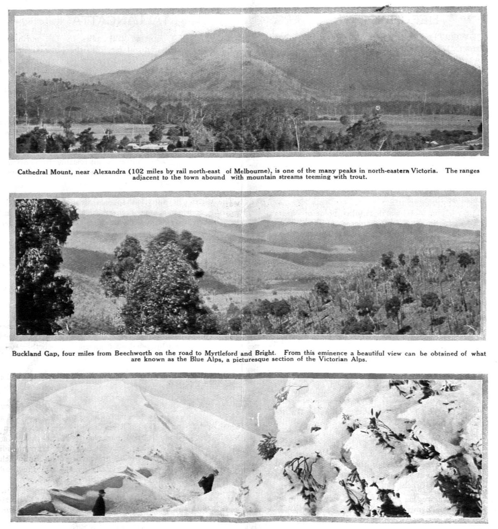
07.Alexandra
08.Mansfield1
09.Bright to Omeo
10.Omeo to Bruthen
11.Omeo to Tallangatta
12.Map of Mountain Areas, and Peaks and
Plateaus
13.Omeo
14.Mounts Ben Cairn and Donna Buang
15.The Baw Baw Ranges
16.Walhalla
17.The Grampians
18.Mount Macedon
19.Woodend
20.The Serra Ranges, Dunkeld and Hamilton
District
21.Nayook and Noojee, The You Yangs, Mount
Martha and Arthur's Seat
22.Tours in the Mount Buffalo National Park.
Map of Buffalo Plateau
Though Victoria has mountain scenery equal to any in the world, it is only in recent years that it has been fully appreciated and developed. Every kind of scenery is scattered throughout the many mountain ranges—in them is repeated the rugged grandeur of the Scottish hill country, the immense vistas of the Alps, and the snow-capped peaks of Switzerland.
Most of these resorts can be reached by train. Others are within easy travelling distance of a railway, and to these regular car services are maintained throughout the tourist season.
For all, the mountains are splendid. For those seeking a change from the sea-side holiday, they are ideal.
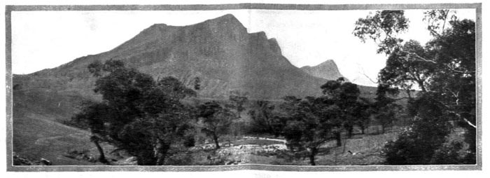
The famous Buffalo Chalet (4,400 feet above sea level) is built practically on the edge of the Buffalo Gorge, over which the waters of the Crystal Brook leap in a sheer drop of 750 feet. The Gorge is one of the most awe-inspiring sights one could imagine—only five minutes' walk from the comfort and conveniences of the most up-to-date guest house in Australia.

1—Mountain mists lend an air of enchantment to the Chalet at Mount Buffalo. 2—A fine fleet of cars with expert drivers is maintained for the conveyance of visitors from the railway to the plateau. 3—Morning sunshine on the Chalet gives it an imposing appearance. 4—The spacious Chalet verandah is the regular rendezvous for guests each morning before setting out on the excursions for the day. 5—There are some delightful walks which are enhanced by the beauty of the snow. 6—A motor snow-plow keeps the mountain road open right through the winter. 7—Motors of all descriptions make the trip to the Chalet. 8—Cosy bungalows close by the Chalet are available for special parties or for families.
The Mount Buffalo National Park is a little more than 200 miles by rail north-eastward from Melbourne, and is reached from either Porepunkah or Bright by road. The Railway Department, which operates the commodious Chalet on Mount Buffalo, runs a regular motor service between the railway and the summit of the mount. Comfortable cars are used, and arrangements can be made for transfer direct from the train to the Chalet.
Mount Buffalo National Park is the finest mountain resort in Australia. It has an altitude of 5645 feet, and offers a diversity of magnificent mountain scenery, including gorges, waterfalls, colossal granite masses, fern gullies, and lakes and streams teeming with trout. At all seasons it is a wonderful holiday playground. Its winter snow and ice sports are thrilling. The wildflowers in spring and summer are exquisite.
Accommodation is provided at the entirely modern Chalet, controlled by the Victorian Railway Department, away up thousands of feet on the plateau, and in close proximity to the head of the famous Buffalo Gorge.
There is hardly a road in Australia more picturesque than that connecting the railway and main road in the valley with the plateau. Every yard is an inspiration, and almost the whole well-graded, sinuous 20 miles from Bright through Porepunkah to the Plateau, is a realm of scenic wonder.
The road crosses the Eurobin Creek at a point a short distance below the Eurobin and Ladies' Bath Falls.
The Eurobin Fails, reached by an easy walk beside a mountain stream, are formed by the water which flows from the Plateau through a deep glen.
On the course of the Falls Creek, as the stream flowing from the foot of the Buffalo Gorge is called, occurs the beautiful spectacle known as the Ladies' Bath Fails. These are about 40 feet deep, the water dropping into a rocky basin, several hundred yards from the Eurobin Falls.
Skirting the eastern bank of the Eurobin Creek, the road rises gradually. About a mile and a half beyond Buffalo Falls House a magnificent view of the 1700 feet "drop" and the Buffalo Falls is obtained.
About seven miles from its start the road comes on to a clear spot called Mackey's Lookout (named after a former Minister for Lands). From this point a wonderful panoramic view is obtained.
There is a sharp turn from here, and the way leads through granite country, past Staker's Lookout (named after a tourist pioneer of the mountain), then over the crest, and the plateau is reached. A small plain is traversed, a bridge spanning the aptly named Crystal Brook is crossed, and suddenly around a sweeping turn the Chalet comes into view.

One of the finest views at Mount Buffalo is that from Bent's Lookout (4,400 feet) near the front of the Chalet. Immediately below are the cultivated fields in the Buckland Valley. In the dim distance are the glistening snow-capped peaks of the Australian Alps, including Mount Kosciusko, (7,328 feet) the highest peak in Australia.
Mount Buffalo National Park has been aptly termed "The Garden of the Gods." At every turn there are views to give pleasure to the eye. The beautiful walks are an unending delight, whether undertaken in winter or summer.
Everywhere there is the music of crystal-clear streams and of noisy waterfalls. Even when the air is calm on these exalted altitudes, the faint murmur of the wind in the forests beneath intensifies the sense of splendid isolation that is one of Buffalo's strongest attractions.
Mt. Buffalo is an all-the-year-round resort. Although it earned its reputation as a winter resort, its beauties are by no means confined to that season of the year. On the hottest day in summer the temperature is seldom above 75 degrees. Spring is wonderful—the wildflowers bloom in splendid profusion; in fact, summer is a continuous springtime, with its cool atmosphere and mild sunshine. Autumn, with its pure revitalising mountain breezes, shows another phase of Buffalo where one breathes air of champagne, and after sleeping peacefully, rises invigorated to welcome holiday exercise.
Within two minutes' walk of the front of the Chalet, on the flat surface of an enormous granite boulder, is Bent's Lookout (altitude 4400 feet). Safely here from a railed enclosure is overlooked the stupendous chasm of the Buffalo Gorge.
Eighty-five miles distant is the faint outline of Mount Kosciusko (altitude 7328 feet)—the highest peak in Australia. In the middle distance stands Mount Bogong (6509 feet), and to the right Mounts Fainter (6160 feet) Feathertop (6306 feet), and Hotham (6100 feet).
Immediately below are the Eurobin Falls and the winding ruddy ribbon of the road in the Buckland Valley.
The Gorge close by consists of two stupendous cliffs of solid granite, varying in depth from 1200 to 1700 feet, over which thunder in a sheer leap of 1700 feet the waters of the famous Buffalo Falls.
Lake Catani (named after a former Engineer for Public Works, who thought out and supervised the scheme) is an attractive 60-acre sheet of water. It is surrounded by low hills, with trees right to the water's edge.
In the seasons, boating, bathing, trout fishing or skating are eagerly enjoyed. The trout fishing is splendid.
Mount Buffalo National Park has no rival in Australia as a winter resort. All snow sports may be indulged in there under conditions equal to the best resorts on the Continent.
In winter the lake is frozen to a depth of eight inches, and skating is most popular.
Toboganning and ski-running give endless frolicsome sport during the snow season. Adjoining the lake are two excellent toboggan runs.
Anything more picturesque than the lake with its moving group of skaters and rushing toboggans it would be hard to imagine.
Overlooking the lake on a high point is the Monolith—a huge granite boulder, 30 feet high, and balanced on the edge of a mighty rocky outcrop. A stairway gives access to its lofty rail-protected summit.
Seven miles distant in a south-westerly direction is The Horn (altitude 5645 feet). It is the highest peak on the Plateau, and is the objective of one of the finest trips which may be made during a stay on the mountain because of the unforgettable views. The last mile to the lookout is a real mountaineering adventure, with good, but entirely safe, climbing. Tourists make the trip to The Horn a day's outing, but they may stay the night there in a specially provided and suitably furnished cottage.
The Leviathan Rock, on the way to The Horn, is believed to be the largest single stone in Australia, and is estimated to contain 30,000 tons of granite. It is 75 feet high, 150 feet long, and 60 feet broad, and rests on a base of about six feet.
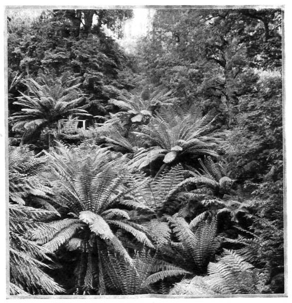
These are but a few of the places to be seen by visitors making a week's stay. There are many other points of interest for those who can stay longer. There are wonderful fern glades, cascades and forests—in short, charm and wonder are everywhere.
For the nights the social life at the Chalet is full of throbbing pleasure. There is something for every visitor—snug lounges, music, dancing in a spacious ball-room, and all modern comfort. Quiet pleasure or rollicking gaiety provides irresistible appeal for everyone.
The Chalet has all the conveniences of a city hotel, and is complete with hot and cold water services, ample bathrooms, electric light, billiard rooms, drying rooms, and efficient sewerage. It can accommodate 201 people.
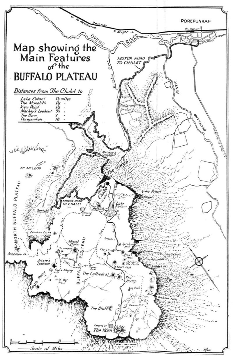
(See plan of Mt. Buffalo Plateau, at the end of this pamphlet.)
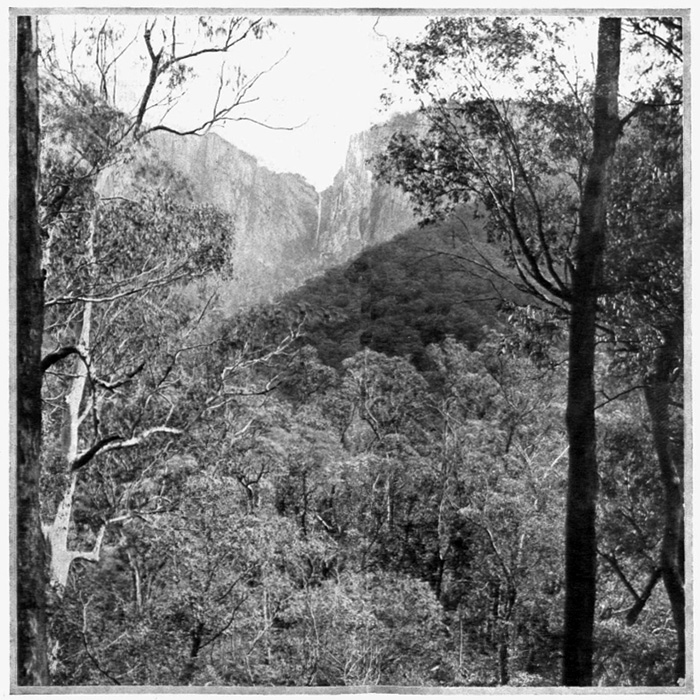
It is a majestic sight looking upward across the waving tree tops to the scar on the face of the Buffalo Gorge. This scar is really the waters of the Crystal Brook tumbling from the Plateau to the depths of the Gorge. Towering cliffs on either side give that impression of grandeur which can be seen only at Mount Buffalo.
Myrtleford is a small township on the Myrtle Creek close to its junction with the Ovens River, 177 miles from Melbourne, on the Wangaratta-Bright branch railway line. Good cod and perch fishing is to be had in the Buffalo River, and trout are taken in the Nug Nug, Sandy, and Happy Valley Creeks.
Among the waterfalls are those on the Nug Nug Creek. The water in the Lily Falls on the Buffalo Creek has a drop of 200 feet. The Twin Falls are a mile further up the same stream.
Although seldom availed of, this may be made the starting point for the trip to the Buffalo Plateau. The route lies westward to the Buffalo River. A rough track leaving the Buffalo River road leads along the ridge of a spur of the range and gives access to the summit of the plateau at a point between Mount Dunne and Pulpit Rock, the "back door of the mountain."
Porepunkah and Bright, four miles apart, have assumed importance as the points from which the Buffalo Plateau can best be reached. In and around each there is plenty to interest the visitor. Porepunkah is the nearest railway point to the mountain.
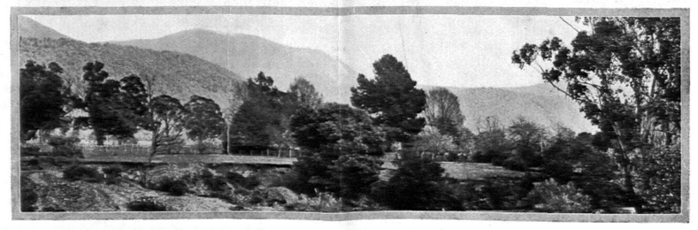
Bright is much the larger township. It is the railway terminus, 196 miles from Melbourne, and the centre of an ideal tourist district. It lies on the Ovens River, with picturesque mountains on the north, south and east.
A pleasant walk is that to The Gap. Splendid views are obtained on the way of Bright, the Wandiligong Valley, and Mount Bogong. From The Gap a further trail leads upward to a spot known as the Landslip. On account of the very fine outlook to be obtained from Clearspot (3500 feet), the trip is well worth making.
The drive through the Buckland Valley is charming in the highest degree. It is the oldest inhabited part. In 1857 the Buckland riot took place here, when the European population drove the Chinese off the goldfield in a body.
Porepunkah, 192 miles from Melbourne, is one of the terminal stations for tourists going to Mount Buffalo. It is the centre of a rich valley district. The Ovens River flows nearby.
Mount Feathertop may be truly described as one of the most beautiful mountains in Victoria. Views are obtained of the surrounding country for miles around. There are some wonderful ski-runs, and the snow sports enthusiast will find ample scope for his prowess.
Mount Feathertop has always been the objective of the more venturesome tourist, but in the last few years it is attaining greater popularity, especially as a company has been formed with the object of establishing a Chalet at Mount Feathertop. A temporary bungalow has been erected, and tourists who desire to spend a holiday at this lofty resort can arrange to do so.
Combined rail, car and accommodation tickets are available at the Government Tourist Bureau. The train journey is made to Bright, thence by car to Harrietville, 16 miles along the Ovens Valley, where a change is made to horses.
Then follows an interesting seven miles circuitous ride up the mountain along the bridle track. It is a ride with attractions all its own. At each turn a new spot of scenic beauty is revealed, until at last the bungalow is reached.
The bungalow is about a mile from the summit of the mountain, whence wonderful views of the surrounding peaks and the valleys are obtainable.

Beechworth is the principal town in the Ovens district, 172 miles from Melbourne, and 1775 feet above sea level. The rail route is by way of the Sydney line to Wangaratta, where trains are changed. It has romantic gold mining memories. Beechworth has gained a wide reputation for beautiful mountain scenery, fine panoramic views and invigorating mountain air.
Adjacent to the town are many fascinating walks, where Nature has piled rocks in various fantastic forms. Among the many attractive outings is that to One Tree Hill, about a mile from the town. Ingram's Rock is only about a mile and a half from the town, and because of the almost level walking along tree-shaded paths, is a favourite resort.
Buckland's Gap is four miles from Beechworth on the road to Myrtleford and Bright. From here a fine view can be obtained of the Blue Alps.
Ten miles out of Beechworth another point of observation is Mount Pilot. It is considered to be the finest lookout position, being higher and better situated than One Tree Hill.
Stanley, a town at the foot of Mount Stanley, is reached by a pleasant drive of about seven miles from Beechworth. Stanley is about 700 feet above Beechworth and the Sugarloaf Mountain. the Mount Stanley fern gullies, Rose Creek and Hillsborough are among the many attractions for the tourist.
"The Eden of Victoria" is the name sometimes given to Yackandandah. It is in the north-eastern district, 184 miles by rail from Melbourne, and is reached by way of Wangaratta and Beechworth. The township is 1003 feet above sea level, and possesses an unrivalled summer and winter climate. The surrounding country is mountainous, but the township is situated on sloping ground at the junction of the Yackandandah and Commissioner Creeks.
Among the picturesque spots are the Indigo Falls about seven miles- out. Brown's Gap is 15 miles from Yackandandah.
Pleasantly situated 212½ miles by rail north-east of Melbourne, and not far from the Murray, Tallangatta, a fair-sized town, stands in the midst of the hills at the junction of the Tallangatta Creek and the Mitta Mitta River. There is ample accommodation, and many enjoyable drives may he made in every direction amid charming scenery.
Enthusiastic mountaineers will find much interesting country to explore. one of the trips being to Mt. Kosciusko, over the New South Wales border.
Guides are available, but it is inadvisable to undertake the trip in winter, when the snow is likely to render the route impassable.
The district is one that appeals strongly to the artist and the sportsman, the scenery being magnificent, and the shooting excellent. The mountain streams have been well stocked with English trout for many years.
Trawool and Granite are on the Goulburn River within several miles of each other, and a little more than 60 miles from Melbourne. They are on the Mansfield railway line, which branches off from the main north-eastern line at Tallarook.
These places are chiefly availed of by sportsmen, who either make their headquarters here or camp in the vicinity, there being plenty of sport for both rod and gun.
Yea, 80 miles from Melbourne, lies at the foot of a range of hills on the Yea River. It is a popular rendezvous for sportsmen, and has trout streams that offer good sport. Other good streams are the Murrundindi River, which has a three-mile stretch of rapids, in which the trout are good game, the Falls Creek, and the head waters of the King Parrott and Silver Creeks.
One of the finest sights in the district is the Wilhelmina Falls, about 17 miles out of the township on the Murrundindi River.
Mount Feathertop is one of the few peaks in Victoria which has snow during the summer months. For the tourist desiring something entirely new and novel in the way of a holiday this locality is recommended.
Prettily circled by a chain of mountains, Alexandra has an appeal all its own. It is one of the oldest townships in the State. Surrounding it is some fine pastoral country. Along the Goulburn River is considerable cultivation.
Leaving the town and going into the hills, the tourist will find good accommodation at Thornton, seven miles out, or at Taggerty, 11 miles in a southerly direction at the foot of the Cathedral Peak and at the junction of the Acheron and Little Rivers. There are many choice camping grounds in the district, with good fishing streams. Rabbits are plentiful, and afford good shooting. There are waterfowl in season for the gun.
Tourists fond of walking will find many delightful excursions around Alexandra. From Brooks' Cutting, three miles distant, the best view of the whole of the Goulburn Valley is obtained; while from Mount Prospect, 1075 feet, three miles away, the lover of good scenery can look down upon the township and away across the Cathedral Mount.
The Royston Falls (18 miles) and the Rubicon Fails (15½ miles) are reached through the Rubicon Forest (declared by experts to be the finest forest in Victoria), by way of Thornton, where the road turning to the right is followed. After passing the Rubicon Bridge a sign post indicates the way. The Rubicon Falls are set in the midst of delightful scenery.
Passing along an alternative track on the east branch of the river one enters a fern glade of entrancing beauty. A few hundred yards further on towers the massive Elephant Rock, a huge monolith, which projects over the outcrop nearly 30 feet.
The route to the Snob's Creek Falls (14 miles) is by the main road to Upper Thornton, the turn-off being indicated by a sign post about 12 miles from the town.
The return to Melbourne may be made by way of Marysville and Healesville, a car journey of 50 miles. The roads are good, and the route embraces some fine scenery, including the famous Blacks' Spur. Healesville is the entraining station for Melbourne.
Mansfield has been described as the capital of the Upper Goulburn. It is 131 miles by rail from Melbourne and is the terminus of the line branching from the main north-eastern line at Tallarook. The township is in a basin surrounded by a fringe of beautiful green hills and mountains, some of which are snow-capped during the winter. Mansfield is noted for its healthy, bracing climate.
In the surrounding district is scenery of a rough and rugged nature. Mount Buller (6000 feet) stands out as a prominent landmark. It is approached through Merrijig, from which it is 12 miles distant. Horses and guides can be engaged here for the ascent.
Power's Lookout, named in the early days after a bushranger of that name, is a prominent cliff, from which a magnificent panoramic view of the surrounding country can be obtained.
Merrijig, a pretty village 11 miles from Mansfield, on the Delatite River, has some of the best trout fishing in the State. The Howqua River is a burbling mountain stream, with clear, beautiful ponds. It is nine miles fro Merrijig to the nearest point on the river, which has gained for itself a reputation for providing excellent rainbow trout sport.
Mount Cobbler (5347 feet) and Mount Howitt (5715 feet) are each about 25 miles distant, and, with the shorter trip to Mount Buller, form objectives for mountaineering excursions. These mountains are snow-covered in winter, and are rapidly becoming very popular with devotees of snow sports, such as skiing.
It is from Mansfield that many of the more venturesome start on excursions through the little-known mountain fastnesses of eastern Victoria. The climb to Mount Howitt is full of excitement. The track curves round steep ravines, and crosses and re-crosses the river as it winds amid the mighty peaks.
In places the ledge on the cliff is just wide enough for a horse to pass; on one side massive walls of granite tower above, on the other there is a sheer drop of hundreds of feet to the valley below. As the head of the stream is neared the country grows wilder.
When the crest of Mount Howitt is reached, the view is unforgettable. Instead of the accustomed ridges or conical peak of the ordinary mountain, a large plain is revealed, covered with snowgrass and dotted with cattle.
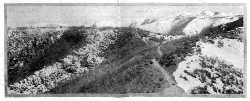
What is claimed to be the highest coach road in Australia extends for 97 miles in north-eastern Victoria through some of the most picturesque and impressive mountain scenery in the State. It is, unfortunately, not passable in the winter, because, on account of its great altitude, it is then snow-covered. It provides a wonderful tour in summer, however, realising the ideal combination of continuity and change.
Motorists have found the trip irresistibly fascinating within the last few years, and the Royal Automobile Club of Victoria has used this route for its motor reliability trials.
This route forms portion of a fine tour by rail from Melbourne to Bright in the north-east, or to Bruthen, in Gippsland, and then across the Alps by road. The road trip consists of two main sections centred on Omeo.
From the rail terminus at Bright to Harrietville is 16 miles over a level road, running between the mountains parallel with the Ovens River, and passing through the small hamlet of Freeburgh. Climbing commences soon after leaving Harrietville, and an altitude of 4000 feet is reached within four miles.
Thirty miles from Bright at The Hospice, Mount St. Bernard, the height is 5060 feet, or 3998 feet above Bright.
A favourite excursion from The Hospice is to Mount Hotham, six miles distant, where a wonderful view is obtained from the summit. A long narrow ridge rises up towards Mount Feathertop. Away to the north Mount Bogong, Victoria's highest peak—6509 feet—rears its mighty form amid an ocean of mountain tops.
All around is splendid grandeur. Other points that can be visited if the tourist has time are Mount Freezeout, The Twins, and the Bogong High Plains, 5000 feet above sea level. In winter these places are the resort of ski-ing enthusiasts, who have formed a club in Victoria.
By the service car (summer season only) Bright to Omeo is now a one-day trip. Tourists may leave Bright at 8.30 am. on Tuesday and Friday and arrive at Omeo at 4 p.m. same day. The road follows east from The Hospice, and traverses the southern end of Mount Smythe, thence along the western slope of Mount Blowhard until near Mount Hotham. The first ten miles of this section of the road excites fervent admiration.
In some places, notably at Mount Blowhard, the road is little more than the width of a vehicle. Below are great cliffs and yawning chasms, down which the traveller looks 1000 to 1500 feet.
Leaving Mount Hotham, the road is on a falling grade. Victoria River, a good trout stream, is passed. The falls on this river, about five miles distant, are a fine spectacle, especially when the river is in flood.
After minor ups and downs, the road plunges through a little creek, and climbs Mount Livingstone, a very tall peak. It is a long pull up, and a delightfully varied road down, winding around countless spurs, and giving occasional glimpses of Omeo nestling in a bower of hills.
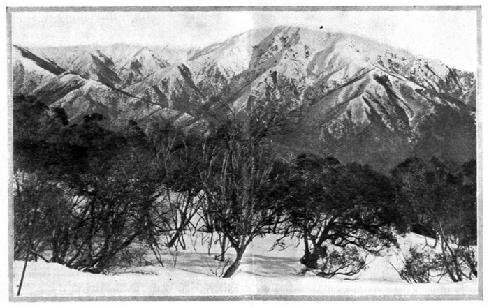
The Victorian Alps have been truly termed "The Roof of Victoria." The route across the Alps is every year becoming increasingly popular. This view is from Mount St. Bernard looking towards Mount Hotham. The Alpine Road is in the foreground.

There is a regular motor service between Omeo and Bruthen (190 miles by rail to Melbourne), forming the second portion of the link by road in the circular tour from Melbourne to Melbourne, by way of the Alps, Omeo, and the Tambo Valley. Cars leave Omeo, and after a gradual climb of nine miles reach the crest of the Dividing Range (2700 feet).
Running through the mining townships of Cassilis and Tongio West, the cars continue through Swift's Creek to Doctor's Flat, and then to Tambo Crossing.
Tambo Crossing is the turning off point for the sequestered mining village of Stirling, and here also is the commencement of the famous rich Tambo River flats. The scenery all the way is most arresting.
It is level running then to Double Bridges, and to the rail connection point at Bruthen, whence the way to the metropolis lies open by rail all the way, 190 miles, or by rail to Bairnsdale, steamer via Lakes Entrance, through the beautiful Gippsland Lakes, to Sale, and then by rail to Melbourne.
Bruthen is a thriving little town, and the outlet for the agricultural and pastoral production of a big district. Bairnsdale and Sale are populous towns, with fine business interests, and the centres of wealthy farming districts.
As already indicated, the round trip may be made in the reverse direction, by train from Melbourne to Bruthen, then by car through the Tambo Valley to Omeo and across the Alps to Bright, and return to Melbourne by train.
The return portions of railway excursion tickets issued from Melbourne to Bright may be used from Bruthen, Bairnsdale and Sale.
Tallangatta may also be reached via Omeo, and the grand scenery along the route is claimed by some to equal, if not to excel, that across the Alps. There is, however, no regular service throughout the whole of the distance, and special arrangements have to be made for at least one of the stages.
A little more than 100 miles is covered by vehicle. The Anglers' Rest Hotel, 14 miles from Omeo, is the first stopping place. Within half a mile of the hotel is the Cobungra Creek. The Bundarrah River is a quarter of a mile, and the Big or Mitta Mitta River, half a mile distant. There is good fishing in all these streams, and the last named river can be fished with waders for 30 miles.
Sportsmen who make Anglers' Rest Hotel their headquarters can, by communicating with the proprietor in advance, arrange to be met at Omeo.
Exploration of the Bogong High Plains may also be conducted from here. It would be well to have the services of a guide for trips of this nature. There are many waterfalls, and a spot locally known as The Ruined Castle, with remarkable features caused by volcanic action, may be inspected.
From the Anglers' Rest Hotel the road closely follows the course of the Mitta Mitta River. The river is crossed by a bridge three miles from the Glen Wills township, the end of the stage coach journey, 35 miles from Omeo.
Sunnyside, three miles by road or one mile by a steep foot track farther on, is 1000 feet higher than Glen Wills. Accommodation is available at the Mount Wills Hotel.
It is a stiff climb to the top of Mount Wills (5758 feet), but a magnificent view is the reward at the summit.
[Click map to display a larger image.]

An early start should be made from Sunnyside for Mitta Mitta, a section of the trip for which special transport arrangements may be necessary. A halt is made at Lightning Creek, 22 miles from Glen Wills. A descent of 500 feet in the next nine miles is made, and the traveller is then in Snowy Creek township, or, as it is sometimes called, Granite Flat.
A track, which provides another means of reaching Mount Bogong, has been cleared from here to the summit, distant about 18 miles. This track can be easily followed on foot, and is negotiable for a pack horse.
After a six-mile stretch along a level road the picturesque township of Mitta Mitta is reached. From here there is a daily motor service to Tallangatta, 38 miles away.

Omeo, an old mining town now, through the falling-off of gold production, is a shadow of its former self. It is the principal township in the Australian Alps and the centre from which roads or tracks radiate to Bright, Tallangatta, Mount Kosciusko, to the wonderful caves on the Limestone Creek, to Bruthen, and Bairnsdale.
The winding main street is characteristic of an old mining township. Like most of such places it originated with a few canvas tents. They dotted the banks of the Livingstone Creek in the days when the Omeo diggings were famous for their richness.
Omeo is 2100 feet above sea level, and is linked with the railway on the south at Bruthen, and on the north at Bright, by motor services. The district is a fine cattle grazing area, and is popular with anglers, there being three good trout streams to choose from.
Fourteen miles out is Lake Omeo, about two miles long by one mile wide. Past its shores runs the well-made roadway to Benambra.
Mount Bogong is 35 miles distant from Omeo, and can be easily reached. The first 29 miles, to Middle Creek, can be covered by car passing Anglers' Rest Hotel, 14 miles out. This house is within half a mile of three fine, swift-running streams, each of which abound with Loch Leven, Rainbow, and Brown Trout.
From Middle Creek the last six miles to the top of the Mount is covered either on horseback or on foot.
The Marble Caves on the Limestone River should be included in the itinerary of this Alpine Tour. They are about 40 miles from Omeo, and are approached by a fair road by way of Mount Leinster for 25 miles, thence by a rough bush track. Buggies can be driven the whole way the last three miles being on a very steep down grade to the Limestone River flat.
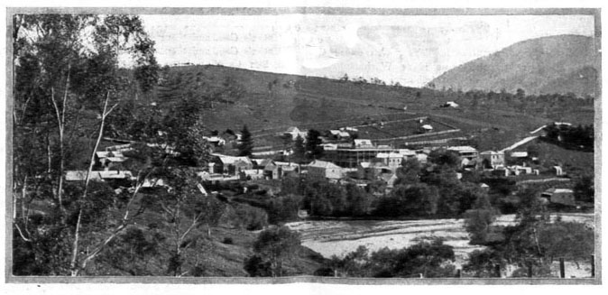
Romance is associated with Omeo, one of the oldest mining towns in Victoria. It is the radial point for roads and tracks leading to the mountains in the Alpine district.
Solid marble forms the entrance to the Marble Arch Cave. Inside the scene is unforgettably impressive. These caves are not yet opened up as a regular tourist objective, but are destined to become an outstanding feature of an Alpine holiday.
Mount Kosciusko can be reached from Omeo. The distance is 75 miles, and the trip takes about five days. The first 25 miles is to Mount Leinster, but the rest of the journey must be made either on horseback or on foot. There is no accommodation en route, and tourist must provide themselves with camping outfits and carry all necessary provisions.

Warburton, with its comfortable guest houses, is a delightful spot for week-ends or longer vacation. This view shows a section of the Yarra River with Mount Little Joe in the background.
One of the finest mountain holidays which one may enjoy adjacent to Melbourne is at Warburton, in the Yarra valley, 48 miles front Melbourne. Towering above Warburton are Mounts Ben Cairn (3400 feet) and Donna Buang—the hill of the crow—4080 feet. These may be made the objective for walking tours, or they may he visited by motor, a fine tourist road climbing the range and connecting with both peaks.
A well-made road runs a winding length of 12 miles to the summit of Mount Donna Buang, but the trip may be made in a steeper six miles by those capable and desirous of making the trip on foot.
From the top where a lookout platform with a ladder of access has been erected, a wide and far-flung view is obtained—partly forest, partly cleared valley of the Yarra just below, to the distant heights of the Baw Baw plateau with its elevation of 5000 feet, and stretching still further eastward into Gippsland.
A fine motor tour is from Warburton to Launching Place, thence to Healesville road at a point known as Panton's Gap, and thence running in an easterly direction to Ben Cairn, a huge granite outcrop, overlooking the Yarra Valley.
From Ben Cairn the road follows just below the crest of the mountains between the two peaks.
Along the route splendid views of the valleys and glens are obtained, and on the descent from Mount Donna Buang the road winds through glorious forest glades of myrtle, mountain ash and eucalypts. In many places the boughs interlacing above form a magnificent archway.
From Mount Donna Buang, the road drops more than 3000 feet in 10 miles. Six miles of the road from Mount Donna Buang to what is known as the Turn Table, at the junction of the Cement Creek road, has been named the Lovers' Drive.
From Cement Creek one may traverse the road along the Acheron Valley, one of the most beautiful forest and mountain drives in the State. The grades are easy, and for miles the road winds along the slope of the ranges through virgin forest at a level of 2500 feet.
Lovers of wild scenery, natural colour, and mountain life will find all on the 71-mile tourist route which commences at Warburton, the train terminus on the picturesque Upper Yarra, 48 miles east of Melbourne, and ends at the mining township of Walhalla, another rail terminus.
A tourist map giving details of distances, landmarks, and camping sites is available at the Tourist Bureau.
The first stage of the journey from Warburton is along the main road to Woods Point, passing up the Yarra Valley and overlooking the bends and reaches of the river.
The Upper Yarra Hotel (20 miles) ends the first stage of the trip at 1000 feet above sea level. Horses may be hired here for the next stage to the first shelter hut (14 miles) and the Yarra Falls, a series of wonderful cascades, having a fall of about 750 feet.
From the lookout above the falls the track is a kind of switchback, with a rise ever a little greater than the fall, until the second shelter hut (14 miles) is reached. on the crest of Mount Whitelaw.
The next stage is an easy walk of about eight miles to the third shelter hut, on Talbot Peak. On this walk there is ample time for a side excursion to Mount Baw Baw (5500 feet), distinctly marked as a commanding point of the range by the trigonometrical station—a high cairn.
Mountaineering ends at Talbot Peak. Here the range breaks down abruptly. The last stage of 15 miles is first an abrupt descent of 3500 feet in three miles on the steep side of Mount Erica (4800 feet), through a magnificent forest of white gum and ferns.
Then the tourist track is lost in older bush roads, which centre upon the Thomson River Bridge, and finally upon Walhalla—strangest and most interesting of all the old mining towns of Victoria.
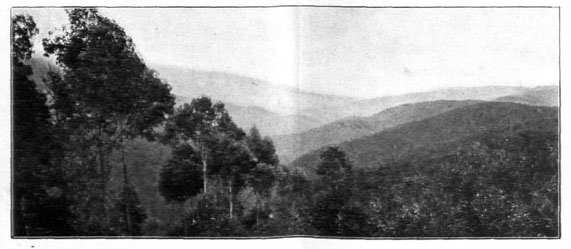
This is a view looking up the Aberfeldie Valley showing a fine succession of spurs which end on the banks of the Thomson River. The Baw Baw Ranges, which are described above, are in the dim distance on the left.
For convenience, the route has been described as from Melbourne by way of Warburton, but the route may be reversed at will. Should this be done, the morning train is taken to Moe, on the main Gippsland line, where passengers change into the narrow gauge train for the 26-mile journey to Walhalla.
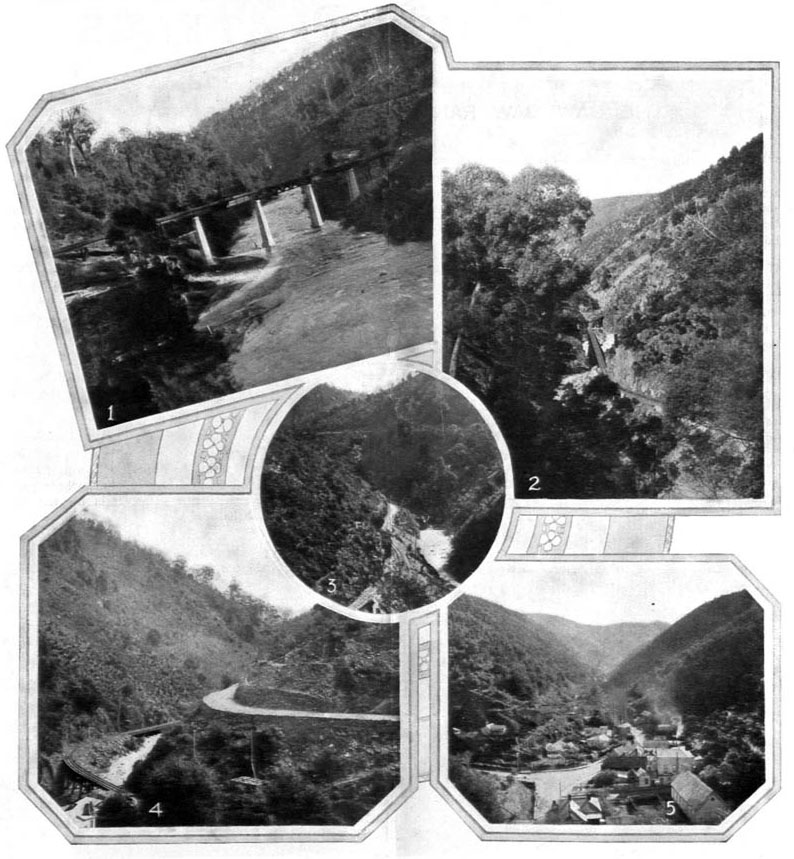
1.—The railway bridge crossing the Thomson River, near Walhalla, one of the many famous trout streams in Victoria. 2, 3 and 4.—The narrow gauge railway running from Moe to Walhalla is declared to be the most picturesque railway route in Victoria. It winds along the beautiful valleys between towering hills, across burbling streams and at times in sight of the roadway. 5.—Walhalla township is set in delightful surroundings among the hills. It is the jumping-off point for dozens of delightful walks and tours in the mountain district.
With its winding and narrow street, and its miles of mountain tracks, Walhalla presents many quaint attractions for the tourist. The journey there over the 26 miles of narrow gauge railway from Moe, curving round hillsides, skirting deep ravines, and crossing mountain streams, is an experience in itself. It would he difficult to imagine a finer scenic railway.
Soon after crossing the Thomson River bridge, a fine structure supported by cement piers, the train enters the Stringers' Creek Gorge. After an enthralling journey, the train draws up at the Walhalla station, built right across the creek, with mountains rising abruptly within a few yards on either side.
Gold production is now negligible, although exploratory work is still going on to re-discover the rich vein which made Walhalla famous; but this delightful little town, in its deep and narrow valley hemmed in on either side by towering heights, will always be the goal enchanting of the holiday maker.
The Weeping Rock is less than a mile from the railway station. From the Greenleaf Spur, about 3i miles out, the best view of the district can be obtained.
Within a mile of the town is Black Diamond Hill. This is the highest point in the immediate vicinity, being 2075 feet above sea level.
A walk of a little more than two miles to Lammer's Creek will well repay those who do not mind some stiff climbing. The route is to Maidentown, and down the Eureka Spur.
Good trips for the trout fisherman are those to the junction of the Thomson and Aberfeldy Rivers, a spot little frequented, and to the Steel Bridge.
Tourists holding return halves of tickets from Melbourne to Warburton may return from Walhalla on payment of the single fare for the extra mileage.

The narrow gauge railway line to Walhalla, 106 miles from Melbourne, is here seen in Stringer's Creek Gorge.

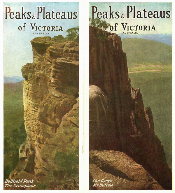
Above—The Grampians Mountains, 164 miles north-west of Melbourne on the main line to Adelaide, are ideal for the lover of rugged heights. Below—Thryptomene grows in profusion on the Grampion Mountains. It is here seen in all its glory.
To reach the wondrous mountain district of The Grampians, tourists leave the train at Stawell. This attractive town, which owes its foundation to sensational discoveries of gold in the early days, is 150 miles northwest of Melbourne, on the main line to Adelaide.
Cars run regularly the 14 miles from the town to the mountains. There are half a dozen houses of accommodation within Hall's Gap and in the Fyan's Creek Valley.
The general shape of the mountains is that of a giant boomerang—Mount William (3830 feet), the culminating point, being on the bend.
Mount Zero, the northern extremity, is 32 miles away in a straight line, while Mount Sturgeon, at the other end, is 28 miles south-westerly.
Properly speaking, the Grampians are the section from Mount William north; to the south the mountains take the name of the Serra Ranges. The Grampians are unique. Not only are the mountains a striking mass in relation to the surrounding flatness, but they have a character all their own. There is nothing else in Victoria like them. They are a system of towering sandstone cliffs.
The rock formations are remarkable, the scenery is of the finest, and the high colours of the cliffs add to the general effect. Nature has stained the rock faces with her universal pigment, iron rust, in all shades of yellow, brown and red.
The vast panoramas from the prominent peaks are among the finest in the State. From one point a vast section of Western Victoria lies stretched out before the tourist like a giant relief map.
Starting out from one of the accommodation houses, and following a well-defined zigzag track, one is led through the Devil's Gap, and by a short divergence to Mushroom Rock. This rock weighs about 50 tons, yet is supported by a small stalk-like pedestal. From here the path leads upwards to the famous Sundial Rock, a ponderous mass of sandstone, from which one of the finest internal views of the Grampians is obtained.
Turning off from the old road to the Borough Huts, a winding road has been cut on the mountainside for 5½ miles, leading to Mount Rosea, passing on the way the beautiful Silverband Falls.
From the falls the track leads through long glades of tree-ferns to the foot of the Grand Stairway up the mountain. This stairway is a remarkable natural ledge about 13 feet wide, leading right up the 800-feet face of the precipice.
An easy climb for another mile leads to the summit of Mount Rosea (3095 feet), so called in admiration of the beautiful native shrub, Pultenoea Rosea, which is found nowhere else but here and on Mount William.
Change of scenery of a delightful nature may be enjoyed by spending a few days in the vicinity of the Borough Huts. Still further variety and wilder forms of nature may be viewed on excursions to the Barbican Rocks.
From the picnic grounds lying just within Hall's Gap many delightful excursions may be made. That which should afford most enjoyment is the exploration of Wonderland. Its charms are innumerable, and no visitor should leave without feasting his eyes upon them. A feature of it is The Silent Street, formed by cliffs of great height running parallel to each other, leaving but a narrow space between, and almost meeting overhead.
Upon emerging from The Silent Street, the visitor passes The Unicorn, and may then proceed to try his powers of self-control on The Nerve Test, a narrow arch-shaped rocky promontory jutting out from the top of the cliff with great depths on either side. The feat is to walk out to the end, turn round, and walk back again. A believer in "Safety First" would leave it alone.
The Grand Canyon is formed by walls of sandstone about 300 feet high, with many curious forms etched by Nature upon them. Its termination has been made rather abrupt by a huge fall of rock, over which flows a beautiful waterfall known as the Bridal Veil.
To the naturalist, desiring to study the ways of the eagle, the Grampians offer unlimited facilities. Kangaroo, wallaby, the emu, and other native creatures, are to be seen in the ranges. They are protected by the Game Act.
A description of this mountain region would be incomplete without mention of its floral beauty. It is a botanical paradise. Its wild flowers in the season are famous for their variety and loveliness. There are showy Grevilleas, Boronias, and Epacrids, with orchids and ferns in 600 different varieties. Quaint grass trees are a feature.
Native heath, which grows in profusion, is the finest in the State, During the flowering season personally conducted tours are arranged by the Government Tourist Bureau.
Comparative proximity to Melbourne, good train service, and natural beauty, make Mount Macedon (3000 feet above sea level) one of Victoria's best tourist resorts. At the trigonometrical station the height is 3325 feet, and at the summit of Camel's Hump 3294 feet. From here extensive views, extending in all directions, may be obtained, especially in the south, with Port Phillip Bay in the distance. Almost due south lie the You Yangs, while in the north tower the mighty peaks of the Victorian Alps.
The best panorama of the surrounding country is obtained at the Camel's Hump, where a tablet indicating the points of interest on the landscape has been erected by the late Sir Thomas Carmichael, a former Governor of the State, in memory of the happy times he had spent on the mountain.
Owing to its elevated position, the district enjoys an equable climate. This makes it ideal for holiday making. The air is invigorating even on the hottest days of summer. Cool and refreshing nights give new life to those in need of rest and recreation. The mountain may be reached by travel to either Macedon (43 miles) or to Woodend (48½ miles).
Two townships, Macedon and Upper Macedon, are in the district. Near to the Macedon railway station is the State Nursery, covering about 90 acres, where millions of trees are grown each year for distribution to the State forests throughout Victoria. The nursery surrounds the district reservoir, and is well worthy of a visit.
Upper Macedon is four miles away. There are comfortable guest houses here. On the higher levels are the State pine plantations. Hidden among the luxuriant trees are also beautiful mountain homes, belonging to business and professional men from the city.
The country cottage of the Governor of Victoria is also on the southern slope of the mountain, and is surrounded by beautiful gardens. Private nurseries on the mountain are a delight at all seasons of the year. During the autumn Macedon has a special appeal, because of the beautiful autumn tints on the trees.
It is about two miles from the Camel's Hump to the summit of Mount Macedon itself. The view from here is not as good as from the Hump because of the timber which intercepts the vision.
There is ample scope for the lover of fern glades. A magnificent fernery lies along the course of the Stony Creek, and a track runs through it almost to the foot of the mount, crossing and re-crossing the creek several times on the way.
Geologists will find much to interest them in the Macedon district.
There is an excellent train service to Macedon—four trains to and from the city each day, with supplemented services during holiday periods.
There are splendid accommodation houses on the northern slopes of the mount, where the views are splendid, and the climate is just as bracing as on the opposite side. Descending the mount towards Woodend is the picturesque residence of the late W. P. McGregor. Extensive grounds surround the house, and there are terraced gardens. Further down towards Woodend are extensive golf links. The road thence to the township traverses wooded country.
Woodend, surrounded by hills and forests of eucalypt, is held in esteem as a health resort. Five miles out is the Hanging Rock. It is difficult to say why it has been give this name. The rock rises to a height of 400 feet above the surrounding country, and easy access is gained to its summit by well-graded paths along its sloping sides.
Its comparatively flat summit is strewn with gigantic boulders, evidently the result of volcanic action in some far distant age. Fanciful resemblances have been traced in some of the rocks to certain personal peculiarities and supposed likenesses to animal forms.
From the summit is obtainable an excellent view of the rich agricultural lands stretching towards Lancefield and Romsey, Mount Alexander, the Bullengarook Ranges, the township of Woodend and Mount Macedon.

Mount Abrupt, 2,720 feet, adjacent to Dunkeld, 178 miles from Melbourne, is one of the most interesting peaks of the Serra Ranges in western Victoria. Its rugged heights are easily accessible.
The Serras share with the Grampians the distinction of being the only mountain resorts in the Western District of Victoria. Dunkeld, a pastoral township on the Wannon River, 178 miles from Melbourne, is the place through which they are most conveniently reached.
Immediately at the back of the town rise the two peaks—Mount Sturgeon, 1946 feet, so called because of its supposed likeness to the fish of that name, and Mount Abrupt, 2720 feet. From Mount Abrupt the curiously serrated ridge of the Serra Range stretches in a northeasterly direction for a distance of more than 30 miles.
A drive to Castle Peak, skirting the Wannon River, is of interest, the scenery being different from that seen in other parts of the State.
Mount Sturgeon, 1,946 feet, also adjoins Dunkeld. It is a sister to Mount Abrupt, and is so named because of its supposed likeness to the fish of that name.
An intensely interesting field for the tourist is served by the branch line of railway which junctions with the main Gippsland line at Warragul, and extends beyond Neerim South as far as Noojee, 88½ miles from Melbourne. It is a grazing district on the fringe of a magnificent hardwood forest, where the mountain ash tree rivals the great redwoods of the Yosemite Valley, in California.
From Noojee, the valleys of the Loch and Latrobe Rivers can be penetrated, and the southern slopes of the Great Dividing Range, of which Mount Horsfall is a prominent feature, can be explored.
The enchanting Glen Nayook is not far from the Nayook station. It is crammed full of beautiful tree ferns, and has been rendered accessible by tracks.
Before Noojee is reached the traveller crosses some of the highest trestle railway bridges in Victoria. The scenery on the last few miles of the trip is fine.
Noojee, the terminal station, is situated between the Loch and Toorongo Rivers, both of which flow south into the Latrobe. The station gives access to glorious wooded and fern bowered valleys comparatively seldom visited, and consequently possessing a newness and freshness which the nature lover cannot fail to appreciate.
The You Yangs, 36 miles from Melbourne, are just big hills with trees, that seem to exist in spite of Nature rather than because of it, with age-worn granite rocks, which swing the mind for a moment away into antiquity. These rocks and these hills, the geologists tell us, are immensely old, perhaps 40,000,000 years.
From the topmost rock (1154 feet), Flinders Peak, Captain Matthew Flinders, R.N., on May 1, 1802, surveyed the Bay—a fact recorded on a tablet inserted in the granite.
The outlook from here is remarkable. By your very feet is broad, expansive Port Phillip Bay, and to the northward Hobson's Bay. Still further away is mighty Melbourne, gleaming in the sun, and seeming to lie at the foot of Mount Dandenong, although we know quite well that Mount Dandenong is 24 miles beyond. We look to the south over Geelong, by clear and lovely Corio Bay, and we behold in a vision of the future what a splendid city Geelong will be as one of the world's greatest ports and as a throbbing centre of manufacturing industry.
A complete circuit may be made of the range of vision. On the distant skyline may be seen Mount Gellibrand, Mount Elephant, Mount Anakie, Mount Buninyong, Mount Warrenheip, Mount Blackwood, Mount Bullengarook, Mount Macedon, Mount Disappointment, the Gellibrand Pile Light, Mount Dandenong, Arthur's Seat, Cape Schanck, Portarlington, Point Flinders, Corio Bay, and Geelong.
The You Yangs may be reached by train to Little River or Lara and a walk of a few miles.
Mount Martha, 44 miles from Melbourne, lies upon a gentle slope overlooking the sea and the esplanade at Dromana. From the mountain top is obtainable a lovely series of views extending in every direction, and including the heights of Macedon, and the You Yangs to the north and north-west across the intervening surface of Port Phillip.
Westward lie Portarlington and St. Leonard's, whilst farther south the eye ranges past the nearer slopes of Dromana, crowned with beautiful residences, to the proud prominence of Arthur's Seat, and beyond all to the open waters of Bass Strait seen through the Heads.
The summit of Arthur's Seat, adjacent to the township of Dromana, on the Mornington Peninsula, is 1200 feet above sea level. There is a splendid drive to the top, affording many beautiful panoramic views on the way. The outlook from the tower at the top is superb. Not only Port Phillip Bay and the waters of Western Port, but a long stretch of the outer ocean is spread before one; the Nepean tongue appears very narrow as it curves symmetrically towards the entrance.
There is at Arthur's Seat a shelter shed and a water tank for the convenience of picnickers.
The enchanting Glen Nayook is not far from the Nayook station, 63 miles from Melbourne. It is a charming railway journey to this spot.

Above—The Kiewa River, flowing la the Kiewa Valley in north-eastern Victoria, is one of the many delightful mountain streams in the State. Snowcapped peaks rise on either side, and the angler will find in the shaded nooks of this stream ample scope for his sport. Below—The Grampion Mountains have geological formations peculiar only to this mountain region. The colouring is unique and to the true lover of nature this wonderful region will be an unending delight.
~ ~ ~ ~ ~ ~ ~
There are innumerable enchanting tours to be made in all directions in the Mount Buffalo National Park. One could spend weeks here and not visit all of the many points of interest.
One of the most delightful tours, and incidentally the longest, is that to The Horn (5645 feet), seven miles from The Chalet. This is usually the objective of a day's trek, the party spending the night in the cottage at The Horn, rising early to view the glorious sunrise from this high point and then returning, perhaps, by a different route to The Chalet next day.
Organised tours under the supervision of experienced guides are arranged by the Government Tourist Bureau. Guests are invited to join these special parties, no charge being made for the special arrangements for comfort and convenience.
Tracks in the Mount Buffalo National Park are well-graded and well-defined.
Motor tours to special features in the district, such as to the hop fields in the valley or to mountains in the other ranges are also arranged at nominal rates.

Mount Bogong
This site is full of FREE ebooks - Project Gutenberg Australia