a treasure-trove of literature
treasure found hidden with no evidence of ownership
(and our other authors) or get HELP Reading, Downloading and Converting files)
or
SEARCH the entire site with Google Site Search
|
Project Gutenberg
Australia a treasure-trove of literature treasure found hidden with no evidence of ownership |
BROWSE the site for other works by this author (and our other authors) or get HELP Reading, Downloading and Converting files) or SEARCH the entire site with Google Site Search |
Title: Northmost Australia
Author: Robert Logan Jack
* A Project Gutenberg of Australia eBook *
eBook No.: 0601141h.html
Language: English
Date first posted: June 2006
Date most recently updated: May 2013

Production notes:
1. Page numbers are at the TOP of each page.


Project Gutenberg of Australia eBooks are created from printed editions
which are in the public domain in Australia, unless a copyright notice
is included. We do NOT keep any eBooks in compliance with a particular
paper edition.

Copyright laws are changing all over the world. Be sure to check the
copyright laws for your country before downloading or redistributing this
file.

This eBook is made available at no cost and with almost no restrictions
whatsoever. You may copy it, give it away or re-use it under the terms
of the Project Gutenberg of Australia License which may be viewed online at
http://gutenberg.net.au/licence.html

To contact Project Gutenberg of Australia go to http://gutenberg.net.au
NOTE:
This ebook comprises Volumes 1 and 2 of Northmost Australia by Robert Logan Jack.
An updated version has been produced in which the 2 volumes have been separated,
all maps have been included for both volumes and high resolution versions
of the maps are available. Searchable indexes have been added and footnotes have
been moved to the end of the paragraph in which the reference to the footnote appears.
Volumes 1 and 2 of the updated version can be accessed from
Robert Logan Jack's listing at Project Gutenberg Australia.
I. INTRODUCTION
II. AUSTRALIA DISTINCT FROM NEW GUINEA. MAGELHAEN, QUIROS
AND TORRES
III. VOYAGE OF THE "DUYFKEN" TO NEW GUINEA AND THE CAPE
YORK PENINSULA, 1605-6
IV. THE VOYAGE OF THE "PERA" AND "AERNEM," 1623: I. THE
SAILING ORDERS
V. THE VOYAGE OF THE "PERA" AND "AERNEM," 1623,
continued: II. GENERAL OBSERVATIONS ON THE EXPEDITION AND ON THE "PERA"
NARRATIVE
VI. THE VOYAGE OF THE "PERA" AND "AERNEM," 1623,
continued: III. THE OUTWARD VOYAGE
VII. THE VOYAGE OF THE "PERA" AND "AERNEM," 1623,
continued: IV. THE RETURN VOYAGE OF THE "PERA"
VIII. THE VOYAGE OF THE "PERA" AND "AERNEM," 1623,
continued: V. THE "AERNEM"
IX. TASMAN'S VOYAGE OF 1644
X. VOYAGES OF THE "BUIJS" AND "RIJDER," 1756: VAN ASSCHENS
AND GONZAL
XI. COOK IN "ENDEAVOUR," 1770
XII. QUIROS, TORRES AND COOK AND THE VAUGONDY AND DALRYMPLE
MAPS
XIII. BLIGH: VOYAGE OF "BOUNTY'S" LAUNCH, 1789
XIV. THE VOYAGE OF THE "PANDORA," 1791: EDWARD EDWARDS
XV. BLIGH, 1788-92, continued: SECOND VOYAGE THROUGH
TORRES STRAIT WITH THE "PROVIDENCE" AND "ASSISTANT," 1792
XVI. THE "HORMUZEER" AND "CHESTERFIELD" (BAMPTON AND ALT),
1793
XVII. FLINDERS, 1791-1814: EARLY LIFE AND VOYAGE TO
AUSTRALIA IN THE "INVESTIGATOR," 1801-2
XVIII. FLINDERS, continued: WITH THE "INVESTIGATOR"
FROM SYDNEY TO THE GULF OF CARPENTARIA, 1802
XIX. FLINDERS, continued: "INVESTIGATOR'S" RETURN TO
SYDNEY, 1802-3
XX. FLINDERS, continued: WITH THE "CUMBERLAND" TO
TORRES STRAIT, 1803—CAPTIVITY AT MAURITIUS, 1803-10, AND CLOSE OF HIS
CAREER
XXI. PHILLIP PARKER KING IN THE "MERMAID," 1819, AND IN THE
"BATHURST," l821
XXII. WRECK OF THE "CHARLES EATON," 1834, AND SEARCH FOR
SURVIVORS, 1836
XXIII. H.M.S. "BEAGLE," WICKHAM AND STOKES, 1839-41: THE
NORMAN RIVER AND NORMANTON AND THE ALBERT RIVER AND BURKETOWN
XXIV. "L'ASTROLABE" AND "LA ZÈLÉE," 1840:
DUMONT-D'URVILLE
XXV. BLACKWOOD AND YULE, 1843-5—H.M.SS. "FLY,"
"BRAMBLE" AND "PRINCE GEORGE" AND THE PINNACE "MIDGE"
XXVI. LEICHHARDT'S OVERLAND EXPEDITION: FROM BRISBANE TO
PORT ESSINGTON, 1844-5—BRISBANE TO THE LYND RIVER
XXVII. LEICHHARDT'S OVERLAND EXPEDITION, 1844-5,
continued: THE LYND VALLEY.
XXVIII. LEICHHARDT'S OVERLAND EXPEDITION, 1844-5,
continued
XXIX. LEICHHARDT'S OVERLAND EXPEDITION, 1844-5,
continued
XXX. KENNEDY'S EXPEDITION, 1848: THE EAST COAST AND THE
COAST RANGE
XXXI. KENNEDY'S EXPEDITION, 1848, continued: FROM
THE COAST RANGE TO THE PALMER
XXXII. KENNEDY'S EXPEDITION, 1848, continued: FROM
THE PALMER TO THE PASCOE
XXXIII. KENNEDY'S EXPEDITION, 1848, continued: THE
FORLORN HOPE—FROM THE PASCOE TO CAPE YORK
XXXIV. KENNEDY'S EXPEDITION, 1848, continued: VOYAGE
OF THE "ARIEL"—TRACES OF KENNEDY AND THE "PUDDING-PAN HILL" PARTY
XXXV. KENNEDY'S EXPEDITION, 1848, continued: VOYAGE
OF THE "FREAK"—SEARCH FOR RELICS OF KENNEDY AND THE "PUDDING-PAN HILL"
PARTY
XXXVI. KENNEDY'S EXPEDITION, 1848, continued:
CARRON'S PARTY AT THE PASCOE RIVER
XXXVII. H.M.SS. "RATTLESNAKE" AND "BRAMBLE," 1847-50:
STANLEY AND YULE
XXXVIII. THE NORTH AUSTRALIAN EXPLORING EXPEDITION, 1855-6:
GREGORY
XXXIX. THE BURKE AND WILLS EXPEDITION, 1860-61
XL. BURKE AND WILLS SEARCH PARTIES IN QUEENSLAND:
LANDSBOROUGH, WALKER AND McKiNLAY, 1861-2
XLI. THE JOURNEY OF FRANK AND ALEXANDER JARDINE, 1864-5:
FROM ROCKHAMPTON TO SOMERSET—CARPENTARIA DOWNS, via EINASLEIGH
RIVER, TO THE MOUTH OF THE ETHERIDGE RIVER
XLII. THE JARDINE BROTHERS' EXPEDITION, 1864-5,
continued: FROM THE EINASLEIGH RIVER TO THE MOUTH OF THE STATEN RIVER,
DE FACTO
XLIII. THE JARDINE BROTHERS' EXPEDITION, continued:
STATEN RIVER, DE FACTO, TO JARDINE RIVER
XLIV. THE JARDINE BROTHERS' EXPEDITION, continued:
THE JARDINE RIVER AND THE PROBLEM OF THE ESCAPE RIVER
XLV. THE JARDINE BROTHERS' EXPEDITION, continued:
RECONNAISSANCE BY THE BROTHERS AND EULAH
XLVI. THE JARDINE BROTHERS' EXPEDITION,
continued
XLVII. SOMERSET AND ITS BACKGROUND
XLVIII. DAINTREE, 1863-71
XLIX. MORESBY: FIRST CRUISE OF THE "BASILISK" TO TORRES
STRAIT, 1871
L. MORESBY, continued: SECOND CRUISE OF THE
"BASILISK" IN TORRES STRAIT, 1873
LI. ABORIGINAL AND POLYNESIAN LABOUR
LII. WILLIAM HANN'S EXPEDITION, 1872: FROM FOSSILBROOK,
DOWN THE LYND RIVER AND ACROSS THE TATE AND WALSH TO LEICHHARDT'S MITCHELL
RIVER
LIII. WILLIAM HANN'S EXPEDITION, CONTINUED: EXCURSIONS IN
THE VALLEY OF THE MITCHELL AND THE RELATIONS OF THAT RIVER TO THE WALSH AND
LYND RIVERS
LIV. WILLIAM HANN'S EXPEDITION, CONTINUED: THE PALMER RIVER
AND THE DISCOVERY OF GOLD
LV. WILLIAM HANN'S EXPEDITION, CONTINUED: PALMER RIVER TO
PRINCESS CHARLOTTE BAY
LVI. WILLIAM HANN'S EXPEDITION, 1872, CONTINUED: THE RETURN
JOURNEY—PRINCESS CHARLOTTE BAY TO THE MOUTH OF THE ANNAN
RIVER—COOKTOWN
LVII. WILLIAM HANN'S EXPEDITION, CONTINUED: THE RETURN
JOURNEY—ANNAN, BLOMFIELDAND DAINTREE RIVERS
LVIII. WILLIAM HANN'S EXPEDITION, CONTINUED: THE RETURN
JOURNEY—FROM THE DAINTREE RIVER TO FOSSIL BROOK
LIX. MULLIGAN'S FIRST PALMER EXPEDITION, 1873, AND THE
DISCOVERY OF PAYABLE GOLD
LX. DALRYMPLE'S EXPEDITION, 1873—THE BEGINNINGS OF
COOKTOWN AND THE FIRST RUSH FROM COOKTOWN TO THE PALMER
LXI. MULLIGAN'S SECOND PALMER EXPEDITION, 1874—FROM
THE PALMER TO THE JUNCTION OF THE ST. GEORGE AND MITCHELL RIVERS, AND BACK
LXII. MULLIGAN'S THIRD EXPEDITION, 1874—FROM THE
PALMER TO THE WALSH
LXIII. MULLIGAN'S FOURTH EXPEDITION, 1874—ST. GEORGE
AND MCLEOD RIVERS AND THE HEADS OF THE NORMANBY AND PALMER
LXIV. MULLIGAN'S FIFTH EXPEDITION, 1875—COOKTOWN TO
JUNCTION CREEK
LXV. MULLIGAN'S FIFTH EXPEDITION, 1875, CONTINUED: JUNCTION
CREEK TO THE COLEMAN RIVER AND COOKTOWN—SIXTH EXPEDITION AND DISCOVERY OF
THE HODGKINSON GOLDFIELD
LXVI. THE COEN GOLDFIELD AND ITS PROSPECTORS, 1876-8
LXVII. THE AUTHOR'S EXPLORATIONS,
1879-80—INTRODUCTORY AND EXPLANATORY
LXVIII. THE AUTHOR'S EXPLORATIONS, 1879-80, CONTINUED:
FIRST EXPEDITION—COOKTOWN TO COEN DIGGINGS AND THE ARCHER RIVER, AND BACK
TO COOKTOWN, 1879
LXIX. THE AUTHOR'S EXPLORATIONS, 1879-80, CONTINUED: SECOND
EXPEDITION—WITH CROSBIE'S PROSPECTING PARTY—COOKTOWN TO THE ARCHER
RIVER
LXX. THE AUTHOR'S EXPLORATIONS, 1879-80, CONTINUED: SECOND
EXPEDITION, CONTINUED: WITH CROSBIE'S PROSPECTING PARTY—ACROSS THE
MCILWRAITH RANGE FROM THE ARCHER RIVER TO THE NISBET RIVER
LXXI. THE AUTHOR'S EXPLORATIONS, 1879-80, CONTINUED: SECOND
EXPEDITION, CONTINUED: WITH CROSBIE'S PROSPECTING PARTY—THE NISBET AND
LOCKHART RIVERS AND HAYS CREEK
LXXII. THE AUTHOR'S EXPLORATIONS, 1879-80, CONTINUED:
SECOND EXPEDITION, CONTINUED: WITH CROSBIE'S PROSPECTING PARTY—FROM THE
LOCKHART RIVER, ACROSS THE MCILWRAITH RANGE TO THE PASCOE RIVER
LXXIII. THE AUTHOR'S EXPLORATIONS, 1879-80, CONTINUED:
SECOND EXPEDITION, CONTINUED: WITH CROSBIE'S PROSPECTING PARTY—FROM THE
PASCOE RIVER TO TEMPLE BAY (OPPOSITE PIPER ISLAND LIGHTSHIP)
LXXIV. THE AUTHOR'S EXPLORATIONS, 1879-80, CONTINUED:
SECOND EXPEDITION, CONTINUED: WITH CROSBIE'S PROSPECTING PARTY—"FIRST
PRELIMINARY REPORT," A SUMMARY OF OPERATIONS BETWEEN COOKTOWN AND TEMPLE
BAY
LXXV. THE AUTHOR'S EXPLORATIONS, 1879-80, CONTINUED: SECOND
EXPEDITION, CONTINUED: WITH CROSBIE'S PROSPECTING PARTY—FROM TEMPLE BAY,
THROUGH THE "BAD LANDS" OR "WET DESERT," TO THE HEAD OF THE JARDINE RIVER
LXXVI. THE AUTHOR'S EXPLORATIONS, 1879-80, CONTINUED:
SECOND EXPEDITION, CONTINUED: WITH CROSBIE'S PROSPECTING PARTY—FROM THE
HEAD OF THE JARDINE RIVER, BY THE PACIFIC COAST, TO FALSE ORFORD NESS
LXXVII THE AUTHOR'S EXPLORATIONS, 1879-80, CONTINUED:
SECOND EXPEDITION, CONTINUED: WITH CROSBIE'S PROSPECTING PARTY—"SECOND
PRELIMINARY REPORT," A SUMMARY OF EVENTS FROM TEMPLE BAY TO FALSE ORFORD
NESS
LXXVIII. THE AUTHOR'S EXPLORATIONS, 1879-80, CONTINUED:
WITH CROSBIE'S PROSPECTING PARTY—FROM FALSE ORFORD NESS TO SOMERSET
LXXIX. THE AUTHOR'S EXPLORATIONS, 1879-80, CONTINUED: WITH
CROSBIE'S PROSPECTING PARTY—"THIRD PRELIMINARY REPORT," A SUMMARY OF
EVENTS FROM FALSE ORFORD NESS TO SOMERSET
LXXX. THE AUTHOR'S EXPLORATIONS, 1879-80, CONTINUED: AN
AFTERWORD
LXXXI. DONALD LAING—A PROSPECTING EXPEDITION IN THE
MCILWRAITH RANGE, 1879-80
LXXXII. J. T. EMBLEY'S EXPLORATIONS AND SURVEYS—I.
EXPEDITION FROM THE HANN RIVER TO THE GULF AND BACK TO THE (SOUTH) COEN,
1884
LXXXIII. J. T. EMBLEY'S EXPLORATIONS AND SURVEYS,
CONTINUED: II. THE PRINCESS CHARLOTTE BAY RIVERS, ETC., 1883-5
LXXXIV. J. T. EMBLEY'S EXPLORATIONS AND SURVEYS,
COTITINUED: III. EAST COAST RIVERS NORTH OF THE ROCKY RIVER GOLDFIELD
LXXXV. J. T. EMBLEY'S EXPLORATIONS AND SURVEYS, CONTINUED:
IV. THE WESTERN RIVERS OF THE PENINSULA
LXXXVI. J. T. EMBLEY'S EXPLORATIONS AND SURVEYS, CONTINUED:
V. THE SOUTHERN GULF RIVERS
LXXXVII. J. T. EMBLEY'S EXPLORATIONS AND SURVEYS,
CONTINUED: VI. THE CAPE YORK DISTRICT
LXXXVIII. THE CAPE YORK TELEGRAPH LINE,
1883-7—BRADFORD'S PRELIMINARY EXPLORATION—SURVEYS DURING
CONSTRUCTION
LXXXIX. MISSIONARY EXPLORATIONS
XC. MINUTIAE OF MARINE SURVEYS —H. M. S. "PALUMA,"
1890-4
XCI. MINUTIAE OF MARINE SURVEYS, CONTINUED: H.M.S. "PALUMA"
AND THE JANET RANGE, 1890-3
XCII. MINUTIAE OF MARINE SURVEYS, CONTINUED: H.M.S. "DART"
AND THE MACROSSAN RANGE, 1896-8
XCIII. WILLIAM BAIRD, 1887-96
XCIV. JOHN DICKIE, 1887-1920
XCV. DICKIE, DICK AND SHEFFIELD IN THE MCILWRAITH AND
MACROSSAN RANGES, 1910
XCVI. WILLIAM LAKELAND, 1876-1910
XCVII. WILLIAM BOWDEN, 1892-1901
XCVIII. ABORIGINAL PROSPECTING—PLUTO AND THE BATAVIA
RIVER, 1910-16
XCIX. CONCLUSION
INDEX OF PERSONS
INDEX OF LOCALITIES
INDEX OF SUBJECTS
R. LOGAN JACK, 1920
Photo. Johnson Sydney.
ABEL JANSZOON TASMAN, 1664 [1]
Reproduced from Jose's History of Australasia.
[1) In this case, and some others, the date of the portrait is conjectural.]
JAMES COOK, 1772
Reproduced from Glasgow Issue of Cook's Voyages, 1807.
WILLIAM BLIGH, 1812
Reproduced from Jose's History.
MATTHEW FLINDERS, 1811
Reproduced from Scott's Life of Flinders.
PHILLIP PARKER KING
Reproduced from Feldheim's Brisbane Old and New.
J. BEETE JUKES, 1870
Photo, from Bust by Joseph Watkins, R.H.A.
LUDWIG LEICHHARDT, 1844
Reproduced from Long's Stories of Australian Exploration.
EDMUND BESLEY COURT KENNEDY, 1847
Reproduced from Long's Stories of Australian Exploration.
WILLIAM CARRON, 1870
Reproduced from Journ. Roy. Soc., N.S.W., Vol. 42.
SIR AUGUSTUS CHARLES GREGORY, 1898
Photo, lent by Hugh Macintosh, Brisbane.
ROBERT O'HARA BURKE, 1860
Reproduced from Long's Stories of Australian Exploration.
WILLIAM JOHN WILLS, 1860
Reproduced from Long's Stories of Australian Exploration.
WILLIAM LANDSBOROUGH, 1870
Reproduced from Feldheim's Brisbane Old and New.
JOHN McKINLAY, 1870
Reproduced from Feldheim's Adelaide Old and New.
FRANK (LEFT) AND ALICK JARDINE (RIGHT), 1867
Reproduced from Byerley's Jardine Expedition.
FRANK JARDINE, 1917
Reproduced from Queenslander of 10th November, 1917.
RICHARD DAINTREE, 1871
Reproduced from Dunn's Founders of the Geological Survey of
Victoria.
WILLIAM HANN, 1873
Reproduced from Photo, lent by his daughter Mrs. Charles Clarke, Maryvale.
NORMAN TAYLOR, 1873
Reproduced from Dunn's Founders of the Geological Survey of
Victoria.
THOMAS TATE, 25 JUNE, 1913 (71st BIRTHDAY)
Reproduced from Photo, lent by his daughter Mrs. Leake, Maxwellton,
Queensland.
HANN EXPEDITION, 1872: (LEFT) THOMAS TATE; (LEANING)
WILLIAM HANN; (ERECT) FRED WARNER; NORMAN TAYLOR (RIGHT)
Reproduced from Photo, lent by Mrs. Leake.
GEORGE ELPHINSTONE DALRYMPLE, 1876
Reproduced from Feldheim's Brisbane Old and New.
WILLIAM J. WEBB, 1916
Reproduced from Photo, lent by himself.
JOHN MOFFAT, 1904
Reproduced from Photo, lent by his daughter Miss E. L. Moffat.
JAMES VENTURE MULLIGAN, 1905
Photo. Poulsen, Brisbane, lent by T. J. Byers, Hughenden.
ROBERT LOGAN JACK, 1877
Photo. McKenzie, Paisley.
BENJAMIN NEAVE PEACH, 1877
Photo. Bowman, Glasgow.
JAMES CROSBIE, 1891
Reproduced from Photo, lent by Mrs. Crosbie.
JAMES SIMPSON LOVE, 1878
Photo. Munro, Edinburgh.
JAMES SIMPSON LOVE, 1920
Photo. Bernice Agar, Sydney.
SIR THOMAS MCILWRAITH, 1893
Photo, lent by Hugh Macintosh, Brisbane.
HUGH LOCKHART, 1875
Photo. Moffat, Edinburgh.
EDWARD HULL, 1869
Photo. A. G. Tod, Cheltenham.
JANET SIMPSON JACK, 1920
Photo. Bernice Agar, Sydney.
JOHN T. EMBLEY, 1887
Photo. Turtle & Co.
JOHN T. EMBLEV, 1919
Photo. J. Ward Symons.
JOHN DICKIE, 1912
Reproduced from Photo, lent by W. J. Webb.
JAMES DICK, 1910
Reproduced from Photo, lent by W. J. Webb.
A. CAPE YORK TO NEW GUINEA = QUEENSLAND 4-MILE MAP, SHEET 21B, WITH ADDITIONS FROM ADMIRALTY CHARTS. SHOWS SEA ROUTES OF "SAN PEDRO" (TORRES), 1606; "DUYFKEN" (JANSZOON), 1606; "PERA" (CARSTENSZOON AND SLUIJS) AND "AERNEM" (VON COOLSTEERDT), 1623; "LIMMEN" (TASMAN), 1643; "RIJDER" (GONZAL), 1756; "BUIJS" (ASSCHENS), 1756; "ENDEAVOUR" (COOK), 1770; "BOUNTY'S" LAUNCH (BLIGH), 1789; "PANDORA" AND HER BOATS (EDWARDS), 1791; "PROVIDENCE" (BLIGH) AND "ASSISTANT" (PORTLOCK), 1792; "HORMUZEER" (BAMPTON) AND "CHESTERFIELD" (ALT), 1793 "INVESTIGATOR" (FLINDERS), 1802; "CUMBERLAND" (FLINDERS), 1803; "MERMAID" (KING), 1818; "ISABELLA" (LEWIS), 1836; "TIGRIS" (IGGLESTON), 1836; "ASTROLABE" AND "MEE" (DUMONT-D'URVILLE), 1840; "FLY" (BLACKWOOD), "BRAMBLE" (YULE) AND "PRINCE GEORGE," 1843-5; "RATTLESNAKE" (STANLEY), 1849 "BASILISK" (MORESBY), 1871-3: AND LAND ROUTES OF KENNEDY AND JACKEY-JACKEY, 1848; F. AND A. JARDINE, 1865; JACK, 1880; BRADFORD, 1883.
B. ORFORD NESS TO CAPE WEYMOUTH AND VRILYA POINT TO ALBATROSS BAY = QUEENSLAND 4-MILE MAP, SHEET 21A, WITH ADDITIONS FROM ADMIRALTY CHARTS. SHOWS SEA ROUTES OF "DUYFKEN," 1606; "PERA" AND "AERNEM," 1623; "LIMMEN," 1644; "BUIJS," 1756; "RIJDER," 1756; "ENDEAVOUR," 1770; "BOUNTY'S" LAUNCH, 1789; "INVESTIGATOR," 1802; "FLY," "BRAMBLE" AND "MIDGE," 1843; "RATTLESNAKE" AND "BRAMBLE," 1848; "ARIEL" (DOBSON), 1848; "FREAK" (SIMPSON) AND HER WHALEBOAT, 1849: AND LAND ROUTES OF KENNEDY, 1848; F. & A. JARDINE, 1865; JACK, 1880; PENNEFATHER, 1881; BRADFORD, 1883; HEY, 1895; EMBLEY, 1897.
C. LLOYD BAY TO STEWART RIVER = PARTS OF QUEENSLAND 4-MILE MAPS 20C AND 20D, WITH ADDITIONS FROM ADMIRALTY CHART. SHOWS SEA ROUTES OF "ENDEAVOUR," 1770; "BOUNTY'S" LAUNCH, 1789; "BRAMBLE" (YULE), 1843; "RATTLESNAKE" AND "BRAMBLE," 1848; "DART," 1896-8: AND LAND ROUTES OF KENNEDY, 1848; W. HANN, 1872; JACK, 1879-80; BRADFORD, 1883; EMBLEY, 1884-96; DICKIE, 1901; DICKIE, DICK AND SHEFFIELD, 1910.
D. ALBATROSS BAY TO CAPE KEERWEER, GULF OF CARPENTARIA = PART OF QUEENSLAND 4-MILE MAP, SHEET 20D, WITH ADDITIONS FROM ADMIRALTY CHART. SHOWS SEA ROUTES OF "DUYFKEN," 1606; "PERA" AND "AERNEM," 1623; "LIMMEN" (TASMAN), 1644; "BUIJS," 1756; "RIJDER," 1756; "INVESTIGATOR" (FLINDERS), 1802: AND LAND ROUTES OF F. AND A. JARDINE, 1864-5; EMBLEY, 1884-95; HEY, 1892-1919; MESTON, 1896; JACKSON, 1902.
E. COOKTOWN TO PRINCESS CHARLOTTE BAY = QUEENSLAND 4-MILE MAP, SHEET 20A, WITH ADDITIONS FROM ADMIRALTY CHARTS. SHOWS SEA ROUTES OF "ENDEAVOUR" (COOK), 1770; "MERMAID" (KING), 1819; "BATHURST" (KING), 1821; "FLY" (BLACKWOOD) AND "BRAMBLE" (YULE), 1843; "RATTLESNAKE" (STANLEY) AND "BRAMBLE" (YULE), 1848; AND LAND ROUTES OF KENNEDY, 1848; HANN, 1872; MULLIGAN, 1875; JACK, 1879; BRADFORD, 1883; EMBLEY, 1884.
F. HAMILTON AND PHILP GOLDFIELDS AND WESTWARD TO THE GULF OF CARPENTARIA, WITH THE KENDALL, HOLROYD, EDWARD, COLEMAN AND MITCHELL RIVERS = QUEENSLAND 4-MILE MAP, SHEET 20B, WITH ADDITIONS FROM ADMIRALTY CHART. SHOWS SEA ROUTES OF "PERA" AND "AERNEM," 1623; "LIMMEN" (TASMAN), 1644; "INVESTIGATOR" (FLINDERS), 1802: AND LAND ROUTES OF F. AND A. JARDINE, 1864; HANN, 1872; MULLIGAN, 1875-95; JACK, 1879-80; EMBLEY, 1874-1896; BRADFORD, 1883; DICKIE, 1901.
G. CAPE GRAFTON TO WEARY BAY AND CAIRNS TO PALMER RIVER = QUEENSLAND 4-MILE MAP 18C AND PART OF 18D, WITH ADDITIONS FROM ADMIRALTY CHART. SHOWS SEA ROUTE OF "ENDEAVOUR" (COOK), 1770: AND LAND ROUTES OF LEICHHARDT, 1845; KENNEDY, 1848; HANN, 1872; MULLIGAN, 1873-75; DICKIE, 1901.
H. PALMER, MITCHELL, LYND, STATEN AND GILBERT RIVERS, AND PART OF THE GULF OF CARPENTARIA = QUEENSLAND 4-MILE MAP, SHEET 18D AND PART OF 19C, WITH ADDITIONS FROM ADMIRALTY CHARTS. SHOWS SEA ROUTES OF "PERA" AND "AERNEM:, 1623; "LIMMEN" (TASMAN), 1644; "BEAGLE" (STOKES), 1841: AND LAND ROUTES OF LEICHHARDT, 1845; F. AND A. JARDINE, 1864; HANN, 1872; MULLIGAN, 1875; EMBLEY, 1884-7; DICKIE, 1891.
K. ETHERIDGE, CHILLAGOE, HERBERTON, CARDWELL AND THE HEADS OF THE HERBERT AND BURDEKIN RIVERS = QUEENSLAND 4-MILE MAP 18A, 2-MILE MAP OF COOK DISTRICT, SHEETS 5 AND 6, AND 2-MILE MAP OF KENNEDY DISTRICT, SHEET 9. SHOWS LAND ROUTES OF LEICHHARDT, 1845; KENNEDY, 1848; HANN, 1872; MULLIGAN, 1873-75.
L. CROYDON AND PART OF ETHERIDGE GOLDFIELDS, THE GILBERT, ETHERIDGE AND EINASLEIGH RIVERS AND THE HEAD OF THE SO-CALLED STAATEN RIVER = QUEENSLAND 4-MILE MAP, SHEET 18B. SHOWS LAND ROUTES OF GREGORY, 1856; MCKINLAY, 1862; F. AND A. JARDINE, 1864; MACDONALD, 1864.
M. BURKETOWN, NORMANTON AND THE SOUTHERN MOUTHS OF THE GILBERT RIVER = QUEENSLAND 4-MILE MAP, SHEET 19A, WITH ADDITIONS FROM ADMIRALTY CHARTS. SHOWS SEA ROUTES OF "PERU" AND "AERNEM," 1623; "LIMMEN" (TASMAN), 1644; "INVESTIGATOR" (FLINDERS), 1802; "BEAGLE" (STOKES) AND HER BOATS, 1841: AND LAND ROUTES OF LEICHHARDT, 1845; GREGORY, 1856; BURKE AND WILLS, 1861; WALKER, 1861; LANDSBOROUGH, 1862; MCKINLAY, 1862; MACDONALD, 1864.
N. NORTH WESTERN CORNER OF QUEENSLAND, AND THE GULF OF CARPENTARIA = QUEENSLAND 4-MILE MAP, SHEET 19A AND PART OF 19D, WITH ADDITIONS FROM ADMIRALTY CHARTS. SHOWS SEA ROUTES OF "LIMMEN" (TASMAN), 1644; "INVESTIGATOR" (FLINDERS), 1802; "BEAGLE'S" BOATS, 1841: AND LAND ROUTES OF LEICHHARDT, 1845; GREGORY, 1856; LANDSBOROUGH, 1861; BEDFORD, 1882; EMBLEY, 1889.
O. INGHAM, TOWNSVILLE AND BOWEN, AND DELTAS OF HERBERT AND BURDEKIN RIVERS = QUEENSLAND 4-MILE MAP, SHEET 14D AND KENNEDY DISTRICT 2-MILE MAP, SHEETS, 1, 2, 6, 7, 8 AND 9. SHOWS SEA ROUTE OF "ENDEAVOUR" (COOK), 1770: AND LAND ROUTES OF LEICHHARDT, 1845; GREGORY, 1856.
P. THE UPPER BURDEKIN VALLEY AND THE ETHERIDGE, GILBERT AND WOOLGAR GOLDFIELDS = QUEENSLAND 4-MILE MAP, SHEET 15C AND PART OF 15D. SHOWS LAND ROUTES OF LEICHHARDT, 1845; GREGORY, 1856; MCKINLAY, 1862; MACDONALD, 1864; DAINTREE, 1864-9.
Q. CARDWELL, TOWNSVILLE, BOWEN, WINTON, ETC., INCLUDING MAPS O AND P, PARTS OF K AND L, AND QUEENSLAND 4-MILE MAPS 14B, 15A, 10D, 11C, AND PARTS OF 14A, 15B, 15D, L0C AND 11D. SHOWS LAND ROUTES OF LEICHHARDT, 1845; KENNEDY, 1848; F. AND A. JARDINE, 1864; GREGORY, 1856; WALKER, 1861; MCKINLAY, 1862; WALKER, 1862; LANDSBOROUGH, 1862; MACDONALD, 1864; DAINTREE, 1863-70; WRIGLEY (AEROPLANE), 1919; ROSS-SMITH (AEROPLANE), 1919.
R. CAMOOWEAL, CROYDON, MOUNT CUTHBERT, CLONCURRY, SELWYN, COLLINGWOOD, INCLUDING PARTS OF L, M AND N, QUEENSLAND 4-MILE MAPS, SHEETS 16C, 16D, 16A, 16B, 12C AND 12D, AND PARTS OF 15D, 15C AND 11D. SHOWS LAND ROUTES OF LEICHHARDT, 1845; GREGORY, 1856; BURKE AND WILLS, 1861; WALKER, 1861; LANDSBOROUGH, 1862; MCKINLAY, 1862; MACDONALD, 1864; JACK, 1881; WRIGLEY (AEROPLANE), 1919; ROSS-SMITH (AEROPLANE), 1919.
The author desires specially to record his thanks to the undernoted persons and institutions. References to many others who assisted him will be found in the text.
AGAR, BERNICE, Sydney. For special pains in the production of photographs of R. Logan Jack, Janet Simpson Jack and James Simpson Love.
ANGUS & ROBERTSON, LTD., Sydney. For permission to produce portraits of Tasman, Bligh and Flinders from books published by them.
BRADFORD, JOHN R., Brisbane. For permission to publish his report (1883) on the Exploration preliminary to the construction of the Cape York Telegraph Line; for information which proved instrumental in tracing my lost maps; and for much useful information which is embodied in the text.
BRADY, A. B., Under Secretary for Works, Queensland. For copies of documents relating to Mulligan's explorations.
BYERS, T. J., Hughenden. For portrait of Mulligan and much information.
CLARK, MRS., Maryvale, Queensland. For portrait group of members of the expedition led by her father, William Hann; for Biographical Details re members of the expedition and Daintree and for other information.
CROSBIE, MRS. J. D., Cairns. For portrait of her late husband, James Crosbie, biographical notes and other information.
CULLEN, E. A., Harbours and Rivers Department, Brisbane. For information re Batavia River and Port Musgrave.
DICK, (THE LATE) James, Cooktown. For information re prospecting in Cape York Peninsula, communicated in correspondence from 1911 till his death in 1916. His many letters amounted almost to collaboration. Indirectly, as is explained in the introductory chapter, he may be said to have brought about the expansion of a proposed annotated version of my reports on the 1879-80 expeditions, on which I was engaged when the correspondence began, into a history covering three centuries of exploration.
DUNN, E. J., formerly Government Geologist of Victoria. For permission to reproduce portraits of Norman Taylor and Richard Daintree from his Founders of the Geological Survey of Victoria.
DUNSTAN, B., Government Geologist, Queensland. For a search in his office for copies of my lost maps; and for the loan of official documents left by me.
EMBLEY, J. T., Melbourne. For portraits of himself; for a special article on his expedition (1884) with Clark, and for information re the McIlwraith and Macrossan Ranges, the Western Rivers, the discovery and occupation of pastoral country in the north, etc. The assistance rendered by him in some portions of this work amounted to collaboration.
FOOT, MRS. W., Cardington, Queensland. For portrait of her father, William Hann, and for information re the Hann expedition, the Etheridge and Gilbert Rivers, etc.
GREEN, D., Townsville. For many contributions of newspaper articles re northern explorers and pioneers, and for gratuitous advertisements in the newspapers controlled by him with the object of eliciting information required by me.
HEERES, J. E., LL.D., formerly Professor at the Dutch Colonial Institute, Delft, afterwards at the University of Leiden. For permission to quote from the English translation of his exhaustive work on The Part borne by the Dutch in the Discovery of Australia, 1606-1765, and to his publishers, "The Late E. J. Brill Company, Limited," Leiden, for their consent.
HEY, REV. NICHOLAS, late of the Mapoon Aboriginal Mission. For geographical and ethnological notes; for notes on explorations by the missionaries, and especially for assisting in the identification of what I believe to be "Coen Revier" of the "Pera" and "Aernem" Expedition.
JOHNSON, L., Sydney. For special care in the reproduction of old portraits from originals in some instance faded or damaged.
JONES, REV. JOHN, Church of England Board of Missions, Sydney. For information re Aborigines of the Mitchell Delta, etc.
LEAKE, MRS., Merriula, Maxwellton, Queensland. For portrait of her father, Thomas Tate; for documents relating to the wreck of the "Maria" in which he took part, and for other information.
LEES, WILLIAM, Brisbane. For assistance and encouragement in my work. For several years back he continually contributed any writing which came under his observation as a journalist, and which appeared to bear on the subject of my study. His extensive knowledge of the North of Queensland and his wide reading enabled him to amass knowledge most useful to me.
LOVE, JAMES SIMPSON, Townsville. For information regarding recent developments in North Queensland. He was the youngest member of my Second Expedition (1879-80), and has since been in a position to acquire a very intimate knowledge of the Cape York Peninsula.
MACGREGOR, THE LATE SIR WILLIAM, G.C.M.G., etc. Administrator and Lieutenant Governor of British New Guinea, Governor of Lagos, Governor of Newfoundland and Governor of Queensland. But for his death (on 4th July, 1919) this book would have been dedicated to him in grateful recognition of his services to science and of his personal and stimulating interest in my geographical and geological work and in the historical questions which I had under investigation. He wrote me on 29th December, 1916: "I am glad to learn that you have on the stocks a work of the kind you mention. I should indeed consider it a very real honour to have it dedicated to me, for I know well that it would be the standard of reference for future generations when personally we are long off the scene."
MACINTOSH, HUGH, Brisbane. For portraits of Sir Augustus Gregory and Sir Thomas McIlwraith, and for a mass of information re explorations, surveys, dates, names, etc., in answer to my inquiries extending over the last decade. His long experience in the Survey Office made him an unrivalled authority on such matters.
McLAREN, JOHN, Utingu, near Cape York. For information re the Coco-nut plantation and conditions in the Cape York district generally.
MAIDEN, J. H., C.M.G., Government Botanist, Sydney. For permission to reproduce portrait of William Carron from his Records of Australian Botanists, and for botanical notes.
MARSHALL, HENRY, Under Secretary for Mines, Brisbane. For the text of James Dick's report on the Dickie, Dick and Sheffield traverse of the McIlwraith Range; for a search in the archives of the Department for my missing map; for statistical and other information.
MITCHELL LIBRARY, Sydney, and HUGH WRIGHT, Librarian. For access to books and maps and special facilities for the examination of Kennedy and early Dutch-Australian Literature and documents.
MOFFAT, Miss E. L., Sydney. For portrait of her father, the late John Moffat.
PARLIAMENTARY LIBRARY, BRISBANE, and J. MURRAY, Librarian. For official statement re construction of Cape York Telegraph.
PARLIAMENTARY LIBRARY, SYDNEY, and F. WALSH, Librarian. For access to Books, Newspaper files and documents and facilities for the perusal of Kennedy and other documents.
PATERSON, FRANK J., TOOWOOMBA, Queensland. For information which assisted in tracing my lost maps and for reminiscences of the survey and construction of the Cape York Telegraph.
POSTMASTER GENERAL'S DEPARTMENT (Federal) and J. McCoNAcniE, Deputy P.M.G., Queensland. For copy of Bradford's report on Cape York Telegraph Survey (1883-4), with maps, and for permission to publish.
PUBLIC LIBRARY, SYDNEY, and W. H. IFOULD, Librarian. For access to Parliamentary papers and documents.
PUBLIC LIBRARY, MELBOURNE. For access to books and maps.
QUEENSLANDER NEWSPAPER, Brisbane. For permission to reproduce portrait of Frank Jardine.
SPOWERS, ALLAN A., Surveyor General, Queensland. For maps of the Department of Lands, and officially authenticated information re explorations and surveys.
WEBB, W. J., Cooktown. For special article on the Cooktown Palmer Rush (1873); for portraits of Dickie, Dick and himself; and for notes on early prospectors.
WHITCOMBE AND TOMBS, Melbourne. For permission to reproduce portraits of Leichhardt, Kennedy, Burke and Wills from books published by them.
WHITE, C. T., Government Botanist, Queensland. For botanical notes, and especially for notes and references re Gastrolobium.
{Page 1}
The Cape York Peninsula, forming, as it does, the link binding the two great islands of Australia and New Guinea, is necessarily of the highest importance from a geological, ethnological, zoological, botanical, historical, political and strategical point of view.
It so happens that the Peninsula is the first part of Australia to which authentic written history refers. On the earliest landing of Europeans there arose the complex questions which obtrude themselves whenever civilisation comes into contact with barbarism.
My practical interest in the Peninsula began with a tour made in 1879 in the course of my Geological Survey work. On my way to the recently rushed and still more recently abandoned "Coen" gold diggings, I crossed the base of the then almost unknown Cape Melville Peninsula, where I found indications of auriferous country, and also the rivers south of Princess Charlotte Bay, down which the unfortunate explorer Kennedy had struggled in vain to keep his appointment with the relief ship twenty-two years earlier. From the Coen, I was only able to push out to the north for a period inexorably limited by the condition of my horses and the quantity of food remaining in my saddle-bags. Even under these conditions, however, I penetrated for some distance into the McIlwraith Range, and on the heads of the river which I named the Peach (unaware that it was the river named the Archer by the Brothers Jardine, who crossed it near its mouth) I found widespread evidence of the presence of gold and tin.
From the Laura Telegraph Office, from Cooktown, and ultimately from my headquarters at Townsville, I made such communications as were possible in anticipation of a complete report to the head of the Department of Mines, which administered the Geological Survey.
My individual impression was that the reefs in the district traversed were of more importance than the alluvial gold, but there had been neither means nor time at my disposal to enable me to satisfy myself of the value of either, and this view I duly represented in my correspondence with the Department.
{Page 2}
The desire of the Government, and of the eager diggers throughout Queensland, was to discover an alluvial goldfield on the pattern of the Palmer, which was by that time approaching exhaustion.
A party of miners, headed by James Crosbie, volunteered to go and settle the question of the existence of payable alluvial gold, and they asked for and obtained government assistance, and I was instructed to lead them to the spot. In addition, a prospecting party was equipped, with money subscribed in Cook-town, and sent out to anticipate the expedition subsidised by the Government.
The combined geological and prospecting parties left Cooktown on 26th November, 1879, and striking out from the "bend of the Kennedy" on the Cooktown-Palmerville road, reached the "Peach" (Archer) River on 20th December. The prospectors commenced operations at once, and were rewarded with "prospects" which led them into the jungle-clad recesses of the McIlwraith Range. Here, to their disappointment, although prospects were obtained here and there, the creeks and gullies were found to run over almost bare rocks, their beds being too steep for the retention of any quantity of alluvial "washdirt." On 30th December, the wet season set in. For the remainder of our time in the field, the creeks were too swollen for the "bottom" to be reached where there was any washdirt at all, or the ground was too sodden to carry our horses. There were long and vexatious delays when it was neither possible to work nor to travel. Nevertheless, we continued, during breaks in the bad weather, to cross the McIlwraith Range and touch the Macrossan Range. Regaining the summit of the McIlwraith Range, we followed it to its northern extremity, where the valley of the Pascoe River separates it from the mountain mass which we named the Janet Range. It was found that the Pascoe River bounds the Janet Range on the south and east, and we practically followed it down till we had finally to cross it where it took an easterly course towards the Pacific. We had already made up our minds that it was safer to chance the unknown in the north than to return to Cooktown across several great rivers, now all certain to be flooded. No sooner had we left the Pascoe than we entered on the Bad Lands or Wet Desert of "heath" and "scrub" without anything for horses to live on. From the Pascoe to the Escape River, our course must have coincided in many places with Kennedy's on his "forlorn hope" journey, and we repeated many of his experiences, as told by his surviving companion Jackey-Jackey, but happily not the series of disasters which resulted in his own death and the disasters which overtook the two parties he left behind to await the relief he went to bring. The natives displayed in our case, as in Kennedy's, a persistent hostility which hampered our
{Page 3}
movements and partially incapacitated me during the final stages of the journey. Horses died of starvation or poison, and the men of the party were running perilously short of food—the journey having been prolonged beyond our calculations—when we reached Somerset on 3rd April, 1880.
Kennedy's maps and journals (1848) perished with him, and what we know of his expedition is taken (as far north as the Pascoe River) from the narrative written by William Carron, one of the three survivors, and (north of the Pascoe) from the "statement" of the black boy Jackey-Jackey, another of the survivors and the only one of the thirteen men to make the complete journey from Rockingham Bay to Somerset. The Geological and Prospecting Party's route only coincided for a short distance, from the head of the Jardine River to its westward bend, with that of the Jardine Brothers (1865). Day after day, during the whole of my journey, I was mapping the mountain ranges, rivers and other features of the country, checking my latitudes by star-observations whenever the night sky was clear enough, and as far as charting was concerned we were in virgin ground.
My report on the two expeditions was completed at my Townsville office in the winter of 1880 and sent to the Minister for Mines, Brisbane, with the relative map, which had taken a good deal of time, subject to interruptions by other duties. The report was printed and officially issued on 14th September, 1881, without my having had any opportunity of seeing it through the press, and to my astonishment the map—which might have been supposed to be of the first importance—was omitted. What became of the map and of my office copy will be seen in Chapter LXVII.
After the map had reached Brisbane and before my report was published, my map had been reduced to a smaller scale and embodied in official maps issued by the Department of Lands. In that form, however, my charting was open, in parts, to an interpretation which I could never have sanctioned.
In 1913, when.I had been out of the government service for about fourteen years, and when for the first time some degree of leisure had begun to fall to my share, I commenced to prepare a revised and corrected issue of the report, with its map reconstructed from my notes, with the intention of offering it to the Government for republication (the report itself having been long out of print). Some progress had been made when my friend James Dick, of Cooktown, sent me proofs of a pamphlet in which he proposed to summarise the narrative of the Geological and Prospecting Expeditions. When I had gone over the proofs, correcting them only in so far as statements of fact were concerned, I fully realised how misleading my original narrative must have been, misprinted as it was, and unaccompanied by the map which
{Page 4}
formed its most essential part. I resumed my task with renewed vigour, and with a wider scope, and Mr. Dick, up to the date of his death, assisted me in many ways through his local and personal knowledge, happily of more recent date than mine. I am grateful to his memory, and am conscious that he was, in a sense, "the only begetter of these ensuing lines."
Between 1880 and 1913, a great deal of charting of the interior had been accomplished by the Departments of Lands and Mines, although even now that work is incomplete. The new lines gave me, when I was recharting the lost map, an opportunity of correcting my sketching to correspond with actual surveys.
The first lesson to force itself upon me was that my estimates of distances covered had been influenced by fatigue or difficulties on the one hand (leading to over-estimation) or by good-going and good-feeding for the horses on the other (leading to underestimation).
The second lesson was that, even in the direction of my course, I had in many instances strayed to the right or left, as a ship may steer a definite course and yet make leeway owing to the pressure of forces incorrectly estimated, or even not recognised. In short, the personal equation had to be introduced and allowed for before I could hope to reconcile my supposed with my actual position on any given date.
Long before I had finished the revision of my own narrative, it had become evident that its significance could not be fully understood without a critical study of the diaries of explorers who had gone before me and whose paths I had crossed from time to time. This led me back from Mulligan to Leichhardt, and as one by one the writings of honoured pioneers came under my review, I subjected them to the tests already applied to my own, and to the best of my ability substituted where the writers were for where they thought they were, and made the necessary allowances and corrections. Then it seemed that the story might as well be continued to the present date by the addition of the developments which have taken place since 1880 through the instrumentality of surveyors, explorers and prospectors. Some of the actors are, happily, still alive, and these have rendered material assistance by the contribution of original matter. Among these are Webb, Bradford, Paterson and Embley. To the last-named gentleman, especially, I am indebted for assistance rendered doubly valuable by his prolonged residence in the Peninsula, and which, in some parts of the work, almost amounted to collaboration.
While dealing with land explorers it was borne in upon me that they owed some of their difficulties and many of their errors to an imperfect comprehension of the work of earlier maritime explorers. They were not, indeed, to be blamed for this, as in few instances could they have perused the narratives or seen the
{Page 5}
charts of the sea-adventurers. As it was, the Dutch sailors named "reviers," or inlets, on the Gulf coast, and subsequent explorers of the interior, almost without exception, made bad guesses at the connection of their rivers with the inlets on the coast line. I do not propose any reform so drastic as to restore their original names to the western rivers of the Peninsula, but content myself, after years of research, with distinguishing the original, or right, or de jure names from the de facto names, the product of pardonable misidentifications sanctioned, in many cases, by half a century of popular and official usage. I have, I hope, succeeded in making it clear that, in many instances, the de facto names are in reality not those bestowed by the earliest explorers, but rather what are called "complimentary" names.
From the preceding explanation, it will be understood that this work began, so to speak, in the middle, and followed lines dictated by the questions which arose during its progress. It was ultimately realised that it would be advisable to arrange it in chronological order, so that the tale told by each explorer might be compared with the facts ascertained by his predecessors and at the same time be complete in itself. Of no less importance was the consideration of precisely how much knowledge each explorer had of the achievements of his predecessors; and this point has exacted very careful study. I am forced to the conclusion that in most instances the later explorers knew very little about their predecessors, having taken what little they knew at second hand and without having had access to important documents, some of which, indeed, only came to light after their own time.
While aiming at chronological order, it must be conceded that it is not always possible to observe it strictly. It may be that the stories of two observers overlap; or a statement may demand historical investigation into the past; or, again, it may be convenient at once to trace the outcome of a newly discovered fact downwards to the present time. Hence a certain amount of repetition is inevitable, as facts or statements are viewed by one observer after another from a different angle.
It is impossible to define the exact base of the Cape York Peninsula, and in writing of it one must occasionally follow its pioneers beyond its southern boundary, however liberal or elastic the definition of the latter may be. The historian of France needs no excuse for referring to happenings in Germany or Italy. In a parallel way, what was commenced as a history of the Cape York Peninsula has come to include Torres Strait, the "Gulf" country west to the boundary of Queensland and the Pacific country as far south as Bowen.
SYDNEY,
30th September, 1920.
{Page 6}
SIXTEENTH- AND SEVENTEENTH-CENTURY IDEAS OF THE GREAT SOUTH LAND. WAS NEW GUINEA PART OF IT? SPANISH AND PORTUGUESE KNOWLEDGE. THE DAUPHIN CHART. DUTCH IDEAS. BULL OF POPE ALEXANDER VI. THE SPANISH MAIN. ENGLAND AND HOLLAND IN THE FIELD. MAGELHAEN'S VOYAGE TO THE PHILIPPINES. HIS DEATH. DID HIS OFFICERS TOUCH AUSTRALIA I QUIROS DISCOVERS SANTA CRUZ AND TRIES TO ESTABLISH A COLONY. WYTFLIET'S BELIEF THAT NEW GUINEA WAS DISTINCT FROM THE GREAT SOUTH LAND. SPANISH KNOWLEDGE OF THE STRAIT. QUIROS' NEW EXPEDITION. FLAGSHIP AND CONSORTS SEPARATE AT ESPIRITU SANTO (NEW HEBRIDES). QUIROS TAKES THAT ISLAND TO BE PART OF THE SOUTH LAND. TORRES DISPROVES THIS. LAYING-OUT THE NEW JERUSALEM. TORRES' REPORT DISCOVERED IN 1762. QUIROS' REPORT DISCOVERED IN 1876. TORRES' VOYAGE. STRIKES THE SOUTH SIDE OF NEW GUINEA. CLEARS TORRES STRAIT, PROBABLY BY THE BLIGH CHANNEL, ABOUT 24TH SEPTEMBER, 1606. DOES NOT CLAIM THE STRAIT AS HIS OWN DISCOVERY AND PROBABLY MADE FOR IT ON INFORMATION ALREADY IN HIS POSSESSION. REACHES THE MOLUCCAS ABOUT 28TH NOVEMBER, 1606. SUCCESSFULLY CONDUCTS LITTLE WAR AT TERNATE. REACHES THE PHILIPPINES ABOUT 12TH MAY, 1607.
A mass of vague and fragmentary evidence points to the conclusion that by the middle of the sixteenth century Spanish and Portuguese navigators had become aware that New Guinea was separated by a strait from a continent lying to the south. The knowledge was, however, jealously guarded. A significant passage occurs in an English edition, published in Louvain in 1597, of CORNELIS WYTFLIET'S Descriptionis Ptolemicae Augmentum (1597):
"The Australis Terra is the most southern of all lands. It is separated from New Guinea by a narrow strait. Its shores are hitherto but little known, since, after one voyage and another, that route has been deserted, and seldom is the country visited, unless when sailors are driven there by storms. The Australis Terra begins at two or three degrees from the equator, and is maintained by some to be of so great an extent that, if it were thoroughly explored, it would be regarded as a fifth part of the world." [1]
The inference, as pointed out by Collingridge, is inevitable that Wytfliet referred to sources of information other than Dutch.
Collingridge adduces [2] reasonable support for his contention that the western coast of Australia had been "charted". (although the word "sketched" might be more appropriate) by the Portuguese
[1) Collingridge, Discovery of Australia, p. 219.]
[2) British Association for the Advancement of Science: Sydney meeting, 1914. See also his work, The Discovery of Australia, Sydney, 1895, p. 172, where the "Dauphin Chart," dated 1530-1536, is reproduced.]
{Page 7}
and the eastern coast by the Spanish prior to the year 1530. In the DAUPHIN CHART, on which this conjecture is founded, the point identified as Cape York is, however, not depicted, as it really is, south of New Guinea, but as lying west of Timor and in the latitude of the north coast of Java. The supposed Gulf of Carpentaria has for its western limit the eastern end of Java, and from its south-western corner what may be called a strait or channel, or still more correctly a canal, runs westward between "Jave" on the north and "Jave la Grande," or Australia, on the south. The supposed Gulf of Carpentaria is, according to the map, interrupted by a few islands, and on it is written, in the Portuguese language, the legend "Anda ne Barcha" (no ships come here).[1] Collingridge conjectures that the French compiler of the map, ignorant of Portuguese, copied this legend from an older Portuguese map, under the impression that it was the name of the Gulf or of the group of islands.
In the sixteenth century, the islands between Asia and Australia came to be well known to European adventurers. In 1512, Portugal took possession of the Molucca group, the centre of the "Spice Islands," and this possession speedily grew to great commercial importance and passed into the hands of Spain. Magelhaen "discovered" the Philippines in 1520 and Spain annexed them fifty years later. Meantime the Dutch and the English were on the alert and looking for a foothold.
As far back as July, 1493, a BULL OF POPE ALEXANDER VI had fixed a north and south line of demarcation between the claims of Portugal and Spain to future discoveries. Portugal was to occupy the hemisphere to the east and Spain the hemisphere to the west of that line, which was placed 100 leagues (5° 43')[2] west of the Azores and Cape Verde Islands. The generosity of the Pope was no doubt fully appreciated by the two beneficiaries, but the line was not quite satisfactory to either of them; besides, it was ill-defined, because some six degrees of longitude extend between the westmost Azores and the eastmost Cape Verdes. A private arrangement or treaty was therefore made on 4th June, 1494, by Don Juan II of Portugal on the one hand and Isabella and Ferdinand of Spain on the other, whereby it was agreed that the line should run 370 leagues (21° 9') west of the Cape Verde Islands.
Assuming 25° W. to be the mean longitude of the Azores and Cape Verde Islands, the bull of 1493 bisected the globe by the meridians of 40° 43' W. and 149° 17' E., the latter meridian giving to Portugal the islands of the Pacific west of the eastmost cape of New Guinea and to Spain all those east of that cape. The treaty
[1) The equivalent of the phrase in modern Spanish, viz. "Barcas no andan," differs so little from the Portuguese that some hesitation may be felt in settling the question on the sole evidence of language. Blank ignorance of Portuguese on the part of a French cartographer is rather a bold assumption. The most genuinely learned men of these days were to be found among the compilers of maps.]
[2) 17½ Spanish leagues= 1 geographical degree.]
{Page 8}
of 1494 cut through the globe by the meridians of 46° 9' W. and 133° 51' E.
It must be remembered that COLUMBUS had just discovered the West Indian Islands a year before the issue of the papal bull. The mainland of America was discovered in 1497 by SEBASTIAN CABOT, a Venetian in the service of Henry VII of England. Then the passage of the SPANISH MAIN, the sphere of influence granted to Spain, became, for Europe, a question of very practical politics, over which much blood was to be shed, as other nations claimed the freedom of the sea. It was not till 1588 that the question was settled by the decisive defeat of the Spanish armada by the English fleet.
Had the nations outside of Spain and Portugal admitted the validity of the bull, the greater part of Australia would have belonged to Portugal, and a slice of the eastern coast, covering Sydney, Brisbane and Rockhampton, would have been Spanish. By the treaty (which was a sort of reciprocal Monroe doctrine), the western half of Australia would have been Portuguese and the eastern half Spanish.
It is needless to say that no other maritime powers ever assented to the partition between Spain and Portugal of all lands to be discovered in the future. The title of the two Powers was soon to be disputed by the rising maritime nations England and Holland. Moreover, the definition of the treaty line in the Pacific raised, between Spain and Portugal themselves, questions which brought them to the verge of war.
Here,then,was an excellent reason why Spaniards and Portuguese should preserve secrecy or practise deceit regarding the location of discoveries in the vicinity of the boundary line, whether by bull or treaty. The interest of a Portuguese tempted him, sometimes beyond his strength, to place his discovery west, while a Spaniard was tempted to place his discovery east of the boundary line in the Pacific. Secret instructions must have been issued to navigators by the authorities of both countries, in consequence of which they would systematically misrepresent their longitudes, and the truth would be arrived at by the authorities on reading the reports and charts with the aid of a "key."
Granting that the "Dauphin Chart" was compiled in parts from Spanish or Portuguese originals and that the land shown to the south of Java really represents the northern portion of Australia, which was already, early in the sixteenth century, vaguely known to both Spanish and Portuguese, the westward-moving of the new continent was clearly in the interest of Portugal, and the warning or danger signal "ships do not (or cannot or must not) come here"—in other words, "not navigable"—was clearly a "bluff." It was, therefore, probably a Portuguese map which was drawn upon for the information given in the Dauphin chart.
{Page 9}
MAGELHAEN AND CANO
MAGELHAEN, a Portuguese who had taken service with Spain, set out with five vessels from Luzar on 10th September, 1519. After passing through the strait which now bears his name, he reached the Philippine Islands, where he was killed by the natives. Only one ship of his squadron returned to Europe, via the Cape of Good Hope, carrying eighteen persons, all very sick. This ship was the "Victoria," Captain Juan Sebastian del CANO. The "Victoria" sailed via the Moluccas to Timor. Thence she must have gone south-westward till "certain islands" were discovered under the tropic of Capricorn. As this land, according to Cano, was only 100 leagues (5° 43') from Timor, it is more likely to have been the continent of Australia (somewhere between Onslow and Carnarvon, Western Australia) than Madagascar, as has been assumed by some writers. Whether Cano actually landed here is uncertain, but it may be taken for granted that in these days no ship could afford to neglect an opportunity of landing for the purpose of taking in water.
TORRES
A Spanish expedition under ALVARO MENDANA DE MEYRA, with PEDRO FERNANDEZ DE QUIROS as second in command, sailed from Callao on 9th April, 1595, and discovered the island of SANTA CRUZ (lat. 11° S., long. 166° E.), where an attempt was made to establish a colony. The result was a disastrous failure, and Mendana's death took place soon after. WYTFLIET'S MAP (1597[1]) shows, in the same latitude as the southmost Solomon Islands (10° S.), a strait dividing Nova Guinea and Terra Australis, and this is actually the latitude of Torres Strait. The map has a note stating that TERRA AUSTRALIS is "SEPARATED FROM NEW GUINEA by a narrow strait. Its shores are hitherto but little known, since, after one voyage and another, that route has been deserted, and seldom is the country visited unless when sailors are driven there by storms." In this harmless statement, there is surely no ground for Collingridge's accusation of fraud on the part of the Dutch, or of a desire to filch the credit of the discovery of the strait. Collingridge adduces a good many fragments of evidence that both the Spanish and the Dutch were well aware of the existence of the strait before the end of the sixteenth century, but after Wytfliet's admission there was a growing tendency on the part of the Dutch to deny the existence of such a strait, and several failures on their part to verify it only strengthened this doubt. They doubted more and more until the question was finally settled by Cook in 1770.
[1) The Discovery of Australia, by George Collingridge, 4to, Sydney, 1895, p. 218.]
{Page 10}
That the strait was known to Spaniards early in the seventeenth century is proved by a remarkable document, dating from somewhere between 1614 and 1621. This is a MEMORIAL which DR. JEAN LUIS ARIAS, a lawyer in Chili, writing on behalf of a number of priests, addressed to King Philip III, urging more vigorous exploration, on humanitarian and religious grounds. NEW GUINEA is referred to in it as "a Country ENCOMPASSED WITH WATER."
QUIROS, who persisted for years in urging the colonisation of Santa Cruz and the further exploration of the South Land, was at last given the command of an expedition, which left CALLAO, Peru, on 21st December, 1605. He hoisted his flag on the "San Pedro y San Pablo" (usually referred to in narratives as "El Capitano," or the Flagship), with, as his Captain or Chief Pilot, JUAN OCHAO DE BILBAHO. This officer was not a man of his own choice, but was forced upon him by the Viceroy at Lima, whose relative and protegé he was. In the course of the voyage he was disrated and replaced by the Junior Pilot GASPAR GONZALEZ DE LEZA. TORRES commanded the "San Pedro" (usually called, "for short," the "Almirante," or Lieutenant's ship). A zabra, or tender, named the "Tres Reyes," was in charge of PEDRO BERNAL CERMEÑO.
The flagship parted company with her consorts at the island of Espiritu Santo, and thereafter the two fragments of the expedition pursued separate courses. It is only with the section commanded by TORRES that the historian of the Cape York Peninsula is directly concerned, but the full significance of Torres' voyage cannot be correctly estimated without some consideration of the events which preceded the separation.
Quiros and Torres were among the last of Spain's navigators of the first order: by the time their expedition set out, Spain's influence in the Pacific was on the wane. The records of their experiences met with the usual fate of such documents. In accordance with what had become almost a matter of routine, they were at first jealously kept secret. Pigeon-holed, they were in due time forgotten, only to be unearthed, piece by piece, through the diligence of patriots, politicians and historians. In reviewing the progress of discovery subsequent to Quiros and Torres, it is necessary to remind ourselves that at any given date the information available was limited to such documents as had come to light, and the problems confronting new explorers were not at all those which would have been before them had they been fully aware of what had already been done. It may be confidently asserted that had the various reports of Quiros and Torres been given to the world in their true chronological order, the course of history would have differed widely from what it has been. Up to comparatively recent times the achievements of Quiros were only known at second hand, and chiefly through the meagre references by Torres, Arias and
{Page 11}
Torquemada. It was only in 1876 that the text of QUIROS' VOYAGE was given to the world by JUSTO ZARAGOZA, whereupon clouds of tradition and misconception were dispelled. Practically the whole of the Quiros documents have been skilfully marshalled by the late SIR CLEMENTS MARKHAM for the Hakluyt Society in the two volumes published in 1904. The chief items in the QuirosTorres bibliography are enumerated in the footnote.[1]
On leaving Callao, the expedition steered WSW. into 26° south latitude, somewhere in the vicinity of Easter Island, when, from considerations of the lateness of the season and other reasons, Quiros turned his ships towards WNW. His original intention had clearly been to go much further south, as may be seen from the text of his directions to Torres:—
"You are to be very diligent, both by day and night, in following the 'Capitano' ship, which will shape a WSW. course until the latitude of 30° is reached, and when that is reached, and no land has been seen, the course will be altered to NW. until the latitude of 10° 15'; and if no land has yet been found, a course will be followed on that parallel to the west in search of the Island of Santa Cruz. There a port will be sought in the bay of Graciosa, in 10° of latitude and 1,850 leagues from the city of The Kings [Lima] to the South of a great and lofty volcano standing alone in the sea, about 8 leagues from the said bay. The Captain who arrives first in this Port, which is at the head of the Bay, between a spring of water and a moderate-sized river,
[1) Historia del Descubrimiento de las Regiones Austriales hecho por el General Pedro Fernandez de Quiros, publicado per Don Justo Zaragoza, 3 vols. Madrid, 1876. This document was written by Quiros' Secretary Luis de Belmonte Bermudez, and signed by Quiros for authentication. (English translation by Markham, 1904.)
The Voyages of Fernandez de Quiros, 1595-1606, translated and edited by Sir Clements Markham, 2 vols., 1904. Hakluyt Society.
True Account of the Voyage that the Captain Pedro Fernandez de Quiros made by order of His Majesty to the Southern Unknown Land, by Gaspar Gonzalez de Leza, Chief Pilot of the said Fleet (translated by Markham, 1904). Corroborates Bermudez. The author confines himself to facts, courses and latitudes, and ignores the insubordination or mutiny.
Torquemada's Voyage of Quiros, Seville, 1615 (translated by Markham, 1904). A sketchy account compiled from the documents available in 1615.
Torquemada is to Quiros as Hawkesworth to Cook.
Relation of Luis Vass de Torres, concerning the Discoveries of Quiros, as his Almirante [Lieutenant]. Manila, July 12th, 1607. A copy fell into the hands of Alexander Dalrymple, 1762, and he published the Spanish text in Edinburgh in 1772. Dalrymple afterwards translated the Relation into English, and it was first printed in Burney's Discoveries in the South Seas, 1806. Reproduced by Collingridge and also by Markham.
Charts of Diego de Prado y Tobar. Sent from Goa in 1613. They are four in number and represent (1) Espiritu Santo, and (2, 3, and 4) Localities in Southern New Guinea, and give the dates of the discoveries.
Markham observes:—"All the maps are signed by Diego de Prado y Tobar, who thus claims to be their author. The Surveys were no doubt made by Torres himself or by his Chief Pilot Fuentiduefias. Prado y Tobar may have been the draughtsman." The charts were discovered about 1878, and were reproduced by Collingridge and Markham.
Two letters to the King sent by de Prado 24th and 25th December, 1613, enclosing the above charts, and also a general chart of Torres' Discoveries (which has not been found). Printed by Collingridge and Markham.
The Arias Memorial (1614-1621).
A Voyage to Terra Australis in the Years 1801, 1802 and 1803 in His Majesty's Ship the "Investigator," by Matthew Flinders, R.N., 2 vols, fcp. London, 1914, vol. i., pp.vii, x, xi.
See also, The Discovery of Australia before 1770, by George Collingridge, 4to. Sydney, 1895. The First Discovery of Australia and New Guinea, by George Collingridge. Sydney, 1906. The Part borne by the Dutch in the Discovery of Australia, by J. E. Heeres, LL.D. Leiden and London, 1899. Life of Tasman, by J. E. Heeres, fol. London, 1898.]
{Page 12}
with bottom from 40 to 35 fathoms, is to anchor there and wait there three months for the other two ships. When together, a resolution will be taken as to what further shall be done, in compliance with His Majesty's orders. If by chance the other ships do not arrive, the Captain before he departs, is to raise a Cross, and at the foot of it, or of the nearest tree, he is to make a sign on the trunk to be understood by him who next arrives, and to bury a jar with the mouth closed with tar, and containing a narrative of all that has happened and of his intentions. Then he will steer SW. as far as 20°, thence NW. to 4°, and on that parallel he is to steer West in search of New Guinea. After coasting all along that land, he is to proceed to the Country of Manila, by the Island of Luzon of the Philippines, in 14° North, thence by the Eastern Indies to Spain."
Much confusion has arisen, and much speculation has been indulged in, owing to a doubt as to the correct interpretation of references by Torres to the "prescribed latitude." The general and very natural impression has hitherto been that Quiros was under orders not to turn north until he had reached a certain southern latitude, the precise situation of which he and Torres were ordered to keep secret.
The narrative of Bermudez (as the mouthpiece of Quiros), only recently given to the world, proves conclusively that there was no mystery and no intentional concealment. Quiros, as a matter of fact, received no orders from Spain, and the valedictory epistle of the Governor of Peru did not restrict his discretionary powers.
The expedition was manned by 130 seafarers and six priests. The flagship and the "Almirante" were vessels of 150 and 120 tons respectively.
QUIROS had barely gone to sea when he began to be ill, and he was more or less of an invalid during the whole of the voyage. From the occasional references to headaches and other symptoms, a layman would conjecture that he had got a "touch of the sun" at Lima. At all events, he was frequently too ill to take his proper place of command and was under the necessity of leaving to subordinates many decisions which were among his own obvious duties. The narrative (written, it must be remembered, by a faithful admirer) naïvely shows him to have been by turn querulous, weak, timid and vacillating, although ever honestly and even zealously solicitous for the glory of his God and the advantage of his King. His sentiments, as reported by Bermudez, were humane, honourable and far ahead of his time, and I do not think they were cant, such as flowed readily enough from the pens of some previous and contemporary navigators. His shortcomings may charitably, and I think justly, be set down as symptoms of his malady.
The too early abandonment of the initial WSW. course was unfortunate for Quiros, who, had he persevered, would probably have anticipated Tasman's discovery of New Zealand. Torres protested against it and endeavoured to induce Quiros to carry out his original intention of touching 30° S. before "diminishing his latitude," but to no purpose.
{Page 13}
There is reason to believe that Quiros was influenced in his decision to steer WNW. no less by the insubordinate, if not mutinous, conduct of a section of his crew than by the lateness of the season. Probably enough, with a commander of greater firmness, the ugly word "mutiny" would never have been heard.
Having reached, approximately, the latitude of 10° S., the expedition steered west for VERA CRUZ, driven by the imperative need for fresh water and firewood. These requisites, however, were obtained at an island named TOUMACO, and the project of making for Vera Cruz was abandoned.
By this time, the INSUBORDINATION on the flagship had to be dealt with. The ringleader was the Chief Pilot, or Captain, JUAN OCHOA DE BILBAHO, for whom Quiros considered that a sufficient punishment was to be relieved of his office and sent on board the "Almirante"—a proceeding which was perhaps a little hard on Torres. Ochoa was replaced by GASPAR GONZALEZ DE LEZA, Junior Pilot.
A bitterly spiteful enemy of Quiros, and necessarily a supporter of the disrated Captain, was DIEGO DE PRADO Y TOBAR, who, according to his own account, voluntarily accompanied Ochoa and boarded the "Almirante" at Toumaco. In allowing an officer of the flagship t0 desert openly and to side with a degraded malcontent, it seems to me that Quiros displayed a weakness which was most reprehensible, unless it was to be pardoned as a "symptom" of his illness. Be this as it may, we owe to the desertion of Prado, as will afterwards appear, a much fuller knowledge of Torres' subsequent proceedings than we should have had if Prado had not accompanied Torres for the remainder of the expedition. In the letters already referred to, Prado states that: "I went as Captain of the ship Capitano,' knew what took place on board and took part in it, and as it was not in conformity with the good of Your Majesty's Service, I could not stay. So I disembarked at Toumaco and went to the Almirante,' where I was well received." The assertion that he was Captain is sheer impudence, as there can be no question that the Captain was Ochoa. Prado was perhaps a mate" of some sort, and the sailing of the ship may at some time have temporarily devolved upon him in the course of duty, but beyond this there was never any justification for his claim. His version of the story is that he gave Quiros timely warning of the mutinous disposition of the "Capitano's" officers and crew, and he insinuates that Quiros either did not believe him or stood so much in fear of the malcontents that he made things so unpleasant that he (Prado) was glad to exchange into the "Almirante."
At Toumaco, the natives were understood to say that large lands (which, of course, might prove to be the desired South Land) lay to the south, and the course was changed accordingly. In latitude 15° 40' S. and longitude 176° E., the promised land
{Page 14}
seemed to have been reached at last, on 30th April, 1606. Good harbourage was afforded by the GRAN BAYA DE SAN FELIPE Y SANTIAGO (Saints Philip and James), otherwise the Port of VERA CRUZ (True Cross), thus going one better than Mendano with his Santa Cruz (Holy Cross). On the banks of the JORDAN RIVER, at the head of the bay, the site for the great colonial city, the NEW JERUSALEM was selected. The country was at first called the Land of ESPIRITU SANTO (Holy Ghost), but as Quiros became convinced that it was part of the great Southern Continent, he expanded the title to AUSTRALIA DEL ESPIRITU SANTO, [1] and took formal possession, in the name of his Sovereign, of "all lands then seen, and still to be seen, as far as the South Pole." The grandiose names bestowed illustrate not only the innate piety but also the weakness for superlatives which characterised the Spaniard of the seventeenth century.
It has been argued (e.g., by the late Cardinal Moran) that Quiros, with three ships under his command, could not have spent five weeks at the Island of Santo without discovering that it was no part of a continent. The fact remains that he did believe it to be continental, although from the first Torres did not agree with him. Quiros approached the island predisposed to believe as he did. The elaborate ceremony which marked his stay, including the nomination of municipal officers, the erection of a votive church and the inauguration of an order of Knighthood of the Holy Ghost, sufficiently attested the sincerity of his belief. The ceremonies and the hopes to which they testified were, indeed, as Sir Clements Markham observed, in the light of our present knowledge, not a little pathetic.
In after years the conviction obsessed him, till he besought his King and the world to believe that he had added to the Spanish Crown a territory of hardly less importance than that gained by the discoveries of Columbus. He died, broken-hearted, shouting this belief into deaf ears.
The argument that Quiros had time enough to ascertain that Santo was an island is sufficiently answered by the fact now clearly discernible from the narrative of Bermudez, that the exploration which took place during the five weeks was confined to the "Gran Baya" and its environs, and that Quiros, in the flagship, was never outside of the bay until the day when he finally departed from it, to be driven out of sight of land and separated from his two consorts. Unexpected confirmation of this fact is supplied by the CHART OF THE GRAN BAYA (brought to light as recently as 1878) signed by PRADO, which shows so many anchorages inside the bay that it may easily be believed they account for as many of the
[1) Markham supports the view that the name should read—as it sometimes does, spelling in the seventeenth century being capricious—Austrialia, a claim to Austria being signified in one of the titles of the King of Spain.]
{Page 15}
thirty-five days as were not spent ashore. The chart, whether the credit of the surveying or only of the draughtsmanship belongs to Prado, agrees so well with modern Admiralty Charts of that portion of the island, that there can be no question of the accuracy of Captain Cook's identification—made, of course, without the assistance of Prado's Chart, which, in 1770, lay unknown in the Spanish archives.
Sir Clements Markham, for many years President of the Royal Geographical Society, had no difficulty in admitting the honesty of Quiros' belief that he had discovered the southern land, and wrote of his approach to the Island of Espiritu Santo:—
"Island after island, all lofty and thickly inhabited, rose upon the horizon, and at last he sighted such extensive coast-lines that he believed the Southern Continent to be spread out before him. The islands of the New Hebrides Group, such as Aurora, Leper, and Pentecost, overlapping each other to the south-east, seemed to him to be continuous coast-lines, while to the south-west was the land which he named Austrialia del Espiritu Santo. All appeared to his vivid imagination to be one continuous continental land."
The expedition, as has been mentioned, remained in the Bay of Saints Philip and James for thirty-five days, viz., from 3rd May to 8th June, 1606, the numerous anchorages laid down on Prado's chart showing how thoroughly the shores must have been examined. The sailors made themselves very much at home and behaved with such arrogance, cruelty and rapacity that the natives treated them with well-merited hostility, and although Quiros "deplored" such excesses, he seems to have taken no suitable steps to stop them, beyond formally prohibiting profane swearing and other unseemly practices. It is noteworthy that the outrageous conduct of Prado was so far condoned that he figured in the list of officers of the municipality of the New Jerusalem as Depositario General. This term is translated by Markham as "General Storekeeper," but in my opinion, the fact that Prado carried off with him, among other things, the manuscript, or at least a copy, of the new chart of the bay and its environs, favours the view that the office held by him was the more responsible one of receiver or recorder.
The three vessels left the bay on 8th June, presumably with the intention of coasting along the continent to the north-west, or, should Espiritu Santo prove to be a cape, of running south-west to 20° S. north-west to 4°, and west on that parallel to the coast of New Guinea, given an open sea, in accordance with the spirit of the instructions given to Torres for his guidance in the event of a separation. As soon, however, as they cleared the cape which formed the north-western horn of the bay, they met with a strong wind from the south-east and endeavoured to get back into the bay for shelter. In this attempt the "Almirante" and the tender succeeded, but the FLAGSHIP was blown further and further to
{Page 16}
leeward and in the morning succeeding the first night was out of sight of land and hopelessly SEPARATED FROM HER CONSORTS. Quiros
himself was "below," too ill to direct the conduct of his vessel. Prado asserts, indeed, that Quiros was a prisoner in the hands of mutineers, but as he was not on board and could only have obtained his information at second hand, and, moreover, was prejudiced and malicious, the statement may be disregarded. Quiros himself, as he complained, had enemies on board, discontented and sulky, but there can be no doubt of the loyalty and devotion of his new Captain, de Leza, and his Secretary, Bermudez, who, perhaps jointly, conducted affairs during Quiros' incapacity.
The "Capitano," having reached 10° S., the latitude of Santa Cruz, without seeing the island, being probably between it and the Solomon Group, it was resolved on 18th June to make for Acapulca. unless some friendly port should first be discovered suitable for refitting and repairing the ship. On a NE. by N. course the line was crossed on 2nd July. The course was shortly altered to NE., and lay, in all probability, between the Marshall and Gilbert Islands. Having reached 38° N. latitude, the vessel steered ESE. until North American land was sighted in 34° on 23rd September. The Mexican coast was then followed to the SE. and Acapulca was reached on 23rd November, 1606. Only one death occurred during the voyage, that of an old priest. Quiros, who landed without resources, was coldly received. He, however, managed to reach Madrid on 9th October, 1607. The remainder of his life was spent in making passionate appeals to the King for the means to prosecute his discoveries and develop the imaginary continent in the interests of Spain. Wearied by his importunities, the Government got him out of the way by giving him an open letter to the Governor at Panama, who was instructed to assist him to his object, at the same time sending an0ther letter in which the Governor was secretly instructed to string him on and delay him ad infinitum. Fortunately for himself, he died on the voyage to Panama (1609-1610) unaware of the treachery of which he was to be the victim. He was only fifty years of age, but was, says Markham, "worn out and driven to his grave by Councils and Committees with their futile talk, needless delays and endless obstructions."
The flagship having disappeared, TORRES waited and searched for it for fifteen days, before feeling himself free to form his own plans for carrying out the instructions given him by Quiros. He weighed anchor on 26th June, and commenced the voyage which took him through the passage on which Dalrymple afterwards conferred the name Of TORRES STRAIT.
Torres' relation or report on this voyage occurs in the form of a letter from Manila, dated 12th July, 1607, addressed to the King of Spain, and is, so far as is known, the first recorded account of the passage of Torres Straits. Had this report been published
{Page 17}
at once future explorers would have followed different lines from those now marked by history. We have already seen how this report disappeared. There are indications that Robert de Vaugondy had got some inkling of it, or of charts relating to it, between 1752, when his map of the region showed no strait, but only a "bight" on the western side (the Dutch idea), and 1756, when his map showed the strait. The report was, in fact, discovered at Manila[1] in 1762, when a copy fell into the hands of Alexander Dalrymple, who printed the Spanish text in Edinburgh in 1772, as an appendix to his Charts and Memoirs. He had not, apparently, mastered its contents, or grasped its significance, in 1770. Years later,. he translated it into English, and permitted Captain James Burney to print the translation in his Discoveries in the South Seas in 1806. Dalrymple, in fact, only knew of Torres' achievement at second hand, and chiefly through the references of Arias, when Cook sailed in the "Endeavour" in 1768.
Up to the last quarter of the eighteenth century, the references to the voyages of Torres, second hand and unauthenticated as they were, contained in Arias' Memorial (written between 1614 and 1641) were practically all that were known to the world of Torres and Torres Strait.
The last, and not the least important, of the sources of information regarding Torres have come to light as recently as 1878. These are CHARTS signed by PRADO, and purporting to have been drawn during his voyage with Torres. It appears that Napoleon I looted the treasures of the Spanish Archives in a wholesale fashion and sent them to Paris. "There," says Collingridge,[2] "they were found some years ago by a friend of mine, who caused them to be restored to their original owners, and acquainted me with their existence." They were reproduced in the Bol. de la Soc. Geografica de Madrid, tom. iv, January, 1878, and, with two letters of Prado, dated 24th and 25th December, 1613, again reproduced by Collingridge.[3] Possibly, as Markham suggests, the surveys were the work of Torres or his Sailing Master, Fuentidueñas, and only the draughtsmanship is to be credited to Prado; but in any case the charts are undoubtedly authentic and in accuracy of surveying bear comparison with modern Admiralty work. Fortunately, Torres followed the pious custom of his time in naming places discovered by him after the Saint or Saints whose festivities appeared in the Calendar of the day, and thus we get several important dates for which no other authority can be cited.
Our sources of information regarding Torres' important voyage are, therefore, practically limited to (1) Torres' Letter to
[1) Flinders' Voyage to Terra Australis in 1801, 1802 and 1803, London, 1814, vol. i, p. 10.]
[2) First Discovery of Australia, p. 122.]
[3) The First Discovery of Australia and New Guinea, Sydney, 1906, pp. 246-256.]
{Page 18}
the King of Spain, (2) Prado's Charts and Letters and (3) the Arias Memorial. In the order in which these became known to the world they should read (1) Arias, (2) Torres and (3) Prado.
It may be here observed that Torres apparently wrote without having the charts before him, as he is vague and unreliable as to latitudes; that Prado's charts contain latitudes which agree with modern official maps; and that the Priests for whom Arias wrote had to rely, to a great extent, upon hearsay evidence and were not able to quote from either Torres or Prado, although it is possible that they had seen the general map of the work of the expedition referred to by Prado in one of his letters, and which is still missing.
In spite of short rations, rough winds and the unwillingness of his crew, Torres, after leaving Espiritu Santo, sailed south-west and claimed to have passed, by one degree, the latitude indicated by the sailing orders. In other words, he reached 21° S. He considered that he had thus proved Espiritu Santo to be an island. In reality he demonstrated that if it was a part of the mainland at all it must have been a cape jutting out from it to the northeast. Having now passed the "prescribed latitude" by a degree without seeing land, he altered his course to the north-west, and again (probably about the latitude of Princess Charlotte Bay, Queensland) to the north-east, and "FELL IN WITH THE BEGINNING OF NEW GUINEA," and after coasting to the west for five days, landed On what he named TIERA DE BUENAVENTURA on 18th July, 1606. Collingridge clearly identifies this land as BASILISK ISLAND, so named by Captain John Moresby, R.N., in 1873.[1] West of Basilisk Island lies Hayter Island, which is separated from New Guinea proper by the narrow China Strait.
Torres then sailed along the south coast of HAYTER ISLAND (which he failed to distinguish from the mainland of N. Guinea) and westward along the south coast of New Guinea, noting "many ports, very large, with large rivers and many plains." "In these parts," he says, "I took possession for Your Majesty," adding: "We caught in all this land twenty persons of different nations, that with them we might be able to give a better account to Your Majesty." Shoals extending to the west were skirted, and eventually cleared, according to Torres, in 11° S. lat.
Having thus passed through TORRES STRAIT, Torres hugged the coast of what is now DUTCH NEW GUINEA, mainly on a north-west course, landing in many places and "taking possession for Your Majesty," and noted that the natives had "iron, China bells and other things, by which we knew we were near the Molucas." At last the point was reached" where NEW GUINEA COMES TO AN END, fifty leagues before you reach the Molucas." Here the adventurers
[1) See Prado's Chart No. 2 and Discoveries and Surveys in New Guinea and the D'Entrecasteaux Islands, London, 1876.]
{Page 19}
found MAHOMEDAN RESIDENTS, with whom they traded for such of their immediate necessities as they could afford to pay for with cloth. The Mahomedans "gave them news of the events of the Molucas" and spoke of Dutch ships.
Torres in his report gives impossible latitudes in and about the GULF OF PAPUA, and the inference is inevitable that he was writing from memory and without having the charts of his voyage, or perhaps even his log, before him. Therefore, the southmost point (11°) at which he says he cleared the strait is open to grave doubt, especially as it is actually nineteen minutes south of Cape York.
Prado's No. 3 Chart[1] shows the expedition in "THE GREAT BAY OF ST. LAURENCE and PORT OF MONTEREY" modern ORANGERIE BAY), lat. 10° 25' (Prado has it 10° 10'), long. 149° 40', with the legend "Discovered by D. Luis Vaes de Torres, 10 August, 1606." This careful survey, which agrees admirably with modern charting, is sufficient evidence of a sojourn of at least a few days, while the sketched rectangular subdivision of the coast land into what are probably agricultural areas or PLANTATIONS suggests that the site was considered to be well adapted for a settlement.
In Prado's No. 4 Map, of the BAY OF S. PETER OF ARLANCA (lat. 3° 40' S., according to Prado, more correctly 3° 56', according to modern charts, long. 134° 7' E.), we have no difficulty in recognising, with Collingridge, TRITON BAY, in Dutch New Guinea, nor in identifying the "ISLA DEL CAPan. LUIS VAES DE TORRES" with the modern AIDUMA ISLAND. A legend on the map reads: "Discovered by D. Luis Vaes de Torres, 18th October, 1606."
THE PASSAGE OF TORRES STRAIT, therefore, took place between the dates of Torres' touching at Orangerie Bay, 0th August, and Triton Bay, 18th October. Considering that, once he had cleared the reefs and banks of the Gulf of Papua, and taken a north-westerly course along the Dutch New Guinea coast, his difficulties were over, it would only be reasonable to assign two-thirds of the time to the voyage east and one-third to that west of the turning-point. On this assumption, the approximate date of clearing the strait would be 24th September.
Torres' report was written at Manila and dated 12th July, 1607, and he states that he had been in that city for two months, thus fixing the date of his arrival at the PHILIPPINES approximately at 12th May.
The time employed between Triton Bay (18th October) and the Philippines (12th May), nearly seven months, has now to be accounted for. If we allow ten days for bargaining with the Mahomedans at Triton Bay and leaving New Guinea "where it comes to a termination fifty leagues before you come to the
[1) See Collingridge's Discovery of Australia, p. 251.]
{Page 20}
Molucas," the time to be accounted for is narrowed to the period between 28th October and 12th May.
At the outside, the run from the west end of New Guinea to BATCHIAN (lat. 0° 37' S., long. 117° 36' E.), at the south-east end of the Moluccas, in a sea already well known to the Spanish, could hardly have taken more than a month, so that we may provisionally date Torres' arrival there at 28th November.
On his arrival at BATCHIAN, Torres met a priest who had about one hundred Christian followers, within the territory of a friendly Mahomedan king. The priest, says Torres, "begged me to subdue one of the Ternate islands inhabited by revolted Mahomedans, to whom Don Pedro de Acunha had given pardon in Your Majesty's name, which I had maintained; and I sent advice to the M. de Campo, Juan de Esquival, who governed the islands of Ternate, of my arrival, and demanded if it was expedient to give this assistance to the King of Batchian; to which he answered that it would be of great service to Your Majesty, if I brought force for that purpose. On this, with 40 Spaniards and 400 Moors of the King of Batchian, I made WAR, and in only four days I defeated them and took the fort and put the King of Batchian in possession of it in Your Majesty's name, to whom we administered the usual oaths, stipulating with him that he should never go to war against Christians and that he should ever be a faithful vassal to Your Majesty."
Assuming a week to have been occupied by the journey of Torres' messenger, and another week for the four-days' missionary war and preparations for the voyage, it was probably about 12th December when Torres himself sailed for TERNATE (lat. 0° 48' N., long. 127° 18' E.). He probably did not take more than three days to reach the latter port, say 15th December.
It is likely enough that Torres stayed for some time at Ternate, where he was well received by Esquival, the Governor, for he did not, as we have seen, arrive at MANILA till about 12th May, and the voyage of about 1,200 knots could hardly have taken five months.
The Moors, or Mahomedans, near the eastern extremity of New Guinea (Triton Bay?), says Torres, "gave us news of the events of the Molucas and told us of Dutch ships." Collingridge observes[1] that "the events of the Molucas were of a stirring nature at that time," and raises the question of whether the Dutch expedition of 1606 could have been sent out in consequence of the Dutch having heard of Torres' discoveries.
The "Duyfken's" cruise along the coasts of New Guinea and the Cape York Peninsula took place within the limits set by the yacht's departure from Bantam on 18th November, 1605, and its return in or before June, 1906. It is therefore simply impossible that the Dutch could have heard, prior to the despatch of the
[1) Discovery of Australia, p. 236.]
{Page 21}
"Duyfken" of the doings of Torres, who only reached Ternate on 2th December, 1606. In fact the "Duyfken" had returned to port before Torres had got in touch with civilisation near the western extremity of New Guinea.
In Torres' narrative, there is not a word implying that he laid any claim to the discovery of a passage between New Guinea and Australia. On the contrary, everything points to his having made for a passage regarding which he was already in possession of some information, and there is a great deal of evidence that the passage had already been used many times by Spanish and Portuguese, although its existence was hidden from the Dutch and English. The fact that Prado carefully labels the charted landing-places on the south coast of New Guinea as having been discovered by Torres in no way supports the claim (which Torres never made) to the discovery of the strait itself.
The narrow sea (ninety-eight knots across) known as TORRES STRAIT, between New Guinea and Cape York, is crowded with islands and coral reefs, among which a newcomer would be lucky indeed, as well as bold and skilful, if he found an east and west passage. Modern surveys have laid down nine such practicable passages, known, in their order from north to south, as Napoleon, Bligh, Bramble, Yule, Simpson, Dayman, Prince of Wales, Normanby and Endeavour. The question is, by which of these did Torres clear the strait?
As Torres himself gives an impossible northern latitude for his voyage in the Gulf of Papua, and the southern latitude (11°) he assigns to the strait is no less impossible, for the reason that it would have brought him well into Queensland, there can be no doubt that he was speaking from memory, and in round numbers, without, for the time, having access to the documents which would have enabled him to make accurate statements. On the other hand, his description of the point where he was able to turn from a southerly to a north-westerly course is of the highest value. "Here," he says, "there were many large islands and there appeared to be more to the southward." Such a description would be ludicrously incorrect if written from any point of view whatever in 11° S. lat., but it fits admirably what would be seen by an observer passing through the BLIGH CHANNEL (10° 20' S.). This is the second channel which Torres could possibly have found, and I eliminate the first, or Napoleon, channel because it is obviously hard to enter and barely navigable without the aid of steam. Torres was, in fact, sailing west, with Jervis and the Belle Vue Islands on his right and the two large islands, Mulgrave and Banks, on his left, while catching glimpses of Hammond, Wednesday, Thursday, Friday, Horn and Prince of Wales Islands still further to the south. I cannot, therefore, agree with Collingridge's suggestion that CAPTAIN COOK in 1770 merely
{Page 22}
rediscovered, in his Endeavour Strait, the channel used by Torres in 1606. No exception can be taken to the name of Torres being applied to the whole of the strait, but the merit of finding channels among its dangerous reefs is considerably greater than if the.reefs had been visible islands.
{Page 23}
EARLY PORTUGUESE AND SPANISH KNOWLEDGE OF NEW GUINEA. DUTCH POSSESSIONS IN THE EAST. "DUYFKEN" VISITS CERAM TO COLLECT INFORMATION ABOUT NEW GUINEA (1603). "DUYFKEN'S" VOYAGE TO NEW GUINEA (1605-6). NINE MEN KILLED BY NATIVES IN NEW GUINEA PROPER. TORRES STRAIT PASSED UNOBSERVED. SOUTHWARD ALONG EASTERN SHORE OF GULF OF CARPENTARIA. A MAN KILLED BY NATIVES AT CARPENTIER INLET. "DUYFKEN" TURNS BACK AT CAPE KEERWEER.
"THE discovery of NEW GUINEA is most commonly credited to the Portuguese. In the early days, these people—then famous for their brave efforts in exploration and settlement—held Malacca[1] and the Spice Islands (i.e., the Moluccas). In 1527, one Jorgo de Meneses was sent from Malacca to the latter islands. He attempted a new route by going round the north of Borneo, and is said to have then discovered New Guinea. He called the new island Papua, because of the fact that the natives of the Molucca Islands called the New Guinea aborigines 'Papuans,' on account of their woolly hair. Next in order came the Spanish navigator Alvaro de Saavedra, in 1537. In 1545 his countryman Ortis de Retes, proceeding to take a more southerly course to the Moluccas, in order to catch more favourable winds, sighted the island, and imagined he was the discoverer, and named it Nueva Guinea. The island first appeared on Mercator's chart of 1569."[2]
The Dutch had been more or less in possession of Java since 1597, but even within the first decade the necessity for expansion had begun to be felt, and had a spur been needed it would have been supplied by the rivalry excited by the comings and goings of the Spanish and Portuguese. The Dutch "General United East India Company," founded in 1602, was a power in the East for three centuries, until its functions were absorbed by the Government of the Netherlands.
On 0th April, 1602, at Banda Island, on board the ship "Gelderlant," a general meeting of ships' officers was held by order of Admiral Wolphert Hermanszoon. The meeting drew up instructions for the yacht "Duyfken" [sic], Skipper Willem Corneliszoon Schouten, and Supercargo Claes Gaeff.
The ship was to proceed to the island of Ceran [sic], calling at certain ports, e.g., Queuin, Quelibara, Quelilonhen and Goulegoulij, where trade might be expected, and to enquire whether anything was to be had besides sago, what was the commerce of
[1) (Malay Peninsula.)]
[2) "Kaiser's Lost Domain, Late German New Guinea. Early Settlement and Development," in Sydney Morning Herald, 27th May, 1916.]
{Page 24}
the port and to what places, what commodities were in demand, how far their navigation had extended, if they knew anything of Nova Guinea, and if they had sent ships there or had been visited by ships from that country.
The above instructions were entered in the "Gelderlant's" log of 10th April, 1602, and under date 15th May following a
note gives what appears to be a brief summary of the report brought back by the "Duyfken":—
"They [the Ceramites, when interrogated] can say nothing definite respecting the island of New Guinea, but say that white people live on the south side, inhabited by Portuguese, but they had seen no Portuguese ships. They can give no information about their [the New Guineans'] commerce and products."[1]
The language of the note is somewhat involved, but it may be taken to mean "white people, possibly Portuguese." Portugal had been in possession of the Molucca Islands, then usually referred to as the Spice Islands, since 1512, and it is more than likely that in the course of nearly a century her sailors had acquired some knowledge of the not very distant southern coast of New Guinea proper and had even spent some time on the land.
In 1605, Jan Willemszoon Verschoor, Manager of the Dutch East India Company at Bantam, Java, sent out the "Duyfken" on a voyage of discovery, under command of WILLEM JANSZOON. The Subcargo (Junior Supercargo?) was JAN LODEWIJS VAN ROSINGIJN.
There is much room for doubt as to whether the "Duyfken" was (1) the 60-ton yacht of the expedition which was equipped in 1603, was commanded by Steven van der Hagen, and came out to the East Indies, or (2) the 30-ton yacht attached to the expedition which left the Texel in Holland on 2nd April, 1595, and which sailed by Madagascar, reaching the south-west coast of Sumatra on 1st June, 1596, called at Bali in 1597, turned back on 26th February of that year, and returned to Holland via the south coast of Java and the Cape of Good Hope, reaching the Texel on 14th August, 1597.[2]
No description of van der Hagen's 60-ton "Duyfken" is available, beyond the statement of her tonnage. The Texel "Duyfken" is described as "a small yacht of 30 tons, carrying 20 men, and having 2 large and 6 small guns, with 2 bombards," and her master was Simon Lambertsz(oon) Mau. The other vessels of the expedition were of 400, 400, and 200 tons respectively. It is reasonable to suppose that this "Duyfken" acted as a tender to the larger vessels, and it is unlikely that in addition to her armament and twenty men she could have had carrying
[1) The Part borne by the Dutch in the Discovery of Australia, 1606-1765, by J. E. Heeres, LL.D., Professor at the Dutch Colonial Institute, Delft. Published by the Royal Dutch Geographical Society in Commemoration of the Twenty-fifth Anniversary of its Foundation. Leiden, E. J. Brill; London, Luzac and Co., 1889, p. 3.]
[2) Collingridge, pp. 216, 222, 240.]
{Page 25}
capacity for native "trade" and stores for her crew sufficient for a voyage of seven months. In the course of the voyage on which she is first heard of, she probably drew supplies periodically from the larger ships of the expedition. I incline, therefore, to the opinion that the 60-ton yacht was the one which Willem Janszoon commanded from November, 1605, to June, 1606.
The "Duyfken" left BANTAM for New Guinea on 28th November, 1605, and was back at BANDA ISLAND in or before June, 1606. Janszoon visited KEI and ARU ISLANDS and made the coast of NEW GUINEA in 5° south latitude. He then followed the land south-eastward, passing TORRES STRAIT without settling the question of whether or not there was a passage, although less than six months later TORRES left the New Hebrides and made for the strait, evidently guided by previous information. Still under the impression that he was off the New Guinea coast, Janszoon kept the land in sight to 131 degrees of south latitude. Instructions drawn up for the use of ABEL TASMAN in 1644 refer to the "Duyfken's" voyage in these terms:—
"It being ascertained that vast regions were for the greater part uncultivated and certain parts inhabited by savage, cruel, black barbarians, who slew some of our sailors, so that no information was obtained touching the exact lie of the country or the commodities obtainable or in demand there; our men having, from want of provisions and other necessaries, been compelled to return and abandon the discovery they had begun, only registering in their chart, by the name of KEERWEER, the extreme point of the discovered land in 13¾° south latitude[1] [correctly, 13° 58' S.]."
JOHN SARIS, an English shipmaster, resided in Bantam for five years in the capacity of factor for the English East India Company, which had been established in 1600.[2] He kept a diary, in which the following entries obviously deal with the "Duyfken," although the vessel is not named:—
"18th Nov., 1605 [old style = 28th November, new style].—Heere departed a small Pinasse of the Flemmings[3] for the discovery of the land called Nova Guinea, which, it is said, affordeth great store of Gold.]
"15th June, 1606 [old style = 25th June, new style].—Heere arrived Nockhoda [i.e., Skipper] Tingall, a Kling man from Banda, in a Java Juncke...He told me that the Flemmings[3] Pinasse which went upon discovery for Nova Ginny was returned to Banda, having found the iland; but on sending their men on shoare to intreate of Trade, there were nine of them killed by the Heathens, which are man-eaters. So they were constrained to returne, finding no good to be done there."
The States of Holland and West Friesland had given the (Dutch) GENERAL UNITED EAST INDIA COMPANY certain advice
[1) Quoted by Heeres, p. 5.]
[2) Observations of Captain John Saris of Occurrents which happened in the East Indies during his Abode at Bantam, from October, 1605, till October, 1609, in Hakluytus Posthumus or Purchas, His Pilgrimes. By Samuel Purchas, B.D., vol. iii, p. 490, of new edition. Glasgow, James Maclehose and Sons, MCMV.]
[3) Heeres, translating into Dutch, substitutes "Hollandse" for "FIemnings."]
{Page 26}
touching a charter for the Australia Company, and a Memorandum, dated 2nd August, 1618, was laid before the East India Company as a basis for the reply. It is argued in this document that the Australia Company should be excluded from the southern parts between the meridian of the east end of Ceylon and that lying 100 miles east of the Solomon Islands, because the East India Company had already busied itself with this part of New Guinea, instancing the explorations, about 1606, by the "Duyve" ("Duyfken") by Skipper Willem Janszoon and Supercargo Jan Lodovijkszoon van Rosingijn, "who made sundry discoveries on the said coast of Nova Guinea, as is AMPLY SET FORTH IN THEIR JOURNALS." Heeres remarks that therefore the journals of the expedition must have been extant in 1618. They were extant, I have no doubt, in 1623, when CARSTENSZOON sailed the "Pera" along the west coast of Cape York Peninsula. Indeed, a close reading of the "Pera's" log gives the impression that the "Duyfken's" charts and journals were the daily study of the officers of the "Pera." Yet there is no reference in Tasman's instructions, drawn up in 1644, to the charts and journals of the "Duyfken."
The "Pera's" log, hereinafter quoted at length, contains the following entry, dated 11th May, 1623:—
"In the afternoon we sailed past a large river (which the men of the 'Duyfken' went up with a boat in 1606, and where one of them was killed by the missiles thrown by the blacks). To this river, which is in lat. 11° 48', we have given the name of REVIER DE CARPENTIER[1] in the new chart."
[1) This river is now named the SKARDON (see Queensland 4-mile Map, Sheet 21A).]
I take this to be evidence of Carstenszoon's familiarity with the "Duyfken's" charts and journals.
There is no absolute certainty that any of the "Duyfken's" men, who "went up" the Carpentier River "in a boat," set foot on the land. The man killed by missiles may have been speared in the boat. If any of the crew landed, this is the EARLIEST RECORDED LANDING Of white men in Australia.
The exact locality of the greater disaster which, according to the Kling skipper, resulted in the death of nine of the "Duyfken's" crew, is not stated. It may, however, be presumed that the slaughter took place at CAPE KEERWEER, and finally determined the abandonment of the enterprise. The loss of nine men, added to the loss of one at the Carpentier River, must have left a 30-or even a 60-ton vessel very short-handed.
The probability that the Duyfken "made still another voyage to New Guinea, including possibly the Cape York Peninsula, has been argued from the following passage in A Narrative and journal of the Voyage made from Bantam to the Coast of Choromandel and other Parts of India, by PAULUS VAN SOLT, in the Years 1605, 1606, 1607, 1608:—
{Page 27}
"On the 4th of March, 1607, through God's mercy, arrived before the Castle [of Victoria, Amboyna]...Here we found the yacht Duyfken' which had come from Nova Guinea [was van Nova Guinea gekommen]."[1]
When van Solt arrived at Amboyna, only nine months had elapsed since the "Duyfken" had put in to Banda on her return from her famous voyage. She might very well have made another voyage to New Guinea in that time, but on the other hand, she may only have been pointed out to van Solt as the vessel which had made the adventurous and disastrous voyage, the fame of which had not yet been forgotten.
At the time when Torres made his way through the strait between New Guinea and Australia—a strait which had probably been known to others before him—and when Janszoon sailed past the western opening of the passage and coasted Australia for 250 miles to the south, never doubting that he was following the coastline of New Guinea, Queen Elizabeth was not long dead and William Shakespeare was still a living force. The events occurring in the Cape York Peninsula some three centuries later were contemporaneous with the gay adventure of Germany in setting forth, carrying "sword and fire, red ruin and the breaking up of realms," for the acquisition of "world-domination," her title being that she was strong enough to take whatever she coveted, and found instead the "downfall" which had been ironically alluded to in her boasting as the absurd and wholly unimaginable alternative.
Through the first three centuries of Australian history, contemporary events in Europe affected more or less the course of exploration. The reader will be apt to reflect, as an example, on the bearing of the Napoleonic wars on the career of Flinders, and I venture to assert that Australian history is no isolated phenomenon, but will be best understood by a reader who can picture to himself what, at any given date, was happening in other portions of the globe.
[1) Heeres, p. 6.]
{Page 28}
MINUTE SUMMARY OF PREVIOUS DISCOVERIES AND FAILURES. INSTRUCTIONS TO EXPLORE AND SURVEY THE COAST OF THE SOUTH LAND AND INQUIRE INTO ITS COMMERCIAL RESOURCES. To MAKE TREATIES WITH NATIVE KINGS. To TAKE POSSESSION OF ANY LAND OF SUFFICIENT VALUE. To CAPTURE SOME NATIVES, WHO MAY IN TIME GIVE USEFUL INFORMATION.
Reports having reached Batavia of the loss of the English ship "Triall" and the perilous experiences of three Dutch ships, the "Wapen van Hoorn," "Amsterdam" and "Dordrecht," on the north-western coast of Australia, the Governor and Council of the East India Company at Batavia resolved to dispatch an expedition for further explorations of the Southern Land. Instructions were accordingly made out for the yachts "Haring" and "Hasewint." Unforeseen circumstances having, however, prevented these yachts carrying out the orders, they were taken over by the "Pera" and "Aernem."
The full text of the instructions is given by PROFESSOR HEERES in his Commemoration Volume, The Part borne by the Dutch, together with an English translation by Mr. C. Stoffel. The latter is followed hereunder, except that I have occasionally employed an English word or two which appeared "more agreeable to the text" than the expression selected by the translator.
"INSTRUCTIONS FOR THE YACHTS 'HARINGH' AND 'HASEWINT,' SELECTED FOR THE JOINT EXPLORATION OF THE SOUTHERN LAND."
INASMUCH as our Superiors earnestly enjoin us to despatch hence some yachts, with the object of making discoveries in the Southern Land; and since, moreover, experience has taught, through great perils incurred by several of our ships, and still more through the destruction of the English ship 'Triall' on the said coast, how necessary it is to have full and accurate knowledge of the true position of this land, so that further misfortunes may henceforth be prevented as much as is possible; and as, moreover, it is desirable that this land, or any inhabited portion thereof, should be explored, so as to ascertain whether any trade with them might be worth while;
"THEREFORE, for the purpose before mentioned, we have resolved to fit out the yachts 'Haringh' [herring] and 'Hasewint' to undertake the voyage and to discover as much regarding the resources of these regions as God Almighty shall permit.]
"You will accordingly set sail from here together, run out of Sunda Strait, and steer your course from the western extremity of Java to the South Land, keeping as
{Page 29}
close to the wind as ever you can, so as not to be driven too far west by the southeasterly winds which generally prevail in these waters. You may therefore run on as far as the thirty-second or thirty-third degree if you do not before that fall in with the land. If you should have sailed so far, and yet have seen no land, you may conclude[1] that you have fallen off too far westward, for sundry ships coming from the fatherland have accidentally come upon the South Land before these latitudes. In this case, you will have to shape your course eastward and run on in that direction until you sight land.
"In running over to the South Land aforesaid, you will have to keep a careful lookout, as soon as you get in 14° or 15°, seeing that the said English ship Triall,' when in 20° 10' S. lat., got on certain sunken rocks, which, according to the observation of the English pilot, extend for 7 miles north-east and south-west, although no dry land was visible. Nevertheless, the men who saved themselves in the pinnace and boat and arrived here stated that about 13° or 14° they had seen masses of reeds, wood and other drift floating about in the sea, from which they concluded that there must be land or islands somewhere in the neighbourhood. The aforesaid sunken rocks on which the Triall' was wrecked ought, according to the report of the Englishmen, to be due south of the west cape of Java.
"Having reached the South Land in the said latitude or near it, you will then sail along the same as far as lat. 50°, in case the land extends so far south, but if the land should come to an end before you have oversailed the said latitude, and should be found to trend eastward, you may follow it in that direction for a little, but if you find no further southward extension possible, you had better turn back. You will do the same if the land should turn westward. On the return voyage you will run along the coast as far as it extends to the north, and next eastward or otherwise as the land goes, and thus follow the land as close and as far as possible and as you judge your provisions will suffice for the return home, even if, in so doing, you should sail round the whole land and emerge to southward.
"The main object for which you are dispatched on this occasion is that from 45 or 50 degrees, or from the furthest point to which the said land shall be found to extend southward between these latitudes, up to the northmost end of the South Land, you are to discover and survey all capes, forelands, bays, lands, islands, rocks, reefs, sandbanks, deeps, shallows, roadsteads, winds, currents and whatever else appertains to the same, so that they may be charted and noted, with their true latitudes, longitudes, bearings and conditions. You will moreover land in various places and carefully observe whether they are inhabited, and what sort of people and country there are, what towns and villages there are, their government, their religion, their policy, their war-equipment, their waters, their vessels, their fisheries, and their commodities and manufactures, and more especially what minerals they have, such as gold, silver, tin, iron, lead and copper, as well as precious stones and pearls, and what vegetables, animals and fruits these lands afford.
"To all of which particulars and whatever else may be worth noting you will pay diligent attention, keeping a careful record or journal with reference thereto, that we may get full information of all your doings and experiences and the Company may obtain due and perfect knowledge of the natural resources of these lands in return for their heavy outlay.
"To all the places which you touch at, you will give appropriate names, choosing for the same either the names of the United Provinces or of the towns therein, or any other dignified names. Of all which places, lands and islands, the Commander and Officers of the said yachts will, by order and pursuant to the Commission of The Honourable the Governor-General, Jan Peterszoon Coen, sent out there [i.e., to the East Indies] by their High Mightinesses the States General of the United Netherlands, together with Messieurs the Directors of the General Chartered United East India Company in these parts, by solemn declaration signed by the Ships' Councils, take formal possession, and in token thereof, besides, erect a stone column in such places as
[1) It will be observed that no direct observation for longitude is suggested.]
{Page 30}
shall be taken possession of, on which should be recorded in bold, legible characters the year, the month, the day of the week and the date, the person by whom, and when such possession has been taken on behalf of the States General above mentioned. You will likewise endeavour to enter into friendly relations and make covenants with as such kings and nations as you shall happen to fall in with, and prevail upon them to place themselves under the protection of the States of the United Netherlands; of which covenants and treaties you will likewise cause proper documents to be exchanged with the other parties.
"All lands, islands, places, etc., which you shall take possession of, as aforesaid, you will duly mark in the chart, with their true latitude, longitude and bearings, together with the names newly conferred on the same.
"According to the oath of allegiance which each of you, jointly and severally has sworn to the Lords States General, His Princely Excellency and Messieurs the Directors, none of you shall be allowed to secrete, or by underhand means to retain any written documents, journals, drawings or observations touching the expedition but every one of you shall be bound on his return here faithfully to deliver up the same without exception.
"According to the writings of Jan Van Huygen [van Linschoten] and the opinion of several others, some parts of this South Land are likely to yield gold, a point in which you should inquire as carefully as possible.
"We also give you, for an experiment, divers ironwares, cloths, 'coast' dress [Heeres explains, in a footnote, 'from the coast of Coromandel'] and linen stuff which you will show and try to dispose of to such people as you may meet with, always carefully noting what articles are found to be most in demand, what quantities might be disposed of, and what might be obtained in exchange for them. We also send samples of gold, silver, copper, iron, lead and pearls, that you may inquire whether these articles are known to the inhabitants and might be obtained there in any reasonable quantity.
"In landing anywhere you will exercise extreme caution, and never go ashore inland unless well armed, trusting no one, however simple the people may appear be, or how plausible, but be always ready to stand on the defensive, so that no disaster may overtake you, such as, God knows, has often happened in like cases. Should people come out to you from the land, you will take the like care that they suffer no harm from our men.
"Coming to the northern extremity and east side of the South Land, you will diligently enquire whether any sandalwood, nutmegs, cloves, or other aromatic fruits grow there. Item, if there are any good harbours or conveniently situated or fruitful lands, where colonies might be planted which might be amply self-supporting. In a word, let nothing pass you unobserved, and whatever you find bring us a full and particular report of it, by which you will do the States of the United Netherlands service and lay up special honour for yourselves.
"In places where you meet with people, you will, by dexterity [behendlicheyt] or otherwise, get hold of some adults, or, still better, young lads or girls, to the end that they should be brought up here, and later, when opportunity offers, be broken in at the said quarters.
"The command of these two yachts is given to JAN Vos, who, during the voyage will carry the flag, convene the Council and preside therein, by virtue of Our Special Commission granted to the above-named Vos for that purpose.
"Given in Fort Jacatra the 29th September, Ao. 1622."
No better instructions could have been drawn up to serve the guidance of sailors setting out on a voyage of discovery with the object of acquiring geographical and commercial knowledge (although some clauses indicating what was expected, such as the references to kings and nations and treaties of alliance, may bring
{Page 31}
a smile on the faces of those who have come to know what was the actual condition of affairs. In other parts, the language employed is intentionally and diplomatically ambiguous. A notable instance
is the instruction regarding the CAPTURE OF SLAVES. The word "behendlicheyt" meaning literally "hardihood," might be rendered as dexterity, adroitness, ingenuity, strategy, smartness, trickery or treachery, and the addition of "or otherwise" left no room for delicate scruples. The sailors made no mistake in interpreting their orders to mean that they were to capture slaves, with a minimum of friction, if possible, but in any case to capture them somehow. It is not so written, but it is easy to understand that the voyagers were expected, by the capture of "adults, or, still better, young lads or girls," to do something substantial towards recouping the expenses of the expedition. Ample evidence will be found in the log of the "Pera," which carried out the instructions originally drawn up for the "Haring" and "Hasewint," that this was the true meaning of the instructions. One hundred and thirty-three years later, the Dutch ship "Rijder" was carrying on the same tactics as were employed by the "Pera," and on the same western shore of the Cape York Peninsula. Even while the "Pera" was at sea, Torres was at work on the same lines, for his Spanish masters, on the southern shores of New Guinea; only he was more successful, as he records with satisfaction that in the course of the voyage he had captured twenty persons.
Early in the seventeenth century, the idea that there was anything reprehensible in slavery had barely suggested itself to the European mind, and I desire to point out that the Dutch were neither better nor worse than their contemporaries. If their proceedings appear simply abominable to readers in the twentieth century, there can be no doubt that those of their contemporary rivals were dictated by the same principles and carried out by the same methods.
At the present day we are confronted by the spectacle of savage populations dying out wherever they come in contact with comparatively civilised men. Belated Christianity, benevolence, philanthropy, charity or fair dealing seem alike powerless to arrest the working of what appears to be a natural law. In these circumstances, it is open to argument that for savage races a probationary period of SERVITUDE is preferable to its only alternative, EXTINCTION.
{Page 32}
II. GENERAL OBSERVATIONS ON THE EXPEDITION AND ON THE "PERA" NARRATIVE
SAILING ORDERS FOR THE SHIPS, WITH A "COVERING LETTER" CONTAINING FURTHER INSTRUCTIONS. JOURNAL OF JAN CARSTENSZOON, COMMODORE, KEPT ON THE "PERA." ENGLISH TRANSLATION. THE COMMAND OF THE SHIPS AND THE "FULL COUNCIL." CAPTAIN OF THE "AERNEM" AND NINE OTHERS KILLED BY NATIVES OF NEW GUINEA PROPER. EXPEDITION PASSED "TORRES STRAIT" SATISFIED THAT IT WAS ONLY A SHALLOW BIGHT AND THAT THE CAPE YORK PENINSULA FORMED PART OF NEW GUINEA.
THE history of the voyages of the "Pera" and "Aernem" in 1623 may be studied in the original records of the Dutch East India Company by those who have the opportunity. They consist, in the first place, of a "covering letter," dated 3rd January, 1624, from the Governor-General and Council to the Directors of the Company, and secondly, what is entitled Journal kept by Jan Carstensz.(oon) on his Voyage to Nova Guinea.
The letter states that, in January, 1623, Governor VAN SPEULT dispatched from AMBOINA the yachts "Pera" and "Arnhem" for the purpose of cultivating friendly relations with the inhabitants of Queij, Aroe and Tenimber and of exploring the land of Nova Guinea. The above-named islanders, it is further stated, had of their own free will placed themselves under the rule and protection of the States of the United Netherlands and promised to come and trade with the fortresses of Banda and Amboina. For the remaining portion of the voyage, along the land of Nova GUINEA (which was described as a barren country, inhabited by absolutely barbarous, cruel savages), the Directors were referred to the enclosure itself.
The second document, the JOURNAL, was printed in full by L. C. D. Van Dijk, in 1859, in Mededlingen Oost-Indisch Archief: No. 1, Twee Togten naar de Golf van Carpentaria. The portions relating to Australia were subsequently printed by Professor Heeres (Leiden, E. J. Brill, London, Luzac and Co.) in his work The Part of the Dutch in the Discovery of Australia, 1606-1765, issued by the Royal Dutch Geographical Society on its twenty-fifth anniversary, in 1899, together with an English translation by Mr. C. Stoflel. The Journal itself is bald and businesslike, makes no pretensions to literary form, and is even careless as to grammatical
{Page 33}
accuracy. Stoffel's translation, on the other hand, is a dainty piece of work. It is as if he had rewritten a plain tale with the object of suiting it for acceptance by a high-class magazine. He has, indeed, while taking no serious liberties with the facts, presented the tale in the garb of early seventeenth-century English, the trick of which he has caught admirably. The only fault to be found with the translation is that it is better than the original. In the following pages, I have ventured, while freely acknowledging my indebtedness to the Dutch translator, to present an almost literally translated English version which, in my opinion, more nearly reflects the rough-hewn story of the author.
The Report is in the form of a DIARY kept on board the "Pera," and is probably in the main a transcription of the ship's log, and is signed by JAN CARSTENSZOON, the COMMODORE of the Expedition. It is headed "Journal kept by Jan Carstensz," that being the contraction in common use at a time when surnames denoted only that the person known by a certain Christian name was the son (zoon) of somebody else.
Although the "Pera" and "Aernem" took over the orders originally drawn up for the "Haringh" and "Hasewint," the SKIPPER of the "Pera," JAN SLUIJS, was not in the position which was to have been occupied by Jan Vos, who, presumably, was the skipper of one of the two vessels. Vos, it was intended, should carry the flag, convene the Council and preside therein." In short, he was not only to command his own ship but to be commodore of the expedition as well. The SKIPPERS of the "Pera" (Sums) and "Aernem" (MELISZOON) had no higher status than that of SAILING MASTERS, and although most of the hard work was assigned to them, they were evidently of less importance than the merchants or traders (kooplieden), as witness the order of precedence observed in the Aru and Queij inscriptions.
A democratic institution, viz., a "FULL COUNCIL" of the assembled officers of both ships,[1] seems to a modern lay reader to have been well calculated to destroy all order and discipline, and yet there is no evidence that on these two ships any serious trouble resulted.
From a reference in the log to a resolution of the Council on a certain date, which resolution is not mentioned in the log of that date, there is reason to suppose that the proceedings of the Council were recorded in a separate minute book, which has been lost, or lost sight of.
It would be interesting to know the names of all the adventurers who set out in 1623 and who lighted upon the Cape York Peninsula, but no list is given in the log, only a few names being mentioned incidentally, while a few more can be gathered from other documents.
[1) The composition of the Full Council is explained in Tasman's instructions.]
{Page 34}
JAN CARSTENSZOON, "Opper Coopman" (Upper merchant, or trader or SUPERCARGO) on the "Pera," acted as COMMODORE of the expedition. The ASSISTANT SUPERCARGO Of the "Pera" was PIETER LINGTES Or LINTIENS. The SKIPPER was JAN SLUIJS. The UPPER STEERSMAN (Chief Mate)was AREND MARTENSZOON DE LEEUW, and the UNDER STEERSMAN (Second Mate) was WILLEM JOOSTEN VAN COOLSTEERDT, who was made skipper of the "Aernem" on the death of Meliszoon, the original master (10th February, 1623). The number of the crew is nowhere stated, but at any rate it was large enough to furnish a boat's crew of thirteen men on occasion. A CARPENTER and an "ASSISTANT" are referred to, but it is not clear whether the latter was the carpenter's apprentice or a midshipman. A CORPORAL and TEN MUSKETEERS are mentioned, but it is doubtful whether these were marines or sailors armed for the occasion. There was also a BARBER-SURGEON, and a "JUREBASS," who was an expert swimmer and who died of liver complaint or of the operation performed by the barber. Stoffel is unable to give an English equivalent for "jurebass" and no more can I, nor can any Dutchman whom I have had an opportunity of consulting. We must, therefore, for the present be content to define a Jurebass as "a person who performs jurebassial functions." My conjecture wavers between a slave, prisoner, convict or hostage on the one hand and a lent or temporarily impressed local pilot on the other.
The "Aernem" set out on the voyage under command of DIRK MELISZOON, assisted by an unnamed FIRST MATE and a SECOND MATE named JAN JANSZOON. On 10th February, 1623, Meliszoon was killed by natives of New Guinea, together with an "assistant." (midshipman?) named JAN WILLEMSZOON VAN DEN BRIEL and eight others. After this disaster, VAN COOLSTEERDT, second mate of the "Perez," was given command of the "Aernem," and JANSZOON, the "Aernem's" second mate, was made FIRST MATE.
It is beyond the scope of this study to follow the fortunes of the expedition except in so far as they are connected with the Cape York Peninsula, but it may be mentioned that the "Pera's" officers completed their voyage under the mistaken impression that they had demonstrated the CONTINUITY OF CERAM AND NEW GUINEA, although pre-existing maps showed this stretch of land to be divided into a chain of islands. When DE LEEUW—evidently some time after the voyage—drew his famous sketch-chart, he must have been satisfied of the error of this conclusion, as he showed the islands. The expedition abandoned the search for the alleged opening now known as TORRES STRAIT, believing that it DID NOT EXIST, and coasted Australia for eight degrees southward, having failed to realise that New Guinea was a distinct island. On the other hand, they furnished the earliest account of a portion of Australia and added materially to the knowledge of New Guinea.
{Page 35}
III. THE OUTWARD VOYAGE
ATTACK BY NEW GUINEA NATIVES. Bows AND ARROWS. A NATIVE KILLED. FALSE CAPE, FREDERICK HENRY ISLAND (SUPPOSED TO BE PART OF NEW GUINEA). EASTWARD ALONG SOUTH COAST OF NEW GUINEA. ENTANGLED IN THE "DRY BIGHT." SATISFIED THAT THERE IS NO STRAIT BETWEEN NEW GUINEA AND THE SOUTH LAND. POOR SAILING QUALITIES OF THE "AERNEM." A MEETING OF THE COUNCIL. SHIPS VISITED BY NEW GUINEA NATIVES, FOR WHOM "TRADE" HAD NO ATTRACTIONS, BUT WHO WOULD GIVE SOMETHING FOR A BOY. TOO WARY TO BE CAUGHT. INEFFECTUAL ATTEMPT TO LAND ON NEW GUINEA COAST. ESCAPE FROM THE "DRY BIGHT" INTO DEEP WATER. AUSTRALIA (CAPE YORK PENINSULA) SIGHTED AND LOST SIGHT OF. SIGHTED AGAIN NEAR CAPE KEERWEER. A DIFFICULT LANDING. ATTEMPT TO ATTRACT NATIVES. ANOTHER LANDING NEAR MOUTH OF MITCHELL RIVER. NO NATIVES. ANOTHER LANDING. THE NATIVES AND THEIR WEAPONS. A NATIVE CAPTURED. DEATH OF THE "JUREBASS" UNDER AN OPERATION BY THE BARBER-SURGEON. A LANDING FOR FIREWOOD. AN ATTACK BY NATIVES REPULSED. LATITUDE OF 17° 8' S. REACHED. MEETING OF COUNCIL. RETURN DECIDED ON. REWARD OFFERED FOR CAPTURE OF NATIVES A LANDING FOR WATER. ANOTHER LANDING. NATIVE FOOTPRINTS. MEMORIAL TABLET ERECTED. STATEN INLET NAMED (ACCIDENT INLET, ONE OF THE MOUTHS OF THE GILBERT RIVER). FLINDERS MISTAKES POSITION OF STATEN INLET.
[BRITISH ADMIRALTY CHART NO. 447, "WESTERN APPROACHES TO TORRES STRAITS," CORRECTED UP TO AUGUST, 1900.]
On 11th March, 1623, the "Pera" and "Aernem" anchored off a promontory, which they named VALSCH CAEP (False Cape), the western extremity of what is now distinguished as FREDERICK HENRY ISLAND, and is separated from the mainland of New Guinea by the narrow Princess Marianne or Dourga Channel. From this point, the "Pera's" log, dealing with an attempt to find an eastward passage through the suspected TORRES STRAIT, the "DRY BIGHT" which was supposed to be "all there was" to it, and the cruises along the western coast of the CAPE YORK PENINSULA, is reproduced almost verbatim.
"In the morning of the 12th [March, 1623], the breeze from the NW. In the forenoon, I, personally, rowed to the land, with the two boats well manned and armed, in order to see if there was anything worthy of note there; but when we had got within a musket shot from the land, the water became so shallow that we could not reach it, whereupon we all of us went through the clay up to our waists and with great difficulty reached the beach, where we saw a number of fresh human footprints. On going a short distance into the bush, we saw 20 or more huts made of dried grass,
{Page 36}
the huts being so small and cramped that a man could hardly creep into them, from which we could sufficiently conclude that the natives must be poor and miserable specimens of humanity. We afterwards tried to penetrate somewhat further into the bush, in order to ascertain the nature and situation of the country. As we were returning, a number of BLACKS sprang out of the bush and let fly their ARROWS at us very furiously and with a horrible shouting, wounding a carpenter in the belly and an apprentice in the leg. They also made signals to other blacks to come to their assistance. Being thus hard pressed, we fired three or four muskets at the blacks, killing one stone dead, which utterly took away their courage, and they dragged the dead man into the bush. Being so far from the boats and a very difficult path to travel, we returned, rowed out and went on board. The same day, at low water, we saw a great shoal, extending SE., S. and SW. from us, where we had been with the yachts on the 11th. The said shoal stretches fully 4 miles [16 minutes] WSW. and W. by S. of the land or hook, to which has been given in the new chart the name of VALSCH CAEP, and which is in lat. 8° 15' S. [really 8° 21' and about 70 miles [280 minutes] east [really SE.] of Aru.
"NOTE that the land which we have touched at, as above mentioned, is low-lying and half-submerged to the north, so that a large part of it is under water at high tide. In the south it is somewhat higher, and here some men inhabit it, and possess huts, but so far as we could ascertain it is barren, although closely covered with tall, wild trees. The men are quite black and naked. Their hair curls, like that of the Papuans. They wear certain fish-bones through the nose, and through the ears pieces of the bark of trees, a span in length, so that they look more like monsters than human beings. Their weapons are ARROWS AND BOWS, with which they are very expert.
"On the 13th, the wind N.: good weather and the current stronger to west than to north. We got under sail in the forenoon, course WNW. to get into deeper water, and when we had run a short distance we got about 8 feet, upon which we turned back, and towards evening anchored in 2 fathoms.
"On the 14th, good weather, the wind N. by W., and the current, as before, strong to the SW. At midday, both boats sent out to take soundings, and they went fully a miles WNW. of the yachts without finding anywhere more than 1½ or 2 fathoms of water. The same day, it was found practicable to set up again the 'Aernem's' main topmast (which had been lowered because it was useless in the calm weather), for which the weather was now every day becoming more suitable.
"On the 15th, wind NNE., good weather, and the current as strong as before. At midday, got under sail, on a tide coming from the NW., in the hope of getting clear of the shoals, but after beating about till towards evening, we were forced by contrary currents to anchor in 3 fathoms.
"The 16th, good weather, the wind NE. by E. Got under sail before midday. In the course of the day the wind dropped. Towards evening the wind veered round to WSW. Course NNW. along the shallows, in 2½ and 2 fathoms. In the evening, anchored in 3 fathoms. We have found that in these parts the currents set very strongly to SW., as before mentioned, and that the water rises and falls fully 1½ and 2 fathoms at each tide.
"The 17th, the wind E. in the morning. Thereupon we set sail, course WNW. and W. by N., getting into deeper water, about 5 fathoms. At noon the latitude was 8° 4'. In the evening we anchored in 6 fathoms, having sailed WSW. 4 miles [16 minutes].[1]
"In the morning of the 18th, good weather, the wind W. In the afternoon we set sail, with a rising tide coming from the W. Course SW. by S., in 6 fathoms. When we had got into water deeper than 7 and 8 fathoms, course changed to SE. by E., and ESE., in 10, 12, 14, 18, 20, 26 and 28 fathoms. Towards evening, we went over to E., having sailed from morning to evening on the course first mentioned 5½ miles [22 minutes] and from evening to morning E., 9 miles [36 minutes].
[1) Carstenszoon's "miles" are Dutch "Leagues," of four minutes (16 to a degree).]
{Page 37}
"On the 19th, course E. and wind W., having VALSCH CAEP NNE., 5 miles [20 minutes] off, the land extending N. by W. The water being now 24 fathoms deep here, went over to ENE., making 4 miles [16 minutes], got 6 fathoms, so we cast anchor about 4 miles from the land.
"On the 20th, wind NNE., good weather, course as before, in 6 fathoms. In the evening we anchored in 5½ fathoms, having this day sailed 7½ miles [30 minutes].
"On the morning of the 21st, we again set sail, the wind NNW. and the course NE., for 4 miles [16 minutes], in 4 fathoms. In the afternoon we made 8 miles E. In the evening anchored in 7 fathoms, just beyond an island lying a mile or more south of the mainland.[1] A quarter of a mile N. by E., and S. by W. of the islet is a rock, on which two leafless trees are standing.
"On the 22nd, the Council having been convened, it was finally resolved to land with the two boats properly manned and armed, seeing that the coast here is covered with coco-nut trees, and is also higher, better looking and more fruitful than any country which we have seen hitherto: afterwards when we failed to get ashore because of mud-flats, we rowed to the before-mentioned islet, and let go the anchor in order to visit it. While we were so engaged, the yacht 'Aernem' got adrift, owing to the force of the current and the wind, and ran foul of the bows of the 'Pera,' much damage being done to both ships...This prevented any further sailing for some days, and indeed had God not specially looked after them, both yachts would have gone ashore.
"On the 23rd, good weather, and the Council having been convened once more, I proposed to try every possible means to get the 'Aernem' into sailing trim again and in the first place another rudder so as not to delay the voyage, but there was absolutely no means of doing this because in neither of the yachts were there any spare rudders or old ones which could be cut down. Prevented thus from making a proper job of it, it was finally resolved (to expedite the voyage and not have the yacht lagging behind) that with the materials available a rudder should be constructed Javanese or Chinese fashion. For this purpose the Pera will have to give up her main topmast, the rest of the required wood to be fetched from the land, and we shall stay here until the rudder has been made.
"On the 24th (while the rudder was being made) the subcargo,[2] with both the boats, went to the aforesaid island to get water for the Aernem (which was very short of it) and came on board in the evening with four firkins full, after great trouble.
"On the 25th, the yacht Aernem again seaworthy (Praise God!) with good weather and a favourable wind got under sail once more, course E., in 5½, 6 and 6½ fathoms along the land. In the evening, in 2½ fathoms and 2 miles off the land, we cast anchor, having sailed ten miles [40 minutes] this day.
"NOTE that the island hereinbefore mentioned lies in 8° 8' S. lat. [8° 16' according to modern charts.—R.L.J.] about a mile N. and S. [i.e., S.] of the mainland, as aforesaid, is pretty high and is well timbered with wild trees on the east side and quite bare on the west. It is about a quarter of a mile in circumference and is surrounded by many boulders and rocks (on which plenty of oysters grow). The soil is very good and suitable for all sorts of plants and cereals. It carries, by our estimate, upwards of too full-grown coco-nut trees, with many young ones coming on, and also some bananas and oubis, with fresh water, which comes trickling through the clay in small rills and may be caught in pits dug for the purpose. There are also a great many bats (vleermuijsjen) which live in the trees, for which reason in the new chart we have given the island the name of VLEERMUIJS EIJLANDT. We have seen no huts or human beings on it, but found unmistakable signs that men had been there before. [The island appears on modern charts as Habeeke Island.—R. L. J.]
[1) The wording ("near an island lying a mile or more south and north of the mainland") is ambiguous, but the island, which was afterwards named Vleermuijs Eijlandt (Bat I.) must have been south of the land. The island and rock are easily identified on modem charts as Habeeke Island and Sametinke Rock.—R. J.]
[2) Ondercoopman, Under Trader, Sub-Cargo, or Assistant Supercargo.]
{Page38}
[1]"On the 26th, good weather, the wind NNW., course SE. by E. along the land in 5 fathoms. In the forenoon four canoes put out from the land and eventually, on our waiting for them, boarded us. There were altogether 25 BLACKS, who had nothing with them but their weapons. They called out and made signs that we should come on shore. We threw them some small pieces of iron and coral, at which they showed great satisfaction. Gold, silver, nutmegs and cloves, which were shown to them, they paid little or no attention to, though they were willing to accept them as presents. Their canoes are very skilfully made out of a single piece of wood, and some are so large that they will carry 20 or more blacks. Their paddles are long, and they used them standing or sitting. The men are black and tall and carry themselves well, with big and strong limbs and curled hair like the Kaffirs, which some of them bind on the neck with a knot, while others let it hang loose down to their waists. They have little or no beard. Some of them have two, and others three, slits through the nose, in which they carry tusks of boars, or the 'teeth' of swordfish. They are stark naked and have their privates enclosed in a conch-shell (which is fastened to the waist with a piece of twine). They have no rings of gold, silver, copper, tin or iron on their bodies, but occasionally they have them of turtle-shell, from which it may be inferred that their country yields no metals, nor any wood of value, being all low and submersible land, as indeed we have found it to be. There were also among them some not provided with paddles, but wearing two strings of human teeth round their necks, and excelling the others in ugliness, carrying on the left arm a hammer, with a handle of wood, with at one end a black conch-shell, the size of a fist, and at the other, by which it is held, a three-sided bone not unlike a staghorn. For one of these hammers they were offered a rug, coral (beads) and iron, which were refused, though the savages were quite willing to barter one for one of the boys, to whom they had taken a fancy. It seems likely that those who carry the aforesaid hammers belong to the nobility or military. The people are cunning and suspicious and by no finesse[2] could they be induced to come near enough to let us catch one or two with the nooses which we had prepared for the purpose. They carried also in their canoes some human thighbones, which they repeatedly held up to us, but what they meant by this is unknown to us. At last they asked for a rope to tow the yacht to land, but found it too hard work and quickly paddled back to the land.
"In the evening anchored in 3 fathoms about 3 miles from land, and sailed this day 13 miles [52 minutes].
"In the morning of the 27th the wind WNW., stiff breeze, course SE. by S. and SE., 7 miles, and ESE. 5 miles, in 5½, 5 and 3 fathoms. In the evening anchored in 5½ fathoms 3½ miles from land. A quarter of a mile landward a shoal was seen, on which the 'Aernem' got stuck, but afterwards (God be praised!) got off again.
"On 28th[3] set sail again, the wind NW., course E., close to the land, in varying depths, such as 7, 9, 12, 4 and 5½ fathoms. At midday the latitude was 9° 6',[4] having sailed 5 miles, and thence till evening we ran E. by S. 4 miles, in 18, 12, 9, 7, 5 and 2 fathoms, when we dropped anchor, and sent the boat out to sound. The water having been found to deepen towards the land, the anchor was lifted and we sailed closer in and anchored in 4 fathoms 3 miles from the shore." [This was probably near Tarudaru Point, at the east end of Heath Bay.—R.L.J.]
"In the morning of the 29th, the wind NNW, mild weather. In the forenoon it was deemed advisable to send off the boat of the Pera with 13 men and the Steersman of the 'Aernem' (victualled for 4 days) to take soundings and follow the land, extending to ENE., for 7 or 8 miles. [SEE MAP A.]
"On the 30th, the wind N., good weather, so that we also sent the boat of the
[1) At the head of this paragraph the words "Clapper Cust" (Coco-nut Coast) occur as a marginal note.—R.L.J.]
[2) A sly allusion to the terms of the sailing orders.—R.L.J.]
[3) This day the modern boundary line between Dutch and British New Guinea waters was passed.—R.L.J.]
[4) According to modern charts, the northmost navigable waters here (in Heath Bay) are about 9° 13' S.]
{Page 39}
Aernem to take soundings in various directions for 2 or 3 miles out from the yachts. At low water we saw several sandbanks and reefs lying dry, to wit: ESE., SSW. and W. In the afternoon the Aernem's boat came back, having found shoals in every direction for two miles out. Towards evening the Pera's boat also returned, and from the Steersman we learned that they had been about 8 miles E. by S. and ESE. of the yachts, and at that distance had found very shallow water, such as 7, 8, 9 and 10 feet, which continued for more than a mile, the depth thereafter increasing to 2, 2½, 3, 5 and 7 fathoms; that the land stretched E. and E. by N., being very low and muddy and overgrown with a tangle of brushwood and wild trees.
"On the 31st, the wind NNE., with rain. After midday I went personally, with both boats, to one of the reefs, to see how things were between the yachts and the land, which area had fallen dry with the low tide. In the afternoon the skipper of the Pera was commanded to take the boat, properly manned and armed, to the land, in order to ascertain what could be done for the service of our masters, and to parley with the people, and, if practicable, get hold of one or two. Very late in the evening, the boat returned, and we were informed by the skipper that, although it was high water, they could not come nearer than a pistol-shot to the land, owing to the mud and shoals, and that the low and submersible land was full of brushwood and wild trees.
"NOTE.—Having heard the above-written reports regarding the shoals to the east, we are sufficiently assured (to our great regret) that it is not possible any longer to trace the land which we have followed so far to the east. Having sailed into the shoal as into a trap, we must get out the same way, trying one direction and another and taking advantage of the ebb; and having attained deeper water, first run south to the 16th degree, or even further, should it be found advisable, and then turn the bow northward along the coast of New Guinea, according to our previous resolution come to on 6th March.[1] We were now, as before mentioned, in lat. 9° 6' S. [say 9° 13'.—R.L.J.] and about 125 miles east of Aru, and, according to the chart furnished to us,[2] and the estimates of the skippers and steersmen, not more than 5 miles from New Guinea, so that the space between us and the aforesaid New Guinea appears to be a bight, which, because of its shoals, we have named the DROOGE BOCHT [Dry Bight] in the new chart.[3] To the land which we have followed up to date, we have, by resolution, given the name of the WESTEINDE VAN NOVA GUINEA (West End of New Guinea), seeing that we have in reality found the land to be an UNBROKEN WHOLE, although marked as islands, such as Ceram and the Papues, in the charts, owing to misunderstanding and misleading information.[4]
"April 1st, the wind W. by S., good weather. Weighed anchor, and with the ebb coming out of the NE., drifted with the stream 1 miles SW., and anchored in 6 fathoms.
"On the 2nd, wind W. by N. Tried to get away to the W., on the ebb, in 4, 5 and 6 fathoms. During the whole day variable winds. Towards evening, anchored in 4 fathoms, 3 miles from the land, and this day advanced W. and W. by N. 4 miles.
"On the 3rd, sailed again at daybreak, the wind N., course WNW., in 7, 2 and 1½ fathoms, the water in these parts being of greatly varying depths, so that the lead
[1) The fact that this resolution is not mentioned in the diary of 6th March leads to a presumption that the minutes of meetings of the Full Council were kept in a separate book; this would be an interesting document.—R.L.J.]
[2) They must have been furnished with the "Duyfken's" charts.—R.L.J.]
[3) A marginal addendum to this note (presumably made by the writer of the Diary itself) reads: "The Drooge Bocht, where we had to leave the west end of New Guinea, is in 9° 20' S. lat."]
[4) The charts available in 1623 already showed the insularity of Ceram, and clusters of islands extending eastward and almost bridging over the space separating Ceram from New Guinea. An observer sailing eastward to the south of these islands (especially if insufficiently acquainted with charts of the region) might be pardoned for regarding the land as unbroken from Ceram to New Guinea. The information in possession of the Spanish and Portuguese of the period was by no means "misleading."—R.L.J.]
{Page 40}
had to be used all the time. In the afternoon, anchored in 4 fathoms, having drifted with the ebb 2½ miles.
"On the 4th, the wind NE. by N., good weather. Set sail again. In the afternoon, anchored in 7 fathoms, out of sight of land, having drifted with the current 8 miles W. by N.
"NOTE.—Here, after immense difficulty and peril, we had again (God be thanked!) got clear of the aforesaid shoals, between which and the land we had sailed as into a trap. The shoals extend S. and N., from 4 to 9 miles out from the mainland, and are 10 miles from E. to W.
"On the 5th, we sailed again at daylight, the wind ENE., on courses varying between SW. and S., whereby we got into deeper water, from 14 to 26 fathoms, and sailed a miles [72 minutes] this day [" het etmael," a day of 24 hours: hence, probably, from daylight of the 5th to daylight of the 6th.—R.L.J.].
"On the 6th, the wind SW., with rain, course SE. At night, latitude 9° 45', and sailed in the day ESE. 11 miles. [How was the night latitude determined?—R.L.J.]
"On the 7th, the wind SE., course E., in 15 or 16 fathoms water, and till evening sailed 4 miles. At night turned SE., and towards daylight [of the 8th.—R.L.J.] anchored in 4 fathoms, but as the yacht swung to the anchor came on z fathoms, and during the night sailed 3 miles.
"In the morning of the 8th, saw distinctly many stones lying on the bottom, but to have such a change in the water (as from 26 fathoms) showed that the land here (though unseen) must he very dangerous to touch at, and it was only through God's providence that the yachts were not wrecked. Got under sail at noon, being in 10° 15', the wind W. by S., and later on variable, till next morning [9th], sailed 6 miles SSW., in 10 and 11 fathoms."
[EDITORIAL NOTE.—The Admiralty chart shows, in lat. 10° 15' S. and 141° E., a reef or shoal reported by the "Glamis Castle" in 1881, and it was probably here that the "Pera's" captain was alarmed by the sudden shoaling of the water in a cable's length.—R.L.J.]
"On the 9th, the wind NE., with rain, course SE. In the evening wind SE. Therefore anchored in 11 fathoms, and this day sailed 5 miles.
"In the morning of the l0th, the wind ENE., course SE., in 9, 10 and 11 fathoms. In the evening wind SE., whereupon anchored, having sailed 5 miles.
"On the 11th, the wind E. by N., a fair breeze, course SSE., lat. at noon 11° 30'. For the whole of this day and night tried, with varying winds and courses, to get south, and in the 24 hours sailed 22 miles [88 minutes]. Course held SE. [SEE MAP B.]
"In the morning of the 12th, the wind SE., good weather, and at sunrise saw the land of NOVA GUINEA (being low, with neither mountains nor hills), 13½ fathoms, clay bottom, course SSW., noon latitude 11° 45', and sailed in the 24 hours SW. 10 miles [40 minutes]."
[EDITORIAL NOTE.—The men on the "Pera" first saw AUSTRALIA, which they believed to be continuous with New Guinea, on 12th April, 1623, probably from a distance of about 35 knots, the nearest land being that west of Port Musgrave. My many attempts to chart the "Pera's," course across the western entrance to Torres Strait only serve to convince me that Carstenszoon overestimated the distances covered, and this tendency probably reflected the mood of the navigators after their escape from the
{Page 41}
"Drooge Bocht" and their belief that they were at last making satisfactory progress.—R.L.J.]
"In the morning of the 13th, the wind SE. by E., being in 24. fathoms, the fore-mentioned land still in sight, and of the same character as before, course SW. Midday latitude 12° 53'. For the rest of the day and night, with the wind as above, and on various courses, tried to make southing, and in the 24-hours' day [noon, 13th-14th?—R.L.J.] sailed 22 miles [88 minutes] on a SW. course.
"On the 14th, the wind E. by W., course S. by E., in10, 11, 12, 13 and 14 fathoms, parallel to the land. At midday the latitude was 13° 47', and the land out of sight. For the rest of the day and the whole of the night, with diverse winds and on different courses, in 7, 6, 5, 4, 3 and 2½ fathoms, we tried to get the land alongside [i.e., changed the course as much as possible to the east.—R.L.J.]. [SEE MAP D.] Towards daylight [15th], we were so near it that we might have recognised persons on the strand. [This must have been at, or near, CAPE KEERWEER, where the "Duyfken" turned back.—R.L.J.]
"On the 15th, in the morning, the wind strong from the east, course S. by E., in 3 and 2½ fathoms, along a bank which lies about a mile from the mainland. At midday the latitude was 14° 30'. [SEE MAP F.] The land which we have hitherto seen and followed extends S. and N., and is low and without variety, and in some places has soft, sandy beaches. Near midday the wind dropped, and we ANCHORED, having sailed 11 miles [44 minutes] south. Great volumes of smoke being visible on the land, the assistant supercargo[1] was ordered to land, with both boats, duly manned and armed, and was specially enjoined to use his utmost endeavours in the interests of our Masters. On the return of the boats in the evening, the assistant supercargo reported that the boats could get no nearer than a stone's-throw to the beach, in which a man would sink to his middle, but that they had seen, in various places, BLACKS emerging from the bush, while others were hiding in the scrubs. They therefore sent one of the hands of the boat ashore, with pieces of iron and beads tied to a stick, in order to attract the blacks. And so, as nothing else could be done, and night was coming on, they turned back. [The anchorage must have been approximately in 14° 40' S. lat.—R.L.J.]
"In the morning of the 16th (Easter Day), wind E. Set sail, course S. by E. Midday latitude 14° 56'. Anchored in the evening in 5½ fathoms, having sailed S. 10½ miles [42 minutes. This distance from the last anchorage would give the position about 15° S.—R.L.J.]
"In the morning of the 17th, the wind S. by W., with rain, and the tide setting to the S. At noon, the wind E., so made sail, course S. by W., in fathoms, along the land. Towards evening the wind dropped, anchored on the ebb, and I, personally, with both boats properly furnished, landed, and with the party went a long way inland, finding a level, fine country, with few trees, and good soil all about for planting and sowing, but, so far as we could make out, absolutely without fresh water. Nor did we see any human beings, or even signs of them. At the edge of the sea, sandy, with a fine beach, and abundance of excellent fish. [This anchorage was probably a little south of the principal mouth of the MITCHELL RIVER.—R.L.J.]
"In the morning of the 18th, the wind ENE., course S. by W., along the land. About midday, in 3½ fathoms, clay bottom, having seen persons on the beach, we anchored, and the skipper of the Perez' was ordered to row ashore with both boats armed for defence. Later in the afternoon, when the boats returned, the skipper reported that as soon as the party had landed a great mob of BLACKS, some with arms and some without, had come up to them, and were so bold and free as to touch the men's muskets and try to take them off their shoulders, and in fact, wanted to take everything they thought they might have use for. These being kept interested with
[1) In the "Summary Extract" of the Journal, this officer's name is given as PIETER LINTIENS. The inscriptions at Aru and Queij Islands spell it Lingtes.—R.L.J.]
{Page 42}
iron and beads, an opportunity was espied, and one of them was seized by a string which he had round his neck and taken on board the boat. The others who were on the beach made a great hubbub and outcry, but those who were concealed in the bush remained there. The said people are pitch black, thin in body, and stark naked, with basket-work or nets round their heads. As regards their hair and figure, they are like the blacks of the coast of Coromandel, but they seem to be less cunning, bold and wicked than the blacks at the west end of New Guinea. Their weapons, some of which we are bringing with us, are assegais, shields, clubs and sticks about 1½ fathoms in length, and are not so formidable as those we have seen among other blacks. As regards their manners and policy, and the nature of the country, Your Worships will in time perhaps be able to elicit some information from the captured blacks, to whom I refer you. [This day's diary concludes with the following curious passage, which, although omitted by Heeres, no doubt because of its irrelevancy, is here reproduced, as given by Van Dijk, because of its reference to two members of the ship's company who are not mentioned elsewhere.—R.L.J.]
"The same day, the slave assigned to us (?) [medgogeven Jurebasse] at Aru, after having been ill for two days, had an intolerable pain in his liver, and consented to be opened by the barber, when there was to be seen mach congealed blood, which had overrun the heart, and this had evidently been the cause of his death.
"On the 19th, the wind SE., so we stayed where we were, and as the yachts were found to be almost out of firewood, the skipper of the Pert:' went ashore, with both the boats duly manned and armed, and when the men were engaged in cutting it, a large party of BLACKS more than 100 in number, came upon them, and tried all sorts of tricks to take them by surprise and club them ['den clop to geven']. Out of this the necessity arose to fire two shots, whereupon they fled, one of them being hit and having fallen. Such of our people as penetrated further inland observed many weapons, and brought some away as curiosities. On their march they also saw many human bones in different places, from which it may be safely presumed that the New Guinea blacks [the crew thought they were still in New Guinea.—R.L.J.] are cannibals, and when hungry do not spare one another."
[EDITORIAL NOTE.—I conjecture that the scene of the landings of 18th and 19th April must have been about 15° 17', or 17 English miles N. by E. of ANGERAM MISSION STATION.-R.L.J.]
"On the 20th, the wind SE., got under sail, course SSW. At noon, with the ebb tide running from the south, anchored in 3½ fathoms in clayey bottom, and the skipper was ordered to land, with both boats duly prepared for defence, and make careful observations, as far as time and place should allow. On his return in the evening, he informed us that a very strong surf covered the beach, so that he could not get near it, still less land. [This was probably about 3 miles north of Angeram Mission Station.—R.L.J.]
"In the morning of the 21st, the wind SE., set sail, course SW., along the land. At noon, lat. 15° 38'. In the evening, anchored with the ebb, in 3½ fathoms. [Say 15° 50', or about 30 miles S. by W. of Angeram.—R. L. J.] [SEE MAP H.]
"In the morning of the 22nd, the wind ENE., course S. Midday latitude 16° 4'. Towards evening, the wind being W. by N., anchored in 2½ fathoms about a mile from land. [Approximately 16° 91.—R.L.J.]
"On the 23rd, the wind NNE., stiff breeze, set sail, course SSW., in 3½, 3, 2½ and 2 fathoms, clay bottom, along the land. Midday latitude 16° 32'. For the rest of the day, tried to get south, with variable Winds. Towards evening, anchored in 3 fathoms close to the land.
"On the 24th, the wind E. by S., course SSW., in 2½, 3½ and 4½ fathoms, clay bottom, along the land. Midday latitude 17° 8'. [SEE MAP M.]
"Item.—This same day, the Council having been convened, the question was submitted by me whether it would be advisable to sail further south: that, after
{Page 43}
several speeches regarding the difficulties which were to be expected, it was agreed that we might get into a huge bight, and it is evident that hereabouts in these climes in the east monsoons north winds prevail, just as south [north?] of the line in the forenamed monsoons south winds do, and so we might fall on a lee shore. On which considerations, it was judged to be best for the interests of our Masters, and was determined and resolved to TURN BACK, and to follow the coast of New Guinea northward as far as it may be practicable also to touch at various places and examine them carefully, and then shape our course for Aru and Queij...It was further proposed by me, and ultimately agreed to, to offer to the boats' crews for each black captured on the land and brought on board ten reals of eight, and that, to this end, the crews may use greater care and diligence, so as to do our Masters signal service, for which they might expect to reap due recognition.
"On the 25th, the skipper of the Pera was ordered to land, with both boats well manned and armed, and especially to look out for fresh water, with which we are now very poorly provided. About midday, the skipper returned and reported that he had sunk pits at various places on shore, but could find no water: also that they had seen 7 small huts on the beach, made of hay, and 7 or 8 blacks, who would not stop to parley. In the afternoon, I, personally, taking both boats, went up a salt inlet for about half a mile [about 2 1/3 English miles.—R.L.J.], and then, with the party, walked a good way into the land, which was under water [salt water?—R.L.J.] in many places, recalling the Waterland in Holland, so that it may be presumed that further into the interior there may be great lakes or marshes. We also saw many footprints of men, and the tracks of large dogs, going from south to north; and since by resolution it has been determined to begin the return voyage from here, we have, in default of stone, nailed to a tree a wooden tablet, on which the following words were engraved:—' Anno 1623 den 24n April sijn hier aen gecomen twee jachten wegen de Hooge Mogende Heeren Staten Gen'.' ['In the year 1623 the 24th April hereto came two yachts on behalf of the High and Mighty Lords States General.'] The addition of the aforesaid river is denominated the STATEN RIVER in the newly made chart." [A marginal note reads:—" The Staten Revier is in latitude 170° 8'."—This was the latitude of the anchorage.—R.L.J.]
[EDITORIAL NoTE.—The exact position of the inlet named the "STATEN REVIER" by the Commodore of the Expedition is open to question—within certain narrow limits.
The position is not defined with sufficient accuracy by the midday solar observation of 24th April.
On that date, the "Pera" sailed southward till midday, close to the land, as indicated by the soundings, which had a maximum of 4½ fathoms. At noon, the sun was taken, and gave the latitude 17° 8' S. As soon as the latitude had been calculated and noted, orders were given to let go the anchor, and probably the anchorage was an (English) mile or two south of 17° 8', and very near the beach. We may assume that it was 2 miles south of the noon position, or, say, 17° 10', i.e., 4 (English) miles north of Accident Inlet. The "Pera," no doubt, waited some time for the arrival of the "Aernem" (which always lagged behind), in order that the officers of both ships might meet in "full council" on board the "Pera." The question of sailing further south or turning back having been discussed at some length, the latter course was decided on, and by this time the afternoon was too far advanced for a landing.
{Page 44}
The skipper of the "Pera" was "ordered" to land on the 25th, and to look out for fresh water. He landed, there can be no doubt, on the nearest beach, where he saw huts and a few natives, and dug unsuccessfully for water. There is no indication whatever that he landed at, or because he saw, any "revier" or inlet. He returned to the "Pera" at noon.
In the afternoon, the Commodore (Carstenszoon) took the two boats and, having found a "salt inlet," rowed up for some 2½ (English) miles. The probability is that he searched to the south for an inlet, the coast-line to the north having already been seen from the ship the day before. Assuming the anchorage to have been 17° 10', there were only 4 (English) miles to go before falling in with ACCIDENT INLET, in 17° 12', one of the mouths of the Gilbert River. It was this inlet, there is every reason to believe, which was named the STATEN REVIER. It would have been 9 (English) miles from the anchorage to the nearest inlet to the north, viz., the (erroneously named) Van Diemen Revier (17° 3' S.), which is another mouth of the Gilbert, known inland as the Smithburne River, and the 18 miles of rowing at sea, added to 4 on the inlet, would have taken so much of the afternoon that the landing party would not have had daylight enough to do all that they did on shore.
There is no ground whatever, now that we have the information furnished by the log of the "Pera," for continuing to hold the belief embodied in Flinders' chart (1802) and all subsequent official maps, that the "Pera's" Staten River runs into the Gulf of Carpentaria between latitudes 15° 24' and 15° 30' S.
The party left the boat and walked some distance, over country which was partly "under water"—presumably stagnant salt water, lying in "claypans." Thereafter they scratched an inscription on a wooden slab, which they nailed to a tree before returning to the ship.—R.L.J.]
{Page 45}
IV. THE RETURN VOYAGE OF THE "PERA"
COASTING NORTHWARD FROM STATEN INLET. "AERNEM" LAGS BEHIND AND DISAPPEARS. Two LANDINGS AND UNSUCCESSFUL SEARCH FOR WATER. "PERA ” CONTINUES NORTHWARD VOYAGE. NASSAU INLET NAMED. MISIDENTIFICATION BY SUBSEQUENT OBSERVERS. FURTHER SEARCH FOR WATER. SUCCESSFUL AT LAST (1ST MAY) IN THE MITCHELL RIVER DELTA. THE WATERING-PLACE RECORDED. CARSTENSZOON'S POOR OPINION OF THE LAND AND PEOPLE. THE VEREENICHDE INLET (THE PRINCIPAL MOUTH OF LEICHHARDT'S MITCHELL RIVER) NAMED. LANDING AT CAPE KEERWEER (5TH MAY). WARLIKE NATIVES. LANDING (7TH MAY). FORMIDABLE OPPOSITION BY NATIVES. ANCHOR SOUTH OF PERA HEAD IN LATITUDE 13° 7' S. LANDING NEXT MORNING (8TH MAY). TRACK NATIVE FOOTPRINTS NORTHWARD TO THE COEN INLET. COLLECT ESCULENT HERBS AND CARRY THEM TO BOAT. NATIVES APPEAR. A NATIVE CAPTURED BY A RUSE. ANOTHER KILLED. FLINDERS' MISIDENTIFICATION OF CARSTENSZOON'S COEN RIVER. FALSE PERA HEAD = RIJDER'S HOEK. LANDING AT PERA HEAD (9TH MAY). ANOTHER WATERING-PLACE. ACROSS ALBATROSS BAY. ROUND DUYFKEN POINT. LAN DING SOUTH OF PORT MUSGRAVE (10TH MAY). SAND DUNE S. FOOTPRINTS. NATIVES REFUSE TO PARLEY. PORT MUSGRAVE (ESTUARY OF BATAVIA RIVER) NOT OBSERVED. INLET (SKARDON RIVER, DE FACTO) NAMED CARPENTIER INLET AND IDENTIFIED AS THAT WHERE ONE OF THE "Duyfken's" CREW WAS KILLED. LANDING AT THIS INLET. ENCOUNTER WITH NATIVES. VAN SPULT INLET, WHERE SHIPS CAN DIP FRESH WATER (ONE OF THE MOUTHS OF THE "JARDINE" RIVER) RECORDED AS A WATERING-PLACE. WOODY, WALLIS AND PRINCE OF WALES ISLANDS. SANDBANKS AND SHOALS FINALLY CLEARED (22ND MAY). SAIL FOR AMBOINA.
"On the 26th [April, 1623], as in this place there was no water (whereof there was great need), as we could hold no parley with the savages, and as nothing of importance could be done, set sail again, the wind ENE., stiff breeze, course N. along the land. [SEE MAP M.] At midday latitude 16° 44'. In the evening anchored in 4 fathoms close under the land. [SEE MAP H.]
"NOTE.—That the yacht 'Aernem,' because of its poor sailing qualities and the small liking and inclination for the voyage which the skipper and steersman had shown, had on various occasions and at different times seriously delayed the voyage, for the Pera (which was leaking badly and had to get more than 8,000 strokes of the pump every 24 hours) was nevertheless obliged to seek and follow her every day for I, 2 or more miles to leeward.
"On the 27th, the wind E. by S., good weather, the skipper of the 'Pera' rowed ashore, with both boats, duly provided for defence, to look for fresh water, and sunk several holes, in which none was found; whereupon we set sail, course SE. by E.,[1]
[1) An obvious mistake, as (1) a SE. by E. course would have run the ship ashore, (2) the coast here runs NNE. to SSW., and (3) the "Pera" made thirty-eight or forty minutes of northing between morning and noon.—R.L.J.]
{Page 46}
along the land. Midday latitude 16° 30' wind W. by N. So we made for the land, two full hours before sunset, with foresail only, so as not to outpace the 'Aernem' (which was a howitzer shot behind us), and in the evening, in 3 fathoms, 1½ miles from the land, hung out a lantern, that the 'Aernem' might keep clear of us when dropping anchor, but this proved useless, because it is quite clear that, with deliberate malice and perversity, and contrary to the instructions and resolution, she ran away from us and shaped a course for Aru (to have a good time there); but that time will show."
[The few particulars available regarding the subsequent proceedings of the "Aernem" will be mentioned later on.—R.L.J.]
"In the morning of the 28th, the wind E. by S., lovely weather, the skipper landed here with the boat, to look for water, and sunk several holes in the sand, without finding any: therefore set sail, course NE. by N., in 2, 3, 4 and 5 fathoms, along the land, and had got 2½ miles [10 minutes] when a violent land wind drove us off the land, and we anchored in 3 fathoms: and the BLACKS made on the land such a great fire and smoke that we could hardly see the shore. In the night, in the first watch, again set sail, and, having gained 3½ miles NNE., anchored in 2 fathoms.
"In the morning of the 29th, wind SE. good weather, course NE. by E., ran 1½ miles along the land, in 2½ and 3 fathoms, and anchored in 2 fathoms, and here also, as before, landed to look for water. Several pits were dug, a good way in from the shore, and no fresh water was found. Here the BLACKS showed themselves at a distance, but were too shy to parley, nor did we succeed in luring any towards us by any sort of strategy. At noon, in the latitude of 16° to', we passed an inlet which is named the REVIER NASSAU in the chart, and having satisfied ourselves [by landing or by observation from the sea?—R.L.J.] that nothing profitable could be done here, set sail again, the wind E., course NNE., along the land, and in the evening anchored in 2½ fathoms."
[EDITORIAL NOTE.—The inlet, in lat. 16° 10', named the NASSAU by Carstenszoon was, no doubt, the mouth of the unnamed creek between Leichhardt's "Rocky Creek" and the "Staaten River" of modern land maps. The creek in question has been traced from east to west through the pastoral blocks Rocky No. 2, Wynola No. 4 and Wynola No. 3 for a distance of about 13 miles. It may be referred to as the NASSAU de jure, to distinguish it from the NASSAU de facto, which falls into the Gulf in lat. 15°55'. The lower course of the Nassau de facto has been named the Nassau from an erroneous identification of it with the Nassau de jure, while its upper course is known as Dunbar Creek. This creek or river is one of the mouths of Leichhardt's MITCHELL RIVER.
The Nassau de jure traverses the continuous deltas of the Mitchell and the Staaten de facto, and in times of high flood would probably be found to be connected with both rivers, as in the whole of this coastal flat the mouths of the large rivers anastomose in a manner which could only be satisfactorily traced in flood seasons (when nobody goes there) with the aid of a canoe. It is, perhaps, more likely that a canoe survey would prove the Nassau de jure to be a trickle emanating from the Mitchell River than from the Staten River de facto.
Although it is quite clear that the inland rivers have, in many cases, been erroneously identified with the "reviers," or inlets,
{Page 47}
named by the Dutch navigators, a wholesale RENAMING of the rivers would be IMPRACTICABLE at the present day. The names of the inland rivers have been irrevocably fixed by the fact that they have entered into history, into literature, into official maps, proclamations and other documents, and even into title deeds. In the circumstances, all that can now be done is to distinguish between the inlets named by the Dutch (de jure) and the watercourses to which the Dutch names have been erroneously applied in the first place, to be afterwards sanctioned by usage (de facto). It must, however, be clearly understood that the de facto names are not names conferred by the Dutch navigators, but names given in compliment to them.—R.L.J.]
"In the morning of the 30th, the wind SE., steady weather, course NNE., in 3 fathoms, along the land. At noon, latitude 15° 39', and anchored in 2½ fathoms, and here, as before, LANDED with the boat to look for fresh water and try to fall in with natives, and after diligently digging several pits found nothing. Then set sail again and in the evening anchored in ½ fathoms [say, 15° 30' S.—R.L.J.]. [SEE MAP F.]
"May.—In the morning of the 1st, the wind E., and the skipper again went ashore with the boat, and in three holes which were dug found fresh water (which forced its way through the sand), and we did our best to take in a supply. About 400 paces north of the outermost hole sunk was a little lake (lagoon) with fresh water, but the water collected in the pits was thought to be better.
"In the morning of the 2nd, the wind ENE., and later in the day SW., continued taking in water.
"On the 3rd, continued taking in water as before, the wind NE., and about midday SW., and I LANDED personally with 10 musketeers and went a good way into the thick bush, without meeting any human beings. The land here is low and flat, the same as hitherto, and continues so as far as 15° 20',[1] but very dry and barren, for during all the time we have been ashore here and have explored the same and examined it to the best of our ability, we did not see a single fruit-bearing tree nor anything that man could make use of. There are no mountains or heights, so that it may safely be presumed that there are no metals, nor any valuable timbers, such as sandalwood, aloe or calumba, and in our judgment this is the dryest and barrenest region that could be found in the world. And even the men are more miserable and unsightly than any I have seen in my age and time. Here they use no implements, large or small, which results from the scarcity of large trees, of which there is not one on the whole coast.[2] This is near the place we were at[3] on the voyage out on Easter Day, 16th April, and we have, in the newly made chart, called it the WATERPLAETS (Watering-place). At this place, in the more sheltered localities, are fine and good-looking sandy beaches, with delicate fish." [A marginal note reads: "De Waterplaats leijdt op de hoochte van 15 gr., 30 minuten." Van Dijk and Heeres agree in this.]
[EDITORIAL NOTE.—In the marginal note, the verb is evidently "liegen," "to lie." Writers of the early seventeenth century
[1) "Leijt op de hoochte van 15 gr. 20 min." Here the verb employed is obviously "leiden," "to lead to."—R.L.J.]
[2) This sentence is obscurely expressed in the original, but I think I have got the drift of it. Mr. Stoffel translates it: "As there are no large trees anywhere on this coast, they have no boats or canoes, whether large or small."—R.L.J.]
[3) They did not land on the 16th, but on the following day, after a few hours' run in the afternoon, the anchor was dropped, on the failing of the wind, "towards evening," and Carstenszoon went ashore, and remarked on the flat, good-looking land, with few trees. The probability is that, writing on 3rd May, he inadvertently referred to the landing as having taken place on the 16th instead of the 17th April.—R.L.J.]
{Page 48}
were trammelled by no canons of spelling. in the text, the writer meant to convey that the dry and barren country he described extended from the Watering-place to 15° 20' (his knowledge of its extent having been derived from the observations made on the outward voyage), and in the marginal note he estimates the position of the Watering-place as 15° 30', or 10 minutes south of the place touched at on 16th (correctly, 17th) April. Accepting this as correct, the Watering-place was about 8 English miles SSW. of Angeram Mission Station, at the mouth of Topsy Creek.—R.L.J.]
"In the morning of the 4th, the wind ENE., good weather, course N. in 7½ fathoms, the land plainly in sight. At noon the latitude 15° 12', and a little to the north an inlet was seen, which we have named the VEREENICHDE REVIER. Wind W., course NNE., near the land for the whole of the night."
[EDITORIAL NOTE.—Evidently the "main" mouth of the river which Leichhardt afterwards named the MITCHELL. The latter name has been too well established by usage for a restoration of the original name to be practicable at this date.—R.L.J.] [See Map D.]
"In the morning of the 5th, the wind E., course N. Noon latitude 14° 5'. Shortly afterwards, the wind W., whereupon made for the land and anchored in 2 fathoms, and I personally went ashore with the boat, duly armed. The BLACKS came towards us offensively with their weapons, but afterwards took to flight. Then our party walked some way inland, and found, leaning against trees,. specimens of their weapons, such as assegais and callaways, which we did not disturb, except that we tied pieces of iron and beads to them to attract the blacks, of which, however, they took little notice, but, in the course of several advances, they insolently held up their shields and launched them at the muskets. These men, like all the others, are lank and meagre of body, and quite naked, but malignant and cruel by nature. [Cape Keerweer.—R.L.J.]
"In the morning of the 6th, the wind E., whereupon set sail, course N., in 3 and 4 fathoms, along the land. At noon, the wind W., in latitude 13° 29'. In the evening, E., 3 fathoms, anchored [13° 20' S.].
"In the morning of the 7th, the wind SE., fine weather, and the skipper rowed to the shore in the boat, having been most strictly ordered to treat the BLACKS well and attract them with iron and beads and capture one while they were engaged with these things. At noon, when they returned, we were given to understand that on their arrival upwards of 100 blacks, with their weapons, had collected on the strand and in a very hostile mood sought to prevent the landing; that a musket shot was fired (to frighten them), whereupon they fled and retreated into the bush, whence they tried every method and trick to surprise and overpower our men. In features and build these people are the same as those we have seen before, pitch black and quite naked, but some of them had their faces painted red and others white, with feathers stuck through their noses. Set sail at noon, wind E., course N., along the land, being then in latitude 13° 20'. [West of mouth of ARCHER RIVER.—R.L.J.] Towards evening, wind W., and anchored in 3½ fathoms.
"In the morning of the 8th, wind ESE., good weather, and I LANDED personally with 10 musketeers. We saw numerous footprints of men and tracks of dogs (going from south to north). We therefore spent some considerable time in following the said footprints, which took us to a river, where we plucked very delicate vegetables
{Page 49}
or pot herbs. When we had got into the boat again, the BLACKS emerged with their weapons from two different points of the bush and came out on the strand. There we enticed them with iron and beads which we held out, till we got close to them, and one of them, who had dropped his weapon, was seized round the waist by the skipper, and then the quartermaster threw a noose round his neck, by which he was dragged to the boat. The others, seeing this, tried to help the captive, furiously throwing their assegais, so that, in our defence, one of them was shot dead, and the others ran away, upon which we embarked without further delay. These men are, like all the others, pitch black and quite naked, with a braided net on their head. Their weapons are assegais, callaways and shields. Beyond this, we cannot give any account of their manners or their ceremonies, or of how the land is populated, on which points we could throw no light, with the few opportunities which we had for exploration or examination. As to what relates thereto, Your Worships may in time, please God 1 get something out of the captive, to whom I refer you. The above-named river lies in latitude 13° 7' and is entitled the REVIER COEN in the the chart. In the afternoon, the wind W. Set sail, course N., along the land, and in the evening anchored in 3 fathoms." [MARGINAL NOTE.-"The Revier Coen lies in lat. 13° 7'."]
[EDITORIAL NOTE.—It is quite clear from the narrative that the "Pera" anchored on 7th May in lat. 13° 7', and that on the following morning a party landed, probably on a beach, and without having observed any inlet, but having found human footprints, followed them north to a river which they named the COEN (the COEN, de jure). [1] Nothing is said as to whether the water was fresh or salt, the only observation made being that the neighbourhood yielded esculent herbs (pigweed). There cannot be a river of any importance in this locality, as the Ward River, running from north to south, a few miles to the east, restricts the possible catchment area of the Coen within very narrow limits.
The name Coen has been irrevocably attached to a river (the COEN, de facto) rising near the Pacific coast in lat. 13° 50' and which falls into the still larger Archer River, which empties into the Gulf of Carpentaria in 13° 20'. GOLD was found in this river in 1876, by a party of prospectors, who erroneously identified it with Carstenszoon's Coen River. The establishment of a township named Coen, with a post and telegraph office, followed in due course. As it had become impossible to confer a new name on the Coen, de facto, the Survey Office has begun to call the river of the goldfield the SOUTH COEN, to distinguish it from the COEN, de jure, which it would be an historical injustice to omit from the map. It remains to be seen whether the name of South Coen will receive popular recognition.
It is quite clear that the landing party had for their walk north and south only the time between daylight and noon, when they returned to the "Pera," less the time taken by (breakfast?), rowing ashore, tracking the footprints, gathering herbs, fighting
[1) In the course of the "Investigator's" survey, FLINDERS landed on 7th November, 1802, at an inlet in 12° 13' S., which he described in his Chart as "INLET, PROBABLY COEN R. OF THE OLD CHARTS." It was a most unfortunate misidentification, which has given rise to much confusion. What Flinders took to be the "COEN RIVER of the old charts" is now charted as the PENNEFATHER RIVER, but had been called the Prince Revier by Tasman in. 1644.]
{Page 50}
and rowing to the ship. It was just after noon when they came alongside, and the latitude of the anchorage (13° 7' S.) having been taken, the anchor was lifted, and the "Pera "resumed her northward voyage. I conclude that they walked about four miles north, and the same distance back,. which would put the COEN RIVER in 13° 4' S. latitude. MR. N. HEY, of the Mapoon Mission, informs me that precisely in this position is a creek, which is the only watercourse between False Pera Head (12° 58' S.), and the mouth of Ina Creek (13° 12' S.). This must be CARSTENSZOON'S COEN REVIER. The subject is discussed in greater detail in the chapters devoted to Mr. J. T. Embley's Explorations and Surveys and Missionary Explorations.
It may be noted here that Flinders' "Chart of Terra Australis," 1802-3 (Admiralty Chart No. 1043), gives the name of "False Pera Head" to a small promontory in lat. 13° 7', while on Sheet 20D of the modern 4-mile map of Queensland issued by the Department of Lands the name is given to a promontory about 3 minutes south of Pera Head, which is in 12° 55'. Although I am not aware on what ground the change was made, I accept it as authoritative, especially as what Flinders called False Pera Head had been named RIJDER'S HOEK in 1756 by JEAN ETIENNE GONZAL.—R.L.J.]
NOTE IN THE DIARY.—" Wherever we have landed, we have treated the blacks or savages with especial kindness by every means in our power, such as offering them presents of iron, beads and cloth, so as by this pretence to win their friendship and be allowed to penetrate some distance inland and make a reliable report on what we saw. But, notwithstanding all this care and fair seeming,[1] the blacks everywhere met us with the most marked hostility, so that in most places our landings were attended with great peril. Thus, and for various other reasons afterwards to be mentioned, it has not been possible to learn how Nova Guinea is populated, what sort of people and soil there are, what towns, what inhabited villages, what distribution of wealth, what religion, what politics, what preparation for war, what waters, what shipping, what raw materials, what manufactures, or what ores of gold, silver, tin, iron, lead, copper or quicksilver are to be had. In the first place, in any further landings, we should have to look out for rain which, at times when need for muskets might arise, would be very damaging to them, whereas the weapons of the savages would not be injuriously affected. Secondly, the paths and roads, which are unknown to us, would have to be surveyed. Thirdly, we might easily, seeing the number of the blacks, be surrounded and cut off from the boats, and then the boats' crews which we always employed in the landings, but who could not be depended upon in the use of their weapons, would have been
[1) This is a very subjective way of putting it!—Note by Heeres.]
{Page 51}
in danger. If, on the other hand, we could make use of trained and proved soldiers (who are really necessary on such an expedition), we might make good reddings and scourings.[1] Still, in spite of all these obstacles and difficulties, we have spared neither labour, trouble nor risk, with the means at our command, to inquire into everything, for our honour and reputation, and that nothing may pass unmarked, the following are the results of our investigations:—
"The land between 13° and 17° 8' is a dry and barren tract, without any fruit trees or anything that man could make use of. It is low and flat, without mountains or heights, overgrown in many places with scrub and stunted timber, with little fresh water and what there is must be collected in holes dug for the purpose. There is also an entire absence of capes or inlets, except for a few bights not sheltered from the sea winds. It extends mainly N. by E. and S. by W., with clay- and sand-bottomed shoals, with numerous salt inlets extending into the interior, across which the natives ferry their women and children by means of dry logs or boughs of trees. The men are in general utter barbarians and built very much alike as to shape and features, pitch black and stark naked, with a braided net on head or neck for keeping their food in, the same consisting, so far as we could make out, of roots which they dig out of the earth, very evil-smelling. Their residences or dwelling-places appeared to us to be on the beaches during the easterly monsoons, as there we saw numerous huts made of hay. We also saw many dogs, herons and water curlews and other wild fowl, and also delicate fish, which may easily be caught with a seine net. They have absolutely no acquaintance with gold, silver, tin, iron, lead or copper, nor even with nutmegs, cloves or pepper, all of which we repeatedly showed them without their evincing any sign of recognising or setting any value on the same. From all of which, taken together with the rest of our observations, it may safely be concluded that they are poor and miserable creatures who prize most such things as iron and beads. Their weapons are shields, assegais and callaways, of the length of I+ fathoms, made of light wood and cane, some with fish-bones and others with human bones fastened to them. As we discovered, they are particularly expert in throwing them by means of a stick half a fathom in length, on which a hook is bound, so as to catch the upper part of the callaway or assegai."
The text of the diary continues:—
"In the morning of the 9th, the wind ESE., good weather: whereupon set sail, course NE. along the land, and after running 2 miles [8 minutes], anchored close to the shore in 9 fathoms [Pera Head.—R.L.J.]. I LANDED IN PERSON, with 10
[1) "Reddinge ende scheuringh," pickings of odds and ends. The old English verb "to redd" means to clean up. Stoffel's free rendering of the phrase is "we might have done a good deal of useful work."—R.L.J.]
{Page 52}
musketeers, and found numerous FOOTPRINTS OF MEN AND TRACKS OF LARGE DOGS, going in a SOUTHERLY direction. We also found FRESH WATER FLOWING INTO THE SEA, and named this the WATERPLAETS. The land is higher here than what we have seen to the south, and in front of the strand there are reefs, which are in 12° 33'."
[EDITORIAL NOTE.—The latitude of 12° 33' is, not 2, but 8½ Dutch miles north of the anchorage at the Coen, de jure. It is evident from what follows that the midday ANCHORAGE of 9th May was still SOUTH of ALBATROSS BAY, and the distance named (2 Dutch miles) would bring the "Pera" to what is now known as PERA HEAD, which is in 12° 55', according to the modern Lands Department map. In deciphering the manuscript, some transcriber, no doubt, mistook the figures 55 for 33.
The latest issue (1908) of the 4-mile Sheet 20D of the Department of Lands shows a small creek falling into the Gulf in 12° 59' S. lat. In this position, says MR. N. HEY (in a letter dated 5th February, 1919), there is only, in wet weather, a SMALL RUNNEL OF FRESH WATER, which could not be called a creek. It is, I have no doubt, the "WATERPLAETS" of 9th May, 1623, regarding which MR. J. T. EMBLEY has given me the following additional particulars, in a letter dated 10th August, 1916: "The Waterplaets is at Pera Head. These headlands are about 80 feet high and consist of soft reddish and whitish sandstone. The red is most conspicuous, as being uppermost, and gives rise to the expression low reddish cliffs 'as in the sea chart and land maps. After the wet season—April and May—small SOAKAGES OF FRESH WATER may be noticed oozing out from the base, and it is this which must have given rise to the WATERPLAETS.'"]
"In the afternoon," continues Carstenszoon, "wind SW., course as before. From the aforesaid watering-place to a high hook, or cape [DUYFKEN POINT.—R.L.J.], is a great bight [ALBATROSS BAY.—R.L.J.] extending NE. by N. and SW. by S., 7 miles [28 minutes]. Anchored in the evening in 4½ fathoms."
[EDITORIAL NOTE.—This night anchorage was in ALBATROSS BAY, and, judging by the course on which next day's journey had to be begun, so as to clear Duyfken Point, outside of the shoals which guard the mouths of the Embley and Mission Rivers. It is singular that Carstenszoon gave no name to the bay, nor to its two "horns," Pera Head and Duyfken Point. On 26th April, 1756, Lavienne Lodowijk van Asschens, in charge of the "Buijs," recognised the bay as that which TASMAN, in 1644, had named VLIEGEBAAIJ, and on 31st May, 1756, Lieut. Jean Etienne Gonzal, commanding the "Rijder," called it MOSSELBAAIJ. The name now current was that of the Queensland Government's steamer "Albatross," which used to patrol Torres Strait during the administration of the Hon. John Douglas.—R.L.J.] [SEE MAP B.]
"In the morning of the l0th, wind ESE., steady weather, set sail, course WNW. [to clear Duyfken Point, after which the course, off the shore, would be N. by E.—R.L.J.] At midday, the latitude 12° 5' [10 miles north of the Pennefather River.—R.L.J.],
{Page 53}
and I personally landed, with the skipper, and, as before, saw many footprints of men and tracks of dogs (going southwards). High dung land, with reefs in front of the sandy beach. When we were pulling back to the ship, the savages showed themselves, with their weapons; whereupon we landed again and threw them some pieces of iron, which they picked up, refusing, however, to come to parley with us; after which we re-embarked. [Apparently the "Pera" lay at anchor in 12° 5' S. from noon of the 10th till the following morning.—R.L.J.]
"In the morning of the 11th, the wind ESE., good weather; thereupon set sail, course NNE., along the land, and in the afternoon passed a LARGE INLET (which the men of the Duyfken,' in the year 1606, went into with the boat, and one man was killed by the missiles of the savages) and which lies in 11° 48', and is by us, in the new chart, entitled the REVIER DE CARPENTIER. [Although it is not distinctly stated, it is evident that the anchor was dropped here for the night.—R.L.J.]
"In the morning of the 12th, the wind ESE., lovely weather, and here I personally rowed, with the skipper, to the shore, on which stood many NATIVES, quite 200 of them, making a violent noise and with their ARROWS (pijlen) ready to throw, and evidently very distrustful, for, though pieces of iron and other things were thrown to them, they would not stop to parley, but tried every trick with the object of wounding and capturing one of our men. This compelled us to fire one or two shots to frighten them, one of them being hit in the breast and carried to the boat, while all the others retired into the sand dunes. In their wretched huts on the beach we found nothing but a four-edged assegai, two or three little stones, and some human bones, with which they make and scrape their weapons. We also found a quantity of resin and a piece of metal, which the wounded man had in his net, and which had probably been got from the 'Duyfken's' men. At last, there being nothing more to be done here, we turned back to go aboard the ship, the wounded man dying on the way."
[EDITORIAL NOTE.—We are now confronted with the most difficult problem raised by the narrative of the "Pera's" eventful voyage, viz., the identification of the "reviers" Batavia and Carpentier.
It will be readily conceded that the diary for 11th May, 1623, proves that the navigators of the "Pera" were familiar with the charts of the "Duyfken," which were undoubtedly then extant. They probably carried copies with them, and would naturally make them their daily study.
Our difficulties begin with the discovery of the "Chart by the Upper Steersman Arend Martensz(oon) DE LEEUW, who took part in the Voyage," in the State archives at the Hague. The chart has no date, but it may be taken for granted that it was compiled prior to 1630, since in that year, Kepler and Eekerbrecht's map followed de Leeuw's in naming the Carpentier Revier the Batavia. It is not stated to what voyage reference is made in the title of de Leeuw's chart, but there can be no doubt that the "Pera's" voyage is indicated. The chart is reproduced in Remarkable Maps, II, 5, and (on a reduced scale) by Heeres (p. 46).
I offer the following as a fair and unbiassed paraphrase of the diary of 11th May, 1623:—
In the morning of the 11th, we left the anchorage at 12° 5', and, with good weather and a favourable wind (ESE.), sailed NNE. along the land. Observed the sun at noon and made the latitude
{Page 54}
11° 48'. North of this latitude, and in the afternoon, having passed a large inlet, which we identified as that where the Duyfken' had one of her men killed, and which we named the REVIER DE CARPENTIER (Carpentier Inlet), we dropped the anchor. We landed here next morning..."
The mouth of a river, now known as the SKARDON, enters the Gulf in 11° 45', and everything points to this having been the inlet which Carstenszoon named the Carpentier.
It is very strange that the "Pera" should have passed, without remark, the entrance to PORT MUSGRAVE, which is practically the estuary of the great river which Tasman was the first to notice in 1644 and to which Asschens, in 1756, gave the name of BATAVIA, no doubt believing it to be de Leeuw's Batavia, that is to say, Carstenszoon's Carpentier. According to Mr. J. T. Embley, who is very familiar with the aspect of this portion of the coast, the entrance to Port Musgrave could hardly be missed by a ship passing in daylight and fine weather. Perhaps it was not unobserved by the officers of the "Pera," but the true explanation of their silence regarding it may lie in their anxiety to make northing, coupled with the fact that they were making good progress and the consideration that they passed the entrance too early in the day to be willing to stop. On the other hand, the identification, later in the day, of the inlet which had been the scene of the "Duyfken's" mishap formed a perfectly sound reason for a halt with the object of making observations on shore.
Returning to DE LEEUW'S CHART: it bears, to my thinking, internal evidence of having been constructed—perhaps by request—some time after the conclusion of the voyage, and from memory, possibly with the aid of notes, by a man who had not, at the time, access to the ship's log or diary, or to the authentic newly made chart so often referred to therein. The following table shows, by means of parallel columns, how imperfect was de Leeuw's knowledge (or recollection) of the positions of the various inlets referred to in the log.
APPROXIMATE LATITUDES (BY SCALE) ON DE LEEUW'S CHART, COMPARED WITH LATITUDES GIVEN IN THE "Pera's" LOG AND CONFIRMED BY MODERN CHARTING
                                                     De Leeuw.  Correct.

R. Van Spult                                         11° 50' S. 10° 58' S.
R. Batavia (a river supposed by de Leeuw to enter
    Albatross Bay, but not mentioned in the log).    12° 34'       —
R. Carpentier (not mentioned by de Leeuw)               —          11° 48'
Watering-place (Pera Head)                           13° 5'     12° 55'
R. Coen                                              13° 35'    13° 7'
R. Vereenichde (Mitchell River)                      14° 50'    15° 12'
Watering-place (south of Angeram Mission Station)    15° 46'    15° 30'
R. Nassau                                            16° 40'    16° 10'
R. Staten (Accident Inlet, Gilbert River)            17°,20-30' 17° 12'
{Page 55}
The watering-place at PERA HEAD, north of the Coen River, to which de Leeuw assigned the latitude of 13° 5' (correctly, 12° 55') is one of the localities where de Leeuw and the "Pera's" log evidently mean the same thing. North of this watering-place de Leeuw shows a bay, at the head of which his supposed "REVIE R DE BATAVIA falls in. This bay (ALBATROSS BAY) is now known to be entered by the Embley and Mission, both considerable rivers, and although de Leeuw may have been justified in conjecturing that at least one river would enter the bay, it is more than doubtful if he could see either the Embley or the Mission. In any case, he had no authority to name this hypothetical river, or any other.
The captain of the "Pera" had his authority very much curtailed by the "Full Council," and even Carstenszoon had to bow to its decisions. It is quite possible that de Leeuw's memory, when he made his sketch-chart, may have recalled a discussion in the Council in the course of which the name Batavia was suggested, but the log leaves no room for doubt that the name Carpentier was finally adopted for the inlet identified with the "Duyfken's" misfortune.
Nevertheless, de Leeuw "got the ear" of cartographers, so that the name of Batavia appeared on Dutch maps long before Asschens gave that name (in 1756) to the river which enters the Gulf at Port Musgrave.—R.L.J.]
"Set sail at noon [12th May], wind SSW., course NNE., along the land, and having run on for 2 miles [8 minutes] came to anchor on the wind failing [say, 11° 40' S. lat.—R.L.J.].
"In the morning of the 13th, the wind SW., good weather, set sail, course NE. by N., in more than 7 fathoms and about 2 miles from the land. At noon, in latitude 11° 16', the wind E. In the evening, anchored in 2 fathoms, near an inlet (revier), which, in the chart, we have entitled the REVIER VAN SPULT. [SEE MAP A.] On the 14th, sailed before daylight, wind SE., steady weather. From the 9th of this month up to date, we have found the land of Nova Guinea to stretch NNE. to SSW., and from here onwards N. and S. Here [while the ship stood by under short sail] I, personally, rowed to the land, with the skipper and to musketeers, and saw many human footprints and tracks of dogs (going southwards) and also a very fine fresh water river which runs out into the sea, whence water could conveniently be taken by boats or pinnaces, and which lies in 10° 50' latitude, and is noted in the chart as DE WATERPLAETS (the Watering-place). The land is high and duny (sand dunes), with reefs in front of the sandy beach. Seeing that no service could be done, or profit made, here, we returned to the yacht (which was standing by with shortened sail)." [SEE MAPS B AND A.]
[EDITORIAL NOTE.—There is no reason to question the correctness of the observation for latitude (11° 16') made at noon on 13th May. The anchorage for that night, which was "near" an inlet from which fresh water was running out to sea, and which was named VAN SPULT, is another matter. The "Pera" dropped her anchor in the evening of the 13th, and sailed before daylight
{Page 56}
of the 14th, so that there was no opportunity for a solar observation.
The latitude attributed to the anchorage at the Van Spult Inlet must therefore have been more or less of a guess based upon dead reckoning. The guess made by the navigators was 10° 50'. Carstenszoon must have overestimated the distance sailed in the afternoon of the 13th. Had the "Pera" reached the latitude of 10° 50', Barn Island and Red Island could not have escaped observation, and indeed the high land of Prince of Wales Island must have appeared a much more striking object than the low-lying mainland. In view of what took place on the following day (14th May), the probability is that the observed inlet was where the modern chart shows a breach in the coast-line, in 10° 59'. The Van Spult is, therefore, probably a mouth of the JARDINE RIVER. The principal channel of that river (which has been carefully surveyed almost to its head), discharges into the Gulf in 10° 54', and the Jardine Brothers, in 1865, found the tide to flow up it for about 6 miles, even in a very wet season. It is quite possible, however, that another mouth, that named the Van Spult, carries fresh water down to the beach. The point could easily be settled, even by a party on foot, as the inlet is, apparently, not more than 10 miles west of Jardine's crossing of the river at his camp 87. After the landing party rejoined the "Pera" on 14th May, 1623, the narrative continues as follows.—R.L.J.]
"Towards evening [14th May], we were about one mile from three little islands, of which the southmost was the largest [WOODY and WALLIS ISLANDS] and some 5 miles [20 minutes] to the north, by our estimate, was mountainous land [PRINCE OF WALES ISLAND], which, however, it was impossible to approach by reason of shoals; for in almost every direction in which we took soundings very shallow water was found, and we sailed for a long time over 5, 4, 3, 2½, 2 and 1½ fathoms, or even less, and at last were obliged to anchor in fathoms, without knowing where to look for greater or less depths. After sunset, therefore, we sent out the boat to take soundings, and water deeper than 2, 3 and 4½ fathoms was found, to which, very well pleased, we brought the yacht, and anchored in 8 fathoms, thanking God Almighty for His unspeakable grace and mercy on this occasion, as on all others.
"In the morning of the 15th, the wind SE., good weather, thereupon set sail, course W., which took us into shallower water, such as 2, 2½. and 3 fathoms; altered course to SW., where we had 3½, 4, 5 and 6 fathoms, or more. Lost sight of the land, which, because of the shoals, reefs and banks, as well as of the easterly winds, it was not possible to reach and follow further. This was agreed to, and it was resolved—to avoid all the obvious dangers which would be encountered if we continued to coast the land any longer—to TURN BACK and, firstly to shape our course for the Yleermuis Eijlant. We therefore stood out to sea, westwards, in 9½ fathoms and upwards, and, keeping west, made 17 miles [68 minutes] in 24 hours, finding no bottom in 27 fathoms.
"NOTE.—That in our landings between 13° and 11°, we only saw blacks or savages twice, and that they received us with even greater hostility than had the men further south; also that they have some knowledge of muskets, of which, apparently, they had learned, to their great cost, from the men of the 'Duyfken,' who landed here in the year 1606.]
{Page 57}
"...In the morning of the 22nd...we turned our course westward...About noon, we saw the island of ARU ahead of us...The yacht Aernem,' which on the 27th ultimo, being then in 17°, alongside of Nova Guinea, deliberately ran away from the Pera, was not to be seen, nor was she heard of from the Aruese who came alongside us with their prows...
"On 8th June, in the evening, anchored before the castle of AMBOINA, having thus completed our voyage through the gracious providence of God, Who, we pray, will bestow on Their High Mightinesses the States-General, on His Excellency the Prince of Orange and on the Directors of the United East India Company, and especially on the Most Noble the Governor-General and his Governors, fortune and success in all their good undertakings.
Remaining ever,
Their High Mightinesses', etc., most obedient and affectionate Servant,
JAN CARSTENSZOON."
On the home voyage of the "Pera" MONUMENTS were erected at Aru and Queij, with inscriptions which have to be recorded here because of their significance as historical documents.
I. AT ARU (SEE VAN DIJK, UNDER DATE 22ND MAY, 1623)
"Anchored opposite the native village of Woodgier on the second of the northmost islands of the Aroe group, where they received a friendly welcome. The same day concluded with the Aroe chiefs a TREATY under which they accepted Dutch protection. A high column was erected bearing the inscription:—
"In the year 1623, on the 1st of February, there came here to Aroe the yachts "Pera" and "Arnhem," Commandeur Jan Carstensz., Koopleiden (Traders) Jan Bruwel and Pieter Lingtes,[1] Skippers Jan Sluijs, Dirck Melisz., Stuurlieden (Mates) Arent Martensz. and Jan Jansz., dispatched under order and command of the Noble Lord General Jan Pietersen Coen, on behalf of their High Mightinesses the States-General, His Excellency the Prince of Orange and Messrs. the Directors of the United East India Company; and we have also on the 4th day of the same taken possession of the island for the above-mentioned Highnesses. Likewise the Chiefs and People have placed themselves under the protection and rule of the aforesaid Lords and saluted the Princely flag."
II. AT QUEIJ (SEE VAN DIJK, UNDER DATE 30th MAY, 1623)
"Reached Queij, in front of the native village of Waijer, whose inhabitants, as well as those of Laer and Ada, were informed of the protectorate of the Dutch. At Laer, a high column was erected, bearing the inscription:—
"Anno 1623, the last day of May, here to Queij came the yacht "Pera," Commandeur Jan Carstensz., Coopman Pieter Lingtes, Schipper Jan Sluijs, Stierman Arent Martensz., by order and command of the Noble Lord General Jan Pietersen Coen, sent on behalf of the High Mighty Lords the States-General, His Excellency the Prince of Orange, etc., and Messrs. the Directors of the United East India Company, and by us also on the said 30th the villages of Waijer, Laer and Ada were
[1) Named Lintiens in the Diary.—R.L.J.]
{Page 58}
taken possession of for the aforesaid personages and the Chiefs and People placed themselves under the protection and rule of the said Lords and saluted the Prince's flag."
The formality and quasi-legal phraseology of these inscriptions contrast strongly with the simplicity of the inscription on the board nailed up at the Staten River.
{Page 59}
V. THE "AERNEM"
CARELESS LANDING ON NEW GUINEA COAST. SKIPPER AND NINE MEN KILLED AND SOME WOUNDED BY NATIVES. "AERNEM'S" INFERIOR SAILING QUALITIES. HER DESERTION OF THE "PERA." CROSSES GULF OF CARPENTARIA. GROOTE ISLAND. ARNHEIM LAND.
No reader of Carstenszoon's narrative can fail to observe that although the "Aernem" was inferior in sailing qualities to her consort, the "Pera," she was expected to keep up with her, and that her failure to do so was the cause of much friction between the officers of the two ships.
Before the expedition left the shores of NEW GUINEA proper, and approximately in 4° 20' S. lat., the "Aernem" met with a DISASTER which is related by Carstenszoon under date 11th February, 1623:-
"The same day the skipper of the yacht "Aernem," DIRCK MELISZOON, without the knowledge of myself or of the supercargo or first mate of the said yacht, unadvisedly rowed to the open beach in the boat, with fifteen persons, officers and hands, with only four muskets, with the object of fishing. There was great disorder in landing, the men running off in different directions, and presently the BLACKS issued savagely from the bush and, to begin with, SEIZED an assistant named JAN WILLENS(ZOON) VAN DEN BRIEL, who was unarmed, and dragged him away from the others, and so forth, without our people having been able to resist or shoot. Next, with arrows, callaways and oars which they took out of the boat, they SLEW no less than NINE of our men and WOUNDED the remaining SEVEN (among them the SKIPPER, who was the first to run away), who by a miracle, and by means of the boat and a single oar, returned to the ship in a sorry plight, the skipper loudly lamenting his gross imprudence and begging forgiveness for the fault he had committed."
He DIED next day, and was succeeded by WILLEM JOOSTEN VAN COOLSTEERDT, second mate of the "Pera."
The return voyage had barely commenced when the "Aernem" once more lagged behind (27th April, 1623) before dark, and the "Pera" saw her no more. (SEE MAP H.) The latter was then at anchor off the coast of the Cape York Peninsula, in about 16° 25' S. lat. Carstenszoon, in his diary, accuses the "Aernem" of deliberate desertion because her men had no liking for the business, and he believed they desired to have "a good time" at Aru, where, apparently, the natives were kind. It is, indeed, more than likely
{Page 60}
that the "Aernem's" complement were heartily tired of the voyage, which brought them daily recrimination on account of the shortcomings of their vessel, for which they were not to blame. They had hardships enough, saw no chance of profit for themselves and were condemned to play the unenviable part of second fiddle. On the other hand, it is probable that the "jury" rudder was lost, in which case (the wind being SE. by E.), the ship would have to stand out to sea, and in course of time some other substitute for a rudder would have to be rigged up. At any rate, ISACK DE BRUNE, Governor of BANDA, reported to the Governor-General, PIETER DE CARPENTIER, that on 14th May a ship was sighted, which proved to be the "Aernem," and that she had lost her rudder on the 13th.
No report of the "Aernem's" voyage is known to exist, and with her parting from the "Pera" she passes out of the region with which we are dealing. HEERES, who has thoroughly investigated the whole of the available documentary evidence, comes to the conclusion that the first land she saw was GROOTE EYLAND and that afterwards she skirted the north-western horn of the Gulf of Carpentaria, forming the northern portion (now known as ARNHEM LAND) of the "Northern Territory" of Australia.
{Page 61}
FIRST TO CIRCUMNAVIGATE NEW HOLLAND (1642-3). TOUCHES VAN DIEMEN'S LAND (TASMANIA). BELIEVES IT TO BE SOUTHERN EXTREMITY OF NEW HOLLAND. COASTS 'NEW ZEALAND. To BATAVIA, VIA NORTH COAST OF NEW GUINEA, WHICH HE BELIEVES TO BE JOINED TO AUSTRALIA. THE 1644 EXPEDITION. THREE VESSELS LEAVE BATAVIA. SAILING ORDERS. SATISFIED THAT THERE IS NO STRAIT BETWEEN NEW GUINEA AND NEW HOLLAND. REPORT, IF ANY, STILL UNDISCOVERED, BUT A SKETCH-MAP SHOWS THAT TASMAN FOLLOWED COAST-LINE FROM THE "DRY BIGHT" (TORRES STRAIT) ROUND THE SHORES OF GULF OF CARPENTARIA, PAST ARNHEIM LAND AND ALONG THE NORTH AND WEST COAST OF AUSTRALIA TO THE TROPIC OF CAPRICORN. A POOR COUNTRY, INHABITED BY MISERABLE BUT MALIGNANT SAVAGES. TASMAN PROBABLY DID NOT CARRY THE "PERA" DIARY OR CHARTS. HAD BEEN FURNISHED WITH AN INACCURATE "SPECIALLY PREPARED" CHART. NAMES NEW INLETS IN CAPE YORK PENINSULA AND OBSERVES MOUTH OF PORT MUSGRAVE ESTUARY. NAMES PRINCE INLET (PENNEFATHER RIVER). NAMES VLIE6E BAIJ (ALBATROSS BAY). MISIDENTIFIES THE "Pera's" COEN AND NASSAU INLETS. ARNHEIM RIVER (= VAN ROOK CREEK?). MISIDENTIFIES "Pera's" STATEN INLET. NAMES VAN DIEMEN INLET (NORMAN RIVER), VAN DER LIJN INLET (BYNOE MOUTH OF FLINDERS RIVER) AND CARON INLET (MOUTH OF FLINDERS RIVER).
Of all her gallant sailors there is none of whom Holland has more reason to be proud than of ABEL JANSZOON TASMAN. In many voyages of discovery he rendered signal services to his country. Only two of these, however, come within the scope of our inquiry.
Prior to the first of these voyages, the western and a portion of the southern shores of Australia were already known, but the theory that the South Land formed part of a great antarctic continent had yet to be disproved. In 1642-3, Tasman demonstrated the INSULARITY OF "NEW HOLLAND" by sailing round it, although at a great distance, with Batavia as his starting- and finishing-post. He touched TASMANIA (named by him Van Diemen's Land) and rounded its southern end, believing it to be the southern limit of the South Land, now to be called New Holland. Thence he sailed eastward to NEW ZEALAND, which he coasted to the north. He returned to Batavia via the Friendly Islands, Fiji and the north coast of NEW GUINEA, which he believed to be the northmost part of New Holland. Tasman's journal is extant and relates, with painstaking industry, the minutest details of his remarkable voyage.
{Page 62}
The voyage which mainly concerns us is that of 1644. The INSTRUCTIONS[1] of the Governor-General and Council of the Dutch East India Company were drawn up at Batavia on 13th January, 1644, and were signed by Antonie Van Diemen, Cornelis Van Der Lijn (Director-General), Joan Maetsuijker, Justus Schouten ("Councillor-Extraordinary to the present assembly"), Salomon Sweers, and Pieter Metschagh (Secretary).
The ships employed in the expedition were the yachts "Limmen" and "Zeemeeuw" and the galiot "Bracq," and their respective complements were:—
"Limmen"    45 sailors, 11 soldiers = 56
"Zeemeeuw"  35           6          = 41
"Bracq"     14                      = 14
                                     —-
Total                                111
                                     —-
From the instructions and a list of members of the Full Council, we gather how each of the ships was officered:—
"Limmen". Commander and Skipper, Abel Janszoon Tasman. Assistant Skipper, Pilot-Major Francois Jacobszoon Visscher. Mate, Crin Hendrikszoon. Trader (Assistant Supercargo), Counsel and Secretary, Anthonio Blauw.
"Zeemeeuw." Skipper, Dirck Corneliszoon Haen. Supercargo, Isaac Gilesemans. Mate, Carsten Jeuraenszoon.
"Bracq." Skipper, Jasper Janszoon Koos. Mate,. Cornelis Robel.
When matters concerning navigation were to be discussed in the FULL COUNCIL, the second mates were to be called in. Councils of individual ships were to consist of the officers, to whom were to be added the Assistant Supercargoes or book-keepers and the master-boatswains. The minutes of the Full Council were to be made out in triplicate.
The fleet left BATAVIA on 30th January, and returned to that port on l0th August, 1644.
The SAILING ORDERS began with a preamble recapitulating the achievements of previous navigators in the region to be visited, and to this narrative we are indebted, inter alia, in default of the "Duyfken's" journal and charts, for some of our scanty information regarding her disastrous pioneering voyage along the coast of the Cape York Peninsula.
The orders were first to go to Banda and there to take in water and firewood and to obtain such information regarding "New
[1) Printed in Dalrymple's Collections concerning Papua, in Major's Early Voyages, in Heeres' Life of Tasman and (partly) in Heeres' Part borne by the Dutch, etc.]
{Page 63}
Guinea" as could be supplied by the Vice-Governor, who, it was said, was likely to have a copy of CARSTENSZOON'S JOURNAL of the "Pera" and Aernem" expedition. This shows that, in 1644, the journal was not obtainable in Batavia; and it may be assumed that the "Pera's" chart was also missing. Tasman, therefore, unless he succeeded in obtaining copies in Banda, must have started on his voyage of exploration without these documents which were so essential to his success in identifying the localities visited and charted by Carstenszoon.
After leaving Banda, Tasman was instructed to make for FALSE CAPE, on the New Guinea coast; to follow the coast east to 9° S. latitude; cautiously to clear the shoals (the so-called "DROOGE BOCHT," the entrance to TORRES STRAIT); to anchor near the High Island (PRINCE OF WALES ISLAND) or the SPEULT RIVER and to send the "Bracq" into the bight to make one more search for the alleged (and actual) passage. Having settled this point, he was to skirt the west coast of "New Guinea" southward to the FURTHEST KNOWN POINT, about 17° S. latitude. Thence he was to follow the coast and connect the coast-line charted by Carstenszoon with the "VAN DIEMEN'S LAND" discovered by himself and supposed to be the southern extremity of the "South Land." He was, however, to carry out only as much of this programme as time would permit; but, in any case, he was to be back in Batavia, via Sunda Strait, "by June or July."
The expedition, as we have seen, returned to Batavia on 10th August, and we are justified in assuming that the instructions were obeyed, although the carrying out of the full programme was impossible. As a matter of fact, Tasman had only followed the Australian coast (already to some extent known) to the Tropic of Capricorn when the prescribed time-limit compelled him to make for Batavia. Considerable portions of the Australian coast west of where the "Pera" turned back had already, however, been discovered and more or less charted from twenty-eight to twenty-one years before; so that Tasman's achievement consisted of a demonstration of the CONTINUITY OF THE LAND from the 44 Drooge Bocht (Torres Strait) to the Tropic of Capricorn. His contributions to cartography were chiefly the southern and western shores of the GULF OF CARPENTARIA and the coast-line from Melville Island to the Tropic of Capricorn.
A clause in the instructions (perhaps mere routine) empowered Tasman to take possession of new discoveries and to enter into Treaties. There is nothing to show that either power was exercised. The tone of contemporary official references to the expedition gives the impression that the Dutch East India Company regarded it as having been only moderately successful and as having failed to add materially to the Company's assets. The presumption is that Tasman did not claim to have discovered any land of value or to
{Page 64}
have fallen in with any potentates with whom it was worth his while to conclude alliances.
Before leaving Batavia, Tasman was supplied with a SPECIALLY PREPARED CHART, which, no doubt, showed all that was known of the south coast of New Guinea (as we know the island to-day) and the north, west and south coasts of Australia. There is reason to believe that, as regards previous exploration of the coast of the Cape York Peninsula, this chart was very imperfect.
In a report under date 23rd December, 164, signed by Van Dieman, Van der Lijn, Sweers, Crooq and Van Alpen (President), representing the Governor and Council of the Dutch East India Company, and addressed to "The Noble, Worshipful, Provident and Very Discreet Gentlemen" (The Directors of the Company in Holland), it is stated that Tasman's expedition, after leaving Bantam on 29th February, 1644, "followed the coast-line, but found NO OPEN CHANNEL between the half-known Nova Guinea and the known land of Eendracht or Willem's River in 22½° S. latitude and 119° longitude.[1] They, however, found a large, spacious BAY OR GULF, as shown in the annexed CHART AND JOURNALS. Nor did they make any profit by bartering, having only met with naked, beach-roaming wretches, destitute of rice and not possessed of any fruits worth mentioning, excessively poor and in many places of a very malignant nature, as Your Worships may in great detail gather from the BATAVIA MINUTES, in which are recorded the courses kept and the incidents of the voyage, under date 4th, 5th and 10th August last, at which time the said Tasman returned to our port through Sunda Strait, from the latitude and longitude aforesaid of the South Land (having continually sailed in shallow water along the coast)...This vast and hitherto unknown South Land has by the said Tasman been sailed round in two voyages and is computed to comprise 2,000 miles of land, as shown by the delineation of the Charts, which we subjoin for Your Worships' inspection."
Whatever became of Tasman's journal, it has not come down to us. There is, however, a CHART, on the scale of 1 cm. to a degree of longitude, showing Tasman's routes in 1642-3 and 1644, entitled "Company's New Netherlands. To the east the large Land of Nova Guinea forming one land with the first-known South Land, and all of it joined together, as may be seen from the dotted course-line of the Yachts 'Limmen' and Zeemeeuw' and the Galiot 'Bracq' anno 1644." A further inscription says: "This Work has been put together out of divers Writings, together with Personal Observations by Abel Janszoon Tasman anno Domini 1644." The chart shows a continuous New Guinea and Cape York Peninsula, with a shallow bight between. PROFESSOR HEERES,
[1) Actually 113° E. The Dutch of this period reckoned longitude from the meridian of the Peak of Teneriffe, which is 16° 46' W. of Greenwich.]
{Page 65}
in his great work, The Life of Tasman,[1] describes it as having been "drawn-up immediately, after the (1644) expedition and under the eye of Tasman himself." It may, indeed, be a copy of the chart forwarded with the Report by the Governor-General and Council at Batavia to the Directors in Holland. It was reproduced by JACOB SWART in his Journaal van de Reis nar het Onbekende Zuidland in den Jare 1642 door Abel Janszoon Tasman (Amsterdam, 1860), and HEERES, in his Life of Tasman gives a version of it, with the place-names and other inscriptions translated into English.
The names along the west coast of the Cape York Peninsula in the charts reproduced by Swart and Heeres are as in Column I of the table below, and the latitudes as in Columns II and III; but the small scale of the map, together with a "personal equation" resulting from mechanical differences in drawing between the two maps, makes it impossible, in some cases, to be certain of the positions indicated within a few minutes of latitude.

[1) The full title is: "Abel Janszoon Tasman's Journal of his Discovery of Van Diemen's Land and New Zealand in 1642, with Documents relating to his Exploration of Australia in 1644, being Photo-lithographic Fac-Similes of the Original Manuscript in the Colonial Archives of the Hague, with an English Translation and Fac-Similes of Original Maps; To which are added Life and Labours of Abel Janszoon Tasman, by J. E. Heeres, LL.D., Professor at the Dutch Colonial Institute, Delft, and Observations made with the Compass on Tasman's Voyage by Dr. W. Van Bemmelen, Assistant Director of the Royal Meteorological Institute, Utrecht". Amsterdam, 1898.
It is almost needless to say that the greater part of the facts quoted in this chapter relating to Tasman's voyage are borrowed from this exhaustive work, for which Professor Heeres is peculiarly qualified not only because of the exceptional opportunities enjoyed by him for obtaining access to the original documents, but also because of his critical and judicial mind. He is, however, not at all responsible for the views and comments herein. I may claim, perhaps, better opportunities for access to Australian documents and charts.—R.L.J.]
{Page 66}
It would be of great assistance to know whether or not Tasman succeeded in getting Carstenszoon's diary and charts from the Vice-Governor at Banda. I am inclined to think that he left Banda without these important documents[1] and had to rely entirely on the general chart with which he was furnished at Batavia. Had he been able to refer to the original report and chart, he would surely have adopted for the northmost "Watering-place" at which he touched, Carstenszoon's name of "Van Spult Revier." The question arises, was the sketch-chart made by de Leeuw, mate of the "Pera," prepared for the guidance of Tasman? I conclude that it could not have been, or Tasman would have used de Leeuw's name of "Batavia Revier" instead of Carstenszoon's "Carpentier."
The note at 17° S. latitude, on Tasman's 1644 chart, which may be freely translated: "Some people have been as far as this," was, in all probability, of the nature of an instruction. To that point the coast had been explored, and it was in Tasman's discretion (I) to hurry past it and begin where Carstenszoon left off, or (2) to land from time to time for the purpose of verifying Carstenszoon's report. His decision would depend upon how much time he was prepared to spend on an already-known coast.
In all probability, he landed, or at least anchored, in several places on the coast of the Cape York Peninsula short of previous explorers' furthest south, as he makes observations, or leaves names, which he could not possibly have got from pre-existing charts, e.g., the Prince Revier 12° 12'), the Revier mit Bosch (12° 30' or 12° 33'), Vliege Baij (13° 12'), Visscher's Revier (13° 42', named after his Assistant Skipper) and the Pera Revier (16° 15'). It remains for us to consider the places named by Tasman, one by one, in their order from north to south.
Having given the shoals of the "Drooge Bocht" a wide berth, the first position noted in Cape York Peninsula is the WATER PLAETS to which the latitude of 11° S. is assigned.
Carstenszoon, in the "Pera," on 14th May, 1623, noted an inlet (SEE MAP A) which he named "WATERING-PLACE" and also "REVIER VAN SPULT," in, as he said, 10° 50' S. lat. For reasons already given, I have pointed out that this (which is the latitude of Red Island) is impossible, and that the Van Spult Inlet must be a mouth of the Jardine River, and in, or about, 10° 59' S. Carstenszoon having described it as an ideal watering-place, where fresh water could be taken up in buckets lowered from ships, Tasman was likely enough to have paid it a visit, especially if he needed water. If he really found and identified it, he was practically
[1) My son, R. Lockhart Jack, suggests that if Tasman had a difficulty in obtaining the "Pera's" charts, he would endeavour to enlist and carry with him some of the "Pera's" old sailors, in the hope of getting from them assistance in the identification of Carstenszoon's reviers.—R.L.J.]
{Page 67}
correct in placing it in 11°. But why did he not 'adopt Carstenszoon's name of "Van Spult"?
The next position noted by Tasman is the "STAETEN REVIER," in 11° 50' (Swart) or 11° 54' (Heeres). (SEE MAP B.) Close to the coast and in either of these latitudes, Tasman would be looking into the mouth of PORT MUSGRAVE, the estuary common to the Batavia, Ducie and Dalhunty Rivers of modern maps. He had just passed (apparently without observing it) the river to which Carstenszoon gave the name of CARPENTIER (called the SKARDON RIVER in modern maps), and still believed that river to be a long way south and this shows how inaccurate was the chart on which he had to rely for information as to his predecessor's discoveries. Having missed the real Carpentier and found another "revier" not very far to the south, he would almost certainly have called the latter the Batavia had he been in possession of either de Leeuw's chart (date uncertain, say 1623-30) or Kepler and Eekerbrecht's chart (1630), as de Leeuw had altered Carstenszoon's name of Carpentier to Batavia and Kepler and Eekerbrecht had copied from him. TASMAN' DID NOT, however, CALL THE INLET THE BATAVIA, but, believing it to be new, called it the Staeten (States) Revier. Why he should have called it by that name is a mystery, seeing that (as proved by his subsequent erroneous identification of another Staeten Revier in 16° 47') Carstenszoon's Staten Revier was shown (although, incorrectly, to the north of lat. 17°) in the "specially prepared" map which he carried.
Up to the date when Tasman passed Port Musgrave, the singular state of affairs was that NO inlet had yet been named the Batavia, although the name even then stood on at least two charts. As a matter of fact, the name was first applied in 1756 to the principal river debouching into Port Musgrave by VAN ASSCHENS, the mate in command of the "Buijs," who, no doubt, was in possession of Kepler and Eekerbrecht's chart, if not of de Leeuw's. Thus Tasman was the first to notice the mouth of the Port Musgrave Estuary, but he gave it a name (Staeten) which cannot be accepted, and Van Asschens was the first to apply the name Batavia to the principal river discharging into the estuary.
Tasman's third position is in 12° 18' (Swart) or 12° 13' (Heeres), and is named the PRINCE REVIER, probably in honour of Prince Frederik Henry, then Stadtholder of Holland. The only opening between 12° 13' and 12° 18' is the mouth (12° 14'-12° 15') of the PENNEFATHER RIVER, which has figured on maps for several decades as the "COEN" River, from Flinders' erroneous identification with the "revier" to which Carstenszoon gave that name. Tasman had named the inlet in question the "PRINCE" more than two centuries before it was named the Pennefather.
Tasman's "REVIER MIT BOSCH"" (Wooded Inlet) is placed in 12° 33' by Swart and in 12° 30' by Heeres. On modern charts,
{Page 68}
the mouth of PINE or NOMENADE CREEK is in 12° 30', but to reach it Tasman must have doubled sharply round DUYFKEN POINT, and it is very odd indeed that his 1644 chart gives no indication of this very prominent cape. The omission may be attributable to a desire to avoid overcrowding the chart with details.
If Tasman really sailed to the mouth of Pine Creek, he was then well inside of ALBATROSS BAY, and his next inlet, which he calls the "REVIER CARPENTIER," 1S placed in a bay in 12° 48'. In 12° 40', the EMBLEY RIVER discharges into Albatross Bay. Tasman's observation may be correct, but why should he have given a new name (Staeten Revier) to Carstenszoon's Carpentier Inlet? And why should he have identified as Carstenszoon's Carpentier an inlet 55 minutes to the south of it? It is easier to believe that he was supplied with a very imperfect chart of Carstenszoon's voyage than that he was careless in his identifications. I conclude that he did not find Carstenszoon's diary and chart at Banda, as the Governor and Council at Batavia expected he would, and that the "special chart" supplied to him was imperfect and misleading.
Tasman next writes "VLIEGE BAIJ" (Fly Bay) on the coast in 13° 12' S. Towards the latter end of the nineteenth century, this bay was labelled by the Hon. John Douglas (I am afraid unalterably) "ALBATROSS BAY." It extends from Duyfken Point (12° 33' S.) to Pera Head (12° 55' S.), and receives the important, and to some extent navigable, MISSION and EMBLEY RIVERS. Here, for the first time, Tasman's latitude will not square with modern charting, as, even if the latitude given by him is meant to be that where he left the bay behind him, he is wrong by 17 minutes too much south. In any case, his name of Fly Bay has priority, by more than two and a half centuries, over the de facto name Albatross Bay. The name probably records the fact that mosquitoes had forced themselves on Tasman's notice. The skipper of the "Buijs," in April, 1756, recognised VLIEGE BAIJ, although, a month later, the skipper of the "Rijder" named it MOSSEL BAIJ. (SEE MAP D.)
South of Albatross Bay, an inlet in 13° 30' (Swart) or 13° 27' (Heeres) was named the REVIER COEN by Tasman, who evidently believed that he had identified the inlet (in 13° 7') so named by Carstenszoon.
The "Investigator" Chart by FLINDERS (1802), corrected by the Admiralty surveyors up to 1896, shows no break in the coast-line in the position (13° 7' S.) assigned to the Coen Revier by Carstenszoon in 1623; nor does the Lands Department map. In the chapter devoted to Missionary Exploration it is shown that the "Pera's" anchorage was in 13° 7' and that a boat's crew landed there, and a short walking distance to the north found a small inlet remarkable only for the presence of esculent herbs, and which was named the COEN. The Rev. N. Hey, of the Mapoon Mission,
{Page 69}
informs me that there is such a water-course in 13° 4' S. lat. Tasman was mistaken in his identification of the inlet in 13° 27-13° 30' with Carstenszoon's Coen, which is in 13° 4'. Tasman's inlet is, in fact, in lat. 13° 20'-13° 21', and is the mouth of the important river named the ARCHER by Jardine in 1865. Some 70 miles from its mouth, the Archer splits into two branches, and the southern and shorter has borne the name of the COEN since 1876, for the reason that the discoverers of a GOLDFIELD on its upper reaches believed it to be the head of the "Pera's" (i.e., Carstenszoon's) Coen. The Lands Department maps now call the river of the goldfield the "SOUTH COEN." Tasman's erroneous identification was probably due to the imperfection of the charts with which he had been supplied.
It would not surprise me if direct investigation were to prove the inlet in 13° 27'-30' which Tasman mistook for the Coen to be a mouth of the Archer. Considering the "habit" of rivers on this coast, I should expect a river like the Archer to have several mouths. In fact, a sketch-map recently made by the Rev. A. Richter, and certified by the Rev. N. Hey, shows a mouth named the DUGALLY RIVER in 13° 33'. There are probably 'other inlets or mouths of the Archer between 13° 33' and 13° 20', where the only charted mouth is located, and in this case we need not even suppose an error of a few minutes of latitude on Tasman's part.
Next in order, in Tasman's 1664 chart, is VISSCHER'S REVIER, in 13° 42'. Here, again, no inlet appears on the most recent Admiralty charts or on the maps of the Lands Department. On the latter, the whole of the coast-line from the mouth of the Archer River to Cape Keerweer is a blank; but my charting (not very far to the east) of Jardine's route of the last days of 1864, from his camp numbered 55 to that numbered 57, shows that a group of considerable streams must find their way to the sea somewhere on this stretch of coast, unless they all go to feed the Archer River. It is, however, equally probable that, assuming Tasman's latitude to be correct, the inlet which he named in compliment to his Assistant-Skipper was a mouth of the Archer itself. So far, there is no reason for suspecting any serious error in Tasman's latitudes. The fact that he named what he believed to be a new "revier" in 13° 42' is strong evidence that he actually landed in or near that latitude.
The next locality noted on Tasman's chart is CAPE KEERWEER (where the "Duyfken" turned back), which he places in 14° 36'. In that latitude nothing like a cape appears in modern official sea charts or land maps. I suggest that his course here was too far out at sea to enable him to lay down this not very prominent cape from his own observation and that he copied it from the defective chart which he carried. (SEE MAP F.)
South of the real (13° 58') and the imaginary (14° 36') Cape
{Page 70}
Keerweer, Tasman's chart shows the "VEREENIGDE REVIER" (the "main channel" of the MITCHELL RIVER), in 15° 12' (Swart) or 15° 6' (Heeres). Modern charts place it in 15° 9'. Did Tasman identify the inlet so named by Carstenszoon, or did he merely copy from the chart supplied to him?
Next in order comes the "WATER PLAETS" in 15° 30', which agrees with Carstenszoon's data. I doubt if Tasman would have attempted to land here if he had had access to the text of Carstenszoon's diary, which shows that water was only to be collected by a tedious process and in trifling quantity. For this reason, I conclude that he did not land, and that he merely copied the note from the chart supplied to him. (SEE MAP H.)
Tasman next places the REVIER NASSAU in 15° 37' (Swart) or 15° 48' (Heeres), instead of in 16° 10' where it was placed by Carstenszoon, and where, according to modern maps, an unnamed creek runs into the sea. A large river, which modern maps name the Nassau, and which is one of the mouths of the Mitchell River, runs into the sea in latitude, 15° 54', but it was unnoticed by Carstenszoon. It is more likely that Tasman copied the Revier Nassau from the imperfect chart supplied to him than that he was 33 or 22 minutes out in his own observation, so that I doubt if he really visited it. His supposed identification of Carstenszoon's Nassau was, unfortunately, accepted by FLIN DERS (1802), and has, since then, passed into geography and literature, so that the error cannot now be corrected. It must, however, be understood that the "NASSAU" MOUTH of the MITCHELL, as it appears on modern land maps, is not Carstenszoon's Nassau, and that the name is merely a complimentary one.
On an inlet in 16° (Swart) or 16° 15' (Heeres), Tasman bestows the name of the REVIER PERA. If the latitude (16°) scaled from Swart's version of Tasman's chart correctly conveys Tasman's meaning, this Pera Inlet must, according to the Lands Department map, be the "TIDAL MOUTH" OF LEICHHARDT'S "ROCKY CREEK." This mouth is navigable by small craft for four miles. It may, therefore, be conceded that Tasman landed at or rowed up the inlet which he named the Pera Revier.
South of the Pera inlet, and 5 minutes south of the mouth of the large river which modern maps (incorrectly, though irrevocably) name the Staaten River, Tasman places the REVIER ARNHEM in 16° 30'. Modern land maps show that a water-course, known as VAN ROOK CREEK, leaks out of the Einasleigh, a tributary of the Gilbert River, and falls into the Gulf in this latitude, only 6 miles south of the mouth of the Staaten River, de facto, after meandering across the coastal plain, in a general WNW. direction, for 150 miles. Carstenszoon, in the diary of the "Pera's" voyage, made no mention of an inlet in this neighbourhood, where he was fuming over the desertion and supposed treachery of the "Aernem."
{Page 71}
I am inclined to believe that Tasman actually saw the inlet which he named the Arnhem, and that he named it in commemoration of the last appearance of that yacht on the "New Guinea" coast.
In an inlet in 16° 47' (Heeres), Tasman believed himself to have recognised Carstenszoon's STATEN REVIER. The modern land map shows a mouth of the Gilbert River falling into the Gulf in 16° 45', and it may be assumed that this is the inlet mistaken by Tasman for Carstenszoon's Staten Revier. There is, however, as is argued elsewhere, every ground for believing that CARSTENSZOON'S STATEN REVIER was ACCIDENT INLET, another mouth of the Gilbert, in 17° 13'. However, seeing that the note in the chart "specially prepared" for Tasman's use laid down 17° as the limit of previous discovery, he was compelled to recognise, SHORT OF THAT LATITUDE, some inlet or other as that which was the "Pera's" and "Aernem's" furthest south, and which Carstenszoon named the STATEN REVIER. That note itself was incorrect, Carstenszoon's diary giving the latitude as 17° 8', while 17° 13' is probably more accurate. That Tasman accepted the authority of the note is an additional proof, if such were required, that he was not in possession of Carstenszoon's diary or chart.
The foregoing attempt to follow Tasman, with the assistance of modern charts, along the coast previously described by Carstenszoon leads to the conclusion that while he might very well, in following the instructions laid down for his guidance, have passed rapidly over the already-described region and commenced operations where Carstenszoon left off, he adopted the alternative course of spending a considerable amount of time in verifying Carstenszoon's information. That his success was indifferent is probably attributable to the imperfection of the chart with which he was supplied.
It must be remembered that we have not the chart which accompanied Tasman's instructions, and that there are good grounds for the belief that it gave only an imperfect, second-hand delineation of Carstenszoon's discoveries; that Tasman, apparently, was not furnished with Carstenszoon's diary or chart; and that we have not Tasman's account of his own voyage and have to rely on a small-scale chart on which he laid down his discoveries, identifications and observations. (SEE MAP M.)
Free at last, and with an absolutely untouched stretch of coast before him, I am inclined to think that Tasman found that he had already spent too much time in verifying Carstenszoon's data, and that he had to hurry over what should have been the most important part of his task. It may be truthfully said in excuse for him that the whole world presents but few stretches of coast less picturesque than that on which he was now entering. It may well be imagined that he was content, in the first place, by a cursory observation, to
{Page 72}
settle whether "New Guinea" (as he regarded it), or Cape York Peninsula (in reality), was continuous with Arnhem Land or whether a passage to the south lay between.
Presumably with the intention of making certain that he was now on an unexplored shore, Tasman made his first descent at 17° 30' (Swart) or 17° 33' (Heeres), where he named VAN DIEMEN INLET (Revier). Next, he named the VAN DER LIJN and CARON INLETS, the latter in 17° 47'.
FLINDERS, in 1802, in the "Investigator," believed he had identified Tasman's Van Diemen Inlet in the mouth of the Gilbert River (16° 57'). All the attendant circumstances point to the incorrectness of this identification, but it has, nevertheless, been adopted without question in subsequent official maps. Firstly, there is the discrepancy between the latitudes of 16° 57' and 17° 30'. Then it is precisely at his Van Diemen's Inlet that Tasman makes the trend of the coast-line change from S. by W. to W. by S. I see no reason for doubting that Tasman's latitude of 17° 30' was substantially correct, especially as it is here that his chart shows the abrupt change in the trend of the coast-line. There can be no reasonable doubt that Tasman's VAN DIEMEN INLET was the MOUTH OF THE NORMAN RIVER, now the port for the Croydon goldfield and a considerable area of pastoral country. Its latitude is 17° 28'.
Tasman's three inlets, the Van Diemen, Van Der Lijn and Caron, are all, according to his chart, within 17 minutes of latitude. The position in which the name of the VAN DER LIJN is written appears to me to be purposely indefinite, as if it were designed to convey merely that the inlet is between the Van Diemen and the Caron. I take it to be what is now mapped as the "BYNOE" mouth of the FLINDERS RIVER.
The CARON INLET is placed on Tasman's chart in 17° 47', and must be the principal MOUTH OF THE FLINDERS itself. Here, however, Tasman's latitude is incorrect, according to modern charts, which place the mouth of the river in 17° 36', so that Tasman's position is II minutes inland. I am under the impression that Tasman had become rather indifferent as to his true position and had come to regard the continuity of the coast of the Cape York Peninsula with that of Arnhem Land as the problem of the moment.
It may be noted here that FLINDERS' chart of 1802 shows the CAPRON RIVER coming from the east and falling into the Norman River at Normanton. Subsequent Lands Department maps have always given the name of the CARRON RIVER to this water-course, thus creating a mistaken impression. that this was supposed to be Tasman's Caron.
From the Caron Inlet (Flinders River) Tasman passes beyond our ken. By following the coast he established the CONTINUITY OF THE CAPE YORK PENINSULA (which he named CARPENTARIA)
{Page 73}
WITH ARNHEM LAND, and incidentally that instead of a passage to the south there was merely the GULF OF CARPENTARIA.
SUMMARY
The loss of Tasman's journal reduces us to conjecture and the weighing of probabilities when we attempt to realise what it was that he accomplished, the groundwork or text of such speculations being the sketch-chart containing the names which he bestowed on certain inlets or capes.
So far as the Cape York Peninsula was concerned, he was apparently supplied with a very imperfect and misleading "SPECIALLY MADE" CHART of the voyage of his predecessor, CARSTENSZOON (in the "Pera"). He failed to procure the copies of Carstenszoon's journal and chart which it was expected he might pick up at Banda. Carstenszoon's journal, however, is available to us, although it was denied to him, so that we are in a position to judge how far he succeeded in identifying the inlets, etc. named by Carstenszoon.
The truth is that he was very unsuccessful; but this must be attributed entirely to the defects with the "specially made" chart and to no fault of his own.
He began his exploration of the Peninsula by rediscovering the "Pera's" "WATERING-PLACE" in or near 11° S. lat., but did not give it the additional name of the "REVIER VAN SPULT" which Carstenszoon had bestowed on it. He next made a very bad guess at the locality of Carstenszoon's COEN REVIER, but either correctly identified or copied from his "specially made" chart (which seems to have been correct in this instance) Carstenszoon's VEREENIGDE REVIER (the MITCHELL RIVER).
Carstenszoon's NASSAU and STATEN REVIERS were incorrectly located by Tasman, the latter inlet being placed north instead of south of 17°, because the "specially made" chart had erroneously fixed that latitude as Carstenszoon's southern limit.
He was the first[1] to notice PORT MUSGRAVE, which—probably misguided by the "specially made" chart—he seems to have taken at first for Carstenszoon's Staten Revier (before he realised that the latter was in the neighbourhood of 17°).
He next found a new inlet (12° 13'-18') which he named the PRINCE REVIER. The name never "caught on." For a good part of the nineteenth century this inlet was believed (incorrectly) to be Carstenszoon's COEN, and towards the end of that century was officially, and irrevocably, named the PENNEFATHER.
He indicated a "REVIER MIT BOSCH" just inside of DUYFKEN POINT, where modern maps now show the mouth of PINE or
[1) Unless he was anticipated by Janszoon, in the "Duyfken," of which there is no record.]
{Page 74}
NOMENADE CREEK. To press Tasman's undoubtedly just claim to priority of nomenclature is not to be thought of, as it would only add one more to the too numerous family of "Scrubby" Creeks.
He was the first to give a name, VLIEGE BAIJ (Fly Bay) to what was afterwards named MOSSEL BAIJ, and, in recent times, ALBATROSS BAY, now unalterably fixed by usage and official recognition.
An inlet in this bay (12° 48') was named by Tasman the CARPENTIER, although its identification with the inlet so named by Carstenszoon would be absurd. This is one of the few remaining uncharted portions of the coast land, and if there should turn out to be an inlet of any importance in the locality indicated, I would suggest that it be named the TASMAN.
In 13° 27'-30', Tasman was the first to note a revier which he erroneously took for Carstenszoon's Coen, but which must have been one of the mouths of the great river named the ARCHER by Jardine in 1865.
A new Revier, VISSCHER'S, was placed by Tasman in 13° 42'. Should there prove to be such an inlet in this uncharted portion of the coast land, there is every reason why Tasman's name (Visscher) should be applied to it.
CAPE KEERWEER (where the "Duyfken" turned back) is placed in an altogether wrong position. 'It is more than doubtful if Tasman saw it, and I believe he merely copied it from his incorrect "specially prepared" chart.
An inlet in 16° was named the REVIER PERA. This inlet, one of the mouths Of LEICHHARDT'S ROCKY CREEK, is only designated a "TIDAL INLET" in the modern official map, and should have the name given to it by Tasman.
On Tasman's REVIER ARNHEM, long use and official recognition have irrevocably fixed the name of VAN ROOK CREEK.
In Tasman's three inlets named VAN DIEMEN'S, VAN DER LIJN'S and CARON'S, there is no difficulty in recognising respectively (1) the mouth of the NORMAN RIVER, (2) the "BYNOE" MOUTH Of the Flinders River and (3) the "FLINDERS" MOUTH of the Flinders.
The name of the Van Der Lijn does not appear to have ever been adopted by modern maps, but Flinders was responsible for erroneous identifications of the Van Diemen and Caron, and, following him, the name Van Diemen still persists as applied to one of the mouths of the Gilbert River, in 16° 58'. The sooner it is dropped the better. Nor could any useful purpose now be served by restoring Tasman's names for the three inlets, even if it were possible to overcome the weight of long-established private and official use of other names.
{Page 75}
VAN ASSCHENS AND GONZAL
START FROM BATAVIA. SEPARATED BY STORM. "BUIJS" MAKES BANDA HARBOUR. HER VOYAGE RESUMED. SIGHTS PERA HEAD, WHICH IS MISTAKEN FOR THE "DUYFKEN'S" CAPE KEERWEER. COASTING NORTHWARD. TASMAN'S VLIEGEBAIJ (NOW ALBATROSS BAY) RECOGNISED. ASSCHEN'S HOEK NAMED (NOW DUYFKEN POINT). BATAVIA RIVER NAMED. VAN SPULT RIVER RECOGNISED. MAKES FOR THE "PERA'S" WATERING-PLACE. BOAT AND CREW LOST. "BUIJS" WAITS AND SEARCHES (WITHOUT LANDING TILL SHORTAGE OF WATER COMPELS THE SURVIVORS TO MAKE FOR TIMOR LAUT, TENIMBER ISLANDS. UNJUST CRITICISM BY THE CHIEF CARTOGRAPHER AT BATAVIA. "RUDER" REACHES FREDERICK HENRY ISLAND. PRINCE OF WALES AND BOOBY ISLANDS SIGHTED. LANDING ON PRINCE OF WALES ISLAND AND EXPLORATION OF PART OF ITS COAST. LANDING ON WEDNESDAY ISLAND. VOYAGE RESUMED. TOO FAR WEST. LAND SIGHTED SOUTH OF PENNEFATHER RIVER. VISITED BY NATIVES IN CANOES. LANDING. TWO DINGOES SEEN. NATIVES GUIDE PARTY TO WATER. THEN GIVE A CORROBORREE. ARRACK AND SUGAR GIVEN TO NATIVES. ANOTHER LANDING NEXT DAY WITH INTENTION OF KIDNAPPING NATIVES. UNSUCCESSFUL. LANDING NEXT DAY. NATIVES MADE DRUNK. ONE WOUNDED AND DRAGGED TO BOAT. GENERAL ENCOUNTER. "RUDER" ANCHORS IN VLIEGEBAIJ (ALBATROSS BAY), WHICH IS NAMED MOSSELBAAIJ. BOAT PARTY DISCOVERS WATER AT THE "PERA'S" WATERING-PLACE OF 9TH MAY, 1623, WHICH IS RENAMED RIJDER'S WATERING-PLACE. WOOD AND WATER TAKEN IN. SOUTHWARD VOYAGE RESUMED. RIJDER'S HOEK NAMED. LANDING. BRUSH WITH NATIVES. ONE CAPTURED. SAILS FOR ARNHEIM LAND. TIMOR REACHED.
We are indebted to Professor Heeres' Commemoration Volume The Part of the Dutch in the Discovery of Australia for the text of a Summary, forwarded by GERRIT DE HAAN, Chief Cartographer at Batavia, to the Governor and Council of the Netherlands East India Company, of the LOGS OF THE "RIJDER" AND "BUIJS," the former commanded by Lieutenant Jean Etienne Gonzal and the latter by "Stuurman" (first mate) LAVIENNE LUDOWIJK VAN ASSCHENS. The Dutch text is accompanied by an English translation by C. Stoffel, which, however, I have not always followed literally.
The two ships set out together from Batavia on 8th February, 1756, but parted company in a storm which was encountered off the Banda Islands. The "BUIJS" took refuge in the port of Banda and remained there till 1st April. The "RIJDER,"[1] having ridden out the gale, continued her voyage alone.
[1) Rijder, Ritter, Rider, person of equestrian rank, Knight.]
{Page 76}
Emerging from the friendly harbour of Banda on 1st April, the "Buijs" barquentine sailed to the east, and on 23rd April, while in latitude 12° 58' S., "sighted the LAND OF CARPENTARIA, recognising what has been named CAPE KEERWEER." The anchor was dropped at sunset.
On 24th April, the noon latitude was 12° 54'. The anchor was dropped at sunset and bearings gave Cape Keerweer 8 1/3° N. and "the inner hook near the river," (inlet) ENE. (SEE MAP D.)
Assuming the correctness of the noon observation of 12° 54' (and there is no reason to doubt it), the point of land was not Cape Keerweer, which is in 13° 59', but either FALSE PERA HEAD or PERA HEAD itself—probably the former, the latter being the "inner hook." The reference to "the revier" (inlet) is obscure, but this may be the fault of the summary rather than of the log.
Under the mistaken impression that he had identified the Cape Keerweer of the "Duyfken's" voyage, Asschens resolved to steer to the north. In the forenoon of 25th April he cleared PERA HEAD. At noon he was in 12° 42' and he anchored at sunset.
Next morning the northerly course was resumed, and in the forenoon "a red point" was seen to form the northern horn of "a deep bay or bight" (now ALBATROSS BAY) on which the "Buijs" had entered after clearing Pera Head. (SEE MAP B.) The bay was recognised as that which Tasman had designated VLIEGE BAIJ. The Point, which now bears the name of the "DUYFKEN," was charted as ASSCHENS' HOEK, and by right of priority should be so called. The error, however, has so long been condoned by usage as to have become unalterable.
Leaving this point and keeping close to the land, the "Buijs" was in 12° 16' at noon. Smoke was observed.on land, and even what appeared to be men and huts. The anchor was dropped at sunset in a position which may be conjectured to have been about 12° 2' S., a little south of the mouth Of JANIE CREEK, between the PENNEFATHER RIVER (which Tasman had already named the PRINCE REVIER) and MAPOON MISSION STATION.
Setting sail again at daybreak on 27th April, the land was found to fall away to the east. As a matter of fact, in coming from the south, the direction of the coast-line changes, about 7 minutes short of Mapoon, from N. by E. to NE. Before midday, Asschens was abreast of "a revier (inlet) with an island lying off its mouth." The inlet (which had been seen by Tasman) was designated by Asschens the BATAVIA, and by this name the largest river of the Peninsula, ending in Port Musgrave estuary in 11° 56' S., is now known. It is true that the name of Batavia had already figured for some time on Dutch maps, but it was improperly applied (following de Leeuw) to the inlet which
{Page 77}
Carstenszoon had named the Carpentier River in 1623, and which is now known as the Skardon River.
The "Duyfken" had passed this inlet in 1606, and the "Aernem" (once) and the "Pera" (twice) in 1623, without observing it. The records of the "Duyfken's" voyage have been lost, and it may be conjectured that the "Buijs" either sailed closer to the land, or approached it in a better light, than the "Pera" or the "Aernem." The supposed island was, no doubt, a sandbank visible at low tide, 3 miles off the mouth of Port Musgrave.[1]
Without landing at the new river, the "Buijs" sailed on to the north. At noon on the 27th, the latitude was roughly estimated at 11° 38'. Smoke was observed on the land, and apparently the mouth of Carstenszoon's CARPENTIER RIVER was not seen. The "Buijs" anchored in the afternoon. At noon on the 28th she was in 11° 29'. At noon on the 29th she was in 11° 3'. (SEE MAP A.) Two hours later, the anchor was dropped in 8 fathoms, the navigators believing themselves to be close to the VAN SPULT RIVER named by Carstenszoon in 1623. In this belief they were quite correct, the solar observation at noon on the 30th giving 10° 56'. They were, in fact, on the Inskip Banks or the "extensive sandy shoals" south of the Banks which are indicated by modern charts.
It had become necessary to take in water and firewood, both of which were running short. The charted Watering-place at the Van Spult River naturally suggested itself to Asschens, but the uncharted shoals called for prudent action. Accordingly, on 30th April, a boat with eight men was sent out to take soundings towards the land. The BOAT was lost sight of before nightfall and was NEVER SEEN OR HEARD OF AGAIN. Whether it was wrecked among the shoals or the crew fell into the hands of the natives must remain a mystery. The "Buijs" waited for the boat till 12th May, when the scarcity of water and firewood compelled her to sail westward for TIMOR LAUT,[2] which was reached on 20th May. No attempt appears to have been made to search the land for the boat's crew, and it may have been that there were too few men left on the "Buijs" to furnish a landing party and risk its loss.
From the cartographer's covering letter, it appears that the sailing orders of the "Rijder" and "Buijs" enjoined some exploration of the interior, and Asschens probably intended to carry out this instruction when the overwhelming disaster overtook him.
[1) Mr. J. T. Embley, who has sailed frequently along this coast, and seen it from probably the same distance as the "Buijs," writes me under date 18th July, 1916: "The Batavia has a little island about three miles out from the mouth, but it is only a high sandbank covered at high tide...The mouth of the Batavia is plainly visible to any boat travelling from the north at a distance of 15 or 20 miles before you come to it. No boat could pass it in the daytime without seeing it."]
[2) The largest island of the Tenimber group, and now known as Yamdena.]
{Page 78}
The cartographer's comment on Asschens is most severe, and, I think, unjust:—
"Of the proceedings of 'Stuurman' Lavienne Lodewijk Asschens (who had command of the barquentine 'Buijs'), the Undersigned can give no account deserving of consideration, while his reports or notes are so misleading that it is clear at the first glance that he can never have had any first-hand knowledge or ocular view of the matters referred to by him, seeing that he has hardly ever been nearer to the land than 3 miles off, at which distance, however, he pretends to have seen a river with an island before its mouth, as well as men, huts, etc.: all which seems to the Undersigned impossible on a flat land, such as this is. Nor has he made any landing on the said coast, although, contrary to Your Worships' orders, he had sailed along it from S. to N. for 40 miles before the misfortune of the loss of the boat befel, as Your Worships may gather from the annexed rough sketch of the coast sent in by him."[1]
Asschens certainly began by mistaking Pera Head for Cape Keerweer, but, with the exception of this mistake, his description can easily be followed on, and agrees with, accurate modern charts. It must be remembered that his description is only known to us from a paraphrase of it made by a very unfavourably impressed (shall we say, prejudiced?) official. He correctly identified Tasman's Vliege Baij (Albatross Bay) and gave the name of Asschen's Hoek to what is now called Duyfken Point. He noted the estuary now called Port Musgrave, which he named the BATAVIA REVIER.[2] Lastly, he correctly located himself abreast of the VAN SPULT RIVER before leaving Australia.
THE "RIJDER" (GONZAL)
After losing sight of her consort, the "Buijs," off Banda, on 26th March, 1756, and unaware that she had found shelter, the "RUDER," having weathered the storm, continued her voyage, and reached FALSE CAPE, the westmost point of Frederick Henry Island, Papua, on 4th April. (SEE MAP A.) "The HIGH LAND OF CARPENTARIA, known by the name of HOOG EIJLAND," was sighted on 10th April. This high land" was, no doubt, HAMMOND and PRINCE OF WALES ISLANDS. A reef (the Gerard and Larpent Banks) was observed to extend from the high land nearly to a hitherto uncharted island, which was named RIJDER'S ISLAND, and which must have been BOOBY ISLAND. Possibly the ship's course lay between the reef and the island. In making cautiously for the coast, the "Rijder" apparently approached PRINCE OF WALES ISLAND near its north-western corner, where a first LANDING was made on 17th April. Only one NATIVE was seen, and he fled on the approach of the boat's crew, who noted bark huts, a bark canoe,
[1) Heeres says: "I have not met with this chart."]
[2) Tasman, who was probably misled by the "specially prepared" chart with which he was provided, had named it the Staeten Revier, under the impression that it was the Staten Revier of Carstenszoon.]
{Page 79}
fishing-lines, claws of animals used for fish-hooks, and spears barbed with bone. The description of the country could not possibly apply to any portion of the adjacent Cape York Peninsula. There were very rich soil, tall grasses, long straight timber and fine valleys with rills of fresh water. Several landings were subsequently made for the purpose of taking in water and firewood before the "Rijder" put out to sea again on 26th April. Her next recorded course was ENE., "following the trend of the coast," in 5, 6 or 7 fathoms. The coast-line of Prince of Wales Island, it is true, takes this direction from the north-western point of the island, but modern charts show that it would have been impossible to carry the depth of water indicated for any distance on an ENE. course. The presumption is that after an unsuccessful attempt on this impossible coast-line, the ship stood out to sea until she had cleared the Gerard and Larpent Banks and then followed the Prince of Wales Channel east-north-eastward, passing the north sides of GOOD and HAMMOND ISLANDS. The anchor was dropped on 28th April in 10° 30' S. The only land in this latitude is WEDNESDAY ISLAND. Here a party LANDED, but found only bark huts inhabited by NATIVES, who fled into the woods. The ship's boat was beached and repaired. The "Rijder" herself lay at anchor till 13th May, to give the "Buijs" a chance of rejoining her.
Had Gonzal taken the "Rijder" east of Wednesday Island, he would have had a clear way into the Coral Sea and the Pacific Ocean, but he turned back on 13th May with the intention of following the coast to the south. He kept well out from the land, and, in fact, overdid it in his natural desire for sea-room, and it was not until 24th May that he again sighted LAND (south of the Pennefather River—Tasman's Prince Revier), in 12° 18' S. (SEE MAP B.) Drawing closer to the shore, he anchored on 25th May in 12° 26' S. (9 miles north of Duyfken Point).
"As they lay at anchor at about 1 or 1½ miles distance from the shore, they saw two of the previously described canoes paddling up to the ship, each containing two men, who, when they had got near the ship, by signs and cries began to signify to our men that they wished them to come ashore. The following day, being the 26th of May, our men went ashore at daybreak, and on landing found several persons there, who, however, all took to flight directly. They also saw two dogs,style="color:#603000">[1] not unlike Bengal jackals. The persons who had fled shortly afterwards returned to them, when they found them armed with the assegays above described. They were accompanied by a number of womenfolk who were clothed with a sort of mat. The natives then all of them sat down on the beach near our men, who made signs to them that they were seeking fresh water, upon which the natives rose and signified their willingness to point out the places where water was obtainable. And so it happened that our men were taken along the beach for a short distance and conducted to a beautiful valley with fine trees. This seemed to be the home of the natives, as there were more women and children and also some places where they lived, consisting merely of shelters beneath the trees covered in with bark. The water which was found here welled up through artificial openings. They walked round and inspected the
[1) They were thus the first white men to record having seen the DINGO.]
{Page 80}
place and then returned to the strand, where they found the two canoes in which the natives had first visited the ship. While they sat on the beach, 19 natives came up to them, having their bodies all besmeared with red, and held a frolic with a kind of song.[1] Then they were treated to some arrack with sugar, and shortly afterwards they retired satisfied into the wood.
"In the morning of the 27th, our men landed again, to see if they could not capture a man or two, but they did not succeed in doing so that day, because they were too late to entice the natives to the beach. Early in the morning of the 28th they landed again in order to execute their plan. On their arrival the natives came dancing and singing, sat down beside them and laid aside their so-called assegais or weapons and again indulged in drinking, under the influence of which two of them were seized, whereupon the others jumped up and set upon our people with their assegais, without, however, wounding anyone; but the ship's clerk, who was trying to get hold of one of the savages, was slightly wounded by him in the hand. Then a shot was fired and one of the natives was wounded and the others fled into the bush. Our people then tried to drag to the boat the two men they had got hold of, but while they were being tied up one of them, by superhuman biting and tearing, managed to break loose and took to flight. Immediately thereafter, upwards of 50 natives came up, preparing to throw assegais, but a single volley put them to flight. Then our men took their one captive on board."
On 29th May, the "Rijder" dropped anchor at noon in 12° 31' S., i.e., about 4 (English) miles north Of DUYFKEN POINT. She lay at anchor all the next day, and two canoes paddled out and inspected her from a distance of half a mile (Dutch). On the 31st, she cleared DUYFKEN POINT, and at noon was in lat. 12° 44' S. (SEE MAP D.) After contending with a contrary current, she anchored at sunset in ALBATROSS BAY, which Gonzal named MOSSELBAAIJ. Asschens had recognised it five weeks earlier as Tasman's VLIEGE BAIJ.
On 1st June, only a short distance was sailed in the forenoon, and an anchor was dropped in 12° 51' S. A boat was sent out the following day, and reported abundant water at or near the "Pera's" WATERING-PLACE of 9th May, 1623, where "the chart showed a fresh-water river." The "Rijder" moved oh, on 3rd June, to the position indicated, which was in 12° 57' S., between PERA HEAD and FALSE PERA HEAD, and dropped her anchor. A stay of ten days was made here while water and firewood were taken in and the boat was repaired. "Water came rushing down the rocks, and there was also a fine pool where many birds of different sorts were seen." The place was named RIJDER'S WATERPLAETS. The above description is not unlike that of the "Pera's" Waterplaets, but the two may be distinct, although they cannot be far apart. No natives were seen.
The voyage was resumed on 13th June. At noon the latitude was 13° 2' S. (the narrative gives 12° 2' S., evidently a clerical error). On the 14th, it was 13° 8' at noon. "At the first glass of the dog-watch," the anchor was dropped, slightly to the south of the RIJDER'S HOEK. To this prominence, in 13° 10', modern
[1) This is the first record of white men having been entertained with a CORROBORREE.]
{Page 81}
charts give no name. The latitude of the anchorage was made out to be 13° S. at noon on the following day. I can only conclude that this was a faulty observation, as it is contradicted by the observations of the two preceding days, which agree with the contour of the coast-line. In the morning of the same day, a boat's crew landed, after having been met by two men in a canoe, who invited them to come ashore. Eleven men and five women met them on the beach, the men being armed with spears. The NATIVES tried to take off the hats of the visitors, which the latter resisted whereupon the natives threatened with their spears. A shot was fired and the crowd fled, with the exception of one youth, who was carried on board.
The sailors found a large pond of fresh water, and judged that the country, if cultivated, would prove fertile. It was remarked that the natives subsisted mainly on roots of trees, and wild fruits such as batatas or oubis, with a little fish, and that they seemed to have some knowledge of gold when some lumps of the metal were shown them. It is not stated on what occasion these observations were made. It cannot have been on the single interview above referred to.
On 16th June, the course was set westward for AERNEM'S LAND. On the 24th, the "MAINLAND OF NEW HOLLAND was sighted, and the home journey was concluded via Timor and Rotti.
Inasmuch as her crew effected landings on Prince of 'Wales Island and at three different localities on the mainland, the "Rijder" added more to our knowledge of the interior and its inhabitants than the "Buijs," whose men were defeated on their only attempt at landing. The "Rijder" was the first (except, perhaps, the "Duyfken") to land a party in the neighbourhood of DUYFKEN POINT and to explore the southern shore of ALBATROSS BAY. The landing south of PERA HEAD confirmed the existence of the "Pera's" watering-place. The last landing on the Peninsula, at RIJDER'S HOEK, was made in a locality till then unvisited. After this landing, probably no white footprint marked the soil until, fourteen years later, Captain Cook landed on the eastern coast of the Peninsula.
{Page 82}
TRANSIT OF VENUS OBSERVED AT TAHITI. NEW ZEALAND VISITED AND DIVIDED INTO TWO LARGE ISLANDS. EAST COAST OF AUSTRALIA STRUCK NEAR CAPE HOWE. COAST FOLLOWED NORTHWARD. LANDING AT BOTANY BAY. ATTEMPTED INTERCOURSE WITH HOSTILE NATIVES. LANDING AT TRINITY BAY. OFF CAPE TRIBULATION. "ENDEAVOUR" ON A CORAL REEF. BEACHED IN ENDEAVOUR INLET (COOKTOWN), CAREENED AND REPAIRED. SEVEN WEEKS IN HARBOUR. SHORT INLAND EXCURSIONS. EXPLORATION OF NORTHERN COAST AND ISLANDS. INTERCOURSE WITH NATIVES FAIRLY AMICABLE, BUT THEIR ACQUISITIVE AND INQUISITIVE HABITS HAVE TO BE CAREFULLY WATCHED. NORTHWARD VOYAGE RESUMED. LANDING AT LOOKOUT POINT. LANDING AT TURTLE, EAGLE AND LIZARD ISLANDS. OUTSIDE OF BARRIER REEF. BECALMED AND DRIFTING ON THE REEF. INSIDE THE REEF AGAIN BY PROVIDENTIAL CHANNEL. NORTHWARD VOYAGE RESUMED. ROUND CAPE YORK AND WESTWARD. PRINCE OF WALES AND HORN ISLANDS. INSULARITY OF NEW GUINEA FINALLY SETTLED. COOK LANDS ON POSSESSION ISLAND AND TAKES POSSESSION OF NEW SOUTH WALES. PLANTS HIS FLAG ON AN AURIFEROUS REEF. HAD HE BUT KNOWN! BOOBY ISLAND AND HOME. ENDEAVOUR STRAIT NOT THE PASSAGE USED BY TORRES. ALEXANDER DALRYMPLE A DISAPPOINTED CANDIDATE FOR THE COMMAND OF THE "ENDEAVOUR." HIS GREAT SERVICES TO CARTOGRAPHY. HIS IDEAL EXPLORER. A SATIRICAL DEDICATION.
Beyond question, Lieutenant-Commander (by courtesy Captain) James Cook, R.N., ranks foremost among the navigators who helped to build up the British Empire. Among the services which he performed, the greatest of all were the discoveries which led to the acquisition of Australia.
The main incidents of his adventures in Australia are so well known that in the present volume it is necessary to do little more than to trace his connection with the Cape York Peninsula.
The great "First" Voyage commenced in 1768 and ended in 1771. Although Cook's original Log or Journal is still extant, it was only given to the world in its entirety by Captain Sir W. J. L. Wharton, R.N., in 1893. The Editor remarks:
"Strange it must appear that the account of the most celebrated and certainly, to the English nation, the most momentous voyage of discovery that has ever taken place—for it practically gave birth to the great Australian colonies—has never before been given to the world in the very words of its great leader. It has fallen out in this wise.]
"After the return of the 'Endeavour,' it was decided that a full and comprehensive account of the voyage should be compiled. Cook's Journal dealt with matters from the point of view of the seaman, the explorer and the head of the expedition, responsible for life and for its general success. The Journals of Mr. Banks and Dr. Solander looked from the scientific side on all that presented itself to their enthusiastic observation.]
{Page 83}
"What could be better than to combine these accounts and make up a complete narrative from them all?
"The result, however, according to our nineteenth-century ideas, was not altogether happy. Dr. Hawkesworth, into whose hands the Journals were put, not only interspersed reflections of his own, but managed to impose his own ponderous style upon many of the extracts from the united Journals; and, moreover, as they were all jumbled together, the whole being put into Cook's mouth, it is impossible to know whether we are reading Cook, Banks, Solander or Hawkesworth himself."
Up to the present day, numerous accounts of the "Voyages," "Lives," etc., have been issued, and in many languages. They condense or expand with the greatest freedom, according to the views or objects of this or that author or editor.
More than fifty years ago, I picked up, at an Edinburgh bookstall, a Glasgow edition [1] of Cook's Voyages, in three volumes, which may serve as an illustration of how Cook's narrative was dealt with and edited in such a fashion that Cook himself would hardly have recognised it. It is Hawkesworth, without the division into chapters, or the rubrics which preface the chapters. Portions, however, are omitted and again portions are added, the Journals of Cook, Banks and Solander, together with Kippis' Life of Cook, having been laid under contribution, while many philosophical observations were evidently contributed by the anonymous editor himself. No acknowledgment is ever made, but, even for statements or facts which at first appear to be new, justification can usually be found somewhere in one or other of the authentic documents. The editing, on the whole, is skilfully done, although Captain Cook is made to speak "in the first person singular," and reflections and observations are put into his mouth which he certainly would never have dreamed of making. What between Hawkesworth and the later editor, the plain tale of a sailor has assumed a mask compounded of pedantry and Calvinistic piety which forms a baffling disguise.
The primary object of the voyage which was commenced in 1768 was the measurement of the sun's distance by means of an observation of the transit of Venus, a project which was urged by the Royal Society and warmly supported by King George III. This object having been accomplished, the expedition was to explore the South Seas.
The barque "Endeavour," of 370 tons, originally built as a collier, was selected as a suitable vessel and added to the Royal Navy. Her complement was ninety-five persons in all, inclusive of eleven who were civilians. Among the latter were Mr. (afterwards Sir) Joseph Banks, a naturalist with a leaning towards botany, who had been President of the Royal Society, Dr. Charles Solander, his Secretary and Assistant, Mr. Charles Green, Astronomer, and Messrs. Reynolds, Parkinson and Buchan, Artists. All of the
[1) Captain Cook's Voyages, including Captain Furneaux's Journal. Glasgow, W. D. and A. Brownlie, 1807-8-9.]
{Page 84}
above-named, except Banks and Solander, died on the voyage. As Banks was merely a passenger, and therefore practically independent of Captain Cook, it would not have been surprising if friction had arisen. But he was plentifully endowed with judgment as well as with initiative and technical knowledge, and was able to render signal services during the voyage, and afterwards to help the Government with sage advice regarding the conduct of the newly acquired colony of New South Wales. Considering that the observations of Cook and Banks sometimes overlapped, and that their journals were written simultaneously, but independently, and that Cook, although self-taught, possessed no mean scientific knowledge, it is, indeed, much to the credit of both men that their intercourse was never marred by jealousy. The obvious explanation is that both were gentlemen in the finest sense of the word. It is, nevertheless, a fact that, reading between the lines of both of their journals, one can find here and there a trace of human weakness. The one can enjoy a joke which tells against the other.
The transit of Venus was duly and successfully observed at Tahiti, the locality selected for the purpose. Intimate relations were established with the natives of the islands during a residence of three months, and showed that an unsophisticated race had attained a measure of civilisation along ethical lines differing widely from those of Europe. New Zealand was next visited, and the information given by Tasman was greatly added to, the essential division of the land into two large islands being established.
Early in the year 1770, Cook set sail from New Zealand and struck the east coast of Australia near Cape Howe. Following the coast to the north, he made his first landing on 28th April at BOTANY BAY, where he stayed till 6th May. Fresh water was taken on board and Banks and Solander revelled in new realms of natural history. Daily attempts were made to cultivate the friendship of the natives, who, unfortunately, proved hostile and suspicious, and on several occasions threw spears. It was observed that they used wimmeras.
Leaving Botany Bay, Cook followed the coast north and northwest, giving to the majority of the capes and bays the names which they now bear. His landings were few and brief, and were made chiefly in search of fresh water. His first landing at the base of Cape York Peninsula was at TRINITY BAY, on 10th June. (SEE MAP G.) It was at CAPE TRIBULATION that his troubles began, on the night of that same day. In fine weather and clear moonlight, the ship stuck fast on a coral reef, and began to leak in an alarming manner. Ballast, six guns, and other material over 50 tons—were jettisoned, and at length, by throwing out anchors, the "Endeavour" was warped into deep water. The leak was temporarily overcome by the process known as "fothering," i.e., a sail was passed below the keel and secured at both bulwarks and
{Page 85}
was pressed into the hole by which the water had been rushing into the ship. Then the pumps easily kept the water under control. In the nick of time, a harbour of refuge was found. On the 17th June, the "Endeavour" lay alongside a steep beach in ENDEAVOUR INLET, where, 103 years later, arose the town of COOKTOWN. (SEE MAP E.) When the bottom could be examined, it was found that the biggest hole was plugged up by a stone which had been detached from the reef. Had this rock dropped out, the ship must inevitably have foundered.
While the ship was being repaired, the officers and passengers explored the land. They were in harbour till 4th August. They made the acquaintance of the kangaroo, the opossum, the dingo, the flying fox, the snake, the turtle, the "alligator" and many birds. Banks collected a store of plants then new to science.
Tied, as they were, to the crippled ship, we cannot expect much information from Cook and his companions regarding the interior. Cook himself climbed GRASSY HILL, south of the harbour, and probably also the jungle-clad hill now known as MOUNT COOK. What concerned him most was the question of a northward passage, and the outlook in this respect was disquieting. He also climbed one of the hills on the north side of the harbour, and another (MOUNT SAUNDERS?) 7 or 8 miles further north. Other members of the party rowed up the ENDEAVOUR RIVER to fresh water.
In Cook's mind, next to the safety of the ship, came the desire to cultivate the friendship of the NATIVES (the Indians, as it was then the fashion to call them) and observe their habits. The party had, however, been in the harbour for no less than three weeks before they "spoke" any of the inhabitants. On 10th July, four men appeared on the north side of the estuary, engaged in spearing fish. Eventually, they paddled their outrigger canoe to the ship and entered into conversation "without expressing any fear or distrust." Small presents were given to the men, who came on board and remained for some time. Besides the spears which they carried, Cook noted the wimmera or throwing-stick. Daily visits followed and amicable relations were established and strengthened by gifts of iron, beads and food. It took the natives, however, only nine days of intercourse to learn how to presume upon the good nature of their hosts. On 19th July, a party of sixteen or seventeen came to the ship, the number including, for the first time, a few women. Scornfully rejecting biscuits, they demanded a turtle and attempted to take it by force. Foiled in this attempt, they leaped into the sea, climbed into their canoe and paddled for the shore. Cook and Banks got into a boat, with a crew, and were the first to land. As soon as the natives landed, they snatched a brand from beneath a kettle of pitch and set fire to the grass around the camp. The smith's forge was destroyed and a pig was burned to death. The natives then made for another
{Page 86}
spot, where sailors were engaged in washing and drying nets, and set fire to the grass. As matters had gone far enough, a musket loaded with small shot was discharged at one of the natives, "which drew blood at 40 yards," says Cook, and the natives fled. Then a ball was fired "across their bows," to convince them that they were not yet beyond the reach of punishment, whereupon the fugitives quickened their pace and were lost to sight. A few minutes later, they emerged from a wood, headed by an old man, made friendly advances, and were forgiven, and received presents, among which, by way of object-lesson, were musket bullets, the uses and effects of which were explained. If the trouble had occurred a few days earlier, Cook remarked, all his powder, which was then ashore, would have been lost.
Four days later, a member of the crew incautiously walked into a native camp, and found himself in the power of four "Indians," who, however, permitted him to depart in peace after having satisfied their curiosity regarding the texture of his clothing and skin and refused the knife which he offered them. They even took the trouble to set him right when he made for the ship in the wrong direction.
Such relations had been established before the "Endeavour" left the harbour that the crew knew most of their aboriginal visitors by name, and were able to distinguish strangers when these made their appearance. The tribe consisted, as far as Cook saw, of twelve men, seven women, one boy and one girl. He observed the native method of fire-raising by friction.
What "frightfulness" means in navigation can be fully appreciated by any passenger on a mail steamer who has the run of the chart-room on the bridge between Cooktown and Cape York. The narrow passage between the land and the Barrier Reef, charted, lighted, buoyed and beaconed though it now is, is crowded with reefs ready to punish remorselessly any deviation from the right path. That this path is negotiated daily in safety and comfort is due to the skill and the ceaseless watch of the officers. What must the passage have been when this was an unknown sea and the frail sailing craft depended on the caprice of light winds!
Cook put out to sea on 5th August. The "Master" had previously visited the "Three Islands" of the Low WOODY GROUP. The "Endeavour" rounded CAPE BEDFORD and anchored off LOOKOUT POINT, where COOK himself LANDED. The lookout was very unsatisfactory, as the chance of getting away to the north seemed doubtful, and so the boats were called upon to scout. The Master landed on the TURTLE ISLANDS to the north. COOK himself LANDED and passed a night on LIZARD ISLAND, and on his way back to the ship landed on EAGLE ISLAND.
The "Endeavour" left LOOKOUT POINT on 13th August and, passing on the north side of EAGLE and LIZARD ISLANDS, found a
{Page 87}
way (COOK'S PASSAGE) through the reef due east of the HOWICK ISLAND. There was deep water (over 150 fathoms) outside of the reef and an open sea to the north-west, in which direction the course was set. At four in the morning of the 16th, it was found that although the lead gave "no bottom" the ship was within a mile of a REEF on which the swell broke thunderously: there was hardly a breath of wind, and a strong current was driving the ship on the reef. After a fight with death lasting till late in the afternoon, a light breeze and a current combined to drive the ship through a narrow opening in the reef into a peaceful anchorage. The passage was appropriately named PROVIDENTIAL CHANNEL.
Cook was, no doubt, even better pleased to get inside the reef than he had been to get outside a few days beforehand he resolved, as he said, "whatever the consequence might be, to keep the main land on board" for the rest of his northward voyage. He had to settle, once and for ever, the question "whether this country did or did not join to New Guinea." This question had been answered centuries before by Spaniards and Portuguese, but so well had these guarded the secret that the answer was unknown not only to the Dutch in 1606, 1623, 1644 and 1756, but also to the English in 1770.
Inside of the Barrier Reef, Cook again saw the mainland, at a point which he named CAPE WEYMOUTH. (SEE MAP B.) On resuming his northward course, he saw and named TEMPLE BAY and passed outside of the FORBES ISLANDS, which he named. He then rounded CAPE GRENVILLE, which he named, leaving the SIR CHARLES HARDY and COCKBURN ISLANDS, which he named, on his right. Still keeping the mainland in sight and steering to the north-west, he passed outside of the islands which he named BIRD and CAIRNCROSS. He also named NEWCASTLE BAY. (SEE MAP A.) Arrived within sight of MOUNT ADOLPHUS ISLAND, he observed that the mainland receded to the west and altered his course to that direction. CAPE YORK, the northmost horn of Australia, was passed and named. The high lands of PRINCE OF WALES and HORN ISLANDS, which the earlier Dutch navigators had taken to be part of the mainland, were recognised as islands. The INSULARITY OF NEW GUINEA was at last settled beyond cavil.
Before bidding a last adieu to Australia, Cook landed on POSSESSION ISLAND and hoisted the ENGLISH FLAG on the highest point.
"Having satisfied myself," says Cook, "of the great probability of a passage, thro' which I intend going with the Ship, and therefore may land no more upon this Eastern coast of New Holland, and on the Western side I can make no new discovery, the honour of which belongs to the Dutch Navigators, but the Eastern Coast from the Lat. of 38° down to this place, I am confident, was never seen or visited by any European before us; and notwithstanding I had in the Name of His Majesty taken possession of many places upon this Coast, I now once more hoisted English Colours, and in the Name of His Majesty King George the Third took possession of the whole Eastern coast from the above Lat. down to this place by the Name of New Wales, [1]
[1) New South Wales in the "Admiralty" copy of the manuscript.]
{Page 88}
together with all the Bays, Harbours, Rivers and Islands, situated upon the said Coast; after which we fired 3 Volleys of small Arms, which were answer'd by the like number from the Ship."
It would have been more correct, dramatically, if the ceremony had been performed on the mainland, but the reason for the use of the island is sufficiently explained by the passage from Cook's diary above quoted.
On the summit of the highest hill in POSSESSION ISLAND, and therefore practically on the spot where Cook planted his flagstaff, a vein of AURIFEROUS QUARTZ was discovered by Mr. J. T. Embley in 1895 and worked by him and others for some years afterwards. [1] It is safe to say that had the discovery been made by Captain Cook the development of Australia would have proceeded from north to south instead of from south to north. By what apparently trivial circumstances the currents of historical events may be directed into one channel or another!
Ten men were observed on a hill in POSSESSION ISLAND, and one of them appeared to have a BOW AND ARROWS. Cook, however, confessed that the observation was of doubtful value, having been made with glasses and from a considerable distance. Subsequent observations have proved bows and arrows to be foreign to the mainland of Australia.
His task accomplished, Cook rounded the southern cape of Prince of Wales Island and set his course to the north-west. One more LANDING was made in Australian waters, at BOOBY ISLAND, on 23rd August, 1770. On his homeward voyage, he visited New Guinea, Timor, Java and the Cape of Good Hope, and reached Dover on 12th June, 1771. In after years, and far from Cape York Peninsula, he was fated to win further laurels and the crown of martyrdom.
The passage discovered by Cook is now known as Endeavour Strait, and is the southmost of the nine passages through the islands and reefs lying between Australia and New Guinea recognised as practicable by the modern cartographers of the Admiralty. The question of its identity with the passage through which Torres found his way in 1606 has already been discussed at some length, and there can be no reasonable doubt that TORRES and COOK deserve the credit of having made genuine and DISTINCT DISCOVERIES, although the existence of a strait was known even before Torres.
Chiefly for the reason that the story of Cook is the best known of all the Australian explorers, it has been judged unnecessary to present to the reader anymore than a brief account of his experiences in the Cape York Peninsula. This chapter may fitly close with the less known story, "in lighter vein," of how nearly another than Cook came to being in command of the "Endeavour."
ALEXANDER DALRYMPLE, a younger brother of Sir John Dalrymple
[1) See Chapter LXXXVII.]
{Page 89}
Earl of Stair, the famous authority on the law of Scotland, was an enthusiastic and scientific Géographer, and a shrewd and capable collector, critic and editor of Voyages. Many important documents came to light through his industrious researches. He had conducted marine surveys in the East Indies, and had been present at the capture of Manila by the British fleet in 1762.
When the Royal Society initiated the project of a Transit of Venus expedition, Dalrymple was consulted as to the details and claimed to have actually selected the "Endeavour" as a suitable vessel. He was nominated as Observer of the transit and expected to be given command of the ship, and might have received it had not the conduct of the expedition been turned over to the Royal Navy. The Naval authorities could not possibly have sent out tars and marines under the command of a civilian. Dalrymple was of the merchant service, and the Admiralty put Lieutenant Cook in command.
This disappointment was never forgotten by Dalrymple during his long and useful after life. (He was born in 1737 and died in 1808.) The memory of his grievance undoubtedly lent a tinge of bitterness to his criticism of the explorers of his own time.
COMMODORE (afterwards Admiral) BYRON, in H.M.S. "Dolphin," made a voyage round the world (1764-6), in the course of which he devoted a good deal of attention to Patagonia.
In 1766, after Byron's return to England, CAPTAIN WALLIS was sent out with the "Dolphin" and CAPTAIN CARTARET with the "Swallow" to continue the discoveries made by Byron. The "Dolphin" parted with the "Swallow" after passing the Straits of Magellan and subsequently visited Prince Rupert Island, Whitsun Island, Tahiti, etc., returning to Ungland in 1768. In Tahiti the men of the "Dolphin" made themselves much at home. The official account of the voyage may be read in Vol. III of A Collection of Voyages round the World performed by Royal Authority, London, 1790. A shorter History of Wallis and Cartaret's Voyage round the World (London, A. Wren and G. Hodges) hints at dalliance with the ladies, in passages such as these: "Port Royal, 5th July, 1767.—The Captain was entertained by a lady of authority, whom he called his Queen."..."27th July.—The Queen parted from him with wild demonstrations of regret. This Island is represented by Captain Wallis as one of the most pleasant in the universe." It was owing to the representations of Wallis that Cook was directed to Port Royal as a favourable locality for the observation of the transit.
DALRYMPLE, while Cook was prosecuting his momentous first voyage, issued his admirable Historical Collection of the Several Voyages and Discoveries in the South Pacific Ocean, and seized the opportunity of expressing in a DEDICATION which is one of the curiosities of literature, his opinion of Byron, Wallis and another
{Page 90}
whom I cannot identify with confidence, and his admiration for an ideal discoverer.
NOT TO HIM WHO
DISCOVERED SCARCELY ANYTHING
BUT
PATAGONIANS
NOR TO HIM WHO
FROM 20° SOUTH LATITUDE,
THINKING IT IMPOSSIBLE TO GO
ON DISCOVERY
INTO 30° SOUTH,
DETERMINED TO COME HOME ROUND THE WORLD
INTO 50° NORTH
NOR TO HIM WHO,
INFATUATED WITH FEMALE BLANDISHMENTS,
FORGOT FOR WHAT HE WENT ABROAD
AND
HASTENED BACK TO AMUSE
THE EUROPEAN WORLD
WITH STORIES OF ENCHANTMENTS
IN THE
NEW CYTHEREA;
BUT
TO THE MAN WHO,
EMULOUS OF MAGELAHANES
AND
THE HEROES OF FORMER TIMES,
UNDETERR'D BY DIFFICULTIES
AND
UNSEDUC'D BY PLEASURE,
SHALL PERSIST THROUGH EVERY OBSTACLE,
AND
NOT BY CHANCE
BUT
BY VIRTUE AND GOOD CONDUCT,
SUCCEED IN ESTABLISHING AN INTERCOURSE WITH
A
SOUTHERN CONTINENT,
THIS HISTORICAL COLLECTION
OF FORMER DISCOVERIES
IN
THE SOUTH PACIFIC OCEAN
IS PRESENTED
BY
ALEXANDER DALRYMPLE.
                    JAN. 1, 1770.
{Page 91}
I am not prepared to admit the justice of the contemptuous allusions to Byron and Wallis. If the third person (mentioned second in order) was Quiros, which his alleged reluctance to go further than 20° south renders probable, it must be remembered that Dalrymple, when he wrote in 1770, was, like the rest of the world, very imperfectly informed as to the proceedings of Quiros. But whatever may have been the shortcomings of Quiros (?), Byron and Wallis, to whom the book was pointedly NOT dedicated, the description of the ideal navigator, the man after Dalrymple's own heart, reads like a pen-portrait of Cook, who was even then, while Dalrymple wrote with his pen steeped in gall, making the great discoveries which the writer himself might have made if he had been given the opportunity. After Cook's return Dalrymple could not but admit the importance of his discoveries, but a tendency towards bitterness may still be traced in his inclinations to belittle the value of the passage between Australia and New Guinea and the assertion that its discovery had been forestalled by Torres.
{Page 92}
INSULARITY OF NEW GUINEA. KNOWN TO THE SPANISH AND PORTUGUESE. DENIED BY THE DUTCH. PROVED BY TORRES, BUT PROOF LONG WITHHELD FROM PUBLICITY. DEMONSTRATED BY COOK.
We have seen that, in 1606, PEDRO FERNANDEZ DE QUIROS found a harbour which he named VERA CRUZ, on the east side of one of the islands of the New Hebrides group. Believing the land adjoining the harbour to be the east coast of the southern continent, he named the supposed continent LA AUSTRALIA DEL ESPIRITU SANTO, and selected a site for its capital, which was to be called the New Jerusalem.
Admiral (i.e., Second-in-Command) Luis DE VAES TORRES, who parted with Quiros at Vera Cruz, threw a justifiable doubt on Quiros' assumptions and sailed along the south coast of New Guinea. He thus demonstrated—though not for the first time—the SEPARATION OF NEW GUINEA FROM AUSTRALIA, a few months after the Dutch vessel the "Duyfken" had made a voyage along the southwest coast of New Guinea and the west coast of Cape York Peninsula, which voyage left, as far as the Dutch were concerned, the question of a strait unsettled. In 1623, CARSTENSZOON, in the "Pera" decided that there was no strait, although the west coast of the Peninsula was indented with a shallow bight.
Carstenszoon's view as to the connection of New Guinea with Australia was held by ROBERT DE VAUGONDY, one of the best-informed Geographers of the eighteenth century, when he and his father, who was Geographer to the King of France, issued their magnificent Atlas Universel, containing a map (on a globular projection) dated 1752. The map also showed Tasmania as a part of Australia, and from Tasmania a "conjectural coast-line" ran north-eastward to include Vera Cruz and then west-north-westward to take in the north side of New Guinea, [1] in accordance with Tasman's ideas on the conclusion of his voyage of 1642-3.
Robert de Vaugondy issued another map (on Mercator's projection) in 1756, "pour servir de la lecture de 1'Histoire des Terres Australes." This, which is generally known as "Vaugondy's
[1) This 1752 map is reproduced in Collingridge's work, p. 305, but transposed to a plane projection.]
{Page 93}
Map," was on a scale of .15 inch to a degree. It is reproduced on a slightly smaller scale (.109 inch to a degree) in Bartholomew and Cramp's Australasian School Atlas of 1915. [1] It shows a very distinct expanse of water between New Guinea and Cape York Peninsula.
A comparison of Vaugondy's two maps, therefore, leads to the conclusion that between 1752 and 1756 the cartographer had become convinced of, or had strong reason to suspect, the existence of Torres Strait. What was the source of his information? As the raison d'etre of the second map was to help in the correct reading of President du Brosses' work, we naturally turn to that work for an explanation of the change in Vaugondy's views between 1752 and 1756; and, strange to say, the text only refers to the connection of New Guinea and the Southern Continent as doubtful. Perhaps something was known to Vaugondy of which du Brosses was ignorant. (SEE MAP A.)
In rediscovering Torres Strait in 1770, COOK was, in one sense, merely settling a question which was still open to discussion, although he discovered a channel distinct from that used by Torres. Had he read Torres' report of 1607 there would have been no such question for him to settle. It is possible that Cook was aware of the conclusion arrived at by Vaugondy between 1752 and 1756, without knowing the ground on which that conclusion was based.
In these circumstances, it would be well to know at what time the fact of Torres' passage through the strait (which he does not claim as a discovery at all) was given to the world, or "published."
In accordance with the custom and policy of Spain, the report would be kept a secret as long as possible. Likely enough, as it so happened that shortly after Torres' voyages Spain's interest in the South Sea diminished greatly, the report would soon be forgotten, "pigeon-holed" and lost sight of.
ALEXANDER DALRYMPLE [2] an eminent British Geographer (afterwards Hydrographer to the Admiralty), published in 1767, an Account of the Discoveries in the South Pacifck Ocean previous to 1764. The chart accompanying the volume bears the date of October, 1767, and shows Torres' route between New Guinea and New Holland, but the text makes no reference to Torres' adventures.
Dalrymple again, in 1770, issued the same map, with the date October, 1767, in his Collection of Voyages and Discoveries in the South Pacific Ocean. Although Volume I is correctly described as "being chiefly a literal translation from the Spanish Authors," it contains no reference to Torres' report.
[1) The only omission from the reproduction is that of the legend "Carpentarie en 1644" applied to Cape York Peninsula, or perhaps more correctly to the whole of the land supposed to continue eastward to Vera Cruz.]
[2) Born 1737. See Biography in European Magazine for Nov., 1802. Mitchell Library, A 923, 9 C.]
{Page 94}
As early as 1774, Dalrymple had claimed, in a letter to the editor of Cook's Voyages, that he had marked Torres' route on his map from information contained in Arias' Memorial, and that he had given a copy of that map to Mr. (afterwards Sir) Joseph Banks before the latter sailed with Cook in the "Endeavour" (i.e., before 27th May, 1768). [1] He therefore was quite justified in assuming that Cook's passage through the strait was "determined by" that information. It is reasonable to suppose that Cook took into consideration the probability of there being a passage, but that he considered it open to doubt as being based on maps only (Vaugondy's 1756 map and Dalrymple's 1767 map—probably then in manuscript—supplied by him to Banks).
It is clear that Dalrymple, although he had been in possession of Torres' Narrative since 1762, had not yet seen, or at any rate had not yet translated, the narrative of Torres when he furnished Banks (prior to 27th May, 1768) with a map showing Torres Strait. He himself states that the information which he had at that date was taken from Arias' Memorial.
I believe that TORRES' REPORT, written in 1607, was, to begin with, kept secret by the Spanish Government, and was then pigeon-holed and forgotten. It need not, however, be supposed that Torres sent in his report, or narrative, without keeping a copy, and there is nothing in the narrative, as given by Dalrymple, to indicate that it was accompanied by a chart. [2] A man who had a genuine grievance against his government, Torres probably (perhaps long after 1607) showed, or gave copies of the narrative and chart to people of importance whom he wished to interest. It is more than likely that he himself gave some high officer of the Dutch East India Company at Manila the copy of the narrative which was found by Alexander Dalrymple in the archives of the city when it was taken by the British in 1762. It is probable that a copy of Prado's general chart had come into Vaugondy's hands between 1752 and 1756, but if a copy of Torres' own narrative had come into Dalrymple's possession in 1762, he had evidently not mastered its contents—perhaps had not reached it in the course of working through the translations—when he published his Collection of Voyages in 1770.
DR. JEAN Luis ARIAS, acting as the mouthpiece of a Committee of priests, in a MEMORIAL to King Philip III of Spain, exhorted the King to rise to a sense of the duties of his position and conquer the Southern Land, to the end that Christianity might be spread, and, above all, that Dutch and English heretics might be forestalled.
[1) Collingridge, p. 200.]
[2) Three very accurate charts of localities on the south side of New Guinea, all of which are described as having been discovered by Torres, were made by Captain Prado, Torres' companion, but they only came to light about 1778. Prado referred, in a letter dated 24th December, 1613, to a general chart of the Quiros-Torres Voyage, which has not yet been discovered. The report of Torres himself bears internal evidence of having been written at a time when he had not the charts of his voyage to refer to.]
{Page 95}
Among the arguments employed are the achievements of early Spanish navigators (recounted at some length), including those of Torres.
Internal evidence dates this remarkable document between 1614 (referred to as the year of Quiros' death) and 1621 (when Philip III died). The Memorial was published in Spanish in Edinburgh, and translated by Dalrymple, who printed it as an appendix to his Charts and Memoirs in 1772.
After relating the parting of Quiros and Torres, in 1606, the memorialist goes on to say:—
"The Admiral Luis Vaes de Torres being left in the Bay, and most disconsolate for the loss of the 'Capitano' [Quiros' vessel] resolved to continue the discovery...Finding himself in great straits in 21° S., to which high latitude he had persevered in sailing in about a SW. direction from the 15° or 20° S., in which lay the aforesaid Baia, he put back to the NW. and NE. up to 14°, in which he sighted a very extensive coast, which he took for that of New Guadalcanal. From thence he sailed westwards, having constantly on the right hand the coast of another very great land, which he continued coasting, according to his own reckoning, more than 600 leagues, having it still on the right hand (in which course may be understood to be comprehended New Guadalcanal and New Guinea). Along the same course he discovered a great diversity of islands. The whole country was very fertile and populous. He continued his voyage on to Bachan and Ternate, and from thence to Manila, which was the end of his discovery." [1]
Had Arias and his colleagues themselves seen Torres' report they would not have had to conjecture, as they did (and rightly), that the land which lay on Torres' right hand included New Guinea, as Torres' report leaves no room for question on the point. They therefore must have obtained the information at second hand. The report was almost new—at the most not fourteen years old—and must have been zealously kept a secret if even priests powerful enough to lecture the King on his neglect of duty, with impunity, were denied a sight of it.
It was not Torres' report but Arias' summary of it which was known to Dalrymple in 1768 (although it may have been in his possession, but still untranslated), and we may believe that it had already come to the knowledge of Robert de Vaugondy between 1752 and 1756.
Torres' report, or a copy of it, was discovered in the archives of Manila in 1762. [2] It was first presented to English readers in a translation by Dalrymple in Captain James Burney's Discoveries in the South Sea, 1806, Part II, p. 467. The translation is
[1) An English translation is given by R. H. Major in Early Voyages to Terra Australis. London, Hakluyt Soc., 1859. Another is printed in the same Society's Voyages of Quiros, 1904. A portion of it is given by Collingridge, p. 225.]
[2) Flinders, Voyage to Terra Australis in 1801, 1802 and 1803. London, 1814. In vol. i. p. 10, Flinders writes: "Torres, it should appear, took the precaution to lodge a copy of his letter in the Archives of Manila, for after that town was taken by the British forces in 1762, Mr. DALRYMPLE found out and drew from oblivion this interesting document of early discovery; and...NAMED the passage TORRES STRAIT."]
{Page 96}
reprinted in Collingridge, p. 229, where it is more accessible to the general reader. Captain Burney refers (p. 272) to the manuscript as follows:
"Mr. Dalrymple has in his possession a copy of the Narrative written by de Torres, of which he has made an English translation...I have to acknowledge the being favoured with the use of this valuable manuscript."
Although Dalrymple had been in possession of a copy of the Torres' manuscript since 1762, or shortly thereafter, he was unaware of its contents in 1768, when he only knew as much of the doings of Torres as is related in the Arias Memorial.
According to Collingridge (p. 229), Quiros' original narrative is in the castle of Simancas, near Valladolid. [1] The probability is that Dalrymple's copy was one of those promulgated by Quiros himself, and not the original, which had been filed in the archives of the State.
[1) The documents in the castle were taken away by Napoleon and afterwards restored. Collingridge, p. 246. Except for this interruption, the archives of Castile and Leon have been preserved in this stronghold since 1563.]
{Page 97}
MUTINY OF THE "BOUNTY" AT THE FRIENDLY ISLANDS. BLIGH AND EIGHTEEN OTHERS SET ADRIFT IN THE LAUNCH. BLIGH MAKES FOR TLMOR, VIA NEW HOLLAND. SCANTY PROVISIONS. REACHES CAPE DIRECTION. COASTS NORTHWARD. LLOYD BAY. RESTORATION ISLAND. FAIR CAPE. CARRON RANGE. CAPE GRENVILLE. LANDING ON SUNDAY ISLAND. INCIPIENT MUTINY QUELLED. FISH AND OYSTERS. BIRD, HANNIBAL AND BUSHY ISLANDS. BOYDONG CAYS. THE MAINLAND. NAMES PUDDING PAN HILL. ORFORD NESS. ESCAPE RIVER. TURTLE ISLAND. WEDNESDAY ISLAND. THROUGH PRINCE OF WALES CHANNEL. BOOBY ISLAND. ARRIVES AT TIMOR, GETS A PASSAGE IN A DUTCH VESSEL AND REACHES PLYMOUTH. WHO NAMED TUESDAY, THURSDAY AND FRIDAY ISLANDS? FATE OF THE "BOUNTY" MUTINEERS.
William Bligh was born in Cornwall about 1753. He was Sailing Master of the "Resolution" in Captain Cook's Second Expedition. In 1781 he took part in the naval action off the Dogger Bank, and next year fought under Howe at Gibraltar.
The story of the MUTINY OF THE "BOUNTY" has been so often told that it need only be referred to here as the event which led to Bligh's acquaintance with the Cape York Peninsula and Torres Strait, which is our immediate concern. His memorable voyage in the "BOUNTY'S" LAUNCH brings into prominence the characteristic faults and virtues of one who was at the same time a capable and courageous navigator and an insufferable master.
The story is told in two books issued by Bligh. The first may be referred to, by way of "short title," as the Narrative [1] and the second as the Voyage. [2] The Narrative was written and published with all possible speed as Bligh's vindication of his conduct, and commences with the departure of the ship from Otaheite on 4th April, 1789, reviews the incidents of the mutiny of 29th April, and ends with Bligh's arrival at Portsmouth on
[1) A Narrative of the Mutiny on board His Majesty's Ship "Bounty," and the Subsequent Voyage of Part of the Crew in the Ship's Boat, from Tofua, one of the Friendly Islands, to Timor, written by Lieutenant William Bligh. Illustrated with Charts. London, 1790.]
[2) A Voyage to the South Seas, undertaken by command of His Majesty for the Purpose of Conveying the Bread Fruit Tree to the West Indies, in His Majesty's Ship the "Bounty," commanded by Lieutenant William Bligh, including an Account of the Mutiny on board the said Ship, and the Subsequent Voyage of Part of the Crew, in the Ship's Boat, from Tofua, one of the Friendly Islands, to Timor, a Dutch Settlement in the East Indies; the Whole illustrated by Charts, etc., Published by Permission of the Lords Commissioners of the Admiralty, London, 1792.]
class="pagenum">{Page 98}
14th March, 1790. The Voyage commences with the departure of the "Bounty" from Spithead on 23rd December, 1788, and includes a revised edition of the Narrative. (ADMIRALTY CHART, No. 780.)
At Tofua, twenty-five of the mutineers took possession of the "Bounty" and forced Bligh and eighteen others, loyal to him, or at least obnoxious to the ringleaders, on board the ship's launch, and cast them adrift. The names of the men in the boat were:—
Lieut. William Bligh, Commander.
John Fryer, Master.
Thomas Ledward, Acting Surgeon.
David Nelson, Botanist.
William Peckover, Gunner.
William Cole, Boatswain.
William Purcell, Carpenter.
William Elphinston, Master's Mate.
Thomas Hayward, Midshipman.
John Mallet, Midshipman.
John Norton, Quartermaster.
Peter Linkletter, Quartermaster.
Laurence Lebogue, Sailmaker.
John Smith, Cook.
Thomas Hall, Cook.
George Simpson, Quartermaster's Mate.
Robert Tinkler, Boy.
Robert Lamb, Butcher.
——. Samuel, Clerk.
Left in this plight, says Bligh:
"My first determination was to seek a supply of breadfruit and water at Tofua, and afterwards to sail for Tonga Taboo, and there risk a solicitation to Poulaho, the king, to equip our boat and grant us a supply of water and provisions, so as to enable us to reach the East Indies."
A stock-taking of the provisions on board furnished a very brief inventory: "Bread, 150 lb.; Pork, 32 lb.; Wine, 6 bottles; Empty Barracoes, 4"—about nine days' rations on a most economical scale. Three days' foraging in TOFUA produced only a few coco-nuts and plantains. On 1st May, thirty NATIVES were met with, and supplied a small quantity of food in exchange for buttons and beads. Next day, the crew, as they were getting into the boat, were stoned by 200 natives, John Norton being killed and every other man being more or less seriously injured. The idea of seeking aid from the king was abandoned. A fresh stock-taking showed that 12 lb. of the pork and three bottles of wine had been consumed: the bread (150 lb.) was intact, and five quarts of rum were discovered. With this provision, the voyage to Timor, via New Holland, was commenced on the evening of 2nd May. The nights were cold; the sea was rough enough
{Page 99}
to enforce constant bailing; and there were frequent heavy rains, which at any rate enabled the unhappy men to catch drinking water. The rough weather continued till 26th May, and in all the twenty-four days the only addition to the food supply consisted of three small birds, two boobies and a noddy. As the boat approached Australia, birds became comparatively plentiful. On 28th May, the boat touched the BARRIER REEF, but a passage was found in 12° 51'. The mainland of AUSTRALIA was sighted, as well as an island, which Bligh named DIRECTION ISLAND. (SEE MAP C.)
This region is thus described by Bligh:—
"As we advanced within the reefs, the coast began to show itself very distinctly as a variety of high and low land, some parts of which were covered with wood. In our way towards the shore, we fell in with a point of a reef which is connected with that towards the sea [the shoals south of CHAPMAN ISLAND, which are almost connected with the 'FREDERICK PATCHES' to the east.—R. L. J.] and here we came to a grapnel, and tried to catch fish, but had no success. The ISLAND DIRECTION at this time lay about 4 miles to the W. by N. and appeared eligible for a resting-place, if for nothing more; but on our approaching to the nearest island [Ashton Rock?__R. L. J.] it proved to be only a heap of stones, and its size too inconsiderable to shelter the boat. We therefore proceeded to the next [ROCKY ISLAND, 130 feet high, and presumably what Bligh named Direction Island, from the circumstance of its being where he picked up his bearings.—R. L. J.], which was close to it and towards the main. On the north-west side of this island, I found a bay, and a fine sandy point to land at. Our distance was about a quarter of a mile from a projecting part of the main [ViLLis POINT?—R. L. J.], which bore from SW. by S. to NNW.¾W., we landed [presumably on the mainland south of Villis Point.—R. L. J.] to examine if there were any signs of the natives...We saw some old fireplaces, but nothing to make me apprehend that this would be an unsafe situation."
The tide was low, and by this time it was nearly dark. Oysters were found, and some of the party spent the night on shore.
Next morning (29th May), the boat passed what is now known as CAPE DIRECTION, and ran the chord of the arc of LLOYD BAY (20 miles), making for the furthest visible point of land, which proved on closer acquaintance to be an island. Bligh took its latitude at noon, 12° 39' (12° 37½' really, but near enough for identification). (SEE MAP B.) The men dug and got water; found oysters in abundance; made a fire with a magnifying glass; and indulged in a generous stew of oysters and palm tops. "This day," says Bligh, "being the anniversary of the restoration of King Charles II, and the name not being inapplicable to our present situation (for we were restored to fresh life and strength), I named this RESTORATION ISLAND."
Being now, as he thought, in a land flowing with water and edibles, Bligh felt himself justified in distributing the remainder of the pork. Next morning (30th May), after prayers, he resumed the voyage to the north. As the men bent to the oars, they saw, on the mainland, a crowd of NATIVES, who were armed with spears
{Page 100}
and wimmeras, and who invited them to come ashore; but the invitation was declined.
"I directed my course," continues Bligh, "within two small islands [Blue Bell Rocks?—R. L. J.] that lie to the N. [NNW.—R. L. J.] of Restoration Island, passing between them and the mainland towards Fair Cape [WEYMOUTH BAY, which extends from Restoration Island to Fair Cape.—R. L. J.]...I was abreast of it [FAIR CAPE] by 8 o'clock. The coast we passed was high and woody [CARRON RANGE.—R. L. J.]. As I could see no land beyond Fair Cape, I concluded that the coast inclined to the NW. and WNW. I therefore steered more towards the W.; but by 11 o'clock at night we met with low land which inclined to the NE.; and at 3 o'clock in the morning [Sunday, 31st May], I found that we were embayed [He had met with the promontory of CAPE GRENVILLE, which is the northern limit of TEMPLE BAY, the southern being Fair Cape.—R. L. J.], which obliged us to stand back for a short time to the southward."
When daylight came (Sunday, 31st May), it was found that the aspect of the country had completely changed.
"There was now," says Bligh," a low sandy coast, with very little verdure, or anything to indicate that it was at all habitable to a human being, except a few patches of small trees or brushwood [the heathy swamp land, interspersed with sandhills, between the Macmillan River and Temple Bay.—R. L. J.]. Many small islands [COCKBURN ISLANDS.—R. L. J.] were in sight to the NE., about 6 miles distant. The east part of the main [CAPE GRENVILLE.—R. L. J.] bore N., 4 miles, and FAIR CAPE SSE., 5 or 6 leagues. I took the channel between the nearest island and the mainland [CAPE GRENVILLE.—R. L. J.] which were all about a mile apart, leaving all the islands on the starboard side. Some of these were very pretty spots, covered with wood and well situated for fishing. Large shoals of fish were about us, but we could not catch any. In passing this strait, we saw another party of INDIANS, seven in number, running towards us, shouting and making signs for us to land. Some of them waved green branches of the bushes which were near them, as a token of friendship; but some of their other motions were less friendly. A little further off, we saw a larger party, who likewise came towards us. I therefore determined not to land, though I much wished to have had some intercourse with these people. Nevertheless, I laid the boat close to the rocks, and beckoned them to approach; but none of them would come within 200 yards of us. An island [SUNDAY ISLAND] of a good height [157 feet] bore N. W., 4 miles from us, at which I resolved to land, and from thence to take a look at the coast. At this isle we arrived about 8 o'clock in the morning. The shore was rocky, but the water was smooth, and we landed without difficulty. I sent two parties out, one north and the other south, to seek for supplies, and others I ordered to stay by the boat. On this occasion, fatigue and weakness so far got the better of their sense of duty that some of the people expressed their discontent at having worked harder than their companions, and declared that they would rather be without their dinner than go in search of it. One person in particular went so far as to tell me, with a MUTINOUS LOOK, that he was as good a man as myself. It was not possible for me to judge where this might have an end, if not stopped in time; therefore, to prevent such disputes in future, I determined either to preserve my command or die in the attempt; and, seizing a cutlass, I ordered him to take hold of another and defend himself; on which he called out that I was going to kill him, and immediately made concessions. I did not allow this to interfere further with the harmony of the boat's crew, and everything became quiet."
The parties collected oysters and clams and a few small fish, and water enough for their requirements. Bligh himself climbed
{Page 101}
to the highest peak (157 feet), and named the scene of the disturbance SUNDAY ISLAND. On rejoining the boat, he steered NW. by N., in which direction he saw a small "key," alongside which he grappled at night. At dawn on the following day (Monday, 1st June), he landed, and named LAGOON KEY. This was the south-western of Cook's BIRD ISLANDS. He observed the shells and tracks of turtles, but the only edibles collected were clams and dolichos (beans). The ruins of a native dwelling were observed.
"After 8 o'clock, Mr. Samuel and Mr. Peckover went out to watch for turtle, and three men went to the east [north-east] key to endeavour to catch birds. All the others, complaining of being sick, took their rest, except Mr. Heywood [Hayward] and Mr. Elphinston, whom I directed to keep watch. About midnight, the bird party returned, with only 12 noddies, birds which I have already described to be about the size of pigeons; but if it had not been for the folly and obstinacy of one of the party, Robert Lamb, (This man, when he went to Java, acknowledged he had eaten nine birds raw after he separated from his two companions), who separated from the other two and disturbed the birds, they must have caught a great number. I was so much provoked at my plans being thus defeated that I gave the offender a good beating. I now [Tuesday, 2nd June] went in search of the turtling party, who had taken great pains, but without success."
The party embarked at dawn on Tuesday, 2nd June, and set a course N. by W. In about two leagues, the sea became very rough, from which Bligh inferred that he was opposite an open channel in the Barrier Reef. Beyond this there was a large shoal, (V Reef), on which were two sandy keys. Between these keys and two others, 4 miles to the west (HANNIBAL and BUSHY ISLANDS), Bligh passed on his way northward. His journal continues:—
"Towards noon, I fell in with six other keys [BOYDONG CAYS and HALFWAY ISLAND.—R. L. J.], most of which produced some small trees and brushwood. These formed a pleasing contrast with the mainland we had passed, which was full of sandhills, and the northmost land...appeared like downs, sloping towards the sea. Nearly abreast of us was a flat-topped hill, which, on account of its shape, I called PUDDING PAN HiLL, [1] and a little to the north were two other hills which we called THE PAPS, and here was a small tract of country without sand, the eastern part of which forms a cape [ORFORD NESS.—R. L. J.], whence the coast inclines to the NW. by N." [SEE MAP A.]At noon, Bligh observed the latitude of 11° 18' S., the Cape bearing W., at an estimated distance of 10 miles. A few miles further, "five small keys bore W. [SW.?], distant 4 miles. My course from the Lagoon Island had been N.W., distance 30 miles."
This day the gunner's watch was lost, so that, as Bligh remarked, "sunrise, noon and sunset for the future were the only points of time accurately known."
[1) The tragic events which followed Kennedy's mistaking a similar sandstone-capped hill, 50 miles to the south, for Pudding Pan Hill, are related in a subsequent chapter.—R. L. J.]
{Page 102}
"At 5 p.m.," continues Bligh, "steering to the NW., we passed a large and fair inlet [ESCAPE RIVER, in 10° 58'.—R. L. J.], into which, I imagine, there is a safe and commercial entrance. It lies in lat. 11° S. About three leagues [miles?—R. L. J.] to the north of this, is an island, at which we arrived about sunset, and took shelter for the night under a sandy point which was the only part we could land at...The island was covered with wood, but in other respects it was a lump of rock.
"Wednesday, 3rd June. We lay at grapnel till daylight. The main bore from SE. by S. to NNW. ½W., 3 leagues; and a mountainous island with a flat top [MOUNT ADOLPHUS ISLAND.—R. L. J.] N. by W., 4 or 5 leagues, between which and the mainland were several other islands. The spot we were at, which I call TURTLE ISLAND [He grappled to the island on Tuesday night, and therefore it would be his TUESDAY ISLAND.—R. L. J.], lies in latitude, by account, 10° 52' S. [say, 10° 55' S.—R. L. J.]. Abreast of it, the coast has the appearance of a sandy desert, but improves about 3 leagues further to the northward, where it terminates in a point, near to which are many small islands. I sailed between these islands, where I found no bottom at 12 fathoms [He did not take the Albany Pass, in which the greatest depth is 11 fathoms.—R. L. J.], the high mountainous land with a flat top [MOUNT ADOLPHUS ISLAND.—R. L. J.] and four rocks to the SE. of it, that I call the BROTHERS, being on my starboard hand. Soon after, an extensive opening appeared in the mainland [He evidently considered Prince of Wales and other high islands to be part of the mainland.—R. L. J.], in which were a number of high islands. I called this the Bay of Islands. We continued steering to the NW. Several islands [ENDEAVOUR STRAIT, across which a chain of islands (including Cook's Possession Island), stretching westward from Peak Point, Cape York, to Rattlesnake Point, Prince of Wales Island.—R. L. J.] and keys were in sight to the northward. The most northerly island was mountainous, having on it a very high round hill; and a smaller was remarkable for a single-peaked hill.
"The coast to the northward and westward of the Bay of Islands [HORN and PRINCE OF WALES ISLANDS.—R. L. J.] is high and woody, and has a broken appearance, with many islands close to it, amongst which there are fine bays and convenient places for shipping. The northernmost of these islands I call WEDNESDAY ISLAND [Wednesday, 3rd June, 1789]. [1] To the NW. of this, we fell in with a large reef [NORTH-WEST REEF.—R. L. J.], which, I believe, joins a number of keys that were in sight from the NW. to the ENE. We therefore stood to the SW., half a league, when it was noon, and I had a good observation of the latitude in 10° 31' S. Wednesday Island bore E. by S., 5 miles; the westmost land in sight [HAMMOND ISLAND.—R. L. J.], SW., 2 or 3 leagues; the islands to the northward from NW. by W. to NE.; and the reef from W. to NE., distant 1 mile. I was now tolerably certain that we should be clear of New Holland in the afternoon.
"I know not how far this reef extends. It may be a continuation or a detached part of the range of shoals that surround the coast. I believe the mountainous islands [PRINCE OF WALES ISLAND.—R. L. J.] to be separate from the shoals, and have no doubt that near them may be found good passages for ships. But I rather recommend those who are to pass this strait from the eastward to take their direction from the coast of New Guinea. Yet I likewise think that a ship coming from the southward will find a fair strait in the latitude of 10° S...
"At 2 p.m., as we were steering towards the westernmost part of the land in sight, we fell in with some large sandbanks that run off from the coast. I therefore called this SHOAL CAPE. We were obliged to steer to the northward again till we got round the shoals, when I directed my course to the west.
"At 4 o'clock, the westernmost of the islands to the northward bore N., 4 leagues;
[1) Bligh did not name Tuesday, Thursday or Friday Islands. He anchored on Tuesday at Turtle Island. After leaving Wednesday Island on Wednesday, 3rd June, he took the Prince of Wales Channel and reached Booby Island in the afternoon. The earliest reference to Thursday Island which has come under my notice is contained in Lieut. James Grant's Narrative of a Voyage of Discovery in the "Lady Nelson," 1801-2. London, 1803.]
{Page 103}
Wednesday Island E. by N., 5 leagues; and Shoal Cape SE. by E., 2 leagues. A small island was seen bearing W., at which we arrived before dark, and found that it was only a rock, where boobies resort, for which reason I called it BOOBY ISLAND. Here terminated the rocks and shoals of the north part of New Holland, for, except Booby Island, no land was seen to the westward of south after 3 o'clock this afternoon.
"I find that Booby Island was seen by Captain Cook, and, by a remarkable coincidence of ideas, received from him the same name; but I cannot with certainty reconcile the situation of some parts of the coast that I have seen to his survey. I ascribe this to the various forms in which land appears when seen from the different heights of a ship and a boat.
"The chart which I have given is by no means meant to supersede that made by Captain Cook, who had better opportunities than I had and was in every respect properly provided for surveying. The intention of mine is chiefly to render this narrative more intelligible, and to show in what manner the coast appeared to me from an open boat. I have but little doubt but that the opening which I have named the BAY OF ISLANDS is ENDEAVOUR STRAITS; and that our track was to the northward of Prince of Wales Isles. Perhaps, by those who may hereafter navigate these seas, more advantage may be derived from the possession of both our charts than from either of them singly."
Without landing on BOOBY ISLAND, Bligh left it late on 3rd June. He reached KOEPANG, Timor, on 14th June, 1789, and having obtained a passage to Europe on a Dutch vessel, landed at PORTSMOUTH on 14th March, 1790. Nine of the mutineers found their way to Pitcairn Island, where they married native women and founded a colony, which is still in existence. The fate of the other sixteen is bound up with the voyage and wreck of the frigate "Pandora" to which a chapter must be devoted.
{Page 104}
"PANDORA" SENT TO APPREHEND "BOUNTY" MUTINEERS. ARRESTS FOURTEEN AT TAHITI. REACHES MURRAY ISLANDS. WRECKED AT PANDORA ENTRANCE WHILE SEARCHING FOR A PASSAGE THROUGH BARRIER REEF. MANY DROWNED. SURVIVORS TAKE TO BOATS. BOATS THREAD BARRIER REEF AND REACH QUEENSLAND COAST NEAR ORFORD NESS. NORTHWARD TO MOUNT ADOLPHUS ISLAND. SKIRMISH WITH NATIVES. WESTWARD. HORN ISLAND. WOLVES (DINGOES). HUNGER AND THIRST. THROUGH FLINDERS PASSAGE (BETWEEN HORN AND WEDNESDAY ISLANDS) AND PRINCE OF WALES CHANNEL. GOOD ISLAND. TIMOR. PASSENGERS TO SPITHEAD. TRIAL AND PUNISHMENT OF MUTINEERS.
The "Pandora" a frigate carrying 160 men and 24 guns, was commanded by CAPTAIN (afterwards Admiral) EDWARD EDWARDS. Her commission was to capture and bring to punishment the mutineers who had seized the "Bounty" one of His Majesty's ships of war, and turned her Captain and his adherents adrift in an unvictualled open boat.
The fullest record of this voyage is the narrative of the Surgeon, George Hamilton. [1] Next in importance as regards detail, though probably more reliable as to the navigation, are the Commander's Reports to the Admiralty, especially one dealing with the wreck on the Barrier Reef and the subsequent passage of the survivors, in four boats, through Torres Strait. [2] Then a Chart of the Voyage, up to the date of the wreck, was constructed by Lieutenant Hayward, and was published in 1798 by Alexander Dalrymple. From the above materials, Flinders compiled a short account of the voyage for his introductory chapter of Terra Australis (I, XVI). On his own chart, he copied the route, as far as the wreck, from Dalrymple; but he frankly admitted that, as regards the boat voyage, the imperfection of the narrative had baffled his editorial capacity. No serious attempt to identify the route followed by the boats appears to have been made up to 1915, when Basil Thomson, [3] formerly of the Colonial Service and
[1) A Voyage Round the World in H.M. Frigate "Pandora," by George Hamilton, Surgeon, R.N. Berwick and London, 1793.]
[2) Report dated Batavia, 25th November, 1791; endorsed "29th May, 1792, from Amsterdam."
[3) Voyage of H.M.S. ">Pandora," dispatched to arrest the Mutineers of the "Bounty"; being the Narratives of Captain Edward Edwards, R.N., the Commander, and George Hamilton, the Surgeon. London, Francis Edwards, 1915.]
{Page 105}
Acting Prime Minister of Tonga, reprinted and edited the narratives of the Commander and Surgeon.
The "Pandora" left Portsmouth in August, 1790, and reached TAHITI on 23rd March, 1791. Here sixteen of the MUTINEERS had settled down, but two had already been killed by the natives. The fourteen remaining were arrested and confined on board the "Pandora" The frigate left Tahiti on 8th May, and after having made some search (without having any clue) for the "Bounty" continued her voyage, via Palmerston Island, Atafu, Samoa, the Friendly Islands and Tongatabu, Wallis Island, the Santa Cruz Islands and Indispensable Reefs, to the Great Barrier Reef. (SEE MAP A.) The latter was met with on 26th August? in about 10° S. lat. Steering westward, the MURRAY ISLANDS were seen and named. The islands were found to be fringed by a reef, which forced the ship to take a southerly course, interrupted by many attempts to find a westerly passage. The last of these attempts was made on 29th August late in the afternoon, when the ship grounded on the reef in about 11° 24' S. lat. The spot is now charted as PANDORA ENTRANCE. The "Pandora" was hammered on the reef during the whole of the night, but at daylight next morning (30th August) slipped over into deep water and SANK. Thirty-one of the ship's company and four of the mutineers were drowned. Ninety-nine men answered the rollcall and found temporary refuge on a sandbank about four miles from the wreck. Very little could be saved and the party were almost destitute of provisions. It may be assumed, however, that the Captain saved his sextant and charts and that each of the boats carried a compass. A reference by Hamilton to the boat's position "at meridian" makes it probable that Lieutenant Larkin, on the "red yawl," had a sextant.
From this point it is necessary to compare the reports of the Commander and Surgeon, remembering always that the two witnesses were in different boats, which parted company for a time.
"On the 1st September, 1791, the BOATS were completed and were launched, and we put everything we had saved on board of them, and at half-past ten on the forenoon we embarked...We steered NW. by W. and WNW., within the reef. This channel through the reef is better than any hitherto known, besides the advantage it has of being situated further to the north, by which many difficulties would be avoided when within the reef. In the run from thence to the entrance of Endeavour Straits, there is a small white island or key on the larboard end of the channel, which lies in latitude l1° 23' S. The sides are strong and irregular.
"On the 2nd September, in the morning, saw land, which probably was the coast of NEW SOUTH WALES. The yawls were sent on shore to ground [sound?] and look
[1) I correct the dates from this point onward. Captain Edwards had lost a day in sailing round the world, but he did not make the correction till he reached Timor.-R. L. J.]
{Page 106}
out. They saw ['on entering a very fine bay,' according to Hamilton] a run of water, landed and filled their two barricois, which were the only vessels of consequence they had with them, [What follows is the narrative of Captain Edwards in the pinnace, the Surgeon, with the yawls, having taken a more southerly course, almost west, for the nearest land.—R. L. J.], and I steered for an island called by Lieutenant Bligh MOUNTAINOUS ISLAND [Mount Adolphus Island.—R.L.J.], and when JOINED BY THE BOATS ran into a bay of that island [on 3rd September]..."
"Everything being ready on the following day, 1st September, at 12 o'clock [10.30 a.m., Captain], we embarked in our little squadron, each boat having been previously supplied with the latitude and longitude of the island of Timor, 1,100 miles from this place. Our order of sailing was as follows:—
"In the Pinnace. CAPTAIN EDWARDS; Lt. Hayward; Mr. Rickards, Master's Mate; Mr. Packer, Gunner; Mr. Edmonds, Captain's Clerk; Three Prisoners; Sixteen Privates.
"In the Red Yawl. Lt. Larkin; MR. GEORGE HAMILTON, SURGEON; Mr. Reynolds, Master's Mate; Mr. Matson, Midshipman; Two Prisoners; Eighteen Privates.
"In the Launch. Lt. Corner; Mr. Gregory Bentham, Purser; Mr. Montgomery, Carpenter; Mr. Bowling, Master's Mate; Mr. McKendrick, Midshipman; Two Prisoners; Twenty-four Privates.
"In the Blue Yawl. Mr. George Passmore, Master; Mr. Cunningham, Boatswain; Mr. James Innes, Surgeon's Mate; Mr. Fenwick, Midshipman; Three Prisoners; Fifteen Privates.
"As soon as we embarked, we laid the oars upon the thwarts, which formed a platform, by which means we stowed two tiers of men. A pair of wooden scales was made in each boat, and a musket-ball weight of bread served to each man.
"At meridian, we saw a key, bounded with white craggy rocks. As the principal part of our subsistence was in the launch, it was necessary to keep together, both for our defence and support. We towed each other during the night and at daybreak cast off the tow-line.
"At 8 in the morning [2nd September] the red and blue yawls were sent ahead to sound and investigate the coast of New South Wales and to search for a watering place. The country had been described as very destitute of the article of water; but on entering a very fine bay [Orford Bay.—R. L. J.] we found most excellent water rushing from a spring at the very edge of the beach. Here we filled our bellies, a tea kettle and two quart pots. The pinnace and launch had gone too far ahead to observe any signal of our success, and immediately we set sail after them. The coast has a very barren aspect, and from the appearance of the soil and land, looks like a country abounding with minerals.
"As we passed round the bay [towards Usher Point, west of Gilmore Bank.—R. L. J.] two CANOES, with three black men in each, put off and paddled very hard to get near us. They stood up in the canoes, waved, and made signs for us to come to them. But as they were perfectly naked, had a very savage aspect, and having heard an indifferent account of the NATIVES of that country, we judged it prudent to avoid them.
"In two hours we joined the pinnace and launch, which were lying to for us. At 10 at night, we were alarmed with the dreadful cry of 'Breakers ahead.' We had got amongst a reef of rocks; and in our present state, being worn out and fatigued, it is difficult to say how we got out of them, as the place was fraught with dangers all round...After running along, we came to an inhabited island, from which we promised ourselves a supply of water. [It was evidently daylight, and therefore 3rd September.—R. L. J.] On our approach, the NATIVES flocked down to the beach in crowds...We made signals of distress to them for something to drink which they understood; and on receiving some trifling presents...they brought us a
{Page 107}
cag of good water, which we emptied in a minute, and then sent if back to be filled again. They, however, would not bring it the second time, but put it down on the beach and made signs to us to come on shore for it. This we declined, as we observed the women and children running and supplying the men with bows and arrows. In a few minutes, they let fly a shower of arrows amongst the thick of us. Luckily, we had not a man wounded; but an arrow fell between the Captain and Third Lieutenant and went through the boat's thwart and stuck in it. We immediately discharged a volley of muskets at them, which put them to flight. There were, however, none of them killed. We now abandoned all hopes of refreshment here. This island lies contiguous to Mountainous Island [Mount Adolphus Island.—R. L. J.]. It may be observed that the channel through the reef is better than any hitherto known. [1] We ascertained the latitudes with the greatest accuracy and exactness."
The writer goes on to advise the Government to plant pines and coco-nut palms as landmarks.
"I steered for an island called by Lieutenant Bligh Mountainous Island, and when joined by the boats [2nd September] ran into a bay of that island [3rd September, MOUNT ADOLPHUS ISLAND.—R. L. J.], where we saw INDIANS on the beach. The water was shoal, and the Indians waded off to the boats. I gave them some presents and made them sensible that we were in want of water. They brought us a vessel filled with water, which had been given them for the purpose, and they returned to fill it again. They used many signs to signify they wished us to land, but we declined their invitation from motives of prudence.
"Just as a person was entering the water with the second vessel of water, an arrow was discharged at us by another person, which struck my boat on the quarter, and perceiving that they were collecting bows and arrows, a volley of small arms was fired at them, which put them to flight. I did not think proper to land and get water by force, as land was seen at that time in different directions, which by appearance was likely to produce that article, and which I flattered myself we might be able to procure without being drove to that extremity. I therefore ran close along the shore of this island and landed at different places at some distance from the former situation. I also landed at another island near it, which I called PLUM ISLAND [Thomson's footnote: 'TREE ISLAND.' Possibly LITTLE ADOLPHUS ISLAND. R. L. J.], from its producing a species of that fruit, but we were unsuccessful in finding the article we were in search of and in so much want of.
"In the evening [3rd September] we steered for the islands which we supposed were those called by Captain Cook the PRINCE OF WALES ISLANDS, and before midnight came to a grapnel...near one of these islands, in a large sound formed by several of the surrounding islands, to several of which we gave names, and called the sound SANDWICH SouND. [2] It is fit for the reception of ships, having from 5 to 7 fathoms of water. There is plenty of wood on most of the islands, and by digging we found very good water [in the morning of 4th September. R.L.J.] on the flat part of a large island which I called LAFORY'S ISLAND [Basil Thomson's Note: HORN ISLAND], situated on the larboard hand as we entered the sound from the eastward. We saw a burying-place and several wolves [Basil Thomson's Note: 'Dingoes'] near the watering-place, but we saw no natives. Here we filled our several vessels with water and made two canvas bags, in which we also put water, but with this assistance we had barely the means to take a gallon of water for each man in the boats. We sent
[1) Evidently an interpolation, being practically a quotation from the Captain's log, which Mr. Hamilton probably saw at Batavia. R. L. T.]
[2) Basil Thomson's Note: "Now called Prince of Wales Channel. It is the best channel through Torres Straits, and if Edwards' narrative had been published, his discovery would doubtless have been perpetuated in his name."]
{Page 108}
our kettles on shore and made tea and portable broth, and a few oysters we picked off the rocks, with which we made a comfortable meal, indeed the only one which we had made since the day before we left the ship."
"3rd September. We steered from these hostile savages to other islands in sight, and sent some armed men on shore...without success. This island we called PLUMB ISLAND, from its bearing an austere, astringent kind of fruit, resembling plumbs, but not fit to eat.
"In the evening, we steered for these islands which we supposed were called the PRINCE OF WALES ISLANDS, and about 2 o'clock in the morning [4th September. 'Before midnight,' says the Captain], came to anchor, with a grappling, alongside of an island, which we called LAFORY'S ISLAND [HORN ISLAND]. As the night was very dark, and this was the last land that could afford us relief, all hands went to sleep.
"The morning [4th September] was ushered in with the howling of WOLVES, who had smelt us in the night...Lieutenant Corner and a party were sent at daylight to search again for water; and, as we approached, the wild beasts retired and filled the woods with their hideous growling."
Water was discovered on digging in a hollow. Signs of recent human presence were also observed.
"After having gorged our parched bodies with water till we were perfectly waterlogged, we began to feel the cravings of hunger—a new sensation of misery we had hitherto been strangers to, from the excess of thirst predominating. We found a harsh, austere, astringent fruit, resembling a plumb...We permitted the men to fill their bellies with them. There was also a small berry, of similar taste to the plumb...We carefully avoided shooting at any bird, lest the report...should alarm the natives, whom we had every reason to suspect were at no great distance...When every other thing was filled with water, the carpenter's boots were also filled. The water in them was first served out, on account of leakage.
"There is a large sound here, to which we gave the name of SANDWICH'S SOUND [now FLINDERS PASSAGE], and commodious anchorage for shipping in the bay, to which we gave the name of WOLF'S BAY, in which there is from 5 to 7 fathoms water all around. This is extremely well situated for a rendezvous in surveying Endeavour Straits; and were a little colony settled here, a concatenation of Christian settlements would enchain the world and be useful to any unfortunate ship;...or should a rupture take place with South America, a great vein of commerce might find its way through this channel.
"HAMMOND'S ISLAND lies NW. by W., PARKER'S ISLAND [WEDNESDAY ISLAND?] from N. and by W. to N. and by E., and an island seen to the north entrance NW. We supposed it to be an island called by Captain Bligh MOUNTAINOUS ISLAND [now BANKS ISLAND.—R. L. J.], laid down in latitude 10° 16' S. [The island now charted as Hammond Island may or may not be the one so named on this occasion, as the above confused description does not tally with anything when the bearings are plotted on the modern chart. The name, however, has been perpetuated, but must be regarded as a 'complimentary' one.—R. L. J.]
"SANDWICH'S SOUND is formed by Hammond's, Parker's and a cluster of small islands on the stat board hand at its eastern entrance. We also called a back land behind Hammond' s Island and the other islands to the southward of it, CORNWALLIS LAND. The uppermost part of the mountain was separated from the main by a large gap. Under the gap, low land was seen; but whether that was a continuation of the main or not we could not determine. Near the centre of the sound is a small, dark-coloured, rocky island. [By a 'back land,' Hamilton probably meant a land
{Page 109}
behind the boats, and on this assumption his CORNWALLIS LAND was probably PRINCE OF WALES ISLAND.—R. L. J.]
"This afternoon, at 3 o'clock, being the 4th of September, our little squadron sailed again, and in the evening saw a high-peaked island lying NW., which we called HAWKESBURY'S ISLAND [It rises to 560 feet]. The passage through the north entrance [i.e., between Flinders Passage and Prince of Wales Channel.—R. L. J.] is about 2 miles wide. After passing through it, saw a reef. As we approached it, we shallowed our water to 3 fathoms; but on hauling up more to the SW. we deepened it again to 6 fathoms. Saw several large turtle, but could not catch any...After clearing the reef, stood to the westward. Mountainous Island [BANKS ISLAND] bore N.½E.; Captain Bligh's WEST ISLAND, which appears in three hummocks, NNW.; a rock [RED WALLIS ISLAND] NW., at the SW. extreme of the mainland, S. and by E.; and the NORTHERNMOST CAPE OF NEW SOUTH WALES SSE. [Not really Cape York, but the projecting hump of land west of the mouth of the Jardine River and south of Cook's Possession Island.—R. L. J.]; and to the extreme of the land in sight, the eastward E.JN., a small distance from the nearest of the Prince of Wales Islands, we discovered another island, and which we called CHRISTIAN'S ISLAND. Saw two hummocks [DUNCAN ISLANDS, or PHIPPS and SPENCER ISLANDS.—R. L. J.] between Hawkesbury's Island and Mountainous Island; but could not be certain whether it was one or two islands.
"We now entered the great Indian Ocean, and had a voyage of 1,000 miles to undertake in our open boats. As soon as we cleared the land, we found a very heavy swell running, which threatened destruction to our little fleet; for should we have separated, we must inevitably perish for want of water, as we had not utensils to divide our slender stock. For our mutual preservation, we took each other in tow again."
"On the 4th September, at half-past 3 in the afternoon, we stood out of the north entrance of the sound i.e., out of FLINDERS PASSAGE into PRINCE OF WALES CHANNEL.—R. L. J.]. Before 5, we saw a reef extending from the N. to the WNW., and which appeared to run in the latter direction, or more to the westward [NORTH-WEST REEF], On the edge of this reef, we had 3¾ fathoms of water, and after hauling to the southwest we soon deepened our water to 5 fathoms. Besides Mountainous and West Islands, seen by Lieutenant Bligh, we saw several other islands between the north and the west, one of which I called HAWKESBURY ISLAND...
"In the evening, we saw the NORTHERNMOST EXTREMITY OF NEW SOUTH WALES [really the hump of land west of the mouth of the Jardine River.—R. L. J.], which forms the south side of Endeavour Straits. At night the boats took each other in tow and we steered to the westward.
"It is unnecessary to retail our particular sufferings in the boats during our run to TIMOR, and it is sufficient to observe the company suffered more from heat and thirst than from hunger, and that our strength was greatly decreased. We fortunately had good weather."
Surgeon Hamilton states that "we ascertained the latitudes with the greatest accuracy and exactness," a claim which he would hardly have made on his own account, and which, it may be conjectured, he simply copied from the Captain's log, of which the latter evidently made only a short abstract for his reports to the Admiralty. Nor, I imagine, would the Captain himself have made such a claim unless he had been provided with a sextant. The Captain gives the position of MURRAY ISLANDS as 9° 57' S. and 216° 43' W = 143° 17' E.; and the WRECK REEF is also given in his table, but the figures are left blank. The Surgeon gives the same position to the
{Page 110}
Murray Islands, and fills in the blank at the Wreck Reef with the figures 11° 22' S. and 216° 22' W. = 143° 38' E. The inference is that he copied from the Captain's log, and set down, without question, data regarding which the Captain himself had some doubt, so that he omitted them from his report.
After many attempts at plotting from Hamilton's data, on various hypotheses as to his meaning, I can no more make head or tail of the positions of the islands and other landmarks mentioned by him than could Flinders, although I had the advantage of more complete charts than were accessible to, or made by, Flinders. One hypothesis, suggested by the Surgeon's tale, which I tried by all possible tests, was that the boats went through Endeavour Strait; but this is flatly contradicted by the Captain's narrative. I am satisfied, therefore, that Basil Thomson is correct in supposing that the "Sound" referred to by both Captain and Surgeon was neither Endeavour Strait as a whole nor the passage between Entrance Island and Prince of Wales Island, but the strait between Horn and Wednesday Islands, now known as Flinders Passage. Edwards thus anticipated Flinders (in the "Cumberland") by twelve years. The island named LAFORY'S was, no doubt, as suggested by Basil Thomson, HORN ISLAND, and the "wolves" which Edwards saw and Hamilton heard must have been DINGOES. This is the only mention of the dingo as an indigenous inhabitant of the Torres Strait Islands which I have met with.
Edwards, then, took the "Pandora's" boats through the FLINDERS PASSAGE, and was actually its discoverer, rounded the north end of HAMMOND ISLAND [1] entered the PRINCE OF WALES CHANNEL and passed through its western half. The first to enter the Prince of Wales Channel was GONZAL, in the "Rijder" in 1756. BLIGH, in the "Bounty's" launch, in 1789, was the first to traverse it from end to end.
Endeavouring to maintain a westerly course through the Channel, Edwards encountered the "NORTH-WEST REEF," and was forced by it southwards, nearly to Good Island, before he found an open sea by which he could make westward for Timor.
On emerging from the strait, a last glimpse of Australian land was obtained, S. and by E. Both Edwards and Hamilton refer to this as the northernmost extremity of New South Wales, Edwards adding "which forms the south side of Endeavour Straits." The land visible from the observer's position could not have been Cape York, which would be shut out by the high Prince of Wales Island, and must have been the blunt promontory west of the MOUTH OF THE JARDINE RIVER.
The provisions with which the boats left the scene of the wreck were inventoried as "a small barrel of water, a keg of wine and some
[1) He gave the name of Hammond to some island hereabouts, but his narrative does not make it clear that it was the island now known by this name.]
{Page 111}
biscuit." The ship's cat was saved from the wreck. The scanty fare was supplemented by shellfish while the party sojourned among the Torres Strait islands.
. The survivors got a passage from Koepang, in TIMOR, to Batavia and thence to Europe. At the Cape of Good Hope, Edwards and his prisoners were transferred to H.M.S. "Gorgon." They arrived at Spithead on 19th June, 1792. The prisoners were tried by court martial, when six were condemned to death (18th September), and three were executed.
It is beyond the limits of our task to relate the whole story of the mutiny, one of the most tragic and romantic in modern history; but the reader who desires to pursue the subject for its own inherent interest may refer to Sir John Barrow's little book, The Mutiny of the "Bounty" (the World's Classics, No. CXCV, 1914).
{Page 112}
BLIGH COMMISSIONED TO CONVEY BREADFRUIT FROM TAHITI TO WEST INDIES. FLINDERS, A JUNIOR OFFICER ON THE "PROVIDENCE," THE HISTORIAN OF THE EXPEDITION. LIEUTENANT PORTLOCK COMMANDING THE "ASSISTANT." BLIGH PLANS TO KEEP CLOSE TO NEW GUINEA. THE PORTLOCK REEFS. DARNLEY ISLANDS. "ASSISTANT'S" BOATS ATTACKED BY ISLANDERS IN CANOES. NEPEAN ISLAND. DARNLEY ISLANDERS COME OUT TO BARTER. IRON IN GREAT DEMAND, STEPHENS' AND CAMPBELL ISLANDS. DALRYMPLE ISLAND. NATIVES BARTER FRUIT AND ORNAMENTS FOR IRON. DUNGENESS REEF AND ISLAND. WARRIOR REEF AND ISLAND. THE CHANNEL (LATER, BASILISK PASS) THROUGH THE REEF. DETERMINED ATTACK BY ISLANDERS. TURTLE-BACKED ISLAND. CAP ISLAND. BANKS ISLAND SEEN AND NAMED. BURKE'S ISLAND. MT. CORNWALLIS (CORNWALLIS ISLAND). TURN-AGAIN AND JERVIS ISLANDS. ORMAN REEF. MULGRAVE ISLAND. NORTH POSSESSION ISLAND. BLIGH TAKES POSSESSION OF TORRES STRAIT ISLANDS. JERVIS ISLAND AND BLIGH CHANNEL (PREVIOUSLY USED BY TORRES). THREATENING ISLANDERS. SHOAL CLEARED. BLIGH'S FAREWELL. SEA-ROOM ENOUGH. TIMOR. PROMOTION OF BLIGH AND HIS SUBSEQUENT NAVAL SERVICES. BLIGH APPOINTED GOVERNOR OF NEW SOUTH WALES. A STERN DISCIPLINARIAN, BUT ARROGANT AND BRUTAL. HLS ATTEMPT TO STOP THE RUM SCANDAL IN NEW SOUTH WALES. ARRESTED AND DEPOSED BY THE NEW SOUTH WALES CORPS. PROMOTION TO VICE-ADMIRAL. DEATH. A FRENCH APPRECIATION OF HIS QUALITIES.
Having reached England after his perilous voyage in the open boat, following on the mutiny of the "Bounty" and written his Narrative, BLIGH was given command of H.M.S. "Providence" and was accompanied by the brig "Assistant" under LIEUTENANT J. NATHANIEL PORTLOCK, in a second expedition having for its object the transference of breadfruit from Tahiti to the West Indies. He had thus another opportunity of traversing Torres Strait, and this time he succeeded in his mission. So far as is known, he wrote no report on this voyage, but he lodged his charts in the Admiralty Office. The only available record of the voyage is the journal kept by MATTHEW FLINDERS, who accompanied Bligh as a junior officer. (Terra Australis, Vol. I, pp. xix. et seq.}. Bligh's charts, "with other authorities," were incorporated in Plate XIII of Flinders' Atlas, and the journal was sanctioned by Bligh, so that there is every reason for accepting it as authoritative. The expedition left
{Page 113}
England in 1791. The quotations which follow are from Flinders' Journal.
Having come to the conclusion, when he threaded Torres Strait in the open boat three years before, that ships attempting the passage from the east should keep in touch with the New Guinea coast, Bligh took the "Providence" and "Assistant" north of his former course. After passing south of the Louisiade Archipelago and the south-eastern part of New Guinea, he sighted the REEFS which he named after Captain PORTLOCK on 1st September, 1792. After seeking vainly for a passage to the south, he steered to the north till he had cleared the Portlock Reef, when he bore NW. and SSW. for the high land which he named DARNLEY ISLAND, and anchored NE. of the island on 4th September, 1792. He might, had he known the soundings, have set a straight course SW. for Dalrymple Island, through what is now charted as "BLIGH ENTRANCE," but he did not, preferring to make for the landmark to which he gave the name of Darnley. (SEE MAP A.)
"5th September, 1792. Boats were again sent to sound the passage. Several large sailing canoes were seen, and the cutter making the signal for assistance, the pinnace was sent to her, well manned and armed. On the return of the boats in the afternoon, it appeared that of four canoes which used their efforts to get up to the cutter, one succeeded. There were in it 15 INDIANS...and they made signs which were interpreted to be amicable. These signs the officer imitated, but not thinking it prudent to go so near as to take a green coco-nut which was held up to him, he continued rowing for the ship. A man who was sitting upon the shed erected in the centre of the canoe then said something to those below, and immediately they began to string their bows. Two of them had already fitted arrows, when the officer judged it necessary to fire in his own defence. Six muskets were discharged, and the Indians fell flat into the bottom of the canoe, all except the man on the shed. The seventh musket was fired at him. and he fell also. During this time, the canoe dropped astern, and the three others having joined her, they all gave chase to the cutter, trying to cut her off from the ship; in which they would probably have succeeded had not the pinnace arrived at that juncture to their assistance. The Indians then hoisted their sails and steered for Darnley's Island.
"No boats could have been manoeuvred better in working to windward than were these long canoes by the naked savages. Had the four been able to reach the cutter, it is difficult to say whether the superiority of our arms would have been equal to the great difference of numbers, considering the ferocity of these people and the skill with which they seemed to manage their weapons.
"6th September. Two boats were sent ahead and the vessels followed them, between Canoe Key and the reef lying from it half a mile to the north. After running 12 miles beyond this narrow pass, they anchored in 13 fathoms, the latitude being 9° 37' and longitude 143° 41' [east of Tobin Cay.—R. L. J.]. In the afternoon, they proceeded 5 miles further to the NNW., and Darnley's Island then bore S. 74-75 E., 2 leagues. Except on the north side, this island appears to be surrounded with reefs and sandbanks to a considerable distance. In sailing for [from.—R. L. J.] Canoe Key, the vessels had left on the larboard hand a long chain of reefs and banks, at the north end of which were three low woody islands, the nearest of these, bearing S. 41° W., 2 or 3 miles from the anchorage, was named NEPEAN ISLAND...
"This day, several canoes from DARNLEY ISLAND came off to both vessels. On approaching, the Indians clapped upon their heads and exclaimed 'Whou! whou! whou!' repeatedly, with much vehemence; at the same time they held out arrows
{Page 114}
and other weapons, and asked for 'toree, toree,' by which they meant iron...Their arms were bows, arrows and clubs, which they bartered for every kind of ironwork with eagerness, but appeared to set little value on anything else...
"Their canoes are about 50 feet in length, and appear to have been hollowed out of a single tree...These vessels are low forward, but rise abaft, and being narrow are fitted with an outrigger on each side to keep them steady. A raft, of greater breadth than the canoe, extends over about half the length, and upon this is fixed a shed or hut, thatched with palm leaves. These people, in short, appeared to be dextrous sailors and formidable warriours, and to be as much at ease in the water as in their canoes.
"7th September. The boats having found deep water round the north end of the three low islands, the vessels followed them, but anchored again soon after noon, in lat. 9° 31' and long. 143° 31', being sheltered by the two western ISLANDS, named STEPHENS' and CAMPBELL'S, and the reefs which surround them...
"8th September. The vessels steered westward...No land or other obstruction had been seen in that quarter, but at 10 o'clock they were forced to haul the wind to the southward, their course being impeded by reefs, upon one of which was PEARCE'S SANDY KEY. At noon they had anchored in 15 fathoms under the lee of DALRYMPLE'S ISLAND, the westernmost before seen; but two other islands were then visible in the S. by W...The latitude here was 9° 37' and longitude 143° 31'-143° 15'E. In the afternoon, NATIVES came out from the beach and exchanged ornaments and plums for iron. A moderate-sized dog, of a brown chestnut colour, was observed amongst the party."
"9th September. The ships still followed the boats, "between the cluster of islands to the southward and an extensive reef to the west. [1]...At noon, the lat. was 9° 48', long. 143° 6', and two other islands came in sight to the westward. Before 2 o'clock, an extensive reef, partly dry, to which the name of Dungeness was given, made it necessary to heave to until the boats had time to sound; after which Captain Bligh bore away along the north side of the reef, and anchored a mile from it...In this situation DUNGENESS ISLAND, which is low and woody, bore N. 64-87° W., 3 miles, and a small sandy isle, named WARRIOUR'S ISLAND, N. 6-1° W., 4 miles...Besides these, there were other low isles, called the Six SISTERS, in sight to the SE., and a long fiat island, bearing S. 33-46° W., over the dry Dungeness Reef. In the west also there were islands visible, at a greater distance, and much higher, than the others. The strait, instead of becoming clearer, seemed to be more and more embarrassed with dangers as the vessels proceeded westward. The latitude of this anchorage was 9° 50½' S. and longitude 142° 55' E.
"l0th September. The boats sounded the channel [BASILISK PASS, so named in 1871 by Captain Moresby, of the "Basilisk."—R. L. J.] to the north-west between Dungeness and Warriour's Islands, and finding sufficient water the vessels got under way at noon to follow them. There were many NATIVES collected upon the shore of Dungeness Island, and several canoes from Warriour's Island were about the brig. Presently Captain Portlock made the signal for assistance, and there was a discharge of musketry and some guns from his vessel and from the boats. Canoes were also coming towards the "Providence" and when a musket was fired at the headmost, the natives set up a great shout and paddled forward in a body; nor was musketry sufficient to make them desist. The second great gun, loaded with grape, was directed at the foremost of eight canoes, full of men, and the round shot, after raking the whole length, struck the high stern. The Indians leaped out and swam towards their companions, plunging constantly to avoid the musket-balls which showered thickly about them. The squadron then made off as fast as the people could paddle, but afterwards rallied at a greater distance, until a shot which passed over their heads made them disperse and give up all idea of any further attack.
"In passing the deserted canoe, one native was observed still sitting in it. The other canoes afterwards returned to him, and, with glasses, signals were perceived
[1) Warrior Reef—R. L. J.]
{Page 115}
to be made by the Indians to their friends on Dungeness Island, expressive, as was thought, of grief and consternation.
"No arrows fell on board the "Providence" but three men were wounded in the 'Assistant' and one of them afterwards died. The depth to which the arrows penetrated into the deck and sides of the brig was reported to be truly astonishing.
"The vessels passed between Dungeness and Warriour's Islands [BASILISK PASS.—R. L. J.]...and anchored at 4 o'clock under the lee of DUNGENESS ISLAND and reef. The passage to the westward then appeared clearer, three high islands bearing from S. 60° W., 3 leagues, to N. 76° W., 5 leagues, forming the sole visible obstructions.
"11th September—...Course WNW., and passed two islands, to which the descriptive names of TURTLE-BACKED ISLAND and THE CAP were given, and soon, after noon, the vessels anchored in 7 fathoms...Lat. 9° 43', long. 142° 40'...Besides the islands above mentioned, there was in sight a mountainous land, to which the name of BANKS was given, bearing S. 43° W., 12 or 13 leagues; also BURKE'S ISLAND, S. 13° W., 8 or 10 leagues, and MOUNT CORNWALLIS, on another island, N. 29° W., 6 or 8 leagues; and from behind this last, to N. 7° W., there extended a level land, which was supposed to be a part of the coast of NEW GUINEA.
"12th September. The vessels followed the boats to the westward reefs, [1] and anchored before noon. Lat. 9° 41' S., long. 142° 24' E. Two other islands were then in sight. A low one, named TURN-AGAIN ISLAND, bore N. 53° W., about 4 leagues, and JERVIS ISLAND, which is rather high, S. 48° W., 9 leagues..."
Here the ships lay at anchor for three days, the boats sounding, while a fresh gale blew from the south-east.
"16th September. The vessels passed to windward of the southern [Orman.—R. L. J.] reef, and steered south-westward, as it trended,...until half-past noon, when they anchored in lat. 10° 3' and long. 142° 14'.[2] The sole direction in which the eye could range without being obstructed was that whence the vessels had come; everywhere else the view was arrested by rocks, banks and islands. The most extensive of these was BANKS ISLAND, extending from S. 14° E. to 62° W., 2 or 3 leagues, with a little hill upon it, named MOUNT AUGUSTUS, which bore S. 14 E. [3] Another large ISLAND, named MULGRAVE'S, extended from behind the last to a cluster of rocks whose extreme bore W. 5° N. The nearest land, bearing S. 24° E., 1½ miles, was the north-westernmost of three small isles, and to this the Second-Lieutenant was sent for the purpose of taking possession of all the islands seen in the strait for His Britannic Majesty George III, with the ceremonies used on such occasions. The name bestowed upon the whole was CLARENCE ARCHIPELAGO. [The name has not been adopted by cartographers.—R. L. J.]
"NORTH POSSESSION ISLAND was found to be little else than a mass of rocks surrounded by a reef, but it was covered with a variety of trees and shrubs. Amongst them was a cluster of coco-nut trees, bearing a small but delicious fruit...There did not appear to be any fixed inhabitants upon Possession Island, but from a fire which had been recently extinguished, and the shells and bones of turtle scattered about, it was supposed to have been visited not many days before...
"17th September. The boats led to the westward, steering for a passage between MULGRAVE'S and JERVIS' ISLANDS; but seeing it full of rocks and shoals the vessels
[1) Charted as the "Orman Reef, 1816."]
[2) There is an error of 4 minutes in the longitude if the latitude and bearing to Mt. Augustus are right.—R. L. J.]
[3) Note by Flinders: "This mountain, in lat. 10° 12' S., long. 142° 13' E., was seen by Captain Bligh from the "Bounty's" launch, and marked in his chart (Voyage, &c., p. 220). It appears to be the same island, indistinctly laid down by Captain Cook in lat. 10° 10', long. 141° 14', and is also one of those to which the term HOGE LANDT is applied in Thevenot's Chart of 1663." (The "little hill" is 1,310 feet high, according to modern charts.—R. L. J.).]
{Page 116}
anchored a little within the entrance...until the boats could sound ahead. The latitude here was l0° 2' and long. 142° 3'. [1]...
"Whilst the boats were sounding, several INDIANS, in three canoes, were perceived making towards them, but on a swivel-shot being fired over their heads they retired to Mulgrave Island, on the south side of the passage.
"On the signal being made for good anchorage further on, the 'Assistant' led to the W. by S.; but on reaching the boats, the bottom was found much inferior to what had been imagined. The approach of night, however, obliged Bligh to anchor soon afterwards...
"In this situation, the vessels were so closely surrounded with rocks and reefs as scarcely to have swinging-room. The bottom was rocky. The wind blowing a fresh gale, and a tide running between 4 and 5 knots an hour. This anxious night was, however, passed without accident, and next morning.
"18th September, the route was continued through the passage, between reefs and rocks which, in some places, were not three-quarters of a mile asunder...
"On clearing this dangerous pass, which Captain Bligh called BLIGH'S FAREWELL, [2] he anchored in 6 fathoms...The latitude here was 10° 5', long. 141° 56'. From north nearly round by the east to S. 8° E., there was a mass of islands, rocks and reefs, at various distances; but in the western half of the compass no danger was visible.
"19th September. The wind moderated, and the vessels steered W. by S. until noon...The latitude was then 10° 8½' S., longitude by timekeeper 141° 31' E., and no land was in sight; nor did anything more obstruct Captain Bligh and his associate in their route to the ISLAND TIMOR."
After his voyage in the "Bounty," Bligh was promoted to Commander and afterwards to Post Captain. In 1794, he was Captain of the 74-gun "Warrior" off Ushant. In 1797, he commanded the 64-gun "Director" at Camper down and distinguished himself on the occasion of the mutiny at the Nore. On 21st May, 1801, he commanded the 64-gun "Glatton" at Copenhagen, and was personally thanked by Nelson.
During the administration of John Hunter and Philip Gidley King as Governors of New South Wales, the colony had got somewhat out of hand, chiefly on account of the "rum"-currency, the usurpation of authority by the New South Wales Corps and questions arising out of the status of freed convicts. To the Government in England, it appeared that the only remedy lay in the appointment of a strict disciplinarian, and his whole career indicated that Bligh was such a man. He took up the reins in 1806.
"Bligh's insistence on discipline," says Professor Scott, [3] "was indeed sufficiently stiff, but unfortunately he was also a quarrelsome, ill-tempered, coarse-speaking man. His manner of doing business with those who had to see him was repellent. He would, with no regard for the dignity of his position, pour forth a stream of personal abuse, loaded with dire threats; and if he felt angry with anyone he would blurt out his displeasure, no matter where he was—on the parade ground, in the street, in his own house, or in church. One who had experience of the Governor
[1) More like 142° 11.' At 142° 3', they would have been clear of all reefs and beyond the Farewell Islands.—R. L. J.]
[2) It is now charted as Bligh Channel. There are very strong grounds for believing that Torres passed through it in 1606.—R. L. J.]
[3) A Short History of Australia, 1916, p. 66.]
{Page 117}
in his tantrums wrote that he would not brook contradiction or protest; 'his features became distorted, he foamed at the mouth, stamped on the ground, and shook his fist at the person so presuming.' He was a law unto himself, and he said so. It can hardly be contended that Bligh's acts were more arbitrary than those of his predecessors, and he had the same refractory material to deal with; but his manner soon made him hated by those who came into personal contact with him, and at length brought about the mutiny by which he was deposed from office."
He was deposed and put under arrest on 26th January, 1808, by the New South Wales Corps, whose officers administered the colony until the arrival of Governor Macquarie in December, 1809. After his return to England, Bligh was promoted to the rank of Rear-Admiral in 1811, and to that of Vice-Admiral in 1814, but he was never again entrusted with official responsibility. He died on 7th December, 1817.
A foreign, and therefore presumably unbiassed, estimate of Bligh's character, that of the Surgeon-Major of the French warship "La Zèelée" [1] may be given here.
"He was a sea-wolf, a rude, brutal, intrepid, indefatigable man. He never slept, and could not bear that any of his crew should sleep. He was a poor eater, and he desired that his crew should diet themselves on his scale. All his words were words of wrath. All his orders were threats. All his threats were of the lash. The day comes when his crew revolt and Jay hold of the shark that has no pity. 'Cease your cries!' say the mutinous sailors. 'We don't want to kill you, but we will not obey you. We will put the launch in the water, and you in it, with four sailors, all good swimmers. Then you can beat the waves with those hands that are always so ready to strike. Farewell, Bligh, and a good voyage. Here is the compass. Search for and find..."
Such was the imaginary scene conjured up by the dramatic imagination of the Surgeon while his ship lay fast on a sandbank in the "Canal Mauvais," near Warrior Island and within a few miles of Bligh's track, and when it seemed more than likely that the crews of the "Astrolabe" and "Zèelée" might have to make for Timor in open boats, as Bligh had done forty-eight years before.
[1) Voyage autour du Monde de l'"Astrolabe" et de la "Zèelée," sous les ordres du Contre-Amiral Dumont D'Urville, 1837-40, par Elie Le Guillou. Paris, 1843.]
{Page 118}
FROM NORFOLK ISLAND. MURRAY ISLANDS SIGHTED. NEW GUINEA SIGHTED. FAILURE TO PASS BETWEEN NEW GUINEA AND LOUISIADE ARCHIPELAGO. DARNLEY ISLAND. NATIVES APPROACH IN CANOES AND BARTER BOWS AND ARROWS FOR KNIVES, ETC. TWO OFFICERS OF THE "CHESTERFIELD" AND A PASSENGER LOST. "HORMUZEER'S "BOAT IN SEARCH. NATIVES IN AMBUSH. TREACHEROUS ATTACK. LANDING PARTY. DARNLEY AND NEIGHBOURING ISLANDS TAKEN POSSESSION OF. EVIDENCE OF MURDER OF THE MISSING MEN. PUNISHMENT. STEPHENS' ISLAND. HOSTILE NATIVES. CAMPBELL'S ISLAND. BRISTOW ISLAND. STEPHENS' ISLAND. NEWS OF MISSING MEN OBTAINED FROM A NATIVE. SIX WERE KILLED AND FOUR WOUNDED. THE WOUNDED MEN ESCAPE IN BOAT AND REACH TIMOR LAUT, TENIMBER GROUP. DUNGENESS AND WARRIOR ISLANDS. SHIPS GO THROUGH BASILISK PASS. GABBA ISLAND. MOUNT CORNWALLIS. TURN-AGAIN ISLAND. TALBOT ISLAND. DELIVERANCE ISLAND. THROUGH THE "PERA'S" "DRY BIGHT" AND CLEAR OF TORRES STRAIT.
"The last passage known to have been made through Torres Strait previously to the sailing of the 'Investigator,'" says Flinders (Terra Australis, I, xix) "was by Messieurs WILLIAM BAMPTON and MATTHEW ALT, Commanders of the ships 'Hormuzeer' and 'Chesterfield.' Their discoveries were made public in two charts by Mr. Dalrymple in 1798 and 1799, and from them, and Captain Bampton's manuscript journal, the south coast of New Guinea and most of the reefs and islands near it are laid down in Plate XIII, after having been adjusted to the observations of Captain Bligh and those subsequently made by me in the 'Investigator' and 'Cumberland.' Flinders then gives an abridgement of BAMPTON'S JOURNAL, which I further condense.
The "Hormuzeer" and "Chesterfield" sailed from NORFOLK ISLAND with the intention of passing through TORRES STRAIT by a route which the Commanders did not know to have been before attempted. (SEE MAP A.)
Late on 20th June, 1793, MURRAY ISLANDS were seen, bearing NW.½W. The following day the course was changed to the north. At the point where the change was made, the latitude was 10° 20'S. and the longitude 144° 50'E., according to Flinders. It is doubtful whether it was the intention of the Commanders to attempt a
{Page 119}
passage via Murray Island; but if so, the Boot and Portlock Reefs no doubt forced them to alter their plans. At noon on the 22nd, they were in 8° 48' S., and land (NEW GUINEA) was seen an hour later. An attempt was made to follow the New Guinea coast and to get away to the north between New Guinea and the Louisiade Archipelago.
No such passage, however, having been found, and following the coast of the Gulf of Papua having carried the ships too far east, it was determined once more to seek a passage through TORRES STRAIT. From 7° 55' S., [1] therefore, the ships turned southward on 26th June. At dawn on 1st July., Bligh's DARNLEY ISLAND was in sight, bearing W. by N.½N., at an estimated distance of 5 leagues. Next day, the boats were employed in sounding, and NATIVES from Darnley Island (to which the ships were near enough for coco-nut trees to be seen) approached in canoes and exchanged bows and arrows for knives, etc.
The following quotations are from Terra Australis (I, xxxiii et seq.}.
"3rd July. Mr. Shaw, Chief Mate of the "Chesterfield," Mr. Carter, and Captain Hill, of the New South Wales Corps, who was a passenger, went away armed, with five seamen, in a whaleboat, and were expected to return on the following day; but the 4th, 5th and 6th passed, without any tidings of them...
"7th July.—Two boats, manned and armed, under the command of Mr. Dell, Chief Mate of the 'Hormuzeer,' were sent in search of the whaleboat. On reaching the island, Mr. Dell heard conch-shells sounding in various parts, and saw eighty or ninety armed NATIVES upon the shore. To the inquiries, by signs, after the missing boat, they answered that she was gone to the westward; but none of them would venture near; nor did they pay attention to a white handkerchief, which was held up, and had before been considered a signal of peace.
"As the boats proceeded on their search round the island, the natives followed along the shore, with increasing numbers. One man, who was rubbed with something blue, and appeared to be a chief, had a small axe in his hand, which was known, from the red helve, to have belonged to Mr. Shaw. On reaching the bay in the north-west side of the island, Mr. Dell remarked that the natives disappeared, all except about thirty, who were very anxious in persuading him to land. They brought down women, and made signs that the boat and people whom he sought were a little way up in the island. He, however, rowed onward, when the beach was immediately crowded with people who had been lying in ambush expecting him to land.
"After having gone entirely round the island and seen nothing of the objects of his research, Mr. Dell returned to the first cove, where a great number of natives armed with bows, arrows, clubs and lances, were assembled at the outskirt of the wood. By offering knives and other things, a few were induced to approach the boat, and the coxswain seized one of them by the hair and neck, with the intention of his being taken off to the ships to give an account of the missing boat and people. A shower of arrows instantly came out of the wood, and a firing was commenced, which killed one Indian and wounded some others. In the meantime, the coxswain found it impossible to keep the man, from his hair and body being greased, and the boat's crew was too much occupied to assist him."8th July. The two Commanders, having heard the report of Mr. Dell, proceeded
[1) This latitude is only attainable at the very head of the Gulf of Papua, between longitudes 144° E. (eastern mouth of Aird River) and 145° 15' E. (mouth of Alele River. New Guinea).—R.L.J.]
{Page 120}
with the ships round the northern reefs and sandbanks to the bay on the north-west side of Darnley Island, which was named TREACHEROUS BAY.
"9th July.—In the afternoon they anchored,...the extremes of the island bearing E.½N. to SW. by S., and the nearest part distant a quarter of a mile. A boat was sent on shore, and returned at sunset with a few coco-nuts, but without having seen any of the inhabitants.
"10th July. An armed party of 44 men landed from the ships, under the command of Mr. Dell. After hoisting the Union Jack and TAKING POSSESSION of this and the neighbouring islands and coast of New Guinea in the name of His Majesty, they examined the huts, and found the greatcoats of Captain Hill, Mr. Carter and Mr. Shaw, with several other things which had belonged to them and to the boat's crew, so that no doubt was entertained of their having been MURDERED. In the evening, the party arrived from making the tour of the island, having burnt and destroyed 135 huts, 16 canoes measuring from 50 to 70 feet in length, and various plantations of sugar-cane. The natives appeared to have retired to the hills in the centre of the island, as not one of them could be discovered...The plantations of the natives, which were extensive and numerous in the plains, contained yams, sweet potatoes, plantains and sugar-canes, included within neat fences of bamboo, and coco-nut trees were very abundant, particularly near the habitations.
"The habitations of the Indians were generally placed at the heads of the small coves, and formed into villages of ten or twelve huts each...In each of the huts...were suspended two or three human skulls, and several strings of hands, five or six on a string. These were hung round a wooden image, rudely carved into the representation of a man or of some bird...In one hut, containing much the greater number of skulls, a kind of gum was found burning before one of these images...
"The corpse of a man who had been shot we found disposed of in the following manner. Six stakes were driven into the ground about three feet from each other and six feet high. A platform of twigs was worked upon them at the height of about five feet, and upon this the body was laid, without covering; but the putrid state of the corpse did not allow of a close inspection.
"11th July.—The 'Hormuzeer' stood north. In the afternoon both ships anchored off STEPHENS' ISLAND. An armed party was immediately sent ashore to obtain intelligence, if possible, of the lost whaleboat. The NATIVES were assembled in hostile array upon the hills, sounding their conches, but after lancing a few arrows they fled. Several were wounded by the shots fired in return, but they succeeded in escaping to a canoe at the back of the island and getting off, all except one boy, who was taken unhurt. In the huts which were burnt, several things were found, and amongst them a sheet of copper which belonged to the 'Chesterfield.'
"12th July.—Stephens' Island was traversed all over, and a spike nail, with the King's broad arrow upon it, was brought on board. [Note by Flinders: 'It had probably been obtained from the crews of either the "Providence" or "Assistant," which had been anchored under Stephens' Island nine months before.']
"13th July.—A boat was sent to CAMPBELL'S ISLAND, but it did not contain either plantations, coco-nut trees or fixed habitations...
"In the afternoon, the ships proceeded to the westward, but, meeting with many reefs, they hauled more to the north, and discovered BRISTOW ISLAND, lying close to the coast of New Guinea. Their attempts to find a passage here were fruitless, and, after incurring much danger, the 'Chesterfield' getting aground, they returned to their former anchorage in the evening of
"21st July.—The banks, reefs and land seen during these eight days will be found marked in Plate XIII.
"Two canoes immediately came off from STEPHENS' ISLAND, and one of the natives remained on board the 'Hormuzeer' till 8 o'clock. He seemed to be without fear, and when inquiry was made after the lost boat and people, he pointed to a whaleboat and made signs that such a one had been at Darnley's Island, and that six of
{Page 121}
the people were killed. [1] Many presents were made to this man, and he was clothed and sent ashore in one of the boats.
"24th July.—Left in afternoon. Course W. Anchored at dusk, Campbell's Island bearing NE. by E. to E. by N.¾W.
"25th July.—Course S. by W.½W., 7 a.m. to 6 p.m., and anchored among small islands. Inhabitants seen on most of them, and two canoes visited the 'Chesterfield.'
"26th July.—Course W. Slow.
"27th July.—Morning, anchored, DUNGENESS ISLAND bearing W. by N. to NW. by W.½N., 6 miles; WARRIOURS' ISLAND NNW.½W., 8 miles...Later in the day, passed between Dungeness and Warriours' Islands [BASILISK PASS, through which BLIGH had passed in the 'Providence' ten months previously.—R. L. J.], and anchored.
"28th July.—Course W. Passed TURTLE-BACKED ISLAND, THE CAP and THE BROTHERS on one side and NICHOL'S KEY on the other. Upon The Cap (which he called Fire Island, not knowing it had already been named), he saw a VOLCANO burning with great violence. [The observer was probably deceived by a bush fire. There is no active volcano on this island.—R. L. J.]
"At noon, THE BROTHERS [GABBA ISLAND.—R. L. J.], with The Cap and Turtlebacked Island behind, bore SE. by S. to S.½E., 4 miles, and MOUNT CORNWALLIS [2] N. by E.¼E.
"29th July.—Course NW. Noon latitude 9° 42' S. [3] The Brothers bearing S. 64° E., and Mount Cornwallis N. 38° E., and Turn-again Island N. 35-58° W.
"30th July.—Boats sounding.
"31st July.—Rounding TURN-AGAIN ISLAND. Noon lat. 9° 32', long. 140° 58'.
"1st August.—Going NW. in afternoon, the 'Chesterfield' grazed coral.
"3rd August.—Both ships made SSE.¾E. for TURN-AGAIN ISLAND for wood, water and refreshments, while the boats should explore for a passage through the reefs. Position of island given as 9½ 34' S., 140½ 55' E. Little 'refreshment' obtained; only small quantities of fish, crabs and shellfish. Bampton contrived an ingenious still for condensing water.
"20th August.—Course for three hours, NW.
"21st August.—West. New Guinea coast visible. North-west end of a long island, which was named TALBOT ISLAND, bore N. by E.½E., 9 or 10 miles.
"22nd August.—Steered W. from daylight. At 7 a.m., the 'Hormuzeer' grounded on a bank whence Talbot Island bore NNE. to ENE., in latitude 9° 27' S.
"24th August.—Got off the bank in morning...
"28th August.—At noon, in 9° 26½', an island was discovered, bearing SW.¾ S., 5 or 6 leagues, which eventually received the name of DELIVERANCE ISLAND.
"29th August.—Course W. At noon, Deliverance Island bore SSW.½W., 9 or 10 miles, and New Guinea NW. to N. by E.½E., 4 or 5 leagues. Lat. 9° 25' S. Anchored shortly after.
"30th August.—Noon, 9° 21' S., Deliverance Island just in sight to SE. by S. Anchored in afternoon.
"3lst August.—Course SW., with extensive shoals on starboard. Noon latitude 9° 27', no land in sight. At sunset, no bottom at 40 fathoms. A swell coming from SSW. announced an open sea in that direction and that the dangers of Torres Strait were at length surmounted."
[1) "Hill and four seamen were murdered by natives. Shaw and Carter were severely wounded, but with Ascott, the remaining seaman, they got into the boat, cut the grapnel rope and escaped. They were without provision or compass, and it being impossible to reach the ships, which lay 5 leagues to windward, they bore away to the west, through the strait, in the hope of reaching Timor. On the tenth day they reached Timor Laut." Note by Flinders. (Timor Laut, now known as Yamdena, is the largest island of the Tenimber group.—R. L. J.)]
[2) Mount Cornwallis is on DAUAN ISLAND (9° 25' S.; 142° 32' E.), off the coast of New Guinea, rising to 795 feet.—R. L. J.]
[3) Flinders remarks that these observations are all four to six minutes south of Bligh's positions.]
{Page 122}
Captains Bampton and Alt succeeded in their main object of finding a new passage through the Coral Sea of Torres Strait. They even succeeded in traversing, from east to west, the dreaded "DROOGE BOGHT" of the early Dutch navigators. In 1623, the "Pera" and "Aernem" coming from the west and keeping slightly closer to the New Guinea coast, had been forced to return from about the longitude of 141° 50' E.
{Page 123}
ENTERS NAVY. THE "BELLEROPHON." JOINS THE "PROVIDENCE" UNDER BLIGH. IS THE HISTORIAN OF THE "BREADFRUIT" VOYAGE. REJOINS THE "BELLEROPHON." THE BREST NAVAL ACTION. MIDSHIPMAN ON THE "RELIANCE." REACHES SYDNEY WITH GOVERNOR HUNTER. FRIENDSHIP WITH SURGEON BASS OF THE "RELIANCE." BASS AND FLINDERS EXPLORE SOUTH COAST IN "TOM THUMB." FLINDERS IN THE "RELIANCE" TO CAPE OF GOOD HOPE, FOR CATTLE TO STOCK THE COLONY OF NEW SOUTH WALES. BASS IN A WHALEBOAT TO WESTERN PORT. SHIPS "FRANCIS" AND "ELIZA" DISPATCHED TO WRECK OF "SYDNEY COVE" AT FURNEAUX ISLANDS. TOTAL LOSS OF THE "ELIZA." FLINDERS ON THE "FRANCIS." THE KENT ISLANDS. FLINDERS AND BASS, IN THE "NORFOLK," CIRCUMNAVIGATE TASMANIA. FLINDERS, IN THE "NORFOLK," SAILS NORTH TO MORETON AND HERVEY BAYS. RETURNS TO ENGLAND IN THE "RELIANCE." GIVEN THE COMMAND OF THE "INVESTIGATOR." HIS MARRIAGE. IS REFUSED PERMISSION TO TAKE HIS WIFE WITH HIM. SAILS FOR SYDNEY. HIS PROVISIONS FOR FOOD SUPPLY AND SANITATION. ROUND THE LEEUWIN. COAST FROM LEEUWIN TO FOWLER'S BAY ALREADY KNOWN. FLINDERS SURVEYS FOWLER'S BAY. CAPE CATASTROPHE. BOAT'S CREW DROWNED. KANGAROO ISLAND. SPENCER'S GULF EXPLORED AND CHARTED. SLTE OF ADELAIDE. EASTWARD. BAUDIN, IN THE "GÉOGRAPHE," MET IN ENCOUNTER BAY. "GÉOGRAPHE" HAD COME THROUGH BASS STRAIT. EXCHANGE OF COURTESIES. FLINDERS TO KLNG ISLAND AND CAPE SCHANCK. ENTERS PORT PHILLIP, BUT THE DLSCOVERY OF THE SLTE OF MELBOURNE HAD ALREADY BEEN MADE BY CAPTAIN GRANT IN THE "LADY NELSON." ARRIVES AT SYDNEY. A CLEAN BILL OF HEALTH. TEMPORARY PEACE WITH FRANCE. THE "NATURALISTE" AND "GÉOGRAPHE" IN PORT JACKSON.
No attempt to estimate the value of the contribution made by Matthew Flinders to the geography of Torres Strait and the Cape York Peninsula would be complete without a relation of the circumstances which led to his visiting that part of the world and the events which followed, and which put a tragic end to his career. The story is taken in the main from his own work on Terra Australis [1] and the atlas issued with it; but there is an immense mass of other documents, both French and English, to be carefully considered. Indeed, in a biography brimful of touching human interest the chief difficulty of a writer
[1) A Voyage to Terra Australis, undertaken for the Purpose of Completing the Discovery of that Vast Country, and prosecuted in the Years 1801, 1802 and 1803, in His Majesty's Ship the "Investigator." 2 vols., 4to. London, G. and W. Nicol, Bookseller to His Majesty, 1814.]
{Page 124}
is to leave out enough to reduce it to reasonable proportions. In this difficult matter of condensation, I gratefully acknowledge my indebtedness to Professor Scott. [1]
Flinders was the son of a physician in Donington, Lincolnshire, where he was born on 16th March, 1774. From his earliest youth, he developed an invincible inclination towards maritime pursuits. The patron so necessary in these days was opportunely found for him in Captain (afterwards Admiral) Sir Thomas Pasley, through whose influence he entered the Royal Navy in 1789, and was rated as "Lieutenant's Servant" on the "Belleroophon" on 31st July, 1790. In 1791, he joined the "Providence" under Captain William Bligh, on his second voyage for the transport of the breadfruit tree to the West Indies. This mission was successfully accomplished, the plants being delivered at their destination near the end of 1793. By this time, Britain was at war with France. The only existing account of the voyage of the "Providence" and her tender, the "Assistant" is that given by Flinders in the introductory chapter of his great work.
On his arrival in England, Flinders (then nineteen years of age), eagerly embraced the opportunity of rejoining the "Bellerophon" and Admiral Pasley, who had received a good report on his conduct from Captain Bligh, made him his aide de camp. In the great battle off Brest, Pasley's active career was ended by the loss of a leg. Afterwards, although he received promotion and honours, he was only fit for administrative duties, and therefore Flinders left the "Bellerophon" after exactly five days' experience of naval warfare (28th May to 1st June, 1794).
In 1788, the British colony of NEW SOUTH WALES was inaugurated by CAPTAIN PHILLIPS, who sailed from England in the "Sirius" commanded by CAPTAIN JOHN HUNTER (who succeeded him in the governorship in 1794). In March, 1794, the "Reliance" and "Supply" were commissioned to convey Hunter to Sydney, and Flinders was a midshipman on the first-named vessel. Sydney was reached on 7th September, 1795.
On the voyage out, a close friendship had sprung up between Flinders and GEORGE BASS, the Surgeon of the "Reliance" The two friends had no sooner landed than they concerted measures for the exploration of the coast of New South Wales. Having secured the best boat available, the "Tom Thumb," eight feet in length, they, and a boy, visited Botany Bay and the St. Georges River before the end of 1795. In a second boat of the same name, they left Sydney on 25th March, 1796, and explored the coast of the Illawarra district to the south and Port Hacking to the north, returning to Sydney on 2nd April.
A British protectorate of the Cape of Good Hope had by this
[1) The Life of Captain Matthew Flinders, R.N. By Ernest Scott, Professor of History in the University of Melbourne. Sydney, 1914.]
{Page 125}
time been proclaimed, and the "Reliance" under Captain Waterhouse, with the "Supply," under Captain William Kent, made a voyage to the Cape and brought back cattle to stock the colony of New South Wales. The ships returned to Sydney on 26th June and 16th May, 1797, respectively. [1] Flinders was one of the officers of the "Reliance."
While Flinders was either confined to the neighbourhood of Sydney during the overhaul of the "Reliance" and "Supply" or engaged in their voyage to the Cape, BASS started on the memorable voyage which led to the discovery of BASS STRAIT. He set out from Sydney on 3rd December, 1797, in a WHALEBOAT with six men. A month later, they found white men near Wilson's Promontory. These proved to be escaped convicts, marooned by the treachery of some of their companions, who made away with the only boat. On 5th January, 1798, Bass discovered WESTERN PORT, only a few miles short of Port Phillip, and remained there for a fortnight. The port is now a naval base for the Commonwealth fleet. Bass firmly (and correctly) believed that he had discovered a strait separating Tasmania from Australia; but official admission or recognition of the fact was delayed until the strait had actually been sailed through.
Flinders had passed as lieutenant while at the Cape in 1797. On his return to Sydney, it was reported that the "Sydney Cove" had been wrecked at the Furneaux Islands (north-east of Tasmania), and the schooner "Francis" and sloop "Eliza" were dispatched from Sydney for the scene of the wreck on 1st February, 1798. Governor Hunter permitted Flinders to embark on the "Francis," "to make such observations serviceable to geography and navigation as circumstances might afford." Unfortunately, the "Eliza" got separated from the "Francis" and was lost with all hands. The "Francis" returned to Sydney on 9th March. The net geographical result of the voyage was the addition to the map of the Kent group of islands, west of Tasmania.
Bass had returned to Sydney from his whaleboat voyage along 600 miles of the coast of New South Wales on 25th February. He and Flinders were eager to "pursue inquiry to the point of proof "regarding the separation of Tasmania from New South Wales, and Flinders desired to circumnavigate Tasmania. Before this object could be attained, however, Flinders, as an officer of the "Reliance" had to make a trip (May to July, 1798) to Norfolk Island. On 7th October, the Governor having put him in command of the sloop "Norfolk" he sailed with a crew of eight men, accompanied by Bass. They CIRCUMNAVIGATED TASMANIA and returned to Sydney on 12th January, 1799.
On 8th July, 1799, Flinders sailed for the north in the "Norfolk." He visited Moreton Bay, where he spent fifteen days, and Hervey
[1) Terra Australis, I, civ.]
{Page 126}
Bay, returning to Sydney on 20th August. He came to the conclusion that there were no important rivers on this stretch of the coast, having missed the Hunter, Clarence, Richmond and Brisbane.
Flinders sailed for England on 3rd March, 1800, in the "Reliance" under command of Captain Waterhouse, and arrived at Portsmouth on 26th August. He pressed the Admiralty for employment in the further exploration and survey of Australia, and through the influence of SIR JOSEPH BANKS was given the "Investigator" a sloop of 334 tons, built as a merchantman and originally known as the "Xenophon" He was promoted to the rank of commander, and took possession of his ship on 25th January, 1801. The Admiralty was most liberal in "finding" the vessel, giving Banks carte blanche to furnish it according to his own and Flinders' ideas, and the assistants were well remunerated, according to the value of money at the time, as witness the sums placed against some of their names. Evidently, the expedition was a popular one. Under Flinders, the following were the officers:—
1st Lieutenant, Robert Fowler.
2nd Lieutenant, Ward Flinders.
Midshipmen, 6, one of whom was John Franklin.
Botanist, Robert Brown (£420 per annum).
Landscape and Figure Draftsman, William Westall (£315).
Botanical Draftsman, Ferdinand Bauer (£315).
Gardener, Peter Good (£105).
Miner, John Allen (£105).
Astronomer, John Crossley (£420). His health broke down, and
   he returned to England from the Cape of Good Hope, when Matthew
   Flinders and his brother, Ward, took over his duties.
The East India Company donated £600 for table-money for the officers and staff.
Britain was at war with France at this time, but in view of the purely scientific aims of the expedition Flinders was provided with a passport signed by the French Minister of Marine on behalf of the First Consul.
With this improvement in his position and prospects, Flinders MARRIED, on 17th April, 1801, Miss Ann Chappell, [1] whom he proposed to take with him, in spite of a regulation to the contrary. The regulation had, indeed, been frequently disregarded, but unfortunately for Flinders recent instances of flagrant abuses on the part of highly placed officers had just then forced the Admiralty to insist on implicit obedience. Even Sir Joseph Banks looked coldly upon what seemed like an attempt to smuggle a wife on board. In the end, Flinders had to yield and leave his bride behind. The separation was destined to last more than nine years, and the married lovers had less than four years of life together.
[1) Scott, Life of Flinders, p. 164.]
{Page 127}
Flinders sailed from Spithead on 18th July, 1801, and it is recorded that he raised discipline, sanitation and food supply to a pitch never before attained, even improving on the methods of Cook. The Australian coast, near CAPE LEEUWIN, was sighted on 6th December, 1801.
From the Leeuwin to Fowler's Bay, the coast was already known.
"In 1791, Captain GEORGE VANCOUVER, in the 'Cape Chatham' sailed along it from Cape Leeuwin to King Georges Sound, which he discovered and named...In 1792, BRUNY D'ENTRECASTEAUX, with the French ships 'Recherche' and 'Esperance,' searching for tidings of the lost 'Lapérouse' followed the line of the shore more closely than Vancouver had done, and penetrated much further eastward, to 131° 38½', east of the present border-line of Western and South Australia. These navigators, with the Dutchman PIETER NUYTS, in the early part of the seventeenth century, and the Frenchman ST. ALOUARA, who anchored near the Leeuwin in 1792, were the only Europeans known to have been upon any part of these southern coasts before the advent of Flinders; and the extent of the voyage of Nuyts is by no means clear." [1]
Fowler's Bay was named and surveyed by Flinders, who now commenced to devote careful study to this part of the coast, seeing that it was new to geography. As an evidence of the minuteness of the survey, Scott compares the 240 names bestowed by Flinders on the South Australian and Tasmanian coasts with the 103 noted by Cook along the whole of the eastern coast of Australia.
Cape Catastrophe was rounded on 20th February, 1802, and the northward trend of the land east of the Cape revived for a time the old idea of the connection of the Bight with the Gulf of Carpentaria. The ominous name of the cape was conferred because on the 21st a boat, with the master of the "Investigator," John Thistle, a midshipman and six sailors, was upset while returning from the shore to the ship, and the whole party was lost.
Spencer's Gulf was explored and charted between 6th and 20th March, 1802, and Kangaroo Island was also discovered. St. Vincent's Gulf was entered on 27th March, and the survey was finished on 1st April. Forty years later, the foundations of the city of ADELAIDE were laid at the foot of the Mount Lofty Range, on country which Flinders had described as "well clothed with forest timber" and "having a fertile appearance."
Kangaroo Island was left behind on 6th April. About half a degree to the east, on the 8th, Flinders met BAUDIN, in the "Géographe" in Encounter Bay. It appeared that the "Géographe" had sailed through BASS STRAIT and had been between Wilson's Promontory and Cape Otway from the 28th to the 31st of March, thus narrowly missing the discovery of Port Phillip.
Captain Nicolas Baudin, on the "Géographe" left Havre on
[1) Scott, Life of Flinders, p. 206.]
{Page 128}
19th October, 1800, accompanied by Captain Hamelin, in the "Naturaliste" on a geographical and scientific expedition, and had passports not only from the Government of the First Consul of France but also from the British Government, although the two countries were at war. Early in the voyage, scurvy made dreadful havoc in both ships. The expedition reached (via Timor), in January, 1802, the southern shores of Tasmania, in which island there was then no European settlement, and sojourned there till March. On 7th-8th March, the vessels were separated by a storm near the east end of Bass Strait. The "Naturaliste "spent some time in Western Port, which had already been discovered by Bass. Finally, Captain Hamelin took her to Sydney, with the object of soliciting aid from the Colonial Governor. In the meantime, Baudin had taken the "Géographe" westward through Bass Strait, and he was fortunate enough to meet the "Investigator" in Encounter Bay. Flinders advised and invited him to make for Sydney to refit and victual his ship. Baudin went on to King Island, where he turned back, and arrived at Sydney on 20th June, 1802.
Baudin had explored the coast from Cape Banks to Encounter Bay. From Cape Banks to Port Phillip, the discoverer was Captain Grant, of the "Lady Nelson" who sailed from the Cape of Good Hope eastward through Bass Strait (3rd-16th December, 1800).
From Cape Otway, Flinders went to King Island, the southern part of which had been discovered in 1799 by Captain John Reid, a sealer, and the northern part by Captain John Black, of the "Harbinger" Leaving King Island on 24th January, 1802, Flinders sighted Grant's Cape Schanck on the 26th. Thence, bearing west, to trace the land at the head of the Great Bight, he entered PORT PHILLIP, which at first he took for Bass' Western Port. It did not take him long to satisfy himself that this was a mistake, and his natural conclusion was that in Port Phillip he had himself discovered a bay of no less importance than Western Port; but the discovery of Port Phillip had been anticipated by Lieutenant John Murray, who succeeded Captain Grant in the command of the "Lady Nelson" Flinders surveyed the bay, and ascended Arthur Seat, where he found himself with Port Phillip on the west and Western Port on the east.
On 9th May, 1802, Flinders entered Port Jackson, with something to be proud—of a clean bill of health—and reported himself to Governor King. In the harbour lay the "Naturaliste" (which had arrived on 24th April), and Flinders was able to inform Hamelin that his lost consort would make for Sydney also. As a matter of fact, Baudin brought the "Géographe" into the port on 20th June, with every man on board sick.
The signing of a treaty of peace (which, unfortunately, proved
{Page 129}
very temporary) between Britain and France had become known in Sydney a few days before the arrival of the "Géographe." There was, therefore, nothing to prevent the utmost kindness being extended to the distressed explorer; but it is pleasing to relate that, even while a state of war was supposed to prevail, the "Naturaliste" had been equally well treated.
{Page 130}
THE "INVESTIGATOR" AND THE "LADY NELSON" SET OUT FOR TORRES STRAIT. THE "LADY NELSON" FOUND UNSUITABLE AND SENT BACK TO SYDNEY. "INVESTIGATOR" CONTINUES VOYAGE NORTHWARD. PORT CURTIS. PERCY ISLANDS. PANDORA ENTRANCE. MURRAY ISLANDS. BARTER WITH NATIVES. SOUTH-WESTWARD. HALFWAY ISLAND. MOUNT ADOLPHUS ISLANDS SEEN. DOUBLE ISLAND. WEDNESDAY ISLAND. THROUGH PRINCE OF WALES CHANNEL. GOOD ISLAND NAMED. LANDING. FLINDERS OBSERVES INDICATIONS OF COPPER. BOOBY ISLAND. FLINDERS LOOKS INTO COOK'S ENDEAVOUR STRAIT, WHICH HE MISIDENTIFIES WITH THE "PERA'S" VAN SPULT INLET. SOUTHWARD. WALLIS ISLAND AND SHOALS. WESTWARD OUT OF SIGHT OF LAND. SOUTHWARD AND SOUTH-EASTWARD. LANDFALL. SKARDON AND BATAVIA RIVERS. LANDING. NATIVES. MUTUAL SUSPICIONS. OPENING (TASMAN'S PRINCE INLET, LATER THE PENNEFATHER RIVER) MISTAKEN FOR "PERA'S" COEN. FLINDERS' IMPERFECT SUPPLY OF CHARTS. THEVENOT'S CHART. SOUTHWARD. DUYFKEN POINT. ALBATROSS BAY (TASMAN'S VLIEGE BAAIJ). LOCATION OF RIVERS ENTERING THE BAY. SOUTHWARD. PERA HEAD SEEN AND NAMED. "PERA'S" COEN INLET PASSED UNNOTICED. RIJDER'S HOEK. MOUTH OF ARCHER RIVER. THE "DUYFKEN'S" CAPE KEERWEER. SMOKES ON SHORE. "PERA'S" VEREENICHDE INLET (MOURN OF LEICHHARDT'S MITCHELL RIVER). ERRONEOUS IDENTIFICATION OF "PERA'S" NASSAU RIVER. MISIDENTIFICATION, IN 16° 25' S., OF "PERA'S" STATEN RIVER. SMITHBURN RIVER, A MOUTH OF LEICHHARDT'S GILBERT RIVER, ERRONEOUSLY IDENTIFIED WITH THE "PERA'S" STATEN INLET (STOKES' ACCIDENT INLET AND THE "PERA" AND "AERNEM'S" "FURTHEST SOUTH"). TASMAN'S CARON INLET MISIDENTIFIED. TASMAN'S VAN DIEMEN INLET IS THE MOUTH OF THE NORMAN RIVER. HIS VAN DER LIJN INLET IS THE "BYNOE" MOUTH OF THE FLINDERS RIVER. HIS CARON INLET IS THE PRINCIPAL MOUTH OF THE FLINDERS. FLINDERS MISTOOK THEM ALL. HIS MISTAKES ACCEPTED BY STOKES AND PERPETUATED. HIS OWN CHARTING IS ADMIRABLE, BUT HIS COMPREHENSION OF THE INLETS MENTIONED BY CARSTENSZOON AND TASMAN IS ERRONEOUS. THIS IS DUE TO THE INSUFFICIENCY OF THE DATA IN HIS POSSESSION. THE "LADY NELSON" AGAIN IN TORRES STRAIT ON THE WAY TO PORT ESSINGTON.
The "Investigator" having been repaired and refitted in Sydney Harbour and a new master (John Aken) having been appointed, it was decided, on consultation with Governor King, that she should proceed to explore TORRES STRAIT and the eastern side of the GULF OF CARPENTARIA, accompanied by the "Lady Nelson" (Captain Murray).
Flinders accordingly left Sydney on list July, 1802, with the "Investigator" and "Lady Nelson." The latter—a 60-ton brig—
{Page 131}
proved herself from the first to be an unsuitable ship, and merely a drag on the larger vessel, and was sent back on 18th October. In following the coast to the north, Flinders named (7th August) PORT CURTIS, now the port of GLADSTONE, and (28th September) the PERCY ISLANDS. (ADMIRALTY CHART, No. 2759A.) On 20th October, he got outside of the Barrier Reef (18° 45' S.; 148° 10' E.) by the passage which now bears his own name. Nine days later, he came inside of the reef by a passage in 9° 50' S. and 144° 45' E., between Portlock and Boot Reefs, which he identified as the one used by Captain Edwards of the "Pandora" in 1791, and therefore named PANDORA ENTRANCE. [1] (SEE MAP A.) The same night (29th October, 1802), he was at anchor north of the largest of the MURRAY ISLANDS. He remarks, [2] "I did not forget that the inhabitants of these islands had made an attack on the 'Providence' and 'Assistant,' [3] nor that Mr. Bampton had some people cut off at Darnley Island in 1793 (pp. xxxiv-xxxix). The marines were therefore kept under arms...Bows and arrows were contained in all the canoes, but no intimation of hostility was manifested by the Indians." He bartered iron articles, including hatchets, for plantains, bows and arrows, etc., with forty or fifty islanders.
From Murray Island, Flinders picked his way cautiously among the reefs and low islets southward and westward towards Cape York. Late in the afternoon of 30th October, he anchored at the south end of the reef surrounding what he called HALFWAY ISLAND. This island is described as being barely a mile in circumference, only a few feet above the reach of spring tides, and covered with casuarina and other trees. Indications of the recent presence of "Indians" were observed.
On 31st October, good progress was maintained to the southwest. At noon, the position was 10° 26" 45" S. and 142° 39½' E., and from this position high land was seen bearing SSE. and at an estimated distance of 10 or 12 miles—almost certainly the MOUNT ADOLPHUS ISLANDS, the larger of which rises to 548 feet. By 2 p.m., the ship passed on the north side of DOUBLE ISLAND and the course was altered to SW. by S., in which direction lay some rocky islets. These, however, when reached, afforded no shelter, and the ship wore round to the west until an anchorage was found on the north side of WEDNESDAY ISLAND (10° 30' S.; 142° 18½' E.), which had been named by Bligh.
On 1st November, the weather was too rough for landing or
[1) Now on Admiralty charts as "Pandora Passage." Not to be confounded with the "Pandora Entrance" in Admiralty Chart, No. 2759A, in 11° 25' S. and 144° E., where the "Pandora" was wrecked.]
[2) Terra Australis. Introduction, p. xxiv.]
[3) This attack was at Darnley Island, 30 miles north-west of Murray Island. The expression "these islands" evidently referred to the group. Flinders was the first to visit the Murray Islands (29th October, 1802), although they were seen and named by Edwards in August, 1791, a few days before the "Pandora "was wrecked.]
{Page 132}
sailing. Some fires were seen on HAMMOND ISLAND, but Wednesday Island showed no sign of habitation except for gigantic ant-hills which were at first taken for huts. On the following morning (2nd November), the course was shaped westward and west-southwestward, with Wednesday and Hammond Islands to the south and the NORTH-WEST REEF on the north. This passage is now officially known as PRINCE OF WALES CHANNEL. (In modern charts the passage between Wednesday and Horn Islands, named FLINDERS PASSAGE, is that used by Flinders in his later voyage [1803] in the "Cumberland.")
HAMMOND ISLAND was so named by Captain Edwards on his voyage in the boat of the wrecked "Pandora."
South-west of Hammond Island, Flinders distinguished another, which he named GOOD ISLAND, after the gardener of the expedition, and the anchor was dropped near its west end in the afternoon. Flinders landed with the botanists and took bearings, and remarked that "the stone is granite...and...porphyry, and in one place I found streaks of verdegrease, as if the cliffs above had contained copper ore." This is the earliest recorded indication of "MINERAL WEALTH" in Queensland territory. The adjacent Hammond Island, nearly a century later, was found to contain auriferous quartz associated with copper pyrites, and there can be no doubt that Flinders' observation on Good Island was correct and his deduction justifiable.
From Good Island, BOOBY ISLAND was visible, and the "Investigator" was therefore in the open sea west of Torres Strait.
The voyage was resumed on 3rd November, with the immediate object of "getting in with the mainland south of the Prince of Wales Island." The course taken was mainly to the south-west between the LARPENT and GERARD BANKS, and must have been a very hazardous one, from the shallow soundings shown on modern charts. Once clear of the shoals, the vessel's head was turned to the south, and at noon she was west of the WALLIS ISLANDS and between the RED and WALLIS BANKS. Flinders wrote: [1] "Between Cape Cornwall [southern point of Prince of Wales Island] and the low mainland...is the opening called in the old Dutch chart SPEULT'S RIVER, but which Captain Cook, who sailed through it, named Endeavour Strait."
Some of the charts prior to Tasman's conveyed the idea that the Van Speult Revier was identical with the passage afterwards named Endeavour Strait, but Carstenszoon's diary (13th May, 1623) clearly points out that it was the (or a) mouth of a fresh-water river draining the land, and as such it was identified by Asschens in the "Buijs" in 1756.
After clearing the WALLIS ISLANDS, further progress to the south was barred by the INSKIP BANKS, and the "Investigator"
[1) Terra Australis, II, p. 122.]
{Page 133}
was forced to the west until the mainland was lost sight of. It was late in the day when the southerly course could be resumed, and at dusk the anchor was dropped in 11° 5' S. and 141° 51' E.
From early morning till 3 p.m. next day (4th November), the wind was unfavourable for an approach to the land, and the ship still headed to the south, the midday latitude being 11° 24½' S. and longitude 141° 46½' E. (SEE MAP B.) A change of wind at 3 p.m. enabled the course to be laid ESE.: the low-lying mainland soon afterwards came into view, and the anchor was dropped near the shore.
On 5th November, the ship had gone but a little way south when the wind failed. At this point, NATIVES could be seen grouped around a fire.
"At 11, the sea breeze came in from W. by N., with dark, cloudy weather, and we steered forward, passing a SMALL OPENING at one o'clock [where the 'Duyfken's' men landed in 1606, one of them being killed by the natives; where Carstenszoon landed in 1623 from the 'Pera' naming the inlet the CARPENTARIA REVIER; the mouth of what is now known as the SKARDON RIVER, the name having been given by Jardine in 1865 to what may possibly have been one of its heads.—R. L. J.]. "This opening was 4 or 5 miles south of where the natives had been seen." A much LARGER OPENING came in sight at 2, into which I hoped to get the ship; but the water was so shallow at 5 or 6 miles off that we were obliged to tack, and after making a second ineffectual attempt it became dark, and we anchored in 6 fathoms, fine dark mud, the centre of the opening bearing S. 37° E., 3 leagues.
"The coast was low, as before, but the trees upon it were taller. The largest opening [PORT MUSGRAVE.—R. L. J.] is about two miles wide, leading in SE., but turning afterwards more east and apparently contracting its width [the mouth of the DALHUNTY RIVER, de facto, of modern maps, where it enters the Port Musgrave estuary.—R. L. J.]. Near the south-west point of the entrance [CULLEN POINT. R. L. J.], which projects a little from the general line of the shore, was a clump of trees higher than usual, presenting the first mark I had yet found for bearings. The latitude of this opening is 11° 55', and agrees nearly with that of the BATAVIA RIVER in the old Dutch chart in the old Dutch chart [i.e. in Thevenot's chart.—R. L. J.]; but the shoal which runs 6 miles out seemed to render it inaccessible to a ship." [1] [What is now known as the BATAVIA RIVER falls into the south-western corner of the Port Musgrave Estuary. Tasman anchored in 1644 off the mouth of Port Musgrave, and named it STAATEN REVIER, which is curious, as there was already a Staten Revier on the map, more than 5 degrees further south.—R. L. J.]
In the morning of 6th November, adverse weather conditions and the fear of the north-west monsoons forbade any further investigation of this important opening, at the mouth of which (on Cullen Point) now stands the headquarters and village of the MAPOON ABORIGINAL MISSION. The "Investigator" therefore coasted to SSW., and anchored at sunset, about 12° 12' S.
"7th November. At daylight [2] we again steered southward, but in two hours the wind died off and an anchor was dropped in 9 fathoms. There was a SMALL OPENING at E° (sic) 5' S., about 3 miles; and the botanical gentlemen being desirous of seeing the productions of this part of the country, the whale-boat was lowered down and we went
[1) Terra Australis, II, p. 125.]
[2) Ibid., II, p. 126.]
{Page 134}
to explore the inlet...We had a good deal of difficulty to get in on account of the shoals, the channel among them being narrow and winding and not more than 9 to 12 feet deep. On the north side was a party of NATIVES, and Bongaree went on shore to them, naked and unarmed; but, although provided with spears, they retreated from him and all our endeavours to bring about an interview were unsuccessful. It was not safe for the gentlemen to botanise in presence of these suspicious people, and therefore we rowed a mile higher up, to a green-looking point on the same side and landed about noon. The depth thus far was 2 fathoms, and I could see 2½ miles further up the inlet to the ESE., where it turned more southward round a wooded point, and, from the strength of the tide, probably extended some miles into the country.
"While the botanists were making their examination and I walked along the shore to shoot some birds, several voices were heard in the wood, as of people advancing towards us...We rowed back to the first place, where the country was open, and the gentlemen botanised, whilst sentinels kept watch on the sandy hillocks...
"Before quitting the shore, a hatchet was made fast to the branch of a tree and set up conspicuously near the water side. We had scarcely shoved off, when the party of Indians, sixteen in number, made their appearance and called to us; but when the boat's head was turned towards them they ran away. On the south side of the entrance were four other natives, who also ran at our approach. We therefore set up another hatchet for them, and returned back to the ship.
"These people were all naked; and in colour, as in everything else, seemed to have a perfect resemblance to the inhabitants of the east and south coasts of Terra Australis. In Torres Strait, bows and arrows are the offensive weapons; but here we saw spears only. Each man had several in his hand, and something which was supposed to be a throwing stick.
"This small opening appears to be the COEN RIVER of the Dutch chart. Its latitude is 12° 13' S..."
Tasman was the first to chart this inlet (1644), and he named it PRINCE REVIER. Flinders' suggested identification of it was a most unfortunate one, and was destined to give rise to much confusion in later years. He could not possibly have made the mistake had he been in possession of the diary of Carstenszoon's voyage in the "Pera" which distinctly places his COEN INLET, where he landed on 8th May, 1623, and kidnapped a native, in 13° 7' S., i.e., midway between the mouth of the Archer River and Pera Head, the southern horn of Albatross Bay. The fact is, Flinders had to rely on second-hand and generalised charts, such as Thevenot's, [1] of which he gives a copy as an inset in his Chart Sheet 2, in the atlas issued with Terra Australis. When, in the process of land exploration, it became necessary to give names to rivers which rose in the ranges near the east coast of the Peninsula, but obviously flowed towards the Gulf, the natural tendency was to connect the new rivers with the few inlets, or reviers, which appeared on the map of the Gulf coast. Thus, when, in 1876, a goldfield was discovered in 13° 55' S. and 143° 13' E., on a river which flowed to the northwest, the discoverers believed themselves to be near the head of the
[1) Melchisadech Thevenot. Divers Voyages Curieux. Fol. Paris, 1663-72. The source of Thevenot's information is left to conjecture. His chart summarises Tasman's discoveries, but as it agrees neither with the version of Tasman's chart published by Swart, nor with that published by Heeres, it was probably taken from some contemporary chart to which neither Swart nor Heeres had access.]
{Page 135}
Dutch Coen River, whose position was very erroneously laid down on the map, on the authority of Flinders, in 12° 13' S. It would be impossible now to alter the name of the COEN GOLDFIELD, which has been sanctioned by half a century of usage, but the Department of Lands has begun to call the "COEN RIVER" of the goldfield the SOUTH COEN, in order to minimise the confusion.
About 1881, the inlet named by Tasman the PRINCE REVIER, and erroneously identified by Flinders as Carstenszoon's COEN REVIER, was renamed the PENNEFATHER RIVER. As the change took place during the administration of the Hon. John Douglas, who used, as Government Resident at Thursday Island, to patrol the pearl fisheries of the Gulf, it was probably made because he had realised the impossibility of the inlet being the real Coen, while at the same time he may have been unaware that it had already been named the Prince by Tasman.
When Flinders and "the botanical gentlemen" finally rowed out of the supposed Coen River (to which we may henceforth refer as the PENNEFATHER) and rejoined the ship, at 3 p.m., he resumed his narrative:—
"We then steered south-westward along the shore, and soon after sunset anchored in 10 fathoms nearly four miles from the land, which...was still low and woody and fronted with a sandy beach." According to the chart, the anchorage was in 12° 23 'S.
"8th November, 1802. Early in the morning we steered along the coast, with good soundings, between 10 and 9 fathoms, muddy bottom. A SANDY POINT, with two hillocks on it,...was passed at 10 o'clock; and, seeing a large bight [ALBATROSS BAY.—R. L. J.] round it, we tacked to work up...This point is one of the very few remarkable projections to be found on this low coast, but it is not noticed in the Dutch chart. [It is, however (unknown to Flinders), very clearly referred to in Carstenszoon's diary of the voyage of the 'Pera' on 12th May, 1623.—R. L. J.] There is little doubt, however, that it was seen in 1606, in the yacht 'Duyfken' the first vessel which discovered any part of Carpentaria; and, that the remembrance may not be lost, I gave the name of the vessel to the point. Our observations placed the south extreme of DUYFKEN POINT in 12° 35' S. and 141° 42" E. [It had already been named ASSCHENS HOEK by Asschens, Skipper of the 'Buijs' who passed it on 26th April, 1756.—R. L. J.]
"On the sea breeze setting in at 2 o'clock, we steered into the bight until past 5, when, having no more water than 2½ fathoms, we tacked and stretched out. The bight extends 11 or 12 miles back from the line of the coast, and there are THREE SMALL OPENINGS in it; but the shore being so low and in many places overrun with mangroves, these openings are probably no more than drains out of salt swamps or lagoons. The bearings when we tacked in 2½ fathoms were:—
[1] Duyfken Point, south extreme, distant 6 or 7 miles, N. 63° W.
[2] A small opening behind it, distant 5 or 6 miles, N. 23° W.
[3] A second opening, distant 4 miles, N. 64° E.
[4] A third, distant 3 miles, S. 78° E.]
These bearings, taken from the shoals off Urquhart Point, very accurately locate:—
[2] PINE OR NOMENADE CREEK, referred to in Tasman's chart as a wooded inlet ("REVIER MIT BOSCH").
{Page 136}
[3] MYALL CREEK, now known as the MISSION RIVER.
[4] The EMBLEY RIVER, which is navigable for boats for a good many miles, and on which the WEIPA MISSION STATION now stands.
Having "reached out of the bight" at 8 p.m., a southward course was kept till 10.30, when the anchor was dropped, approximately in 12° 45' S. lat.
"Next morning" (9th November), says Flinders, [1] "I set the west extreme of Duyfken Point at N. 9° E. and the furthest land in the opposite direction at S. 9° E. [SEE MAP D.] This land forms the south side of the large bight, and besides projecting beyond the coast-line and being a little higher than usual, is remarkable for having some reddish cliffs in it and deep water near the shore. It is not noticed in the Dutch chart [referring to Thevenot's chart.—R. L. J.], but I called it PERA HEAD, to preserve the name of the second vessel which, in 1623, sailed along this coast."
Modern maps give the name PERA HEAD to the northmost point of this blunt promontory, while its southern portion, where the "reddish cliffs" are marked on Flinders' chart, is distinguished as FALSE PERA HEAD; on the other hand, Flinders, in his chart, applies the name of False Pera Head to a blunt projection about 14 miles south of Pera Head proper. It is to be noted that Flinders' FALSE PERA HEAD is in 13° 8' S., practically where Gonzal, in the "Rijder" had placed RIJDER'S HOEK in 1756.
It is fortunate that Flinders did not add a third name to the two which had already been given to the "bight" so carefully charted by him. TASMAN had named it VLIEGE BAIJ in 1644, and as such it was recognised by ASSCHENS, in the "Buijs" on 26th April, 1756. On 31st May, 1756, GONZAL, in the "Rijder" had named it MOSSEL BAAIJ. Tasman's name of Vliege Bay has undoubtedly the right of priority, but usage has irrevocably fixed the name of ALBATROSS BAY, bestowed upon it about 1881, after the small government steamer used for patrol purposes during the residency of the Hon. John Douglas.
The narrative of Flinders is resumed, after his sailing out of Albatross Bay on 9th November, 1802:—
"PERA HEAD was passed at a distance of one mile and a half at noon, with 9 fathoms water; and the most projecting part of the cliff found to be in 12° 58½' S. and 141° 40' E. The sea breeze had then set in, and we steered southward till past 10 o'clock, when a decrease in the soundings to 3 fathoms obliged us to tack at a league from the land; and the wind being at south-west, we worked along the shore till 10 in the evening, and then anchored in 6 fathoms, oozy bottom. At daylight (10th November), the land was seen to be 5 miles distant, equally low and sandy as before; and a SMALL OPENING in it, perhaps not accessible to boats, bore S. 79° E. [mouth of ARCHER RIVER.—R. L. J.]."
Between Pera Head and the anchorage of 9th November, Flinders had unwittingly passed the inlet in 13° 7' S. where
[1) Terra Australis, II, p. 129.]
{Page 137}
Carstenszoon landed on 8th May, 1623, and which he named the COEN REVIER. The unfortunate misidentification of this inlet with the "Coen River" of the goldfield has already been alluded to. Carstenszoon's latitude (13° 7' S.) places it north of the blunt projection which Gonzal named RIJDER'S HOEK on 13th June, 1756, and which Flinders saw obviously from a distance and named FALSE PERA HEAD (not what is called False Pera Head on modern charts). In Chapters LXXXV and LXXXIX it is shown that Carstenszoon's Coen Revier is the creek located by the missionaries about 13° 4' S.
"On getting under way again [10th November]" continues Flinders, "we closed in with the shore and steered along it at the distance of 2 or 3 miles, in soundings from 3 to 7 fathoms, until noon. Our latitude was then 13° 42' 35", long. 141° 32', being nearly the position of CAPE KEERWEER, at which the yacht 'Duyfken' gave up her examination. I could see nothing like a cape here; but the southern extreme of the land, seen from the masthead, projects a little, and from respect to antiquity the Dutch name is there preserved [i.e., at 13° 57' S.—R. L. J.]. At 4, we passed the southern extremity of CAPE KEERWEER, round which the coast falls back somewhat; the water then became more shallow and did not admit of [the coast] being safely approached nearer than 4 miles. An opening is laid down here in the Dutch chart, called VEREENICHDE RIVER, which certainly has no existence. [Evidently referring to Thevenot's map, which puts the Vereenichde River in 14 and makes no mention of Cape Keerweer. Flinders does not deny the existence of the river, but merely states that it is not in the position assigned to it by the Dutch chart.—R. L. J.] All this afternoon the sea breeze was fresh and favourable, and by 8 o'clock, when we anchored in 5 fathoms [This would be about opposite the mouth of Jardine's Hersey Creek.—R. L. J.], the distance run from noon exceeded 40 miles. A fire was seen on the land about 4 miles off, and some smokes had been passed in the day; so that the country should seem to be at least as well peopled in this part of Carpentaria as further northward. The coast was, if possible, still lower than before; not a single hill had yet been seen; and the tops of the trees in the highest land had scarcely exceeded the height of the ship's masthead."
In coasting from the mouth of the ARCHER RIVER southward to CAPE KEERWEER, Flinders failed to observe two inlets noted on Tasman's chart, in 13° 27-30' and 13° 42' S. The former was erroneously identified by Tasman with Carstenszoon's COEN and the latter was named by him VISSCHER'S REVIER. It would not surprise me if both inlets should turn out to be mouths of the Archer River. It would be surprising if a river of such importance as the Archer were almost the only one on the western coast of Carpentaria to have a single mouth. In fact, the Dugally River, located on a missionary sketch-map in 13° 33½' S., is obviously a mouth of the Archer, and probably the same is true of Visscher's Revier.
Continuing his account of the voyage. Flinders writes (II, p. 130):—
"11th November, 1802.—The land wind came from NNE., and our course was pursued along the shore at the usual distance. At 8 o'clock, the depth decreased
{Page 138}
to 2½ fathoms and obliged us to steer off, though 5 miles from the land; and when fair soundings were obtained, the tops of the trees only were visible from the deck. [SEE MAP F.] At noon we had closed in again, the shore being distant 5 or 6 miles and the depth 6 fathoms, on a gravelly bottom. Our latitude was 14° 51' 5", long. 141° 33'; the extremes seen from the deck bore N. 29° to S. 26° E., and a smoke was seen arising at S. 28° E. The sea breeze came in from the south-westward, but the trending of the coast being nearly SSE., we lay along it until past 4 o'clock and then tacked off, in 3 fathoms...At 8 in the evening, the breeze died away, and a stream anchor was dropped in 5 fathoms, mud and shells, 5 or 6 miles off the shore, where the latitude, from an observation of the moon, was 15° 5' S.
"12th November, 1802.—At sunrise next morning, the ship was steering southward, with a land wind at east; and at 7 o'clock we passed an OPENING near which several NATIVES were collected. The entrance seemed to be a full mile in width, but a spit from the south side runs so far across that there is probably no access to it unless for rowing boats. Its latitude is 15° 12' S., corresponding with a bight in the Dutch chart to the south of the second waterplaets. [This, beyond question, was the VEREENICHDE REVIER, afterwards named by LEICHHARDT the MITCHELL RIVER. R.L.J.]...Our course southward was continued at 2 or 3 miles from the shore...The latitude at noon was 15° 25' 20", and long. 141° 32'. At 1 o'clock, we steered SSW., with the whaleboat ahead...until 7 in the evening, when the stream anchor was dropped about 4 miles from the shore. [SEE MAP H.]
"13th November, 1802.—We were again under way very soon after 5 o'clock, and at 6, being then 4 miles from the land and steering SSW., a LAGOON was seen from the masthead over the front beach. It has doubtless some connection with the sea, either by a constant or a temporary opening, but none such could be perceived. The latitude, 15° 53', corresponds with that of NASSAU REVIER in the old chart; and from the examples already seen of the Dutch rivers here it seems probable that this lagoon was meant. [Subsequent cartographers have accepted Flinders' suggestion, which was, however, altogether a mistaken one. CARSTENSZOON gave the name of NASSAU REVIER to an inlet in 16° 10' S., where modern Lands Department charting places the mouth of an unnamed creek, near the head of which were LEICHHARDT'S CAMPS of 2nd and 3rd July, 1845. Thevenot's chart (perhaps reduced and generalised from Tasman's) places the Nassau about 16.—R. L. J.]
"A few miles further south, the shoal water obliged me to run westward out of sight of land from the deck. [Thus Flinders missed the 'Tidal Arm' of LEICHHARDT'S 'ROCKY CREEK,' which had already been named the REVIER PERA by TASMAN.—R. L. J.] At noon, when the latitude was 16° 24' 29" and longitude 141° 14½, trees were visible from the deck at N. 70° E., and from thence to S. 50° E., the nearest part, whence a smoke arose, being distant 7 or 8 miles, and the depth of water 4 fathoms. The slight projection here is probably one of those marked in the old chart on each side of STATEN RIVER; but where the river can be found I know not."
This "nearest part" of the land, "whence a smoke arose," is identifiable, with the aid of Flinders' chart, about 16° 25', where, as a matter of fact, one of the mouths of a large river is placed by modern Lands Department maps. Flinders' identification of it, however, with the STATEN REVIER of the "Pera's" voyage is a very unhappy one, the latter (which was the "furthest south" of the "Pera" and "Aernem") being, in all probability, ACCIDENT INLET, one of the mouths of the GILBERT RIVER, in latitude 17° 13' S. To do Flinders justice, the identification of an inlet which he did not even see was suggested by him in the most tentative way; but it was accepted by Stokes (1841), Leichhardt (1845) and Jardine (1864), and the river has become
{Page 139}
for all time the STAATEN RIVER, de facto, though not de jure. It is noteworthy that Flinders, although his diary carefully gives the latitudes and his conjectures as to the identification of his inlets with "the Dutch chart" (Thevenot's), his own chart, "North Coast, Sheet 2," names no rivers or inlets south of Cape Keerweer. The inference is that although he indulged in conjectures his intention was to be careful not to commit himself.
Flinders continues his narrative of 13th November:—
"The nearest approach made to the land in the afternoon was 5 or 6 miles, with 3 fathoms water. At dusk we anchored in 6 fathoms, mud, at 6 or 7 miles from the shore. [Flinders' chart gives the latitude of this anchorage as 16° 41' S., i.e., just outside of the 'Pera's' anchorage of 26th April, 1623.—R. L. J.]"
The voyage was resumed at daylight on 14th November.
"We steered," says Flinders, "a course nearly due south, which, as the coast then trended southward, brought us in with it. At noon, the latitude was 17° 3' 15", longitude 141° 0': a PROJECTING PART bore N. 59° E., 3 or 4 miles. [SEE MAP M.]...There appeared to be a SMALL OPENING on the south side of this little projection, which corresponds in latitude to VAN DIEMEN'S RIVER in the old chart [Thevenot's.—R. L. J.], but across the entrance was an extensive flat, nearly dry, and would probably prevent even boats from getting in. If this place had any title to be called a river in 1664 [i.e., by Tasman.—R. L. J.], the coast must have undergone a great alteration since that time."
TASMAN'S CHART, according to Swart's version, gives to his VAN DIEMEN RIVER the latitude of 17° 30', and it cannot therefore be doubted that Flinders was in error in supposing his "small opening" south of the "little projection"—where, in fact, one of the mouths of Leichhardt's GILBERT RIVER is pushing out delta-mud into the Gulf to be the Van Diemen Inlet. The "small opening" must be the SMITHBURN RIVER of modern Lands Department maps, which is one of the numerous mouths of the GILBERT.
"14th November, continued.—In the afternoon, our course along shore was more westward; and this, with the increasing shallowness of the water, made me apprehend that the Gulph would be found to terminate nearly as represented in the old charts, and disappoint the hopes formed of a strait or passage leading out at some other part of Terra Australis. At 4 o'clock, after running more than an hour in 3½ fathoms, or less than 3 at high water, our distance from the shore was 5 miles, and a SMALL OPENING then bore S. 14° E., which seems to be the CARON RIVER marked at the south-east extremity of the Gulph in the Dutch charts [i.e., in Thevenot's version of Tasman's chart. My impression is that Thevenot, in reducing Tasman's chart to an inconveniently small scale, found himself crowded towards the south-eastern corner of the Gulf and omitted some of Tasman's names.—R. L. J.], but," continues Flinders, "whatever it might have been in Tasman's time, no navigator would now think of attempting to enter it with a ship. The latitude is 17° 26' and longitude 140° 52' E. From 4 till 7, our course was W. by S., close to the wind, the depths being mostly 3 fathoms and the land barely within sight from the masthead. We
{Page 140}
then stood off; and the water being smooth, anchored on muddy ground in 4½ fathoms, which became 3½ at low water."
The position of this anchorage is not given on Flinders' own chart. The "small opening" in 17° 26', which Flinders thought might be TASMAN'S CARON RIVER, was the mouth of the modern NORMAN RIVER, which was named the VAN DIEMEN REVIER by TASMAN in 1644. The precise position of the mouth, according to Captain John Lort Stokes' survey of 1844, [1] is 17° 28'. Stokes suggests, by a dotted line entering the sea in 17° 23', the position of the CARON RIVER, and in this position, according to the Lands Department Map, Sheet 19A, there actually appears an insignificant water-course. But it is easier to believe that Flinders' position was two minutes too far north than that it was three minutes too far south, and the mouth of the NORMAN RIVER, however little Flinders may have thought of its possibilities, is a genuine "opening" and is at the present day the port for Normanton and the Croydon goldfield. Granting that the modern NORMAN RIVER is TASMAN'S VAN DIEMEN (and there seems no room for doubt), his VAN DER LIJN'S REVIER was the "Bynoe" mouth of the FLINDERS RIVER, and his CARON REVIER was the principal mouth of the Flinders. Flinders' course after he saw (from a distance) the mouth of what he erroneously took for the Caron was too far from the land to permit of his seeing the Van der Lijn and Caron Inlets.
As Flinders, when he altered his course after passing the supposed Caron Inlet, passed out of the waters of the Cape York Peninsula, it is unnecessary for us to follow his further progress with critical minuteness. Some observations on the character of his work are, however, in place here.
From his earliest youth, Flinders had put before himself a lofty ideal, his constant endeavour, as he declared, being to do his work in such a manner that no one should have to come after him to correct it. Incidentally, it may be mentioned that he carried a chronometer, and his longitudes are reliable, which even Cook's were not. The chronometer was first adapted to navigation by James Harrison in 1735. [2] It had been officially tested on a voyage to Barbados in 1763, when its efficiency was demonstrated, and it is odd that Cook was not furnished with one, and had to rely mainly on lunar observations for his longitudes. [3] In a word, the accuracy of Flinders' own work along the western coast of the Cape York Peninsula was beyond praise. On the other hand, his interpretation of the work of previous
[1) Admiralty Chart, No. 1807.]
[2) See The Royal Observatory of Greenwich, by E. Walter Maunder, London, 1900. I am indebted to Mr. G. F. Dodwell, B.A., Government Astronomer, South Australia, for this reference.]
[3) Wharton's Captain Cook's Journal, p. xxvii.]
{Page 141}
navigators was very faulty. For this, however, he could hardly be blamed, as his identifications were for the most part based on second-hand and erroneous data. He had not the advantage of access to the most important documents, viz., Carstenszoon's diary of the "Pera's" voyage and Tasman's chart of his second voyage, both of which came to light after his time. The onus of the confusion which has arisen lies rather with those cartographers who came after him and who treated his obviously tentative suggestions as authoritative statements.
The "Lady Nelson" was destined to make another appearance in Torres Strait. In 1824, with the double object of extending British commerce with the east and forestalling the suspected intention of the French to claim part of Australia, H.M.S. "Tamar" Captain James Gordon Bremer, was sent out from England to Sydney with instructions to establish a settlement in the vicinity of Melville Island. At Sydney, the "Tamar" was joined by the "Countess of Harcourt" and the "Lady Nelson" commissioned by the colonial authorities to assist in the conveyance of troops and stores.
The three ships sailed via Cape Grafton, Snapper Island, Cape Tribulation, Cape Flattery and the Howick Islands, passed Cape Melville and the Flinders Islands, and anchored off Cape Direction on 12th September, 1824. (SEE MAPS C, B AND E AND ADMIRALTY CHART, No. 2922.) Thence they sailed by Forbes Island and BLIGH'S SUNDAY ISLAND to the BIRD ISLANDS [1] (13th September). (SEE MAP B.) From the Bird group they sailed to MOUNT ADOLPHUS ISLAND, where they anchored on 14th September. (SEE MApA.) They had, in the course of the day, passed TURTLE ISLAND, where BLIGH had been with the "Bounty's" launch on a Tuesday (which may therefore be considered his TUESDAY ISLAND, even if he did not name it so). On 15th September the "Tamar" and her consorts passed WEDNESDAY and THURSDAY ISLANDS, got into the open sea and, keeping a westerly course, crossed the mouth of the Gulf of Carpentaria, to anchor at PORT ESSINGTON on 20th September.
So far as his journals and charts show, Bligh (1789) named only Sunday and Wednesday Islands. Lagoon Island, of the Bird group, and Turtle Island, off the mouth of the Escape River, were, respectively, the islands at which he touched on Monday and Tuesday. He named Wednesday Island because he passed it that day on his way to the open sea, but obviously he could not have named Thursday and Friday Islands. There is no Monday Island on modern charts, but there are TUESDAY, THURSDAY and FRIDAY ISLANDS (the Tuesday Island not being where Bligh was on Tuesday), and the question arises, who named the three last? As regards
[1) Bligh had landed on Lagoon Island, one of the Bird group, on Monday, 1st June, 1789, and that may therefore be regarded as his Monday Island.]
{Page 142}
Thursday Island, at least, the date of its naming is narrowed down by its mention by the Commander of the "Lady Nelson" to the period between 1789 and 1824. The probability is that KING named Tuesday, Thursday and Friday Islands in 1818, although the names do not appear on his charts.
Having completed her mission at Port Essington, the "Tamar" left for Mauritius and England on 10th November, 1824, taking the "Countess of Harcourt" with her. The "Lady Nelson" was left behind, to make herself useful in the transport and provisioning services required by the new settlement. On 28th February, 1825, she set out from the port to bring buffaloes from Timor. She fell into the hands of pirates and her men, with, apparently, only one exception, were murdered. Her wreck lay for many years on the rocks at Baba Island, one of the Serawatti group. [1]
[1) Narrative of a Voyage of Discovery in H.M. Ship "Lady Nelson," 1800-1802. By Lieutenant James Grant. London, 1803.
The Logbooks of the "Lady Nelson," with the Journal of her First Commander, Lieutenant James Grant, R.N. By Ida Lee, F.R.G.S. (Mrs. Chas. Bruce Marriott). London, 1915.
"An Historical Vessel, the 'Lady Nelson.'" By W. S. Campbell. Journ. Aust. Hist. Soc., Vol. III (1914), p. 483.
H.M.S. 'Lady Nelson.'" By W. C. Thomson. Trans. Roy. Geogr. Soc. Aust., Victorian Branch, Vol. XIX (1901), p. 85.
{Page 143}
ALONG SOUTH COAST OF GULF OF CARPENTARIA. SWEERS AND BENTINCK ISLANDS. INVESTIGATOR ROADS. OVERHAUL AND REPAIRS. THE SHIP ROTTEN AND DANGEROUSLY UNSEAWORTHY. MORNINGTON ISLAND. SIR EDWARD PELLEW ISLANDS VISITED. MARIA ISLAND SEPARATED FROM MAINLAND. NORTH COAST OF ARNHEM LAND. FLEET OF MALAY VESSELS COLLECTING BÊCHE DE MER. OUTBREAK OF SCURVY. FLINDERS SAILS FOR TIMOR. SAILS FROM TIMOR TO SYDNEY VIA THE LEEUWIN. THE "INVESTIGATOR" BROKEN UP.
Satisfied at last that he had really reached the "bottom" of the Gulf and that there was no passage between "New South Wales" and the "mainland of New Holland," and weary of the monotonous flats defended by wide shoals, Flinders turned the head of the "Investigator" to the northwest, in order to survey the western shores of the Gulf. On 22nd November, 1802, an anchorage was found in INVESTIGATOR ROADS, between SWEERS and BENTINCK ISLANDS, and fears having arisen as to the condition of the ship, she was careened and examined by the carpenters. (SEE MAP M.) Their comprehensive report (26th November) may be summed up in a single line of Kipling. The ship was "just a pack of rotten planks puttied up with tar." With luck and fine weather she might hold together for six months. Flinders resolved to pursue his work until the monsoons abated, and then to make for Sydney by the west side of Australia, unless forced by rough weather to run for shelter to some port in the East Indies.
After such repairs had been made as were possible in the circumstances, Tasman's CAPE VAN DIEMEN was found to be an island, and named MORNINGTON ISLAND. Next the SIR EDWARD PELLEW group of ISLANDS was visited and named. Here were found traces of the former presence of MALAYS, in the shape of fragments of pottery, basket-work, rags, etc. The so-called CAPE MARIA had to be called MARIA ISLAND. In BLUE MUD BAY, the master's mate was fatally speared by NATIVES. MELVILLE BAY was discovered on 12th February, 1803.
On 17th February, the "Investigator" left the Gulf and steered west along the north coast of ARNHEM LAND. Here were met no
{Page 144}
fewer than sixty MALAY VESSELS, in squadrons. Their business was to collect bêche de mer for sale to Chinese merchants at Timor.
Early in March, a severe outbreak of SCURVY reinforced the argument furnished by the rotten condition of the ship in favour of a speedy return to Sydney. Flinders therefore made for TIMOR, which was reached by the end of March. His intention was to send Lieutenant Fowler home in any Europe-bound ship, with his reports and charts, and a scheme for completing the survey. No such ship offered itself, and the "Investigator" finally sailed for Sydney on 16th April, 1803. She touched at CAPE LEEUWIN and the north-west cape of Tasmania, but otherwise gave the land a wide berth. SYDNEY was reached on 9th June. Flinders was the first to CIRCUMNAVIGATE AUSTRALIA, although Tasman had previously demonstrated its insularity, but not its separation from Tasmania. The crew were in a very bad way with scurvy and dysentery, and Flinders himself was much debilitated. As for the "Investigator," she was in such a crazy condition that Flinders believed she must have foundered had she encountered a single gale between Timor and Sydney. She had done her last exploratory work, and was broken up at Deptford in 1810. [1]
[1) Terra Australis, II, p. 284.]
{Page 145}
"FLINDERS ON THE "PORPOISE" AS A PASSENGER FOR ENGLAND VIA TORRES STRAIT. "BRIDGEWATER" AND "CATO" ACCOMPANY "PORPOISE." "PORPOISE" AND "CATO" STRANDED ON WRECK REEF AND DESERTED BY THE "BRIDGEWATER." THREE LIVES LOST. NINETY-FOUR MEN ON A SANDBANK. FLINDERS AND THE CAPTAIN OF THE "CATO" WITH TWELVE MEN REACH SYDNEY IN A BOAT. FLINDERS GIVEN THE SCHOONER "CUMBERLAND." SAILS FOR SANDBANK IN COMPANY WITH THE "ROLLA" AND "FRANCIS." "ROLLA" TAKES SOME OF THE SHIPWRECKED MEN TO CANTON. "FRANCIS" TAKES OTHERS TO SYDNEY. THE "CUMBERLAND" UNSEAWORTHY, BUT FLINDERS TAKES HER THROUGH TORRES STRAIT BY THE QJMBERLAND PASSAGE AND PRINCE OF WALES CHANNEL, AND TOWARDS TIMOR, VIA BOOBY ISLAND AND ARNHEIM LAND. CALLS AT KOEPANG. NO FACILITIES FOR REPAIRS. LEAVES FOR CAPE OF GOOD HOPE. FLINDERS, UNAWARE THAT WAR BETWEEN FRANCE AND ENGLAND HAD BROKEN OUT AGAIN, IS COMPELLED BY ROUGH WEATHER TO RUN INTO PORT LOUIS, MAURITIUS. FROSTY RECEPTION BY GOVERNOR DE CAEN. SUSPECTED OF ESPIONAGE. THE BREACH WIDENS. SEVEN YEARS' CAPTIVITY. FLINDERS REGAINS HIS LIBERTY ON THE CAPTURE OF MAURITIUS BY THE BRITISH. RETURN TO ENGLAND. REJOINS HIS LOST BRIDE. FAILING HEALTH. THREE YEARS WRITING HIS GREAT WORK, "TERRA AUSTRALIS." HIS DEATH.
After consultation with Governor King, Flinders determined to go to England as a passenger by the "Porpoise" under command of Lieutenant Fowler, to lay his charts and journals before the Admiralty and to solicit the grant of another vessel to continue his investigations. Fowler's instructions were to go by TORRES STRAIT "by the route Captain Flinders may indicate." The "Porpoise" left Sydney on 10th August, 1803, accompanied by the "Bridgewater" of the East India Company, and the "Cato" of London, both bound for Batavia. [1]
On 17th August, the "Porpoise" which was in the lead, struck on WRECK REEF (22° 11' S., 155° 13' E.) and the "Cato" immediately did the same. The "Bridgewater" weathered the reef and shamefully deserted her consorts. (She reached Bombay and left for London; after which she was never heard of again.)
Three lives were lost in the WRECK, but the remainder (ninety-four
[1) Terra Australis, II, p. 286.]
{Page 146}
in number) of the crews of the "Porpoise" and "Cato" got on a dry sandbank. They saved what they could from the stranded "Porpoise" including three months' provisions and sails to make tents, but the "Cato" had disappeared.
On 25th August, Flinders took three weeks' rations and left for Sydney, with Captain Park, of the "Cato" and twelve men, in a six-oared boat. The men left on the sandbank did fairly well on the rations saved from the "Porpoise" supplemented by fish and turtle, and they built a boat of 32 feet keel, which was ready for launching early in October.
Flinders arrived in SYDNEY on 8th September, his boat having rowed 700 miles in fourteen days, and reported the disaster to Governor King. It was planned that Captain Cummings, of the "Rolla" a 438-ton ship bound for Canton, should call at the reef and take some of the shipwrecked men to his destination, while the "Francis" was to bring the rest back to Sydney. Flinders was to take command of the "Cumberland" a 29-ton schooner, and sail her to England, with his charts and papers.
The flotilla left PORT JACKSON on 21st September and reached the sandbank on 7th October. Flinders selected to go with him on the "Cumberland" John Aken, late Master of the "Investigator" Edward Charrington, Boatswain, John Elder, Steward, and seven seamen; and, on 11th October the three ships sailed for their respective destinations. From the first, the "Cumberland" proved an unseaworthy craft. (SEE MAP A.) Flinders took her through TORRES STRAIT, past MURRAY ISLAND (see Inset Map on Plate 13, Terra Australis Atlas) on 22nd October, and thence, not far from his track in the "Investigator" a year earlier, but a little to the south, through what is now known as CUMBERLAND PASSAGE, and between HORN [1] and WEDNESDAY ISLANDS (24th October), north of HAMMOND ISLAND, and westward through PRINCE OF WALES CHANNEL, north of BOOBY ISLAND, and westward, via Arnhem Land, towards TIMOR, which was reached on 10th November.
Flinders had originally planned to call at Koepang, in Timor, Mauritius, the Cape of Good Hope, St. Helena and the Canaries; but by King's desire Mauritius was cut out of the programme. As it happened, there were no facilities for repairs at Koepang, and Flinders therefore left, with his ship unrepaired, for the Cape. Bad weather shortly afterwards compelled him, in spite of himself, to run to the Mauritius for shelter: moreover, he doubted if it would be safe to complete the voyage in the "Cumberland" and
[1) Flinders did not actually give this name, but referred to "a hill forming something like two horns at the top." This hill appeared to him to be on PRINCE OF WALES ISLAND itself, but as he approached it from the north-east he got a glimpse of a bight, which must have been the "BOAT PASSAGE" separating what is now called HORN ISLAND from Prince of Wales Island. Flinders, as well as Cook, passed north of ALBANY ISLAND, taking it for part of the mainland.]
{Page 147}
hoped to sell her and get a passage to England by some other ship. He arrived at Port Louis, MAURITIUS, on 17th December, 1803. When he left Sydney, England had been at peace with France, but WAR, unknown to him, had broken out soon after between the two countries.
The Governor, or Captain-General, of the island was GENERAL DE CAEN, an old soldier, who had been, in fact, one of the most conspicuously heroic figures in the battle of Hohenlinden, and was violently anti-British; and Flinders was unfortunate enough to strike the wrong note with him from the first. In the prejudiced eyes of the Governor, he appeared, to begin with, as an impostor; next as a spy; and finally as an enemy who knew too much to be safely set free; and all the time as a person of arrogant and unconciliatory bearing, who demanded rights where he should have sued for favours. This was very far indeed from being the true character of Flinders; but he was wounded by the hostile reception he met with when he expected a sympathetic welcome and generous assistance. On the other hand, it was undeniable that his passport was three years old and was for the "Investigator" and not for the "Cumberland" and he should have made allowance for the fact that his mere presence at the Mauritius in a time of war would naturally raise a suspicion that he was not engaged in the investigation covered by his French passport. Although when Flinders left Sydney, Governor King had objected to his touching at the Mauritius, he had foreseen the possibility of the "Cumberland" being driven by stress of weather into French waters, and that, in such a case, the necessity would arise for an explanation of her presence there. Accordingly, he had provided Flinders with two letters addressed to General Magallon, Governor of the Mauritius (De Caen's predecessor), to be forwarded from the Cape, or by such opportunity as might offer itself. These letters, together with passports and commission, were actually sent ashore for the Governor's inspection when Flinders found himself obliged to seek shelter and assistance. The probability is that De Caen chose to regard them as personal and not official letters and declined to read them; or if he did read them, considered them irrelevant, and confined himself to the consideration of the passport and commission.
The details of FLINDERS' CAPTIVITY on the island, which grew, as it did, out of a misunderstanding, are most distressing, but he received much kindness from civilians and from some of the French officers. His detention lasted till 13th June, 1810. Although, on 1st March, 1806, Napoleon, then Emperor, ordered Flinders' release, the order did not reach Mauritius till July, 1807, and by that time De Caen considered that the circumstances had altered, and took the responsibility of disobeying the order, pending further instructions. Britain had, in fact, gained the mastery of the sea;
{Page 148}
had taken possession of the Cape of Good Hope; and was threatening Mauritius. In June, 1809, a British squadron was actually blockading the island. On 15th March, De Caen consented to the liberation of Flinders. On 13th June, Flinders had his sword returned to him and was liberated on parole. [1] The blockading squadron being still outside the harbour, Flinders arranged for a passage in the "Otter" to the Cape, where he was delayed for six weeks. In August, 1810, he embarked on the "Olympia" and he reached ENGLAND on 23rd October. He lost no time in rejoining the wife he had left as a bride more than nine years before. The British captured Mauritius on 3rd December, 1810.
In spite of failing health, Flinders laboured for over three years on his narrative and charts, and his great work on Terra Australis was published in 1814. The first copy of the book and atlas came to his hand on 18th July, and he died on the 19th. His wife lived till 1852, and he left a daughter, born 1st April, 1812.
[1) Terra Australis, II, p. 381.]
{Page 149}
FIRST VOYAGE OF "MERMAID." SURVEY OF AUSTRALIAN COAST. A WEEK IN ENDEAVOUR ESTUARY. CULTIVATING THE NATIVES. A RUPTURE AND A SKIRMISH. BOAT NAVIGATION ON ENDEAVOUR RIVER. CHART. SAILING NORTHWARD. CAPE FLINDERS AND FLINDERS ISLANDS. ISLANDS NEAR CAPE GRENVILLE. MCARTHUR AND HANNIBAL ISLANDS NAMED. AGROUND. FLOATED WITH DIFFICULTY. ESCAPE RIVER NAMED. TURNS NW. BETWEEN ALBANY AND MOUNT ADOLPHUS ISLANDS. THROUGH PRINCE OF WALES CHANNEL TO BOOBY ISLAND. THIRD VOYAGE OF "MERMAID." TEN DAYS IN ENDEAVOUR ESTUARY. LIMITED INLAND EXPLORATIONS. TRICKY NATIVES. LANDINGS ON LIZARD AND BLIGH'S SUNDAY ISLANDS. COOK'S TRACK FOLLOWED TO BOOBY ISLAND. CAPE WESSEL. BOTANY BAY. SHIP UNFIT FOR FURTHER SERVICE. VOYAGE OF THE "BATHURST." SAILS NORTHWARD ACCOMPANIED BY MERCHANT VESSELS. TRINITY BAY. ACROSS BATHURST BAY. LANDING. SURPRISE ATTACK BY NATIVES. ONE MAN WOUNDED. FLINDERS ISLANDS SHOWN TO BE DISTINCT FROM MAINLAND. CAVE-DRAWINGS ON CLACK'S ISLAND. STRAIT BETWEEN ALBANY ISLAND AND MAINLAND. BY "MERMAID'S" TRACK TO BOOBY ISLAND. TO CAPE WESSEL AND SYDNEY. KING'S NEW CHARTS. HIS SAILING DIRECTIONS FOR THE INNER PASSAGE.
CAPTAIN, afterwards Admiral, PHILLIP PARKER KING, a son of Phillip Gidley King, who had been Governor of New South Wales from 1800 to 1805, left England in 1819 in H.M.S. "Mermaid" on a surveying cruise along the Australian coast. [1] He was accompanied by Allan Cunningham as Botanist.
On 27th June, 1819, the "Mermaid" anchored in the ENDEAVOUR RIVER. (SEE MAP E.) Amicable relations were maintained with the NATIVES for nearly a week, but on 2nd July the aboriginal instincts of curiosity and acquisitiveness brought about a rupture. Some of the sailors were washing clothes, to which the natives took a violent fancy, going so far as to insist that one of the sailors should denude himself for their benefit. They threw a spear, and shots had to be fired over their heads before they would desist. Two days later, they attempted to decoy and ambush the white visitors.
On 8th July, a boat was rowed up the ENDEAVOUR RIVER to
[1) Narrative of a Survey of Intertropical and Western Coasts of Australia, 1819-22, by Admiral Phillip P. King. London, 1827.]
{Page 150}
the limit of boat navigation, about 10 miles "as the crow flies," and this portion of the river was charted and soundings were taken. [1] In this chart, the name "MOUNT COOK" appears for the first time.
The ship left the harbour on 11th July, and followed the coast to the north. After passing CAPE BEDFORD and CAPE FLATTERY, Lieut. Jeffreys named the COLE GROUP OF ISLANDS (off Murdoch Point), CAPE BOWEN [2] and CAPE NINIAN. On 14th July, the "Mermaid" passed CAPE FLINDERS, the northmost point of Stanley Island, Flinders Group (14° 8' S.; 144° 14" E.), where the wreck of the "Frederick" was seen. On 20th July, King named HAGGERSTON and the SIR EVERARD HOME ISLANDS and MARGARET BAY, all in the vicinity of Cape Grenville. (SEE MAP B.) Bligh had already crossed the mouth of Margaret Bay in the "Bounty's" launch, in 1789.
On 24th July, the McARTHUR and HANNIBAL ISLANDS were named. [3] (SEE MAP A.) The same day the "Mermaid" grounded off the mouth of the ESCAPE RIVER and was got off with great difficulty. It is to this incident that the river owes its name, and not, as is generally supposed, to the attempted escape of Kennedy.
From the Escape River, King steered (25th July) NNW., altering his course to NW. between ALBANY and MOUNT ADOLPHUS ISLANDS. Practically following the route taken by Bligh in the "Bounty's" launch, he rounded the northern capes of WEDNESDAY and HAMMOND ISLANDS. Thence, between GOOD ISLAND and the NORTH-WEST REEF (PRINCE OF WALES CHANNEL), he followed the track of Flinders, in the "Cumberland" to BOOBY ISLAND. The long distance from the Escape River to Booby Island was covered in a single day. Crossing the Gulf of Carpentaria, WESSEL'S ISLAND was reached on 28th July. (ADMIRALTY CHART, No. 447.)
The "Mermaid's" second voyage does not concern the present inquiry. On her third, she left Sydney on 14th June, 1820, and anchored for the second time in the ENDEAVOUR RIVER on 27th July. The previous watering-place was found to be dry. (SEE MAP E.) The party made observations and took in wood and water, and explored the land within a radius of 6 miles. The NATIVES appeared inclined to be tricky: on one occasion, they approached furtively dragging spears with their toes.
The anchor was weighed on 5th August, and on the following
[1) Plan of Endeavour River, surveyed by Mr. J. S. Roe, Master Mate of H.M. cutter "Mermaid," 1819.]
[2) My notebook contains a sketch of Cape Bowen, taken from the steamer "Normanby" on 9th July, 1877. The bare hillside shows three thick horizontal beds of sandstone, separated by soft beds, presumably of shales, and resting on what appear to be highly inclined schistose rocks.]
[3) King also named Hannibal Bay, but the name, for some reason, has been omitted from modern charts.]
{Page 151}
day a party landed on the LIZARD ISLAND, where rough weather detained the ship till the 8th. She touched on the 13th at Bligh's SUNDAY ISLAND, off Cape Grenville, and on the 14th at CAIRNCROSS ISLAND. (SEE MAP A.) On 15th-16th June, King followed Cook's track through ENDEAVOUR STRAIT to BOOBY ISLAND. He passed CAPE WESSEL on 19th August, and reached Botany Bay on 4th December, 1820. (ADMIRALTY CHART, No. 447.)
A survey of the "Mermaid" in Sydney showed her to be unfit for further sea service, and after consultation with Governor Macquarie the purchase of a 170-ton brig was effected. The ship was renamed the "Bathurst" Her complement was 33 men, among whom were Allan Cunningham, Botanical Collector, Andrew Montgomery, Surgeon, and an aboriginal named Bardwell. The "Bathurst" left Sydney on 26th May, 1821, accompanied by the merchant ship "Dick," bound for Batavia. On 17th June, the merchant brig "San Antonio," from Sydney for Singapore, was overtaken at the largest of the FRANKLAND ISLANDS (17° 15' S., opposite the mouth of the Mulgrave River), and she followed the "Bathurst" and "Dick." (SEE MAP K.) The same night they anchored in TRINITY BAY, where they rode out a storm. (SEE MAP G.) On 20th June, they were at LIZARD ISLAND, which, according to King, is granite. (SEE MAP E.) On 21st June, they rounded CAPE MELVILLE and crossed Bathurst Bay, landing, 22nd June (at BATHURST HEAD?). Here the landing party was surprised and threatened by NATIVES, and one man was slightly wounded. Presumably, the Bay, the Head and the Bathurst Range were named on this occasion. This voyage showed that CAPE FLINDERS, till then believed to be a point of the mainland, was really the northern extremity of the chain of islands which prolongs Bathurst Head to the north for about 10 miles, and, as King demonstrated the fact, it may be assumed that it was he who gave the islands the name of the FLINDERS GROUP which they still bear. Cook had no idea of the contour of this portion of the coast, as he was too far to the east to see it in fact, outside of the Barrier Reef. Flinders was still further east, both in the "Investigator" and "Cumberland."
On 23rd June, CUNNINGHAM observed aboriginal CAVEDRAWINGS on schistose rocks, underlying sandstone, on CLACK'S ISLAND (144° 15' E., 14° 5' S.). They were executed in white on a ground of red ochre, and represented sharks, porpoises, turtles, lizards, tripang, starfish, clubs, canoes, water-gourds and quadrupeds.
The ships were detained by bad weather from 27th June to 1st July, on which day they reached the opening between ALBANY and MOUNT ADOLPHUS ISLANDS. (SEE MAP A.) Thence they
{Page 152}
followed the "Mermaid's" track of 1818 to Booby Island, via Prince of Wales Channel. The "Bathurst" left BOOBY ISLAND, where she parted with the "Dick" and "San Antonio" on 1st July. CAPE WESSEL was reached on 3rd July, 1821, and SYDNEY on 25th April, 1822.
The series of Admiralty Charts issued after King's surveys, bringing the charts of Cook and Flinders up to date, may be said to have set the hydrography of the Coral Sea on a firm foundation. There were, however, many shoals, reefs and other dangers still to be located before Torres Strait could be safely navigated by sailing vessels.
King was responsible for the "INNER PASSAGE" in the first issue of the Sailing Directions. Two notes from the "Directions" may be quoted here, with a view to their preservation:—
1. The "Lalla Rookh" passing eastward through Torres Strait in 1821, struck a reef "inside of "(i.e., east of) BOOBY ISLAND. She was repaired at PORT LIHOU, on the south side of Prince of Wales Island, and concluded her voyage to Sydney outside of the Barrier Reef.
2. H.M.S. "Tamar" touched at MOUNT ADOLPHUS ISLAND in 1824.
[1) I have not seen this first edition, but it is reprinted in Complete Sailing Directions for the Various Passages to and through Torres Straits; Comprising the Inner Passage by the late Admiral King and the Outer Routes by Raine Island, and by the North-Eastern Entrance, by Captain Blackwood, R.N.: to which are added The Exact Positions of Outlying Islands, Reefs and other Dangers in the Outer Route of the Straits, as lately determined by Captain Denham, H.M.S."Herald." 2nd Edition, Reading and Wellbank, Sydney, 1864.
{Page 153}
WRECKED ON A REEF NEAR SIR CHARLES HARDY ISLANDS. BOATSWAIN, CARPENTER AND THREE SAILORS TAKE A BOAT. ALL BUT ONE REACH TIMOR LAUT. TWENTY-SIX LEFT ON WRECK. IN TWO YEARS NEWS OF WRECK REACHES SYDNEY. RAFT WITH NINE PERSONS LEAVES SHIP. ALL KILLED BUT TWO BOYS, WHO ARE TAKEN TO AUREED ISLAND. A SECOND RAFT, WITH SEVENTEEN PERSONS, DRIFTS TO BOYDONG CAYS. THE CASTAWAYS INVITED BY NATIVES TO LAND. ALL KILLED IN THEIR SLEEP EXCEPT TWO BOYS. THE BOYS AND THE HEADS OF THE ADULTS TAKEN TO AUREED ISLAND. TWO OF THE FOUR BOYS TAKEN TO MARSLAND ISLAND AND LATER TO MURRAY ISLAND, WHERE THEY ARE WELL TREATED. THE "ISABELLA" FROM SYDNEY AND THE "TIGRIS" FROM INDIA GO IN SEARCH OF SURVIVORS. TWO BOYS RESCUED AT MURRAY ISLAND BY THE "ISABELLA." EXPLOITATION OF TORRES STRAIT ISLANDS BY PAPUANS. ETHNOLOGICAL AND GEOGRAPHICAL RESULTS OF VOYAGES OF "ISABELLA" AND "TIGRIS." CAPTAIN ASHMORE'S CHARTS.
The "Charles Eaton" a 313-ton barque, commanded by CAPTAIN G. F. MOORE, left Sydney on 29th July, 1834, for Canton, and was WRECKED on the Barrier Reef, near the SIR CHARLES HARDY ISLANDS. (SEE MAP B.) The only available boat was taken by George Pigott (Boatswain), Laurence Constantine (Carpenter), and three seamen, two of whom were William Frendall and Joseph Wright. The four above named, having sailed through Torres Strait, landed at Timor Laut after a run of only five days, the fifth man having died on the voyage. It was not till twelve months later that they were able to leave the island, and they eventually reached Amboyna and Batavia, whence the news of the wreck slowly travelled to Sydney.
The story told by these men was that on 15th August, 1834, the "Charles Eaton" "was making for an apparent opening in the reef near Sir Charles Hardy's Islands" (ENE. of Cape Grenville) when she grounded. "She fell broadside on, the sea making a clear breach over her. The longboat and one of the quarter boats were stove. The remaining boat was lowered and three seamen jumped into her. The Captain and officers determined to continue in the ship, as they thought the boat could not live. The rest of the crew and passengers went on the poop."
The Captain of the ship "Mangles" reported that he had seen, on an island in Torres Strait, a white boy who said he had been in
{Page 154}
the wreck of the "Charles Eaton" The Captain made an unsuccessful attempt to get the boy from the natives.
For the rescue of any of the crew or passengers who might still be alive among the natives, the Government of New South Wales fitted out their schooner the "Isabella" under command of CAPTAIN C. M. LEWIS. The Captain's journal was edited by CAPTAIN PHILLIP PARKER KING, R.N.[1] Additional particulars are given by WILLIAM EDWARD BROCKETT. [2] The words "I shipped on the 'Isabella'" are the only clue to the capacity in which Brockett was on board, but he was evidently an educated man, and was occasionally entrusted with difficult and delicate duties, so that it may be taken for granted that he was an officer.
The story has also been lucidly retold by CAPTAIN JAMES H. WATSON in the Scottish Australasian for September, 1916.
The Hon. East India Company also sent their sloop "Tigris" (CAPTAIN IGGLESTON) from Bombay on the same quest. The two search ships, in fact, met at Double Island, Torres Strait.
In a very short time after striking the reef, the "Charles Eaton" became a hopeless wreck, but the upper part held together and gave a foothold for the greater number of the passengers and crew.
When she left Sydney, there were altogether thirty-one persons on the ship, including about a dozen passengers, among whom were Captain D'Oyley, H.E.I. Co.'s Artillery, his wife, two sons and a native Indian servant, Dr. Grant and George Armstrong, Barrister. Five left with the boat, leaving twenty-six on the wreck.
After the departure of the boat, as above related, the first raft was constructed, but it proved of insufficient capacity. The raft, therefore, carrying only nine persons, viz.. Captain Lewis, Dr. Grant, Mr. Armstrong, Captain D'Oyley, his wife and two sons and native servant, with, probably, an officer or seaman, left the ship. Of the fate of this FIRST RAFT little is known with certainty. The only survivors were the two D'Oyley boys, who said that the ADULTS of the party had all been killed. The boys were taken in a canoe to an island, probably AUREED, and in all probability the heads of the adults were taken there at the same time. (SEE MAP A.) So at least we are justified in conjecturing from what happened to the occupants of the second raft.
Seven days after the first, a SECOND RAFT left the ship, carrying seventeen persons, including Mr. Clare (Chief Officer), W. Mayor (2nd Officer), John Ireland (Steward's Boy), a boy named Sexton,
[1) A Voyage to Torres Straits in Search of the Survivors of the Ship "Charles Eaton," which was wrecked upon the Barrier Reef in the Month of August, 1834, in His Majesty's Colonial Schooner "Isabella," C. M. Lewis, Commander. Arranged from the Journal of the Commander by Authority of His Excellency Major-General Sir Richard Bourke, K.C.B., Governor of New South Wales, etc., etc., etc., by Phillip P. King, Captain R.N., F.R.S. etc. Sydney, 1837.]
[2) Narrative of a Voyage from Sydney to Torres Straits in Search of the Survivors of the "Charles Eaton," in His Majesty's Colonial Schooner "Isabella," C. M. Lewis, Commander. By William Edward Brockett. Sydney, 1836, pp. 54. Illustrated.
{Page 155}
and thirteen others. These, after being two days and nights half-immersed in the sea, on a daily ration of two glasses of water and half a biscuit, drifted among a number of small islands. In the morning of the third day, they saw a canoe, carrying about a dozen natives, approaching. The natives were apparently unarmed, and appeared very friendly. Proposals that the castaways should land were acceded to, and they were taken in the canoe to "the island of BOYDAN." (SEE MAP B, BOYDONG, lat. 11° 30' S., about 40 miles north-west of the Sir Charles Hardy Islands.)
On this island, where there was neither water nor food, the castaways lay defenceless, sleeping the sleep of utter exhaustion, when they were set upon and BEATEN TO DEATH, with the exception of IRELAND and SEXTON, who for some reason were spared, although Ireland had a spear wound. Growing boys have obviously some potential value, even among savages. The heads of the murdered men were cut off and placed, together with Ireland and Sexton, in a canoe which proceeded to AUREED ISLAND, where a party of natives were in temporary residence for the fishing season, and where they found the two D'OYLEY BOYS, who had arrived before them. (SEE MAP A.)
With the addition of the crew of the canoes from Boydong and their captives, and the murderers of the castaways of the first raft and their captives, there were now on this island about fifty persons. About two months after the arrival of Ireland and Sexton, the natives left the island in two parties. No. 1 PARTY took Ireland and the two-year-old D'Oyley boy, and No. 2 PARTY took Sexton and the elder D'Oyley boy, and both set out in their canoes, for destinations which were of course unknown to the captives.
The boys with No. 2 PARTY of savages were never heard of again. No. 1 PARTY, after cruising among islands for some weeks, reached MARSDEN ISLAND. [1] To this island came, after a time, a native named Dappar and his wife, who took Ireland and the younger D'Oyley boy to their home on MURRAY ISLAND, where they were kindly treated until their rescue by the "Isabella."
Ireland related that at BOYDONG ISLAND the savages ate the eyes and cheeks of the murdered people, not, as he judged, for food, but with an idea that the act would increase their efficiency against enemies.
The "Isabella" left SYDNEY on 3rd June, 1836, and on the 9th was "in the latitude of CATO'S REEF" (23° 20' S. and 155° 35' E.). (ADMIRALTY CHART, No. 780.) Six days later, Captain Lewis saw floating wreckage, but did not suppose it to have come from the "Charles Eaton." On 17th June, the northmost reefs of the EASTERN FIELDS (ADMIRALTY CHART, No. 2759 A) were rounded
[1) This island was probably named in honour of the Rev. Samuel Marsden, Rector of St. John's, Parramatta, who, in 1812 and for many years after, was unofficially regarded as "the head of the English Church in New South Wales." See J. P. McGuanne in Journ. Roy. Aust. Hist. Soc., Vol. V (1919).]
{Page 156}
and a westward course was set for the "PANDORA PASSAGE" in the Barrier Reef (ADMIRALTY CHART, No. 2422), which was cleared in lat. 9° 58' S. and long. 144° 46' E. on the 18th, and before noon of that day the anchor was dropped off Murray Island. [1]
In the absence of all information, Captain Lewis' obvious course would have been to commence his search for survivors at the Sir Charles Hardy Islands, where the wreck took place. But the meeting of the captain of the "Mangles" with a white boy on an island in Torres Strait indicated that survivors might be searched for further to the north, and therefore MURRAY ISLAND was selected as the starting-point.
Natives of Murray Island came out in canoes and made known by signs that a white man was with them. This man, who proved to be JOHN IRELAND, two years older than when he shipped as Steward's Boy on the "Charles Eaton" was ultimately brought out to the "Isabella" and exchanged for tomahawks. Later on, WILLIAM, the younger of the D'OYLEY boys, was also produced and ransomed, the chief difficulty being his reluctance to part with his black foster-mother. He did not understand English, but spoke the Murray Island language fluently.
On 24th June, the "Isabella's" launch was sent to WYER ISLAND, south of Murray Island, where the men saw a string of HUMAN SKULLS in a hut. There was no reason to suppose that the skulls were those of white men, but they, no doubt, gave Captain Lewis a hint.
Four days later, the "Isabella" left for Darnley Island, steering north-west, but grounded on Canoe Key, where she was detained for a week. On the 5th July, she sailed round the reefs east and north of DARNLEY ISLAND, and anchored on the north side of the island. The natives recognised the two boys. The island was searched for survivors of the wreck, but without avail. On 21st July, the low woody islands west of Darnley Island, viz., STEPHEN'S and CAMPBELL'S, were searched, and also (by parties in the two whaleboats) islands lying to the windward, known by the native names of MASSEED and CADDOW (presumably the two YORKE ISLANDS designated on the modern chart MASSIK and KODALL). [2] The inhabitants, who were apparently in a state of great alarm and anxious to get rid of their visitors, came down to the beach, offering gifts of coco-nuts, shells, etc. Ireland believed that they had skulls hidden in the bush, but they denied the imputation and fled.
On 25th July, the "Isabella" anchored at AUREED ISLAND, which was carefully searched. No natives were met with, but in a hut there were found a great number of SKULLS, many of them having marks of violence, lashed with rope of European make to a
[1) The route is plotted in ink, with notes in Captain Lewis' own handwriting, on a copy of Flinders' Chart, PI. XIII of the Atlas to Terra Australis, in the Mitchell Library.
[2) Such variations are only natural when Europeans spell foreign words phonetically.
{Page 157}
mask-like figure of turtle-shell. The skulls were taken possession of and carried to Sydney, where a sufficient number were pronounced to be OF EUROPEAN ORIGIN to account for the majority of the shipwrecked people.
The object of the expedition had been attained, and the "Isabella" left Aureed on 26th July, on the home voyage, calling at HALFWAY, MOUNT ADOLPHUS and DOUBLE ISLANDS. While at Double Island, the "Isabella" was overtaken by the "Tigris" It appeared that the latter had sailed south-west from Murray Island by a new route, now known as the TIGRIS PASSAGE, changed her course to north-west and rounded the north end of Halfway Island and followed on the track taken by the "Isabella" to DOUBLE ISLAND. The two ships left Double Island on 2nd August, passed through the PRINCE OF WALES CHANNEL, passed BOOBY ISLAND on 3rd August and reached RAFFLES BAY, and ultimately TIMOR, where they parted, the "Isabella" for Sydney and the "Tigris" for India.
Although the geographical results of the "Isabella's" voyage were of no great importance, the voyage furnished ethnological data of considerable value. It gave, before the disturbing influence of a white invasion had had time to make itself seriously felt, a picture of the islands of the Coral Sea inhabited by a race of Papuan type, absolutely distinct from the Australian, who, while carrying their agricultural acquirements with them, had specialised in navigation and fishing, roaming from island to island in their canoes, fishing and turtle-hunting here and there at what their observation of winds, rains and currents had taught them were seasonable times for their pursuits, with, probably, only a limited enjoyment of home or head quarters. They worked the islands and fishing and hunting grounds on a carefully thought out plan, comparable to a scientific rotation of crops. As far as their opportunities permitted, they were HEAD-HUNTERS and SLAVERS. They penetrated by sea at least as far south as CAPE GRENVILLE, and it is very singular indeed that they seem never to have attempted to seize or settle upon the mainland of Australia, and that they had communicated very few of their accomplishments to the inhabitants of the continent. So far as observation goes, slight or local infusions of Papuan blood into the Australian race are the only traces of their descents on the coast. It seems to me that the only possible explanation must be that they had not had time enough to make their mark on the Cape York Peninsula. In other words, it may not have been many centuries, or perhaps not even many generations, since they had begun their systematic exploitation of the Torres Strait islands and reefs. To all appearances, they had not had time, up to 1836, to exhaust or seriously impoverish the fishing and hunting grounds which it was their custom to harry year after year.
{Page 158}
It is stated by Captain Watson [1] that Captain Moore, of the "Charles Eaton" carried CAPTAIN SAMUEL ASHMORE'S CHARTS, which I have been unable to find, although modern Admiralty charts locate several "dangers," etc., as having been "seen by Mr. Ashmore." According to Captain Watson, Ashmore was "a well-known master mariner of Sydney who, like Captain Thomas Beckford Simpson, of a decade or two later, never went a voyage without, on his return, giving his brother mariners and the public the benefit of what he learned by a careful study of the many problems which confronted the early navigators, of the dangers on the Australian coast."
[1) Scottish Australasian, Sept., 1916, p. 4957.]
{Page 159}
"BEAGLE'S" FIRST SURVEYING CRUISE. SYDNEY TO TORRES STRAIT. ENDEAVOUR STRAIT. POST OFFICE ON BOOBY ISLAND.; PORT ESSINGTON. PORT DARWIN. POINT PEARCE. STOKES SPEARED. SWAN RIVER. INFANT CITY OF PERTH. PENAL SETTLEMENT ON ROTTNEST ISLAND. TIMOR. SWAN RIVER. ALBANY. ADELAIDE. SYDNEY. "BEAGLE'S" SECOND SURVEYING CRUISE. RESTORATION ISLAND CROWDED WITH VISITORS FROM TORRES STRAIT ISLANDS. BOATING UP SUPPOSED VAN DIEMEN INLET (A MOUTH OF THE GILBERT RIVER). BOUNTIFUL ISLAND. INVESTIGATOR ROADS. SURVEYING AND SOUNDING. BOAT PARTIES SENT OUT. POINT BAILEY. POINT PARKER. PROPOSED TRANSCONTINENTAL RAILWAY TO POINT PARKER (1881). GENERAL FEILDING'S EXPEDITION. THE PEOPLE'S PATRIMONY. SIR THOMAS MC!LWRAITH'S GOVERNMENT OUSTED. PROGRESS OF DISTRICT DELAYED FOR AGENERATION. "BEAGLE" PROCEEDS EASTWARD TO GORE POINT. BOAT PARTIES EXPLORING SHALLOW COAST SOUTH OF GULF OF CARPENTARIA. POINT TARRANT. PASCOE INLET. NICHOLSON RIVER. AN "IMPORTANT INLET." ALBERT RIVER. TWENTY-SEVEN MILES UP AN INLET (A MOUTH OF LEICHHARDT RIVER). GUN ACCIDENT TO LIEUTENANT GORE. INLET NAMED DISASTER INLET. "BEAGLE" AT MOUTH OF FLINDERS RIVER (TASMAN'S CARON INLET?). BYNOE MOUTH OF FLINDERS (TASMAN'S VAN DER LIJN INLET). ABORIGINAL FUNERAL CUSTOMS. BOAT PARTY EXPLORES THE "IMPORTANT INLET" (ALBERT RIVER) FOR 40 MILES. PLAINS OF PROMISE. STOKES ADVISES EXPLORERS TO START INLAND FROM THIS POINT. SITE OF BURKETOWN. IMPORTANT MINERAL FIELDS EASY OF ACCESS. BOAT PARTY EXPLORES NORMAN RIVER (TASMAN'S VAN DIEMEN INLET). SITE OF NORMANTON, NOW TERMINUS OF RAILWAY FROM CROYDON GOLDFIELD. SMITHBURN RIVER (A MOUTH OF LEICHHARDT'S GILBERT RIVER). ACCIDENT INLET (ANOTHER MOUTH OF GILBERT) is THE "PERA'S" "FURTHEST SOUTH" AND CARSTENSZOON'S STATEN INLET. UNFORTUNATELY, STOKES ACCEPTED FLINDERS' GUESSES AT THE IDENTITY OF THE INLETS NAMED BY THE DUTCH NAVIGATORS AS FACTS. "BEAGLE" COASTS PENINSULA NORTHWARD. BOOBY ISLAND. PORT ESSINGTON. TIMOR. SWAN RIVER. ADELAIDE. SYDNEY. LANDSBOROUGH'S BURKE AND WILLS SEARCH EXPEDITION FROM SITE OF FUTURE NORMANTON ACROSS BARKLY TABLELAND TO CAMOWEAL. PASTORAL OCCUPATION PROGRESSING NORTHWARD. CAPTAIN NORMAN STEAMS FROM SWEERS ISLAND AND SELECTS SITE FOR NORMANTON TOWNSHIP AND CUSTOM HOUSE.
On 29th May, 1839, Commander John Clements Wickham left Sydney in H.M.S. "Beagle" to explore the northern part of the Australian continent. The story of this and the other Australian voyages of the "Beagle" is told by Captain (afterwards Admiral)
{Page 160}
J. Lort Stokes, who succeeded Wickham in the command in 1841. [1]
An interesting link with the last important surveying voyage was found at Port Stephens, where Wickham and his officers were the guests of CAPTAIN PHILLIP PARKER KING, who was settled as Superintendent of the AUSTRALIAN AGRICULTURAL COMPANY. This company, in about eighty years of usefulness, up to the present date has contributed greatly to the industrial progress of Australia. (SEE MAP E.)
In crossing Princess Charlotte Bay, Wickham identified the "remarkable level-topped hill" called by Captain Cook, JANE'S TABLELAND. (SEE MAP B.)
At the northern extremity of Lloyd Bay, he surveyed Cook's CAPE WEYMOUTH and Bligh's RESTORATION ISLAND, which he observed were of granite.
In BOYDONG ISLAND, he recognised the scene of the massacre of the castaways on the second raft from the "Charles Eaton" (SEE MAP A.)
Sailing, as Cook had done, between Reefs Y and Z, and between the Brothers and Albany Islands, the "Beagle" was headed for MOUNT ADOLPHUS ISLAND, where (in Blackwood Bay) the anchor was dropped on 12th July. From Mount Adolphus Island, she sailed west, past POSSESSION ISLAND, into ENDEAVOUR STRAIT. In this neighbourhood, channels about the WALLIS ISLANDS and Cape Cornwall (PRINCE OF WALES ISLAND) were surveyed. Wickham called the largest of the Prince of Wales Islands COOK ISLAND, but the name has not been adopted in official cartography. [2]
A few days afterwards, the "Beagle" passed BOOBY ISLAND, on her way to Port Essington. Some particulars regarding this island recorded by Stokes are worthy of preservation. The island, he says, is 30 feet above sea-level and is composed of porphyry. The famous "POST OFFICE" was started in 1835 by Captain Hobson, of the "Rattlesnake" (afterwards Governor of New Zealand), who also erected a flagstaff on the island.
Wickham's observations and experiences during the rest of this voyage may be briefly alluded to.
Leaving PORT ESSINGTON on 4th September, 1839, he called at PORT DARWIN (12th September), and then he and Stokes explored the VICTORIA RIVER in boats. (ADMIRALTY CHART, No. 2759 A.) Afterwards, on landing at POINT PEARCE, near the mouth of that river, to correct his chronometers, Stokes was speared in the left
[1) Discoveries in Australia, with an Account of the Coasts and Rivers Explored and Surveyed during the Voyage of H.M.S. "Beagle" in the Years 1837-43, by Command of the Lords Commissioners of the Admiralty. By Captain J. Lort Stokes, Commander, R.N. London, 1846.
[2) The "group" name of Prince of Wales Islands has been dropped, and the largest island alone is now known as Prince of Wales Island, the others having received distinctive names, such as Wednesday, Hammond, Horn, and so on.]
{Page 161}
shoulder by NATIVES from an ambush in a cliff. Having drawn out the spear, he ran, with the natives in pursuit, to safety in the arms of a party of sailors coming from the boat with instruments. By 12th December, he had recovered from the wound sufficiently to bear the motion of the vessel, which accordingly left Point Pearce for the Swan River settlement. Twelve days later, he was "just able to crawl on the poop." At the SWAN RIVER, he was interested in the shipping in Gage's Roads, which included some American whalers, and in the infant city of PERTH. On 25th March, 1840, he visited the penal establishment for aborigines on ROTTNEST ISLAND. A surveying cruise to the north, along the western coast of Australia, commenced on 4th April and ended at TIMOR on 23rd July, 1840.
TIMOR was left behind about 9th August. The SWAN RIVER was revisited. The town of ALBANY was visited on 2nd and ADELAIDE on 27th November, and the "Beagle" returned to SYDNEY on 23rd December.
On 3rd June, 1841, the "Beagle" again left SYDNEY for Torres Strait, this time in command of Captain Stokes, as Captain Wickham had not recovered from dysentery contracted at the Swan River. On anchoring on 19th June at RESTORATION ISLAND, off Cape Weymouth (SEE MAP B), it was found that the island was temporarily occupied by a large party of BLACKS from Torres Strait, who had come in canoes. Some further surveying was done between POSSESSION and WALLIS ISLANDS (SEE MAP A), and BOOBY ISLAND was reached on 23rd June (SEE MAP H).
On 27th June, the "Beagle" lay off BOLD POINT (17° S.; 140° 56' E.), on the Cape York Peninsula. Two miles north-north-east of the point, an inlet was observed, and, following Flinders, it was taken for Tasman's Van Diemen Inlet. It was explored in whale-boats by Messrs. Forsyth, Fitzmaurice and Tarrant up to fresh water, a distance of 27 miles by the windings, but not more than 10 in a direct east-south-easterly line. NATIVES were seen, but they displayed no hostility. This inlet is, in fact, as later exploration has proved, the largest of the many MOUTHS OF THE GILBERT RIVER.
Leaving Bold Point on 5th July, the "Beagle" reached BOUNTIFUL ISLAND [1] (16° 41' S.; 139° 55' E.), east of Mornington Island, the following day. On 8th July, she dropped anchor in INVESTIGATOR ROADS, between Sweers and Bentinck Islands. (SEE MAP M.) On the latter were found the well sunk by Flinders and a tree branded "Investigator." About a dozen NATIVES were observed under MOUNT INSPECTION, but they displayed no hostility.
[1) So named by Flinders on account of the abundance of turtles.]
{Page 162}
Surveying and sounding in this neighbourhood occupied the time till 21st July.
Two boats were sent out from Investigator Roads on 9th July, under Lieutenants Forsyth and Parker. They returned on the 13th with the report that they had passed to the south of Bentinck Island and landed at POINT BAILEY (SEE MAP N), between which and the south end of Mornington Island were what were named the FORSYTH ISLANDS. At POINT BAILEY (139° 4' E.; 16° 55' S.), a native well was observed. Ten and a half miles to the south-east was POINT PARKER, where, from a hillock 30 feet in height, there was a view of "a vast level."
[In 1881, Point Parker became "a name to conjure with," as it, or some place near it, was designated as the northern terminus of a "Transcontinental Railway" which, as an "all-Queensland" line, was to connect the existing railway from Brisbane to Charleville with the Gulf of Carpentaria, and thus shorten the line of communication between Australia and England. The distinguishing feature of the undertaking was that, on the American model, the interior of the country was to be settled along the railway on a land-grant system, of which principle Sir Thomas McIlwraith's government approved. The railway was to be constructed by a British syndicate and handed over to the Government, the syndicate receiving as a consideration alternate blocks of land on both sides of it. There seemed no reason why the settlement of a large inland population should not have followed the realisation of such a scheme, as was the experience of America.
It was, however, too good an opportunity to be missed by the rising Labour Party, and the Government fell, on a cry, raised by Sir Samuel Griffith and his followers, of the danger involved in the "alienation of the people's patrimony." The immediate construction by the new Government, on borrowed money, of a railway to the Cloncurry copper-field was promised as an alternative. It was not, however, till the end of 1907 that Cloncurry was connected with Townsville by rail. The delay of twenty-six years deprived the great majority of the pioneer discoverers of the copper-fields of the just reward of their struggles; there was no population settled on "alternate blocks"; and the Townsville railway does not answer the purpose of a "transcontinental" line, as it adds, for the produce of the mines, the circumnavigation of Australia to the distance from a European market.
Major-General the Hon. William Feilding was in charge of the Transcontinental Railway Expedition, and he traversed the country from Charleville to Point Parker in what proved to be an exceptionally hot and dry summer, and was consequently delayed beyond expectation. Acting under instructions from the Colonial Treasurer of Queensland, I rode from Townsville to Cloncurry (558 miles), where I arrived on 20th September, 1881. General Feilding only arrived on 7th October, so that I had already had an opportunity of inspecting a portion of the mining district. After his arrival, while the main body of the expedition toiled on in the direction of Point Parker, I accompanied him and Ernest Henry, one of the leading pioneers, on excursions to outlying mining properties, which, of course, still lay idle from the want of facilities for transport. My reports were dated between 12th October, 1881, and 1st March, 1882. [1] I parted with General Feilding on 9th October, 1881, at Gregory Downs and, after spending some further time in the mineral district, returned to Townsville by a route south of that by which I had travelled to Cloncurry.
It is evident, from the soundings given in modern charts, that the immediate
[1) Six Reports on the Geological Features of Part of the District to be traversed by the Proposed Transcontinental Railway. By Robert L. Jack, Government Geologist. Brisbane, by Authority, 1885. Reissued, with Notes and Additions, as Bulletin No. 5 of the Geological Survey of Queensland, 1898.
{Page 163}
neighbourhood of Point Parker, although admirably protected from the weather, does not afford the depth of water required by ocean-going steamers. A better site for a harbour would have to be looked for further west.—R. L. J.]
The "Beagle" left INVESTIGATOR ROADS on 21st July, and at the same time Lieutenants Fitzmaurice and Pascoe set out in boats to examine a portion of the mainland which it was unsafe for the ship to approach too closely. The officers on the boats reported on 30th July to Captain Stokes (who by this time had brought the ship to Flinders Inlet) the occurrence of a cape which was called POINT TARRANT (139° 31' E.; 17° 24' S.), and, 2 miles west of it, a "promising inlet," up which a boat was taken for about a league to the south-west. (SEE MAP M.) Ten miles south-east of Point Tarrant was a "large inlet," which was named the PASCOE INLET (17° 30' S.). [It is now known to be the mouth of the NICHOLSON RIVER.—R. L. J.] Seven miles further in the same direction was an "important inlet," afterwards named the ALBERT RIVER.
The "Beagle" herself, which had left Investigator Roads on 21st July, anchored on the 24th off GORE POINT, on the mainland, where (in 139° 56' 30" E.; 17° 38' S.) a sand-hill rises to a height of 40 feet. Between the sand-hill and a quoin-shaped [1] clump of mangroves to the south-east, is an opening, which was explored in boats by Stokes and Gore for 27 miles by the windings (9 miles direct, to SW.-½-W.), up to "plains with open woodlands." It was named DISASTER INLET, owing to a gun accident with injured the hand of Lieutenant Gore, who was shooting at white cockatoos. A pedestrian excursion for 6 miles S.-½-E. appears to have been devoid of interest or incident. There can be little doubt that Disaster Inlet is a mouth of the LEICHHARDT RIVER.
On 26th July, the "Beagle" went eastward, approaching the low "head" of the Gulf of Carpentaria as closely as the soundings permitted (about 13 geographical miles off), to MIDDLE POINT (140° 12' E.), 2 miles east of which is MORNING INLET.
On 28th July, the ship anchored in about 140° 35' E.; 17° 35' S., off the mouth of a large inlet, which was named the FLINDERS RIVER (which I believe to be Tasman's CARON REVIER), and which was explored southward in a boat on the 29th and the morning of the 30th to 17° 51½' S. Here the river split up into two branches, one of which came from the east and the other from the south. The former is now regarded as the "main" channel of the FLINDERS RIVER, and, in fact, joins, or rather "leaves," the "BYNOE" MOUTH of the river; while the latter is known as" ARMSTRONG CREEK. The reach below (north of) the conjoined Armstrong and Flinders was named Burial Reach, because an unburied aboriginal corpse was observed exposed in the fork of a tree.
[1) A quoin is the wedge which used to be placed below the breech of a cannon to give the desired elevation.]
{Page 164}
In the afternoon of the 30th, Captain Stokes, accompanied by Lieutenant Gore and Messrs. Forsyth and Dring, took a boat back to the west to the "important inlet" noted by Fitzmaurice and Pascoe on 21st July. They followed it to the south-west for about 40 miles as the crow flies, and more than 50 by the windings, until the water had become quite fresh and the country had opened up into the "PLAINS of PROMISE" [1] (1st August). It was named the ALBERT River. At Stokes' "furthest south" (17° 58½'), he was, in fact, nearing the southern limit of the coastal plain in which the mouths of the NICHOLSON, GREGORY and LEICHHARDT RIVERS anastomose. The party returned to the ship on 6th August. Stokes indulged in speculations on the facilities for INLAND EXPLORATION afforded by the landing at the Albert, opening up into country of the most inviting character. They were wise words, and if they had come under the eye of Kennedy I might have averted the disasters which overtook that unfortunate explorer in 1848.
Up the ALBERT RIVER, about half-way to Stokes' furthest point, now stands the town of BURKETOWN, which serves as the port for a large pastorally occupied area, as well as for the northern portion of the continuous mineral district extending from the heads of the Burke and Wills Creeks (21° 30' S.), through CLONCURRY COPPERFIELDS and the LAWN HILL SILVER-LEAD MINES.
While Captain Stokes was occupied as above mentioned, Lieutenant Fitzmaurice had been engaged in examining the coast of the Gulf between the mouth of the Flinders River and what was known to him as the Van Diemen Inlet of Tasman. Ten miles from the Flinders, he found the BYNOE INLET (Tasman's VAN DER LIJN REVIER), another mouth of the same river. Seven miles further, there was another, which he did not name, in reality Tasman's VAN DIEMEN REVIER, but now known as the NORMAN RIVER, on which stands NORMANTON, the sea outlet for a large pastoral country and the terminus of the railway to the CROYDON GOLDFIELD. From this inlet, the coast-line begins to trend only a few degrees to the east of north, and it continues so for 25 miles to the wrongly named Van Diemen Inlet (16° 58' S.). North of this, the coast-line trends north-north-east to the 16th parallel.
Thirteen miles south of the supposed Van Diemen Inlet (Smithburn River, a mouth of the Gilbert), "an opening of some magnitude" was observed (17° 11' S.), with ponds of fresh water on its southern side. Two and 4 miles south of it were smaller openings (marked in the modern chart in 17° 13' and 17° 15½ S.). The "opening of some magnitude" was named ACCIDENT INLET because "Mr. Fitzgerald had been seriously wounded in the ankle by the discharge of a gun, which had gone off within a few yards of it." He was, in fact, maimed for life.
[1) This country is now all occupied as pastoral holdings: the part reached by the explorers is now Alice Vale No. 5 block on Bustard Plains run.]
{Page 165}
ACCIDENT INLET is the outlet of CROOKED CREEK, one of the mouths of the GILBERT RIVER, and there is every reason to believe it to be the STATEN REVIER, the "Pera's" boat's "furthest south" in the year 1623. Another opening was noted in 17° 4' S., and this is marked in modern charts "Southern Mouth of Gilbert R." It is certainly a mouth of the Gilbert, but Accident Inlet, which is another, is further south. This so-called "Southern Mouth" is named the SMITHBURN RIVER in the maps of the Lands Department. (SEE MAPS H, F, D, B and A.)
From the Smithburn mouth of the Gilbert River, after the wounded Lieutenant had been taken on board, the "Beagle" ran along the western coast of the Cape York Peninsula to BOOBY ISLAND. In passing, a cursory examination was made of the NORTH WALLIS ISLAND (now RED WALLIS ISLAND), which is described as a conical hill of coarse sandstone, 70 feet in height modern charts say 60. A "grave" was seen, containing several skeletons covered with turtle-shells.
BOOBY ISLAND was left on 17th August, 1841. CAPE WESSEL was passed on the 18th, and PORT ESSINGTON was reached on the 20th. KOEPANG (TIMOR) was visited. Touching at the SWAN RIVER and ADELAIDE, the "Beagle" returned to SYDNEY on 15th March, 1842. After a visit to Tasmania, she arrived in England on 30th September, 1842.
It is greatly to be regretted that Stokes accepted, without hesitation or investigation, Flinders' erroneous identifications of several of the "reviers," or inlets, named by the early Dutch navigators. In the case of Flinders, as we have already seen, the errors into which he fell were very pardonable, as he had not seen Carstenszoon's Journal of the voyage of the "Pera" (1623) and was only acquainted with the chart of Tasman's voyage of 1644 through the medium of Thevenot's by no means careful reduction. Tasman's chart, in fact, only became available through Jacob Swart's reproduction in 1860. We have to remind ourselves that Flinders, although permitting himself to make guesses as to the identity of Carstenszoon's and Tasman's inlets, modestly omitted the names from his own chart. It would have been well if Stokes had imitated Flinders' caution, since he, no more than Flinders, could have seen Swart's version of Tasman's chart, and he was equally unacquainted with Carstenszoon's "Pera" journal which was first published by Van Dijk in 1859. The acceptance by Stokes as facts of what Flinders merely put forth as conjectures gave official authority for a number of errors which must for all time disfigure the maps, to the detriment of historical accuracy.
Taking the various inlets in their order from south to north, the corrections which should be made, but which have been rendered impossible by long official and private usage, may be traced, so as to distinguish between de facto and de jure names.
{Page 166}
1. The FLINDERS RIVER, first named by Stokes, may be accepted as a safe starting-point.
2. The BYNOE INLET, so named by Stokes, is another mouth of the Flinders, but it had already been named by Tasman VAN DER LIJN'S REVIER.
3. The NORMAN RIVER, to which Stokes alluded only as "another inlet," and to which he attached so little importance that he gave it no name, and which Flinders had erroneously conjectured to be Tasman's CARON REVIER, is Tasman's VAN DIEMEN REVIER. (The name of Van Diemen Revier is erroneously applied in modern charts to a mouth of the GILBERT RIVER in 16° 58' S.)
4. Stokes' ACCIDENT INLET (a mouth of the GILBERT RIVER, continued inland as CROOKED CREEK) was the "furthest south" of the "Pera" and "Aernem" expedition in 1623 and was named the STATEN REVIER by Carstenszoon, who was on board the "Pera" and in command of the expedition.
5. The Smithburn River, or SMITHBURN MOUTH OF THE GILBERT, was fortunately not named by Stokes, who merely refers to it as an "opening." (The modern chart, corrected to 1896, calls it "Southern Mouth of Gilbert River," although Accident Inlet, another mouth, is still further south.)
For the reason that many of the names of the officers have been conferred on capes, islands and other geographical features of Torres Strait, the Gulf of Carpentaria and the neighbourhood of Cape York, the full list of the personnel of the "Beagle" is given below.
John Clements Wickham, Commander and Surveyor (1837-41).
John B. Emery, Lieutenant.
Henry Eden, Lieutenant.
John Lort Stokes, Lieutenant and Assistant Surveyor (succeeded Wickham in 1841;
   afterwards Admiral).
Alex. B. Usborne, Master.
Benjamin Bynoe, Surgeon.
Thomas Tait, Assistant Surgeon.
John E. Dring, Clerk in Charge.
Benjamin F. Helpman, A. T. Freeze, Thomas T. Birch and L. R. Fitzmaurice, Mates
   (Fitzmaurice was appointed Assistant Surveyor when Stokes succeeded Wickham in the
   command).
William Tarrant, Master's Assistant.
Charles Keys, Clerk.
Thomas Sorrel, Boatswain.
John Weeks, Carpenter.
A corporal of marines and seven privates.
Forty seamen and boys.
The following changes took place during the voyages:—
May, 1839. Usborne invalided by wound. Tarrant acted as master until the position was filled by C. J. Parker in December, 1840.
August, 1839. Birch exchanged into the "Britomart" and was replaced by Pascoe.
{Page 167}
September, 1839. Freeze exchanged into the "Pelorus" and was replaced by Forsyth.
December 7th, 1839. Stokes speared at Point Pearce.
February, 1840. Helpman entered Colonial service in Western Australia.
March, 1841. Emery and Eden returned to England.
March, 1841. Wickham invalided and Stokes took command.
March, 1841. Emery succeeded by Lieutenant Graham Gore (Gore's father was with Bligh and his grandfather with Cook).
In consequence of the disastrous issue of the Burke and Wills expedition, parties set out in different directions, in the year 1861, in search of traces or survivors, and two of these, Landsborough's and Frederick Walker's, reached the base of the Cape York Peninsula. Both parties had been carried north by the 200-ton brig "Firefly" (Captain Kirby). Walker's debarked at Rockhampton and Landsborough's at the Albert River. LANDSBOROUGH established a depôt 20 miles up the river and commenced his land travelling on 17th October, 1861. He ran the ALBERT (SEE MAPS N AND R) up to its head, either by the Gregory or O'Shanassy branch, crossed the BARKLY TABLELAND and followed down the Herbert (now GEORGINA) RIVER southward to 20° S., i.e., to about the site of CAMOWEAL township, when the hostility of the natives compelled him to retrace his steps to his depôt on the Albert River, which he regained on 7th December, to find that Walker had already been there. WALKER had gone westward from Rockhampton to the Barcoo River in long. 146° E. and lat. 24° S., and from this point had shaped his course to the north-west, running down the river which was afterwards called the NORMAN, and crossing the Flinders to the Albert. He had left the depôt on his return journey before Landsborough's arrival. [1]
By the end of 1869, the northward march of pastoral occupation had brought it to the southern shores of the Gulf of Carpentaria, BURKETOWN had been established as a township on the Albert, and a custom house on SWEERS ISLAND was supposed to meet the requirements of the Gulf and Straits. A small steamer named the "Back Diamond" (Captain Norman) left Sweers Island in February, 1870, and landed 200 tons of cargo at the point where the NORMANTON custom house now stands. The new township and the river itself were named in honour of Captain Norman.[2] Normanton is now the port for a considerable area of pastoral country, as well as for the Croydon goldfield, with which it is connected by a
[1) Tracks of McKinlay and Party across Australia, by John Davis, one of the Expedition. Edited from Mr. Davis's Manuscript Journal. With an Introductory View of the Recent Australian Explorations of McDouall Stuart, Burke and Wills, Landsborough, etc., by William Westgarth. London, 1863.
[2) Captain William Campbell Thomson, "The Gulf of Carpentaria." Proc. Queensland Branch of Roy. Geogr. Soc. of Australasia, V, p. 26, 30th September, 1889.]
{Page 168}
railway. The railway which links Cairns with the Etheridge goldfield will probably in the future be joined with that from Croydon to Normanton. The ultimate northern, or Gulf, terminus of the Townsville-Hughenden-Cloncurry-Mount Cuthbert railway will probably be at Burketown rather than at Normanton, as not only is the distance less (Burketown 152, Normanton 184 miles), but the tendency will be to keep the line as far as possible on the high and mineralised country extending through Mount Oxide and Lawn Hills.
I have already pointed out, when dealing with Flinders' conjectural identifications, that the "small opening in 17° 26' S." (17° 28' S., really), which he thought might be Tasman's Caron Revier, was much more likely to have been what Tasman named the Van Diemen Revier, and that this VAN DIEMEN INLET is the mouth of the modern NORMAN RIVER.
{Page 169}
A FRENCH SCIENTIFIC EXPEDITION ADMIRABLY EQUIPPED AND CARRIED OUT. DARNLEY ISLAND. CHANGED AND ALMOST CIVILISED. BARTERING WITH NATIVES. WARRIOR ISLAND. THE "MAUVAIS CANAL" THROUGH REEF. AGROUND. SHIPS FLOATED AND REPAIRED. INHABITANTS OF PAPUAN TYPE. THEIR WATER SUPPLY SCHEME. BLIGH CHANNEL CLEARED. TIMOR. THE NAPOLEON PASSAGE.
This admirably planned and equipped expedition left Toulon on 7th September, 1837, and returned to that port on 6th November, 1840. Its brilliant achievements and scientific reports [1] form a valuable and permanent addition to the world's knowledge of south polar as well as of tropical regions. As usual, however, we confine ourselves to that portion of the work bearing on the region dealt with in this book.
The two vessels of the expedition, coming from New Zealand, sailed westward, to the north of the PORTLOCK REEFS and ANCHOR CAY, and dropped anchor in Treacherous Bay, DARNLEY ISLAND, on 31st May, 1840. (SEE MAP A.) A boat was sent ashore, and the NATIVES greeted their visitors with waving palm branches. They endeavoured to entice the sailors to accompany them inland, using women as decoys. This invitation having been declined, they displayed a desire for iron articles of all kinds, but indicated a preference for axes. They had, however, no eatables to offer in exchange, and would not take the hint when palm trees bearing fine coco-nuts were pointed out to them. When, after what the Surgeon called "an agreeable hour" had been spent ashore, and the visiting party turned back on the sound of the recall from the flagship, the natives were so friendly as to carry them to the boat and to repeat the word "to-morrow" again and again.
In 1886, the Hon. John Douglas described Darnley Island [2] as the most important in the Strait, and as having a native population
[1) Voyage au Pol Sud et dans L'Oceanie sur les Corvettes "L'Astrolabe" et "La Zèlée," 1837-40, sous le Commandement de M. ]. Dumont-D'Urville, Capitaine de Vaisseau. Publie par Ordonnance de Sa Majeste. Paris, 1846. 10 Volumes and 2 Atlases.
Voyage autour du Monde de "L'Astrolabe" et de "La Zèlée," sous les Ordres du Contre-Amiral Dumont-D'Urville, 1837-40, par Elie Le Guillou, Surgeon-Major de "La Zèlée." Paris, 1843.]
[2) The Islands of Torres Strait (with Map), by the Hon. John Douglas, F.R.G.S., Special Commissioner of British New Guinea, 1st April, 1886. Proc. Queensland Branch of the Geogr. Soc. of Australasia, Vol. I, p. 70.
{Page 170}
estimated at 300, besides fifty South Sea Islanders and three or four Europeans. Further evidences of progress were a police station and a mission station, with plantations of bananas, coco-nuts, sweet potatoes and bamboos.
On 1st June, the voyage was resumed, and the vessels passed STEPHENS' and DALRYMPLE ISLANDS, and made for the south end of the WARRIOR REEF. "On the right," says the Admiral, "was the Grand Reef, off which is the little WARRIOR ISLAND, called TOUD [1] by the natives. I wished to anchor behind this little island and establish our second stage. I kept close to the reef on the starboard side, confident that it was completely charted. The blacks of Toud Island ran out on the reefs to watch us." The Surgeon puts it more elegantly: "We entered a calm channel, bordered with islets which looked like oases on the surface of the blue sea. There were shady dwellings beneath clumps of vegetation and coco-nut groves. The natives ran out on the reefs to see us pass and invited us to approach. We sailed confidently, being provided with the carefully constructed charts of the scientific King...But here are two passages, one wide, free and open, and the other narrow, tortuous and bristling with reefs. The "Astrolabe" takes this one. There are shoals ahead..."
Both vessels GROUNDED in the narrow channel, on which the name of CANAL MAUVAIS was appropriately bestowed. They were, in fact, on the wrong side of Warrior Island. The channel on the south side, which Moresby named BASILISK PASS in 1871, had already been used by BLIGH (" Providence"and "Assistant") in 1792 and by BAMPTON and ALT ("Hormuzeer" and "Chesterfield") in 1793.
The ships, which had, unfortunately, grounded at high water, were very seriously—it seemed for a time hopelessly—in danger, and there was something maddening in the thought that the brave ships which had triumphantly come through the storms of the southern seas were cast away on a mud-bank in good daylight and fine weather, while the crews would have to make their way in boats to Timor. But by dint of superhuman exertions the ships were at last floated, the "Zèlée" on the 2nd and the "Astrolabe" on the 4th June. Naturally, they had sustained considerable damage; and, while the necessary repairs were being effected, the way out of the passage was carefully surveyed and sounded.
The NATIVES of the island were considered to be of New Guinea origin, as by their hair, their habits, and especially their custom of tattooing, they recalled the Papuans. They were entirely distinct from the Australian aborigines, and much more industrious and enterprising. They possessed about thirty very fine carved canoes or dugouts, and fishing was their daily avocation. Near the south end of the island were about a dozen huts. As there was no fresh
[1) TUTTE in modern charts.]
{Page 171}
water, the natives had a system of collecting it in large clam-shells placed so as to catch the drip from pandanus trees when showers fell. Their weapons were of Papuan type, bows and arrows, and spears barbed with iron, and they had also iron hatchets. Their vocabulary included a few English words, and the conclusion was inevitable that they must have enjoyed frequent opportunities of intercourse with the English. A heap of bones and skulls of the dugong, observed at the north end of the island, was believed to be a depôt to be drawn upon, as required, for the decoration of graves.
On 8th and 9th June, the ships, piloted by the boats which had been engaged in sounding, cleared the CANAL MAUVAIS. In the morning of 10th June, GUEBORAR (GABBA, or "THE BROTHERS") ISLAND was passed on the north, and, says D'Urville, "served as a guide-post towards BLIGH'S EXIT: then we saw the high summits of BANKS, MULGRAVE and JERVIS ISLANDS." In the afternoon, PASSAGE ISLAND (which marks the entrance to Napoleon Passage) was left behind and the anchor was dropped south of the JERVIS REEF, which stretches east and west between Jervis and Mulgrave Islands. The next day was spent in soundings to assure a safe passage through BLIGH CHANNEL. The passage of the channel was made on 12th June, and a week later TIMOR was in sight. BLIGH took the "Providence" and "Assistant" through the channel which bears his name in 1792, and there is every reason to believe that he had been anticipated by TORRES in 1606.
Jervis Island was named by Bligh in 1792 and surveyed by Moresby in the "Basilisk" in 1873, but I have been unable to ascertain who discovered the channel now charted as "NAPOLEON PASSAGE (1859)," a few miles north of Bligh Passage and between Jervis Island and Jervis Reef. The name suggests a French explorer, while the "HAMELIN BOULDERS" in the middle of the passage are reminiscent of Captain Hamelin, of the "Naturaliste" whom Flinders met in Sydney in 1802. Captain James H. Watson informs me that he has seen a reference in the Shipping Gazette to the passage (apparently by the Prince of Wales Channel) through Torres Strait of a British ship called the "Napoleon III" in July, 1856. It is quite possible that the same vessel may have revisited the Strait three years later and discovered a new passage, but I have failed to find any record of the occurrence.
{Page 172}
THE NATURALIST, J. BEETE JUKES, THE HISTORIAN OF THE CRUISE. BLACKWOOD'S ADDITIONS TO "SAILING DIRECTIONS" OF TORRES STRAIT. JUKES' WORK A GEOLOGICAL CLASSIC. FIRST CRUISE OF "FLY" AND "BRAMBLE," SYDNEY TO TORRES STRAIT. HINCHINBROOK CHANNEL EXPLORED. TULLY RIVER. DALLACHY AND WRECK CREEKS. GOULD ISLAND. "FRIENDLY" NATIVES ATTACK BOAT'S CREW. JUKES AND PARTY STONED NORTH OF ROCKINGHAM B\Y. LANDING IN ENDEAVOUR HARBOUR. BAROMETRICAL OBSERVATIONS ON LIZARD ISLAND. OUTER EDGE OF BARRIER REEF. LANDING NEAR CAPE MELVILLE. NATIVES GUIDE PARTY TO WATER AND AFTERWARDS ATTACK THEM. SURVEY OF CAPE MELVILLE, THE BARRIER REEF AND THE INNER PASSAGE. "BRAMBLE" GOES TO CAPE DIRECTION. ASCENT OF MOUNT DIRECTION BY BOAT PARTY. ATTACK BY NATIVES. A SAILOR KILLED. "BRAMBLE" REJOINS "FLY" IN WRECK BAY. SIR CHARLES HARDY ISLANDS. RAINE ISLAND. A CROWDED BREEDING-PLACE FOR BIRDS. MURRAY ISLAND. ISLANDERS EAGER TO TRADE. COCO-NUT PLANTATIONS. WEDNESDAY ISLAND. BOOBY ISLAND. PORT ESSINGTON, TIMOR, SWAN RIVER AND TASMANIA. "FLY'S" SECOND TORRES STRAIT CRUISE, WITH "BRAMBLE" AND "PRINCE GEORGE." RAINE ISLAND. ERECTION OF BEACON. THE GREAT DETACHED REEF. SURVEYING ENDEAVOUR STRAIT. "FLY" AND "BRAMBLE" VISIT PORT ESSINGTON AND SOURABAYA. THEIR RETURN TO TORRES STRAIT. BOOBY ISLAND DEPÔT. PASSAGE BETWEEN ALBANY ISLAND AND MAINLAND. DARNLEY ISLAND. TRADE AND FRIENDLY INTERCOURSE WITH NATIVES. MURRAY ISLAND. NATIVES CIVILISED AND FRIENDLY. TRADE. "BRAMBLE" SURVEYS PART OF OUTER EDGE OF BARRIER REEF AND RETURNS TO SYDNEY. "FLY" AND "PRINCE GEORGE" TO NEW GUINEA. FRESH WATER AT SEA. FLY RIVER. ATTACK ON BOAT PARTY BY WAR CANOES. "MIDGE" CHARTING COAST. "MIDGE" AND GIG SEPARATED FROM "FLY" AND "PRINCE GEORGE." BOATS REACH PORT ESSINGTON VIA BOOBY ISLAND. "FLY" RETURNS TO DARNLEY ISLAND TO INTEREST NATIVES IN SEARCH FOR MISSING BOATS. NATIVES ENGAGED IN CIVIL WAR. BLACKWOOD AND EVANS ASSAULTED. CIVIL WAR ENDS IN TOURNAMENT. HONOUR IS SATISFIED. "FLY" JOINS "PRINCE GEORGE" AT BRAMBLE CAY. THE "PRINCE GEORGE" TO AIRD RIVER, NEW GUINEA. SHARP FIGHT. "PRINCE GEORGE" SENT TO BOOBY ISLAND. LOG FOUND IN BOOBY ISLAND POST OFFICE GIVES NEWS OF MISSING BOATS. "FLY" RETURNS TO DARNLEY ISLAND. GENTLE PEACE. "FLY" SAILS VIA WARRIOR ISLAND TO EVANS BAY, CAPE YORK. JUKES CONTRASTS AUSTRALIAN NATIVES WITH ISLANDERS. "FLY" TO BOOBY ISLAND. JOINS "PRINCE GEORGE." SHIPS REACH PORT ESSINGTON. TWO SHIPWRECKED CREWS RELIEVED. "PRINCE GEORGE" TO SINGAPORE. "FLY" TO SYDNEY. JUKES RECOMMENDS ESTABLISHMENT AT CAPE YORK.
Her Majesty's Ship "Fly," under command of CAPTAIN F. P. BLACKWOOD (Sailing Master, F. J. Evans; Mate, D. Aird), was commissioned by the Admiralty to continue the SURVEYING WORK on the coast of Australia which had been commenced by FLINDERS and carried on by KING, WICKHAM
{Page 173}
and STOKES. She was accompanied by the tender "Bramble" LIEUTENANT C. B. YULE, and the pinnace, which was named the "Midge" did useful service in the minutiae of the surveying operations. Blackwood devoted himself heart and soul to the work, but he was a parsimonious writer. He has left us a short "Abstract of the Voyage," [1] which is little more than an itinerary, and incomplete at that. The Admiralty charts, as revised and corrected by him, and his "Chart of Endeavour Strait," and Notes in "Sailing Directions," a were apparently his only published contributions to the hydrography of Torres Strait. Fortunately, there was, among the scientific staff, a naturalist, J. BEETE JUKES, whose account of the voyage not only took its place at once as a geological classic, but abounded in that human interest which gives to a book of travel a permanent value apart from its geographical and scientific data. It is to this work, [2] therefore, that we must turn for the greater number of the incidents and observations which made the voyages of the "Fly" memorable. Jukes joined the Geological Survey of Great Britain on his return from Australia, and was subsequently appointed Director of theGeological Survey of Ireland and Professor of Geology in the University of Dublin.
Between 19th May and 1st June, 1843, the "Fly" and "Bramble" lay in ROCKINGHAM BAY, off GOULD ISLAND. The passage between "MOUNT HINCHINBROOK" and the mainland, which had been "suspected" by King, was explored by Lieutenant Shadwell, Mr. Porcher and Jukes.
On the mainland, Blackwood explored "a fresh-water stream of considerable size," in the north-western portion of Rockingham Bay, probably the TULLY RIVER. Two others, traced by Lieutenant Ince, Mr. Pym and Jukes, through jungles till they became streamlets of no importance, were probably DALLACHY and WRECK CREEKS.
The NATIVES of Gould Island commenced by being very friendly, and soon fell into the habit of paddling up to the ships for long talks, punctuated by the occasional receipt of trifling presents. Such
[1) Printed as an Appendix by Jukes.]
[2) Complete Sailing Directions for the Various Passages to and through Torres Straits, comprising the Inner Passage by the late Admiral King, and the Outer Routes by Raine Island, and by the North-Eastern Entrance, by Captain Blackwood, R.N., to which are added the Exact Positions of Outlying Islands, Reefs and other Dangers in the Outer Route to the Straits, as lately determined by Captain Denham, H.M.S. "Herald." Second Edition. Reading & Wellbank, Sydney, 1864.]
[3) Narrative of the Surveying Voyage of H.M.S. "Fly," commanded by Captain F. P. Blackwood, R.N., in Torres Strait, New Guinea and other Islands of the Eastern Archipelago, during the Years 1842-1846. By J. Beete Jukes, M.A., F.G.S., Naturalist to the Expedition. London, 1847.]
{Page 174}
confidence did they inspire that boats' crews would sometimes "neglect" to take their firearms when they went ashore. On 31st May, one crew netted a good haul of fish, which they shared with the natives. Greatly to their surprise, they were assailed shortly afterwards with SPEARS AND STONES. Mr. Weekes, the boatswain, was struck by a stone, which laid him off duty for a week. One of the men happened to have an uncharged fowling-piece, and after some search a ball was found on the bottom of the boat, and with this one of the foremost of the blacks was wounded, whereupon the attack was abandoned.
On another occasion, Jukes, Ince and Pym, when on a creek on the north side of Rockingham Bay, were STONED by some forty or fifty blacks, and replied with small shot. One of the blacks was slightly wounded.
On 4th June, Jukes and others landed in ENDEAVOUR HARBOUR, but found no trace of the visit of Captain Cook, nor even of Captain King. (SEE MAP E.)
On 5th June, Jukes, with Evans and others, climbed the hill on LIZARD ISLAND to make barometrical observations. They camped on the summit for the night and took a series of bearings in the morning. They made the altitude nearly 1,200 feet. While they descended, a party of NATIVES, five men and some women and children, were seen below them. After they joined the ship, the voyage to the north was resumed.
From 7th to 17th June, the "Fly" was engaged in surveying the outer edge of the BARRIER REEF between Lizard Island and Cape Melville.
On 17th June, Blackwood, Mackay and Jukes landed 2 miles south of CAPE MELVILLE and Jukes observed that the formation was granite. Some NATIVES approached, and after mutual laying down of arms, guided the visitors to water. At sunset, the latter boarded the boat which was waiting for them. They then discharged their guns into the sea—with what object does not appear, unless they meant to "impress" the natives, who were observing them from some cliffs about 200 yards distant. It may be conjectured that the natives took this to mean that, having "shot their bolt," the visitors were at their mercy. At all events, the stowing away of the guns in the lockers was the signal for the discharge of two SPEARS, which fell close to the boat. The arms were got out again, and Jukes, having loaded one barrel with ball and the other with shot, fired at trees in the vicinity of the blacks, alarming the blacks sufficiently to put them to flight. A confiscated spear was found to be barbed with an iron nail and two sting-ray spines.
For some time after this incident, the "Fly" was "in and out" of the BARRIER REEF near Cape Melville. Jukes himself was not on board, and Blackwood is silent, but the expression "in and out" may be taken to mean that the inner passage and the landward side
{Page 175}
of the Barrier Reef, from the PIPON ISLANDS and MELANIE ROCK south-westward, were surveyed on this occasion.
Lieutenant Yule was dispatched with the "Bramble" from Cape Melville, to measure the difference in latitude between that cape and CAPE DIRECTION, and Jukes was a passenger. Evidently the "Bramble" took the passage inside the reef, as NIGHT ISLAND is mentioned as having been seen before CAPE DIRECTION was reached on 24th June. (SEE MAP C.) At daybreak on the 25th, two NATIVES were observed near the anchorage fishing from a large outrigger-dugout. Following on a brief parley, some amicable bartering of spears, etc., for bottles, biscuits and ribbons took place. After breakfast, two boats were rowed ashore with a party comprising Lieutenant Yule, Dr. McLatchie, Messrs. Pollard and Sweatman, Jukes and nine seamen. The landing-place was probably near VILLIS POINT, where Bligh had landed in 1789 from the "Bounty's" launch. A few men were left in the boats, and the rest of the party ascended MOUNT DIRECTION, where they made a series of observations. The hill was of granite and 490 feet high. The two blacks who had been fishing reached the hill-top shortly after the whites, and were presently joined by a third. To keep them in good humour and prevent them disturbing Yule and the observing party, Jukes and McLatchie engaged their attention by dancing and "daffing." When the serious business was finished and the descent had begun, the blacks shouted and signalled to others below, who replied, and the whites began to suspect that they were being betrayed into an ambush. The suspicion was justified when they reached the bottom of the hill and made for the boats, and a crowd of natives concealed in the bushes assailed their flank and rear with a flight of SPEARS. Yule, at this time, was limping painfully in the rear (being crippled with rheumatism), and was followed by a sailor named Bayley, who carried the artificial-horizon box. Jukes happened to look back just in time to see a tall savage discharge a spear from a wimmera and transfix BAYLEY, who DIED of the wound three days later. The post mortem showed that the spear had passed from behind between the heads of two ribs and the spine, splintering the bones, and then penetrated the left lobe of the lungs all but an eighth of an inch. The spear was barbed with a three-inch bone, wrought to an acute spindle-shape, and this barb remained in the body when the spear was withdrawn.
Some random shooting into the scrub followed this act of treachery, but no good could be done, and it would have been mere folly to follow the natives into the jungle.
The "Bramble" which had left the "Fly" at Cape Melville about a week before the end of June, rejoined her in Wreck Bay (143° 50' E.; 12° 10' S.). (ADMIRALTY CHART, No. 2920.)
There is nothing in the narratives of Jukes or Blackwell to
{Page 176}
indicate the route taken by either the "Fly" from Cape Melville or the "Bramble" from Cape Direction. It may be considered the most probable conjecture that both ships got outside of the Barrier Reef, the "Fly" by the MELVILLE PASSAGE, due north of Cape Melville (4-mile Sheet 20C), and the "Bramble" by "BLIGH'S BOAT ENTRANCE" (15° 52' S.), east of Cape Direction. In Wreck Bay, which is an indentation in the outer edge of the Barrier Reef, there were seen (between 26th June and 12th July), the WRECKS of the "Ferguson" (1840) and "Martha Ridgway" (1841). Three vessels were met on their way to pass through Torres Strait. Two of these, the "Winscales" and the "John Wrenwick" carried sheep, potatoes and ale, and a bargain was made for fresh provisions, which were badly needed, SCURVY having broken out on board; and it may be added, the fresh food acted like a charm. (SEE SHEET B AND ADMIRALTY CHART, No. 2920.)
From Wreck Bay, and probably by the line of soundings shown on the chart extending north-westward from the MARTHA RIDGWAY REEF, the flotilla made for the SIR CHARLES HARDY ISLANDS, which were visited on 12th July. (SEE MAP B.) Jukes describes them as composed of a brown siliceous rock, like a flinty slate passing into porphyry, the northmost island rising to 280 feet (modern charts give 320 feet). Thence the route lay by the POLLARD CHANNEL, south of the COCKBURN REEF.
Jukes and Aird, in the "Midge" arrived at CAPE GRENVILLE on 18th July and ascended the eminence which modern charts name HIGHGATE HILL (249 feet. Jukes gives it as 400). The rock was of the same character as that of the Sir Charles Hardy Islands, and the view comprised a "barren sandy country with low, scrub covered hills." In fact, this was the dreary stretch of scrubby sand-dunes through which the MACMILLAN RIVER finds its way into MARGARET BAY.
Probably the "Fly" and her consorts next rounded COCKBURN REEF and surveyed the eastward "course recommended" of the charts, by the "NORTH CHANNEL" to Raine Island. (ADMIRALTY CHART, No. 2354.)
RAINE ISLAND was visited on 29th July, and Blackwood and Jukes spent the night on it. It is described as an oval rim of coral, enclosing a sandbank which rises a few feet above the sea. As a breeding-place for birds it can have few rivals. It was hardly possible to walk or lie down without stepping on a bird or an egg. "The whole island," says Jukes, "stank like a foul hen-roost, and we were covered with bird-lice and ticks. After sleeping in the sand, we dined upon young boobies and frigate-birds' and terns' eggs."
On 1st August, the ships anchored in PANDORA ENTRANCE (where the "Pandora" was wrecked in 1791). On the 3rd, 4th and 5th, they skirted the outside of the BARRIER REEF to the northward.
{Page 177 }
On the 5th, they entered the reef by a small opening in 10° 1' S., and reached MURRAY ISLAND the same day. (SEE MAP A.) The highest point of the large island was estimated at 700 feet (modern charts make it 750). Many huts were observed and the INHABITANTS were numerous and eager to trade. In fact, they were so numerous and so hearty in their manners, when Blackwood landed on the 6th, accompanied by Jukes and Melville (artist) and exchanged iron for coco-nuts, turtle-shell and bows and arrows, that he feared his men might be hustled, with an undesirable collision as the probable result. Jukes observed that the whole of the lower portion of the island, and even a good part of the hill slopes, were covered with a continuous plantation of COCO-NUTS.
Murray Island was left behind on the 7th, and the survey was extended to MOUNT ADOLPHUS ISLAND (11th). Jukes climbed Mount Adolphus (518 feet) and observed that this and the whole of the York Islands (meaning, apparently, Mount Adolphus and the smaller islands in the vicinity) were composed of porphyry.
On 14th August, 1843, the ships passed north of WEDNESDAY ISLAND and hove to off BOOBY ISLAND for a visit to the "POST OFFICE." The log-book and a bag of beef and some biscuits were observed. The "Fly" then sailed to PORT ESSINGTON, TIMOR, the SWAN RIVER and TASMANIA.
The "Fly" left Sydney on 22nd March, 1844, accompanied by the "Bramble" (Lieutenant Yule) and a small revenue cutter named the "Prince George" and sailed direct to RAINE ISLAND, where a party under command of LIEUTENANT INGE landed on 27th May. (ADMIRALTY CHART, No. 2354.) Their primary business was the erection of a BEACON on the island to mark what was believed to be a safe passage through the Barrier Reef for ships coming from the east. A tank and some necessary timber were obtained from the wreck of the "Martha Ridgway," but other building material had to be cut or quarried from various islands or the mainland. The work was not completed until the middle of September.
As there was no anchorage close to Raine Island, the "Fly" lay about twelve miles to the south-west, under the shelter of the "GREAT DETACHED REEF," while the smaller vessels were fetching and carrying for the party camped on the site of the beacon. The "Fly" herself had to keep in touch with, and serve as a base for, the party operating on the island, but she managed, with the assistance of the "Prince George" to put in a good deal of surveying and sounding between Raine Island and Endeavour Strait. From 8th August to 25th September, the "Bramble" (Lieutenant Yule)
{Page 178}
was surveying ENDEAVOUR STRAIT.[1] (SEE MAP A.) On 21st September, the "Fly" left Endeavour Strait for PORT ESSINGTON and SOURABAYA, Java, where she arrived on 19th October, 1844, to be joined, shortly afterwards, by the "Bramble" and "Prince George"
The "Fly" and "Bramble" returned to TORRES STRAIT on 10th February, 1845. At BOOBY ISLAND, they left provisions for possible future shipwrecked people—fortunately for themselves, as it turned out. They were engaged up to 19th April in surveying the central and north-eastern parts of Torres Strait. During this time they laid down the "track recommended" from the north-eastern end of the Barrier Reef to Endeavour Strait. Lieutenant (afterwards Commander) Shadwell, of the "Fly" made a series of magnetical observations. SHADWELL POINT, near Somerset, was named after him. Yule, in the "Bramble" surveyed the passage between the mainland and ALBANY ISLAND and named it PORT ALBANY. [2]
From 28th March to 1st April, the ships lay off the west side of DARNLEY or ERROOB ISLAND, and the officers and men spent a good part of the time on shore. They sedulously cultivated a good understanding with the NATIVES, and came to regard some of them as personal friends. Among these were two individuals named MAMMOOS and SEEWAI, who were leaders rather by virtue of their strength of character than by right of any hereditary or electoral chieftainship. It was observed by Jukes that TOBACCO was cultivated and smoked, and he puzzled himself over the question of whether the plant and the custom had been introduced by early Portuguese, Spanish or Dutch visitors. He saw carved wooden figures, and was of opinion that they had no religious significance, but represented the filling up of idle time, or perhaps the instinctive expression of artistic feeling. The barter of iron articles, chiefly axes and knives, for coco-nuts and turtle-shell went on briskly. Jukes made the observation that DARNLEY and MURRAY ISLANDS were of VOLCANIC origin, while the islands extending from Cape YORK to MOUNT CORNWALLIS were composed of granite or old metamorphic rocks. Dr. Muirhead and Lieutenant Risk [3] were among the persons who landed on Darnley Island.
On 11th April, the ships anchored off MURRAY ISLAND and the NATIVES gave Blackwood and Jukes a hospitable and even effusive welcome. During the whole of their stay (till 15th April), the most friendly relations were maintained between the islanders and the ships' companies. Bartering was carried on with zest, the islanders frequently visiting the ships in their canoes. It was noted
[1) I gather the impression that Blackwood intended to apply the name "Endeavour Strait" to the whole of Torres Strait.]
[2) MacGillivray's Voyage of the "Rattlesnake," 1, 132. MacGillivray erroneously gives the year as 1846 instead of 1845.]
[3) RISK POINT, on the mainland, opposite the Hannibal Islands was probably named after him.]
{Page 179}
that the shore was lined with a continuous row of huts, each enclosed in a courtyard of ten to twenty yards square, fenced with bamboo. The interiors were neat and clean. The natural products most in request were yams, plantains and coco-nuts, which seemed to be parted with reluctantly; on the other hand, the market was, perhaps, overstocked with bows and arrows. Many of the houses contained SKULLS, on which the tenants did not appear to set much value. One skull was sold for a fig of tobacco.
Blackwood and Jukes visited the smaller islands of the group, DOWAR and WYER, in the "Midge" DARNLEY ISLAND is composed of a lava-form hornblendic trap rock, with volcanic sandstone and conglomerate. WYER and DOWAR are composed of volcanic sandstone and conglomerate, dipping at high angles quaquaversally, i.e., from the centre towards the circumference of the islands. There is an igneous rock also in the centre of the coral ring known as BRAMBLE CAY.
On 19th April, Lieutenant Yule left with the "Bramble" for Sydney, against the prevailing wind of the season. She was successful, although Jukes remarks that the feat had only twice been attempted before, first in the "Zenobia" by Captain Lihou,[1] and second by Captain McKenzie in the "Heroine" (1845). On this southward voyage, the "Bramble" surveyed the outside of the BARRIER REEF from Lizard Island to 16° 40' S. (south of TRINITY OPENING). (SEE MAPS E AND G AND ADMIRALTY CHART No. 2759A.)
The "Fly" and "Prince George" finally left Murray Island for New Guinea on 21st April. (SEE MAP A.) On the 25th, they anchored off the WARRIOR REEF, the eastern outline of which had already been surveyed by the "Bramble." Thence they made northward for BRISTOW ISLAND and the adjacent portion of the NEW GUINEA coast, into which the FLY RIVER discharges its waters. The sea-water was found to be barely salt 10 miles out from the shore.
Blackwood and Ince explored, with the "Fly's" gig (29th April to 1st May), the FLY RIVER, which was 5 miles wide at its mouth. They found a depth of 4 fathoms, and the water quite drinkable. They were not, however, allowed to go far without opposition. A landing had been made on the north, or left, bank of the river, when something like 500 men rushed at them from the woods, and they retreated. They were no sooner in the boat than a hot pursuit was commenced by four WAR CANOES, each containing forty men. At nightfall the party in the gig shook off their pursuers, and at midnight they reached the "Prince George"and safety.
The water was too shallow for the "Fly" and "Prince George"and on 2nd May it was planned to outline the coast with the
[1) After whom is named PORT LIHOU, Prince of Wales Island (Admiralty Chart. No. 2354).]
{Page 180}
"Midge," under Mr. Pym, and the second gig, under Mr. Harvey. Mr. Millery is also mentioned as being in the gig as a volunteer. Besides those named, there were twelve seamen. Dirty weather set in and the boats and ships lost sight of one another. Captain Blackwood's plans were upset and an earnest search for the boats took the place of the projected survey.
On 6th May, the "Fly" anchored at BRAMBLE CAY, and on 6th and 7th she sailed northward towards AIRD'S HILL.
No trace of the MISSING BOATS having rewarded the search, it was resolved to return to DARNLEY ISLAND and enlist the services of some of the friendly natives, to "explain" matters to the New Guineans, and accordingly the anchor was dropped in TREACHEROUS BAY on 24th May.
The island (which Jukes estimated to contain no more than 100 men of military age) was in a ferment, and something like civil war was in progress. When, after a time, the position began to get clearer to Blackwood and Jukes, the trouble appeared to resolve itself into a trial of strength between Mammoos and Seewai and their respective partisans—a sort of tournament, in fact. The islanders had seen and heard nothing of the missing boats, and had no time for other people's affairs, and so turned deaf ears to the proposal that either leader should withdraw himself from the business in hand. Specifically and emphatically did they object to visit "DOWDEE" (their name for the nearest portion of New Guinea), whose people they feared and hated.
In such a condition of affairs, the atmosphere is electric, and it is not surprising that in a few days the strangers, hitherto treated as friends, were subjected to an unprovoked assault. Blackwood and Evans had been ashore taking a meridian observation, and when they returned to their boat five ARROWS were discharged at them, and muskets had to be fired in return. Happily, there were no casualties on either side.
At last the contending parties of natives met and "had it out" with bows and arrows. There were only light wounds on either side. Apparently somebody's, or everybody's, honour was satisfied, and the affair was over, obviously to the great relief of all concerned.
The peace, however, did nothing to overcome the reluctance of the islanders to go to "Dowdee," and after promises had been made and broken again and again, the idea of obtaining help from Darnley Island had to be abandoned.
The "Fly" left Darnley Island on 27th May and joined the "Prince George" at BRAMBLE CAY.
On 29th May, Blackwood and Jukes went on board the "Prince George" and sailed to a point 24 miles north of 8° S. latitude, and up a large inlet (AiRD RIVER) in 7° 50' S., where they had a sharp encounter with the New Guinea men, ten or twelve of whom were shot, some, it was supposed, being killed.
{Page 181}
It would be going too far outside the scope of this work to detail the further adventures of the "Fly" and "Prince George" in New Guinea. The point that chiefly concerns us is that nothing was heard or seen of the missing boats.
The "Prince George" was sent, on 2nd June, direct to BOOBY ISLAND, where she found, in the "post office," an account of the adventures of the boats.
On 3rd June, the "Fly" once more cast anchor in Treacherous Bay, DARNLEY ISLAND, and this time gentle peace was smiling on the land. Nevertheless, the islanders did not disguise their satisfaction when they heard that their white friends had been obliged to shoot some of the detested Dowdeeans.
There were on the island a good many visitors from Tutte (WARRIOR) and Damood (Damuth or DALRYMPLE) ISLANDS, and these reported that the MISSING BOATS had passed by their islands peaceably and safely.
On 4th June, the "Fly" left Darnley Island, ran rapidly round Attagor (Attagoy or STEPHEN'S ISLAND), and between DAMOOD (Dalrymple) and TUTTE (Warrior Island), and anchored under DOVE ISLAND (10° S.; 143° 2' E.). On the following day she was in EVANS BAY, CAPE YORK, where the 6th, 7th and 8th were employed in watering. The presence of five AUSTRALIAN NATIVES gave Jukes an opportunity of contrasting the physical characteristics of this race with those of the natives of the islands, who are of Papuan type. Briefly, his observations may be stated thus:—
Skin.—Australians, sooty black. Islanders, reddish or yellowish brown.
Hair.—Australians, uniformly fine, and either straight or waved in broad, open curls. Islanders, tufted on head and body: on the head frizzled when short, and forming hard pipe-ringlets when long.
Jukes says of the Australians:—
"Houseless and homeless, without gardens or any kind of cultivation, destitute of the coco-nut, the bamboo, the plantain or the yam, as of almost all useful vegetables, they pass their lives either in the search for food or in listless indolence. Instead of associating with us on something like terms of equality, bartering with us, teaching us their words and learning some of ours, laughing, joking and engaging in sports, like our Erroobian friends, these Australians sat listlessly looking on, standing where we told them, fetching anything or doing anything we ordered them, with great docility indeed, but with a complete want of interest or curiosity. In our endeavours to get words from them, they merely repeated our sounds or imitated our gestures." [1]
In the vegetation of the two regions, there was a line of demarcation
[1) My own experience corroborates these remarks. In spite of many more opportunities for learning the Aboriginal language, or languages, than Jukes enjoyed, I was completely baffled by the attitude which he so well describes. All attempts that I made to "exchange words," although my object was quite well understood to begin with, met with the invariable routine of amusement as at a game, a tired feeling, brain-fag, sulks and insubordination.—R. L. J.]
{Page 182}
equally clear. On the mainland, gum trees extended to Cape York and the immediately adjoining islands, with jungle-foliage only in gullies. On the northern islands of the strait, there were no gum trees, and the woods were dense and umbrageous, and often matted into thickets, with coco-nuts, plantains, bamboos, etc. "It was evident," says Jukes, "that in crossing Torres Strait we were passing from the Australian centre of life, so to speak, into that of the Indian Archipelago, or, more strictly, perhaps, of the Moluccas."
Having replenished the water supply at Evans Bay, the "Fly" sailed to BOOBY ISLAND, where she found the "Prince George" whose men had learned through the "post office" all about the movements of the LOST BOATS. It appeared that the boats, unable to sight the ships or to make Bramble Cay, the length of their stay being determined by the amount of the provisions carried, had made for Booby Island, where, fortunately, the provisions left by the "Fly" in February were still available. Their men had got water at PORT LIHOU, Prince of Wales Island, and then taken on the "Midge" to PORT ESSINGTON.
The "Fly" and "Prince George" arrived at PORT ESSINGTON on 12th June, 1845. There they found the crews and passengers of the "Hyderabad" and "Coringa Packet" which had been WRECKED, the former in the Cumberland Passage, near Murray Island, and the latter on outside reefs in 17° S. and 150° E. The "Prince George" conveyed some of the men to Singapore and the "Fly" took the rest to SYDNEY, where she arrived on 25th September, 1845. There, orders were waiting, requiring the "Fly" to return to England, while the survey was to be continued by Yule in the "Bramble" with a tender to be commanded by Master (now Lieutenant) Aird. The "Castlereagh" was subsequently purchased in Sydney for this purpose, but was found unsuitable and was resold. The "Bramble" was paid off in Sydney, but on the arrival of the "Rattlesnake" to replace the "Fly" was recommissioned to act as her tender and again put under the command of Lieutenant Yule. [1]
In reviewing the voyage of the "Fly" Jukes strongly urged the establishment of a POST AT CAPE YORK similar to that at Port Essington. He foreshadowed the changes soon to be brought about by steam navigation, citing Captain McKenzie's article in the Nautical Magazine for February, 1847, in support of his views, and insisted on the necessity for coaling stations. He predicted for such a settlement that it would speedily become "another Singapore."
[1) MacGillivray's Voyage of the "Rattlesnake," 1, p. 43.]
{Page 183}
LEICHHARDT'S PREVIOUS HISTORY. THE OVERLAND EXPEDITION. START FROM BRISBANE. PERSONNEL AND EQUIPMENT. MOBILISE AT JIMBOUR. ITINERARY FROM JIMBOUR TO THE HEAD OF THE LYND.
For a brief hour, as the southern cross appears to a watcher in the north, DR. LUDWIG LEICHHARDT, the first land explorer to reach the Cape York Peninsula from the south, rises above our horizon.
Leichhardt was born in Trebatch, Liibben, Prussia, in 1813. Owing to the accidental omission of his name from the military rolls, he found himself, on arriving at the age of manhood, free to indulge the passion for travel which had been born with him. He reached Sydney in 1842, and as soon as he had attained sufficient prominence to be noticed, was posted in his native country as a deserter. At a later date, in recognition of his services to science, the King of Prussia was graciously pleased to remove the stigma from his name by granting him a free pardon. He might prove a useful instrument for peaceful penetration.
For a little over two years, Leichhardt occupied himself in BOTANICAL AND GEOLOGICAL TRAVELS, in the course of which he went as far north as Moreton Bay (Brisbane).
Apart from the mysterious circumstances surrounding his death, Leichhardt's fame rests on his successful TRAVERSE OF THE AUSTRALIAN CONTINENT from Moreton Bay to Port Essington, the early settlement in Coburg Peninsula, in the north of Arnhem Land, which has since been superseded by Port Darwin.
LEICHHARDT LEFT SYDNEY on 13th August, 1844, accompanied by JAMES CALVERT, JOHN ROPER, JOHN MURPHY (aged 16), WILLIAM PHILLIPS (a "prisoner of the Crown") and "HARRY BROWN," an aboriginal of the Newcastle tribe.
In Brisbane, there were added to the party, PEMBERTON HODGSON, a botanist; JOHN GILBERT, who had been collecting for Gould, the Naturalist; CALEB, an American negro; and CHARLEY, an aboriginal from Bathurst.
The expedition was mobilised at JIMBOUR, on the Darling Downs, and finally left that station on 1st October, 1844.
{Page 184}
The scientific EQUIPMENT consisted of a sextant and mercurial horizon; a chronometer; a compass; and Arrowsmith's Map of New Holland. The TRANSPORT animals were seventeen horses and sixteen bullocks.
A SPRING CART formed part of the initial train, but was evidently not meant to go far: as a matter of fact, it was abandoned after a few days.
Leichhardt's original idea was to LIVE almost entirely ON GAME, as far as meat was concerned. This was, however, soon found to be impracticable, and as it was necessary to reduce the number of the party, HODGSON and CALEB LEFT on 3rd November to return to Jimbour, the main camp being then on the heads of the DAWSON RIVER.
The ITINERARY of the expedition from Darling Downs to the heads of the rivers falling into the Gulf of Carpentaria need only be briefly summarised, as only the latter portion of the journey comes within the region forming the subject of this work.
From JIMBOUR station, north of DALBY [1] to near MiLES, [1] the plain on the southern side of the Bunya Bunya Range was followed. The range was crossed north of Miles and the heads of the DAWSON RIVER were successively crossed on a course which was at first nearly west and gradually swung round to the north. The COMET RIVER was next run down from its head to its junction with the MACKENZIE. After the high ground forming the PEAK RANGE had been traversed, a descent was made into the valley of the Isaacs River, in the latitude of Broad Sound. The ISAACS was then run up to its head, at a gap in the DENHAM RANGE, leading to the head of the SUTTOR RIVER; and the Suttor was followed down to the Burdekin. (SEE MAP Q.) The BURDEKIN valley was next followed up, past Sellheim railway station on the Townsville to Charters Towers line, Dalrymple and the Valley of Lagoons, and the DIVIDE between the waters of the Pacific and the Gulf of Carpentaria was cleared north of MOUNT LANG. (SEE MAPS O, P AND K.)
[1) The route is more easily followed by the introduction of names of places which did not exist in Leichhardt's time than it would be if only his own place-names were given.]
{Page 185}
LEICHHARDT'S OVERLAND EXPEDITION, 1844-5, CONTINUED THE LYND VALLEY ACROSS THE DIVIDE. THE LYND RIVER DISCOVERED. TELEGRAPH LINE. CAMP 23RD MAY, 1845. GEOLOGICAL OBSERVATIONS. CAMPS 25 AND 26TH MAY. OAKS AND MULINDIE. ROB'S RANGE. THREATENING NATIVES. CAMP 27TH MAY. LUNAR OBSERVATIONS FOR LONGITUDE. LYNDBROOK RAILWAY STATION. CAMP 31ST MAY. FOSSILBROOK. CAMP 1ST JUNE. FULFORD CREEK. CAMP 2ND JUNE. NATIVES. CAMPS 3RD AND 4TH JUNE. KIRCHNER RANGE. CAMPS 5TH AND 6TH JUNE. NATIVES. HORIZONTAL SANDSTONE. TATE RLVER. CAMPS 7TH, 8TH AND 9TH JUNE. LEICESTER. LYGON. CAMP 10TH JUNE. THE LYND, AFTER TRAVERSING MOUNTAINOUS COUNTRY, ENTERS ON FLATS. CAMPS 11TH AND 12TH JUNE. SANDSTONE AND CONGLOMERATE. MASSIE CREEK. CAMP 13TH JUNE. BOX-TREE FLATS. NATIVE HUTS. CAMPS 14TH AND 15 JUNE. LAST OF THE LYND RIVER. AGE OF THE HORIZONTAL SANDSTONE. PERMO-CARBONIFEROUS? DAINTREE'S DESERT SANDSTONE. MOUNT MULLIGAN. PROBABLE EXTENSION OF ARTESIAN WATER AREA. FAUNA OF THE LYND VALLEY.
(SEE MAP K.)
After spending some time in an attempt to get on western waters, Leichhardt succeeded in crossing the DIVIDING RANGE and dropped down on the river to which he gave the name of LYND, and which he ultimately followed down to the north-west till it joined the MITCHELL RIVER.
Leichhardt's narrative of this portion of his travels shows some carelessness as regards the direction and the distances travelled daily. It may be assumed that, as he knew that he was following a river with a general north-westerly course, he trusted to the establishment of his position from time to time by observations for latitude, but as a matter of fact such observations were not always possible or convenient. The best that can now be done is to assume the correctness of the latitudes given and trust to hints in the narrative for the position of intermediate camps. Arrowsmith's map, however, gives additional information on many points, and, as it was "laid down from Leichhardt's original map," such information is of material assistance.
The gap by which Leichhardt crossed the DIVIDING RANGE on 23rd May, 1845, appears to have been that which now takes the TELEGRAPH LINE from Junction Creek to Mount Garnet. From this gap he reached the LYND in about 6 miles. The rock passed over was mainly granite. CAMP, 23RD MAY. Lat. 17° 58' S.
{Page 186}
25th May.—Eight miles down the river WNW. Granite and pegmatite. CAMP 25TH MAY. This camp was probably about the mark LL 7 of the modern survey.
26th May.—This day's journey was mainly in granite country, although basalt was met with towards the end of the stage. Very rough and mountainous. Probably covered 8 miles to WSW. down the river. CAMP 26TH MAY must have been about the western boundary-line of Glenfinlas block, St. Ronan's run.
27th May.—Low rocky ranges. Course of river mainly NW. Basalt reappeared on the banks of the river below "a range of rugged little peaks" (Ros's RANGE?) and "extended for some distance, now filling the flats with its rough and cellular blocks and pebbles and again forming small hillocks of black bare rock." CAMP 27th May. The latitude is given as 17° 44' 40", which is probably a clerical error, and should read 17° 54' 40", and on this assumption the camp would be about the modern bench mark L, XIX. This day some NATIVES, men, women and children, were met with. "The men poised their spears and shook their waddies to frighten us," says Leichhardt, "but when, notwithstanding their menaces, we approached them, they left all their goods and, with their weapons only, hurried up the rocks with wonderful agility."
A halt of three days was made at this camp while a bullock was killed and the beef dried, the last of the salt having already been used. A series of LUNAR OBSERVATIONS enabled Leichhardt to calculate the longitude of the camp as 143° 30'. It may be that by a clerical error "143" has been substituted for "144," as the error is practically one degree; but if Leichhardt really meant 143° 30' his longitudes must be taken with caution. Arrowsmith charts the camp at 144°, which is impossible.
The expedition moved on down the river on 31st May, the country being granitic except for small outbreaks of basalt. The distance travelled is not mentioned, nor the direction, but the latter must have been NW. and the former about 14 miles. CAMP 31st May was probably on the site of the "LYNDBROOK" station on the modern CHILLAGOE-ETHERIDGE RAILWAY.
On 1st June, 8 miles down the river to NW. took the party to the infall of Fossilbrook. CAMP 1st June. Lat. 17° 45' 50" S., at Bench Mark LF.
2nd June.—Seven and a half miles WNW. down the river, in porphyry and granite. CAMP 2nd June. Opposite mouth of HACKETT'S (FULFORD) CREEK.
3rd June.—Seven miles NW. down the river, in porphyry and granite, but had to leave the river in some places and cross porphyry hills. Saw a family of NATIVES, who fled. CAMP 3rd June. Talc schist near the camp.
4th June.—Travelling so rough that the party was compelled
{Page 187}
to leave the river. Regained the river after covering about 8 miles, gaining about 5 miles to NW. Camp in lat. 17° 34' 17.
5th June.—The party travelled about 9 miles west, on the chord of an arc formed by a northward detour of the river. A range north of the river was named KIRCHNER RANGE. (The 4-mile map names one of its peaks MOUNT VALENTINE.) The rocks observed during the day's journey were granite, syenite, permatite and hornblende rock. CAMP 5th June. On bank of river, near bench mark L 95.
6th June.—Nine miles west. Porphyry rocks, "composing hills of an almost conical form." CAMP 6th June. Lat. 17° 39' 47" S. Opposite bench mark L 87.
7th June.—Travelled about 9 miles down the river, NW. Porphyry for the first 4 miles, and then sandstone rocks appeared in the distance on the left. As the party progressed, the sandstone approached the river, until they were forced to travel in its bed. CAMP 7th June. About a mile short of the mouth of the river which Hann afterwards named the TATE. Passed a camp of NATIVES.
8th June.—Travelled about 9 miles NW. Open country, although the sandstone ranges approached the river in many places. CAMP 8th June. About 2 miles below bench mark L 71.
9th June.—Ten miles down the river NNW. Box-tree flats interrupted by "abrupt barren craggy hills composed of sandstone, which seemed to rest on layers of argillaceous rock." CAMP 9th June. Near the division between Torwood and Torwood No. 1 pastoral blocks.
10th June.—Five miles NNW. down the river, over similar country. CAMP 10th June. Lat. 17° 9' 7". At bench mark L54.
11th June.—Travelled 8 miles a few degrees west of north, the river opening up into fine flats. CAMP 11th June. About 6 miles below bench mark L 50. (SEE MAP G.)
12th June.—Travelled 9 miles NNW. CAMP 12th June. Lat. 16° 55' S. (SEE MAP H.)
13th June.—Travelled 9 miles NNW. on "a coarse conglomerate of broken pieces of quartz, either white or coloured with oxide of iron." Leichhardt remarks of this conglomerate that "it greatly resembles the rock of Wybong Hills on the Upper Hunter." CAMP 13th June. About 2 miles south of MASSIE CREEK.
14th June.—Travelled 9 miles N. by W. over extensive box-tree flats. Saw a TWO-STOREY NATIVE HUT or gunyah. CAMP 14th June. Lat. 16° 38' S.
15th June.—Travelled 9½ miles N. by W. down the river, over similar country. CAMP 15th June. Lat. 16° 30' S.
This was the LAST CAMP ON THE LYND. It will be observed that a sandstone, apparently resting on argillaceous strata, and
{Page 188}
associated with a conglomerate bearing a resemblance to certain rocks on the Upper Hunter, was met with from 7th to 15th June. I have been accustomed to regard this and similar sandstones, occurring in tablelands in this district, as belonging to DAINTREE'S DESERT SANDSTONE formation (Upper Cretaceous), but in view of its proximity to "TAYLOR'S CARBONIFEROUS RANGE" and the relation of the latter to MOUNT MULLIGAN, it is at least as likely to prove to be PERMO-CARBONIFEROUS. (See postea, under "Hann's Expedition.")
Beneath this horizontally-bedded sandstone, or at least a portion of it, there is reason to believe that the LOWER CRETACEOUS sedimentary rocks (which, in this region, are the principal source of ARTESIAN WATER) will be found. The probability is that the fossiliferous strata of the Walsh River and Elizabeth Creek (vide, Taylor, in Hann's Expedition) are continued BENEATH THE NEWER SANDSTONES OF THE LOWER LYND till they join the great artesian basin of western Queensland.
All the way down the Lynd, GAME was abundant, and the presence of animals not destined for "the pot" was noted by the leader of the expedition Among these were scrub turkey, bower bird, black cockatoo, kite, crow, duck, teal, white crane, native companion, pike, perch, sawfish (10th June), kangaroo, wallaby, opossum, bandicoot and dingo.
{Page 189}
(SEE MAP H.)
It is easy to follow Leichhardt's footsteps down the Mitchell with the aid of modern maps. It must not, however, be forgotten that seventy years ago Leichhardt was traversing an absolutely uncharted new land, and that his were the first contributions to the charting which now delineates the topography of the interior of the Cape York Peninsula.
Before tracing Leichhardt's progress north and west of the mouth of the Lynd, it is necessary to consider the RHEOGRAPHY OF THE NASSAU, de jure, AND MITCHELL RIVERS, as it is now understood.
Travelling from south to north, the three rivers, the NASSAU, de jure (the STAATEN, de facto), the LYND and the MITCHELL, are perfectly distinct, but long before they reach the Gulf of Carpentaria they have entered a coastal plain which is common to them all, and have lost their identity by linking one with another in a complex system of anastomosis.
For about 25 miles of its lower course, before joining the Mitchell, the LYND begins to leak through numerous channels into the Staaten, de facto. Then the MITCHELL, nearly as far down as
{Page 190}
the mouth of the Palmer, sends similar leakages to the STAATEN, de facto. Below the Palmer, the MITCHELL, now only a little more than a degree of longitude from the sea, begins to spread out a FAN OF MOUTHS, which, however, do not keep independent courses but form a bewildering network of anastomosing channels. It is difficult at all times for a traveller to be certain which is the "main channel" of such a river, and it must be that, if not from year to year, at least from century to century, floods alter the channels in such a manner that their comparative importance undergoes radical alterations.
Leichhardt himself did not actually see the JUNCTION OF THE LYND WITH THE MITCHELL when he camped about 2 miles south of it on 15th June, 1845. Had he realised, at the time, the importance of the Mitchell, he would not have been content to take, as he did, his information about it from his followers. Roper, Brown and Charley described the river at the junction as having a very broad sandy bed, quite bare of vegetation, and, meandering through the sand, a small stream which here and there expanded into large water-holes.
The expedition moved on 16th June WNW. down the Mitchell for an estimated distance of 9 miles. The CAMP was on HIGHBURY LAGOON, on the left bank of the river (long afterwards a Native Police Reserve).
A delay of two days was made at this camp while a bullock was killed and the meat cured. The flour had been finished three weeks before.
On 19th June, a stage of about 8 miles was made to the NW., down the Mitchell. The CAMP, beside a deep lagoon on the left bank, was in lat. 16° 22' 16" S., and must have been about bench mark 10 M. Here Leichhardt noticed the tracks of CROCODILES.
20th June.—Ten miles NW. down the Mitchell, past some fine LAGOONS. Camp at bench mark 20M.
21st June.—Nine miles NW. down the Mitchell, past more fine lagoons. The CAMP, in lat. 16° 9' 41" S., was on "a small creek, scarcely a mile from the river, from which John Murphy and Brown brought the leaves of the first PALM TREES we had seen on the waters of the Gulf. They belonged to the genus Corypha." This creek runs into the left bank of the river near bench mark 30M. NATIVES were observed collecting the seeds of water-lilies for food.
From the Lynd to the camp of 21st June, Leichhardt's course is now followed by the road connecting GAMBOOLA with DUNBAR cattle station.
22nd June.—Twelve miles NW. down the Mitchell. Passed a very long lagoon and noted the superior quality of the grass now known as MITCHELL GRASS, which is the most appreciated of all on the "sheep country" of the western interior of Queensland. The
{Page 191}
CAMP, in lat. 16° 3' 11" S., was on a swamp or sedgy lagoon near bench mark L.
23rd June.—Eight or 9 miles NW. down the Mitchell, passing a great number of dry SWAMPS. The CAMP was in lat. 16° 0' 26", about the bench mark R 100. The river is thus described: "Its banks were covered with a rather open vine brush. Palm trees became numerous and grew 40 or 50 feet high, with a thick trunk swelling in the middle and tapering upwards and downwards. Sarcocephalus, the clustered fig tree, and the drooping tea tree were also present as usual. The bed of the river, an immense sheet of sand, was full a mile and a half broad, but the stream itself did not exceed 30 yards in width." In the course of this day's journey, the infall of the PALMER RIVER was passed, but was not observed.
24th June.—Nine miles W. by N., to lat. 15° 59' 30" S., the CAMP being on PLAIN CREEK. This creek leaks out of the left bank of the Mitchell and falls into Dunbar Creek, which itself leaks out of the Mitchell. Leichhardt, referring to it, remarks that "a chain of water-holes, fringed with mangrove myrtle, changed into a creek which had no connection with the river, but was probably one of the heads of the Nassau."
This erroneous conjecture has been followed by all subsequent cartographers, and the creek named DUNBAR CREEK where it issues from the river, is designated the Nassau River further to the west. It SHOULD BE NAMED THE DUNBAR THROUGHOUT.
The inlet which the Dutch navigators named the NASSAU REVIER is the river which hugs the parallel of 16° 30' S. lat. westward from the meridian of 142° 35' E. long., and which is erroneously named the Staaten on modern maps. The true STATEN REVIER of the Dutch is one of the mouths of the Gilbert River, probably Accident Inlet.
25th June.—Travelled 10 miles NW., but did not follow the river, which made large windings to the north. The track lay "over a well-grassed forest land and several CREEKS, WHICH, ALTHOUGH RISING NEAR THE RIVER, APPEARED TO HAVE NO COMMUNICATION WITH IT." The plains, says Leichhardt, "rose slightly towards the river, forming a remarkable watershed, perhaps between the Nassau (i.e., DUNBAR CREEK) and the MITCHELL."
Leichhardt was, in fact, puzzled by a phenomenon which is well known to travellers in lands where large rivers deploy upon flat country. The beds of such rivers tend to silt up, and the deposits left by periodical floods raise the banks until they become the highest land of the neighbourhood. The best known instance is that of "China's Sorrow," the HOANG Ho, whose channel has to be laboriously cleared out from time to time as a precaution against the inundation of the "netherlands."
The CAMP of 25th June was in 15° 21' 26" S. lat., on an anabranch now known as LEICHHARDT CREEK.
{Page 192}
Here Leichhardt determined to LEAVE THE MITCHELL, which was carrying him too far north, his intention being to round the southern end of the Gulf.
26th June. Seven miles almost due west, passing a number of fine long reedy water-holes. The CAMP, in lat. 15° 52' 38" S., was on LONDON CREEK, and on the road which now connects DUNBAR and KALKA stations. [1]
27th June.—Eight miles WSW. to a CAMP on a lagoon parallel to a dry creek, "which," says Leichhardt, "must belong to the Nassau, as its latitude was 15° 55' 8"." This is the water-course which, as has already been pointed out, ought to be called DUNBAR CREEK.
The smoke of NATIVES' FIRES was seen on the plains in every direction, and in all probability the fires were gathering signals.
After the party had arrived in camp, Leichhardt relates that "whilst Charley and Brown were in search of game, they observed a NATIVE sneaking up to our bullocks, evidently with the intention of driving them towards a party of his black companions, who, with POISED SPEARS, were waiting to receive them. Upon detecting this manoeuvre, Charley and his companion hurried forward to prevent their being driven away, when the natives gave the alarm, and all took to their heels, with the exception of a lame fellow, who endeavoured to persuade his friends to stand fight. Charley, however, fired his gun, which had the intended effect of frightening them, for they deserted their camp, which was 300 yards from ours, in a great hurry, leaving, among other articles, a small net full of potatoes [yams?] which Charley afterwards picked up. The gins had previously retired; a proof that mischief was intended."
28th—June. Crossing DUNBAR CREEK (which Leichhardt erroneously believed to be the Nassau), the party travelled 9 miles west, over "a most beautifully varied country, of plains, of forest land, and chains of lagoons. The camp was on a chain of shallow lagoons, connected by a hollow."
(SEE MAPS H AND F.)
It is convenient, in this place, to conclude the description of the Lower Mitchell, as it is now known.
It has already been pointed out how Leichhardt, in 1845, followed down the river which he had named the Mitchell, while it was still a distinct watercourse and ran in its own valley, and how, having entered on the delta, he ran down Dunbar Creek, one of the mouths of the Mitchell, which (following Flinders) he erroneously identified with Carstenszoon's Nassau Revier. The error has since been confirmed by long usage, and DUNBAR CREEK, de jure, has become the NASSAU RIVER, de facto.
[1) Assuming the correctness of the modern map, Leichhardt's positions from 20th to 25th June are all about 4 miles too far south.]
{Page 193}
The JARDINE BROTHERS' traverse of the delta of the Mitchell in 1864 was further west than Leichhardt's. Keeping a northerly course, they crossed DUNBAR CREEK (the Nassau River, de facto) and were the first to wander among the anastomosing channels intersecting the delta. They next crossed the SCRUTTON RIVER, which comes out of Magnificent Creek and runs into the Dunbar, and MAGNIFICENT CREEK (named by them Arbour Creek), which comes out of the Mitchell proper and runs into the "South Mouth" of the river. Lastly, they followed the MITCHELL proper northwestward to lat. 15° 10' S., where the "North Mitchell" leaks out of the mouth which is named the "Main Channel."
Most of the mouths of the Mitchell (below the infall of the Palmer) were surveyed by J. T. Embley in 1886-7.
It was the part of the CHURCH OF ENGLAND MISSION to the Aborigines to make the latest addition to our knowledge of the delta. I am indebted to the Rev. John Jones, of the Australian Board of Missions, for a pamphlet entitled "Mitchell River Aboriginal Mission," printed in Thursday Island, undated, but evidently issued after 11th July, 1905, as it contains excerpts from Bishop White's diary of that date. A map attached to the pamphlet shows that KILPATRICK CREEK has been traced northwestward to its junction with the "South Mitchell," while another creek, to the west, runs NNW. and joins Kilpatrick Creek. On this creek, which may be referred to as BOSWORTH CREEK, is located "OLD" BOSWORTH (CATTLE) STATION (lat. 15° 30' S.), as well as the site of a new mission station, to be named YEREMUNDO. West of Magnificent Creek, a chain of fine fresh-water lagoons extends from east to west, and on the banks of the lagoons are first the out-mission-station DAPHNE, and then the head station TRUBANAMAN. Below the head station the lagoons merge into a winding salt-water inlet, opening into the Gulf in lat. 11° 25' S. Two out-stations of the mission, KOONGALARA and ANGERAM, are situated on this salt-water inlet, the former about a mile west of the head station and the latter on the sea coast. A few miles south of the Trubanaman Creek and lagoons, TOPSY CREEK commences in the east, also as a chain of fresh-water lagoons, and further west becomes a salt-water inlet, which falls into Trubanaman Creek. Bishop White, in his diary, expresses the belief that both Trubanaman and Topsy Creeks leak out of Magnificent Creek, and I have no doubt that he is right.
The Mission, for which a reserve of about 500 square miles has been set apart, was initiated in 1902, and evidently exercises a civilising influence on the natives, but I am unable to assign the credit due to individual missionaries for their part in the exploration of this exceptionally interesting geographical region.
{Page 194}
28TH JUNE, 1845. ATTACKED BY NATIVES. GILBERT KILLED. ROPER AND CALVERT WOUNDED. JOURNEY (WESTWARD AND SOUTHWARD) RESUMED, 1ST JULY. LEICHHARDT'S OWN SUMMARY OF RESULTS. SALT WATER, 7TH JULY. CROSS NASSAU RIVER. CROSS VAN.DIEMEN RIVER, 9 JULY. GILBERT RIVER, 12TH JULY. NORMAN RIVER, 14TH JULY. CARON RIVER, 17TH JULY. BEAME'S BROOK. NICHOLSON RIVER. ROUND SOUTH END OF GULF OF CARPENTARIA. REACH PORT ESSINGTON, 17TH DECEMBER. RETURN TO SYDNEY. LEICHHARDT'S SECOND EXPEDITION. AN ATTEMPT TO CROSS THE CONTINENT TO THE SWAN RIVER SETTLEMENT. INADEQUATE PREPARATIONS. LEAVES JIMBOUR, 7TH DECEMBER, 1846. TURNS BACK FROM PEAK RANGE. REACHES CONDAMINE RIVER, 6TH JULY, 1847. THIRD EXPEDITION, TO CONNECT HIS LINES WITH SIR THOMAS MITCHELL'S AT ROMA. RETURN TO JIMBOUR, SEPTEMBER, 1847. FOURTH EXPEDITION, FROM THE CONDAMINE TOWARDS THE SWAN RIVER SETTLEMENT. STARTS MARCH, 1848. MYSTERY OF THE FATE OF LEICHHARDT AND HIS PARTY. LEICHHARDT'S PERSONAL CHARACTER.
At Leichhardt's camp on 28th June, 1845, a terrible disaster overtook his party. (SEE MAP H.
"After dinner," says Leichhardt, "Messrs. Roper and Calvert retired to their tent, and Mr. Gilbert, John Murphy and the aboriginal Brown were platting palm leaves to make a hat. Gilbert then retired with John to the tent. This was about seven o'clock, and I stretched myself upon the ground as usual, at a little distance from the fire, and fell into a dose, from which I was suddenly roused by a loud noise and a call for help from Calvert and Roper. NATIVES had suddenly ATTACKED us. They had doubtless watched our movements during the afternoon and marked the position of the different tents; and as soon as it was dark sneaked upon us and threw a shower of spears at the tents of Calvert, Roper and Gilbert, and a few at that of Phillips, and also one or two towards the fire.
"Charley and Brown called for caps, which I hastened to find, and as soon as they were provided they discharged their guns into the crowd of the natives, who instantly fled, leaving Roper and Calvert pierced with several spears and severely beaten by their waddies. Several of these spears were barbed and could not be extracted without difficulty. I had to force one of them through the arm of Roper, to break off the barb; and to cut another out of the groin of Mr. Calvert. John Murphy had succeeded in getting out of the tent and concealing himself behind a tree, whence he fired at the natives, and severely wounded one of them before Brown had discharged his gun."
GILBERT was KILLED outright. On coming out of his tent,
[1) Macgillivray, who was Naturalist on the "Rattlesnake," wrote in September, 1849:—I am convinced that some at least of the collisions which have taken place in Australia between the first European visitors and the natives of any given district have originated in causes of offence brought on by the indiscretion of one or more of the party and revenged on others who were innocent. As a memorable instance I may give that which happened during Leichhardt's overland journey to Port Essington, when his camp was attacked one evening and Mr. Gilbert lost his life. Long afterwards, the undoubted cause of this apparently unaccountable attack transpired, in the acknowledgment, while intoxicated, by one of the persons concerned, that a gross outrage had been committed upon an aboriginal woman a day or two previously by the two blacks belonging to the expedition." (Voyage of the "Rattlesnake," 1, 313.) Macgillivray, who was a man of sound and temperate judgment, and who had more than once been confronted with the aboriginal problem in its most practical form, must be respectfully heard, and it may be presumed that he had satisfied himself of the truth of the story, although, as he tells it, it certainly would not pass for legal evidence in a court of justice.
{Page 195}
he handed a gun and ammunition to the aboriginal Charley, and then dropped dead. "The spear," says Leichhardt, "had entered the chest between the clavicle and the neck; but made so small a wound that for some time I was unable to detect it."
"Mr. ROPER had received two or three spear wounds on the scalp of his head: one spear had passed through his left arm, another into his cheek below the jugal bone, and penetrated the orbit, and injured the optic nerve, and another in his loins, besides a heavy blow on the shoulder. MR. CALVERT had received several severe blows from a waddi; one on the nose, which had crushed the nasal bones; one on the elbow, and another on the back of his hand; besides which, a barbed spear had entered his groin, and another into his knee. As may be readily imagined, both suffered great pain and were scarcely able to move."
Both the wounded men recovered rapidly. Calvert was able to resume his duties by 21st July.
The JOURNEY WAS RESUMED on 1st July, and SALT WATER was met with on the 5th, in an inlet from the Gulf of Carpentaria. It is of interest, before going further, to quote Leichhardt's own summing-up of his progress to this point. He remarks, with satisfaction:—
"We had now discovered a line of communication by land between the eastern coast of Australia and the Gulf of Carpentaria. We had travelled along never-failing and, for the greater part, running waters; and over an excellent country, available, almost in its whole extent, for pastoral purposes."
On 7th July, the party forded a salt-water river, in 16° 30' S. lat., which Leichhardt (erroneously, following Flinders, who followed Tasman) supposed to be the "Pera's" STATEN REVIER, but which, it is now clear, must have been the "Pera's" NASSAU REVIER. It would be impossible to restore the original name, and long use has indelibly stamped the river as the STAATEN, de facto.
On 9th July, the explorers camped on what Arrowsmith's map [1] called the VAN DIEMEN RIVER. This, according to modern maps, is the SMITHBURN MOUTH OF THE GILBERT, erroneously identified by Flinders as Tasman's Van Diemen River. On the 12th, 13 miles to the south-west, they crossed a small river which Leichhardt named the GILBERT. (SEE MAP M.) This appears to have been CROOKED CREEK (ending in ACCIDENT INLET), below the modern
[1) Australia, from Surveys made by Order of the British Government combined with those of D'Entrecasteaux, Baudin, Freicinet, etc., etc., by John Arrowsmith, 1838. Evidently the map by which Leichhardt travelled.
{Page 196}
Midlothian Station. It is the southmost mouth of the Gilbert, and there are the strongest grounds for the belief that it was the "furthest south" of the "Pera" and "Aernem" named by Carstenszoon the STATEN REVIER.
On 18th July, Leichhardt camped in 17° 41' 52", probably east of the modern township of NORMANTON. There does not appear to have been anything distinctive enough about the NORMAN RIVER, in this region, to call for a name. It was simply that the party had to go a long way round to the east and south to avoid mangrove swamps. On the 17th, presumably because he was near the latitude (16° 23') of the inlet which Flinders had mistaken for Tasman's Caron Revier, he reckoned he had identified "Caron RIVER (CORNER INLET)." Possibly it was BRANNIGAN CREEK.
It may be said here that I have made painful and conscientious attempts to follow Leichhardt round the southern end of the Gulf by the aid of his diary and Arrowsmith's illustrative map, and I warn those who may essay the task in future that "that way madness lies." Leichhardt did not give sufficient data for the identification of his positions on the modern map, whereas Arrowsmith, with only the coast-line to guide him, must have had even a harder task than was mine. I have come to the deliberate conclusion that all charting of this portion of Leichhardt's journey is worthless. His latitudes must be wrong. Perhaps his sextant was out of order. He must have been very careless about distances and bearings.
We find him camped on 6th August in what he calls lat. 17° 57' S., on a river which, he says, "I am inclined to think is the ALBERT of Captain Stokes and the Maetsuyker of the Dutch navigators." Sir (then Mr.) Augustus Gregory noted (in 1856) the obvious mistake and named the river the LEICHHARDT.
On 18th August, Leichhardt struck a large river which must have been the real ALBERT, and had to follow it up 4 or 5 miles to the south-west before he could find a crossing. A running creek was found falling into its left bank, and was named BEAME'S BROOK, after Walter Beames, of Sydney. (SEE MAP N.)
Leaving Beanie's Brook on a north-westerly course, a river, which Leichhardt named the NICHOLSON, after Henry Alleyne Nicholson, of Bristol, was crossed within two miles. Pursuing this, or a slightly more northerly course, the 138th meridian of east longitude was passed. This line now divides the State of QUEENSLAND from the NORTHERN TERRITORY.
Leichhardt's journey across the southern end of the Gulf of Carpentaria was marked by few noteworthy incidents. His assiduity in making botanical and geological observations had full play, and his success in "shooting for the pot" gave him no reason for complaint as regards diet, emus, pigeons and cockatoos being abundant.
{Page 197}
It is not within the scope of our subject to follow the fortunes of the expedition from the GULF TO PORT ESSINGTON, which was reached on 17th December, 1845. At the small settlement, the party were entertained for a month by the Commandant, Captain Macarthur. The schooner "Heroine" Captain Mackenzie, conveyed the party, via Torres Strait and the inner passage, to SYDNEY, where they arrived on 29th March, and were accorded an enthusiastic welcome.
LEICHHARDT'S SECOND EXPEDITION had for its object the crossing of the continent from BRISBANE TO THE "SWAN RIVER SETTLEMENT" (now Perth). Having collected funds and made other necessary preparations, he LEFT MELBOURNE in September, 1846. The expedition was, like the first, mobilised at JIMBOUR, which was left on 7th December. The party comprised LEICHHARDT, DANIEL BUNCE (Botanist and Naturalist), JOHN F. MANN (Draftsman), HOVENDEN HELY, JAMES PERRY (Saddler), HENRY BOECKING (Cook), TURNBULL (Assistant Storekeeper) and WOMMAI (or Jimmy) and "HARRY BROWN" (both aboriginals).
The progress of this second expedition is mainly to be followed in BUNCE'S "NOTES FROM TRAVELS WITH DR. LEICHHARDT" and MANN'S "EIGHT MONTHS WITH DR. LEICHHARDT." [1] Both men had grievances against their leader, and refused to follow him in his subsequent campaigns. This circumstance may have coloured their narratives, but even allowing for such colouring, there seems to be strong grounds for the belief that Leichhardt's PREPARATIONS for a two-years' trip were INADEQUATE beyond all reason or prudence. There was hardly any MEDICINE CHEST, and as for FOOD, Bunce states:—
"The quantity of FLOUR taken was just sufficient to admit of a daily allowance of 3½ OUNCES to each man for a period of 8 MONTHS, by which time it was supposed they would have become sufficiently abstemious in their habits to enable them to dispense with that staff of life during the remainder of their journey, which it was expected would terminate in TWO YEARS from that period."
It is not to be wondered at that the expedition was a fiasco.
By slow marches, interrupted by long periods of camping in different places, the expedition wound its way to the NORTH-NORTHWEST. The route of the previous "overland expedition" was followed for the most part, the chief exception being that the head waters of the DAWSON were crossed a little further to the east and the EXPEDITION RANGE was crossed from east to west into the valley of the COMET RIVER.
EVERYTHING WENT WRONG FROM THE START. Much time was lost in SEARCHING FOR HORSES, mules, cattle, sheep and goats, which
[1) See also Ernest Favenc's History of Australian Exploration, Sydney, 1888, p. 165, and Rev. J. E. Tenison-Woods' History of the Discovery and Exploration of Australia, London, 1865, Vol. II, p. 147.]
{Page 198}
continually strayed. A heavy WET SEASON set in, and the march along alluvial flats on which mud was drying in the sun brought MALARIAL FEVER in its train. By the end of March, 1847, the whole stock of FLOUR had SOURED. Parties of the sick had to be left here and there, the main body having to wait for them to catch up. The individual members of the expedition grumbled and discussed the advisability of retreat, and the leader, himself sick, lost his nerve and displayed the most embarrassing vacillation.
Bunce's statement that the expedition set out on a two-and-a-half years' trip, with only a starvation allowance of flour for eight months, if true, shows that the leader was rash to the point of criminality. On the other hand, if his followers were aware of the state of affairs from the start (and in handling the loads daily they must have learned the facts in a few days at most), their only course, as sensible men, would have been to refuse to embark on an expedition foredoomed to failure.
On 22nd June, 1847, LEICHHARDT TURNED BACK from a point on the eastern side of the PEAK RANGE in lat. 22° 50' S. (approx.). This was the point from which he had originally planned to strike west for the Swan River, but the hopelessness of the task had become obvious, and the inevitable had to be accepted.
CHAUVEL'S STATION on the CONDAMINE RIVER, at that time the furthest outpost of civilisation, was reached on 6th July, 1847, and the party was broken up.
Here Leichhardt heard of the successful termination of SIR THOMAS MITCHELL'S EXPEDITION, and on 9th August he set out from HENRY STUART RUSSELL'S STATION, on what may be called his THIRD EXPEDITION, accompanied by F. N. ISAACS, JAMES PERRY, DANIEL BUNCE AND WOMMAI (Jimmy), the aboriginal. No difficulty was experienced in reaching and identifying Mitchell's FITZROY DOWNS and GRAFTON RANGE. The route traversed by Leichhardt, indeed, offered no natural obstacles (except black soil in wet seasons) and is now served by the Western Railway. Leichhardt joined lines with Mitchell at MOUNT ABUNDANCE, near Roma, where smiling vineyards now gratify the eye of the tourist.
Leichhardt returned to JIMBOUR about 14th September, and shortly afterwards went to SYDNEY. His journal of this Third Expedition is given in an Appendix to Bunce's Travels with Dr. Leichhardt, and is also to be found, as edited by the REV. W. B. CLARKE, in Waugh's Australian Almanac for 1860. The latter, it may be pointed out, is an instance of the extraordinary media chosen by Clarke for the publication of his writings, which were valuable at the time, and have now become of historical as well as scientific importance. It may well be doubted whether any human being is in possession of Clarke's Omnia Opera, and the fact that somebody vaguely recollected having somewhere seen something written by Clarke is, no doubt, responsible for the
{Page 199}
luxuriant growth of unverifiable legend which has gathered around his statements and opinions.
Leichhardt's FOURTH, and last, EXPEDITION set out from "BIRRELL'S STATION on the CONDAMINE" in March, 1848. Its only record is contained in a short letter, dated 3rd April, from "MACPHERSON'S STATION on the COGOON," [1] in which he states that he had travelled to that station, via MOUNT ABUNDANCE, in eleven days. The rest is silence.
The party consisted of LEICHHARDT, BOECKING, CLASSEN, HENTIG, STUART, KELLY, and two BLACK BOYS. Boecking, who had been cook on the second expedition, was the only white man who had been with Leichhardt before. BUNCE makes the significant statement that he and other members of the second expedition had agreed to join the fourth on certain conditions to which Leichhardt had agreed at the conclusion of the second expedition, but which he repudiated on his return from Sydney. We can only conjecture that the disputed stipulations referred, inter alia, to food, medicines and remuneration. Bunce's words regarding the "stipulations" are: "They were such as we humbly conceived to be of the greatest importance to the success of the expedition."
From the mass of documents relating to Leichhardt's preparations, I carry away the impression that he was short of funds, and that what appeared mean and parsimonious to the men who were prepared to share his adventures and privations, may have been forced upon him by pecuniary considerations, added to, of course, by his desire to TRAVEL LIGHT, and TRUST TO LUCK for game and vegetable foods. It appears also, according to Bunce, that Leichhardt held some faddist theory that men could train themselves to dispense with farinaceous food.
As on his second expedition, LEICHHARDT'S GOAL on his fourth and last was the SWAN RIVER SETTLEMENT (Perth, Western Australia). He is known to have entertained theories as to the northward extension of the supposed "Great Australian Desert," which would naturally lead him to the north of a direct westerly course. Many conjectures have been made regarding his route, some even supposing that he would make for the Gulf of Carpentaria before turning to the south-west. Several SEARCH PARTIES tried to solve the mystery of his fate; none of them, however, met with any success, except, perhaps, Mr. (afterwards SIR) AUGUSTUS GREGORY'S, who, in April, 1858, discovered traces of what may have been ONE OF LEICHHARDT'S CAMPS on the upper waters of the BARCOO RIVER between the modern townships of Tambo and Blackall, and, perhaps, Duncan Macintyre of Glengower's.
Macintyre, who had made a journey down the Flinders to the Gulf of Carpentaria towards the end of the year 1864, reported on
[1) Now better known as Muckadilla Creek. It runs south-eastward from Muckadilla railway station and falls into the Balonne River about fifty miles south of Roma.]
{Page 200}
his return that he had seen two trees marked L on the western bank of the Flinders in about 20° S. lat. (SEE MAP R.) It would be natural to suppose that the marks were Landsborough's, made in 1862, but the growth of bark over the incised letters appeared to be of considerably greater age than two years, and besides there were no numbers, whereas it was Landsborough's custom to mark his camps with consecutive numbers as well as initials. On these grounds it was argued that the marked trees indicated camps of Leichhardt on his last journey. Two old horses picked up by Macintyre on the Dugald River (which he named) about 100 miles west of the marked trees, he also supposed to have been Leichhardt's. The ladies of Melbourne raised a sum of money and sent Macintyre back to the locality in 1865, but no further traces of Leichhardt were discovered. On this occasion, Duncan Macintyre observed a tract of fine land on Julia Creek, where, later, his brother, Donald, took up Dalgonally Station. (See Proc. Roy. Geogr. Soc., Vol. IX, p. 303, quoting letter to the Editor of the Melbourne Age of 24th December, 1864, signed by Drs. Ferd. von Mueller and David Wilkie, and The Empty North, by John Norman Macintyre. Sydney, Penfold, 1920.)
It will never be known whether Leichhardt and his party were killed by natives, or whether they fell before one of the other furies of the waste whose dread names are Famine, Thirst, Flood and Fire.
In the cities of the south, Leichhardt was noted for a charming and ingratiating manner, and this served him in good stead while he was soliciting financial aid for his schemes of exploration. He desired above all things to win the honour of a British Knighthood, and this ambition was probably never lost sight of when he cultivated the friendship and support of influential colonists. The conspicuous success of his "Overland" expedition, and afterwards the tragedy of his mysterious disappearance from the face of the earth, stimulated the enthusiasm of a generous public to a high appreciation of the amiable and admirable qualities he had displayed.
The success of the "Overland" expedition was due in a great measure more to the luck of an exceptionally favourable season than to the perfection of his plans. His other expeditions were no less ill-planned, and they confronted him with obstacles which he was incompetent to overcome.
Out in the field with his men, and faced with difficulties which foresight and resource on his part should have averted or minimised, he would not have been recognised as the suave and tactful courtier known to Sydney Society. The coarse bully lecturing his followers and comparing himself to a general leading an army had forgotten that he had taken advantage of the mistake of a registrar to evade the military service which was the law of his own land. He was callous to the sufferings of the fever-stricken members of the party, who were unable to keep up with his pace. He made agreements
{Page 201}
which he refused to fulfil. He carried secret stores of dainties on which he luxuriated while his followers were on the brink of starvation. In the middle of the nineteenth century he was a living proof that the Prussian spirit, as the world came to know it in 1914-18, was no new thing.
It is painful to write such words of a man who did unquestionable service to Australia, and I am conscious that my opinions may be supposed to be tinged with the bitterness engendered by the Great War. As a matter of fact, these opinions were formed on the whole mass of documentary evidence before the war broke out, and I am unable to place the easy-going rule of saying nothing but pleasant things of the dead above the duty devolving on the historian to write the unvarnished truth. It may be added that my conclusions had been arrived at before my reading on the subject had taken me as far as Ernest Favenc's History of Australian Exploration. [1] After reading that writer's illuminating remarks, it will be understood that I make no claim to originality for my estimate of Leichhardt's personal character.
[1) Sydney. Turner & Henderson, 1888.]
{Page 202}
KENNEDY LEAVES SYDNEY IN "TAM O'SHANTER," CONVOYED BY H.M.S. "RATTLESNAKE." LANDS AT TAM O'SHANTER POINT, ROCKINGHAM BAY. ARRANGEMENT FOR MEETING SHIP IN PRINCESS CHARLOTTE BAY. EQUIPMENT, INCLUDING CARTS AND A FLOCK OF SHEEP. PERSONNEL. THIRTEEN PERSONS. "RATTLESNAKE" ASSISTS IN DEBARKATION (24 AND 25 MAY, 1848). THOMAS HUXLEY. MOUNTAINS AND SCRUBS TO THE NORTH. TRY SOUTHWARD. HULL, TULLY AND MURRAY RIVERS AND DALLACHY, WRECK AND MEUNGA CREEKS CROSSED. NATIVES OCCASIONALLY ASSIST. THE SHEPHERD DESERTS AND JOINS NATIVES, BUT IS RECOVERED. CARTS AND SHEEP CAUSE DELAY AND TROUBLE. SOUTHWARD TO NEAR SITE OF CARDWELL. ATTACKED BY NATIVES, WHO ARE REPULSED, WITH LOSS (4TH JULY). WESTWARD UP MEUNGA AND KENNEDY CREEKS. NORTHWESTWARD. SCRUBBY MOUNTAINS. CARTS ABANDONED (14TH JULY). OVERDRIVEN AND HUNGRY SHEEP AND HORSES. HEWING A WAY THROUGH SCRUB AND UP MOUNTAINS. RAIN. SCRUB LEECHES. SUMMIT OF RANGE BETWEEN TULLY AND HERBERT RIVERS (9TH AUGUST).
EDMUND BESLEY COURT KENNEDY had been second in command of Sir Thomas Mitchell's expedition, which left Buree on 15th December, 1845, and which penetrated to the Darling River, Balonne, St. George and the Maranoa River. In 1847, he led an expedition with the object of tracing the course of the Barcoo, when he followed the river into South Australia till it ran out into marshes.
In 1848, he was appointed by the Government of New South Wales to the leadership of an expedition designed TO EXPLORE the coast country FROM ROCKINGHAM BAY (18° S. lat.) TO CAPE YORK. The successes of Mitchell and Leichhardt had roused him to emulate their exploits and to plan an expedition on a more ambitious scale than the one which he had already concluded. He carried a copy of Leichhardt's Overland Expedition, then fresh from the press. No doubt it was his daily study, and Leichhardt's methods his model. The influence of the book is very distinctly traceable in the nature of his preparations and equipment—which proved singularly inapplicable to the country he was to travel over. He and his party left Sydney in the "Tam O'Sbanter" barque, on 29th April, 1848, convoyed by H.M.S. "Rattlesnake." The "Rattlesnake's" voyages extended to New Guinea and the Louisiade Archipelago, although she set out from Sydney with the
{Page 203}
specific object of surveying the "Inner Passage," viz., that between the eastern side of Cape York Peninsula and the Barrier Reef. [1]
The ship was also to carry Kennedy's party to Rockingham Bay and assist in their debarkation and start. The two vessels anchored on 23rd May under the lea of the westmost of the Family Islands group, and the debarkation was accomplished on the two following days. The "Rattlesnake" carried a distinguished group of naturalists, among whom was THOMAS HUXLEY, Assistant Surgeon. Huxley accompanied Kennedy, before the "Rattlesnake" sailed, on an excursion made by the explorer "for the purpose of searching a way out from the low swampy district of Rockingham Bay," and contributed a drawing, reproduced in the Narrative of the Voyage, of a scene entitled "Cutting through the Scrub." Kennedy is represented hacking at vines with a tomahawk, and is followed by a man carrying a gun. Both men lead spirited and gaily-caparisoned horses. MacGillivray remarks:—
"I last saw poor Kennedy on the evening before he broke up his camp: he was then in high spirits and confident of success. The party, of 13 men and 28 horses (with carts, a flock of sheep for food, etc.), appeared to be furnished with every requisite for their intended journey, and the arrangements and appointments seemed to me to be perfect. Nor did I, despite the forebodings of others, argue anything but a successful result to an undertaking, the blame of which was afterwards attempted to be thrown upon those who had planned it." [2]
We learn from the Narrative of the Voyage that Kennedy's original plan was to explore first to the east of the dividing range; to meet a vessel [3] which was to wait at Cape York with supplies; and then to make his way southward by the west coast to the southeast corner of the Gulf of Carpentaria, and make his way back, as might be found convenient, to the nearest settlement. It was a gigantic undertaking, and its success obviously depended upon the endurance of the horses, regarding which bushmen of experience might well have entertained serious forebodings.
It appears also that H.M.S. "Bramble" was to be in PRINCESS CHARLOTTE BAY in the beginning of August, [4] and Kennedy expected to obtain SUPPLIES from her. He arrived, however, too late, and abandoned the attempt to reach the coast on 13th October, in the belief that the "Bramble" must have left the rendezvous.
Kennedy was provided with a SEXTANT and must also have carried a CHRONOMETER/ as, in the few instances where the latitude is given and the still fewer instances where the longitude is recorded, the figures are as accurate as could be expected in the circumstances.
[1) Narrative of the Voyage of H.M.S." Rattlesnake," commanded by the late Captain Owen Stanley, R.N., F.R.S., etc., during the Years 1846-50. By John MacGillivray, F.R.G.S., Naturalist to the Expedition. London, T. and W. Boone, 1852.]
[2) With all due respect to MacGillivray's high attainments in his own line of study, the value of his opinion on a question of bush equipment may be doubted.]
[3) The "Rattlesnake" herself, according to Carron.]
[4) Carron's Narrative, quoted in "Rattlesnake," Vol. II, p. 203.]
[5 )The search party from the "Freak" found "part of a key belonging to a chronometer" on the site of the Pascoe camp on 3rd May, 1849.]
{Page 204}
He may have given these readings to Carron at the request of the latter, or Carron may have assisted in the observations and noted the results.
The leader kept a DIARY, which was LOST, or lost all but a few unimportant scraps. Carron kept a private diary, but that portion of it which would have been of geographical value, bringing the travels of the party to his last camp at the mouth of the Pascoe River, was lost, and it was only from an abstract of it that he reconstructed his narrative.
Practically, the only record of the ill-fated expedition is contained in an octavo booklet entitled:—
"Narrative of an Expedition undertaken under the Direction of the late Mr. Assistant Surveyor, E. B. Kennedy, for the Exploration of the Country lying between Rockingham Bay and Cape York: By WILLIAM CARRON, one of the Survivors of the Expedition";
to which are added:—
(1) "The Statement of the Aboriginal Native JACKEY-JACKEY, who accompanied Mr. Kennedy";
(2) "The Statement of DR. VALLACK and CAPTAIN DOBSON, who rescued the Survivors of the Expedition"; and
(3) "The Statement of CAPTAIN SIMPSON, of the 'Freak,' who proceeded in search of Mr. Kennedy's Papers, etc."
The booklet was printed in Sydney in 1849 by Kemp & Fairfax. It is now almost inaccessible to the public, the only copy for sale in Sydney being priced at three guineas. It has, however, been substantially incorporated in the Voyage of the "Rattlesnake" and an examination of the copy in the Mitchell Library enables me to point out the omissions from the reprint.
1. The Statement of Captain Dobson, of the "Ariel" is omitted entirely.
2. In Captain Simpson's Statement, the portion of the diary relating to the voyage from the Percy Islands to the Claremont Islands is omitted.
3. In "Rattlesnake" II, p. 263, after the words "pick them up," the following passage seems to have been inadvertently left out:
"At 2 p.m., the tide commenced ebbing, the schooner got under way and worked down towards the 'Freak.' At half-past 6 p.m., the tide being down, the schooner anchored about 1 mile to the northward of us, while I returned on board."
Besides Carron's Narrative, some facts have been gleaned from documents in the Parliamentary Library of New South Wales, to which I obtained access through the courtesy of Mr. Charles Walsh, Parliamentary Librarian. Chief among these are:—
(a) A notice of the arrival at Sydney, on 5th March, 1849, of the schooner "Ariel" printed, together with an interview with the Survivors, in the Sydney Morning Herald of 6th March, 1849.
{Page 205}
(b) Report of an Investigation conducted by Captains Innes and Brown at the Instance of the Government, held at the Water Police Court on 6th March, 1849, reported in Sydney Morning Herald of the day following.
(c) Official Announcement by the Colonial Secretary of the Deaths and Disasters, 9th March, 1849. Govt. Gazette, Vol. XXV, 1849, p. 394.
(d) Dispatch, dated 1st October, 1849, by Earl Grey to Sir Charles Fitzroy, Governor of New South Wales, acknowledging the receipt of Papers forwarded by the latter on 25th April. Govt. Gazette, Vol. XXVII, 1850, p. 336.
(e) Debate, 17th July, 1849 (reported in Sydney Morning Herald of 18th) on Mr.Darvell's Motion to erect a Tablet to the Memory of Kennedy in St. James' Church, Sydney.
Having carefully perused all the available material, I propose, in the pages which follow, to tell the story as it appears to me, in the light of modern maps. In other words, an attempt is made to ascertain where Kennedy was from day to day and to compare my conclusions with the ideas held by Carron or Jackey-Jackey as to his whereabouts. It must be remembered that although Kennedy was an expert surveyor, and no doubt had provided himself with "blanks" constructed from the then existing Admiralty charts, and plotted his work on these blanks, this material, there is every reason to believe, has been irretrievably lost, as has also his journal.
Kennedy's party consisted, besides the LEADER, of WILLIAM CARRON, Botanist; THOMAS WALL, Naturalist; C. NIBLET, Storekeeper; JAMES LUFF [1] EDWARD TAYLOR and WILLIAM COSTIGAN, Carters; EDWARD CARPENTER, Shepherd; WILLIAM GODDARD, THOMAS MITCHELL, [2] JOHN DOUGLAS and DENIS DUNN, Labourers; and JACKEY-JACKEY, an aboriginal from the Hunter River; thirteen persons in all. Kennedy seems to have had no misgivings about the unlucky number! There were also 28 horses, 100 sheep, three kangaroo dogs and one sheep-dog. One ton of flour, 600 lb. of sugar, 90 lb. of tea, 22 lb. of gunpowder, 130 lb. of shot, a quarter-cask of ammunition, 588 feet of tether rope, 40 hobble chains and straps, boxes and paper, etc., for preserving specimens, firearms, cloaks, blankets, tomahawks, horse-shoes, cooking utensils, four tents and a canvas sheep-fold constituted the chief items of the load, and there were, besides, 24 pack saddles and harness for nine draught horses. The greater part of the load was to be carried in ONE HEAVY SQUARE CART and TWO SPRING CARTS, while each man had a horse to ride and a spare horse in reserve. Some of the stores, which it was not expected would be required before the arrival of the expedition at Cape York, were repacked and sent on board the "Rattlesnake" on 30th May. After a good deal of rehearsal and experiment, A START was made on 5th June, with seven pack-horses and three carts, carrying 21 cwt., drawn by nine horses. (SEE MAP K.)
[1) Luff had been with Kennedy in 1847, when he traced the course of the Barcoo.]
[2) The Mural Tablet in St. James' Church, Sydney, has "J. Mitchell."]
{Page 206}
The large party, with its equipment, was LANDED AT TAM O'SHANTER POINT on 24th and 25th May, 1848. The tents were pitched in the form of a square, with the SHEEP-FOLD in the centre, about 200 yards from the beach and near a fresh-water creek. One HORSE was DROWNED in landing.
A party of NATIVES approached (24th May) and watched the landing of the sheep with curiosity, and without displaying hostility.
KENNEDY and three others rode out to examine the country in advance of the main party, leaving on 30th May and returning to the camp on 3rd June, HUXLEY accompanying him part of the way. Kennedy came to the conclusion that a get-away to the north or north-west was impossible because of swamps and dense scrubs. Had he gone further north, the coast range coming down close to the sea would have formed an insuperable barrier to his progress. If he had left the sheep and carts behind and landed at Port Douglas he might have got away by the now-existing road; but of course he knew nothing of the country before him. Again, had he landed at Cardwell, 18 miles south of Tarn O'Shanter Point, and made a road up a comparatively easy spur of the coast range, as George Elphinstone Dalrymple did in 1864, he might have carried his expedition to a successful issue.
It was most unfortunate that, before parting with the "Tam O'Shanter" and "Rattlesnake" Kennedy did not make a reconnaissance to the south. As it was, he started on 5th June, with an outfit of CARTS and SHEEP, to penetrate a country equally unsuitable for the carriage of the one and the feeding of the other.
The caravan had only gone two miles south when it met with a large tidal river, which was then named the MACKAY on the Admiralty charts, but which has since been named the HULL RIVER. A boat lent by the "Rattlesnake" assisted in carrying the stores and some of the sheep across, while the horses and the remainder of the sheep swam. The NATIVES assembled in great numbers to watch the landing, but gave no trouble. Kennedy himself CAMPED, in the dark, on the south side (right bank) of the river, whilst Carron and five others recrossed for fresh water, with which they filled their kegs, returning to Kennedy's camp at midnight.
On 6th June, LIEUTENANT SIMPSON, of the "Rattlesnake," left to rejoin the ship, and the exploring party thereafter saw no more white faces. Carron does not explain how the carts were got across the river, but says that early in the morning they loaded the carts and pack-horses and travelled for 3 miles inland, when they met with impassable swamps and returned to the beach and resumed their southward course. In 2 miles (say 3) they reached, about dusk, a second tidal river, larger than the first, the TULLY (subsequently named after the Commissioner of Crown Lands, who took part in Dalrymple's expedition in 1864), and CAMPED on its left, or northern, bank.
{Page 207}
In the morning of 7th June, a RAFT or punt was improvised by covering the body of one of the carts with a tarpaulin, its buoyancy enhanced by air-filled kegs and water-bags; and the tether-ropes having been tied together and made fast on both banks, the punt was pulled from bank to bank. Most of the things were thus got across during the day, and the party CAMPED, some on the right and some on the left bank of the river.
8th June. The remaining baggage was transported across the river. The horses also were taken across, not without difficulty. Nothing is said about the sheep, which probably were ferried in the punt. The party camped on the right bank of the river, near the beach.
9th June. With the exception of Kennedy, Jackey-Jackey and three others, the party remained in camp, where they were visited by a great number of NATIVES, who evinced no hostility.
10th June. Kennedy and his companions returned to the camp at night, having found nothing but swamps and no practicable inland route for the carts.
11th June. After about 4 miles of travelling southward along the beach, the party came to another river, the MURRAY, and CAMPED. Near the river, they explored an untenanted native camp, noting a shield, four wooden two-handed swords, fishing lines, fish-hooks made of shells, cooking ovens of a now well-known type, consisting of excavations nearly filled with stones, and gourds for holding water.
12th June. Taylor having failed, owing to the strength of the ebbing tide, to swim across with a rope, some NATIVES who had been observed fishing from canoes were induced to take the rope across and make it fast on the right bank, receiving a tomahawk for the service. It was 10 o'clock before the last of the baggage had been punted across, by moonlight. The horses were led across a quarter of a mile above the ferry, the operation being watched with interest by several natives, who afterwards visited the camp and were presented with fish-hooks. It may be assumed that the party CAMPED at night on the southern, or right, bank of the river, and that the carts were got across somehow on the following day, but Carron says nothing about these matters.
13th June. In the morning CARPENTER, the shepherd, was MISSING, and was ascertained to have taken with him a damper weighing 11 lb., 10 lb. of sugar and 2 lb. of tea. He was FOUND, after much searching, next day, in the act of sharing the damper with a party of NATIVES. He expressed contrition, but, according to Carron, "throughout the expedition he was of very little service, being, in fact, little better than an idiot." Carpenter died at the Pascoe camp on 26th November. It is well known that many Australian shepherds of the old days went mad as a natural consequence of their lonely life. If Carpenter had really been
{Page 208}
recruited from that class, it is more than likely that his mind was unhinged by the new style of shepherding, with its attendant difficulties, to which he had been introduced.
Carron mentions that on the 14th an ALLIGATOR rose to the surface of the water close to the camp and appeared to have his eyes on the sheep. The unhappy sheep were further disturbed by a pack of dogs belonging to the natives.
On 15th June, the party progressed 3 miles inland, and camped on the edge of some fresh-water swamps. On this and the following day, Kennedy, with a small party, endeavoured, without success, to find a way through the swamps. The camp was broken up on 17th June, and a stage of 5 miles was made along the edge of the swamp, the cart-wheels often sinking to the axles in the rotten ground.
The next day, Sunday, 18th June, was observed as a day of rest, the Leader reading prayers at eleven.
19th-22nd June. Kennedy and five others explored unsuccessfully for a way out of the swamps, and the Leader made up his mind to return to the beach. There was heavy rain from the night of the 19th to the night of the 22nd. Two of the horses left at the main camp were found bogged, and were extricated. Parties of NATIVES, as many as 80 or 100, came and surveyed the main camp from a distance.
23rd June. The expedition moved on southward by the beach, and presently crossed a small tidal river (DALLACHY CREEK?), on a sand-bar near its mouth. Turning inland for a short distance, they camped on the north, or left, bank of "a small river" (WRECK CREEK) south of the last. Kennedy and five men spent the next day (24th June) looking for a way out of the swamps, but without success.
On 25th June, they accomplished 5 or 6 miles southward, near the beach, the ground being rotten and sandy.
On 26th June, after a little distance southward along the beach, another "small river "was met with, which Carron thought might be the same they had left the day before (WRECK CREEK), but which must have been MEUNGA CREEK, 2 miles north of the modern town of CARDWELL. In crossing this creek, the carts sunk into the mud, and had to be unloaded, the goods being carried ashore. In this operation, a number of NATIVES, who had by this time learned to address some of the party by name, assisted. One or two were detected in petty acts of theft. The CAMP was made on a grassy rise, after cutting through half a mile of mangroves.
On 27th June, a progress of 5 miles was made inland (west), the country rising gradually and becoming dryer. Probably the night's CAMP was on MEUNGA CREEK, where it turns south. On the 28th, a road had to be cut for 3 miles west, through a
{Page 209}
thick scrub, after which a CAMP was made in open forest country. LUFF and DOUGLAS were very ill with AGUE.
From 29th June to 1st July, Kennedy and three others, leaving the main camp, explored 40 miles of country, having, as they believed, at last found the WAY OUT. A fresh start was to have been made on Monday, 3rd July, but was delayed by the continued ILLNESS of LUFF and DOUGLAS. The HORSES were GETTING WEAK and the SHEEP were FALLING AWAY, and for this reason four days more were spent at the camp. On 4th July, Kennedy and three others, roaming "some distance from the camp," were ATTACKED BY NATIVES. "One spear was actually thrown, when Mr. Kennedy, fearing for the safety of his party, ordered his men to FIRE upon them. Four of the natives fell, but Mr. Kennedy could not ascertain whether more than one was killed, as the other three were immediately carried off into the scrub."
On 6th July the camp was broken up and the WESTWARD MARCH was resumed. Early in the day two creeks were met with, running to the north-east. The second was crossed with difficulty, the CARTS having to be lowered into its bed with ropes and pulleys. The CAMP was made on the north, or left, bank, in hilly open forest country, with a high range visible to the west.
On 7th July, small progress was made, owing to fallen timber which impeded the carts. The evening CAMP was made on a creek with a large sandy bed. This was, no doubt, what is now called KENNEDY CREEK, one of the heads of Meunga Creek.
8th July. Cutting SCRUB on north side of Kennedy Creek. Small progress. CAMPED in open forest country with large boulders of granite.
9th July (Sunday). Rest and prayers.
10th to 13th July. Travelling at an estimated rate of 3 to 5 miles per day (probably less), cutting SCRUB and crossing many small creeks. I am convinced that they must have taken an ENE. course till they had rounded MOUNT CARRUCHAN (2,810 feet), as they could never have got the CARTS across the spur of the range connecting that mountain with MOUNT ALMA (3,300 feet). These four days' travelling probably brought them to DEEP CREEK or DUNDONALD CREEK, tributaries of the MURRAY RIVER. On the 11th the party was visited by a small tribe of NATIVES, "who appeared very friendly and did not stop long."
On 14th July, in crossing country which had the appearance of being frequently inundated, ONE OF THE CARTS BROKE DOWN and had to be left behind. A start had been made early in the morning, and at dusk THE OTHER TWO CARTS STUCK FAST at the crossing of a small creek and some of the horses got bogged. It was only two hours short of midnight when the loads were carried to a dry CAMP.
This experience finally convinced Kennedy that the CARTS were a useless impediment, and he admitted that they had to be LEFT
{Page 210}
BEHIND. While it is impossible to withhold our admiration for the tenacity of purpose with which he clung to his original plan, it is to be deplored that he was not convinced of its hopelessness till forty days of incessant work and worry had taken the heart out of man and beast. Certainly the horses never recovered from the strain which had been put upon them at the beginning of the journey.
The 15th and 17th July were devoted to rearranging the load for transport on pack-saddles, a crosscut saw, pickaxes and various other articles being left behind; among them Carron specially lamented his specimen-box. Sunday the 16th was given to rest and prayers.
On 18th July, the company set out in the new order, "rejoicing," says Carron, "to have got rid of one great impediment to our progress." He adds: "The BLACKS regarded us with curious interest as we proceeded on our way, forming a train of twenty-six horses, followed by the sheep, and Mitchell occasionally sounding a horn he had brought with him." Little wonder that the blacks were impressed by this outburst of innocent merriment ! But for the absence of a score or so of banners, it might have been a Chinese procession. Carron records that the SHEEP had by this time grown very thin and poor. "They had, however, become so habituated to following the horses that they cost us very little trouble in driving them." Thus is the wind tempered to the shorn lamb ! On this day, after travelling about 6 miles (presumably NNW.) through open forest land, the party camped near a creek on the edge of a thick scrub.
For four days, from the 19th to the 22nd July, the march was continued over mountainous country, with numerous belts of SCRUB, which had to be cut. Considering the sheep, the scrub, the steep gullies and the inevitable windings, the rate of progress may be estimated at 3 miles per day. SUNDAY, the 23rd was devoted to REST AND PRAYERS.
On 24th July, similar country was passed through, with occasional patches of open forest, and the CAMP was pitched by a creek running to the north. One HORSE, which had fallen lame, was shot. This would leave twenty-five. A tribe of friendly NATIVES visited the camp. The creek was found to be one of two branches of a river running to the south-east, the other running east, possibly BEAR CREEK and DAVIDSON CREEK, affluents of the TULLY RIVER.
25th July. The party went up the creek (NW.) for 3 miles, having much scrub to cut, and crossed the creek; here several horses fell among granite boulders. Unable to get out of the scrub before dark, the party CAMPED and the horses were tied up for the night. The next day is not accounted for by Carron. Probably it was spent in hacking through the scrub for a short distance.
{Page 211}
27th July. The greater part of the day was occupied in cutting scrub and little progress was made. Eventually the creek was recrossed and a path was cut to the top of a high hill on which there was grass for the horses. Here the party spent the night, the horses being tethered lest they should fall down the steep bank of the creek. A high granite range lay ahead.
28th July. No sooner had the HORSES been untethered than one of them fell down 30 feet and was KILLED (twenty-four left). The party cut through the scrub down the hill to the foot of the range, and camped.
29th July. Kennedy was out exploring the range, which was densely scrubby. The following day being Sunday was spent in the usual manner. On Monday, Kennedy took out Jackey-Jackey and four others, clearing a way up the mountain through the scrub, a task which occupied them till Wednesday, 2nd August.
On 3rd August, the party climbed a spur of the range by the cleared track. One horse was unable to do his part and was tied up to a tree and left behind, the party going on a little further and CAMPING in the scrub. Next morning (4th August), the whole of the horses, including the weak one, and the sheep, were driven back to grass by Carron, Mitchell and Dunn, who camped beside them. At the main camp, Niblet and three others remained to watch over the stores, while Kennedy, Jackey-Jackey and four others formed an advance party cutting scrub. The main camp was on the creek by which the party had camped on 24th July.
On 6th August, the party camping with the horses and sheep were visited by seven or eight NATIVES, who ran away on seeing Carron shoot a bird which had opportunely perched on a neighbouring tree.
Carron left his camp on 7th August with the sheep and horses, widening and improving the partially cleared track made by the advance party, whom they overtook on the 9th. At Carron' s camp on the night of the 8th, great difficulty was experienced in lighting a fire, everything having been saturated with rain, and he and his companions were copiously bled by LEECHES. I may say that I have had a similar experience on the coast range further north, and that the annoyance is something frightful. Carron left one horse, which was too weak to travel, at his camp on the morning of the 7th, thus reducing the number to twenty-three.
{Page 212}
TRIBUTARIES OF HERBERT RIVER. HERBERT VALLEY. STOREKEEPER'S DEFALCATIONS. HLS DUTIES ADDED TO THOSE OF THE BOTANIST (CARRON). DRASTIC RATIONING. WILD RIVER (HEAD OF HERBERT). NETTLE CREEK. HORSES DYING. HORSEFLESH EATEN. ACROSS WATERSHED OF PENINSULA. SLTE OF FUTURE GLEN LLNEDALE TIN MINES. EMU CREEK. WALSH RIVER. TIN MINES OF THE FUTURE. FRIENDLY NATIVES. GODDARD TEMPORARILY LOST. THE FUTURE WOLFRAM CAMP. DOWN HODGKINSON VALLEY. MITCHELL RIVER (2ND SEPTEMBER, 1848). KENNEDY BELIEVES IT WILL TAKE HIM TO PRINCESS CHARLOTTE BAY. DOWN THE RIVER. TOO FAR WEST. STRIKES NORTH-WEST. NATIVES AND THEIR FOOD. PALMER RIVER CROSSED AT SITE OF FUTURE PALMERVILLE. DEMONSTRATION BY HOSTILE NATIVES. NATIVES BURN GRASS AND THROW SPEARS AND ARE REPULSED.
(SEE MAP K.)
On 9th August, the united party reached the SUMMIT OF THE COAST RANGE, which Kennedy estimated to be over 2,000 feet above sea-level, and CAMPED on the western side of a small river, which must have been BLUNDER CREEK, a tributary of the Herbert River, which falls into the south end of Rockingham Bay. (SEE 16-MiLE MAP OF QUEENSLAND, OR, PREFERABLY, THE 16-MILE INSET IN SKETCH MAP OF THE WALSH AND TINAROO MINERAL FIELD, 1904: No. 181 OF GEOLOGICAL SURVEY PUBLICATIONS.)
Sixty-six days of toil and hardship had brought the explorers into the HERBERT VALLEY, their actual start for the north having been preceded by a long and arduous journey in the opposite direction. Kennedy was, at this furthest south, 2 miles from the site of Cardwell and within a few miles of the point where, had he only known, he might have ascended the range by DALRYMPLE'S GAP and then made his way with ease up the Herbert valley to the point which he had at length reached with so much difficulty.
On 10th August, BLUNDER CREEK was crossed and the party camped on the right bank, lat. 17° 48' S. long.; 145° 20' E. The horses swam across and the sheep followed them "like dogs." A deep channel between two rocks was bridged with three trees, over which the men carried the stores. "NIBLET, who had been very UNWELL for three or four days, was taken much worse to-day."
Consideration for the horses kept the party in camp on the 11th. Five miles of uneven open forest country were covered on the 12th, and the party CAMPED by a chain of rocky water-holes, which must
{Page 213}
have been near the left, or southern, bank of QUAMBER CREEK(?). The 13th, being Sunday, was given to rest and prayers.
Next day (14th August) it was found that NIBLET, the storekeeper, had been APPROPRIATING STORES for himself and making false returns. Kennedy thereupon gave the charge of this department to Carron and a weekly ration was directed to be weighed out for the future. The FLOUR was found to have been reduced to 700 LB. Having started with 2,240 lb. on 5th June, about two-thirds had been consumed in 70 days, or at the rate of about 118 lb. per man, which works out at about 1.7 lb. per man per day. The future RATION was fixed at 50 lb. per week for the thirteen men; equal to a little over half a pound per man per day. In addition, there were to be served out weekly for the thirteen men: 12 lb. of sugar and 2¾ lb. of tea; and, as before, a sheep was to be killed every second day. Starting with 100 sheep, 35 would be eaten in the 70 days, and allowing 5 more for losses, there would now be about 60 left.
The journey was resumed on 15th August, scrub having to be cut nearly all day, and the party camped "by the side of a fine Casuarina creek coming from the north-east." There can be no doubt that this was the WILD RIVER, the head of the Herbert. The CAMP was probably about 4 miles above the modern WOODLEIGH cattle station and 20 miles below the tin-mining township of HERBERTON, which is now connected by RAILWAY with the port of Cairns, in Trinity Bay. One more HORSE was ABANDONED, leaving twenty-two.
16th August. No reference is made by Carron to the crossing of the Wild River, and the presumption is that it was forded without difficulty, as it may be in many places. (MULLIGAN must have crossed KENNEDY'S TRACK here on 8th June, 1875.) This day's stage, to the north-west probably, ended near the head of NETTLE CREEK, a tributary of the Wild River and a prolific source of stream tin in later years. One HORSE, too weak to travel further, was KILLED (leaving twenty-one) and what flesh was on him was EATEN in two days, and the SAVING OF ONE SHEEP for future consumption was effected. On the following day (17th), only a short stage had been made when the party camped out of consideration for the horses, there being rugged and broken country to the north-west. This country, although the explorers were not aware of it—or at any rate Carron was not—was the DIVIDE BETWEEN the rivers falling eastward into the PACIFIC and westward into the GULF OF CARPENTARIA. The night's CAMP must have been a little north of the modern tin-mining township of COOLGARRA and not far from the present TELEGRAPH LINE and road from Coolgarra to Herberton.
On 18th August, the march was continued ACROSS THE DIVIDE and 4 miles north-west till a camp was found "by the side of a fine river, with steep reedy banks lined with large casuarinas and
{Page 214}
flooded-gum trees, and abundance of grass in the valley." The march was difficult, one HORSE falling into a gully, to DIE next day, thus leaving only twenty. The position of this CAMP is given as 17° 30' S. and 145° 12' E., and if this is correct the camp would be down the valley a little below the GLEN LINEDALE tin mines, Glen Linedale being one of the heads of EMU CREEK, which falls into the Walsh River.
A halt on Saturday, 19th August, was substituted for the usual Sunday halt, and the journey was resumed on the 20th. The expedition moved on to the north-west during that and the three following days, camping on the 23rd by "a creek running to the westward, with rather a broad bed and steep banks of strong clay." The country traversed during the four days, in the valley of Emu Creek, was undulating forest land, with red ant-hills, up to 10 feet in height, on the sandy flats. About midway between the CAMPS of the 18th and 23rd, the expedition's track is now crossed by the CHILLAGOE RAILWAY east of LAPPA LAPPA JUNCTION. The district traversed between these two points is now thickly studded with tin, copper and silver mines. The creek on which the CAMP was pitched on 23rd August was the WALSH RIVER, about three miles below the mouth of Eureka Creek.
When the party approached the camp, about a score of NATIVES made a friendly visit and were presented with fish-hooks and a tin plate.
The camp having been pitched, Goddard and Jackey-Jackey went out to shoot wallabies for the pot. They parted at a hill, which they agreed to round in different directions, and meet. GODDARD, however, got LOST and did not reach the camp till late next day, after the party had searched anxiously for him. Only a short stage to the north-west was made that day (24th August), owing to the late start. The march was probably continued northward on the 25th and 26th. Carron does not give the direction in which the party travelled; but it was probably north, as they wished to go in that direction, and that it was possible to do so was proved by Mulligan in 1874 (6th to 9th September). Carron mentions only that three or four of the party suffered severely from eating figs. It is now known that these native figs can be made more wholesome by a period of burial, this method being practised by the blacks. (MULLIGAN'S CAMP of 8th September, 1874, west of WOLFRAM CAMP, was probably on KENNEDY'S footsteps of 25th August, 1848.)
27th August (Sunday). Prayers at eleven. Carron refers to the "poor condition of the horses," saying that the wool from slaughtered sheep was carefully saved to stuff saddles.
28th August. During this day's (presumably northward) march, a HORSE, too weak to travel, was SHOT, and the meat saved for consumption. (This left nineteen.) Only a short distance was
{Page 215}
covered, and the CAMP was pitched on a small creek, which I assume to be MOUNT MULLIGAN CREEK, draining the south-eastern end of Mount Mulligan and falling into the Hodgkinson River. (SEE MAP G.)
Another weak HORSE was ABANDONED before a start was made on 29th August, leaving eighteen. The party CAMPED at night on the HODGKINSON RIVER, which was not running, but had large water-holes.
On the 30th and 31st August and 1st September, the party followed the HODGKINSON down the valley to the north-west, with much difficulty, owing to the roughness of the country, the depth of the gullies and the density of the scrub on the hills. On 2nd September, they left the river at a bend—probably about 6 miles short of its junction with the Mitchell, and in about 5 miles to the north-west CAMPED on the MITCHELL RIVER itself. They had been under the impression that the Hodgkinson would lead them to Princess Charlotte Bay. [1]
On Sunday, 3rd September, prayers were read as usual, and some of the party hunted for food, bagging an emu, a kangaroo and some fish.
For six days (4th to 9th September), the party followed the MITCHELL to west-north-west, sometimes in its bed and sometimes over hill-tops, being under the impression that the river would lead them to Princess Charlotte Bay. Kennedy's mountain BAROMETER was BROKEN, so that altitudes, for the future, could only be guessed at. The CAMP of 9th September was on the river, probably about the 144th meridian, where it is now crossed by the TELEGRAPH LINE between the Walsh and Palmerville stations (HANN'S CAMPS 16 and 48, 1873).
There is no evidence in Carron's narrative that Kennedy identified this river with Leichhardt's Mitchell, and, of course, Kennedy was many leagues higher up the river than Leichhardt had been. The mere fact that he expected it to lead him to Princess Charlotte Bay proves that he considered it a different river.
Kennedy must by this time have been convinced that he had gone far enough west if he was to strike Princess Charlotte Bay, where the relief ship was awaiting him. On 5th September, while they were travelling down the Mitchell, Carron says: "We were now in the vicinity of CAPE TRIBULATION." Possibly Kennedy may have told him they were near the latitude of that cape, but they must then have been at least 80 miles west of it. The Leader now (10th August) ALTERED his COURSE from NW. to N.: in fact, he took the route which HANN followed in 1872 and MULLIGAN in 1873, and which is now followed by the TELEGRAPH LINE from the Walsh to the Palmer.
[1) MULLIGAN'S journey of 2nd and 3rd September, 1874, practically covered the same ground as KENNEDY'S of 28th August to 2nd September, 1848.
{Page 216}
The 10th September was a Sunday, and although the party was on the march, there were "prayers as usual at eleven o'clock." Exactly twelve hours later, three SPEARS were thrown into the camp, and were answered by a few SHOTS fired in the dark, but no casualties appear to have resulted on either side.
From the 11th to the 14th September, the course was north, over "rotten," but fairly level, country, partly liable to inundation and occasionally with small grass-covered hillocks, among which the failing horses continually stumbled and fell. A camp was surprised and the NATIVES having fled in alarm, a half-cooked chestnut cake and some pandanus fruit were taken away, fish-hooks being left in compensation. The pandanus did not prove satisfactory because of its laxative properties and its tendency to produce violent headache. It might have been better, after all, to have eaten the fish-hooks and left the pandanus to the natives. On the 15th, the party crossed the PALMER RIVER and CAMPED on its right, or northern, bank, opposite the site of the future PALMERVILLE. The Hodgkinson, Walsh and Palmer are, of course, designated by names bestowed long after Kennedy's day. By what name he distinguished them will never be known.
After the camp had been pitched, a party caught a few fish in the river. Towards evening, six or eight NATIVES threatened the camp, shipping their SPEARS in throwing-sticks (wimmeras). An endeavour to convince the intruders that hostility was not intended was construed into an indication of fear and the advance was continued, whereupon the white men FIRED. No one was hurt, and the invaders retired, but only to go and attack the fishing party. Here again they met a determined defence, and they only fled after they had been fired on.
The party remained in camp on the following day (16th September), when they were again ATTACKED, this time by 12 or 14 NATIVES, armed with spears and boomerangs.
"Their bodies were painted," says Carron, "with a yellowish earth, which, with their warlike gestures, made them look very ferocious. The grass in the position they had taken up was very long and very dry, quite up to the edge of the gully; they set it on fire in three or four places, and the wind blowing from them to us, it burned very rapidly. Thinking we should be frightened by this display, they followed the fire with their spears shipped, making a most hideous noise, and with the most savage gestures. Knowing the fire could not reach us, as there was nothing to burn on our side of the gully, we drew up towards them with our firearms prepared. They approached near enough to throw three spears into our camp, one of which went quite through one of our tents. No one was hurt, but a few of our party fired at them; we could not tell whether any were wounded, as they disappeared almost immediately. We kept three on watch this night for fear of the natives."
It does not appear that Kennedy or any of his party prospected the Palmer, or had any suspicion of the presence of GOLD, which was to be so amply demonstrated by the subsequent explorations of HANN and MULLIGAN.
{Page 217}
LEAVE THE PALMER, 17TH SEPTEMBER, 1848. ON "CONGLOMERATE" TABLELAND. ON PACIFIC (PRINCESS CHARLOTTE BAY) WATERS. HEADS OF KENNEDY RIVER. THE BELIEF THAT KENNEDY RAN THIS RIVER DOWN TO THE OCEAN IS ERRONEOUS. WANGOW CREEK, 22ND AND 23RD SEPTEMBER. JACK'S TRACK CROSSES KENNEDY'S. GREAT HEAT. THE "CONGLOMERATE" RANGE. DOWN WARNER RIVER. SALT WATER. LOST SHEEP. HORSEFLESH, A LITTLE FLOUR AND A LITTLE GAME. NATIVES BURNING GRASS ON PLAINS. MEN AND HORSES EXHAUSTED. JANE'S TABLELAND SEEN. SALTWATER CREEK (6TH OCTOBER). NATIVE CAMP INSPECTED. STONE OVENS, NETS AND BOTTLE-GLASS. ANNIE RIVER. NATIVES FOLLOW AND THROW SPEARS AND ARE DRIVEN BACK. NATIVES VISIT CAMP AND FETCH WATER. MANGROVES ON SHORE OF PRINCESS CHARLOTTE BAY. USELESS TO FORCE A WAT TO THE BAY, AS THE "BRAMBLE" MUST HAVE LEFT. FURTHER LOSSES AMONG HORSES, WHICH ARE CHIEFLY DRIVEN ON FOR FOOD. BAGGAGE LIGHTENED. STEWART RIVER. NORTHWARD ON EASTERN SIDE OF FUTURE ROCKY RIVER GOLDFIELD. TRACK OF A HURRICANE. UP NISBET VALLEY. MEN DESPAIRING. THREE ILL. ALARMING SHORTNESS OF RATIONS. ASCENDING SCRUBBY WESTERN SLOPES OF MCILWRAITH RANGE. JACK'S CAMPS 25 AND 26 NEAR KENNEDY'S TRACK. A MAN TOO LAME TO WALK. TENTS BURNED TO LIGHTEN LOAD. SCRUBBY MOUNTAINS. HEAD OF PASCOE RIVER, RUNNING SOUTHWARD. JACKEY-JACKEY SHOOTS A CASSOWARY. HORSES KILLED FOR FOOD. SCARCITY OF GRASS. BREADLESS FOR LACK OF WATER. NORTHWARD THROUGH JANET RANGE. CAMP (11TH NOVEMBER) ON TIDAL WATER NEAR MOUTH OF PASCOE RIVER. CARRON AND JACKEY-JACKEY WALK TO BEACH. LAST SHEEP KILLED. CAMP MOVED EAST TO BARRETT HILL. NINE HORSES LEFT OUT OF TWENTY-SEVEN. PROVISIONS ALMOST EXHAUSTED. DASH TO CAPE YORK PLANNED. CARRON AND SEVEN MEN TO BE LEFT IN CAMP. KENNEDY, COSTIGAN, DUNN, LUFF AND JACKEY-JACKEY TO MAKE THE DASH. KENNEDY HOPES TO BRING RELIEF BY WATER IN 14 DAYS. DIVISION OF HORSES AND RATIONS.
(SEE MAP G.)
From the 17th to 21st September, inclusive, the course is given by Carron as north-west; more probably it was north-west to begin with, and then veered round to the west until a gap was found in the "CONGLOMERATE RANGE," which bounds the Palmer valley on the north—likely enough the same gap which was subsequently made use of by "MACMILLAN'S ROAD," and then the north-western course was resumed, to be changed to a northern as soon as the nature of the ground permitted. "There was," says Carron, "occasionally fair travelling over stiff soil intersected by many creeks, most of
{Page 218}
them dry, but we were everywhere able to find water at intervals of a few miles. We passed over some ironstone ridges and rocky hills covered with Callitris, Cochlospermum and Sterculia"
After clearing the gap and getting on the "Conglomerate" tableland, Kennedy was on PACIFIC WATERS, and must have crossed the heads (here no more than rivulets) of the river to which his name was afterwards given, and which is popularly believed to have been followed by him northward to Princess Charlotte Bay. That this idea is erroneous is evident when we consider that his course was nearly north, while the Kennedy River presently turns sharply to the north-east. A few miles to the north would take him out of the catchment area of the Kennedy. It should therefore be understood that the KENNEDY RIVER was NAMED IN HONOUR OF KENNEDY, but was not, as is supposed, traced by him from its head to the ocean. (SEE MAP E.)
On 22nd September, the explorers "crossed a creek running eastward" and CAMPED. This was, in all probability, WANGOW CREEK. The CAMP of 23rd September was on the same creek, at a point where it ran temporarily south-west. My first camp on my second Cape York Peninsula expedition must have been close to this camp of Kennedy's.
Kennedy crossed to the right bank of the creek next morning, and as the creek was running south-west, he supposed it to be an affluent of the Palmer (Carron, p. 193). He had not yet grasped the idea that he was now at last on PRINCESS CHARLOTTE BAY WATERS. By this time the heat had become intense, noonday shade temperatures of 95 to 100 degrees Fahr. being recorded, and this must have added greatly to the distress of the surviving horses.
The description of the country traversed (northward) on the 24th and 25th is that which is typical of the sandstone tablelands in these latitudes.
On the morning of 25th September, three HORSES were MISSING, and four men were left behind to search for them, while the rest of the party moved on. At night, a CAMP was made on a large water-hole. One of the four men came in, stating that the other three had halted for the night. Carron, by Kennedy's instructions, went back and led them (and presumably also the lost horses) to the camp in the dark. The best KANGAROO DOG failed to reach this camp, having been overpowered by the heat. He crawled into the camp of the 28th, 30 miles on, but DIED next day.
On 26th September, Kennedy's CAMP was fixed "in a sandy creek where the country seemed to fall slightly to the north-east." Kennedy was still under the impression that the waters he was meeting with ran into the Mitchell, via the Palmer, and "still hoped to find a river running into Princess Charlotte Bay." As a matter of fact, he had been on such rivers for several days without
{Page 219}
being aware of it; but the valleys on sandstone tablelands are not, as a rule, separated by "ranges." The "sandy creek" of the CAMP of 26th September was the "STATION CREEK" of modern maps, about 5 miles south of MULLIGAN'S ROUTE (1875), between his 80th and 81st camps, and which he (Mulligan) named the WARNER RIVER.
In this place it becomes necessary to refer once more to the comedy of errors arising out of the multiplication of "Kennedy" Rivers and Creeks. The river which Kennedy is supposed to have followed down towards Princess Charlotte Bay is placed in Carron's sketch map on the 144th meridian of east latitude, and this was, of course, the only river in these parts then known to geographers. In what is practically the same map, attached to A. J. Richardson's Overland Expedition from Port Denison to Cape York under the Command of F. and A. Jardine, Esqrs., in 1865, this river appears as the "Kennedy River." It was not known, even at that date, that quite a number of rivers run northward into Princess Charlotte Bay, their mouths anastomosing when they reach the coastal plain. From east to west, these now appear on the maps as the Laura River, Normanby River, Kennedy Creek, Kennedy River, North Kennedy River and Hann River. The first of the "Kennedy" group, viz., Kennedy Creek, might advantageously be renamed. The Kennedy River, long known as such by the thousands who have come and gone between Cooktown and the Palmer, and the largest of the group, should retain the name of the revered explorer who was the first to reach Princess Charlotte Bay by land. To the whole of the so-called North Kennedy, the name of Therrimburi Creek, which is borne by its upper reach, should be applied. It was BETWEEN THERRIMBURI CREEK AND THE HANN RIVER (named by Mulligan) that KENNEDY TRAVELLED northward in 1848.
On 27th September, the party travelled over sandy ridges and marshy flats subject to inundation. The CAMP was made at a rocky creek containing very little water, probably the WARNER RIVER (STATION CREEK), where it takes an easterly course before falling into the so-called "North Kennedy River" (Therrimburi Creek). The SALT WATER came up the creek to the camp, but fresh water was obtained in a lagoon.
For the next two days (28th and 29th September), a halt was necessitated by the STRAYING of the SHEEP.
The SHEEP are only once again referred to in Carron's narrative, viz., on 11th November, when the last was killed at the Pascoe camp, and it may be surmised that the majority were finally LOST here, as the party evidently subsisted for the rest of the way to the Pascoe mainly on horseflesh, a little flour and what game they could shoot. When we last took stock of the sheep, on 14th August, 60 were left of the original 100. Since that date, reckoning
{Page 220}
the consumption at one in two days, and balancing losses while travelling by economies made possible by the capture of game, there should have been 38 left on 27th September.
Two NATIVES were seen, carrying spears, on 28th September.
On 30th September, the expedition moved on for 5 or 6 miles to the west, across a plain, when, finding a dry lagoon where a supply of water was expected, they RETURNED to the camp on STATION CREEK. Nothing is said of the SHEEP, but the poor animals must have been about equally unfortunate whether they had to be left where there was no water or were driven 10 or 12 miles back in the summer heat.
The 1st of October, being Sunday, was spent in rest and prayer. Next day (2nd October), the party again crossed the plain westward, the NATIVES BURNING THE GRASS behind them, so that they were glad to hurry on to a patch which had already been burned. They must have reached water, probably in the HANN RIVER, about the place where I crossed it on 4th September, 1879. One horse, too weak to travel, was bled, and his blood was mixed with flour and made into a pudding. The HORSE DIED next day, and his flesh was prepared for food. This left seventeen horses alive. The STRENGTH OF THE MEN WAS DECLINING, and it is sad to record that their morals also had been sapped by privation and toil, so that, to guard against selfish peculation, it became necessary to watch the horseflesh when it was drying in the sun.
When the march to the north-west was resumed on 4th October, JANE'S TABLELAND [1] was in sight. It appears in Arrowsmith's map, issued in 1838. I saw this tableland on 4th September, 1879. It is impossible, from Carron's journal, to account satisfactorily for the whole of the 4th, 5th and 6th October (1848), but on the afternoon of the 6th the CAMP was pitched near "a salt-water creek," which is probably that now shown on the maps as "SALTWATER CREEK," and which was known as such to the diggers who rushed the "Coen" in 1878. My track from the Hann River to Saltwater Creek, on 4th September, 1879, probably coincided with Kennedy's.
Near the explorers' camp of 6th October, a NATIVE CAMP was inspected in the absence of its owners. There were seven or eight conical huts built of saplings and lined inside with woven strips of bamboo and covered outside with palm leaves. It was obviously a camp designed to keep out rain in the wet season. In the huts were stone ovens, fishing-nets and pieces of BOTTLEGLASS.
On 7th, 8th and 9th October, the march was continued NNW. to "a river running into Princess Charlotte Bay, in lat. 14° 30' S. and long. 143° 56'," which must have been the ANNIE RIVER, if the latitude is correct. The longitude given is evidently about
[1) This conspicuous table was probably named by King, in the "Bathurst," in 1821.]
{Page 221}
10 minutes too far east, as the river was crossed 12 or 14 miles from the sea, where the water was only brackish.
During the midday halt on 10th October, the party were visited by a large number of NATIVES, including women, who had been collecting the fruit of the nondah. When the march was resumed, says Carron, "the natives followed us at some distance, continually THROWING SPEARS after us for some time: one was thrown into the thigh of a horse, but, fortunately, not being barbed, was taken out, and the horse was not much injured. We then rode after them in two or three directions, and FIRED at them, when they left us, and we saw no more of them."
On the 11th, when halting in a place where there was no water, the travellers were visited by NATIVES, who, in exchange for fish-hooks, brought water in bark vessels, and left quietly.
I am unable to place Kennedy's camps between the 9th and 20th of October, but it is evident that he must have travelled north-north-west and kept as close to the west coast of PRINCESS CHARLOTTE BAY as the mangroves and salt-water creeks and swamps permitted. In all probability, from the ANNIE to the STEWART RIVER, his route was near perhaps a little west of that followed by William Hann on his "home" trip, 5th to 8th September, 1872, between his camps Nos. 32 and 35. (SEE MAP C.)
On 13th October, a last unsuccessful attempt was made to penetrate the mangroves to the beach. It may be surmised that this was somewhere near the latitude of the Rattlesnake Reefs. H.M.S. "Bramble" was to have been in Princess Charlotte Bay in the beginning of August, and Kennedy was satisfied that the ship must have come and gone, and that relief was no longer to be expected.
On the 15th (Sunday), there were "prayers as usual at 11 o'clock," and the sugar was finished. Next day (16th) a horse which fell into a rocky water-hole was killed and his flesh was dried in the sun. This left sixteen horses, for the most part too exhausted to carry loads, and the horses were now driven on chiefly for food. One tent and other useless articles of baggage were left behind.
In the four days, 16th to 20th October, the march continued across the creeks which drain the eastern side of the MC!LWRAITH RANGE, including the valleys of the Rocky River, Scrubby Creek and Chester River, which now form the ROCKY RIVER GOLDFIELD. It is noted on the 19th that "several of our horses were now quite unable to carry anything but the saddle." On the following day the party "passed over a piece of stiff ground about two miles in extent, which appeared to have been the scene of a devastating HURRICANE. The ground was covered with fallen timber, which rendered it very difficult to cross. The wind must have swept from the south-west to the north-east, and from the appearance of the saplings which were growing from the stumps of some of
{Page 222}
the trees which had been broken, this terrific storm appeared to have taken place about two years ago. Not a tree had been left standing...Many of the trees in the middle of the fallen timber measured two feet in diameter. Some were torn up by the roots, and the trunks of others were snapped off at various heights from the ground." It is interesting to compare this description with that of the cyclone-swept clearing seen by me on 20th February, 1880.
Kennedy's camp of 20th October was in 13° 35' S. lat., which was probably in the valley between the McIlwraith and Macrossan Ranges, south of the mouth of the NISBET RIVER. It is safe to assume that Kennedy followed this valley, which not only affords an easy passage to the north, but is practically the only one.
On the 22nd October, only a short stage was made, three of the party, Douglas, Taylor and Costigan, who were suffering from diarrhoea, being compelled to ride, in spite of the weakness of the horses. The flour was found to be reduced to 200 lb. In 70 days which had passed since it was weighed at 700 lb., the 13 men had consumed 500 lb., or at the rate of 0.55 lb. per man per day, so that they must have kept strictly to the ration fixed on 14th August. The three sick men "complained despairingly to Mr. Kennedy that they should NEVER BE ABLE TO REACH CAPE YORK"—and they never did. The travelling this day is briefly described as "between the hills," which makes it almost certain that the party was between the McIlwraith and Macrossan Ranges, and now ascending the valley of the NISBET RIVER. The blacks were burning the grass to the south.
In the six following days, 23rd to 28th October, the expedition travelled over "a rocky mountainous country, interspersed with deep gullies and creeks, fringed with belts of scrub." Kennedy must have got up on the eastern slopes of the MC!LWRAITH RANGE, crossing Swallow, Cherry, Surprise and Greyhound Creeks. Had he but known, he might have found an ideal natural road by running the Nisbet River to its head and crossing into the Lockhart Valley by an almost imperceptible gap.
In all probability, when I was attacked on 9th January, 1880, and my horse was killed by the blacks, I was standing on Kennedy's footsteps. I probably also followed his track on 18th January, 1880, between my Camps 25 and 26. Dickie, Dick and Sheffield's "home" track, as far as it went NNW. from Cherry Creek, in 1910, was probably also Kennedy's.
29th October. This was Sunday and there were "prayers at eleven o'clock" and three wallabies were shot to eke out the scanty food supply. The party remained in camp, and the horses must have needed rest.
30th October. Luff was too lame to walk. Here the two last of the round tents were burned to lighten the load and enable Luff
{Page 223}
to ride. The party had left Rockingham Bay with a 6 ft. by 8 ft. tent for Kennedy and two large tents and a small round one for the others.
It is doubtful, from the wording of Carron's narrative, whether the party left camp on the 1st and 2nd November. One more horse was killed, leaving fifteen.
Very little progress was made on 3rd November, the party having had to cut through scrub intersected by deep gullies and rocky hills. In the afternoon they reached "a small river, with very uneven rocky bottom, running southerly," with a rapid current swollen by a recent rainfall. There can be no doubt that this was the upper portion of the PASCOE RIVER, the only stream with a southerly fall in these parts. (Here I crossed his track, in 1880, between my Camps 31 and 32, and again between Camps 32 and 33.) The Pascoe, it may be remarked, has a singular course. Rising in the centre of the Janet Range, it first runs south-south-east and south for 14 miles, then west for 20 miles, due north for 16 miles, north-east for 17 miles, and finally east for 10 miles, when it falls into Weymouth Bay.
On reaching the Pascoe, five of the horses, including the one carrying CARRON'S BOTANICAL SPECIMENS AND SEEDS, fell in crossing the river, but the specimens were recovered. The night's camp was in a thick bamboo scrub by the side of the river, the HORSES being TIED TO TREES.
On the 4th November, the camp was not moved. Jackey-Jackey climbed a hill and saw grass ahead, and shot a cassowary. Mr. Wall failed to preserve the skin "properly." Greater misfortunes were to follow.
While admiring the persistency with which the botanist and naturalist kept their object before them, one cannot help wondering whether they had not lost all sense of proportion. To load even a single horse with specimens at the same time that they were daily throwing away the necessaries of life seems a questionable proceeding.
On 5th November, the camp was moved to the hill from which Jackey-Jackey had seen the grass, and another horse was killed, leaving fourteen. A halt was made at this hill on 6th November, and two more horses were killed, leaving twelve. The condition of the remaining horses, which had, apparently, not eaten for four days, may be imagined.
On 7th and 8th November, travelling over "very rough rocky ground, intersected with gullies and belts of scrub, the head of the PASCOE [1] was reached.
On 9th November, starting without breakfast, having had no
[1) This river was afterwards named in honour of Lieutenant Pascoe, the officer in command of the party of marines who arrived at Somerset on 25th March, 1863.—R. L. J.]
{Page 224}
water to bake with, the party got over a gap and into a creek running to the north. They must have threaded their way among the peaks afterwards named SOUTH PAP, NORTH PAP, MOUNT DOBSON and MOUNT NELSON—probably west of the "Paps" and east of the "Mounts." They ran the creek down, and in the evening found water in its bed and camped. (SEE MAP B.)
On 10th November, the expedition moved about three miles northward down the valley of the creek and camped near a spot where a great number of pandanus trees were growing. On the 11th, a further progress of 2 or 3 miles was made to the north; the creek was crossed where it turned eastward and showed the influence of the tide; and the party camped. This day the LAST SHEEP presumably the only one that had reached the camp—was KILLED.
The camp was visited by several NATIVES, who conducted themselves peaceably, having been gratified by presents of a tin plate and fish-hooks and impressed by the shooting of fourteen or fifteen hawks. One of the dogs killed a puppy belonging to the natives, and the puppy was eaten by Dunn, Luff, Costigan and Goddard.
On Sunday, 12th November, there were "prayers at eleven." Carron and Jackey-Jackey walked to the beach in the hope of finding a supply of salt, but were disappointed.
On 13th November, the camp was shifted to a more suitable position on the right or southern bank of the creek, at the foot of a high bare hill. The hill was evidently what appears in the Admiralty Chart of 1897 as BARRETT HILL, the camp being at the northern end of the hill. Carron gives its latitude as 12° 35' S., but it is really 12° 31'.
Kennedy was constitutionally averse to admitting his defeat and hard to convince; but he had at last been satisfied by the unanswerable logic of facts that it was impossible to complete the journey as he had originally planned. He now made preparations for a DASH TO CAPE YORK, from which he hoped to bring speedy relief to the party left in charge of CARRON at the depôt on the PASCOE RIVER, near its outfall into Weymouth Bay.
A short distance below the depôt, the creek which had been followed down from 9th November becomes a tidal inlet and joins the PASCOE RIVER. The river itself is little more than a mile north of the camp of the 11th. North of the river, a range of mountains extends north-westward, by Fair Cape to Temple Bay. To this I gave the name of the CARRON RANGE (see my Diary of 11th February, 1880). According to the Admiralty Chart of 1897, individual peaks of the range are now named WALL HILL, HUXLEY HILL, STANLEY HILL, KENNEDY HILL (the highest point, 1,440 feet) and CARRON HILL (1,380 feet). [1] South of the river mouth lies
[1) Names given by the officers of the surveying ships "Palutna" and "Dart," 1890-8. See the chapters on Minutiae of Marine Surveys.]
{Page 225}
the mountain mass which I named the JANET RANGE in 1880. Individual points now appear on the chart, including SIMPSON HILL at the mouth of the Pascoe, BARRETT HILL (on the north end of which was Carron's depôt), the ROUND BACK HILLS, near Cape Weymouth, MOUNT TOZER (the highest point, 1,953 feet), the "SOUTH" and "NORTH" PAPS, MOUNT DOBSON, MOUNT NELSON and the GODDARD HiLLS. [1] The names commemorate Kennedy's expedition, the voyage of the relief ship "Ariel" (1848), the voyage of the "Rattlesnake" and the administration of two Premiers of Queensland, Sir Horace Tozer and Sir Hugh Nelson.
Kennedy and Carron took stock of the PROVISIONS remaining on 13th November, which consisted of 46 lb. of flour, 75 lb. of dried horseflesh and 1 lb. of tea. The consumption of flour since stock was taken on 23rd October had been at the rate of 0.7 lb. per man per day.
The twenty-seven HORSES with which the expedition set out from Rockingham Bay had now been reduced to NINE. There were, apparently, twelve on 6th November, so that three are unaccounted for. They either died in the passage of the Janet Range, or Carron omitted to mention some deaths or losses when they took place.
KENNEDY TOOK with him SEVEN of the HORSES, the 75 lb. of HORSEFLESH, 18 lb. of FLOUR and half a pound of TEA. CARRON and his party were left with 28 lb. of FLOUR, half a pound of TEA and two HORSES, which were to be killed for food as occasion required. He was instructed to make his provisions last for six weeks. Besides Carron, the party left at the depôt consisted of Wall, Niblet, Taylor, Carpenter, Goddard, Mitchell and Douglas. Those eight men were to wait in camp for the relief which Kennedy hoped to bring them by water in fourteen days at the earliest. Kennedy expected to meet H.M.S. "Bramble" at Port Albany and to have a party sent out at once to Weymouth Bay by sea.
Mr. Archibald Meston in his Report on the Aboriginals of Queensland, [1] states that in 1896 he mustered the blacks of the district surrounding Moreton Telegraph Station, and adds: "One old fellow remembered Kennedy's expedition of 1848 and all the fatal circumstances of the last sad days. He said Kennedy had been shooting blacks all along his track."
If that old black really saw the Kennedy expedition forty-eight years before he told the story, there can be no doubt that he exaggerated grossly. Carron records only two instances (16th September and 10th October, 1848) when Kennedy's party used firearms in self-defence. If there was any foundation for the
[1) Names given by the officers of the surveying ships "Paluma" and "Dart," 1890-8. See the chapters on Minutiae of Marine Surveys.]
[2) Report on the Aboriginals of Queensland, by Archibald Meston, Special Commission under Instructions from the Queensland Government, Brisbane. By Authority, 1896.]
{Page 226}
"old fellow's" story, he was probably confounding the Kennedy with the Jardine expeditions. Supposing him to have been ten years old in 1848, he would be fifty-eight when Meston interviewed him, and at fifty-eight an Australian aborigine is in his dotage. The accuracy of such a person's recollection of dates, figures or names would be open to grave doubt.
{Page 227}
KENNEDY AND PARTY, WITH SEVEN HORSES, LEAVE PASCOE CAMP, 13 NOVEMBER, 1848. HIS JOURNALS LOST. JACKEY-JACKEY'S ACCOUNT OF THE 40 DAYS' JOURNEY. FLOUR SOON EXHAUSTED. DRIED HORSEFLESH AND NONDA FRUIT. LUFF LAME. COSTIGAN ACCIDENTALLY SHOT. THE THREE WHITE MEN LEFT AT WHAT KENNEDY MISTOOK FOR BLIGH'S PUDDING-PAN HLLL. A HORSE KILLED AND THE FLESH DIVIDED. A LIVE HORSE LEFT WITH THE THREE MEN FOR FOOD. KENNEDY AND JACKEY-JACKEY CONTINUE NORTHWARD JOURNEY. HORSE BOGGED IN SWAMP. (ENTERING ON THE "WET DESERT"?) KENNEDY BOGGED. KENNEDY ILL. JACKEY-JACKEY CARRIES HIM FROM CAMP TO CAMP, HIDES HIM FROM THE BLACKS AND SCOUTS FOR FOOD. PAST THE REAL PUDDING-PAN HLLL. JARDINE RLVER? SCRUBS AND BOGS. JACKEY-JACKEY BOGGED, WITH HIS HORSE ON HIM. KENNEDY SAVES HIM. THE HORSE DIES. HENDERSON RIVER? MOUTH OF ESCAPE RIVER. ALBANY ISLAND IN SIGHT. UP ESCAPE RIVER. NUMEROUS BLACKS, WHO PRETEND FRIENDSHIP. A SLEEPLESS NIGHT. BLACKS APPEAR IN FORCE AT DAWN. THEY DOG THE TWO MEN ALL DAY AND AT DUSK SPEAR KENNEDY, WHO DIES, AND WOUND JACKEY-JACKEY. THEY ALSO SPEAR THE LAST TWO HORSES. JACKEY-JACKEY BURIES KENNEDY AND STEALS AWAY, EVADING THE ENEMY. STRUGGLES ON, STARVING AND DAZED. REACHES PORT ALBANY (23RD DECEMBER, 1848). SEES THE "ARIEL" AND IS TAKEN ON BOARD.
KENNEDY, accompanied by COSTIGAN, DUNN, LUFF and JACKEY-JACKEY, LEFT THE PASCOE DEPÔT on 13th November, 1848. On 22nd December, JACKEY-JACKEY, the sole survivor of the party, having been forty days on the journey, ARRIVED AT CAPE YORK and he was taken on board the "Ariel" on the following morning. The "Ariel" sailed the same evening bent on relief, and Dr. ADONIAH VALLACK, who was on board, committed JACKEY-JACKEY'S DEPOSITION to writing. This deposition is a document of the utmost value, not only because it is almost the only record of Kennedy's last journey, but also because it throws light on the aboriginal mind and its limitations. I have myself on many occasions been under the necessity of eliciting information from aboriginals, and my experience is that a very short course of interrogation is sufficient to confuse and give them brain-fag, which generally ends in sulks, so that it is difficult or impossible to obtain from them a consecutive tale. Jackey-Jackey's "Statement" is a marked instance of this limitation, and it is evident that Dr. Vallack, tactful as he was, gave up the attempt to pin the hero of the tale down to dates. Moreover, the poor fellow was DISTRACTED,
{Page 228}
WEAK from wounds and fatigue, and STARVING, and was probably UNCONSCIOUS for a considerable part of the eventful forty days; and thus could not be expected to take note of the divisions of time in such a manner as to satisfy either a Justice of the Peace or an historian.
As the "Statement," for what it is worth, must form the text from which any conclusions whatever regarding the last days of Kennedy's career must be drawn, it is given below in its entirety; but I have added my conjectures as to dates in notes within the text and appended explanatory footnotes.
I STARTED WITH MR. KENNEDY from Weymouth Bay for Cape York, on the 13th November, 1848, accompanied by COSTIGAN, DUNN, AND LUFF, leaving eight men at the camp, at Weymouth Bay. We went on till we came to a RIVER [1] which empties itself into Weymouth Bay. A little further north we crossed the river [13th November]; next morning a lot of NATIVES camped on the other side of the river. Mr. Kennedy and the rest of us went on a VERY HIGH HILL [2] and came to a flat on the other side and camped there [14th November]; I went on a good way next day [15th November]; a HORSE FELL down a creek; the FLOUR we took with us LASTED THREE DAYS; we had much trouble in getting the horse out of the creek; we went on, and came out, and camped [16th November] on the ridges; we had NO WATER. Next morning went on and LUFF was taken ILL with a very bad knee; we left him behind, and Dunn went back again and brought him on [17th November]; Luff was riding a horse named Fiddler; then we went on and camped at a little creek [3] [18th November]; the flour being out this day we commenced EATING HORSEFLESH, which Carron gave us when we left Weymouth Bay; as we went on we came on a small river, [4] and saw no blacks there; as we proceeded we gathered NONDAS, and lived upon them and the meat; we stopped at a little creek [5] and it came on raining, and COSTIGAN SHOT HIMSELF; [6] in putting his saddle under the tarpaulin a string caught the trigger and the ball went in under the right arm and came out at his back under the shoulder; we went on this morning all of us, and stopped at another creek in the evening [19th November], and the next morning [7] we KILLED A HORSE named Browney, smoked him that night [20th November], and went on next day, taking as much of the horse as we could with us, and went on about a mile and then turned back again to where we killed the horse, because Costigan was very bad and in much pain; we went back again because there was no water; then Mr. Kennedy and I had dinner there and went on in the afternoon [21st November], LEAVING DUNN, COSTIGAN AND LUFF at the creek. This was at Pudding-Pan Hill,
[1) Pascoe River.—R. L. J.]
[2) A spur of the Carron Range.—R. L. J.]
[3) Glennie Creek.]
[4( MacMillan River, near my Camp 44 of 21st February, 1880.—R. L. J.]
[5) The creek falling into the left bank of the Macmillan opposite my 43rd Camp.—R. L. J.]
[6) A reporter elicited from Jackey-Jackey that "it was on a Sunday morning Costigan shot himself" (Sydney Morning Herald, 6th March, 1849). Jackey-Jackey was not likely to be mistaken on this point, as Kennedy's custom was to differentiate Sunday from week-days. The date would therefore be the 19th, the first Sunday after the departure from Weymouth Bay.]
[7) "Next morning," i.e., the morning after the accident.—R. L. J]
{Page 229}
near Shelburne Bay. MR. KENNEDY CALLED IT PUDDING-PAN HiLL. [1] We left some horse meat with the three men at Pudding-Pan Hill and carried some with us on a pack-horse. Mr. Kennedy wanted to make great haste when he left this place, in order to get the doctor to go down to the men that were ill. This was about three weeks after leaving Weymouth Bay. [2] ONE HORSE was LEFT with the three men at Pudding-Pan Hill, and WE (Kennedy and myself) took with us THREE HORSES. [3] The three men were to remain there until Mr. Kennedy and myself had gone to and returned from Cape York for them. Mr. Kennedy told Luff and Dunn when he left them, if Costigan died they were to come along the beach till they saw the ship, and then to fire a gun; he told them he would not be long away, so it was not likely they would move from there for some time. They stopped to take care of the man that was shot; we (me and Mr. Kennedy) KILLED A HORSE for them before we came away. Having LEFT THESE THREE MEN, we camped that night [21st November] where there was no water; [4] next morning Mr. Kennedy and me went on with the FOUR HORSES: [5] two pack-horses and two saddle-horses; ONE HORSE got BOGGED in a swamp. We tried to get him out all day, but could not; we LEFT HIM there, [6] and camped at another creek [7] [22nd November]. The next day Mr. Kennedy and I went on again, and passed up a ridge very scrubby and had to turn back again, and went along gulleys to get clear of the creek and scrub. [8] Now it rained and we camped [9] [23rd November}; there were plenty of BLACKS here, but we did not see them, but plenty of fresh tracks, and camps, and smoke. [10] Next morning we went on and camped at
[1) It is clear, from subsequent events, that Kennedy was mistaken in his position and believed that he was at the Pudding-Pan Hill of the Charts (named by Bligh) when he was actually 50 miles south of it. As far as appearance goes, any one of the numerous fragmentary Desert Sandstone tablelands might be supposed to bear a fanciful resemblance to an inverted "pudding-pan." All the known circumstances are in favour of Kennedy's so-called Pudding-Pan Hill being west of Cape Grenville. The probability is that it was the "Sandstone Table" sketched by me on 25th February, 1880, in 12° 1' S. lat. and 142° 34' E. long. Jackey-Jackey's petulant remark: "Mr. Kennedy called it Pudding-Pan Hill "was evidently his reply to cross-examination when the spot where the men had been left had become the question of the hour in the minds of the officers of the relief ship.]
[2) Jackey-Jackey has accounted for only nine days. They probably seemed like three weeks to him, and his arithmetic was defective.]
[3) Jackey-Jackey breaking down under the strain of prolonged cross-interrogation and his memory and arithmetic hazy. He states on the 21st—no doubt correctly—that he and Kennedy left the so-called Pudding-Pan Hill with two pack-horses and two saddle-horses.]
[4) Say near Middle Peak, 11° 56' S. lat., 142° 52' E. long.]
[5) They left the Pascoe with seven horses. One was killed on 19th November, one live horse and one which was killed for food were left with the party at the so-called Pudding-Pan Hill on 20th. Four were now left to go on with Kennedy.]
[6) This leaves three horses alive.]
[7) Say 11° 47' S. lat. and 142° 50' E. long.]
[8) The description of this country, with its bogs and scrub, corresponds with that of the country where my own party were in great difficulties from the same cause (involving starvation for the horses) between Camps 51 and 55, 1st-6th March, 1880, and where the Jardine Brothers had experienced similar difficulties between their Camps 71 and 77, 17th-23rd January, 1865. The "ridge very scrubby" may have been the same on which Jardine's 74th and 75th Camps and my 51st, 54th and 55th were situated.]
[9) This camp was probably west of Helby Hill, near Jardine's 77th and my 52nd Camp. The "gulleys" to which the travellers doubled back" to get clear of the creek and scrub "were probably heads of my "Captain Billy's" and "Camisade" Creeks.]
[10) The Herald reporter obtained a significant addition to Jackey-Jackey's story (Sydney Morning Herald, 6th March, 1849): "Mr. Kennedy once got into a bog, after leaving Pudding-Pan Hill, up to his shoulder, and was 'like a pig in the mud,' Jackey says. He lifted him out...After Jackey had taken Mr. Kennedy out of the bog between Shelburne Bay and Escape River, they SPELLED FOR SEVERAL DAYS, he was so ill, and Jackey says he carried him often on his back—not far; only half a mile at a time...Sometimes Jackey carried Mr. Kennedy from place to place when he was ill, out of the way of the blacks, and, as he terms it, 'planted' him." It may be conjectured that this "spell" of several days took place at the camp of 23rd November. We may suppose that perhaps for three days (24th, 25th and 26th) Jackey-Jackey was busy collecting food, evading the blacks, and from time to time carrying his enfeebled master to new hiding-places.]
{Page 230}
another creek [1] [27th November], and on the following morning we continued going on, and camped in the evening close to a scrub [2] [28th November]; it rained in the night. Next day we went on in the SCRUB, but COULD NOT GET THROUGH. I cut and cleared away, and it was near sundown before we got through the scrub—there we camped [29th November]. [SEE MAP A.] It was heavy RAIN next morning, and we went on in the rain; then I changed horses and rode a black colt, to spell the other, and rode him all day, and in the afternoon we got on clear ground, and the HORSE FELL down, me and all; the horse lay upon my right hip. Here Mr. Kennedy got off his horse and moved my horse from my thigh; we stopped there that night [30th November], and could not get the horse up; we looked to him in the morning and he was DEAD; [3] we left him there. We had some horse meat left to eat, and went on that day and crossed a LITTLE RIVER and camped [4] [1st December]. The next day we went a good way; Mr. Kennedy told me to go up a tree to see a sandy hill somewhere; I went up a tree, and saw a sandy hill a little way down from Port Albany. That day we camped near a swamp [5] [2nd December]; it was a very rainy day. The next morning we went on, and Mr. Kennedy told me we should get round to Port Albany in a day; we travelled on all day till twelve o'clock (noon), and then we saw Port Albany; then he said: "There is PORT ALBANY, Jackey a ship is there you see that island there," pointing to ALBANY ISLAND; this was when we were at the mouth of ESCAPE RIVER. [6] We stopped there a little while; ALL THE MEAT WAS GONE; I tried to get some fish, but could not; we went on in the afternoon half a mile ALONG THE RIVER-SIDE, [7] and met a good lot of BLACKS, and we camped [3rd December]; the blacks all cried out "Powad powad," and rubbed their bellies; and we thought they were friendly, and Mr. Kennedy gave them fish-hooks all round; everyone asked me if I had anything to give away, and I said "No," and Mr. Kennedy said, "Give them your knife,Jackey"; this fellow on board was the man I gave the knife to; I am sure of it; I know him well; the black that was shot in the canoe was the most active in urging all the others on to spear Mr. Kennedy; I GAVE THE MAN ON BOARD MY KNIFE; [8] we went on this day, [9] and I looked behind, and they were getting up their spears, and ran all round the camp which we had left; I told Mr. Kennedy that very likely those black fellows would follow us, and he said, "No, Jackey, those blacks are very friendly"; I said to him, "I know these black fellows well, they too much speak"; we went on some 2 or 3 miles and camped [4th December]; I and Mr. Kennedy watched them that night, taking it in turns every hour all night; by-and-by I saw the black fellows; it was a MOONLIGHT NIGHT; and I walked up to Mr. Kennedy and said to him, "There is plenty of black fellows now"; this was in the middle of the night; Mr. Kennedy told me to get my gun ready; the blacks did not know where we slept, as we did not make a fire; we both sat up all night; after this, daylight came [5th December], and I fetched the horses and saddled them; then we went on a good way up the river, and then we sat down a little while, and we saw three BLACK FELLOWS coming along our track, and they saw us, and one fellow ran back as hard as he could run, and fetched up plenty more, like a flock of sheep almost; I told Mr. Kennedy to put the saddles on the TWO HORSES and go on, and the blacks came up, and they FOLLOWED us ALL THE DAY; all along it was raining, and I now told him to leave the horses and come on without them, that the horses made too much track.
[1) Possibly on the Jardine River, west of False Orford Ness.]
[2) Say west of Orford Ness, having passed the real Pudding-Pan Hill.]
[3) This leaves only two horses.
[4) Probably Henderson Creek, from the right bank to the left.]
[5) A mangrove swamp near the mouth of Henderson Creek.
[6) The Escape River was named by Captain King, R.N., on 24th July, 1819. See Narrative of a Survey of the Tropical and Western Coasts of Australia, 1818-1822. Murray, 1827.]
[7) Kennedy came to the mouth of the Escape River and ran up the right bank because he could not cross, precisely as I did on 18th and 19th March, 1880.]
[8) The question of the identity of this man was discussed later on, during the voyage of the "Ariel."
[9) Jackey-Jackey evidently meant "next day," 4th December.
{Page 231}
Mr. Kennedy was too weak, and would not leave the horses. We went on this day till towards evening [5th December]; raining hard, and the blacks followed us all the day, some behind, some planted before; in fact, BLACKS ALL AROUND following us. Now we went on into a little bit of a scrub, and I told Mr. Kennedy to look behind always; sometimes he would do so, and sometimes he would not look behind to look out for the blacks. Then a good many black fellows came behind in the scrub, and threw plenty of SPEARS, and HIT MR. KENNEDY in the back first. Mr. Kennedy said to me, "Oh ! Jackey-Jackey ! shoot 'em, shoot 'em." Then I pulled out my gun and fired, and hit one fellow all over the face with buck shot; he tumbled down, and got up again and again, and wheeled right round, and two black fellows picked him up and carried him away. They went away then a little way, and came back again, THROWING SPEARS all around, more than they did before; very large spears. I pulled out the spear at once from Mr. Kennedy's back, and cut out the jag with Mr. Kennedy's knife; then Mr. Kennedy got his gun and snapped, but the gun would not go off. The blacks sneaked all along by the trees, and speared Mr. Kennedy again in the right leg, above the knee a little, and I GOT SPEARED over the eye, and the blacks were now throwing their spears all ways, never giving over, and shortly again speared Mr. Kennedy in the right side; there were large jags to the spears, and I cut them out and put them into my pocket. At the same time we got speared, the HORSES GOT SPEARED too; and jumped and bucked all about, and got into the swamp. I now told Mr. Kennedy to sit down, while I looked after the saddle-bags, which I did; and when I came back again, I saw blacks along with Mr. Kennedy; I then asked him if he saw the blacks with him; he was STUPID WITH THE SPEAR WOUNDS, and said "No"; then I asked where was his watch. I saw the blacks taking away watch and hat as I was returning to Mr. Kennedy; then I carried Mr. Kennedy into the scrub; he said, "Don't carry me a good way"; then Mr. Kennedy looked this way, very bad (Jackey rolling his eyes). I said to him, "Don't look far away," as I thought he would be frightened; I asked him often, "Are you well now," and he said, "I don't care for the spear wound in my leg, Jackey, but for the other two spear wounds in my side and back," and said, "I am bad inside, Jackey." I told him black fellow always die when he got spear in there (the back); he said, "I am out of wind, Jackey"; and I asked him, "Mr. Kennedy, are you going to leave me?" and he said, "Yes, my boy, I am going to leave you"; he said," I am very bad, Jackey; you TAKE THE BOOKS, Jackey, to the Captain, BUT NOT THE BIG ONES, [1] the Governor will give anything for them." I then tied up the papers; he then said, "Jackey, give me paper and I will write"; I gave him paper and pencil and he tried to write, and he then fell back and died [2] [5th December, dusk]; and I caught him as he fell back and held him, and I then turned round myself and cried; I was crying a good while until I got well; that was about an hour, and then I BURIED HIM; I digged up the ground with a tomahawk, and covered him over with logs, then grass, and my shirt and trousers.
That night I left him near dark; I would go through the scrub, and the BLACKS THREW SPEARS at me, a good many, and I went back again into the scrub; then I went down the creek which runs into ESCAPE RIVER, and I walked along the water in the creek very easy, with my head only above water, to avoid the blacks, and get out of their way; in this way I went half a mile; then I got out of the creek, and got clear of them, and walked on all night nearly, and slept in the bush without a fire; I went on next morning and felt very bad, and I spelled for two days [6th and 7th December]; I lived upon nothing but salt water; next day I went on and camped 1 mile away from where I left [8th December, camp], and ate one of the pandanus fruits;
[1) There were two or more books, larger than the others, to which Kennedy attached great importance even in his dying moments. It may be taken for certain that they were the diary of the whole trip from Rockingham Bay. It is impossible to conjecture the nature of the smaller books.]
[2) The deplorable events of this day, culminating in Kennedy's death, took place on the right bank of the Escape River, the ground which I covered on 19th March, 1880, between Camps 62 and 63.]
{Page 232}
next morning I went on 2 miles, and sat down there, and I wanted to spell a little there, and go on; but when I tried to get up, I could not, but fell down again very tired and cramped, and I spelled here two days [camp]; then I went on again 1 mile, and got nothing to eat but one nonda [camp]; and I went on that day [1] and camped [camp], and on again next morning, about half a mile, and sat down where there was good water, and remained all day [camp]. On the following morning, I went a good way, went round a great swamp and mangroves, and got a good way by sundown [camp]; the next morning I went and saw a very large track of black fellows; I went clear of the track and of swamp or sandy ground; then I came to a VERY LARGE RIVER; [2] and a large lagoon; plenty of ALLIGATORS in the lagoon, about 10 miles from Port Albany. I now got into the ridges by sundown, and went up a tree and saw ALBANY ISLAND [camp]; then next morning at four o'clock [3] I went on as hard as I could go all the way down, over fine clear ground, fine ironbark timber, and plenty of good grass; I went on round the point (this was towards Cape York north of Albany Island) and went on and FOLLOWED A CREEK DOWN, and went on top of the hill, and SAW CAPE YORK; and I knew it was Cape York, because the sand did not go on further; I sat down then a good while; I said to myself, "This is PORT ALBANY, I believe inside somewhere"; Mr. Kennedy also told me that the ship was inside, close up to the mainland; I went on a little way, and SAW THE SHIP and boat; I met close up here two black gins and a good many piccaninnies; one said to me "Powad, powad!"; then I asked her for eggs; she gave me turtle's eggs, and I gave her a burning-glass; she pointed to the ship which I had seen before; I was very frightened of seeing the black men all along here, and when I was on the rock cooeying, and murry murry glad when the boat came for me [8 a.m., 23rd December, 1848].
[1) Next day.]
[2) The head of Kennedy Inlet, now called Jackey-Jackey Creek. Here Jackey-Jackey secreted the papers and books entrusted to him by Kennedy on 1st December. They were recovered in a very damaged condition, by the Chief Officer of the "Freak," whom Jackey-Jackey led to the spot on 11th May, 1849.]
[3) This must have been 23rd December, although by the most liberal reckoning of the Camps mentioned by Jackey-Jackey it would only be the 15th. Eight days are thus unaccounted for. Hungry, thirsty and utterly exhausted as the narrator of the tale was, as is evident from his creeping on at the rate of a mile or half a mile in a day, his periods of sleep and insensibility were, no doubt, longer than he knew, and as he scarcely knew, at times, what he was doing, his memory was not to be relied on—at least since his and Kennedy's arrival at the Escape River.]
[4) Peace.]
{Page 233}
CAPTAIN DOBSON TAKES "ARIEL" IN SEARCH OF SURVIVORS OF EXPEDITION, 24 DECEMBER, 1848. JACKEY-JACKEY ON BOARD. DR. VALLACK ELICITS STORY OF FORLORN HOPE FROM JACKEY-JACKEY. NATIVES IN CANOE NEAR GILMORE BANK. ONE BOARDS "ARIEL," IS RECOGNISED BY JACKEY-JACKEY AS ONE OF KENNEDY'S MURDERERS, AND IS DETAINED. ONE OF THE BLACKS SPEARS BARRETT AND IS SHOT. EVIDENCE THAT KENNEDY'S BODY HAD BEEN EXHUMED. VOYAGE SOUTHWARD RESUMED. BLIGH'S PUDDING-PAN HILL PASSED. HANNIBAL BAY. CAMISADE CREEK. SHELBURNE BAY. JACKEY-JACKEY RECOGNISES KENNEDY'S "PUDDING-PAN HILL." LANDINGS. CANOE FOUND CONTAINING PART OF A CLOAK BELONGING TO THE THREE MEN LEFT AT SUPPOSED PUDDING-PAN HILL. UNABLE TO REACH THIS HILL. MUST PUSH ON FOR PASCOE CAMP. "ARIEL" REACHES MOUTH OF PASCOE. CARRON AND GODDARD RESCUED AND TAKEN ON BOARD.
THE Schooner "Ariel" (72 tons), [1] under the command of CAPTAIN DOBSON, having on board DR. ADONIAH VALLACK and BARRETT, who were to join Kennedy's party, was chartered by the Government of New South Wales to await Kennedy's arrival and supply him with provisions for the return journey. The ship left Sydney on 2nd October, 1848, and reached PORT ALBANY on the 27th of the same month. Although the period for which she had been chartered had expired, she was still waiting when JACKEY-JACKEY ARRIVED on 23rd December with the news of the fate of the expedition.
The story of the rescue of the survivors is contained in (1) a STATEMENT BT CAPTAIN DOBSON, printed with Carron's Narrative but not reprinted in the Voyage of the "Rattlesnake" (2) a STATEMENT BY DR. VALLACK, printed with Carron's Narrative and reprinted in the "Rattlesnake" (3) a few NOTES BT DR. JOHN MACGILLIVRAT in the Voyage of the "Rattlesnake." Captain Dobson's Statement is short and bald and he evidently delegated to Dr. Vallack the task of writing the history of his voyage.
JACKEY-JACKEY was seen from the ship about 8 a.m. on
[1) Number of hands not stated. One of the crew was named Parker and another is referred to by Dr. Vallack as "Thomas" and "Tom," but it is not clear whether this was a Christian name or a surname.]
{Page 234}
23rd December, "first standing, then walking very lame, then sitting down on a rock." When taken on board he became faint and had to be revived with wine. He carried the mark of a spear wound on his forehead. (SEE MAP A.)
The "Ariel" after losing the remainder of the day in an attempt to increase the supply of beef, got away on 24th December. DR. VALLACK spent that day in eliciting the information already given in JACKEY-JACKEY'S "STATEMENT." The deponent could not be kept too long under the strain of examination and Dr. Vallack humoured him "by changing the subject now and then by speaking of his comrades at Jerry's Plains." The anchorage for the night was 5 miles south of SHADWELL POINT, opposite the mouth of HENDERSON CREEK.
A dead calm the following morning (25th December) made it useless to weigh anchor till about 10 o'clock, when a light breeze sprang up. Shortly afterwards, a CANOE was met with—probably about 2 miles north of the Gilmore Bank—and the native crew were interrogated. One native was allowed to come on board, and Jackey-Jackey, who had been stationed in the foretop, recognised the NATIVES as those WHO HAD SPEARED KENNEDY, the one who had come on board being the one to whom Jackey-Jackey had given his knife at Kennedy's request. The native was therefore forcibly detained, and it was observed that his arm was decorated with part of a bridle and a piece of a tendon of a horse round his arm. The other blacks in the meantime had jumped into the sea and the long-boat was put out to examine the deserted canoe for other relics. Observing the boat, the natives re-entered the canoe and paddled for the shore. The boat, however, overtook the canoe, when all the blacks again sprang overboard, with the exception of one, who SPEARED BARRETT in the arm, and was himself shot. The boat returned to the ship towing the canoe, in which lay the dying native. A portion of a spear, an inch in length, was extracted by Dr. Vallack from Barrett's arm on 13th February.
There were found in the canoe "the leg part of a pair of trousers, three spears, a piece of iron of a saddle, hooks and lines, etc.," and a piece of moleskin was taken off the captive native's leg and identified by Jackey-Jackey as part of his own trousers which he had tied round KENNEDY'S head before burying the body. Jackey concluded, and, no doubt, correctly, that the BODY had been EXHUMED. (SEE MAP B.)
With a favouring and refreshing breeze the ship resumed her course, and shortly afterwards Jackey-Jackey pointed out from the foretop, a HILL which he said was LIKE PUDDING-PAN HILL. THIS WAS the real "PUDDING-PAN HILL" of the chart, but the absence of certain surroundings which Jackey-Jackey had noted soon convinced him that it was NOT THE HILL TO WHICH KENNEDY HAD erroneously GIVEN THAT NAME. On his vehement insistence, the
{Page 235}
"Ariel" kept on its course to the south and anchored at nightfall "in the centre of HANNIBAL BAY, RISK POINT ahead."
There is no Hannibal Bay in the chart from which I made my travelling "blank" in 1869, nor in that of 1894, but the double bay extending north from the latitude of the Hannibal Islands to False Orford Ness was so named in the older charts which, presumably, were carried by Kennedy and Captain Dobson in 1848. Risk Point, although not named in the chart which I used in 1879, nor in later issues, must have appeared in the charts carried by Kennedy and Captain Dobson in 1848, and is located from bearings taken by Captain Simpson as 11° 35' 30" S. The probability is that the anchorage of 25th December was off the mouth of CAMISADE CREEK, where, thirty-one years later, the blacks attacked my own party.
While approaching the anchorage in the afternoon of 25th December, Dr. Vallack saw about forty NATIVES on the shore.
On 26th December, the "Ariel" struck a reef within a few minutes of weighing anchor, but got off without damage. She ANCHORED in the afternoon in SHELBURNE BAY in sight of a HILL which Jackey-Jackey identified by surrounding landmarks as the locality WHERE COSTIGAN, DUNN AND LUFF HAD BEEN LEFT on 20th November (Costigan having been mortally wounded by an accidental gunshot) and which Kennedy erroneously supposed to be the "Pudding-Pan Hill" of the chart. Captain Dobson saw two NATIVES on the shore WEARING what he took to be either CLOAKS OR BLUE SHIRTS.
It is unfortunate, considering how important it was to locate the last resting-place of Costigan, Dunn and Luff, that Captain Dobson did not record the latitude of his landing, which he might easily have done from the chart in the absence of an observation.
At daybreak of 27th December a party consisting of CAPTAIN DOBSON, DR. VALLACK, BARRETT, a sailor named TOM and JACKEY-JACKEY landed on the coast, the last named acting as guide. From a careful consideration of every expression made use of by Dr. Vallack, the probability is that the boat, which was left in charge of two of the "hands," touched first at DOUBLE POINT. A CANOE was found here, containing part of a cloak which Jackey-Jackey said belonged to the men left behind on the 20th November. The party then "trudged through dense scrub inland for about an hour." Considering the density of the scrub, that Barrett had a spear wound, and that Jackey-Jackey had by no means recovered his "condition," probably not more than 2 miles were covered. The direction of the march is not stated, although "inland" may be taken to be south-west, or at right angles to the coast-line. Jackey-Jackey then declared that they were not going far enough south and might as well get away in that direction from a new point of departure on the coast which would be easier to reach by
{Page 236}
the boat. Returning to the boat, it was decided, before again going inland, to visit a point, probably "WHITE POINT," about 4 miles distant, and at "the southernmost part of the bay," where fires had been seen in the morning, as well as on the previous night. No camp, however, was seen, but only the remains of a bush fire. Jackey-Jackey then pointed out a place, about three miles distant and "more in the central part of the bay," as the spot where the next landing should be made. Jackey-Jackey, who was weak and lame and had to rest from time to time, led the party westward for a distance estimated at 6 miles, but which was probably less. He then climbed a tree, from which he reported that he could see KENNEDY'S SUPPOSED "PUDDING-PAN HILL," but it was still a long way off, and as the party had left early in the morning without food, under the impression that only a short walk was before them, they went back to the boat and rejoined the ship. The men waiting in the boat reported having seen from 50 to 100 NATIVES on the beach.
Concluding, as there was every reason to do, that Costigan, Dunn and Luff must have long ago been dead; and seeing that Jackey-Jackey had collapsed and was no longer capable of acting as a guide through the bush; and, above all, mindful of their duty to the men still possibly alive at the Pascoe Camp, it was resolved to spend no more time in investigating the circumstances attending the death of the "Pudding-Pan Hill" party.
The "Ariel" accordingly left Shelburne Bay next morning, 28th December, dropping her anchor at night between the "M" REEF and YOUNG ISLAND.
On the 29th, the anchor was dropped at the mouth of the PASCOE RIVER in WEYMOUTH BAY, and on the following day the last SURVIVORS OF KENNEDY'S EXPEDITION found rest and succour on board the "Ariel"
{Page 237}
POSITION OF COSTIGAN, DUNN AND LUFF'S CAMP. "FREAK'S" BOAT COASTING SHELBURNE BAY NORTHWARD. LANDING. CANOE FOUND, CONTAINING HOLSTER RECOGNISED BY JACKEY-JACKEY. BOAT REJOINS "FREAK" NEAR ORFORD NESS. SHIP "COQUETTE" OVERTAKEN. BOAT PARTY LAND 12 MLLES UP ESCAPE RLVER. SCENES OF KENNEDY'S DEATH AND BURIAL SEARCHED. CONVINCING RELICS FOUND. WHALE-BOAT PARTY LED BY JACKEY-JACKEY TO PLACE WHERE HE HAD HIDDEN KENNEDY'S PAPERS. CHARTS AND NOTEBOOKS FOUND, BUT APPARENTLY ALMOST DESTROYED. LARGER NOTEBOOKS, WHICH PROBABLY CONTAINED KENNEDY'S DIARY, NOT FOUND.
BEFORE relating the story of the rescue of the two survivors of the Pascoe Camp, the last efforts made to discover traces of COSTIGAN, DUNN and LUFF, and of KENNEDY himself, have to be recorded.
The brig "Freak," CAPTAIN T. BECKFORD SIMPSON, Chief Officer, Macnate, was chartered by the Government of New South Wales" to call (on her way to Port Essington) at Shelburne Bay and Escape River, to ascertain—if possible—the fate of the three men left at the former place, and recover the papers of Mr. Kennedy secreted by Jackey-Jackey." JACKEY-JACKEY was on board, together with two other natives of his own tribe. CAPTAIN SIMPSON'S PRIVATE LOG of the voyage, which appeared in Carron's book, and was reprinted in the Voyage of the "Rattlesnake" gives the only available account of what was done.
In the afternoon of 4th May, 1849, the "Freak" anchored near Round Point, the eastern horn of SHELBURNE BAT. (SEE MAP B.) The importance of the exact position of the anchorage was fully realised by the Captain, who took careful bearings from three distinct landmarks which were then, and are now, laid down on the chart.
Conical Hill—SE.½E.
Saddle Hill—S.¾E.
Remarkable Sand Patch—SW.½W.
Unfortunately these bearings, when plotted on the chart, FIX NO POSITION; the inference being that the landmarks had only
{Page 238}
been sketched from a surveying vessel, and were therefore valueless for Captain Simpson's purpose. Had he contented himself with giving the bearing of Round Point and marking the approximate latitude and longitude, as taken from the chart, the position of the anchorage and of what Jackey-Jackey pointed out as KENNEDY'S SUPPOSED "PUDDING-PAN HILL" would have been tolerably certain. From the anchorage the bearing of that hill is given as W.¼N. Whether we assume the anchorage to have been "in 6 fathoms water" (as stated) on the bearings given from Conical Hill, or on those given from Saddle Hill, W.¼N. would place the supposed Pudding-Pan Hill NORTH of where the "Ariel's" boat party first landed on 27th December, 1848; and where that party tried, guided by Jackey-Jackey, to get away SOUTH. The presumption is that, seen from a point of view new to him, Jackey-Jackey pointed out the WRONG HILL to Captain Simpson. For a mistake of this kind, Jackey-Jackey might very well be excused, as my own travels showed the neighbourhood to be full of little detached sandstone tablelands, any one of which might be fancifully likened to an inverted pudding-pan. The balance of probability is in favour of COSTIGAN, DUNN AND LUFF'S LAST CAMP and KENNEDY'S SUPPOSED "PUDDING-PAN HILL" being in the positions I have assigned to them.
From daylight to 8 p.m. on the following day (5th May), the whale-boat of the "Freak" manned by the Second Officer, four seamen, Jackey-Jackey and his two aboriginal companions, skirted the coast of SHELBURNE BAY and the Pacific from ROUND POINT to a point nearly opposite HELBY HILL, landing at three places, as detailed in the Officer's short report:—
"I kept close along the beach all day, LANDED three times; first near the Creek where the 'Ariel's' boat [first] landed. Saw no indications there of Europeans. I landed again some distance further on, where I saw a NATIVE CAMP and a CANOE. In the latter I found a leathern pistol-holster, marked 34, which Jackey recognised as belonging to the party. Three NATIVES were seen by Jackey, who, on perceiving the boat, ran into the bush. At the third place I landed I saw no indication of men. I was close to the beach all along, and occasionally fired a musket."
The holster found in the canoe could only have been one belonging to the unfortunate COSTIGAN, DUNN AND LUFF PARTY, but whether they died a natural death or were killed by the natives can never be known.
The "Freak" was anchored about a mile from the shore, at a place from which the HANNIBAL ISLANDS bore SE. by E.½E., when she took the boat's crew on board at 8 p.m. RISK POINT lay S.½E. Risk Point is thus shown to be the not very prominent cape north of Captain Billy's Creek, where my party came down to the beach on 9th March, 1880, near Camp 56. As related elsewhere, we travelled that day northward along the beach to Camp 57, where the natives gave us a camisade.
{Page 239}
While waiting for the boat, the men on the "Freak" saw a CANOE and five NATIVES on the beach. Early next morning (6th May), the boat, manned as before, started to continue the exploration of the beach northward, LANDING first where the canoe and natives had been seen. In the evening, the boat was picked up at TERN ISLAND, near the mouth of the ESCAPE RIVER, having covered 48 miles, and the Officer reported:—
"I ran along close to the shore all day. I LANDED a little to the southward of ORFORD NESS. [1] We met about thirty NATIVES on the beach, who came up to us without hesitation, and appeared very friendly; they shook hands with all of us, and brought us water. Jackey at first thought he recognised the native who escaped from the 'Ariel' among them; he got a little excited and wanted to shoot him; when he approached nearer he was satisfied he was not the same individual. [2] At another place where I landed I found part of the lower mast of a vessel about 400 tons, and pieces of WRECK; saw no natives or indication of them on the beach."
Next day (7th May) Captain Simpson boarded the schooner "Coquette" which was lying at anchor. The "Coquette" CAPTAIN ELLIOTT, we learn from the Voyage of the "Rattlesnake" had been sent from Sydney to AWAIT the arrival of KENNEDY'S EXPEDITION AT PORT ALBANY, the period for which the "Ariel" had been chartered for that purpose having expired. She was, when the "Freak" came up with her, trying to recover four anchors lost shortly before by the ship "Lord Auckland" from Hobarton, when the latter was aground on "X" Reef. Captain Elliott had heard from the "Sea Nymph," from Hobart Town, of the fate of Kennedy's expedition and was about to sail for Sydney. He had seen a NATIVE at Port Albany who had, apparently, been WOUNDED in the FACE WITH LARGE SHOT, and as he exactly answered the description given by Jackey, there is little room for doubt that he was the individual mentioned in the Statement of the latter as having been wounded with buck-shot on 1st December, 1848.
Captain Elliott lent two men and himself joined Captain Simpson's boating party which set out next morning (8th May) at daylight. With this reinforcement, two boats were "manned, thus making a most formidable party," says Captain Simpson.
At the mouth of the ESCAPE RIVER, the little bay west of Sharp Peak was pointed out by Jackey-Jackey as the place where KENNEDY and he first met HOSTILE NATIVES. (SEE MAP A.) The party LANDED about 12 miles up the inlet at the first place where the left bank [3]
[1) Near the REAL "PUDDING-PAN HILL," not the hill so named by Kennedy.]
[2) The NATIVE in question was reported missing while the "Ariel" was at anchor on the night of 11th January between Cape Bedford and Turtle Reef, near Cooktown The night was dark and stormy and sharks were seen in the morning. It is doubtful whether the native ever reached land, and if he did there were about 400 miles to walk to Orford Ness, through hostile tribes. Even supposing him to have escaped death at sea he could hardly have covered the distance on foot in four months, delayed as he must have been, by the necessity for procuring food daily.—R.L.J.]
[3) His right, as the Captain reckoned.]
{Page 240}
was free of mangroves. This, Jackey-Jackey said, was WHERE HE ADVISED KENNEDY on the day when he was killed TO LEAVE THE HORSES, and swim the river, here about 30 yards wide. Jackey pointed out the tree where he TIED THE HORSES while they searched unsuccessfully for oysters, having had NOTHING TO EAT that day.
Three or four miles further up the stream, which had narrowed considerably and was overhung with mangroves, the fresh water was reached and a LANDING was made at a clear spot on the left or western bank. Near this was "an extensive PLAIN, with numerous large ant-hills on it, which JACKET knew as the place he had CROSSED the day Mr. Kennedy was killed."
"We walked," says Captain Simpson, "some distance across a swamp, still following the course of the creek. We traced the creek for nearly a mile, looking out for a crossing place, when JACKEY pointed out on the other side the place where he had SECRETED THE SADDLE-BAGS. At length we came to a tree which had fallen and formed a kind of bridge, over which we passed with difficulty, and returned to the place where Jackey said the saddle-bags were planted. Jackey then showed us the place where 'horse tumble down creek' after being speared. Some horse-dung was found on the top of the bank close to this place, which confirmed Jackey's statement. He then took us a few yards into the scrub to look for the saddle-bags, and told us to look about for a broken twig growing over a thick bush. The place was found, but THE SADDLE-BAGS WERE GONE. On searching under the bush among the leaves, the horizon glass of a sextant was found a strong proof that Jackey had hit upon the right place.
"Jackey then took us through a dense scrub for some distance, when we came on open swampy ground about half a mile wide. On the opposite side there was more scrub, close to which there were three large ant-hills. Jackey took us up to the centre one, five yards from which poor KENNEDY FELL. Against this ant-hill Jackey placed him when he went after the saddle-bags. Jackey told us to look about for broken SPEARS; some pieces were found. He then took us to a place about sixty yards from the ant-hill, WHERE HE PUT MR. KENNEDY, who then told him not to carry him far. About a quarter of a mile from this place, towards the creek, Jackey pointed out a clear space of ground, near an angle of a very small running stream of fresh water, close to three young pandanus trees, as the place where the unfortunate gentleman DIED. Jackey had taken him here to wash his wounds and stop the blood. It was here, when poor Kennedy found he was dying, that he gave Jackey instructions about the PAPERS, when Jackey said, 'Why do you talk so: You are not going to leave me?'
"JACKEY then led the way to a dense tree-tea scrub, distant about three or four hundred yards, where he had CARRIED THE BODY AND BURIED IT. When we came to the edge of the scrub, Jackey was at a loss where to enter, as he said when he was carrying the corpse he did not look behind—all the objects in front being nearly alike he did not get a good mark. Into the midst of the scrub we went, divided ourselves and searched in every direction, but COULD NOT FIND THE PLACE. Jackey had not made the spot too conspicuous; fearing the blacks might find it, he had only bent down two twigs across each other. The scrub was not very extensive but exceedingly thick. I placed the party (eleven in number) five yards asunder and traversed it this way in all directions, but without success. I then took Jackey to the plain where the poor gentleman died, and told him to go towards the scrub in the same manner he did when he was carrying the corpse, and not to look back, which he did, telling me the manner in which he carried it and where he shifted it from one shoulder to another. In this manner he entered the scrub, and I have no doubt he took us very near the exact place where the body was buried. We sounded the ground all round with our ramrods, but without success. After taking another good look we reluctantly gave up the search, as the night was rapidly approaching, and returned to the boats."
{Page 241}
Near the scrub where Kennedy was buried, the party searched for, and found, a prismatic COMPASS which Jackey-Jackey told them he had left there. In another place he had left a sextant, which was not found. The trough of an ARTIFICIAL HORIZON and a bottle of QUICKSILVER were, however, found near the spot where the sextant had been left.
Captain Simpson was of opinion that Kennedy's body had not been exhumed and that the small mound must have been levelled by rains. As for Jackey-Jackey's idea that the moleskin rag found in the canoe (see Dr. Vallack's Statement, 25th December, 1848) was the one he had bound round Kennedy's head, he admitted that the saddle-bags which the natives certainly carried away, contained trousers exactly similar to those from which he tore the rag."
Jackey-Jackey," adds Captain Simpson, "was very quiet, but felt, and felt deeply, during the day. When pointing out the spot where Mr. Kennedy died, I saw tears in his eyes, and no one could be more indefatigable in searching for the remains. His feelings against the natives were bitter, and had any of them made their appearance at the time, I could hardly have prevented him from shooting them."
The party regained the boat, got clear of the intricate navigation of the inlet before dark and CAMPED on the beach near POINT SHADWELL at 11 p.m.
At daybreak on 9th May, they rowed to the beach of the inlet west of SHARP POINT, where some natives had been seen launching a canoe the previous morning. They found only a CANOE and a CAMP which the natives had abandoned. One of Jackey's aboriginal comrades got a glimpse of a native disappearing into the bush. In the camp was a small piece of red CLOTH identified by Jackey as part of Kennedy's cloak, and a piece of painted CANVAS. The canoe was destroyed.
The BOATS REJOINED THE SHIP at 10 a.m. At half-past twelve, the "Freak" and "Coquette" LEFT THE ESCAPE RIVER, to anchor at night on the north side of ALBANY ISLAND.
On 11th May, Jackey-Jackey and his two aboriginal companions were taken in the whaleboat by Mr. Macnate, Chief Officer of the "Freak" up KENNEDY INLET for an estimated distance of 11 miles and landed at a point where the channel had narrowed to 40 feet. From this spot, Jackey-Jackey led across country for about 2 miles straight to the place where he had secreted the PAPERS entrusted to him by Kennedy on 5th December, 1848. The papers had been taken out of the hollow log in which they had been hidden, and had been saturated with water and much damaged. They consisted of a ROLL OF CHARTS and some MEMORANDUM BOOKS, including one in which Jackey-Jackey had drawn sketches. [1]
[1) Captain Simpson, on 15th May, 1849, wrote a letter to Captain Owen Stanley, R.N., Commander of H.M.S. "Rattlesnake," which was communicated by the latter to the Secretary of the Royal Geographical Society, and read at a meeting of the Society on 27th January, 1851:—
"A river which runs into the centre of Newcastle Bay was next examined, and the place found where Jackey had concealed the SMALL PAPERS in a hollow log, but a rat or some animal had pulled them out where they had been exposed to the weather, and were quite saturated with water. They consisted of a ROLL OF CHARTS, ON WHICH HIS TRACK WAS LAID DOWN; these, with care, may possibly be deciphered: I am sure if you had them you could do it. There were some MEMORANDUM BOOKS, much defaced, and also a TIME BOOK. I have sent everything carefully packed, to Sydney." It is evident that Captain Simpson was of opinion that the roll of charts on which Kennedy's route was laid down was, though damaged, not incapable of being deciphered if placed in competent hands.]
{Page 242}
A PAIR OF COMPASSES which Jackey-Jackey expected to find was missing. The blacks probably carried away the compasses, which would make excellent barbs for spears, and left the papers, for which they had no use. Captain Simpson observed in his report that he feared the papers were "nearly destroyed," but thought the charts might be deciphered, with care. This was, apparently, never done, though the charts were carefully packed and sent to Sydney.
It is evident that the memorandum books and time book referred to in the letter quoted in the footnote were distinct from the "big ones," to which Kennedy attached supreme importance, and which probably contained his full journal.
WHERE ARE THE CHARTS AND BOOKS? Unless they can be recovered, we now know all that can ever be known of the gallant but unfortunate Kennedy.
{Page 243}
DEPARTURE OF KENNEDY'S FORLORN HOPE, 13TH NOVEMBER, 1848. THE EIGHT MEN LEFT BEHIND. HARROWING SUFFERINGS FROM STARVATION AND SLCKNESS AND THE HOSTILITY OF THE NATIVES. DYING ONE AFTER ANOTHER. THE "BRAMBLE" SEEN GOING SOUTH. FRANTIC ATTEMPTS TO ATTRACT HER ATTENTION. SHE SAILS ON (2ND DECEMBER). LAST HOPE GONE WITH HER. DESPAIR. TREACHERY AND MOCKERY OF NATIVES. THREATENED ATTACK IN OVERWHELMING NUMBERS. ALL THE PARTY DEAD BUT TWO. RESCUE BY CAPTAIN DOBSON AND THE "ARIEL'S" CREW, LED BY JACKEY-]ACKEY (30TH DECEMBER), AT THE MOMENT WHEN AN ATTACK BY THE NATIVES WAS ABOUT TO BEGIN. CARRON AND GODDARD, THE ONLY SURVIVORS, WASTED TO SKELETONS, HELPED TO THE "ARIEL." CARRON'S JOURNAL SINCE KENNEDY'S DEPARTURE AND AN ABSTRACT OF CARRON'S JOURNAL FROM ROCKINGHAM BAY TO THE PASCOE THE ONLY RECORDS SAVED. "ARIEL'S" ARRIVAL AT SYDNEY, 5 MARCH, 1849. CARRON'S LAST TWO CAMPS VISITED BY "FREAK'S" OFFICERS, 3RD MAY, 1849. REMAINS OF WALL AND NIBLET FOUND, AND BURIED IN ALBANY ISLAND. CHARACTER OF KENNEDY. PLOUS, AMIABLE, CAPABLE AND PERSISTENT. JACKEY-JACKEY'S HEROISM, DEVOTION TO KENNEDY AND MASTERY IN BUSHCRAFT. OFFICIAL INVESTIGATION IN SYDNEY. CARRON WRITES A NARRATIVE EXPANDED FROM THE ABSTRACT OF HIS DIARY. MEMORIAL TABLET IN ST. JAMES' CHURCH, SYDNEY. CARRON'S DEATH IN 1876.
(SEE MAP B.)
IT now becomes necessary to resume the consideration of CARRON'S NARRATIVE, for his account of the party left under his charge on the 13th November, 1848, when Kennedy set out on his ill-fated journey to Cape York to obtain relief.
The party camped near the mouth of the Pascoe consisted of eight individuals, viz., CARRON, WALL, NIBLET, TAYLOR, CARPENTER, GODDARD, MITCHELL and DOUGLAS. They had been told by Kennedy that in the most favourable circumstances they might expect relief in fourteen days, but were instructed to make their provisions last for six weeks. These PROVISIONS consisted of 28 lb. of flour, ½ lb. of tea, and two horses, which were to be killed for food as required.
The men left behind were, as may well be believed, weak and weary, and settled down in their last camp with "a sort of sluggish indifference" and without the stimulus of hope.
One horse was killed on the 14th and the other on the 27th November, and the last of the FLOUR was FINISHED on the 4th
{Page 244}
December, and what little horseflesh remained was almost unfit to eat. A midday shade temperature of 110° F. prevailed. The RAINS set in on the 27th and continued for three days, and the heat and humidity, together with the absence of salt, made it difficult to preserve the meat, some of which was eaten in a putrid condition. The men were now face to face with STARVATION, twenty-one days after they had settled in camp. The flour had been consumed at the rate of less than a quarter of a pound per man per day, so that evidently an economical regimen had been submitted to.
DOUGLAS DIED on the 16th and TAYLOR on the 20th November, and they were buried side by side. CARPENTER died on the 26th and was buried in the bed of the creek, the survivors being too weak to carry the body to the resting-place of his companions. In all three cases, however, Carron read the burial service. Carron says that Carpenter "did not suffer very acutely on the approach of death, but the animal energies were destroyed, and they withered away one after another, without pain or struggle."
The stores of the party included a fair amount of ammunition, but it had to be used with economy in view of the requirements of defence. There were plenty of fish-hooks, but the eager anglers never got so much as a bite. A small bag of shell-fish was brought up from the beach by Carron and Goddard on the 4th December, and another on the 7th by Carron and Mitchell, but after the latter date none of the party had sufficient strength for such work. A few small pigeons, a heron and a small wallaby fell to the guns, up to the 29th December, but these were far below the food requirements of the men. The kangaroo dog was killed on the 21st December and furnished two days' food for the survivors, then four in number. The sheep-dog was only saved from the same fate by the arrival of the rescue party.
There was at first a disposition to TRUST TO THE NATIVES FOR FOOD. The men were afraid to leave the camp and for the most part were unable to go far from it. Some natives came to the camp, on the 16th November, bringing "a few small pieces of fish, old and hardly eatable." Two days later they returned, this time with women, and "brought some fish, but it was such as they would not eat themselves; also a kind of paste, made of different kinds of leaves and roots, mixed with the inside of the roasted mangrove seeds, all pounded up together, then heated over a fire in a large shell. Although we did not much like the taste of the paste, and it was very full of sand, we ate some of it as a vegetable."
There can be no doubt that the visits of the natives under a pretence of offering food, which was always in such quantities and of such a quality as to suggest a spirit of mockery, were prompted by a desire to spy on the camp and ascertain the defensive capacity of its inhabitants.
On 19th November FIFTY OR SIXTY ARMED MEN came up and made
{Page 245}
a HOSTILE DEMONSTRATION, but retired on a show of resistance being made. This being Sunday, prayers were read as usual.
On 21st November (the day after the second death in the party)
"about SIXTY NATIVES," as Carron relates, "came to the camp, well armed with spears, and pieces of fish, which they held up to us, to entice us to come to them. We took no notice, however, of their invitations, but preparing our firearms, we turned out. They were now CLOSING ROUND us in all directions, many of them with their spears in their throwing-sticks, ready for use—pointing them to their own necks and sides, and showing us by their postures how we should writhe with pain when they struck us. Then they would change their tactics and again endeavour to persuade us that they meant us no harm, but they would not lay down their spears. Some of them seemed inclined to go away, but others appeared determined to attack us. After keeping us standing for about an hour, ELEVEN SPEARS were THROWN AT us. Three of my party then fired, slightly wounding one of them, when they all immediately ran away as fast as they could. Some of them, however, remained hovering in sight for some time after. Three of the spears that were thrown fell short of us, the rest passing very close, but fortunately no one was hurt. The three spears which passed us were barbed with bone, and were very heavy."
On 26th November (the day of the third man's death), the NATIVES RETURNED, bringing a few small fish, and leaving their spears at a distance. Apprehensive of a trap, however, the besieged refused to accept the fish. It is noteworthy that the two visits in force occurred each time after the death of one of the party, of which the hovering natives were evidently aware.
By the end of November the distress of the survivors reached such a pitch that they ate the hide of the last horse. The hide of the horse killed previously had been given to the dogs.
The LOWEST DEPTHS OF MISERY were sounded by the unhappy men on the 2nd December, the day after Kennedy's death. H.M.S. "Bramble" had been seen on the previous day sailing southward, having waited at Cape York till the limit of time specified in her instructions had been exceeded and she was relieved by the "Ariel." Still on the look out for Kennedy's expedition, the "Bramble" actually lowered a boat the following morning, as if with intent to land a party. Failing, however, to see the signals made by the men on shore, the schooner CONTINUED ON HER SOUTHWARD VOYAGE, and the sufferers were apparently left to their fate. The events of these two days are best related in Carron's own tragic words:—
"1st December. The wind was blowing strong from the south-east this morning. On going up the hill in the afternoon, I saw a schooner from the northward beating to the southward. I supposed her to be the "Bramble" as it was about the time Mr. Kennedy had given me expectation of being relieved by water, and I afterwards found I was right in this supposition.
"I naturally concluded she had come for us; and full of hope and joy I immediately hoisted a FLAG on a staff we had previously erected on a part of the hill where it could be seen from any part of the bay. We placed a ball above the flag to put the crew on their guard against the natives. We then collected a quantity of wood, and at dusk lighted a FIRE, and kept it burning till about half-past seven or eight o'clock.
{Page 246}
I then fired off three ROCKETS one after the other, at intervals of about twenty minutes. I also took a large PISTOL up the hill, and stood for some time firing it as quickly as I could load it, thinking they might perhaps see the flash of that, if they had not seen the rockets.
"2nd December. Early this morning I was up, straining my eyes to catch a view of the bay, and at length saw the schooner standing in to the shore, and during the forenoon a BOAT was LOWERED. I now made quite certain they were coming for us, and thinking they might come up the creek in the boat for some distance, I hastened down the hill and began to pack up a few things, determined to keep them waiting for our luggage no longer than I could help. I looked anxiously for them all the afternoon, wondering much at their delay in coming, until at last I went up the hill, just in time to see the SCHOONER PASSING THE BAY. I cannot describe the feeling of despair and desolation which I, in common with the rest of our party, experienced as we gazed on the vessel as she fast faded from our view. On the very BRINK OF STARVATION AND DEATH death in the lone wilderness, peopled only with the savage denizens of the forest, who even then were thirsting for our blood HOPE, sure and certain hope, had for one brief moment gladdened our hearts with the consoling assurance that, after our many trials and protracted sufferings, we were again about to find comfort and safety. But the bright expectancy FADED; and although we strove to persuade ourselves that the vessel was not the 'Bramble' our hearts sunk within us in deep despondency."
The remainder of the story of the camp cannot be better told than in Carron's own words, on which it is impossible to improve, and which I only abridge in a few places where incidents have already been related.
"9th December. The NATIVES visited us this morning and brought with them a few pieces of turtle's entrails and a few nondas. I gave them an old shirt and a knife, the latter being highly prized by them. GODDARD had a fit of AGUE to-day, followed by FEVER.
"l0th December. We all of us had fits of AGUE this morning, and none of us could get up till the afternoon, when, being Sunday, I read prayers.
"11th December. The NATIVES came this morning, and brought us a little vegetable paste, and some pieces of turtle's entrails, with some shark's liver. The latter was fresh, but one could not eat it, as it all melted into a yellowish oil when boiled for a few minutes. I gave them a few fish-hooks, but found it very difficult to get them to leave the camp.
"13th December. This morning MITCHELL was found DEAD by the side of the creek, with his feet in the water. He must have gone down at night to get water, but too much exhausted to perform his task, had sat down and died there. None of us being strong enough to dig a grave for him, we sewed the body in a blanket, with a few stones to sink it, and then put it into the brackish water.
"15th December. The thermometer fell this morning and was broken. It was raining heavily all day, and two bags of my seeds and several other little things were washed out of the tent by the water which ran down the hill. We were all very ill and weak.
"16th December. It was raining this morning, and we remained in the tent. Hearing one of our dogs barking, however, I went out and saw several NATIVES with pieces of fish and turtle, which I took from them, when they left us. The natives also brought us some roasted nymphaea roots, which they call 'dillii.'
"During the last few days we shot seven pigeons. Wall and Goddard used to go into the scrub and sit beneath a tree, to which they used to come for berries to feed their young, and, watching their opportunity, shoot them.
"21st December. Our KANGAROO DOG being very weak, and unable to catch anything,
{Page 247}
we KILLED and lived on him for two days. There was very little flesh on his bones, but our dried meat was so bad that we very much enjoyed the remains of our old companion, and drank the water in which we boiled him.
"24th December. The NATIVES took a tin case from Wall whilst he was talking to them, he not being able to resist them. My legs had swelled very much, and I was able to walk but a very short distance.
"26th December. The NATIVES brought in a few pieces of fish and turtle, but both were almost rotten. They also gave us a blue-tongued lizard, which I opened, and took out eleven young ones, which we roasted and ate. There was nothing but scales on the old one, except in its tail.
"We always divided whatever we got from the natives, be it what it might; but they brought us very little that was eatable. I could easily perceive that their pretended good feeling towards us was assumed for the sake of fulfilling their own designs upon us. Although they tried to make us believe they were doing all in their power to benefit us, THEIR OBJECT was to obtain an opportunity of coming upon us by surprise and DESTROYING us. They had at many times seen the fatal effect of our firearms, and I believe that it was only the dread of these that prevented them from falling upon us at once and murdering us...It would be almost impossible for any class of men to excel these fellows in the scheming and versatile CUNNING with which they strove to DISGUISE THEIR MEDITATED TREACHERY. In fine weather I always had our firearms standing out for them to see, and once or twice every night I fired off a pistol to let them know we were on the look out by night as well as by day.
"28th December. NIBLET AND WALL both DIED this morning. Niblet was quite dead when I got up, and Wall, though alive, was unable to speak. They were neither of them up the day previous. I had been talking with them both, endeavouring to encourage them to hope on to the last; but sickness, privation and fatigue had overcome them, and they abandoned themselves to a calm and listless despair. We had got two pigeons the day before, which in the evening were boiled and divided between us, as well as the water they were boiled in. Niblet had eaten his pigeon and drank the water, but Wall had only drunk the water and eaten part of his half pigeon.
"About eleven o'clock as many as FIFTY NATIVES, armed with spears, and some of them painted with a yellowish earth, made their appearance in the vicinity of our camp. There were natives of several STRANGE TRIBES amongst them. They were well aware that neither Niblet nor Wall was able to resist them, if they did not know they were dead. They also knew that we were very weak, although I always endeavoured as much as possible to keep that fact from them. This morning, when I made signs to them to lay down their spears, they paid no attention, with the exception of two, who had been in the habit of coming very frequently to the camp. These two came running up quite close to us, without their spears, and endeavoured to persuade one of us to go across a small dry creek for a fish which another of the rascals was holding up to tempt us. They tried various methods to draw our attention from the rest, who were trailing their spears along the ground with their feet, closing gradually round us, and running from tree to tree, to hide their spears behind them. Others lay on their backs on the long grass, and were working their way towards us, unnoticed as they supposed. GODDARD AND MYSELF stood with our guns in readiness and our pistols by our sides for about two hours, when I fell from excessive weakness. When I got up we thought it best to send them away at once, or stand our chance of being speared in the attempt, both of us being unable to stand any longer. We presented our guns at the two by our side, making signs to them to send the others away, or we would shoot them immediately. This they did, and they ran off in all directions, without a spear being thrown or a shot fired.
"As the evening came on, there came with it the painful task of removing the bodies of our unfortunate companions who had died in the morning. We had not strength to make the smallest hole in the ground as a grave; but after great exertion we succeeded in removing the bodies to a small patch of phyllanthus scrub, about four feet high, and eighty yards from the tent. We then laid them side by side and
{Page 248}
covered them with a few small branches; and this was all the burial we were enabled to give them.
"29th December. Goddard went into the scrub and shot three pigeons. We ate one at night, and the others we reserved till next day. Our bowels were greatly relaxed, which was partly stayed by eating a few nondas, which we got occasionally.
"The six weeks having expired which Mr. Kennedy had led me to expect would be the longest period we should have to wait, I now began to fear the rainy season had set in, and filled the creeks to the northward, so that his party had been unable to cross them, or that some untoward accident had happened, which prevented us being relieved.
"I did not quite despair, but I knew we COULD NOT LIVE LONG. OUR SHOT WAS ALMOST CONSUMED, not having more than eight or ten charges left, and although we had plenty of ball, we were too weak to attempt to form any plan to make shot. Our sole remaining companion, the sheep-dog, I intended to kill in a day or two; but he would not last long, as he was nothing but skin and bone.
"30th December. Early this morning we ate the two pigeons left yesterday and boiled each a quart of tea from the leaves we had left; but we had not had any fresh tea to put into the pot for a long time. Goddard then went into the bush, to try to get another pigeon or two, and if the natives made their appearance I was to fire a pistol to recall him to the camp. After he had gone I saw NATIVES coming towards the camp, and I immediately fired a pistol; but before Goddard could return they came into the camp and handed me a piece of paper very much dirtied and torn. I was sure, from the first, by their manner, that there was A VESSEL IN THE BAY. The paper was a NOTE FROM CAPTAIN DOBSON, of the schooner 'Ariel,' but it was so dirtied and torn that I could only read part of it.
"For a minute or two I was almost senseless with the joy which the hope of our deliverance inspired. I made the natives a few presents, and gave them a note to Captain Dobson, which I made them easily understand I wanted them to take to that gentleman. I was in hopes they would have gone, but I soon found they had other intentions. A great many NATIVES were coming from all quarters well ARMED WITH SPEARS. I had given a shirt to the one who had brought the note and put it on him; but I saw him throw down the note and pull off the shirt, and picking up his spear he joined the rest, who were preparing to attack us. We were expecting every minute to be attacked and murdered by these savages, our newly awakened hope already beginning to fail, when we SAW CAPTAIN DOBSON and DR. VALLACK, accompanied by JACKEY and a man named BARRETT (who had been wounded a few days before in the arm by a barbed spear), approaching towards us, across the creek. I and my companion, who was preserved with me, must ever be grateful for the prompt courage with which these persons, at the risk of their own lives, came to our assistance, through the scrub and mangroves, a distance of about three miles, surrounded as they were all the way by a large number of armed natives."
The STRANGE CONDUCT OF THE NATIVES in first bringing Captain Dobson's letter and then refusing to carry the answer was probably caused by an imperfect comprehension of the means of communication. In any case, they, no doubt, thought the Captain's letter would furnish one more PRETEXT FOR A VISIT TO THE CAMP. Understanding, from the directions accompanying the reply, that the besieged knew that relief was coming, they prepared to ANNIHILATE THE SURVIVORS before they could be reinforced by the addition of the new-comers. CARRON'S NARRATIVE approaches the end:—
"I WAS REDUCED ALMOST TO A SKELETON. The elbow bone of my right arm was through the skin, as also the bone of my right hip. My legs were also swollen to an
{Page 249}
enormous size. GODDARD WALKED TO THE BOAT, but I COULD NOT DO so without the assistance of Captain Dobson and Dr. Vallack, and I had to be carried altogether a part of the distance. The others, Jackey and Barrett, kept a look out for the blacks.
"We were UNABLE TO BRING MANY THINGS from the camp. The principal were the firearms and one parcel of my seeds, which I managed to keep dry, containing eighty-seven species. All my specimens were left behind, which I regretted, for, though much injured, the collection contained specimens of very beautiful trees, shrubs, and orchideae. I could also only secure an ABSTRACT OF MY JOURNAL, except that portion of it from 13th November to 30th December, which I have in full. MY ORIGINAL JOURNAL, with a botanical work which had been kindly lent me by a friend in Sydney for the expedition, WAS LEFT BEHIND. We got safely on board the 'Ariel' and, after a very long passage, arrived in SYDNEY.
"I am confident that no man could have done more for the safety of the party than was done by MR. KENNEDY, nor could any man have exerted himself more than he in the distressing circumstances of our perilous journey. He walked by far the greater part of the distance, giving his one horse for the use of the weak men and the general use of the expedition. I never rode but two hours all through the journey, and that was on two successive days when we were in the vicinity of Cape Sidmouth and I was suffering from bad feet.
"The unfortunate DEATH OF OUR brave and generous LEADER, deeply and extensively as I know it to have been lamented, can have no more sincere mourner than myself.
"The tale of his sufferings and those of his party has already been read and sympathised over by hundreds, and it would ill become me to add anything to the artless narrative of the faithful and true-hearted JACKEY, who having tended his last moments and closed his eyes, was the first, and perhaps the most disinterested, bewailer of his unhappy fate."
It may be remarked that Carron's narrative gives very few geological notes. Probably if Kennedy's diary had been preserved it would have added much to our geological knowledge. CAPTAIN DOBSON concludes his brief "Statement" by saying:—
"We then pursued our way to Weymouth Bay and RESCUED MR. CARRON AND GODDARD. We brought with us what INSTRUMENTS we could from the camp—they were not many, as Mr. Carron was hardly in a state to tell me what was there. I should have returned to the camp at Weymouth Bay to save everything, but for the HOSTILITY OF THE NATIVES, who surrounded us in great numbers, and, as soon as we had left the camp, rifled it."
Some further particulars of the closing scene of the tragedy are given by DR. VALLACK.
On 29th December, 1848, the "Ariel" anchored in Weymouth Bay. The afternoon was wet and squally, and the day was too far spent for a landing party to reach Carron's Camp and return to the schooner. An anxious look out for a flagstaff or signals, of which nothing was seen, led to a gloomy foreboding that all had been lost.
At daylight, next morning, the 30th, the "Ariel" shifted to a distance of about half a mile from the land. No sooner had she dropped anchor than FIVE CANOES were seen, paddling towards them from among the mangroves, five to ten natives in each. From the foremost canoe came shouts of "ferraman" and "white man"
{Page 250}
and the natives pointed towards the hill which had already been indicated by Jackey. Doubts as to the reality of the friendliness of the natives were allayed by the presence of some women and children in the canoes. CAPTAIN DOBSON wrote a NOTE TO CARRON, which was given to one of the natives, who was instructed by gestures to take it to the camp. A boat followed the canoes and CAPTAIN DOBSON, BARRETT, DR. VALLACK and JACKEY-]ACKEY LANDED among the mangroves. Having at length cleared the swamp, the party followed up a creek, for about 2 miles, when Jackey-Jackey exclaimed, "See, two white fellows sit down and camp." The NATIVES, who had been "DEMONSTRATING," must have WITHDRAWN on the approach of the boat party. "On the other side of the hill," says Dr. Vallack, "not two hundred yards from us, were TWO MEN sitting down, looking towards us, the tent and fire immediately behind them; and on coming up to them, two of the most pitiable creatures imaginable were sitting down. One had sufficient strength to get up; the other appeared to be like a man in the very last stage of consumption. Alas! alas! they were THE ONLY TWO LEFT of the eight, the remainder having died from starvation."
Dr. Vallack continues:—
"Whilst here we were considering what was best to be done, when NATIVES in great numbers were descried watching our movements. Jackey said, "Doctor," calling me aside, "now I tell you exactly what to do. You see these black fellows over there" (and in pointing to them I saw a great number, some 800 yards away, peeping from behind trees), "you leave him tent, everything, altogether, there, and get the two white fellows down to the boat quick." Jackey was exceedingly energetic, and grave as well. "Get away as quick as possible" was resounded by all, but what was to be done? Two MEN ALMOST DEAD to walk 2 or 3 miles! We looked over the tent, asked Carron for what important things there were, and each laid hold of what appeared to be of most value, the Captain taking two sextants, other parties, firearms, etc., etc. "Come along," again and again Jackey called out, and the Captain too, whilst they were half-way down the creek, and Barrett and I loaded ourselves. I took a case of seeds, some PAPERS OF CARRON'S, a double gun and pistols, which, together with my own double gun and brace of pistols, thermometer [1] and my pockets full of powder and shot, was as much as I could manage. Seeing CARRON COULD NOT GET ALONG, I told him to put his hands on my shoulders, and in this way he managed to walk down, as far or nearly through the mangrove swamp, towards the water's edge, when he could not in that way get any further, and BARRETT, with his disabled arm, CARRIED HIM down to the edge of the water. GODDARD, the other survivor, who was JUST ABLE TO WALK down, spoke and looked exceedingly feeble. They were brought on board at noon, and attended to according to my instructions. Carron's legs were dreadfully swollen, about three times their natural size, from oedema. In the afternoon both reviving and thanking God for their deliverance. I was for some time afraid of Carron. At 10 p.m., they are both doing well, and I trust will be enabled to tell us their tale, which will render it unnecessary for me to write it down here. I told the Captain to proceed direct on to Sydney, Jackey, Carron and Goddard and the Captain stating it would be running too great a risk to go to recover anything from the tent. Moreover, with so small a party as the Captain, Jackey and myself (BARRETT really being UNFIT to go, and the SAILORS all REFUSING to
[1) The broken one.—R. L. J.]
{Page 251}
go), I consider the Captain deserves considerable credit for his action throughout in exerting himself to rescue the survivors."
The "Ariel" accordingly LEFT WEYMOUTH BAY on the following day, 31st December, 1848, and reached SYDNEY on 5th March, 1849. The tidings of the disastrous conclusion of Kennedy's expedition having reached Sydney, the brig "Freak" as already stated, was chartered by the Government of New South Wales to make a FURTHER SEARCH for Kennedy's papers and for traces of the parties left at Kennedy's so-called "Pudding-Pan Hill" and the Pascoe. An account of the discovery of a few of KENNEDY'S PAPERS between the Escape River, where he died, and Cape YORK, and of the unsuccessful attempt to reach the scene of the DEATH OF THE THREE MEN AT "PUDDING-PAN HILL" has already been given.
The "Freak's" whaleboat, on 3rd May, 1849, landed in WEYMOUTH BAY a party which included CAPTAIN SIMPSON of the "Freak," CAPTAIN SAMPSON of the "Harbinger" (who volunteered), JACKEY-JACKEY and two of his aboriginal comrades. The landing and the overhaul of CARRON'S CAMP were made under very difficult circumstances owing to torrential rain and the threatening aspect of the natives. At the landing-place were found part of a BLANKET, part of a TARPAULIN, a piece of CANVAS and a small TIN DISH. Three outrigger CANOES were also met with and in these some pieces of IRON were observed. These articles, Captain Simpson concluded, came from the PILLAGE of Carron's last camp. A tree was found with the carved letters "K. LXXX." This, Jackey-Jackey said, was the camp of the 11th November, 1848 (the last but one). This would indicate that it was KENNEDY'S 80TH CAMP.
Of the LAST CAMP, to which CARRON'S PARTY removed on the 13th November, the day on which Kennedy left for Cape York, Captain Simpson writes:—
"This spot was strewed with portions of BOOKS, all of a religious or scientific character. Found NO MANUSCRIPTS. Parts of harness, leather belts, pieces of cedar boxes in leather covers, were also found; one or two tins for carrying water, a camp stool and part of a table, and piece of a tent-pole; the bones, skull, and part of the feathers of birds, etc.; SPECIMENS of natural history, all DESTROYED. I observed the bones of a HORSE and the skull of a DOG. A piece of torn calico with a portion of a CHART adhering to it was picked up; I thought I could make out the words "River Mitchell" on it. I found, among the pieces of books, a portion of Leichhardt's Journey Overland.
"It was some time before I could find the remains of WALL AND NIBLET, who were the last men that died, and had not been buried, the survivors being too weak. I placed myself at the camp and looked about for the likeliest place to which a corpse would be taken under the circumstances. I went down into a small gully, about sixty yards from the camp. Under some small bushes, in about two feet of water, I found THEIR BONES, two skulls and some of the larger bones, the smaller ones having most probably been washed away by the flood. The bones were carefully collected and taken on board. From the position in which these bones were found, agreeing
{Page 252}
with the description given me by Mr. Carron, I feel confident that they are the remains of Wall and Niblet."
The remains of Wall and Niblet were carried on by the "Freak" to ALBANY ISLAND, where, on the top of the highest hill at the southern end of the island, they were INTERRED on the 13th May, 1849. A tombstone was erected on the spot by Captain Owen Stanley, of H.M.S. "Rattlesnake" who himself died in March, 1850.
There is abundant evidence that CARRON'S LAST CAMP was pitched, not on Simpson's Hill, at the mouth of the Pascoe, but on Barrett's Hill, two or three miles to the west, near the tributary of the Pascoe River, which the expedition followed down on the 9th, 10th and 11th November, 1848. In this position, the camp, flagstaff and signals cannot have been sufficiently conspicuous to attract attention from the sea. Had it been placed on Simpson's Hill it must have been visible from the "Bramble" when that ship sailed to the south on the 3rd December, to the heartrending disappointment of the despairing watchers on the land, and the lives of Mitchell, Wall and Niblet would probably have been saved. It must not, however, be forgotten that Carron's party did not know whether relief was to come by land or sea, and therefore the position of their last camp may have been the result of a compromise. It is also impossible to say whether they judged the site chosen to have strategical advantages for defence against the savages. Lastly, it is only too likely that the weak and dispirited men had not energy enough to look for a better site and move the camp.
The touching narratives of the survivors and rescuers give a very clear insight into KENNEDY'S CHARACTER. Unquestionably brave, he was always scrupulously fair and considerate towards his enemies. His plan of operations had been most carefully thought out, but with its cumber of carts and sheep it proved absolutely inapplicable to the country to be traversed; it is not too much to say that the plan would have been rejected with horror by any man knowing the country, as I for one came to know it later, and as, of course, Kennedy could not have conceived it when he set forth full of confidence in the perfection of his arrangements. Nevertheless, a more reasonable leader would have realised the impossibility of the task under the conditions much earlier than Kennedy did, and would have remodelled his equipment, as he did at last, after men and horses had had all the heart worked out of them before the journey could have been said to have begun. He and nine others paid, in full measure, the penalty of an admirable perseverance which had degenerated into obstinacy.
The persistence displayed by Kennedy, the inability to bow before the forces of Nature and admit defeat, were closely allied to the piety which distinguished him above other explorers. The heartfelt prayers which ascended from his moving tents every
{Page 253}
Sunday morning—sometimes under circumstances which would have driven other men to work rather than to pray—were persisted in to the very last, although they seem almost invariably to have been followed by some new disaster. Kennedy had the spirit which drew from Job in his agony the defiant cry: "Though He slay me, yet will I trust in Him, but I will maintain mine own ways." He was revered and loved by all who shared with him the hardships of the terrible journey.
REQUIESCAT IN PACE!
A sufficient reason why no serious attempt has hitherto been made to garner the geographical results of Kennedy's expedition is to be found in the fact that the task was practically impossible until the progress of settlement had brought with it the production of land maps on which his course could be traced.
CARRON AND WALL merit the highest commendation for the fidelity with which they persisted in their scientific duties, even when everything pointed to their efforts being made in vain. Carron has furnished in his (which is the only) record of the Kennedy expedition, a narrative as thrilling as that of Daniel Defoe, and with the additional advantage of being true in every line.
Perhaps, after all, the hero of the tale is the aboriginal JACKEY-JACKEY. The laurel wreath due to the first explorer to reach Cape York by land would have been justly placed on his black brow. The unavoidable limitations imposed on him by his ancestry have already been pointed out, but
"Though tawny was his hide,
He was white, clear white, inside,"
and in courage, prudence, resourcefulness and loyalty he could not have been surpassed by the whitest of men.
The "Ariel" arrived in SYDNEY on 5th March, 1849. A reporter of the Sydney Morning Herald at once interviewed the survivors of the expedition and the officers of the schooner. The report gives an abstract of Jackey-Jackey's narrative, as taken down by Dr. Vallack, and some further particulars which account for a portion of the time spent on the forlorn hope between the Pascoe and Cape York. These have already been embodied in notes appended to Jackey-Jackey's "Statement."
Jackey-Jackey now said that thirteen days elapsed between KENNEDY'S DEATH and his own arrival at Cape York. On a critical consideration of the statement, read in the light of other evidence, I conclude that only ten out of the eighteen days are accounted for. I have no doubt that Jackey-Jackey crawled along in a dazed condition and was too far gone to take an accurate account of time. He added that he had taken three spears out of Kennedy's body.
{Page 254}
If the guns and powder had not been damaged by the constant rain, he believed that Kennedy would have got through.
An OFFICIAL INVESTIGATION, ordered by the Attorney-General, was held on 6th March at the Water Police Court by Captains Innes and Browne.
CARRON put in his diary of the period during which he was in charge of the party left at the mouth of the Pascoe. The subsequently published booklet gives the substance of the diary put into narrative form, together with the previous part of the journey from Rockingham Bay to the Pascoe, which was compiled from an abstract of his private diary.
GODDARD'S examination added nothing to Carron's narrative, but he gave instances of Kennedy's consideration for the subordinate members of his party.
Dr. VALLACK put in the Statement of Jackey-Jackey which he had taken on board the "Ariel" and gave an account of the voyage of the "Ariel" to Shelburne Bay and Weymouth Bay, and the doings on shore in these localities, but added practically nothing to the "Statement" included in the booklet.
The evidence was handed to the Attorney-General, who submitted it to the Government.
On 9th March, the Colonial Secretary, the Hon. E. Deas Thomson, officially announced the fate of the expedition in the Government Gazette. The announcement pays a high tribute to Kennedy and Carron and generously recognises the devoted services of Jackey-Jackey. It contains also the statement that "it is hoped from the documents which have been preserved, a narrative of the expedition may be compiled for publication at a future date."
On 25th April, 1849, the Governor, Sir Charles Fitzroy, transmitted the PAPERS relating to the expedition to Earl Grey, who replied:—
"DOWNING STREET, 1st October, 1849.
"SIR,
"I have to acknowledge the receipt of your despatch No. 55, of the 25th of April last, with the PAPERS which accompanied it, containing an account of the exploratory expedition undertaken by Mr. Assistant Surveyor Kennedy, and of the investigation which had taken place into the circumstances connected with the death of that gentleman and others of his party.
"I have read the melancholy narrative contained in these documents with much regret, and it has given me deep concern to observe the loss of life which has resulted from the undertaking. I avail myself, however, of the earliest opportunity of expressing to you the sense which I entertain of the courage and enterprise shown by every individual belonging to the party, by whom, notwithstanding so calamitous an issue, much appears to have been achieved; and I especially appreciate the intrepid zeal and energy by which their leader would seem to have been distinguished.
"I have, &c.,
"GREY.
"Governor Sir Charles A. Fitzroy."
{Page 255}
On 17th July, 1849, on the motion of Mr. Darvall, a sum of £100 was placed on the Supplementary Estimates for the erection of a MEMORIAL TABLET in St. James' Church, Sydney. The vote was carried on a division by twenty-one votes to four. In the course of the debate, the Colonial Secretary (the Hon. E. Deas Thomson) said:—
"A NARRATIVE BY ONE OF THE SURVIVORS WOULD SHORTLY BE PUBLISHED, and advantage had been taken of the departure of a vessel to Torres Straits to send down Mr. Kennedy's faithful companion Jackey-Jackey, in the hope of recovering the Journal of the former. The Journal had not been found, but A CASE HAD BEEN DISCOVERED, somewhat affected by damp, in which were many VALUABLE MAPS, delineating the route pursued by Mr. Kennedy and the general features of the country through which he passed. THESE DOCUMENTS, he was happy to inform the House, WOULD SUPPLY A GOOD DEAL OF INFORMATION at present wanting, and would serve as a material guide to any person attempting the same route."
The principal objector was MR. ROBERT LOWE, afterwards Lord Sherbrooke. His arguments were: (1), that "the expedition was a most ill-advised one, and was commenced by the Government on its own responsibility, without consulting the Council"; and, (2), that the expense should be defrayed by private subscription rather than be taken from the public purse.
The mural tablet in St. James' Church is of white marble. A bas-relief representing Kennedy lying under a palm tree and supported by his faithful Squire, with armed savages in the distance, is followed by the inscription:
THIS TABLET
Erected by the Executive Government pursuant to a Vote of the Legislative Council of New South Wales in testimony of the respect and gratitude of the inhabitants of the Colony commemorates the active services and early death of
EDMUND BESLEY COURT KENNEDY
who, after having completed the Survey of the River Victoria, was chosen by the Government to conduct the
FIRST EXPLORATION OF YORK PENINSULA,
where, after the most patient and persevering exertions, to overcome the physical difficulties of the country, and the destructive effects of consequent disease, by which the expedition, originally consisting of thirteen persons, was reduced to three, he was slain by the Aborigines in the vicinity of Escape River on the 13th December, A.D. 1848. [1]
Falling a sacrifice, in the 31st year of his age, to the Cause of Science, the Advancement of the Colony and the Interests of Humanity.
{Page 256}
Flebile Principium melior Fortuna sequatur.
The Persons who perished by disease were:
Thomas Wall (Naturalist)
W. Costigan
C. Niblet
E. Carpenter
James Luff
J. Mitchell
E. Taylor
J. Douglas
Denis Dunn
Requiescat in pace.
The Survivors are
William Carron (Botanist)
William Goddard
and
Jackey-Jackey,
an Aboriginal of Merton District, who was Mr. Kennedy's sole companion in his conflict with the savages, and, though himself wounded, tended his Leader with a Courage and Devotion worthy of Remembrance, supporting him in his last moments and making his grave on the spot where he fell.
[1) My reading of Jackey-Jackey's statement renders the date more probably 5th December. The writer of the inscription had no better evidence to guide him than that which is before me.—R. L. J.]
A few biographical notes on Carron's career are furnished by Mr. J.H.Maiden, C.M.G., in his "Records of Australian Botanists" (Journ. Roy. Soc., N. S. Wales, XLII, 1908). Carron was born in Norfolk, England, on 18th December, 1823, and arrived in Sydney in 1843, in charge of plants for one of the Macleays. He was a Licensed Surveyor when he joined Kennedy's expedition. After the expedition he was engaged for some time in collecting plants. [Documents in the Mitchell Library show that he was appointed Sub-Collector of Customs at Eden, New South Wales, in 1856.—R. L. J.] He was on the staff of the Botanic Gardens, Sydney, as a Collector, from 1st September, 1866, to 31st December, 1875, when he left to take up the position of Forester on the Clarence River. He died at Grafton on 25th February, 1876.
The portrait herewith is reproduced, by permission, from Mr. Maiden's "Records."
{Page 257}
FIRST NORTHERN CRUISE. MACGILLIVRAY AND HUXLEY, NATURALISTS. SHIPS LEAVE SYDNEY, IITH OCTOBER, 1847. UPSTART BAY, 10TH DECEMBER. RETURN TO SYDNEY. SECOND NORTHERN CRUISE. SHIPS LEAVE SYDNEY, 29 APRIL, 1848, CONVOYING "TAM O'SHANTER," WITH KENNEDY'S EXPEDITION. DEBARKATION OF EXPEDITION AT ROCKINGHAM BAY, 23RD-24TH MAY. "BRAMBLE" TO MEET KENNEDY IN PRINCESS CHARLOTTE BAY IN FIRST WEEK OF AUGUST. "RATTLESNAKE" GOES NORTH. TRINITY BAY. MOUNT PETER BOTTE NAMED. LIZARD ISLAND. CAPE MELVILLE. PIPON ISLANDS. "BRAMBLE" ARRIVES FROM PRINCESS CHARLOTTE BAY. KENNEDY NOT THERE. BOAT PARTY ATTACKED BY NATIVES IN BATHURST BAY. BOTH SHIPS TO PELICAN ISLAND. "BRAMBLE" SENT TO CHART PRINCESS CHARLOTTE BAY. "RATTLESNAKE" TO BLIGH'S SUNDAY ISLAND. REJOINED BY "BRAMBLE," 29TH SEPTEMBER. BOTH SHIPS TO EVANS BAY, THROUGH ALBANY PASSAGE. INFLUX OF MOUNT ADOLPHUS ISLANDERS TO EVANS BAY. STANLEY RECOMMENDS SETTLEMENT ON ALBANY ISLAND. "ARIEL," WITH REINFORCEMENTS AND PROVISIONS FOR KENNEDY, ARRIVES 27TH OCTOBER. KENNEDY LATE. "ARIEL" LEFT TO WAIT FOR HIM. ARRIVAL OF JACKEY-]ACKEY, SOLE SURVIVOR OF KENNEDY'S "DASH TO CAPE YORK." "RATTLESNAKE" AND "BRAMBLE" LEAVE, 2ND NOVEMBER. THROUGH PRINCE OF WALES CHANNEL TO BOOBY ISLAND. "RATTLESNAKE" TO PORT ESSINGTON AND SYDNEY (24TH JANUARY, 1849). "BRAMBLE" LEFT AT BOOBY ISLAND TO SURVEY IN ENDEAVOUR STRAIT AND INNER PASSAGE. PASSED (1ST AND 2ND DECEMBER, 1848) CLOSE TO MOUTH OF PASCOE, WITHOUT SEEING CARRON'S SIGNALS. THIRD NORTHERN CRUISE. "RATTLESNAKE" AND "BRAMBLE" MEET IN MORETON BAY. TO NEW GUINEA. LEAVE FOR CAPE YORK. TOGETHER TO MARSDEN ISLAND. "BRAMBLE" SENT TO BOOBY ISLAND. "RATTLESNAKE" ARRIVES AT EVANS BAY, 1ST OCTOBER, 1849, AND IS REJOINED BY "BRAMBLE." WHITE WOMAN CLAIMS PROTECTION. HER REMARKABLE STORY. SHIPWRECK AND LIFE AMONG NATIVES. A WHITE USURPER ON MULGRAVE ISLAND. MACGILLIVRAY'S VIEWS ON THE BREEDING OF ISLANDERS AND CAPE YORK NATIVES. CREWS WITNESS TOURNAMENT AND CORROBBOREE. "YOUNGER BROTHERHOOD" WITH INDIVIDUAL MEMBERS OF SHOOTING PARTIES. MEW RIVER, MUDDY BAY. "RATTLESNAKE" STARTS NORTH, 3RD DECEMBER, 1849. THE THREE SISTERS, COCO-NUT, DOVE, ARDEN, KEATS, RENNEL AND MARSDEN ISLANDS. DARNLEY ISLAND (6TH DECEMBER). BARTER. MUMMY. TO NEW GUINEA. SURVEY OF LOUISIADE ARCHIPELAGO. TO SYDNEY (5TH FEBRUARY, 1850). DEATH OF CAPTAIN OWEN STANLEY (13TH MARCH). "RATTLESNAKE" RETURNS TO ENGLAND, WITH MARINES FROM THE ABANDONED PORT ESSINGTON STATION.
EARLY in the year 1845, the Admiralty determined to replace the "Fly" by the "Rattlesnake," but his formal instructions were not handed to the Commander, Captain OWEN STANLEY, until the eve of his departure from England, towards the close of the following year.
{Page 258}
It was intended that the "Rattlesnake" (28 guns) should be accompanied by the "Bramble" under LIEUTENANT C. B. YULE, and the "Castlereagh" under Lieutenant Aird. A survey, however, proved the "Castlereagh" to be unfit for the service, and she was left behind. The complement of the "Rattlesnake" when she commenced her northern work, was 154 officers and men, and that of the "Bramble" 36. A decked boat, named the "Asp" followed the expedition, and appears when conducting independent operations to have usually been in charge of LIEUTENANT DAYMAN. JOHN MACGILLIVRAY was Naturalist and a younger naturalist was THOMAS HUXLEY, who was destined to attain world-wide fame as a biologist. Owing to the illness and death of the Commander of the expedition, which took place before the work was completed, it is not to his pen, but to MacGillivray's that we owe the narrative of the voyage, [1] and from Huxley's brush came the spirited drawings which illustrate the text.
The "Rattlesnake" left PLYMOUTH on 11th December, 1846, and reached SYDNEY on 16th July, 1847. On 11th October, she, with the "Bramble" set out for Port Curtis and the north, anchoring in UPSTART BAY (between the sites of Bowen and Townsville, two towns not as yet founded) on 10th December, 1847. (SEE MAP O.) They returned to SYDNEY on 14th January, 1848.
The second northern cruise began at Sydney on 29th April, 1848. Up to that date, with the exception of Leichhardt's brief appearance on the base of the triangular area of the Cape York Peninsula, in 1845, the exploration of the Peninsula had penetrated only in a few places for a few miles from the coast, and had been entirely the work of maritime pioneers. The time had now arrived for the opening up of the interior, and Kennedy's ambitious scheme for an overland journey from Rockingham Bay to Cape York was about to be carried out. The "Rattlesnake" and "Bramble," therefore, had the honour of convoying the barque "Tam O'Shanter," with KENNEDY'S EXPEDITION on board, to ROCKINGHAM BAY, the scene of its initial operations. (SEE MAP K.)
On 23rd and 24th May, 1848, the sailors assisted Kennedy with the debarkation of his men, horses, sheep and stores, and immediately thereafter began their own labours to complete the survey of the INNER PASSAGE to the north. It was arranged that the "Bramble" was to be in PRINCESS CHARLOTTE BAY during the first week of August, to wait for Kennedy and to assist him in any way possible. (SEE MAP E.) We have already seen how
[1) Narrative of the Voyage of H.M.S. "Rattlesnake," commanded by the late Captain Owen Stanley, R.N., F.R.S., etc., during the Years 1846-1850. By John MacGillivray, F.R.G.S., Naturalist to the Expedition. Published under the Sanction of the Lords Commissioners of the Admiralty. London, 1852.]
{Page 259}
Kennedy was unable to keep the appointment, arrived only on 9th October, and did not think it worth while to force his way through the mangroves and swamps of the coastal plain to the bay, from which the "Bramble" must long ago have sailed away. (SEE MAP G.)
The "Rattlesnake" was in TRINITY BAY (the site of the future town of Cairns) on 26th July, and shortly afterwards gave to the mountain behind Cook's Cape Tribulation the name of PETER BOTTE, from a fancied resemblance to the mountain of that name in the Mauritius. A fortnight (31st July to 14th August) was spent at LIZARD ISLAND. (SEE MAP E.) CAPE MELVILLE was reached on 21st August and the PIPON ISLANDS on the following day. Here the "Rattlesnake" was joined by the "Bramble" and Yule reported that he had waited ten days in Princess Charlotte Bay without seeing anything of Kennedy. While the "Rattlesnake" lay off CAPE MELVILLE, a watering party was attacked by NATIVES on a small stream "inside of the cape" (i.e., in BATHURST BAY, to the west), but no casualties took place. (SEE MAP C.)
From the Pipon Islands to PELICAN ISLAND (143° 50' E.; 13° 55' S.), which was reached on 28th August, the course of the "Rattlesnake" and "Bramble" was probably across Bathurst Bay, through Rattlesnake Channel (between Denham Island and Bathurst Head), across Princess Charlotte Bay, and west of the Beabey Patches and Stainer Island. [1]
From Pelican Island, the "Bramble" was dispatched to the south, to fill in details of the survey to the head of PRINCESS CHARLOTTE BAY. The "Rattlesnake" anchored at No. 5 CLAREMONT ISLAND (143° 43' E.; 13° 39' S.), now charted as FIFE ISLAND, on 31st August, and at NIGHT ISLAND (143° 35' E.; 10° 1' S.) on 8th September. (SEE MAP B.)
On 29th September, the "Rattlesnake" arrived at Bligh's SUNDAY ISLAND, where she was rejoined by the "Bramble." The two ships were at CAIRNCROSS ISLAND on 3rd October, and at the northern entrance of Port Albany (ALBANY PASSAGE) on 7th October. (SEE MAP A.) On the 8th, they went on to EVANS BAY, where they took in water, after having cleared out the wells dug by the "Fly."
"While the ship ['Rattlesnake'] remained at Cape York, the 'Bramble,' 'Asp,' pinnace and our second cutter were engaged in the survey of ENDEAVOUR STRAIT and the PRINCE OF WALES CHANNEL, which they finished before they left, thus completing the survey of the INNER ROUTE between Dunk and Booby Islands" ("Rattlesnake" I, p. 122). Among the surveys made by Yule in the "Bramble" was that of ALBANY PASSAGE. Yule named
[1) Named after F. G. Beabey, Boatswain (1899), and C. E. Stainer, Lieutenant (1898), H.M.S. "Dart."]
{Page 260}
PORT ALBANY ("Rattlesnake" I, p. 132). The pinnace was sent to BOOBY ISLAND and found letters.
About the same time that the "Rattlesnake" arrived at Cape York, five canoes arrived from Mount Adolphus Island, temporarily increasing the population of Evans Bay to about 150 men, women and children. They visited the ship and were friendly and well treated. They only stayed a few days, and then dispersed along the coast to the south. Stanley considered Cape York a suitable locality for a military post, such as was then contemplated, as Port Essington was not answering the purpose for which it had been founded. In Evans Bay, water was obtainable only in wells, and he judged a small sandy bay on Albany Island to be preferable. MacGillivray noted the occurrence of porphyry in the vicinity of Cape York and of sandstone cliffs, 30 feet high, on ALBANY ISLAND.
It had been "arranged" that KENNEDY should be at Cape York by the beginning of October, but such arrangements are liable to be overruled by unforeseen circumstances. The schooner "Ariel" Captain Dobson, sent from Sydney, with Dr. Adoniah Vallack and another man as reinforcements, and with sheep and other provisions for Kennedy, arrived at Cape York on 27th October.
The "Rattlesnake" or the "Bramble" was constantly on the look out for the expected arrival of the land party till 2nd November, when this duty was delegated to the "Ariel" It was not till 23rd December that Kennedy's aboriginal "boy" JACKEY-]ACKEY, sole survivor of the forlorn hope which had attempted a "dash" to Cape York (Kennedy and his three white companions having perished), more than half dead, hailed the "Ariel" from the shore. It has already been related how Captain Dobson took Jackey-Jackey on board the "Ariel" and sailed promptly to the relief of the main body of the expedition marooned in WEYMOUTH BAY and rescued the two survivors, CARRON and GODDARD, on 30th December.
The "Rattlesnake" and "Bramble" left Evans Bay on 2nd November and reached BOOBY ISLAND on the 4th, having passed through PRINCE OF WALES CHANNEL. The "Rattlesnake" arrived at PORT ESSINGTON on 9th November, 1848, and at SYDNEY on 24th January, 1849.
The "Bramble" was left at Booby Island with instructions to finish some work in Endeavour Strait and the Inner Passage, and was then to proceed to Sydney. She passed WEYMOUTH BAY on 1st and 2nd December, full in sight of the party dying of sickness and starvation and frantically making signals of distress. (SEE MAP B.) CARRON has described with a glowing pen the elation arising from the certainty of being snatched from the very jaws of death and the subsequent agony of despair when their hopes were dashed to the ground.
{Page 261}
Granting that one of the possibilities of the situation was that the exploring party had been lost, and that another was that they had been compelled to abandon their intention of making for Cape York, there still remained a third, viz., that they had made for the coast in the hope of signalling the ship which had been ordered to meet them at Cape York on her return voyage, or of being picked up by some other vessel. Yule had, no doubt, technically obeyed orders when he waited in Princess Charlotte Bay and at Cape York for Kennedy, who did not keep his appointment; but he might have been expected not to have lost sight of the third possibility, and to have kept a look out as he passed southward within sight of the coast. He may, indeed, have done so, and I have already pointed out that Carron's flagstaff was not planted in the most commanding position. It must also be admitted that on the afternoon of 1st January the declining sun in the look out's eyes may have prevented him seeing the signal flag as he scanned the shore, and that the noise of the pistol shots might not carry far, as "the wind was blowing strong from the south-east"; but the fires and rockets might have attracted attention during the night. At the judicial investigation held in Sydney on 6th March, 1849 (the day after the arrival of the "Ariel" with the survivors), Lieutenant Yule was not called upon to give evidence, as he would almost certainly have been had he been on the spot. His account of the "Bramble's" traverse of Weymouth Bay might have been of material value as a commentary on Carron's narrative. The "Rattlesnake" was in Sydney from 24th January to 8th May, 1849, and MacGillivray makes no mention of the arrival of the "Bramble" which probably came no further south than Moreton Bay, where she was joined by the "Rattlesnake" on 17th May.
The "Rattlesnake" which left SYDNEY on 8th May, picked up the "Bramble" in Moreton Bay nine days later. On 26th May, the two ships sailed for the LOUISIADE ARCHIPELAGO and NEW GUINEA. On 27th September, they left New Guinea for Cape York to meet a vessel which was to bring them supplies from Sydney. Next day they anchored off BRAMBLE CAY. (SEE MAP A.) By STEPHENS' and CAMPBELL'S ISLANDS, they went to MARSDEN ISLAND, where they anchored on 29th September. Here the "Bramble" left the "Rattlesnake" to call at the BOOBY ISLAND post office. The "Rattlesnake" sailing via ARDEN and COCONUT ISLANDS, reached EVANS BAY, Cape York, on 1st October, and was rejoined by the "Bramble" Yule reported that the boats of an American whaler lost on the Alert Reef, outside the Barrier, had arrived at Booby Island, and their crews had been saved from starvation by the provisions deposited there.
{Page 262}
During the stay of the "Rattlesnake" at Cape York, a remarkable incident took place. On 16th October, a WHITE WOMAN claimed the protection of a boat's crew who had landed on the beach. She was Barbara Thomson, a native of Aberdeen, who had immigrated with her parents to New South Wales, where she had married. Some four and a half years ago, she had embarked with her husband in the cutter "America" bent on the salvage of oil from a whaler wrecked on the Bampton Shoal. The guide, a member of the shipwrecked crew, failed to discover the wreck, whereupon recrimination and quarrelling ensued. Two men were accidentally drowned and a third was left on a small uninhabited island. Then the "America" made for Torres Strait and was wrecked on "the eastern Prince of Wales Island" (Entrance Island?). The only two men then on the ship (one of them Barbara's husband?) were drowned in the attempt to swim ashore; but the woman was rescued by the natives, one of whom, named Boroto, took her to wife; and she also enjoyed the protection of a person of importance in the tribe, who lived in Muralug (Prince of Wales Island), and who recognised her as the re-embodied spirit of his deceased daughter, who had been named Gi'Om, which name was conferred on her.
A year ago, the people of the island had heard of the visit of "two war canoes"—no doubt the "Rattlesnake" and "Bramble"—to Cape York. Recently, when the smoke-telegraph conveyed the news of the return of the two ships, Gi'Om had persuaded her hosts, chiefly by hints of great rewards, to take her to Cape York. Once safely on board the "Rattlesnake" and in spite of objections and threats on the part of her black friends (who seemed to have become genuinely attached to her), she elected to return to Sydney, where she was ultimately restored to her parents.
Gi'Om had much to tell of a WHITE MAN, with a name which sounded like Wini, who had lived with the Badu (MULGRAVE ISLAND) tribe for many years. This man had once visited Prince of Wales Island in the hope of inducing Gi'Om to "share his fortunes." From the fact of his not understanding English and having to converse with her in the native language, she took him to be a foreigner.
"He had," says MacGillivray, "reached Mulgrave Island in a boat, after having, by his own account, killed his companions, some three or four in number. In course of time, he became the most important person in the tribe, having gained an ascendancy by procuring the death of his principal enemies and intimidating others; which led to the establishment of his fame as a warrior, and he became in consequence the possessor of several wives and canoes and some property in land, the cultivation of which last he pays great attention to. Wini's character appears from the accounts I have heard—for others corroborated part of Gi'Om's statement—to be a compound of villainy and cunning, in addition to the ferocity and headlong passions of a thorough savage. It strikes me that he must have been a runaway convict, probably from Norfolk Island. It is fortunate that his sphere of mischief is so limited, for a more
{Page 263}
dangerous ruffian could not easily be found. As matters stand at present, it is probable that not only during his life but for years afterwards, every European who falls into the hands of the Badu people will meet with certain death."
Lieutenant J. Sweatman, of the "Bramble" connected the advent of Wini on Mulgrave Island with the murder of a boat's crew belonging to a Sydney bêche de mer and tortoise-shell vessel, who, in June, 1846, landed on MULGRAVE ISLAND to barter, but rowed off to a sandbank on the appearance of suspicious symptoms among the natives. Four men were killed on the sandbank, while two others, who were in the boat, apparently escaped. "In my opinion," observes MacGillivray, "Wini's arrival on Mulgrave Island probably took place long before the murder of the boat's crew. More, I think, than three years and a half must have been required for him to have acquired the influence, reputation and property referred to by Gi'Om; and this supposition accords with her phrase of 'many years.'"
Only two years ago, i.e., before 1849, adds MacGillivray, two men and a boy, who had reached BANKS ISLAND in a boat, were murdered by the natives. MacGillivray remarks that the natives of DARNLEY ISLAND, which is more frequently visited by ships than Banks Island, are safe to deal with, and that the MURRAY ISLANDERS treat distressed strangers with kindness.
MacGillivray's observations led him to the conclusion that the CAPE YORK NATIVES were of mixed Australian and Papuan blood. The PRINCE OF WALES ISLANDERS look down upon them and are justified in regarding them as inferiors. Bows and arrows are in use on the islands, but not on the mainland, where also there is no true chieftainship. I may point out that observations prior to MacGillivray's leave it doubtful whether, even in the islands, there is chieftainship, or anything more than the temporary ascendancy of individuals showing unusual strength of character. Nor am I certain that a deliberate preference for wimmeras and spears to bows and arrows is in itself a proof of mental inferiority. On the other hand, the superiority of the islanders in cultivation, in industry and in land and marine architecture, is beyond question.
During a stay of nine weeks in the neighbourhood of Cape York, the men of the "Rattlesnake" had good opportunities for observing the natives of the "Land's End" of the Australian continent, with whom they kept up friendly relations. They were interested spectators of a FIGHT or tournament, of fifteen warriors on each side, which resolved itself into duels with spears between individual combatants. When shooting parties left the ship, each sportsman was assisted by a favoured black individual who had been selected as associate, or botaiga (younger brother), and there was keen competition for this honour.
A native DANCE, of about 150 performers, was got up for the entertainment of the visitors; but it proved, according
{Page 264}
to MacGillivray, "a very poor affair," and broke up in disorder because of the distribution of biscuits having been entrusted to one of the women.
A fine fresh-water stream was discovered running into Muddy Bay, and was named the MEW RIVER. As there was some good land on its banks, MacGillivray considered this a good site for a SETTLEMENT, Port Essington having by this time been abandoned.
On 3rd December, 1849, the "Rattlesnake" left Cape York and anchored at ERNEST ISLAND, 27 minutes to the north. The island is composed of syenite, rises to a height of 751 feet and contains a village of 150 inhabitants.
SUE ISLAND (142° 50' E.; 10° 12' S.) is the central of the "THREE SISTERS" GROUP, POLL ISLAND lying to the south and BET ISLAND to the north. The group is about 21 minutes east of Ernest Island. Sue Island, which is composed of coral sand, has a village of sixty inhabitants and a coco-nut plantation. Seven men paddled out to the "Rattlesnake" in a canoe and bartered tortoise-shell for tobacco. The men "differed in no material respect" from the natives of Prince of Wales and Darnley Islands. The "Rattlesnake" anchored for the night of the 7th off the west end of the reef which runs east and west (chiefly east) of BET ISLAND.
On 8th December, the "Rattlesnake" sailed ENE. between COCO-NUT and DOVE ISLANDS and anchored at ARDEN ISLAND to the NE. A party landed on 8th December, but found no natives in residence. She then proceeded to KEATS ISLAND, where she anchored, having passed RENNEL and MARSDEN ISLANDS on the right. The following day she anchored north of DARNLEY ISLAND, where, on the 11th, 12th and 13th, the usual bartering took place in the villages. In addition to coco-nuts, sago palms and mangoes were noted among the cultivated trees. The MUMMY of a child was offered for sale, and over this deal friction arose, which at one time threatened to develop into serious trouble. Huxley was allowed to enter a hut and sketch its interior and contents.
On 14th December, the "Rattlesnake" proceeded to BRAMBLE CAY, where some of the party landed, collecting turtles' and birds' eggs. The booby was present in great numbers.
On 19th December, the "Rattlesnake" left BRAMBLE CAY for CAPE POSSESSION, New Guinea (146° 20' E.; 8° 38' S.), and, two days later, was at anchor in the lee of the Paiwara Islands, where she lay for a week while Yule, in the "Bramble," surveyed between CAPE DIRECTION and REDSCAR BAY, New Guinea. (ADMIRALTY CHART, No. 2758 A.) Observations were made (for the second time) to ascertain the height of MOUNT OWEN STANLEY (13,205 feet).
On 6th January, 1850, the DUCHATEAU ISLANDS (152° 25' E.; 11° 25' S.) were reached, and the survey of the LOUISIADE ARCHIPELAGO was entered upon.
{Page 265}
The "Rattlesnake" left the Duchateau Islands on 8th January, and reached SYDNEY on 5th February, 1850. CAPTAIN OWEN STANLEY DIED there on 13th March, while apparently convalescing from an illness contracted during the last cruise, and Lieutenant Yule succeeded to the command.
The "Bramble" was left in Sydney when, on 2nd May, the "Rattlesnake" left for England, with, it may be noted, the greater number of the marines from the abandoned station of Port Essington on board. The voyage to England was made by the north end of New Zealand and round Cape Horn, and ended at CHATHAM on 9th November, 1850.
{Page 266}
BRITISH GOVERNMENT FORMS PARTY TO EXPLORE INTERIOR. EIGHTEEN PERSONS, INCLUDING LEADER (A. C. GREGORY) AND FERDINAND MUELLER. LANDING OF PARTY NEAR PORT ESSINGTON (1ST SEPTEMBER, 1855). DEPÔTS ON VICTORIA RIVER. NATIVES ATTEMPT TO BURN THE PARTY OUT. TO ROPER RIVER. A CAMP OF LEICHHARDT'S? NATIVES ATTEMPT TO ROB A CAMP. LEICHHARDT'S MCARTHUR RIVER. FUTURE QUEENSLAND BORDER, 21ST AUGUST, 1856. NICHOLSON RIVER FOLLOWED DOWN TO EAST. ALBERT RLVER CROSSED. EASTWARD TO CROOKY CREEK. SOUTH-SOUTH-EASTWARD. NAMES LEICHHARDT RIVER AND CROSSES IT NEAR FUTURE FLORAVILLE STATION. ATTACK BY NATIVES CHECKED (4TH SEPTEMBER). EASTWARD TO FLINDERS RIVER (9TH SEPTEMBER). EASTWARD TO NORMAN RIVER (11TH SEPTEMBER). RIVER FOLLOWED UP TO SSE. A FEW MILES. EASTWARD TO BELMORE CREEK (50 MILES BELOW FUTURE CROYDON GOLDFIELD). DOWN CLARINA CREEK. WESTWARD TO SITE OF FUTURE HAYDEN RAILWAY STATION. NORTHWARD ACROSS CREEN CREEK (15TH SEPTEMBER). SCARCITY OF WATER. NORTHWARD TO WILLS AND WALKER CREEKS. WALKER CREEK A LEAKAGE FROM GILBERT RIVER AND FALLS INTO NORMAN RIVER. NORTHWESTWARD TO SMITHBURN BRANCH OF GILBERT RIVER. THE BRANCH FOLLOWED UP TO ITS LEAKAGE FROM THE GILBERT. SOUTH-WESTWARD UP GILBERT RIVER. SITE OF FUTURE MIRANDA DOWNS STATION (23RD SEPTEMBER). CONFLUENCE OF ELNASLEIGH AND GILBERT RLVERS. GILBERT RLVER STILL FOLLOWED UP SOUTH WESTWARD. CAMP NEAR SITE OF FUTURE GILBERT TELEGRAPH OFFICE. AURIFEROUS AND CUPRIFEROUS COUNTRY. TURNING NEAR THE FUTURE CUMBERLAND TOWNSHIP, THE GILBERT RIVER IS FOLLOWED UP SOUTHWARD (29 SEPTEMBER) TO JUNCTION OF ROBERTSON RIVER. UP ROBERTSON RIVER (SE. AND NE.). NEWCASTLE RANGE CROSSED. COPPERFIELD RIVER CROSSED NORTH OF FUTURE KIDSTON TOWNSHIP. NORTH-EASTWARD. EINASLEIGH RIVER CROSSED (12TH OCTOBER) SOUTH OF FUTURE CARPENTARIA DOWNS STATION. EASTWARD. ACROSS WATERSHED OF PENINSULA. DOWN THE DRY RIVER TO THE BURDEKIN (16TH OCTOBER). DOWN BURDEKIN RIVER TO ITS JUNCTION WITH BELYANDO RIVER (21ST OCTOBER). MICLERE CREEK. GREGORY CREEK. MACKENZIE RIVER. ARRIVES AT CONNOR AND FITZ'S STATION, DAWSON RIVER (22ND NOVEMBER). VIA RANNES, NANANGO AND CABOOLTURE TO BRISBANE (16TH DECEMBER, 1856). GREGORY'S VERY ACCURATE CHARTING.
In 1854, at the instigation of the Royal Geographical Society, the British Government, although at the time much preoccupied with the Crimean war, organised an expedition designed "to lay open, if favoured with success, more of the interior of the great Australian Continent than the many energetic but partial attempts hitherto made have succeeded in developing." A sum of £5,000 was voted and it was understood that more
{Page 267}
would be provided if necessary. The command was given to Mr. (afterwards Sir) AUGUSTUS CHARLES GREGORY, then Assistant Surveyor, Western Australia. The full party was thus composed:—
Commander: A. C. Gregory.
Assistant Commander: H. C. Gregory.
Geologist: J. S. Wilson.
Artist and Storekeeper: J. Baines.
Surgeon and Naturalist: J. R. Elsey.
Botanist: Ferdinand von' Mueller (afterwards Baron and Sir Ferdinand).
Collector and Preserver: J. Flood.
Overseer: G. Phibbs.
Stockmen, &c.: C. Humphries, R. Bowman, C. Dean, J. Melville,
     W. Dawson, W. Shewell, W. Selby, S. Macdonald, H. Richards, J. Fahey.
The proceedings of the expedition are summarised in a British Parliamentary Paper, 1 while the Diary is given in a Collection of Mr. Gregory's Journals published by the Queensland Government. [1]
The expedition was conveyed to the scene of its land operations by the barque "Monarch" and the schooner "Tom Tough," which left Sydney on 18th July, Brisbane on 12th August and Port Albany on 27th August, 1855. After passing through ENDEAVOUR STRAIT, PORT ESSINGTON was reached on 1st September. The horses were landed at POINT PEARCE. The "Monarch" went on to Singapore while the "Tom Tough" was sent up the VICTORIA RIVER to establish a depôt at the highest convenient point.
After preliminary rides, during which the McADAM RANGE was crossed and the FITZMAURICE RIVER was reached, the land party left POINT PEARCE on 6th October. The VICTORIA RIVER was reached on 17th October, but it was not until the 20th that Elsey and two men were found camped at a spring, and they told that the schooner had grounded lower down the river (below Mosquito Flat). With infinite labour the damaged ship was brought up the river to a point in 15° 39' 43", near STEEP HEAD, where a depôt was established. Further reconnaissances connected the explorer's route with the points named during the voyage of the "Beagle."
Finally, a party consisting of A. C. and H. C. Gregory, Baines, Mueller, Flood, Phibbs, Bowman, Dean and Fahey started out, on 3rd January, 1856, to the south-west to carry out the main purpose of the expedition in the exploration of new country, A second depôt was established in 17° 43' S. (approx. longitude
[1) Papers relating to an Expedition recently undertaken for the purpose of Exploring the Western Portion of Australia. Presented to both Houses of Parliament, London, 1857.]
[2) Journals of Australian Explorations by Augustus Charles Gregory, C.M.G., F.R.G.S., etc., and Francis Thomas Gregory. Brisbane Government Printer, 1884.]
{Page 268}
130° 30' E.) and a party of four (the two Gregorys, Mueller and Dean) continued the journey. A river, which was named the STURT, was followed to the SW. to 20° 16' 22", where it entered a dry salt lake (6th March). The party then made for the (second) DEPÔT CAMP, which was reached on 28th March. The party there, in charge of Baines, had been "somewhat annoyed" by frequent attempts on the party by the NATIVES to burn them out. The principal DEPÔT CAMP near Steep Head was reached on 6th May. Elsey was in charge, Wilson having gone down the river to where the "Tom Tough" was still undergoing repairs. One member of the crew had died. All was quiet at the depôt. The natives had been respectful to the full party, but isolated units or small parties had at different times been threatened.
The journey on which Gregory crossed and recrossed the southern base of the Cape York Peninsula STARTED FROM THE DEPÔT CAMP on 21st June, 1856, and the party comprised, besides the leader, H. C. Gregory, Elsey, Mueller, Bowman, Dean and Melville. They had thirty-four horses and five months' provisions. The general course followed was E. by N. as far as Leichhardt's ROPER RIVER (14° 50' 56" S. lat.; approx. E. long. 133° 40'), and thence south-eastward, parallel to the Limmen Bight—Bentinck Islands shore of the Gulf of Carpentaria to the meridian of 138° E., which three years later was to become the dividing line between Queensland and the Northern Territory. [1]
In running down what was named ELSEY CREEK, a tributary of the Roper, the remains of a hut were noted. This was taken to be one of Leichhardt's camps on his last journey. On 19th July NATIVES were detected in the act of breaking into the camp and had to be scared away by a charge of shot. Two horses died from poison on the 21st.
On 4th August, Gregory identified Leichhardt's MCARTHUR RIVER, although he must have been still considerably south of Leichhardt's course of 1845.
On 19th August, the expedition struck the waters of the NICHOLSON RIVER, which were followed for more than a week to the east. On the 21st the 138th meridian was passed and the future territory of Queensland was entered. (SEE MAP N.) On 30th August, the river was found to bend from east to north and it was left behind, the party continuing to follow an easterly course, and after crossing a large tributary, now known as the GREGORY RIVER, camped for the night on the left bank of the BARKLY [2] RIVER.
The Queensland portion of the Nicholson River was surveyed by Twisden Bedford in 1882. Run-surveys made in 1889 by
[1) This meridian line was run in 1885-6 by the South Australian Surveyors Messrs. Poeppel and Carruthers.]
[2) Gregory spells the name "Barclay," but it was given in honour of Sir Henry Barkly, Governor of Victoria.]
{Page 269}
J. T. Embley connected the Nicholson River with Lawn Hill Creek. (SEE MAP M.)
Gregory was now in touch with the "Beagle" (1841) and LEICHHARDT (1845), for the Barkly had only to be followed down a short distance when it received Leichhardt's BEAME'S BROOK, [1] shortly below which it widened into what Stokes called the Hope Reach of the "Beagle's" ALBERT RIVER. Beanie's Brook is in reality one of the channels of the Barkly or Albert River and, as it happens, the only one which carries running water through all but the most prolonged droughts. On the banks of the Hope Reach, certain marks on trees were understood to denote the presence, in the month of March, 1856, of a boat party sent up the Albert by Lieutenant Chirnmo, of H.M. steamer "Torch."
It had been arranged that the "Tom Tough" should await the land party on the Albert River, but she had evidently failed to make the rendezvous in time, and Gregory left instructions which it was expected would be found by Baines.
It appeared that, having reached Soerabaya, the "Tom Tough" was overhauled and pronounced to be in need of extensive repairs before she would be fit for a voyage to the Gulf of Carpentaria. She was therefore left behind, while another schooner, the "Messenger" was chartered for the service. The latter reached the Albert on 11th November, and found Gregory's letters. She then sailed for Sydney by the west coast.
From the right bank of the Albert River below Beame's Brook, Gregory steered (3rd September) eastward for about 10 miles over box flats and grassy plains to HARRIS CREEK, which he followed to the NE. for a few miles until he had satisfied himself that it was one of the heads of the "SALTWATER ARM" of the Albert. (Here he was 8 miles SE. of the modern township of BURKETOWN.) Then turning SSE., he crossed CROOKY CREEK, here running north, and another head of the Saltwater Arm. On the same course, he camped for the night at "Millar's Waterhole," on MILLAR CREEK, by far the longest tributary of the Saltwater Arm. The telegraph line from Burketown to Normanton, via Floraville, now crosses Millar Creek at the water-hole. The names Harris, Crooky and Millar designate the three branches of the SouthWestern Arm on modern maps, but there is nothing in the diary or report to indicate that they were bestowed by Gregory.
The following day (4th February) brought the party by a course still to the SE., to the bank of a large river which Leichhardt, who had crossed it about 12 miles lower, i.e., down stream, had mistaken for the Albert, but which Gregory now named the LEICHHARDT. Its course is to the north and it falls into the Gulf only 2 miles east of the Albert, the mouths of the rivers being interlaced by the Landsborough Inlet. Gregory's camp of 4th
[1) Beame's Brook Hotel of modern times is near the junction.]
{Page 270}
September must have been at or very near the modern FLORAVILLE STATION. It was visited in the evening by a party of nine armed BLACKS, who seemed at first inclined to be hostile, but eventually retired. On the following morning, however, they returned, reinforced to the number of nineteen, and rushed the party, when it was about to make a start, with poised spears, "but just as their leader was in the act of throwing a spear," says Gregory, "he received a charge of small shot. This checked them, and we charged them on horseback, and with a few shots from our revolvers put them to flight, except one man, who climbed a tree, where we left him."
Without notable incidents, the expedition, travelling eastward, crossed PUNCHBOWL and "M" CREEKS, heads of MORNING INLET, "L" and ARMSTRONG CREEKS, tributaries of the Flinders, and reached the FLINDERS on 9th September (18° 8' 41"). Still keeping an easterly course, the camp of the 10th September was on BROWN CREEK, a tributary of the Norman River. The NORMAN RIVER itself was crossed next day and followed up, on its right bank, to SSE. to the camp in 18° 18' 5". (SEE MAP L.)
On the 13th September, they steered ENE., through box flats for five or six hours, and must have crossed BELMORE CREEK—probably not recognisable—some 50 miles below (west of) the present CROYDON GOLDFIELD. The course was then altered to the north till a dry creek in a rocky channel was met with, falling to the west, and this was followed down till 6.15 p.m. when a waterless camp was made. This was, no doubt, CLARINA CREEK. Next day water was found some distance down the creek, in 17° 59' 26", and the camp was shifted. This was probably about a mile south of the HAYDEN Station on the present Normanton-Croydon Railway.
On 15th September, a course of N. 10° E. (mag.) brought the party in six hours to "a small water-hole in a sandy creek, 15 yards wide," in 17° 46' 11". This must have been the CARRON RIVER ( = CREEN CREEK), some 35 miles below (WNW. of) the "CREEN CREEK" TELEGRAPH OFFICE of the "seventies."
On the 16th, on a general NNE. course, the party travelled to what must have been WILLS CREEK, and then followed the creek down to the west in search of water. The camp had been made in 17° 34' 5", before water was found in a hole half a mile lower down. A day's halt was made for the sake of the horses.
On 18th September, a day's march to North 10° East (mag.) brought them to a fine lagoon on the bank of WALKER CREEK, in 17° 21' 20", about 36 miles below (west of) where the creek leaks out of the Gilbert River. Walker Creek is one of the mouths of the Gilbert, and falls into the Norman River a few miles before the latter reaches the Gulf. Two days were spent here in refreshing the horses, with the exception of one unfortunate which was killed
{Page 271}
for meat, the flesh being sun-dried. The ration of flour was reduced to three-quarters of a pound per day.
Three hours, on the 21st, on a NE. course, brought the explorers to the SMITHBURN BRANCH, or mouth, of Leichhardt's GILBERT RIVER. The branch was then followed up for some 12 miles and the camp was pitched on the southern or left bank of the GILBERT'S main channel, in 17° 18' 5" S., just above where the "branch" leaks out of it.
The left bank of the Gilbert River was then followed up to ESE. The camp of 22nd September was above the outfall of Walker Creek. On the 23rd, east of where MIRANDA DOWNS Old Station was afterwards built, and west of the Bobby Towns Lagoon 5 the confluence of the EINASLEIGH RIVER with the Gilbert was passed unobserved, and the left bank of the GILBERT was followed on a south-easterly course to a camp in 17° 36' S.
Gregory and his party crossed to the right bank of the river next day, and followed its south-easterly course, camping on 27th September in 18° 15' 21", near what is now COBB & Co.'s "TONKS" STAGE. The night before, they had camped near the present GILBERT TELEGRAPH AND POST OFFICE. 1 A belt of auriferous and cupriferous country was afterwards discovered to extend eastward from the Gilbert Telegraph Station, through the Cumberland and Etheridge.
Above "Tonks," the Gilbert River first comes from the east for about 12 miles, and then from the south. The party rounded this bend and camped on the right, or eastern bank, on 29th September in 18° 25' 33", about 4 miles above the junction of MACDONALD CREEK.
Some distance east of the river, but for the most part keeping it in sight, the party followed it up to the south on 29th and 30th September and 1st October, passing through what was afterwards known as the GREEN HILLS GOLDFIELD. (SEE MAP P.) On the 1st October, the camp was in 18° 40' 29", on the right bank of a river which Gregory understood to be still the Gilbert, but he had in reality left the river about 2 miles back and was on the branch now known as the ROBERTSON RIVER. After reconnaissances, an east-south-east course was taken and the camp on 4th October was in 18° 47' 54" on the left, or south-eastern bank of the Robertson River west of MOUNT HELPMAN. On the 4th the camp was moved 3 miles ENE. up the river, and the three following days were spent in reconnaissances, while a fourth was lost owing to the straying of horses.
On 10th and 11th October, the course of the march was to the east. The camp of the 10th appears to have been between Bowman's Springs and the bend of the Robertson River, which here runs to the north. On the 11th, the "NEWCASTLE RANGE"—by which Gregory appears to have understood the dividing ridge
[1) Not "Gilberton," which is much further up the river.
{Page 272}
between the Robertson and the Einasleigh was crossed, and the camp was made in 18° 45' 53" S., within a two hours' march (say 5 miles) of the Copperfield River.
On 12th October, after steering E. 30° N. for an hour and three quarters, a creek coming from the south was crossed. It had a sandy bed 100 yards wide, but only a few pools of shallow water. [It must have been the COPPERFIELD RIVER, about 12 miles below (north of) Kidston, the township of the modern OAKS GOLDFIELD.—R. L. J.] On the same course, over basaltic country, another water-course was met with in the afternoon and the camp was pitched in 18° 38' 12" on a water-hole 70 yards wide. [This must have been the EINASLEIGH RIVER.—R. L. J.]
Gregory believed the two rivers met with on this day's march to be tributaries of Leichhardt's LYND RIVER. As a matter of fact, they unite some 15 miles north of Gregory's track at the modern copper-mining township of Einasleigh, and the united stream, under the name of the EINASLEIGH RIVER, falls into the GILBERT about 170 miles lower. The Lynd has its source in the range which divides the Gulf and Pacific waters about 60 miles N.E. of Gregory's camp of 12th October.
This misconception persisted for some time after the establishment of CARPENTARIA DOWNS station on the Einasleigh, which was believed, even by the owner of the station, to be the Lynd. The Jardine Brothers first, in 1864, settled the distinctness of the two rivers.
The progress made by Gregory on 13th and 14th October was to the east, mainly in basaltic country traversed by small tributaries of the Einasleigh draining to the SW. The camp of the 14th was on one of these, in|granite country, in lat. 41° 38' S. and long. 144° 33' 15" E.
On 15th October, the so-called "GREAT DIVIDING RANGE" was crossed early in the day, and at 1.15 p.m. the camp was pitched, in 18° 49' 13", on a small tributary of the DRY RIVER, which falls into the Burdekin River. Following the Dry River to the SE., Leichhardt's BURDEKIN RIVER was reached early next day, and the camp was made at 2 p.m. on its right, or western, bank in 18° 57' 48", about 9 miles above the present GREENVALE head station. It must have been near the site of that station of the future that Gregory, on 17th October, noted trees which had been cut with iron axes and a bullock-bone, and judged these to be traces of LEICHHARDT'S CAMP of 26th April, 1845.
As Gregory was now retracing Leichhardt's tracks, it is unnecessary to follow his progress minutely, but a few details may be noted. (SEE MAP Q.)
Still following the Burdekin down, Gregory observed, on 21st October, in 19° 16' 22", that the BLACKS used throwing-sticks (wimmeras) to propel their spears. On 27th October, he crossed
{Page 273}
]the BROUGHTON RIVER, south-east of Charters Towers, and camped at the mouth of GLADSTONE CREEK.
He followed the Burdekin to the SE., to its junction with the SUTTOR RIVER, which comes from the south. He then followed up the Suttor to the south as far as lat. 21° 22' 43", where he placed his camp of 3rd November.
Six miles south of this camp, the stream now known as the Suttor, branches off to the east. Gregory, however, followed southward on what is undoubtedly the more important watercourse, the BELYANDO, which he believed to be the Suttor. Ten miles above the Suttor, the Belyando is joined by another creek, which Gregory followed up to E. and SE., still in the belief that he was on the Suttor. This appears on modern maps as "MISTAKE CREEK," the name being apparently a sarcastic reference to Gregory's natural—and justifiable—mistake. A branch of this creek goes off to the SE. 45 miles above its junction with the Belyando, and is named MICLERE CREEK. Gregory camped on Miclere Creek on 8th November, in lat. 22° 26' 16". Two days later he camped west of BLAIR ATHOL, on what is now known as GREGORY CREEK, which runs WNW. into Mistake Creek.
Leichhardt's MACKENZIE RIVER was reached on 15th November. (QUEENSLAND 16-MiLE MAP.) On the 17th, below the junction of the COMET and MACKENZIE RIVERS, one of LEICHHARDT'S CAMPS on his second journey was identified. On the 22nd, the party arrived at Connor and Fitz's Station on the DAWSON RIVER (23° 51' 15" S.). Thence, via Rannes (Hay's Station), Rawabelle, Boondooma, Tabinga, Nanango, Colinton, Kilcoy, Durundur and Caboolture. BRISBANE was reached on 16th December, 1856.
Gregory did not travel by dead reckoning and rarely gave even his own estimate of the distance covered. But his carefully taken latitudes and occasional lunar observations for longitude are thoroughly reliable, and enable us to lay down the position of his nightly camps with confidence on modern maps. Kennedy was also an expert surveyor and may have been no less accurate on his Cape York Peninsula trip, but his records perished with him.
In addition to the charting of his route, Gregory made careful petrographical notes on the journey which we have followed, and these, so far as the Peninsula part is concerned, I have added to the map along his line of travel.
Gregory's expedition (March-July, 1858) in search of Leichhardt did not touch the Cape York Peninsula.
{Page 274}
FLUSH TIMES IN VICTORIA. A "THOROUGH" INLAND EXPEDITION PLANNED. POLICE INSPECTOR BURKE, LEADER, WILLIAM J. WILLS, ASTRONOMICAL AND METEOROLOGICAL OBSERVER. EIGHTEEN MEN LEAVE MELBOURNE WITH CAMELS, HORSES, DRAYS AND 21 TONS OF PROVISIONS. DEPÔT AT FORT WILLS, COOPER'S CREEK. TIRED OF WAITING FOR FULL EQUIPMENT, BURKE MAKES A "DASH" FOR GULF OF CARPENTARIA, WITH WILLS, KING AND GRAY. NORTHWARD, 6TH DECEMBER, 1860. UP DIAMANTINA RLVER. ACROSS WATERSHED AND DOWN CLONCURRY RIVER TO ITS JUNCTION WITH FLINDERS. DOWN THE FLINDERS TO THE GULF BETWEEN BYNOE MOUTH AND NORMAN RIVER, 11TH FEBRUARY, 1861. THEY MISTAKE THE FLINDERS FOR STOKES' ALBERT RIVER. BACK TO SITE OF FUTURE CLONCURRY TOWNSHIP. SELWYN RANGE. O'HARA'S GAP. DOWN BURKE RIVER. SITE OF FUTURE BOULIA TOWNSHIP. DEATH OF GRAY, 17TH APRIL. BURKE, WILLS AND KING REACH FORT WILLS IN THE AFTERNOON OF 21ST APRIL. PARTY IN CHARGE HAD LEFT AT NOON, LEAVING LETTER FOR BURKE. HOPELESS TO OVERTAKE THEM. A WEEK IN CAMP. DEATH OF CAMELS. STARVATION. LIVING ON ALMS GIVEN BY NATIVES. ATTEMPT TO GO WESTWARD TO EYRE'S MOUNT HOPELESS FRUSTRATED. SEARCH FOR AND PREPARATION OF FOOD (NARDOO) TAKES ALL THE TIME. NO PROGRESS. DEATH OF BURKE AND WILLS. KING MEETS NATIVES, WHO SUPPORT HIM TILL HE IS RESCUED BY HOWITT'S SEARCH PARTY, 15TH SEPTEMBER. DEATH OF FOUR MEMBERS OF OTHER SECTIONS OF THE EXPEDITION.
Strictly speaking, the famous "Burke and Wills Expedition" has no place in a history of the Cape York Peninsula. At its "furthest north" it merely touched one of the angles of the Peninsula, but its disastrous finish was the signal for the dispatch of a number of search parties, three of which were destined to add something to our knowledge of the region under review. [1]
[1) Burke's Diary.]
Tracks of McKinlay and Party across Australia, by John Davis, one of the Expedition. Edited from Mr. Davis's Manuscript Journal: With an Introductory View of the Recent Australian Explorations of McDouall Stuart, Burke and Wills, Landsborough, etc., by William Westgarth. London, 1863.
A History of the Discovery and Exploration of Australia, by the Rev. Julian E. Tenison Woods. London, 1865.
The History of Australian Exploration from 1788 to 1888, by Ernest Favenc. Sydney, 1888.
Stories of Australian Exploration, by Charles R. Long, M.A. Melbourne, 1903. Revised Edition, 1918.
A Short History of Australia, by Professor Ernest Scott. London, 1916.
Anniversary Address of the President of the Royal Society of Victoria (Sir Frederick McCoy), 25th April, 1864.
G. Phillips, "The Victorian Exploring Expedition, 1860-61." Queensland Geogr. Journal, Vol. XXIII, 1908.
{Page 275}
The sixth and seventh decades of the nineteenth century were "flush" times in the new colony of Victoria, for the output of the goldfields had flooded it with prosperity. A period of lavish, extravagant and whimsical private spending suggested that the Colony should do something worthy of itself in its collective capacity, and a proposal for a thorough exploration of the interior of Australia by a strong party equipped as no previous party had ever been was enthusiastically taken up. A sum of £12,000 was found in Victoria for the expedition itself, and it has been calculated that, including the relief expeditions, at least £50,000 was expended. An ideal leader seemed to have been found in ROBERT O'HARA BURKE, a popular Inspector of Police. With him was associated WILLIAM JOHN WILLS, at first as astronomical and meteorological observer, but he soon became second in command. There were in all eighteen men when the expedition left Melbourne in August, 1860, with at least 20 camels, numerous horses and drays and 21 tons of provisions.
A depôt, FORT WILLS, Camp 65, was made on Cooper's Creek on the Queensland side of the South Australian border line, and here Burke and half the party waited for some time for the arrival of the other half, with the greater part of the stores. Burke soon grew tired of waiting and, having determined to make a dash for the GULF OF CARPENTARIA, left Fort Wills on 16th December, 1860, accompanied by Wills, King and Gray, taking two horses, six camels and three months' provisions. On a course a little east of north, he struck the DIAMANTINA, which he named and followed up, and then crossed the almost imperceptible watershed between that river and the Cloncurry, which latter river was struck at the site of the future Cloncurry township. (SEE MAP R.)
The CLONCURRY (which Burke named after Lord Cloncurry) was traced down to the north till it fell into the Flinders, and the FLINDERS was then followed down till it debouched on the coastal plain and led the party of four almost to the sea. (SEE MAP M.) By this time it was the middle of February, 1861, and four of the camels had died and the stock of provisions had diminished to such an extent that a single exhausted pack-horse could easily carry it. King and Gray were therefore left behind on 9th February while Burke and Wills pushed on through the mangroves. They did not actually see the blue water of the Gulf, but they saw the salt water rushing through the tortuous passages in the mangrove swamps with the rise and fall of the tides. The camp (No. 119, lat. 17° 53', according to Wills' Diary) where King and Gray were left behind has been identified by means of marked trees on the right bank of the Bynoe Arm (or mouth) of the Flinders, about 5 miles below where it leaks out of the river. Burke and Wills probably reached (11th February, 1861) a point between the BYNOE MOUTH OF THE FLINDERS and the mouth of the NORMAN RIVER. From the
{Page 276}
time when they struck the Cloncurry they had entertained the belief that that river and the Flinders were Stokes' ALBERT RIVER. As it happened, the mistake mattered nothing to them, but it meant a great deal to those who went out in search of them later on.
Burke and Wills having rejoined King and Gray (12th February), no time was lost in facing southward towards the depôt on Cooper's Creek. The party apparently retraced their steps past the site of the future township of Cloncurry (where they had first struck the river), and then followed the river up to the infall of the MALBON RIVER, after which it would be natural for them to shorten the way by taking the chord of the arc described on the outward journey in following up the Diamantina. (SEE MAP R.) Keeping on a southerly course and crossing the SELWYN RANGE by O'Hara's Gap, they struck a river falling to the south and now known as the BURKE RIVER. Following this river they passed the site of the future BOULIA township (in Sheet 12A).
Three of the party reached the FORT WILLS DEPÔT late on 21st April, 1861. The fourth, CHARLES GRAY, had succumbed, on the way, to fatigue and hunger on the 17th. The day's delay caused by his obsequies had tragic consequences for the three survivors.
William Brahe and three other men had been left in charge of the depôt to await (1) the arrival of the second half of the full expedition (with stores) and (2) the return of Burke and his companions from their ill-advised dash to the Gulf. Neither event, although long overdue, having taken place, and his own stores having been dangerously depleted, he left the camp at noon on the very day of Burke's arrival, having first buried a note to that effect, which was found by Burke. He also left some provisions.
Emaciated and footsore as Burke and his companions now were, they judged that they could not hope for success in chasing a party mounted on animals which presumably were fresh and in good condition. One is inevitably reminded of the agonising moment when Kennedy's party, left to starve and die at the mouth of the Pascoe, saw and failed to attract the attention of the rescue ship.
Burke, Wills and John King spent altogether about a week at the depôt, while in one false start one of the two camels died. Another false start was made and each man carried a bundle, in addition to a pack carried by the last camel; but they had not gone far when the camel knocked up and they had to return to the camp. Their plan had been to go down Cooper's Creek for some distance and strike west for Eyre's Mount Hopeless. The camel was shot and the meat sun-dried, and for a few days the men depended for food mainly on the alms given them by a tribe of friendly natives, who ultimately left them to their own resources. They then tried to live as the blacks did, but the time spent in finding and preparing nardoo to support life left them no time for
{Page 277}
progress towards their goal. Wills, unable to travel, was left behind, while Burke and King went back to the depôt in search of the natives. BURKE DIED next morning, and King returned to where WILLS had been left, and found him also DEAD. BRAKE'S PARTY, all this time, had not been far away. In fact, had the Gulf party waited at the depôt till 8th May, they would have been found by Brahe and Wright who, after they had effected a junction, visited the depôt together on that date. Strange to say, Brahe and Wright observed no trace of the Gulf party's recent occupation of the camp, and they themselves left no trace by which King, who returned a few days later, could gather that they had been on the spot.
Before it was too late, KING again fell in with the blacks, who supported him for nearly three months, until he was RESCUED by A. W. Ho WITT'S search party on 15th September.
One of BRAHE'S PARTY, named Patton, died at the depôt. WRIGHT'S PARTY, which was to have brought on the bulk of the provisions to the depôt, but failed to do so, was delayed by an outbreak of scurvy and the death of three of its members, Messrs. Stone and Purcell and Dr. Beckler.
In some respects the story of Burke and Wills is strikingly parallel to that of Kennedy. Both expeditions were marked by the high courage of their leaders, by their many mistakes in judgment, by the hamper of over-equipment, by the frequency of harrowing delays and disappointments, leading to fatal results, and by sufferings beyond the capacity of the human frame. But they differed widely as regards the attitude observed by the aboriginal NATIVES. The northern tribes dogged Kennedy's footsteps day after day, malignantly watching for signs of exhaustion which would give them the opportunity to attack with impunity. On the other hand, the tribe into whose hands Burke, Wills and King fell, treated their guests with what was nothing short of philanthropy, considering their own limited means.
It has already been pointed out, in the case of the survivors of the "Maria" that even two neighbouring tribes might act on diametrically opposite principles. In one case there was barbarous murder, and in the other, help unceasing and unselfish.
{Page 278}
SEARCH PARTIES LEAVE BEFORE SUCCESS OF HOWITT'S PARTY IS KNOWN IN MELBOURNE OR ADELAIDE. LANDSBOROUGH REACHES ALBERT RIVER BY SEA. DEPÔT ESTABLISHED AT THE FUTURE BURKETOWN. FLRST EXPEDITION LEAVES DEPÔT, 17TH OCTOBER, 1861. TO HEAD OF O'SHANASSY RIVER. ACROSS BARKLY TABLELAND TO SITE OF FUTURE CAMOOWEAL TOWNSHIP. THREATENING NATIVES. LANDSBOROUGH'S RETURN. BEAME'S BROOK. WALKER'S TRACKS OBSERVED. REACHES DEP6T, 19 JANUARY, 1862. SECOND EXPEDITION. SOUTH-EASTWARD. CROSSES LEICHHARDT RIVER ABOVE TIDAL WATERS, 14 FEBRUARY. SOUTHEASTWARD UP ALEXANDRA RIVER. TO FLINDERS RIVER NEAR DONNOR'S HILL. UP RIVER PAST SITE OF FUTURE RICHMOND AND HUGHENDEN TOWNSHIPS. OBSERVES WALKER'S TRACKS IN WALKER CREEK. SOUTHWARD DOWN TOWERHILL CREEK AND THOMSON RIVER. WARREGO RIVER. WILLIAMS' STATION ON DARLING RIVER. DISCOVERY OF MUCH GOOD COUNTRY. RACE FOR COUNTRY FOLLOWS.
ERNEST HENRY. OCCUPATION OF HUGHENDEN STATION. DISCOVERY OF CLONCURRY MINERAL FIELD. ATTENTION REDRAWN TO STOKES' "PLAINS OF PROMISE." J. G. MACDONALD STARTS, JIST AUGUST, 1864, FROM CARPENTARIA DOWNS, ELNASLEIGH RLVER, FOR ALBERT RLVER. MACDONALD TRAVERSES FUTURE ETHERIDGE AND GILBERT GOLDFIELDS SOUTH-WESTWARD TO GILBERT RIVER. FOLLOWS RIVER DOWN NORTHWARD TO SITE OF FUTURE CUMBERLAND TOWNSHIP, AND NORTH-WESTWARD TO SITE OF FUTURE STRATHMORE STATION. WESTWARD TO NORMAN RIVER NEAR SITE OF FUTURE GLENORE RAILWAY STATION. WESTWARD ACROSS FLINDERS RIVER. SOUTH-WESTWARD ACROSS LEICHHARDT RIVER TO GREGORY RIVER. DOWN GREGORY AND ALBERT RIVERS TO NEAR BURKETOWN (30TH SEPTEMBER, 1864). SOUTH-EASTWARD TO LEICHHARDT RIVER AND SELECTS FLORAVILLE AS SITE OF STATION TO COMMAND "PLAINS OF PROMISE." RETURN TO CARPENTARIA DOWNS (22ND OCTOBER, 1864). TAKES OUT CATTLE TO STOCK FLORAVILLE.
WALKER'S SEARCH EXPEDITION LEAVES NOGOA RIVER, 15 SEPTEMBER, 1861. EMERALD DOWNS. BARCOO RIVER. BARCALDINE. ARAMAC. MUTTABURRA. CAMERON DOWNS. AFTON DOWNS. NAMES STAWELL AND WOOLGAR RIVERS. NORTHWARD DOWN NORMAN RIVER. WESTWARD TO FLINDERS RIVER (NEAR FUTURE MILGARRA STATION). OBSERVES HORSE AND CAMEL TRACKS OF BURKE AND WILLS EXPEDITION. WESTWARD TO LEICHHARDT RIVER. ENCOUNTER WITH NATIVES. SAILORS' EFFECTS FOUND IN NATIVE CAMP. SOUND OF A GUN DOWN THE RIVER. GREGORY'S TRACKS OBSERVED. BURIED LETTER FROM CAPTAIN NORMAN DIRECTS WALKER TO DEPÔT (SITE OF FUTURE BURKETOWN). WALKER REACHES DEP6T, 7TH DECEMBER, L86L, AND MEETS NORMAN. STORES REPLENISHED. HASTENS BACK TO FLINDERS RIVER. RUNS BURKE AND WILLS' TRACK DOWN THE RIVER (NORTHWARD) TO THEIR CAMP 119. REACHES PORT DENISON 5TH MAY, 1862.
MCKINLAY'S SOUTH AUSTRALIAN SEARCH EXPEDITION. LEAVES ADELAIDE, 16TH AUGUST, 1861. FINDS GRAY'S REMAINS. ENCOUNTER WITH NATIVES. HODGKINSON
{Page 279}
(SECOND-IN-COMMAND) SENT TO BLANCHE WATER STATION, S.A. RETURNS WITH NEWS OF RESCUE OF KING BY HOWITT. McKiNLAY VISITS GRAVES OF WILLS AND BURKE. DETERMINES TO LOOK FOR THEIR TRACKS IN THE NORTH. UP DlAMANTINA RlVER. UP HAMILTON RlVER. CROSSES SfiLWYN RANGE. DOWN McKiNLAY RIVER TO ITS JUNCTION WITH CLONCURRY RIVER (30TH APRIL). DOWN CLONCURRY RIVER. CROSSES AND NAMES DUGALD RIVER. NORTHWESTERLY TO GREGORY'S LEICHHARDT RIVER. DOWN RIVER TO THE GULF (ALBERT INLET). SATISFIED THAT BURKE AND WILLS HAD NOT REACHED THE GULF HERE. PROVISIONS DIMINISHING. MAKES FOR PORT DENISON. SOUTHEASTWARD TO FLINDERS RIVER. ON DIVIDE BETWEEN BELMORE CREEK AND GILBERT RIVER. SUBSEQUENT DISCOVERY OF GOLD AT CROYDON. GREGORY RANGE. UP GILBERT RIVER. UP PERCY RIVER TO ITS HEAD. NORTH-EASTERLY TO NEAR SITE OF FUTURE CARPENTARIA DOWNS STATION. ACROSS WATERSHED. DOWN DRY RIVER AND BURDEKIN RIVER. LAST CAMEL KILLED AND EATEN. Loss OF HORSES. BURY "ALL BUT THE CLOTHES THEY STOOD IN." HARVEY AND SOMERS' STATION ON BOWEN RIVER (2ND AUGUST, 1862). STRATHMORE. NATIVE POLICE CAMP. ARRIVE AT BOWEN. LEAVE BY SEA FOR ROCKHAMPTON (17TH AUGUST, 1862). FOUNDING OF BOWEN, 1861. JIMMY MORRILL, A SHIPWRECKED SAILOR, SIXTEEN YEARS AMONG BLACKS.
The Brahe and Wright sections of Burke's expedition, having effected a junction and visited Fort Wills (8th May, 1861), hastened back to civilisation. Their reports reached Melbourne in the end of June, and steps were at once taken to send out various parties in search of the missing men. The most successful was that led by A. W. HOWITT, which rescued the only survivor, KING (15th September), and found the bodies of WILLS and BURKE. There was no occasion for this party to extend their search in the direction of the Cape York Peninsula.
Moved by the Royal Society of Victoria, the Victorian Government, with the assistance of the Queensland Government, dispatched the "Firefly," a 200-ton brig, Captain Kirby, conveying WILLIAM LANDSBOROUGH and his party, who were to land at the Gulf of Carpentaria, and commence a search for Burke and his men. Unfortunately the brig was severely damaged at the Sir Charles Hardy Islands, but she was refitted and ultimately taken (with twenty-five horses) to the Albert River by COMMANDER NORMAN of H.M. Colonial Steamship "Victoria" where the hulk was utilised as a depôt. [1]
[1) Extracts from "Report of W. Landsborough, in Command of the Queensland Burke Relief Expedition, to Captain Norman, with reference to the Albert River. Sweers Island, 8th October, 1861." Proc. Roy. Geogr. Soc., Vol. XXXIII, p. 79.
Journal, "Landsborough's Expedition from Carpentaria to Victoria," ibid. p.
97.
G. Phillips, "The Victorian Exploring Expedition, 1860-1," Queensland Geogr.
Journ., Vol. XXIII, 1908.
Dispatch from Governor Sir H. Barkly to the Duke of Newcastle, 21st August,
1862. Quoted in Proc. Roy. Geogr. Soc., London, Vol. XXXIII, p. 150.
C. Bourne, Journal of Landsborough's Expedition from Carpentaria in Search
of Burke and Wills, Melbourne, 1862.
{Page 280}
The "Victoria" anchored on 1st October, 1861, 28 miles up the ALBERT RIVER (20 miles in a straight line), where the water, although influenced by tides, was fresh. Landsborough recommended as a site for the proposed depôt to be formed of the "Firefly" hulk the vicinity of "a narrow mere which I called Wood's Lake," i.e., the site of the future township of BURKETOWN. (SEE MAP M.) The report in which this recommendation is made was addressed to Captain Norman and is dated Sweers Island, 8th October. After that date, the "Victoria" must have come on to the ALBERT INLET, and established the depôt. Landsborough finally set out from the depôt on 17th October. As Burke had reported that he followed the Albert River to the sea, Landsborough's first task was to run that river up. He found its main feeder to be the GREGORY RIVER, which, with its important branch, the O'SHANASSY, he traced to SSW., almost to the source of the latter, naturally without seeing any trace of Burke, who had mistaken a mouth of the Flinders for the Albert. (SEE MAPS N AND R.) He then crossed the BARKLY TABLELAND to the south and followed down the Herbert (now GEORGINA) River to 20° 11' 15" S. (27th December, 1861), i.e., to a few miles south of the present CAMOOWEAL township, where the threatening attitude of the NATIVES made it advisable, considering the numerical weakness of his party, to turn back. He named the GREGORY and O'SHANASSY RIVERS, and the SEYMOUR and THORNTON RIVERS, tributaries of the latter, the BARKLY TABLELAND and the HERBERT (NOW GEORGINA) RIVER.
On passing BEAME'S BROOK on his return journey from this "FIRST EXPEDITION," he observed (18th January, 1862) the tracks of an exploring party making for the depôt on the Albert. (These must have been WALKER'S TRACKS.) He reached the depôt early next day. (SEE MAP M.)
On what is called his "SECOND EXPEDITION," Landsborough left the FIREFLY HULK DEPÔT on 8th February, 1862. Crossing the LEICHHARDT RIVER on 14th February, at a ford formed by a basaltic ledge, just above the influence of the tide, in latitude 18° 10' 30" S. (where is now FLORAVILLE TELEGRAPH STATION), he struck out to the south-east and passed DONNOR'S HILL on the CLONCURRY RIVER close enough to note that it was composed of sandstone and conglomerate and reached the FLINDERS RIVER on 19th February. (SEE MAP R.) This course would take him up the valley of the ALEXANDRA RIVER, a tributary of the Leichhardt, for about 40 miles and up the valley of its tributary, COLLIER CREEK, for some 16 miles, and then for a few miles across the watershed between the Alexandra and the Cloncurry Rivers. He then followed up the Flinders (SSE.) via FORT BOWEN, MOUNT BROWN, MOUNT LITTLE, HERVEY DOWNS, O'CONNELL CREEK (near the modern township and railway station of RICHMOND), SLOANE CREEK,
{Page 281}
WALKER CREEK and JARDINE CREEK, to all of which places he gave their names. (SEE MAP Q.) Between Walker Creek and the Jardine he passed the site of the modern town of HUGHENDEN. On 8th March, on O'CONNELL CREEK, he saw CATTLE TRACKS, and on WALKER CREEK he discovered TRACKS which he (no doubt correctly) believed to be those of WALKER'S PARTY. From the Jardine Valley he crossed the low WATERSHED BETWEEN THE GULF OF CARPENTARIA AND THE GREAT AUSTRALIAN BIGHT and passed southward to COXON CREEK, one of the heads of the Thomson River. Coxon Creek led him to TOWERHILL CREEK, which he followed southward, apparently to its junction with Cornish and Landsborough Creeks, which unite with Towerhill Creek and form the THOMSON RIVER. From the Thomson River he crossed country to the south-east to the WARREGO RIVER, which he followed down to Williams' station on the DARLING (21st May, 1862).
As regards the primary object of his travels, the evidence procured by Landsborough was of a purely negative character, but perhaps more than any explorer of these regions he had the good fortune to demonstrate the existence of an enormous extent of first-rate PASTORAL COUNTRY.
The steamer "Victoria" was back in Moreton Bay on 14th March, 1862.
A sequel to Landsborough's expedition was the race for the magnificent pastoral country described by him. One of the first starters was ERNEST HENRY, of Mount McConnell station, near the junction of the Belyando with the Burdekin River. He had been, as a member of one of George Elphinstone Dalrymple's expeditions, among the earliest to follow up Leichhardt's discoveries in that region. In his early youth he had served as a subaltern officer in the Crimean War. Along with a companion named Devlin, he pushed through the spinifex country between the Cape and Flinders Rivers. Descending to the Jardine Valley, he followed the Flinders down to a point which he selected as the site for a new station, on which he bestowed the name of HUGHENDEN, the Tudor manor house in Buckinghamshire owned by his grandfather, and known to fame in later days as the residence of Benjamin Disraeli. [1] The name in due course passed on to the town which grew up near the station. Not long after the foundation of the station, Henry drifted westward and discovered the mineral riches of CLON CURRY. He died at Epping, near Sydney, on 26th March, 1919.
Another of the immediate effects of Landsborough's expedition was the settlement of the fine "country" on the ALBERT RIVER, or Inlet. First observed by STOKES in 1841, the importance of this district was emphasised by LANDSBOROUGH in a manner which ensured attention. The leader in this new enterprise was JOHN
[1) "Early Carpentaria," by "Pioneer." The World's News, 5th May, 1906.]
{Page 282}
GRAHAM MACDONALD, who was already known in other districts as an enthusiastic explorer. When Landsborough's report became known, Macdonald started at once for the "Albert." He was then resident at CARPENTARIA DOWNS station, as Managing Partner of the firm of Towns and Black, of which Mr. (afterwards Sir) John Robertson was a member. [1] This station had just been taken up, and was supposed to be on LEICHHARDT'S LYND RIVER, but shortly afterwards Jardine proved it to be a tributary of the Gilbert and named it the EINASLEIGH. Macdonald's was the "old" station, not the one which now appears on maps [2] and which I saw in course of erection by the Brothers Barker in 1886. [3] The "old" station (which was Jardine's starting-point in 1864) is about 11 miles to the north, down the Einasleigh.
Macdonald gives the position of the old station, from information supplied to him by A. J. Richardson, the surveyor attached to Jardine's expedition, as 18° 37' 10" S. and 144° 3' 30" E., and Richardson himself in his Journal [4] gives the same figures, with the addition that the longitude was the mean of seven sets of lunar observations, and the latitude the mean of several northern and southern observations. The latitude is correct, according to modern mapping, but the longitude is about 8 miles too far west. (SEE MAP P.)
From the "old" station, then, which was at the time the "furthest north" of settlement, and which he left on 31st August, 1864, Macdonald struck south-west and saw the ROBERTSON RIVER (which he named) at the apex of its V-shaped bend to NW. and NE. Continuing to the south-west, he cut the GILBERT RIVER, which he followed northward to the (future) Cumberland Goldfield. (SEE MAPS Q AND L.) The names MACDONALD TOWN and MACDONALD CREEK are reminiscent of this trip, although they were bestowed by later comers. From the Cumberland, Macdonald followed the river on its westward and north-westward course to about opposite the modern STRATHMORE STATION, when, having headed the CARRON (or Charron?) RIVER, he turned to the west. After crossing the Carron River, which falls into the NORMAN RIVER, he crossed the latter at GLENORE, where the modern railway from Normanton to the Croydon Goldfield now crosses it. (SEE MAP M.) After crossing the FLINDERS RIVER, he turned more to the south (almost to SW.) and, practically on the line now taken by the telegraph poles, struck the LEICHHARDT RIVER in about 18° 14' S. latitude. Thence he went westward to the GREGORY RIVER, which—under the names of the Barkly and the Albert—he followed down northward,
1) G. Phillips, Queensland Geogr. Journ., Vol. XXIII.
[2) See 6-mile Sketch Map of the Croydon and Etheridge Goldfields, 1911, Publication No. 230 of Geological Survey.]
[3) Geol. Observations in the North of Queensland, 1886-7, by R. L. Jack, Govt. Geologist. Brisbane, by Authority, 1887 (p. 3).]
[4) 30th February. 1864, Journ. Roy. Geogr. Soc., London, Vol. XXXVI, p. 21.]
{Page 283}
almost, if not quite, to the site of BURKETOWN (30th September). Thence he returned (SE. by E.½E.) to his former crossing of the Leichhardt, where he fixed upon the site of a head station, to be called FLORAVILLE, designed to command the greater part of what Stokes had designated the PLAINS OF PROMISE nearly a quarter of a century before.
His return track to Carpentaria Downs was almost the same as his outward track; indeed, he generally camped at his old camps. On arriving, however, at the ROBERTSON RIVER, he ran the river up to its head. (Gregory had already run it up for some distance in 1856, although he had not given it a name.) Macdonald arrived at CARPENTARIA DOWNS on 22nd October, 1864.
Very shortly afterwards he took cattle along his tracks to stock the new Floraville station. In May, 1865, he chartered the "Jackmel Packet" for the conveyance of supplies to Burketown.
Mr. Macdonald, who afterwards was a Police Magistrate, died in Brisbane in 1918.
FREDERICK WALKER, an officer of Native Police, with troopers and a few white men, among whom were Haughton, Rodney and Macalister, was sent to search for Burke or his tracks on a traverse from the east coast of Queensland to the Gulf of Carpentaria. He came north by the "Firefly" which also carried Landsborough's party, and landed at Rockhampton, [1] from which he travelled westward to "Mr. Macintosh's station on the Nogoa." The station was left behind on 15th September, 1861. Passing EMERALD DOWNS on the 20th, Walker reached Dismal Creek, a tributary of the BARCOO RIVER, at the intersection of the 146th meridian and 24th parallel, i.e., between the modern townships of BLACKALL and JERICHO. On 30th October, after having, apparently, travelled via Barcaldine, Aramac, Muttaburra, Cameron Downs and Afton Downs, he reached (at his Camp 30) and named the STAWELL RIVER, which he then followed up about 12 miles northward to its junction with the WOOLGAR. (SEE MAP Q.) Crossing the river (to which he gave its name), he struck out north-west, and on 10th November (Camp 36) cut a river, running north-west, which might be either the "Bynoe" or the NORMAN. (SEE MAP R.) Modern charting proves that it was the latter. He followed
[1) "Journal of Mr. Walker from the day he left Macintosh's Station on the Nogoa to that of his arrival at the Albert River, Gulf of Carpentaria," Journ. Roy. Geogr. Soc., London, Vol. XXXIII, p. 133.
Ernest Favenc, History of Australian Exploration, Sydney, 1888, p. 396.
John Davis, edited by William Westgarth, Tracks of McKinlay and Party across Australia. London, 1863.
Governor Sir H. Barkly, Dispatch from, to the Duke of Newcastle, 21st August, 1862, in Journ. Roy. Geogr. Soc., London, Vol. XXXIII, p. 150.
G. Phillips, "The Victorian Exploring Expedition, 1860-1," Queensland Geogr. Journ., Vol. XXIII, 1908.]
{Page 284}
this river down for 120 miles and left it, near his Camp 48, on 25th November. (SEE MAP M.) His 45th Camp (21st November) was opposite the site of the modern VENA PARK STATION.
West of Camp 48, he struck the FLINDERS RIVER (25th November, Camp 49) about 3 miles north of Gregory's camp of 9th September, 1856, and 6 miles north of the modern MILGARRA station, but had to follow up the right bank of the river to the south for a couple of miles above Milgarra before he found a convenient crossing. On the bank of the river he found CAMEL AND HORSE TRACKS, making down stream, which could only have been made by BURKE'S expedition.
Keeping a course of west by north from the Flinders, almost on Gregory's track, he crossed ARMSTRONG, "L," GOAT and "M" CREEKS, camping on the latter (28th November, Camp 52) near the GEARY HILLS. He recognised this as very GOOD PASTORAL COUNTRY.
On 1st December, salt water was met with on LAGOON CREEK, a tributary of the Leichhardt, and after a considerable southward detour the LEICHHARDT RIVER itself was reached. But it was "salt 'as brine." Followed up to SSE. for 8 miles it was still salt, but fresh water was found in a small creek (Camp 55, 1st December, 1861). Here the NATIVES made a threatening attack. Few details are given, but it is stated that "their (the blacks') right wing, which was the strongest, got over the river and were off, but the centre and left wing suffered a heavy loss." Near the camp, a camp of the natives was found to contain a sailor's jumper and an empty brandy bottle.
Steering NNW., Walker's Camp 56 (2nd December) was on MILLAR'S CREEK, close to Gregory's of 3rd September, 1856. A course of NNW. brought him next day (Camp 57) to the Albert (Barkly or GREGORY) River, where the water was slightly salt and influenced by the tides. After the camp had been made snug, the sound of a GUN was heard down the river.
Near this camp, on the 4th, a tree marked by GREGORY (1856) was found, and also a buried bottle containing a letter from CAPTAIN NORMAN, dated 29th November, stating that the "Victoria's" depôt was 12 miles down the river (i.e., on the site of the modern town of BURKETOWN). Walker crossed the BARKLY RIVER and BEAME'S BROOK, and on 7th December, 1861, "shook hands with Captain Norman."
At the depôt, Walker was supplied with the rations and stores necessary to replenish his equipment, and eagerly addressed himself to the task of taking up BURKE'S TRACKS from the point where he had seen them on the Flinders. He hastened back to the FLINDERS, no doubt, avoiding the difficulties which had delayed him on his outward course, and succeeded in tracking Burke to "two or three camps," i.e., probably to his Camp 119, when he
{Page 285}
had to give it up, owing to the obliteration of the hoof-marks by rain. His exact course from this point to Port Denison, which he reached on 5th May, cannot be traced, as his journal, as printed by the Royal Geographical Society, ends with his meeting with Captain Norman. Westgarth's map in "McKinlay's Tracks" sketchily indicates Walker's homeward route, and if the sketch is correct, Walker's route must have been partly up the Lynd (and it is difficult to imagine what could have taken him there) and on, via Bowen, to Rockhampton. On the other hand, Landsborough saw TRACKS which there was every reason to believe to be WALKER'S on what he named WALKER'S CREEK, between Richmond and Hughenden, so that the probability is that Walker ran up the Flinders and struck eastward for Port Denison, crossing the heads of the Thomson and Cape Rivers, and the Belyando and Bowen Rivers on his way to Port Denison.
Walker's correspondence with Captain Norman shows that his first intention was to make for Adelaide via Eyre Creek on the conclusion of his task of tracking the hoof-marks of the camels. Seeing where he left the camel track, he probably argued that Burke and Wills must have made good their return to Fort Cooper, and he was probably influenced by considerations of his own chances of not finding water on Eyre Creek in deciding in favour of the Port Denison route.
JOHN McKiNLAY was born at Sandbank, on the Clyde, in 1819, and settled in Australia when still a young man. McKinlay's party (officially known as the South Australian Burke Relief Expedition) was composed of W. O. Hodgkinson (second in command), afterwards Minister for Mines, Queensland; John Davis; Robert Poole; Middleton (camel driver); E. Palmer (bullock driver); Bell and Wylde; and Frank, an aboriginal. It left ADELAIDE on 16th August, 1861. The work of the expedition had already been done by Howitt, although the news had not yet reached Adelaide. On 20th October, McKinlay found human remains (27° 15' S.; 140° E.), which must have been those of Gray, although, misled by cock-and-bull stories told by the blacks in circumstantial detail, he regarded them as evidence of the massacre of the whole of Burke's party, followed by a cannibal orgy. He had a rather serious encounter with the NATIVES three days later. Hodgkinson was shortly afterwards sent back on a mission to Blanche Water Station, in South Australia, and on his return, in about five weeks,
[1) "Diary of Mr. J. McKinlay, Leader of the Burke Relief Expedition fitted out by the Government of South Australia," Proc. Roy. Geogr. Soc., Vol. XXXIII, p. 13.
Tracks of McKinlay and Party across Australia, by John Davis, edited by William Westgarth. London, 1862.
Anniversary Address of the President of the Roy. Soc. Victoria (Sir Fredk. McCoy), 25th April, 1864.]
{Page 286}
brought the news of Hewitt's rescue of King. McKinlay next found Hewitt's camp and visited the graves of Wills and Burke.
Leaving the region which had already yielded up its story, McKinlay determined to get on the track of Burke further north. According to his diary he ran up the "Mueller River" (the DIAMANTINA) to its head (22° 40' S. lat., 8th April, 1862). It is now understood that he actually came up the HAMILTON RIVER, east of Boulia, crossed the SELWYN RANGE by "McKiNLAY'S GAP," and ran for some distance northward down the "McKiNLAY RIVER." (SEE MAP R.) He probably followed the McKinlay (which, lower down, is called the Gilliat) down to its junction with the CLON CURRY (30th April), which latter river here, and here only, runs, as described by him, from west to east, its general course being from south to north. Twenty-five miles below the junction, viz., at Caroline Creek, the CLONCURRY River approaches the FLINDERS RIVER (which lies east of it), and for the next 32 miles of their northerly course the two rivers are seldom as much as 4 miles apart. In fact, now that the rivers have deployed on the coastal plains, the usual "anastomosis" has commenced, and from the Cloncurry eastward, high floods would connect that river with channels running into the Flinders, the Saxby and the Norman Rivers.
Keeping the left, or western, bank of the Cloncurry River, McKinlay crossed and named the DUGALD RIVER (2nd May, 1862). He had been practically on Burke and Wills' track since he struck the Cloncurry, but observed no trace of the lost expedition. By the time he crossed the Dugald, however, he must have been fully convinced that the river he was following, lead where it might, was not taking him to the Albert Inlet, although Burke and Wills had believed they were on the Albert when they reached the sea 72 miles east of that inlet. He, therefore, steered north-west from the Dugald River and, on 6th May, struck Gregory's LEICHHARDT RIVER in 18° 55' S. lat. (7 miles below the modern LORRAINE cattle station). He then followed the Gregory down to the north (past the modern AUGUSTUS DOWNS station) to the sea (Camp 60, 18th-21st May, 1862). (SEE MAP M.) This camp was probably between the ALBERT INLET and LANDSBOROUGH INLET, the latter of which connects the Albert with the Leichhardt. In spite of the mistake which he was now aware Burke must have made, McKinlay had to visit the Albert Inlet, where he might chance to meet the parties which were to come by sea and commence the search from the Gulf. He saw a tree which had marked LANDSBOROUGH'S Camp 5 in February, 1862.
He had now proved that the Albert was not the river which Burke and Wills had followed to the sea: the ship which had conveyed Landsborough's expedition had already left the inlet. His provisions were diminishing to danger-point; he knew that the
{Page 287}
lost men had been found, and there was no further reason why he should linger. Therefore, as his rations would not suffice to carry him back to Adelaide, he made for PORT DENISON, then the northmost known harbour on the east coast.
Retracing his steps up the Leichhardt, he crossed to the right bank about 6 miles north of the site of the present FLORAVILLE TELEGRAPH OFFICE. Thence, on an eastward course, differing little from Gregory's (1856) and Walker's (December, 1861), he came, on 5th June (Camp 12), to a large, broad creek, or mass of creeks, or river—the Flinders. His 14th Camp (7th-11th June) was on the NORMAN RIVER (which he named), opposite Gregory's camp of 10th September, 1856, and Walker's camp (No. 48) of 24th November, 1861. From the Flinders, he travelled, mainly E. by S., crossing the range (sandstone on granite) dividing tributaries of Belmore Creek from tributaries of the Gilbert River. (SEE MAP L.)
[The modern Croydon township is on Belmore Creek, about 10 miles north of McKinlay's track, and is the centre of the goldfield which was opened in January, 1886, in consequence of the discovery of payable gold by W. C. Brown, the owner of Croydon Downs cattle station, and the brothers T. and R. Aldridge. In 1887, the population was about 6,000. [1]]
The range which McKinlay crossed south-east of Croydon was named by him the GREGORY RANGE. It has since proved fairly rich in reef GOLD and stream TIN. McKinlay was under the erroneous impression that the waters draining the south-western side of the range represented the principal head of the Flinders. Turning to the south-east, he struck the GILBERT RIVER, which he provisionally called Stuart Creek, being unaware of the name it already bore. He followed the Gilbert to the south-east till the PERCY RIVER fell in, and traced the latter north-eastward to its source (PERCYVILLE, now a gold and copper-mining centre). (SEE MAP P.) From the head of the Percy River, McKinlay appears to have kept the same north-easterly course, crossing the COPPERFIELD RIVER near the modern mining township of KIDSTON, and the EINASLEIGH RIVER south of the now "old" (but then nonexistent) CARPENTARIA DOWNS station. Then, crossing the "GREAT DIVIDING RANGE" (here unimportant) between the Gulf and Pacific Waters, he got on the head of the DRY RIVER, and followed it, and the BURDEKIN RIVER, into which it flows, down to the junction of the BELYANDO RIVER, practically on Gregory's tracks. (SEE MAPS O AND Q.) All the way down the Burdekin, dray tracks
[1) Geological Observations in the North of Queensland, 1886-7. By Robert L. Jack, Government Geologist. Brisbane. By Authority, 1887.
Report on the Croydon Goldfield. By William H. Rands, Assistant Government Geologist. Brisbane. By Authority, 1896.
Some Croydon Gold Mines. By B. Dunstan, Acting Government Geologist. Brisbane. By Authority, 1905.]
{Page 288}
were seen, but no settlers were met with. The last of the CAMELS was killed for food on 31st July and the horses were by this time reduced to nineteen. This day he and his party buried "everything but the clothes they stood in."
On 2nd August, 1862, McKinlay reached civilisation at HARVEY AND SOMERS' STATION on the BOWEN RIVER (a tributary of the Burdekin). Five miles further they reached STRATHMORE STATION, where Messrs. Sellheim [1] and Toussaint, the owners, entertained them hospitably for a week. Near the station was a camp of NATIVE POLICE, under a white sergeant. Troopers were sent back for the valuables buried on the Burdekin.
The party embarked at PORT DENISON on 17th August, 1862, in the "Ben Bolt" (80 tons), Captain Tom McEwin, for ROCKHAMPTON.
Incidentally, it may be mentioned that Port Denison was discovered by the "Burdekin Mouth" party in 1860, and Bowen was founded in 1861.
Westgarth refers to the discovery of JIMMY MORRILL about six months after McKinlay's arrival at Port Denison. Morrill was the sole survivor of twenty-one men who left the wrecked "Peruvian" in 1846 and landed from a raft on the north side of Cape Cleveland, in which neighbourhood he lived among the blacks for the next sixteen years. Merrill's experiences form the subject of a pamphlet written by himself, and of considerable ethnological value. (James Morrill. A Sketch of a Residence among 'the Aboriginals of North Queensland for Seventeen Years. Brisbane, Courier Office, 1863, 8vo, pp. 24.)
[1) P. F. Sellheim, afterwards a Police Magistrate and Goldfield Warden, and Undersecretary for Mines.]
{Page 289}
PROGRESS OF SETTLEMENT OF QUEENSLAND UP TO 1864. SOMERSET. NAMES OF MEMBERS OF THE EXPEDITION. CATTLE AND HORSES TO STOCK A STATION. EQUIPMENT. CAMP AT J. G. MACDONALD'S CARPENTARIA DOWNS STATION, WHICH WAS SUPPOSED TO BE ON LEICHHARDT'S LYND RIVER. ALICK'S RECONNAISSANCE DOWN THE RIVER, WHICH IS NAMED THE EINASLEIGH. HIS RETURN TO CARPENTARIA DOWNS. A. J. RICHARDSON, SURVEYOR. HIS NARRATIVE AND MAP. F. J. BYERLEY EDITS THE BROTHERS' DIARY. EXPEDITION LEAVES CARPENTARIA DOWNS. DOWN EINASLEIGH RIVER TO INFALL OF ETHERIDGE RIVER. CAMP 13. CANNIBALISM. SUMMARY OF ITINERARY. EINASLEIGH RIVER FALLS INTO GILBERT RIVER. THE DUTCH STATEN REVIER, DE JURE, IS ONE OF THE MOUTHS OF THE GILBERT RIVER.
QUEENSLAND was separated from New South Wales in 1859. The Governor of the new colony, SIR GEORGE BOWEN, on his return from a voyage to the northern ports, recommended SOMERSET, Cape York, as the site of a settlement, "on account of its geographical importance, as harbour of refuge, coaling station and entrepôt for the trade of Torres Strait and the North Pacific." MR. JOHN JARDINE, then Police Magistrate and Gold Commissioner at Rockhampton, was placed in charge of the new settlement as "Government Resident" and a detachment of marines was landed in 1863.
Gradually as it became evident that the prevailing industries of the new settlement were destined to be chiefly maritime, THURSDAY ISLAND, off the mainland of Cape York, became the chief depôt for the ships engaged in the search for pearls, pearl-shell and bêche de mer and the seat of Government was eventually transferred to the island.
Shortly after his installation, Mr. Jardine foresaw the necessity for a regular supply of FRESH MEAT to the new settlement, and proposed to the Government to send his two sons, Frank (22) and Alick (20) overland with a herd of cattle to form a station from which it might be supplied. The proposal was agreed to and the Government instructed a surveyor to accompany the expedition.
With all the advantages of health and youth, and above all, of training from their childhood in the bushmanship which Australia requires and bestows, the two brothers were unusually well qualified
{Page 290}
to lead such an expedition as that on which they were about to embark. For them no glamour of romance shone in the far north to lure them to adventure. Their object was strictly business. Their attitude towards the natives was from the first fair and considerate, but on the other hand they were determined to "stand no nonsense." The lessons unintentionally taught by Leichhardt and Kennedy had not been thrown away upon the young explorers. They chose their line of advance with a view to its capacity for the support of travelling cattle.
In the sixteen years that had elapsed since Kennedy had set out from Rockingham Bay, the settlement of northern Queensland had made rapid strides. Ports had been opened at MACKAY, BOWEN, CARDWELL and SOMERSET, and pastoral occupation was approaching the Gulf of Carpentaria. The whole of the CAPE YORK PENINSULA, however, was still unoccupied except for the settlement at its extreme northern point, and the BROTHERS JARDINE were destined to be the FIRST TO TRAVERSE IT from end to end. The ill-starred KENNEDY, as we have already seen, almost succeeded, but laid down his life within a few miles of the goal.
The younger brother, ALICK, led a party of ten, with thirty-one horses, overland from Rockhampton (14th May, 1864) to Bowen (17th June). Six more HORSES were added when the elder brother, FRANK, joined the party at Bowen on 16th July and five more belonging to MR. RICHARDSON, the Surveyor, brought the total up to forty-two. The CATTLE were collected at Bowen, and, as opportunity offered, between Bowen and CARPENTARIA DOWNS. The latter station, which had recently been taken up by J. G. MACDONALD, was at that time the NORTHMOST dwelling-place along the Jardines' route, and they selected it as the spot where their expedition was to be finally mobilised.
The PARTY which left Carpentaria Downs included: Frank Lascelles Jardine; Alick Jardine; Archibald J. Richardson (Surveyor); C. Scrutton; R. N. Binney; A. Cowderoy and four black boys named Eulah, Peter, Sambo and Barney; ten persons in all. They carried "provisions estimated to last, with care, four months." The main item was 1,200 lb. of flour. The "mob" of cattle numbered about 250 head of bullocks and cows.
The CARPENTARIA DOWNS STATION of these days was the "OLD" STATION, now shown in the 16-mile map in 18° 37' 10" S. lat., while the modern station, of which I saw the beginnings in 1886, is also shown on the map in 18° 44'. (SEE MAP P.) It was situated on the right, or eastern, bank of the EINASLEIGH RIVER which was then believed to be Leichhardt's "LYND." A station higher up the valley, to the south, still retains the latter name.
While waiting for his brother at Carpentaria Downs, ALICK JARDINE set out on 3rd September to reconnoitre the route to be followed by the expedition down the SUPPOSED LYND RIVER. He
{Page 291}
was accompanied by HARRY BODE (who was on the look out for cattle country), his own black boy "Eulah" and Mr. Bode's black boy. It may be mentioned that I met Mr. Bode in 1879 when he was residing near Bowen. ALICK JARDINE traced the river for 180 miles, to north-west and west, and from the fact that it had not joined Leichhardt's Mitchell River, and other circumstances, he satisfied himself that it was NOT THE LYND, and the name "EINASLEIGH" was conferred on it. No adventure marked the outward journey. On the return two parties of NATIVES were met with, but they displayed no hostility. The party RETURNED, on 21st September, TO CARPENTARIA DOWNS, where they remained till the arrival of Frank Jardine, with the cattle, on 6th October.
The JARDINE BROTHERS kept DIARIES which were afterwards EDITED by FREDERICK J. BYERLEY, Staff Surveyor, Rockhampton, a gentleman whom I afterwards knew, and who was gifted with literary talents which made the task a congenial one. Byerley's amplification of the diaries, under the title of Narrative of the Overland Expedition of the Messrs. Jardine from Rockhampton to Cape Fork, Northern Queensland, was published in Brisbane by J. W. Buxton in 1867.
RICHARDSON also kept a DIARY and charted the route travelled, and a paper by him, entitled An Overland Expedition from Port Denison to Cape York under the Command of F. and A. Jardine, Esqrs., was read before the Royal Geographical Society of London on 27th November, 1865. The paper was accompanied by a MAP on the scale of 40 miles to an inch showing the route followed by the main expedition. As he always accompanied the main caravan, he had no first-hand information to give regarding the numerous and important reconnaissances of the brothers.
BYERLEY'S publication also includes a MAP (on a 38-mile scale), which is practically Richardson's, with the addition, however, of KENNEDY'S route and with the omission of the Lynd River (of Leichhardt's charting). Regarding KENNEDY'S route, as charted by Byerley, it may be observed that it differs considerably from the route as I have charted it, by the aid of surveys which were nonexistent in Byerley's time.
The EXPEDITION finally LEFT CARPENTARIA DOWNS on 11th October. It is only possible to give a short summary of the incidents and observations made by the travellers until they come within the region which is more immediately the subject of this review. (SEE MAP K.)
Between the 11th and 22nd October, the caravan had covered 120 miles DOWN THE EINASLEIGH VALLEY, the LAST CAMP (No. 13) being near the right bank of the river about 5 miles above the point where the Etheridge River, coming from the south, falls into the Einasleigh. (SEE MAP L.) In this portion of their course, except for the last day and a half, the travellers found
{Page 292}
exceedingly rough country, their choice of evils often being between barren ridges and a river bed hemmed in by basaltic cliffs or flowing over high bars of granite; both horses and cattle suffered severely and the cows began to calve.
The BLACKS gave no actual trouble, although they had to be carefully guarded against. About fifty of them, "painted and fully armed," dogged the heels of the party on 15th and 16th October from Cawana Swamp to opposite Barney's Nob. Another "mob" was surprised on the 18th and decamped with their weapons, which included spears and a large stone axe. On the following day, near the lower junction of the anabranch named PARALLEL CREEK, HUMAN REMAINS were seen roasting on a fire. "Whether this was the body of an enemy cooked for food or of a friend disposed of after the manner of their last rites must," says Frank, "remain a mystery until the country and its denizens become better known." On the 21st, two blacks were seen spearing fish. It was judged advisable that the CATTLE AND the majority of the HORSES should REST AND FEED at Camp 13 while the brothers reconnoitred the proposed course. The valley had now become more open and it was surmised that a way might be found to the north, whereas the Einasleigh was now bearing them steadily westward. It is now known that the EINASLEIGH falls into the right bank of the GILBERT RIVER about 50 miles west of the Jardines' Camp 13. To ONE OF THE MOUTHS OF THE GILBERT, ACCIDENT INLET, JAN CARSTENSZOON, on the Dutch ship "Pera" gave the name of the STATEN RIVER on 24th April, 1623.
The following is a brief summary of the ITINERARY of the expedition from Carpentaria Downs "Old Station" to the mouth of the Etheridge River, as read in the light of modern maps:—
11th October, 1864. DOWN EINASLEIGH RIVER, NW. Byerley says 20 miles, Richardson 19. Distance by map, 14 miles. (SEE MAPS P AND K.)
At 5 miles passed MOUNT EULAH (now called MOUNT HARRY), CAMP No. 1, a mile N. of junction of COPPERFIELD RIVER, near EINASLEIGH COPPER MINE and EINASLEIGH STATION on the modern RAILWAY from Chillagoe to the Etheridge. Richardson gives LATITUDE of camp as 18° 23' 59", which is 7 miles too far north.
12th October. Shifted to CAMP 2, 1½ miles down the EINASLEIGH. (SEE MAP K.)
13th October. Travelled NNW. down the EINASLEIGH. Passed the MOUNT ALDER GOLD DIGGINGS of the future. Passed lagoon now known as "JARDINE'S LAGOON," CAMP 3, on a small dry creek (LIGHTHOUSE CREEK?). Distance travelled 11 miles (B.), 10 miles (R.)
14th October. Travelled 11 miles NNW. down the EINASLEIGH. CAMP 4 on junction of CANAL CREEK with the river. The creek is described as "deep, sandy and dry, 80 yards wide, coming from
{Page 293}
ENE., its banks steep, and lined with immense Melaleuca trees"; "also," says Byerley, quoting Jardine, "some magnificent Leichhardt trees." The only creek that would answer to this description is the one now called JUNCTION CREEK, in which case the distance travelled is understated by 5 miles, and the camp is on the site of the modern AMBY CATTLE STATION opposite the EINASLEIGH HOT SPRINGS.
15th October. Travelled 8 miles NNW., a mile or two from the right bank of the Einasleigh. CAMP 5 is among the hills called by the Brothers the JORGENSEN RANGE and the western edge of a swamp which they called CAWANA SWAMP. Richardson gives the LATITUDE as 18° 2' 7", which may be taken as correct.
6th October. Travelled NW.: 11 miles (R.), 10 miles (B.): winding through the JORGENSEN RANGE. CAMP 6, at the point where WARROUL CREEK falls into PARALLEL CREEK, which here leaves the EINASLEIGH RIVER as an anabranch, to fall in again 22 miles lower. Warroul Creek has got into the maps as ELIZABETH CREEK, and was identified by W. Hann in 1872 as the creek on which MOUNT SURPRISE CATTLE STATION was situated. MOUNT SURPRISE is now a STATION on the Chillagoe-Etheridge RAILWAY.
17th October. PARALLEL CREEK is separated from the Einasleigh River by a high ridge of BASALT. Travelled WNW. down Parallel Creek 8 miles (B.), 7½ miles (R.). CAMP 8 was in bed of creek (Byerley calls it Camp 8, although really Camp 7, and his numbering is followed with the object of facilitating reference to his narrative).
18th October. WNW., down PARALLEL CREEK, which had now become a gorge. 10½ miles (R.), 10 miles (B.). CAMP 9.
19th October. W. by N. 8 miles. Midway, the lower confluence of PARALLEL CREEK with the EINASLEIGH was passed. CAMP 10 on an alluvial flat on right bank of river. The LATITUDE given by Richardson (17° 45' 40" S.) is about right. (SEE MAP L.)
20th October. WNW., 11 miles down the EINASLEIGH. At 6 miles crossed the mouth of GALAA CREEK (now on the map as MARTIN CREEK) and got out of the stony country. From 7 to 11 miles, low sandstone ridges. FLOOD-MARKS 30 feet above river. CAMP 11.
21st October. WNW., 11 miles down the river. Good travelling. DESERT SANDSTONE tablelands to north and (according to modern maps) also to south. CAMP 12.
22nd October. W., 10 miles down the river. CAMP 13, on a creek which was named COOROORA CREEK, but does not appear on modern maps, was half a mile north of the river and about 5 miles east of the point where the ETHERIDGE RIVER falls into the southern, or left, bank of the Einasleigh. Richardson gave the LATITUDE as 17° 34' 32", which must be nearly correct, and estimated, after plotting his route, that the CAMP was 18 or 20 miles SSW. of LEICHHARDT'S LYND RIVER. The actual distance is about
{Page 294}
53 miles, but the inaccuracy of Leichhardt's charting was mainly responsible for the miscalculation.
Had the Brothers Jardine followed their EINASLEIGH RIVER a few miles further they would have seen it JOINED BY THE ETHERIDGE. Fifty miles west of the confluence, the conjoined stream meets the river which Leichhardt named the GILBERT, and this name is retained till the river waters discharge into the Gulf nearly a hundred miles west. The Einasleigh has actually a longer course than the Gilbert, but historical considerations have determined that the Gilbert be regarded as the main stream and the Einasleigh as a tributary. ACCIDENT INLET, one of the many MOUTHS OF THE GILBERT (in 17° 13' S. lat.) was the "furthest south" of the "Pera" and "Aernem" and was consequently named the STATEN REVIER by Carstenszoon in 1623.
{Page 295}
WAS THE EINASLEIGH THE LYND? RECONNAISSANCE BY THE BROTHERS. MAJORMITCHELLING. OPHTHALMIA. WAS BYERLEY CREEK THE LYND? PROGRESS OF THE MAIN EXPEDITION. DISASTROUS FIRE AND LOSS OF RATIONS, ETC. LOSSES OF HORSES AND CATTLE. RECONNAISSANCE DOWN COCKBURN CREEK AND NASSAU RIVER (DE FACTO) TO MARAMIE CREEK. INTERLACING MOUTHS OF GREAT RIVERS FALLING INTO GULF OF CARPENTARIA. BACK TO THE MAIN EXPEDITION, NOW CAMPED ON COCKBURN CREEK. FIGHTING WITH NATIVES. DOWN COCKBURN CREEK AND THE NASSAU RIVER (DE FACTO). CAMPS 22 TO 26. SCORPIONS AND MOSQUITOES. CAMPS 27 TO 35. DEATH OF STALLION FROM SNAKE BITE OR POISON PLANT. "LYND" QUESTION SETTLED. THE TRUE POSITION OF THE NASSAU RIVER OF THE EARLY DUTCH NAVIGATORS.
THE Brothers, according to their diary, accompanied by Eulah, left Camp 13, on the EINASLEIGH, on 24th October, 1864, and after majormitchelling [1] to the north, northeast and north-west, returned on the 27th, having failed to find the LYND RIVER. (SEE MAP L.) They had made about 40 miles of northing and had struck the creek which they named BYERLEY CREEK (now mapped as the RED RIVER) and another which they named MAROON CREEK, and which appears in modern maps as the head of the STATEN RIVER. [2] This STATEN RIVER, de facto, and which will, no doubt, be so called for all time, is de jure, the NASSAU, one of its mouths (17° 24' S. lat.) having been named the NASSAU REVIER by Jan Carstenszoon on 26th April, 1623. BYERLEY CREEK, or Red River, is a tributary of the STATEN RIVER, de facto.
Had the Brothers struck north-east from their 10th or 11th Camp, on the Einasleigh, they would have reached LEICHHARDT'S LYND RIVER in less than 30 miles. Beyond Camp 11, the chance was lost, as the courses of the two rivers diverge, the Einasleigh to the west and the Lynd to north-north-west.
[1) This expressive verb, indicative of a method of exploration favoured by Major (afterwards Sir Thomas) Mitchell, was in common use among Australian bushmen in the "seventies," when I first made their acquaintance.—R. L. J.]
[2) Carstenszoon spelt the name Staten, which spelling, except in quotations, I retain. In modern Dutch, the double "a" is correct, but in 1623 spelling was no more fixed in Holland than it was in England.]
{Page 296}
The Staten River, de facto, north of the Einasleigh, flows mainly west, while the Lynd runs to north-north-west, and is east of the heads of the Staten, de facto.
On their way back to Camp 13, the reconnoitring party blazed a track to guide the party with the cattle to Byerley Creek.
After their return to Camp 13, the Brothers discussed the situation with Richardson, who contended that the EINASLEIGH RIVER, which they had by this time traced for 50 miles, could be no other than the LYND. It is unfortunate that a question of this sort should have been discussed with heat; but so it was. The Brothers lost confidence in the Surveyor, who, on his part, performed his duties in a half-hearted and perfunctory manner and, as it were, under protest, for the remainder of the journey.
On the 29th, the BROTHERS, accompanied by EULAH, set out on a further reconnaissance to the north. Having crossed BYERLEY CREEK (the RED RIVER of modern maps), they gave the name of MAROON CREEK to what is now known to be the head of the STATEN RIVER, de facto (the NASSAU RIVER, de jure). Further north, they came on a creek running, like their Maroon Creek, to the north-west, and named it COCKBURN CREEK. (SEE MAP H.) The latter is a tributary, or head, of the Staten, de facto, as is also Byerley Creek, which, before it falls into the Staten River, de facto, bears the names of Red River and Wyaaba Creek in parts of its course.
The reconnoitring party penetrated northward, as far as can be made out, to about 16° 35' S. lat. (approximate longitude 143° 5' E.), having for some distance been travelling almost parallel with the long-sought-for LYND. They TURNED BACK about 15 miles south of the MITCHELL, and on 3rd November reached the lagoons on BYERLEY CREEK (the Red River, de facto), to which the body of the expedition had by this time moved, in two stages, making this their CAMP 15. (SEE MAP L.) The majority of the men who had been with the cattle were now suffering from OPHTHALMIA. The shade temperature was 90° at daylight and 103° at noon.
On 4th November, BYERLEY CREEK, now admitted not to be the Lynd, was crossed within half a mile north of Camp 15. CAMP 16 was about 4½ miles further north, on what was named BELLE CREEK.
On 5th November, the BROTHERS, accompanied by BINNEY, EULAH and BARNEY, went ahead with the cattle and having marked a line of trees for 15 miles to the north, camped for the night, with the cattle, at MAROON CREEK (head of the STATEN RIVER, de facto), in which there was no water. Some of the horses had been missing when the cattle left Camp 16. These having at length been collected, RICHARDSON, SCRUTTON AND COWDEROY
{Page 297}
brought them along, but were too late in the day to overtake the cattle. (SEE MAP H.) While they were unpacking and preparing camp (a dry camp, No. 17, some distance south of the Staten, de facto), the GRASS TOOK FIRE, with the result that 420 lb. of flour, almost all the tea, 100 lb. of rice, jam, apples and currants, a box of cartridges and caps, 2 tents, 1 pack-saddle, 22 pack-bags, 14 surcingles, 12 leather girths, 30 ring pack-straps, 2 bridles, 2 pairs of blankets, clothing and needles, awls, twine, etc., were destroyed. The most heroic exertions were required to save the rest of the stores. Scrutton is said to have snatched some of the powder canisters from the fire with the solder melting on the outside.
While waiting at MAROON CREEK (STATEN RIVER, de facto) for the party to whom this misfortune occurred, the BROTHERS and their three companions had an anxious and trying time. At their camp, only a trifling amount of water had been obtained by digging, not enough even for their own horses. They could not go back to look for the men left behind, whose delay they could not understand. They had to go forward and find water for the cattle.
On the 6th, the BROTHERS marked a line, while their companions drove the cattle to COCKBURN CREEK, where they camped (CAMP 18); and still the men did not arrive with the horses and packs. They remained the two following days at Camp 18, still awaiting the two parties left behind, and came near starvation. They succeeded, however, in killing three small "opossums" on the 7th and in shooting a calf on the 8th. On the latter day, twenty or thirty of the cattle were found to be missing, and "Maroon," a stallion designed for stud purposes, died of POISON or SNAKE-BITE. On the 9th, ALICK went back and met the rear party.
On 10th and 11th November, the BROTHERS and EULAH followed COCKBURN CREEK down for 38 miles [1] to the north-west, instructions having been left for the rest of the party to follow with the cattle and pack-horses. On the 12th, about 9 miles further on the same course, they found two sandy water-courses, which they supposed to be the heads of the Mitchell, but which must have been branches of the STATEN RIVER ( de facto). Then, striking out to north by west, they crossed 16 miles of barren inundable country to MARAMIE CREEK, so named, in the aboriginal language, because of the abundance of fresh-water crabs.
On the 13th, the Brothers followed MARAMIE CREEK down for 25 miles to WSW. Nothing but a waste of tea tree and spinifex was to be seen, and it was evident that this was no country for travelling cattle.
On 14th November, the Brothers struck south and came on "what they supposed to be the Mitchell, which was afterwards ascertained to be the Staten of the Dutch navigators, or one of its
[1) Modern mapping shows that the distances must have been over-estimated.]
{Page 298}
heads" (Byerley, p. 19). As already mentioned, the river is the "STATEN," de facto and not de jure.
Here the NATIVES for the first time evinced a threatening disposition. Running the river up from the point where they had struck it (8 miles below the junction of Cockburn Creek), the little party of explorers was followed for 3 miles by a noisy crowd of armed blacks. "Getting tired of this noisy pursuit, which might at any moment end in a shower of spears, the Brothers turned on reaching a patch of open ground, determined that some of their pursuers should not pass it. This movement caused them to pause, and seeming to think better of their original intention, they ceased to annoy or follow the little party, which pursued its way for 5 miles further, when they camped in the bed of the stream."
The character of the country to which the Jardines had now penetrated had entirely changed. The littoral of the southern end and eastern side of the Gulf of Carpentaria is a network of salt-water inlets, which if nothing were known of their hinterland, might be supposed to be the delta of a single gigantic river. The inlets, however, prove to be the ANASTOMOSING MOUTHS of a great number of rivers which take their rise in the high ground to the south and east. Any one of the rivers may be followed down with confidence till it enters the deltal plain, whereupon it splits up into anabranches, which sooner or later coalesce with similar anabranches of other rivers. On the other hand, a traveller who attempted to follow any inlet of the sea up to its head, would find himself, within the deltal area, in a maze of anabranches. With no fingerpost to guide him, he might, for example, turn to the right and find himself on the Norman, or to the left and find himself on the Gilbert. Moreover, any two travellers crossing the NETWORK OF DELTAL ANABRANCHES, say from south to north, on parallel courses a few miles apart, would form quite different ideas as to what were "main streams" and what were mere "tributaries." An anabranch might in one place contain a long deep water-hole, and a few miles distant be only a barely distinguishable hollow. It may be stated that the mouths of the Nicholson, Gregory, Albert, Leichhardt, Flinders, Norman, Gilbert, Staten, de facto, Dunbar, Mitchell, Coleman, Holroyd and Archer Rivers anastomose.
For this reason, the rivers named by the Jardine Brothers, who kept as much as possible on the upper edge of the delta out of consideration for their cattle, are difficult of identification, even with the aid of modern maps.
On 15th November, the BROTHERS and EULAH moved up and found the MAIN CAMP (Camp 18) settled on COCKBURN CREEK about 25 miles above its confluence with the Staten, de facto. Richardson gives the latitude of the camp as 16° 46' 5" S.
On the 16th, the now UNITED EXPEDITION followed COCKBURN
{Page 299}
CREEK down (NW. by W.) for about 11 miles and camped (CAMP 23). [1]
On the 17th, a further move of 5 miles was made to where COCKBURN CREEK falls into the STATEN RIVER (de facto), which the Brothers took for the Staten and Richardson for the Lynd. CAMP 24 was 6 miles down the river below the junction. At this camp SCRUTTON "was bitten in two or three places by a SCORPION, without, however, any very severe effects." The camp of the 18th, No. 25, was about 8 miles further down the river. The next camp, No. 26, was made on the 19th, 11 miles further down.
On the 20th, 9 miles further west, [2] the party having been compelled to camp early in the afternoon owing to a deluge of rain (CAMP 27), was ATTACKED by about a score of NATIVES and there were some narrow escapes, one spear passing between Cowderoy's legs. Two shots in reply, although they missed their aim, dispersed the assailants.
21st November, 1864. The camp was shifted 3 miles to the west, to a spot where there was some grass and plenty of water (CAMP 28). Thirteen of the horses were missing in the morning and were not found till the 27th. The BLACKS had been among them and had scattered them all over the country, and they were "wild as hawks "and had broken their hobbles.
On the 22nd, as FRANK JARDINE was riding out alone looking for good travelling for the cattle, he was ATTACKED by NATIVES, who threw half a dozen spears at him. When he had shot three of the natives, the remainder (about nine) fled, leaving their weapons behind. The black boy Sambo was assailed by three natives who, after a boastful harangue, threw spears. The pinch of starvation now began to threaten and stern restrictions were imposed: on the consumption of rations. Kites hovered around the camp in myriads and grew so bold as to snatch the meat cooking on the fire.
Camp 28, where the party was compelled to stay for seven days, was a very undesirable residence. Mosquitoes, sandflies and gadflies tormented the explorers, who had worries enough on their minds. The final misfortune was the loss, on the night of the 26th November, of fifteen cattle owing to the carelessness of the man in charge, who slept on his watch. Only seven of the cattle were recovered.
Finally, when a start was made on the 27th, one of the horses was missing and had to be left behind. FRANK JARDINE rode on, on the north side of the river, ahead of the party, looking for good travelling and a suitable camp. Nine miles down the river he
[1) The numbers of the camps are as given by the Brothers. Richardson gives none, except in his map. The expedition was usually split up into two or three parties which camped at different places.
[2) Distances obviously much exaggerated, probably owing to windings of the river and difficulties.
{Page 300}
passed a number of NATIVES, who seemed indifferent to his presence, but 2 miles further on he met seven more and a spear flew past, within six inches of his face. He shot one of his assailants. Shortly afterwards, he crossed to the other side of the river and met the other members of the party, who had also been attacked by the natives in force. They had killed or wounded several of their assailants. The distance travelled down the river (westward) was estimated by Richardson at 8 miles. CAMP 29 (infall of Emu Creek from the south).
CAMP 30 (28th November) was 9 miles further down the river. The poverty of the country travelled and its obvious liability to be inundated gave rise to much misgiving, as the wet season was now drawing nigh.
On 29th and 30th November, CAMPS 31 AND 32 marked stages of 9 and 11 miles respectively down the river. [1] Camp 32 was within a quarter of a mile of the left bank of MARAMIE CREEK, near its junction with the STATEN RIVER (de facto).
CAMP 33, 10 miles down the river, was made on 1st December. This day two parties of BLACKS were seen FISHING in the river with four-pronged spears and also lines and hooks, the latter made of wood barbed with bone.
On 2nd and 3rd December, the expedition moved on to CAMPS 34 AND 35, over stages of 10 and 6 miles respectively. At the last-named camp, the river had become a SALT-WATER ESTUARY, and the hope that it would turn to the north and lead them in the desired direction was finally abandoned by the Brothers. On the 4th, the camp was moved 2 miles WNW. to good feed close to the mangroves. CAMP 36 (LEICHHARDT'S CAMP of 5th July, 1845).
The long-drawn dispute between the Brothers Jardine and Richardson over the identification of the river which they had followed to the west since Cockburn Creek fell into it, was now brought to an end. It was admitted by Richardson that its course lay altogether west of the Lynd and that Leichhardt's Mitchell River was still to the north. It was, in fact, a new and distinct river. The Brothers proposed to name it the "Ferguson" after Sir George Ferguson Bowen, first Governor of Queensland (there was already a "Bowen" river), although they erroneously believed it to be identical with the Staten River of the Dutch navigators. For the last mistake the Jardines were not responsible, as the Admiralty charts of their day placed the Staten where the mouth of the "Ferguson" really is, as do the charts still in use. The name "Ferguson" never was adopted, and officially in the maps of the Lands Department, the river is still known as the Staaten. It falls into the Gulf where the NASSAU REVIER was placed by the Dutch
[1) Distances uniformly over-estimated, as proved by comparison with the total distance between the mouths of Cockburn and Maramie Creeks.]
{Page 301}
in 1623. THE DUTCH STATEN REVIER is ACCIDENT INLET, one of the mouths of the GILBERT. Modern Lands Department maps, following Flinders' chart, confirmed by King, erroneously place the Dutch Nassau Revier in 15° 55' S. latitude, the inlet in that position (on which is the "Nassau Landing" for Lochnagar and Dunbar cattle stations) being DUNBAR CREEK, one of the many mouths of the MITCHELL RIVER.
{Page 302}
LEAVE THE STATEN, DE FACTO. SHARK'S FLESH. INUNDABLE COUNTRY. CAMP 38. HOSTILE NATIVES. LOSS OF HORSES. HORSES MAD FROM THIRST. LOSS OF "INDISPENSABLES." SICKNESS. LEICHHARDT'S "ROCKY CREEK." CAMP 39. DUNBAR CREEK. CAMP 40. ANASTOMOSING OF RIVER MOUTHS IN A COMMON DELTA. ARTESIAN WATER A PROBABILITY. GROUP OF MODERN STATIONS. CONFLICT WITH NATIVES. LEICHHARDT'S MITCHELL RIVER. CAMPS 42 AND 43. POISON PLANTS. "BATTLE OF THE MITCHELL." ABORIGINAL TACTICS. CAMP 47. BEGINNING OF WET SEASON. CAMP 48. HEAVY RAIN AND NO WATER FOR THE CATTLE. BALOURGAH CREEK. CAMP 51. EDWARD RIVER. COLEMAN RIVER. HERSEY CREEK. CAMP 52. HOLROYD RIVER. THALIA CREEK. CAMP 54. VEREENICHDE RIVER. THE "DUYFKEN'S" VOYAGE (1606). CONFLICT WITH NATIVES, WHO DISPERSE CATTLE. SOME CATTLE LOST. KENDALL RIVER. SINCLAIR CREEK. CAMPS 56 AND 57. PATCH OF GOOD COUNTRY. KINLOCH CREEK. THE DESERT SANDSTONE. SOUTH COEN RIVER. ARCHER RIVER. GOOD COUNTRY. CAMP 58. TRIBUTARIES OF WATSON RIVER. CAMP 62. MERLUNA DOWNS. MYALL CREEK. MISSION RIVER. CAMP 63. COX CREEK. BATAVIA RIVER. CAMP 64. TRUE POSITION OF COEN RIVER. THE DUTCH LANDING (1623). GOLD IN BATAVIA RIVER. CAMP 65. CATTLE BOGGED. CAMP 66. NIMROD CREEK. HORSES DROWNED. CAMP 67. HORSES POISONED. "BLACK THURSDAY." CAMPS 68 AND 69. LAST CONFLICT WITH NATIVES. LIGHT JOBS FOR THE DAY OF REST. MODERN SQUATTING RUNS. CARPENTIER REVIER (1606). THE CAPE YORK TELEGRAPH SURVEY. MISIDENTIFICATION OF JARDINE'S CREEKS. DISMOUNTED AND FOOTSORE. PALM CREEK. CAMP 70. DALHUNTY CREEK. RICHARDSON RANGE. GIGANTIC ANTHILLS. SKARDON RIVER. "MOST ABOMINABLE COUNTRY." THE BLASTED HEATH. STARVING HORSES AND CATTLE. HORSEFLESH. CAMP 73. SHELBURNE BAY SIGHTED. CAMP 74. INTERSECTIONS OF KENNEDY'S AND JACK'S TRACKS. CABBAGE-TREE HATS. CAMISADE CREEK. CAMP 77. BACKBONE OF PENINSULA. CAMP 78. CONFRONTING THE ESCAPE RIVER PROBLEM.
THE meagre diet of the camps at the mouth of the Staten River, de facto, was varied by the addition of shark's flesh, which was jerked (sun-dried), together with the flesh of a bullock which was killed.
The position of the party was now very serious. The HORSES were leg-weary and emaciated, and both they and the CATTLE were falling off owing to the insufficiency of food and were rapidly diminishing in numbers. Trying to progress to the north the party had been forced to march further and further to the west till they reached the mangrove swamps of the Gulf littoral. In the flat country where they now found themselves, ominous FLOOD MARKS
{Page 303}
on the trees proclaimed that at any moment the water might rise above the heads of the travellers. (SEE MAP H.) At least one large river, the MITCHELL, was known to cross their path to the north. And the WET SEASON might set in to-morrow, if reliance could be placed upon what was then known of meteorological conditions in Northern Queensland. The supply of farinaceous FOOD was already limited and had been seriously diminished by fire. Finally, the hostility and treachery of the ABORIGINAL INHABITANTS had to be taken into consideration. The Brothers must have marvelled day by day, as every explorer of these regions has done, why the blacks did not compass their death by the simple expedient of killing their horses when the latter strayed from the camps in search of grass. Thanks only to the limited intelligence of the natives, this method of warfare does not appear to have suggested itself.
It is probable enough that the Brothers themselves, their black boys and some of the white men, might, if the blacks had let them alone, with their skill in bushmanship, have contrived to subsist for a time on the natural products of the country even if they had lost all the cattle and horses, as well as their rations. But the savages would certainly have waited for the time when relaxed watchfulness, hunger and fatigue would make them an easy prey, as in the case of Kennedy.
Everything pointed emphatically to the necessity for an immediate CHANGE OF COURSE to the north, with a leaning to the east, to escape from a country subject to periodical, and now imminent, INUNDATION.
With much rejoicing, the whole expedition turned their backs on their Camp 36, on the STATEN RIVER, de facto, on 5th December, 1864, and after crossing sand flats and sandy ridges covered with tea tree, camped in a dry swamp (CAMP 37), say 10 miles [1] from Camp 36. This camp must have been very near LEICHHARDT'S CAMP of 4th July, 1845, in 16° 15' 11" S. lat. A little slimy green water was, however, found about 2½ miles to north-north-west.
Next morning (6th December), half the HORSES were MISSING, and the camp was shifted to the green water (CAMP 38). After having been packed for this short journey, a very useful MULE slipped away and got lost, carrying with him a load of "indispensable" articles. He only got ten minutes' start, but he travelled faster than a black boy could track his footprints.
The Brothers found nine of the horses at Camp 35 and camped there for the night, without food or blankets, and with myriads of mosquitoes for company. They returned to Camp 38 next day (7th December), to learn that five of the horses and the MULE were still MISSING, Sambo and Binney having searched for them in vain.
[1) F. Jardine says 13; Richardson 12. Both continually over-estimate distances made, though perhaps not distances covered. At Camps 35, 36 and 37, the Jardines must have been on or near Leichhardt's track of 6th and 7th July, 1845.]
{Page 304}
Sambo had been two days without food or water, and was DELIRIOUS, but when sufficiently recovered to speak, he stated that he had followed the mule's tracks to the back of Camp 35, when he was obliged to return.
On 8th December, ALICK JARDINE and SAMBO set out in the direction of Camp 35. They found four of the five lost horses, one of them, named "Lucifer," at Camp 35, quite mad (it was supposed from drinking salt water.)
On resuming the search next morning (9th December), Alick and Sambo met Eulah and Barney, who had also seen the MAD HORSE. Sambo and Barney were sent after the mule, and Alick and Eulah came in sight of "Lucifer," but only succeeded in knocking up their mounts in pursuit of him. They then returned to Camp 38, with the recovered horses.
In the meantime (8th December), FRANK JARDINE had been out 18 miles to the north of Camp 38, hoping to find water on the desired route, but without success, and the prospect of driving the cattle over dry country was disheartening. On 10th December, Frank Jardine and Eulah rode westward from Camp 38 for 6 miles, when they found themselves on extensive marine plains and downs. After 19 miles more, mainly south (and probably over the site of the modern cattle-station named MENTANA) they came on "Lucifer's" track and found the place where he had been drinking salt water and lying down. They followed the tracks for fifteen miles and camped without water.
From daylight on the following day (11th December), Frank and Eulah followed the tracks, mostly on foot, leading their horses, and were thus led, at sundown, to Camp 33, on the STATEN, de facto. Here, for the first time since they left Camp 38, they found water. It was brackish, but it satisfied a two days' thirst. While they were trying to catch something to eat, the elusive "Lucifer" was seen, but he galloped away at once. Frank mounted his horse and, heading the mad animal, drove him back to Eulah's horse, "but to no purpose, for he galloped past without taking the least notice of him, and as it was now dark they had to let him go." "Lucifer" was again tracked next day (12th) and was found at noon 13 miles off. He was white with perspiration, and it was surmised that he had galloped the whole distance. He was, besides, still quite mad, and Frank made up his mind to leave him behind. The remaining HORSE, "Deceiver," was found shortly afterwards—DEAD, whereupon the tired and hungry men made their way back to CAMP 38.
"LUCIFER" and "DECEIVER," says Byerley, were the two best riding horses, and the MULE the best pack-animal. His own loss was aggravated by his carrying his pack with him. This carried most of the odd ARTICLES that were hitherto DEEMED INDISPENSABLE, but which henceforth they had perforce to dispense with. One pack contained all that remained of the tea, currants and raisins
{Page 305}
saved from the fire and two pairs of boots—the only ones the Brothers had; and the other was filled with oddments, such as files, gimlets, ragstone, steel, weighing maching, awls, tomahawks, American axes, shoeing tools and a number of things that they could not do without; but perhaps the most important loss was that of the spade, to which they had many times been indebted for water. The losses also included the mallet and chisel with which the successive numbers of the camps had hitherto been cut on trees.
ALICK had spent a day (11th December) in searching for WATER, and was rewarded by finding it in a creek 8 miles north-north-west of Camp 38. One day's march in the right direction was thus secured.
During the detention at Camp 38, Richardson determined the variation of the compass to be 4 degrees east (misprinted "40 degrees" in Byerley). Previously he had been allowing 6 degrees.
To the other considerations which so urgently dictated a forward movement, was now added the ILLNESS of SCRUTTON and COWDEROY, brought on by drinking the impure water of Camp 38.
The party fared forth on 13th December, and in 8 miles reached the place where water was known. Alick, however, riding ahead of the main body, had come on water four miles further on, in what was probably LEICHHARDT'S "ROCKY CREEK," and the cattle were brought on. A disappointment ensued when the water turned out, although covered with nymphea, to be salt. Good water was luckily found a mile up the creek to the east (CAMP 39). At this camp a fine barramundi was caught and six whistling ducks were shot.
With the intention of striking the Mitchell about the head of the tide, the course was altered next day (14th December) to north-east. Water was passed at 5 miles and 9 miles from Camp 39, and CAMP 40 was pitched on a well-watered creek at 14 miles (DUNBAR CREEK). Richardson gives the latitude of the camp as 15° 56' 31" S.
The position assigned to Camp 40 is on what is called the "NASSAU RIVER" in the 4-mile map (1910) and in the "Tenure Map" (December, 1911). As has already been pointed out, the RIVER SO CALLED BY CARSTENSZOON, in 1623, is that WHICH THE JARDINE BROTHERS FOLLOWED DOWN FROM CAMP 24 TO CAMP 36. Modern maps show that the water-course (15° 53' S. lat.), erroneously named the Nassau River (the NASSAU, DE FACTO), is ONE OF THE MOUTHS OF THE MITCHELL RIVER, which leaves the main stream at BURKE'S LAGOON, near Dunbar cattle station, and is there known as DUNBAR CREEK. CAMP 40 may, therefore, be placed with confidence on DUNBAR CREEK. Between their 38th and 39th camps, the Brothers must have crossed the (apparently insignificant) water-course which, some 10 miles to the west, becomes the Revier Nassau (16° 10' S. lat.) and which Carstenszoon, of the" Pera" named on 29th April,
{Page 306}
1623. It is now too late to give effect to the claim of this STATEN RIVER, DE JURE, for recognition.
On 15th December, a stage of 22 miles was made to the north-east, over better country than had been met with for some time, part of it being SANDSTONE RIDGES rising above the level of the inundable land. Four or five miles from Camp 40, a creek was passed falling to the west, which the Brothers proposed to call Arbour Creek, but which does not appear on Richardson's map, or on Byerley's. At 19 miles a halt was made at a dry swamp, which now appears on the maps as the "SCRUTTON RIVER," running out of the main stream of the Mitchell below Dunbar Creek and joining DUNBAR CREEK (the Nassau River, de facto), midway between Camp 40 and the Gulf. Eulah, having been sent ahead, found a good site for a camp 3 miles further, and the caravan pushed on to it (CAMP 41). "It was," says Byerley, "well worth the extra fatigue to the stock. They were rewarded by an excellent camp, plenty of green GRASS, open country, and WATER, which was alike acceptable to men and beasts. The creek received the name of EULAH CREEK, in honour of the discoverer." It was not, however, so named in Richardson's map or Byerley's, and is called "MAGNIFICENT CREEK" in modern maps.
Probably the Jardine Brothers passed through this country in an unusually bad season, and it was lucky for them. Had they not been ready to perish from THIRST in crossing the inundable country they would have run a serious risk of DROWNING.
Yet it is evident from the subsequent course of occupation that the country traversed by the interlacing and anastomosing MOUTHS OF THE MITCHELL RIVER is not worthless, as it seemed to its first explorers. In good seasons at least, the coastal plains afford abundant FOOD FOR STOCK, and the Brothers' experience of 15th December indicates the existence of ELEVATED SANDSTONE PLATEAUX to which stock may retreat in times of flood. Moreover, there is almost a certainty that the ARTESIAN WATER area of Normanton is prolonged in that direction, although the coastal alluvium makes it impossible to see the outcrop of the basal beds of the Lower Cretaceous strata. The area in question, according to modern maps, now contains cattle stations at OLD and NEW MENTANA, DUNBAR, KALKA, LOCHNAGAR, RUTLAND PLAINS and KOOLATA, as well as the MISSION STATION of TREBANAMAN. (SEE MAP F.)
From Camp 41 to Camp 42, the company travelled about 6 miles north-eastward on 16th December. The two Brothers, riding ahead, had barely gone a mile when they were confronted by a party of NATIVES, who jeered and brandished spears. A stand was made and eight or nine fell to the rifle fire, whereupon the remainder retired. CAMP 42 was on an anabranch of the MITCHELL RIVER, running NNW., "its bed in some parts densely timbered, the foliage rich and luxuriant: in others there are fine sheets of
{Page 307}
excellent water. Leichhardt's melaleuca, fan-leaved palm and fig trees, some of the latter bearing ripe fruit, also vines and tropical trees unknown to me" (Richardson, p. 33).
On 17th December, about 7 miles were travelled to northwest, among the channels of the MITCHELL. One of these, about midway, was taken to be the "MAIN STREAM." It is described thus by Richardson: "Bed 500 yards wide, sandy, and two channels, some water, not running, banks low, and flood marks above them; the foliage of the trees on both sides is very dense and rich in various shades of green. The latter part of our journey bore some resemblance to a deserted garden, which had contained many choice plants and trees, acacia, bauhinia, Leichhardt, and fan-leaved palm, the latter numerous, also cedar." Game was plentiful, including wallabies, native companions, duck, and Torres Strait pigeons. CAMP 43 was on a flooded gum flat. Here one of the cows died from the effects of some POISONOUS PLANT.
The story of the 18th December is given in Byerley's words (p. 35), which cannot be abridged or paraphrased:
"18th December. The river was followed down to-day for 9 miles through a complete network of anabranches, gullies, and vine scrubs to another branch, which may be called the true stream. It was 30 yards wide, deep, and running strongly. Here the party had to camp for about 3 hours, whilst the Brothers searched for a good crossing. The cattle and pack-horses were crossed in safety, but some of the pack-bags got wetted in the passage. They were travelled another mile over to a sandstone bar, crossing another deep sheet of water that had been previously found. This stream had been explored in search of a ford for 4 miles further up but without success. It continued of the same width and appeared to do so much further. This day, Sunday, was marked by the severest conflict the travellers had yet had with the natives, one which may well be dignified by the name of the 'BATTLE OF THE MITCHELL.' On arriving at the running stream before mentioned, whilst the cattle halted, the Brothers and Eulah, taking axes with them to clear the scrub, went down to find a safe crossing. At about a mile and a half they came on to a number of blacks fishing: these immediately crossed to the other side, but on their return, swam across again in numbers, armed with large bundles of spears and some nullahs, and met them. The horsemen, seeing they were in for another row, now cantered forward towards the camp, determined this time to give their assailants a severe lesson. This was interpreted into a flight by the savages, who set up a yell, and redoubled their pursuit, sending in the spears thick and fast. These now coming much too close to be pleasant (for some of them were thrown a hundred yards), the three turned suddenly on their pursuers, and galloping up to them, poured in a volley, the report of which brought down their companions from the camp, when the skirmish became general. The natives at first stood up courageously, but either by accident or through fear, despair or stupidity, they got huddled in a heap, in, and at the margin of the water, when ten carbines poured volley after volley into them from all directions, killing and wounding with every shot with very little return, nearly all their spears having been expended in the pursuit of the horsemen. About thirty being killed, the leader thought it prudent to hold his hand, and let the rest escape. Many more must have been wounded and probably drowned, for fifty-nine rounds were counted as discharged. On the return of the party to the cattle an incident occurred which nearly cost one of them his life. One of the routed natives, probably burning with revengeful and impotent hate, got into the water under the river bank, and waited for the returning party,{Page 308}
and as they passed threw a spear at Scrutton, before anyone was aware of his proximity. The audacious savage had much better have left it alone, for he paid for his temerity with his life. Although the travellers came off providentially without hurt, there were many narrow escapes, for which some of them might thank their good fortune. At the commencement of the fight, as Alexander Jardine was levelling his carbine, a spear struck the ground between his feet, causing him to drop his muzzle, and lodge the bullet in the ground a few yards in front of him. His next shot told more successfully. There were other equally close shaves, but providentially not a scratch. This is one of the few instances in which the savages of Queensland have been known to stand up in fight with white men, and on this occasion they showed no sign of surprise or fear at the report and effect of fire-arms, but it is probable that they will long remember the 'Battle of the Mitchell' (Camp XLIV). Course NNW. Distance 7 miles."
The camp was probably on the ALICE RIVER, about 3 miles west of the modern KOOLATAH STATION.
The TACTICS OF THE ABORIGINES consist mainly of AMBUSCADES AND HARASSMENT OF THE REAR of travelling parties. It is rarely, as Byerley observes, that they venture to stand up in bodies to fight.
The MITCHELL RIVER was followed down to the north-west on 19th, 20th and 21st December, CAMPS 45, 46 AND 47, representing stages of 13, 11 and 9½ miles. The head of the SALT WATER was found between Camps 45 and 46. Heavy RAIN fell on 20th and 21st.
At sunset on the 21st it was discovered that the BLACKS were "STALKING" the party at the camp, under cover of screens of boughs. The Brothers, Scrutton and the four black boys mounted and PURSUED THE NATIVES for a couple of miles, driving them at last into the scrub, but using no fire-arms. At the conclusion of the chase, two dozen abandoned spears were collected along the line of retreat.
The MITCHELL RIVER [1] was finally LEFT BEHIND on 22nd December and the camp was pitched 15 miles to the north (lat. 15° 2' 10" S.) "at a puddle without a blade of grass" (CAMP 48). [2]
In the locality attributed to Camp 48, the modern map (Sheet 20B) sketches a water-course about to fall into the Gulf, and obviously suggests that this water-course is the Coleman River. Mr. Embley informs me that he is not responsible for the sketch or the suggestion, and that he only traced the Coleman down (westward) to a point 30 miles east of the coast. He believes, in fact, that flood waters of the Coleman flow southward into the Mitchell by courses indistinguishable in normal dry weather.
The following day (23rd December) there was HEAVY RAIN. "Twelve miles of wretched country were traversed, white sandy undulating ground, clothed with shrubs and underwood in the
[1) The river was surveyed for the Department of Lands by Mr. J. T. Embley, in April, 1887.]
[2) If the latitude is correct, the distance must have been greatly over-estimated.]
{Page 309}
place of grass, and the CAMP pitched on a low stringybark ridge, WITHOUT WATER, for in this flat sandy country the ground absorbs the rain as soon as it falls. The horses had to be watched again to-night, for there was not a blade of grass to be got. A small quantity of water was found in a creek about a mile and a half ahead. Late in the evening the horses and water-bags were taken to it, and sufficient water brought back for the use of the camp" (CAMP 49).
On 24th December the journey was continued 7 miles to the north and Camp 50 was pitched on a ridge timbered with bloodwood and stringybark. The grass was poor, but it was better than none (CAMP 50). This camp cannot have been far south of the EDWARD RIVER surveyed by Mr. J. T. Embley in 1885. That river runs westward between the COLEMAN and HOLROYD RIVERS and very likely is to be connected with one or other or both.
25th December. The RAIN which had set in the night before, continued to fall heavily during the whole of Christmas Day. In spite of this, 15 miles were gained to the north. At 7 miles, was a creek in which some swamp mahogany trees (balourgah) were growing. The creek at 15 miles was named "CHRISTMAS CREEK." It ran in a rocky bottom and was well watered, and blue grass was plentiful on its banks (CAMP 51). In the course of his traverse in 1885, Mr. Embley sketched Balourgah and Christmas Creeks as joining—or rather parting—a few miles above (east of) the Brothers' line of march and as being probably mouths of the Edward River to the south, while Christmas Creek is joined just above the Brothers' crossing by a water-course which emanates from the Holroyd River to the north. Thus mouths of the Edward and Coleman Rivers appear to be confluent.
26th December. The rain still continued but was not heavy enough to prevent travelling, and a further stage was made to the north and the night's camp was made on HERSEY CREEK, "a splendid sheet of water in a rocky creek, 80 yards wide and very long" (CAMP 52). According to the Brothers, the distance travelled this day was 13 miles and according to Richardson 12 miles, whereas their maps agree in showing the distance between Christmas and Hersey Creeks to be not more than 5 miles. Perhaps the name Hersey Creek should be applied to another mouth of the Holroyd River, 9 miles north of that to which the name is attached on modern maps. The matter could probably be settled satisfactorily by some one on the spot who might be able to identify the long water-hole among the rocks. It is not in any case a matter of great importance, and the de facto may be accepted as the de jure.
On 27th December, the party made a northing of 10 miles to a small creek with water for the men and horses but not enough
{Page 310}
for the cattle (CAMP 53). This may have been the other mouth of the HOLROYD RIVER above referred to.
28th December. The cattle satisfied their thirst 5 miles north of Camp 53, at a fine sheet of water in the river which the Brothers named HOLROYD CREEK. The river is described as having a sandstone bed with several channels. Two miles further north was another similar stream which was named DUNSMUIR CREEK. Both streams are channels of the HOLROYD RIVER which was surveyed in September, 1885, by Mr. Embley. The upper reaches of this river were named the Lukin River in 1875 by Mulligan. The river rises far to the east in the Hamilton Goldfield.
Four miles north of the Holroyd River (inundable box flats), THALIA CREEK, a salt-water inlet, was met with. On following the creek up to the east for a mile and a half, CAMP 54 was pitched on a lotus lagoon, where the water was only slightly brackish.
The party had hardly settled down in Camp 54 and were digging trenches and making such other preparations as they could for an impending thunderstorm, when the BLACK BOY who had been tailing the cattle, came in with the report that he had been PURSUED BY NATIVES, who were now engaged in "RUNNING" THE HORSES. The Brothers and Scrutton rushed out and found the horses flying about in all directions, while a party of natives waited for the men. "When the distance had been reduced to 60 yards, SPEARS began to fly and were answered by Terry BREECH-LOADERS. The blacks (some of whom were observed to be unusually tall) ultimately retired, having paid for their gratuitous attack by the loss of some of their companions" (Byerley, p. 40). "The THUNDERSTORM now broke with great violence, and the frightened CATTLE STAMPEDED from the camp. The rain continued to fall heavily until midnight."
There is a very unsatisfactory discrepancy between the narratives of Frank Jardine and Richardson concerning the proceedings of 29th, 30th and 31st December. I am inclined to follow Richardson, as his sole business was to chart the progress of the main caravan, while the Brothers Jardine went "majormitchelling" in search of country which would be safe in a time of floods, and perhaps their notes were not very intelligible to their editor, Byerley.
From THALIA CREEK (Camp 54) it appears that Richardson and the cattle on 29th December travelled ENE. for about 4 miles, when a TIDAL RIVER, 40 yards wide, was met with. (SEE MAP D.) Frank Jardine, on a NNE. course, had struck it further west, where he estimated the width of the stream at 100 yards. The river was followed up by Richardson, the pack-horses and the cattle for 1½ miles before it could be forded. In the next 51 miles, on the ENE. course, the inundable tea-tree flats began to be varied by low ridges covered with bloodwood. CAMP 55 was pitched beside a tea-tree swamp. Heavy rain fell at night.
{Page 311}
THALIA CREEK and the "TIDAL RIVER," I take it, must be mouths, perhaps the most important mouths, of the KENDALL RIVER, de facto, which was run down by Mr. Embley in February, 1886, as far west as the 142nd meridian of east longitude. This Kendall River, de facto, according to Mr. Embley, is the most considerable water-course in the district, but I am of opinion that he was mistaken in identifying it with the water-course to which Jardine gave the name of KENDALL CREEK.
Ten head of CATTLE had been MISSING when Frank Jardine left Camp 54, and as they had not been recovered, he determined on his return to Camp 55, to wait there while they were searched for. The search proved fruitless, and "as it would have been madness to have remained longer in such dangerous country," the cattle were finally left behind. "The country," says Byerley, "was all alike, and they were satisfied beyond doubt that it must be ONE SEA DURING THE RAINS." On the night of the 30th, the camp was visited by a rain-and-wind STORM of unusual severity.
On 31st December, the distance travelled from Camp 55 was estimated at 12 miles on a general course of ENE.½E. Two miles from Camp 55, a CREEK was met with, 50 yards wide, with steep banks and water 3 feet deep. (QUEENSLAND 4-MILE MAP, SHEET 20D.) It was named KENDALL CREEK, [1] after a friend of Richardson's, although Frank Jardine seems to have considered it identical with a creek further to the west which he had seen the day before, and which he named the MACLEOD.
Richardson's Kendall Creek was followed up for 3 miles to the east before it could be forded, and the journey could be continued on the desired course of NNE.½E.
As plotted from Richardson's narrative, his Kendall Creek practically coincides with what appears on the modern map as "SINCLAIR CREEK, G 52-4." This SINCLAIR CREEK, de facto, has apparently been named on a mistaken identification with the creek so named by Jardine (SINCLAIR CREEK, de jure), which is further north.
The remainder of the journey of 31st December (5 miles NNE.½E.) was on bloodwood and stringybark forest country alternating with tea-tree flats. The latter were now bogs, owing to the rains. CAMP 56 was on the left, or southern, bank of the KENDALL, de jure (SINCLAIR, de facto).
What must be called the KENDALL RIVER, de facto (see southeast corner of Sheet 20D and north side of Sheet 20B of Queensland 4-mile Map), has been surveyed by Mr. Embley, in 1886, as far down as the western boundaries of "Dunning" and "Lockton" runs (142° E. long.). From this point, the supposed seaward course
[1) In 1879-80 I believed the "Coen" (South Coen) of the Goldfield to be the head of what Richardson had named Kendall Creek. In this I was mistaken, as the South Coen has since been ascertained to be a tributary of the Archer River.]
{Page 312}
of the river is indicated in the modern 4-mile map by a dotted line running about 12 miles towards Cape Keerweer (WNW.). Mr. Embley informs me that this conjecture is not his. It is more than likely that Jardine's Thalia Creek, Tidal Inlet, Macleod Creek and Kendall Creek (Kendall Creek, de jure = Sinclair Creek, de facto) reach the Gulf between the Holroyd River and CAPE KEERWEER, where the "men of the 'Duyfken'" turned back in 1606, and where the "men of the 'Pera'" landed on 5th May, 1623, and were attacked by the natives.
1st January, 1865. The KENDALL, de jure, i.e., what the Brothers called Kendall Creek and the modern map names Sinclair Creek, was crossed a mile above their Camp 56 and a course of NE.½N. was pursued through bloodwood and stringybark forest on ridges of red sand resulting from the decomposition of sandstone. Twelve miles on this course took the party to CAMP 57, on the small and canal-like NEW YEAR CREEK coming from the NE. and running S. by E. Four miles short of the camp another water-course was named SINCLAIR CREEK. It looks as if the two creeks were one and the same. A heavy rain set in during the afternoon and lasted till midnight.
Sheet 20D of the 4-mile map shows an isolated east and west line 5 miles long, marked "SINCLAIR CREEK, G 52-4," about 7 miles south-west of Camp 56 (which camp the information to be gleaned from the Jardine and Richardson diaries places approximately in 14° 1' S. and 142° E.). A creek in the position indicated in the 4-mile map, although it may be called the SINCLAIR, DE FACTO, would, in my opinion, in all probability be what Jardine, or, rather, Richardson, named "KENDALL CREEK." What the Jardine Brothers named "Sinclair Creek" (SINCLAIR CREEK, DE JURE) lies to the north of Camp 56.
On 2nd January, the stage was 15 miles to NNE. over country described by Frank Jardine as "an extensive plateau, sloping away to the eastward, terminating abruptly in a perpendicular wall, overlooking the valley on the head of which the party camped." [Evidently a sandstone tableland.—R. L. J.] He adds that the country covered on this and the previous day "would make a FINE CATTLE RUN, being watered at every 6 or 7 miles by running creeks, besides a large swamp." CAMP 58, in 13° 46' 46", was pitched near the head of a small creek running NNE.
3rd January. The creek was followed down to NNE. for 3½ miles till it fell into a larger creek, running WSW., which was named the "KINLOCH," after John Kinloch, Mathematical Master of Sydney College. At 7 and 12 miles from Camp 58, small, deep, running creeks were crossed, the first by an improvised bridge. Four miles beyond the second of these creeks, CAMP 59 was pitched. Its latitude is given as 13° 35' 54". The country traversed this day consisted of sandstone ridges, timbered with
{Page 313}
bloodwood and stringybark, with occasional ironbarks, zamias, pines and grasstrees; in fact, the usual features of the DESERT SANDSTONE TABLELANDS. The small creeks had a fringe of banksias with a few "mahogany" trees. The escape of the party from the inundable coast land must have been a source of profound satisfaction. There was a heavy storm of rain and thunder at night.
In consequence of the rain, the country traversed on the following day (4th January) was boggy. The travellers soon got on a river and its anabranches. CAMP 60 was on one of the anabranches, the total distance covered in the day being 6 miles. Frank Jardine proposed to call this water-course "MICKETEEBOOMULGEIAI" ("the place where the lightning struck"). Fortunately the name has not stuck, to be a terror to future students of the gentle art of orthography. It is, in fact, the river on which, 90 miles higher up, is the centre of the GOLDFIELD which its discoverers called the "COEN." It is NOT, however, the DUTCH COEN, but a tributary of the ARCHER RIVER. The name "Coen" has been too long in use to be changed, but the Lands Department has begun to call the river of the goldfield the "SOUTH COEN" to distinguish it from the Coen proper.
On 5th January, the party travelled, in the rain, 14 miles N. by E., crossing at 5 miles a large river 200 yards wide, and dry, in spite of the rains, which was named the ARCHER RIVER, and two of its anabranches. The valley of this river is described by Frank Jardine as "of great richness and beauty, and the BEST COUNTRY FOR CATTLE seen north of Broadsound." "The banks," he continues, "are fringed by a thick belt of vine scrub, containing very many Leichhardt trees and other handsome trees and shrubs of great luxuriance and growth." (Byerley, p. 43).
Of the ARCHER RIVER, Richardson (p. 38) says: "I believe this river to be the same as that one NAMED at its mouth the COEN BY THE DUTCH." The discoverers of the goldfield to the south-east named it, as well as the river on which it occurred, the COEN, following Richardson's suggestion; but their river is in reality only a tributary of the Archer and neither river is the Coen of the Dutch. The inlet named "COEN REVIER" by Jan CARSTENSZOON on 8th May, 1623, is about 17 miles north of the mouth of the Archer.
CAMP 61 was pitched on a small water-hole in a water-course running SSE.
6th January was a toilsome day for the horses, but 16 miles were gained to the north, through undulating country with open box forest and some ironbark, bloodwood, acacia, sterculia and pandanus. The ground was "rotten" from the rains, and yet the WATER-COURSES were TOO SANDY TO RETAIN WATER. A "RANGE" was sighted 5 or 6 miles to the east—the escarpment of a fragmentary sandstone tableland. The day's march was a
{Page 314}
little to the west of the DIVIDE BETWEEN the ARCHER and WATSON RIVERS, and across the heads of MERKUNGA AND GUMBOL CREEKS, tributaries of the Watson. CAMP 62 was on a little clay water-hole with barely water enough for the men.
On 7th January, the stage was 15 miles, across "numerous small water-courses similar to those of yesterday." "It was strange," remarks Frank Jardine, "to see the horses bogging leg-deep during a thunderstorm and in five minutes after unable to get a drink of water." The course lay across LAGOON CREEK, the principal head of the WATSON RIVER (about 10 miles west of the modern MERLUNA DOWNS cattle station, which has recently been "nationalised" by the State Government), and SAY CREEK, a similar tributary of the Watson, to the heads of MYALL CREEK, which enters ALBATROSS BAY under the name of the MISSION RIVER. CAMP 63 was on a small deep creek falling to NNW., but without much water. Scrub turkeys, wonga wongas and Torres Strait pigeons were seen.
The next day's journey (8th January) added 18 miles of northing between MYALL and Cox CREEKS, both here running northward, the former to turn to the west and become the MISSION RIVER [1] and the latter to fall into the BATAVIA RIVER, which runs to the north-west and discharges into the Gulf. For the first 15 miles there was "good undulating forest country, timbered chiefly with box and apple-gum and a few ironbarks, and intersected with numerous canal-like creeks running north-west. The last 3 miles was wretchedly bad, being similar to the tea-tree country of the Staaten" (de facto). "The whole country between the Archer and Staaten is without water, save immediately after rain sufficiently heavy to set the creeks running." CAMP 64 (lat. 12° 38' 2" S.) was on a small shallow tea-tree water-pan. (SEE MAP B.) The night was marked by heavy rain and high wind. Two of the horses were knocked up.
On 9th January, a distance of 16 miles was accomplished to the north. A little more than half-way, a large RIVER was crossed 20 miles west of the modern MORETON TELEGRAPH STATION. The Brothers believed this to be the DUTCH COEN, but Richardson identified it correctly as the BATAVIA RIVER.
A digression becomes necessary at this point.
It is distinctly stated in Carstenszoon's Diary of the Voyage of the "Pera" that "the Coen Revier is in 13° 7' latitude," but a careful reading of the narrative shows that that was the latitude of the anchorage of 7th May, 1623. A boat party landed next morning, and followed northward the footprints of men and dogs, which led them to a "revier" notable only for the fact that esculent herbs a great prize for scurvy-haunted sailors grew on its banks. They spent some time in walking, in collecting
[1) The Mission River was surveyed by Mr. Embley in 1897.]
{Page 315}
herbs and finally in a skirmish with the natives when they returned to the boat; and they were alongside the "Pera" at midday. The "Coen," therefore, cannot be many miles north of the boatlanding. Now it so happens that, in quite recent years, members of the Mapoon Mission to Aborigines have located a small INLET IN 13° 4' N. LAT. (between Pera Head and the mouth of the Archer), and I consider it practically demonstrated that this is CARSTENSZOON'S COEN REVIER. Unfortunately, Flinders, in 1802, made a bad guess, and suggested that an inlet, now known as the PENNEFATHER RIVER, in 12° 13' S. lat., was "probably the Coen R. of the old charts," and the suggestion having been accepted without question, much confusion has arisen. The subject of the true location of the Coen is discussed in detail in Chapters VII, LXXXV, and LXXXIX.
The BATAVIA RIVER, as seen by Richardson, is described by him as "running NW. by W., 120 yards broad, sandy bed, 30 feet deep; water very clear and good, running about 2 feet deep." Crocodiles were seen in it by the Brothers Jardine. The head of the river is in 13° 11' S. lat. and 143° 17 E. long. PLUTOVILLE, the centre of the "BATAVIA GOLD RUSH," is about 13 miles west of its source. Below this, the river, to the north-west, cuts its way through the DESERT SANDSTONE formation, and for a considerable distance divides the sandstone shelves named by me in 1880 the "SIR WILLIAM THOMSON RANGE" and the "GEIKIE RANGE."
The Jardines' CAMP 65 was on a tea-tree swamp north of the river.
On 10th January, the progress made was only 2½ miles to NNE. The greater part of the journey was on ridges timbered with bloodwood and stringybark. The trouble began at a watercourse running north-west, with the water knee-deep and the gently sloping banks very boggy. The CATTLE SANK IN THE MUD. Four refused to face it and had to be let go. Thirty or forty stuck fast and the greater part of the day was spent in hauling them out with ropes. Five had to be abandoned when only their backs and heads were out of the slough. The horses came through the ordeal better, but their saddles and loads had to be carried by the men. At CAMP 66, which was, of course, pitched on the nearest piece of sound ground, the remainder of the day was spent in drying the arms and loads and in jerking the beef of one of the bogged bullocks. HEAVY RAIN fell at night.
A stage of from 2 to 3 miles was the total result of next day's toil (11th January).
"After having travelled with the greatest difficulty for 2 miles over execrable country, so boggy as to be barely possible to traverse, their progress," says Byerley (p. 45), "was stopped by a creek 25 yards wide, flooded 'bank and bank' and running like a mill sluice. This was the River Batavia [a mistake: it was a tributary of NIMROD CREEK, which falls into the right bank of the Batavia.—R. L. J.]. The usual
{Page 316}
formidable fringe of VINE SCRUB covered the margin and approaches, and had to be cut through before the cattle could cross. In addition, a large melaleuca which leant over the stream, was felled across it, by means of which (by tying a rope above it as a leading-line) they were enabled to carry over the packs, saddles, stores, etc., on their heads. The CATTLE, ACCUSTOMED TO SWIMMING, took the water in splendid style, ONE, however, getting entangled and DROWNED. With the HORSES they were not so fortunate, for though a headstall was put on each, with a rope attached to the bit, to haul them across, the rapidity of the current swept away TWO of them into a tangle of vines in the middle of the stream, under which they were carried and DROWNED, despite the exertions of four or five of the party to pull them across by the rope. Their efforts to save them nearly cost their own lives, and A. JARDINE chronicles receiving a 'nasty crack' on the head from a log in attempting to disentangle his own horse, 'Jack,' from the vines. The other, 'Blokus,' was a Government horse, belonging to Mr. Richardson. Both were useful horses and a great loss to the party, but only the forerunner of much greater ones. The creek at last crossed, the party attempted to push forward on the other side; but after travelling a mile leading the horses, slushing through bog and swamp, under a heavy rain, they were obliged to turn back and encamp on some high ground on the banks of the creek, about half a mile above the crossing, where there was a little good grass. Several of their horses were left behind, one more in particular, 'Nell Gwynne,' being too weak to travel." [CAMP 67.]
This camp (Camp 67) was in the centre of what is now a "POLICE RESERVE" of about 840 square miles.
12th January. The HORSES left bogged on the previous day were got out, but FIVE DIED from eating some POISONOUS HERB, and one was missing and was supposed to have been drowned. BLINDNESS was one of the effects of the poison. The remaining horses were confined in an improvised yard. Owing to the loss of so many transport animals, only one man, Binny, tailing the cattle, could now be allowed to ride. Horseshoes and other articles were buried in a "cache." The day was marked "BLACK THURSDAY" in the Leader's diary, and the entry closed with the words "Nil desperandum."
The HORSES were now reduced to TWENTY-ONE, and these the poorest and worst, another of the malignant peculiarities of the poison being that it attacks the animals which are in the best condition—presumably because they eat more heartily.
"With stout hearts and naked legs," the Brothers Jardine, Binney, Scrutton and the four black boys set out on 13th January to face what further trials might be ahead of them, for by this time their wardrobes had been reduced to shirt and belt. A stage of 10 miles NE. by N. was made with the utmost difficulty during the day. The country was composed of ridges of red soil, divided by boggy black soil flats covered with tea tree. "The CATTLE floundered and BOGGED at every hundred yards, and even the spare unladen horses had to be pulled out. The latter were at length so completely knocked up that it was necessary to leave some of them at one side of the swamp, the party carrying their pack and loads about a quarter of a mile on to a dry ridge on the
{Page 317}
other. Here they camped, and, tired as they were, they were obliged to keep a vigilant watch, as, to add to their many annoyances, the NATIVES had been following them all day." (CAMP 68.)
On the 13th and 14th there had been no rain. By the morning of the 14th, the swamp behind camp 68 had been so much dried that the horses were got across without any great difficulty. During the remainder of that day, however, in crossing the teatree flats between the red-soil ridges, the HORSES again and again BROKE THROUGH THE CRUST and the packs had to be unloaded and carried by the men. Two more HORSES DIED during the day from the effects of the POISON, leaving only nineteen. The camp was made a little after midday (CAMP 69). RAIN, the heaviest the party had yet experienced, began shortly afterwards and lasted for three hours. In the midst of preparations for the protection of the stores from the deluge, some fifteen or twenty unarmed NATIVES came up to the camp and were CHASED AWAY.
"They were soon back again, however," says Byerley (p. 48), "with large bundles of SPEARS barbed with fish-bones, but not before the party had had time to prepare for them. The rifles were dry and loaded. Frank Jardine here owns to a feeling of savage delight at the prospect of having a 'shine' with these wretched savages who, without provocation, hung on their footsteps, dogging them like hawks all through the thickest of their troubles, watching, with cowardly patience, for a favourable moment to attack them at a disadvantage. Even then, however, he would not be the aggressor, but allowed them to come within sixty yards and ship their SPEARS in the WIMMERAS before they were fired upon. The two foremost men fell to the only two shots that were discharged, and their companions at once broke and fled; nor was the advantage followed up, as the travellers were careful to husband their ammunition, and their caps were running short. This, however, was the LAST OCCASION on which the party was molested, their sable adversaries having, probably, at last learned that they were worth letting alone, and never again showing themselves."
The 15th of January, "being Sunday," was observed as a day of rest, which was much needed by men and beasts. If the party did not travel, neither were they guilty of "profaning the day by idleness." Useful employment was found in SPREADING OUT THE CONTENTS OF THE BAGS TO DRY, everything having become mouldy from the damp, and in PICKING OUT PANDANUS THORNS from one another's feet and legs. Heavy rain fell during the night and three inches of water ran through the tents.
Very wisely, RICHARDSON MADE NO ATTEMPT TO CHART THE ROUTE BETWEEN THE BATAVIA RlVER AND THE HEAD OF THE JARDINE, i.e., from Camp 67 to Camp 78, and the reason is obvious. The expedition was boring through scrubs, unable to see any distance ahead, floundering through bogs or winding about to avoid them, and, in short, until the Pacific was sighted and a bearing was taken to Cape Grenville, did not know where it was. The latitude could not be ascertained, for black clouds blotted out the stars by night. Moreover, the flooded state of the country made it impossible to
{Page 318}
judge of the relative "values" of water-courses, a "creek of the fourth magnitude" being indistinguishable from a "river."
In these circumstances, with the aid of the charts now existing, I am obliged to attempt to HARMONISE THE NARRATIVE of the explorers WITH THE TOPOGRAPHY of the district, as the latter is now understood. I take it for granted that the water-courses laid down on modern maps actually exist and are in the positions assigned to them. The survey incidental to the construction of the Cape York Telegraph line (Cooktown to Cape York) in 1884-7 gives firm data for the intersections of the line by numerous creeks. The country is now partly taken up in pastoral "runs" and partly reserved for the aborigines or the police. In 1885-6 and 1895-7, Mr. Embley traversed and surveyed most of the important creeks and rivers as well as the boundaries of reserves and pastoral leases within the region now under consideration.
On the western or Gulf side of the peninsula, between 11° 45' and 12° 5' of south latitude, modern maps, viz., the Admiralty Chart, the 4-mile map (Sheet 21A), the 12-mile "Tenure Map" and the 16-mile map of Queensland, show a GROUP of RIVERS named in their order from north to south, the SKARDON, DALHUNTY and DUCIE. A critical examination of the narratives of the Jardine Expedition leads to the conclusion that the so-called DALHUNTY (the Dalhunty River, de facto) is the river to which the Brothers gave the name of the SKARDON; that the Jardines' DALHUNTY is the so-called SOUTH ALICE CREEK, a tributary of the NORTH ALICE, which falls into the Ducie; and that the so-called SKARDON, with its head east of the McDonnell station of the Cape York Telegraph line, falls into the Gulf in 11° 45' south latitude, at the inlet where a boat's crew from the "Pera" landed on 12th May, 1623, which Carstenszoon (who obviously followed the "Duyfken's" chart) then identified as the "CARPENTIER REVIER," "which the men of the 'Duiffken' anno 1606, went up with a boat, and one of them was killed by the projectiles of the savages" (Heeres, p. 42). It would, however, be impossible to substitute the original name of the "Carpentier," bestowed 314 years ago, for the de facto name of "Skardon," which has been confirmed by thirty-three years of usage. The de facto name of "Skardon" was unalterably fixed by the telegraph surveyors in 1887. Mr. Embley informs me that the river at the McDonnell Telegraph Station has a large deep channel and carries a large volume of water in flood times.
The mistake by which the Carpentier River, de jure, became fixed as the Skardon River, de facto, made it necessary to find another water-course to bear the Jardines' name of "Dalhunty," and accordingly the river (falling into Port Musgrave) which was the Jardines' SKARDON, DE JURE, became the DALHUNTY, DE FACTO.
With these observations, we return to the NARRATIVES OF THE EXPLORERS.
{Page 319}
On the 16th of January, 1865, it is stated that the FEET AND LEGS of the men had been CUT IN PIECES by the thorny vines. [From my own experience in the same district I can testify that such WOUNDS are more or less POISONED and are difficult to heal.—R. L. J.] With considerable reluctance, but driven by necessity, the men packed up and RESUMED THEIR JOURNEY. It had rained in the morning, but the weather cleared as the day went on. Five miles from Camp 69, the party descended gradually into a valley and crossed, "the horses bogging a little; a smaller stream of excellent water running to the west. A little further on a deeper creek, but sandy and firm, water also running knee-deep in the same direction." Richardson, from whom the above quotation is taken, conjectured that the last creek mentioned was one of the heads of the Batavia River. It was, in fact, the "ROCKY CREEK" of the subsequent Telegraph survey, and if he had crossed it twenty-two years later he might have seen the telegraph wire above his head. Unhappily no such infallible guide to Cape York cheered the foot-sore wanderers.
Rocky Creek, according to the Telegraph survey, is one of the heads of what appears on the modern 4-mile map as the DUCIE RIVER. Five or six miles [1] further, the PALM CREEK of the Telegraph survey was crossed, and at 15½ miles from Camp 69, the party camped (CAMP 70) on the north, or right, bank of a creek which the Brothers named the DALHUNTY. It is described as "ten yards wide; water knee-deep and running slowly to the westward: banks steep." This DALHUNTY RIVER, DE JURE, has unalterably become the SOUTH ALICE CREEK, DE FACTO.
The PALM CREEK of the Telegraph survey, according to Mr. Embley (in a recent letter to me) where it crosses the line, "has a big channel and carries a large volume of flood water."
Shortly after the construction of the telegraph line, in which Frank Jardine took part, he changed the name of Palm Creek to the DUCIE RIVER, in honour of the Earl of Ducie. He ran the river down westward for some 20 miles, where he established BERTIE HAUGH STATION (named for his own son). He found that 20 miles further west, the river ran into PORT MUSGRAVE, the common estuary of the DALHUNTY ( de facto) and the DUCIE and BATAVIA RIVERS.
On this day's march (16th January, 1865), Richardson refers for the first time for many months to something resembling a range. "They walked," he says, "over some high ridges, or one might almost say LOW RANGES; there does not appear to be a distinct range, merely a succession of gradually ascending ridges, which are not well grassed." They were now, in fact, getting on to the sandstone shelf which lies west of my "Sir William Thomson
[1) Distances over-estimated, for a reason which it is easy to understand, viz., the "difficulty" equation.]
{Page 320}
Range" and which forms the divide between the waters of the Gulf of Carpentaria and the Pacific Ocean. This divide, or watershed, the Brothers named the RICHARDSON RANGE.
One more of the horses died in the course of the day from the effects of the POISON PLANT eaten at Camp 67.
On 17th January, "the country was similar to that of yesterday, save that the RIDGES were HIGHER AND MORE STONY." The ascent commenced at Camp 70 and the summit was reached in 4½ miles. ANT-HILLS of bright red earth were noted by Richardson as reaching the height of 25 to 30 feet. At 2 and 10 miles from Camp 70, creeks were crossed, running west, probably to join the NORTH ALICE CREEK [1] of the Telegraph survey. CAMP 71 was pitched on the right bank of a creek (with vine scrub and Seaforthia palms) 15½ miles north of Camp 70, which was named SKARDON CREEK. This creek crosses the telegraph line a few miles further west and discharges into Port Musgrave. It was erroneously identified by the telegraph surveyors as the Jardines' "Dalhunty" and the error has been imported into official maps subsequent to 1887. It must remain the DALHUNTY, DE FACTO, although it is the SKARDON, DE JURE.
The two last of the "good" HORSES DIED at this camp from the POISON eaten at Camp 67. The forty-two with which they had set out were now reduced to fifteen of the "culls."
A general course of N. by E. was kept on 18th January and 12 miles were believed to have been accomplished. Applying the "correction for difficulty," the distance works out at about 4 miles of northing.
"The march to-day," says Byerley (p. 50), "is described as being through the MOST ABOMINABLE COUNTRY that can we]l be imagined, being a continuation of loose white sandy ridges thickly covered with LOW BUSH from 3 to 8 feet in height, broom, fern, grasstree, pandanus and 'five-corner' bushes being thickly matted together with PRICKLY VINE. Not a tree relieved the monotony of this waste, and, what was worse, NOT A BLADE OF GRASS was seen for miles. Several DEEP CREEKS were crossed, all running strongly with clear pellucid water to W. and NW. The timber, when it occurred,was bloodwood, stringy- and iron-bark on the ridges, banksia, grevillia and several kinds of teatrees in the gullies, which were honeycombed and boggy. Two new kinds of PALM were seen. The bush, which seems to be what Kennedy alluded to as "HEATH," could only be got through by leading a horse ahead, the others following slowly behind him, the cattle then following in their track. A straight course was impossible, as all the boggy creeks and gullies had to be run up to their heads before they could be crossed...The packs were continually being knocked off the horses, occasioning great delay...Some black perch were caught in one of the creeks and scrub turkeys were seen. Poor 'Nel Gwynne's' foal knocked up to-day, after having kept up bravely since the mare's death. Nothing remained therefore but to kill him. The party being without meat, and it being impossible to stop in such a country to kill a beast, part of his flesh was dressed and carried on, which was a grateful addition to the food, and although two or three at first refused to eat of it, the craving of hunger soon made them forget their repugnance to HORSEFLESH.
[1) Named after Frank Jardine's daughter.]
{Page 321}
At night the horses had to be short-hobbled, and a watch kept over them. The weather kept fine, raising the hopes of the Leader of getting in before the rains." (CAMP 72.)
A clear night permitted of a star being taken, and the latitude of the camp is given as 11° 46' 36" S. This I take to be about 3' 30" too far south.
19th January. In similar "ABOMINABLE COUNTRY," boggy creeks had to be headed, and capsized horses had to be set on their feet again and again, and only about 8 miles of northing were gained. CAMP 73 was on the head of a small creek running to the east, and the WATERSHED OF THE PENINSULA had been crossed at last. Late in the afternoon, after the camp had been pitched, the Brothers saw SHELBURNE BAY from trees which they had climbed in search of the honeycomb of the native bee.
20th January. After having pushed on for 2 miles northward through brushwood and scrub, the travellers were confronted with a dense PINE-AND-VINE SCRUB. After some delay, a NATIVE TRACK was found and followed through the scrub for 2 miles further, when it was found that the tangle of scrub and vine ropes was more than the cattle could face. The native track was therefore retraced, and half a mile was made to the east, to a point whence Shelburne Bay was distinctly visible. Thence a stony spur of the range was followed down and the party camped on a small creek running east. (CAMP 74. ) The total distance covered was estimated at 9 miles, and the actual northing at a mile and a half. Quoting from the Leader's diary, Byerley observes that the tracks of NATIVES were very numerous on this day's journey, "and it was evident by the neat cutting of the marks on the trees that they were provided with good IRON TOMAHAWKS. Many TURKEYS' NESTS were found, but the eggs only benefited the stronger stomachs of the party, having young ones in them in most cases."
From a point near Camp 74, Richardson got a prismatic compass bearing of 117° to CAPE GRENVILLE and thus determined the position of the camp with some approach to accuracy. [My camp 51 (1st March, 1880), must have been practically on the same spot.-R. L. J.]
It is a coincidence, although, considering the nature of the country, by no means a "remarkable" one, that in this region the THREE PARTIES which were making for Cape York, Kennedy's (by this time reduced to himself and a black boy), the Jardines' and my own, each HAD TO DOUBLE BACK and search for a new opening.
From their 74th almost to their 76th Camps, the track of the Brothers was east of mine, and west of Kennedy's, mine being on the western and the Jardines' and Kennedy's on the eastern side of the watershed. Kennedy's and mine could not have been more than 2 miles apart.
{Page 322}
21st January. The SCRUB was so dense that more than seven hours were spent in cutting 8 miles through it to the NNE. It was described by the Brothers as "FEARFULLY DIFFICULT." "The cattle occasionally got their horns entangled in the vines and had to be cut loose. One cow got furious at being thus arrested, and when extricated galloped straight away and was no more seen...A great variety of PALMS were seen in the scrubs, which were covered with fruit and berries, but only the 'Seaforthia,' the most graceful of the family, the Caryota urens, remarkable for its star-shaped fronds, and the more common Corypha, of which the Colonial straw hats are made, [1] were known to the travellers." Four deep and narrow creeks were crossed, running generally east, says Richardson. The Brothers say, seven creeks, running westward. There can be no doubt that as regards the direction of the flow Richardson was in the right, as they were on the coastward side of the watershed. They must have crossed KENNEDY'S TRACK, between his camps of 21st and 22nd November, 1848. CAMP 75 was probably on, or not far from, my "CAPTAIN BILLY CREEK." Its latitude is given by Byerley as 11° 37' 46" S., which I take to be 3½ miles too far south. The fact that Richardson (who made the observations) does not record the latitude suggests that he himself doubted its accuracy.
22nd January. The same class of country prevailed, with even a more marked ABSENCE OF GRASS. The distance travelled was estimated at 10 miles, but the actual northing can hardly have been more than half. Four or five creeks were crossed, all running east. CAMP 76 was among open brushwood near one of them, which was probably CAMISADE CREEK, at the mouth of which (my Camp 57) the blacks made a nocturnal attack on my party in 1880. Heavy RAIN set in before Camp 76 was reached and continued till midnight.
23rd January. The rain fell steadily all day long. The course was altered to NNW., and for some distance was on the DIVIDE between the Pacific (5 miles to the east) and the Gulf (48 miles to the west). The distance traversed was estimated at 9½ miles, and was probably about 6. CAMP 77 was on a teatree water-course in forest country, with GRASS enough for the camp. It cannot have been more than 2 miles west of my Camp 52.
24th January. Two miles from Camp 77 a stream was struck, running north, with a clear bed 30 yards wide. The right bank was followed for 3½ miles through heath and brushwood, a track having to be cut for the passage of the horses and cattle. A heavy thunderstorm then caused the creek to rise rapidly and bar further progress. CAMP 78. Rain fell at intervals till midnight. This
[1) The "Cabbage Tree Palm." The hats are woven by solitary bushmen, and being indestructible and highly valued as a protection from the sun, command fancy prices, up to £5.]
{Page 323}
camp cannot have been more than 2 miles west of MY CAMP 53, from which I DOUBLED BACK to the south, on 4th March, 1880, TO AVOID the death of all my horses from STARVATION.
The Brothers and Richardson agreed that this stream must be the ESCAPE RIVER to which reference has so often been made, and this theory, lightly formed, as it seems to me, and adhered to with an amazing obstinacy, was destined to lead to the most serious consequences. It is now known that the Escape River, which was named by Captain King, R.N., on 24th July, 1819, and where Kennedy met his death in 1848, "heads" not more than 13 miles south of the point where it enters the Pacific 16 miles from Somerset, whereas Camp 78 was at least 31 miles south of the outlet. Acting on the theory they had adopted, the idea of the Brothers was to get on the left bank of the river to avoid the swamps which Jackey-Jackey's narrative had shown to exist near the mouth of the Escape.
{Page 324}
CROSS TO LEFT BANK OF THE MYSTERIOUS RIVER. HEATH AND BRUSHWOOD. FLOODS. CAMP 79. MCHENRY RIVER. SWIMMING. DEP6T AT CAMP 82. RECONNAISSANCE DOWN THE MYSTERIOUS RIVER BY THE BROTHERS, WHO CONCLUDE THAT IT FALLS INTO GULF. THEIR RETURN TO THE DEPÔT. SHORTAGE OF FLOUR. SECOND RECONNAISSANCE. A RAFT. SWIMMING. MOUTH OF THE REAL ESCAPE RIVER. NEWCASTLE BAY. ON KENNEDY'S TRACKS. THE MYSTERIOUS RIVER AT CAMP 82 CANNOT BE THE ESCAPE. UNSUCCESSFUL ATTEMPTS TO CROSS THE ESCAPE. WANDERINGS BETWEEN THE ESCAPE AND THE EAST COAST. THE MYSTERIOUS RIVER MUST BE THE ESCAPE AFTER ALL. FLOODS AND HEAVY TRAVELLING. EXHAUSTED HORSES. RETURN TO DEPÔT. FLOUR EXHAUSTED. WATER AND JERKED BEEF ONLY. HORSES REDUCED TO THIRTEEN. FRESH START OF THE EXPEDITION, DOWN THE MYSTERIOUS RIVER TO THE WEST IN SEARCH OF "THE BEND." CAMPS 83 AND 84. ELIOT RIVER. CAMP 85. DIFFICULTIES IN BOGS. SWIMMING. CAMP 86. NO BREAKFAST. LIGHT JOBS FOR SUNDAY. SOLUTION OF THE PROBLEM. THE MYSTERIOUS RIVER IS NOT THE ESCAPE AND FALLS INTO ENDEAVOUR STRAIT NEAR CARSTENSZOON'S VAN SFULT RIVER (1623). THE MYSTERIOUS RIVER NAMED THE "DECEPTION," THE "FERGUSSON," AND FINALLY THE "JARDINE." CAMP 87.
ON 25th January, 1865, the party CROSSED THE SUPPOSED ESCAPE RIVER and travelled N. 16° W. down its left side for 10 miles, the rain falling heavily almost all day. The country was "of the usual character, heath and brushwood." "A delay of a couple of hours occurred in consequence of a thunderstorm flooding a narrow gutter that might be hopped over. It was not until this subsided that the horses and cattle could be made to face it, the poor brutes having been so frightened with bogs and water that the horses had to be led over the smallest of them." CAMP 79 was in "a miserable hole" in the middle of the brush.
The RIVER which the expedition now followed down proved to be an ENTIRELY UNKNOWN one, to which the name of the JARDINE was subsequently given. The great mistake was made of regarding it as King's ESCAPE RIVER and believing that by keeping on its left bank a deep crossing and formidable swamps would be avoided.
On 26th January, the river (subsequently named the JARDINE) was traced for 10 miles a little to the north of west, and the rain
{Page 325}
fell heavily all day, as well as during the night following. CAMP 80, at the end of this stage, was pitched on the right bank of a river, which was named the McHENRY, coming from the south, and of a volume equal to that of the Jardine itself. This river probably takes its rise near the 74th Camp.
On 27th January, the party crossed to the left bank of the McHenry. "This was accomplished in safety, CATTLE AND HORSES TAKING THE WATER LIKE DOGS, the greater difficulty being in getting over the packs, saddles and stores, which had to be carried on the heads of the swimmers of the party, and this necessary part of a bushman's education was not common to all." RAIN fell steadily the greater part of the day. The day's journey was estimated at 5 miles; the country slightly improving, with a little grass on the banks of the Jardine. CAMP 81.
28th January. Following the JARDINE, with its "endlessly recurring water-courses, each with its eternal fringe of thick vine scrub," was soon found to be intolerable, and a course was shaped to the west. The intention was to run the river (supposed to be the Escape) down to the head of the tide and to leave the cattle to recruit while the Brothers found a practicable way to Somerset. The westward excursion proved a failure, and "far from improving the travelling, made it worse, as they got into a maze of scrub, heath and swamp, through which they had to thread their course. They had therefore to make their way back to the river." The total distance travelled was estimated at 12 miles. I reckon that it must have been more, and that CAMP 82, on the bank of the river, was about 9 miles NNE. of Camp 81. The rain poured all day long.
In the last portion of its course, the river seemed to be making at last as if it would really become the Escape. This hope, however, was to prove illusory.
CAMP 82 was established as a depôt and resting-place for the main body of the party and the animals, while the Brothers went out to reconnoitre. Packs, saddles and stores were found to be for the most part completely rotted from the constant wet. (SEE MAP A.)
The EXCURSION OF THE BROTHERS, who were accompanied by EULAH, occupied the 30th and 31st January and the 1st February, and the reconnoitring party returned to the main camp (82) early in the morning of 2nd February.
They found that it was IMPOSSIBLE TO GET AWAY FROM THE RIVER, as they no sooner got out of sight of it than they became entangled in thick brush and teatree swamps WITHOUT a blade of GRASS. Following the windings of the river for a distance which they estimated at 31 miles, they struck a large creek which they named the ELIOT, coming from the south. The course of this river has since been determined by the CAPE YORK TELEGRAPH SURVEY. It rises in 11° 30' S. lat. and the telegraph line now
{Page 326}
follows its left bank to N. 10° W., and it falls into the left bank of the Jardine River in 11° 9' S. According to the modern4-mile map, the junction of the Eliot with the Jardine is about 16 miles a little north of west of Camp 82. After wading across the Eliot, their saddles and packs on their heads, and the water up to their necks, the explorers FOLLOWED THE JARDINE for 14 miles further, until they were satisfied that the Jardine River must shortly fall into the Gulf, and could not by any possibility be the Escape. Rain was falling for the greater part of the three days they were out.
On their return to CAMP 82, the Brothers found an unaccountable DEFICIENCY of 30 lb. in the now very scanty supply of FLOUR. Byerley, who records the incident with hearty disgust, remarks that similar instances of non-communal meanness had blotted the records of the followers of Burke and Wills and of Kennedy.
It was now determined that the Brothers should CROSS THE JARDINE RIVER and make another attempt to reach Somerset or the mouth of the real ESCAPE RIVER. The RAIN being almost continuous, the Jardine was still high and the 3rd and 4th February were consumed in experiments to find a practicable crossing. All their labour had only resulted in their finding themselves hopelessly on the WRONG SIDE of a RIVER which was NOT THE ESCAPE, whatever it was.
A raft was constructed by stretching a hide over a framework of dead nondah, the only timber light enough for the purpose—and it was scarce. On this the saddles, rations, etc., were floated across the Jardine on 5th February. Byerley's account of the passage is as follows:—
"The river having sunk considerably during the night, the crossing was commenced this morning, despite the downpour of RAIN, which lasted all day without a break. The stream was 130 yards wide, the banks fringed with scrub and the current still running rapidly. It required, therefore, strong and expert swimmers to get the horses across, the method being as follows: One of the party went in first, with a line made fast to the bit of the horse's bridle, and another followed, holding on by his tail by way of rudder. Now as a horse can swim faster than a man, and is, of course, heavier in the water, the leader has no easy task, even if his horse swim honestly for the opposite bank, but should he turn or boggle at all, man and line are alike powerless; the use of the rudder, therefore, will be seen. When the leader reaches the opposite bank, he has to scramble up nimbly, or he may have the horse on him, and, arrived there, be in readiness with the line to assist him should he get entangled in the saplings and vines which fringe the banks. It will be remembered that in crossing the Batavia [NIMROD CREEK.—R. L. J.] on the 11th January, two horses were drowned, in spite of every care and precaution. Here, however, they were fortunate enough to cross their four horses without accident, Mr. Scrutton, old Eulah and the black boys doing good service, being all excellent swimmers. The saddles and rations were then floated over in the raft, and the advance party (THE BROTHERS and EULAH) CAMPED ON THE NORTH SIDE, leaving the remainder of the party and cattle in charge of Mr. Scrutton."
{Page 327}
"Even now," continued Byerley, "FRANK JARDINE was uncertain as to what stream they were on, and still LEANED TO THE BELIEF THAT IT WAS THE ESCAPE." "The necessity for reaching their journey's end was becoming urgent, for their tea and sugar were exhausted."
On this, their SECOND EXCURSION undertaken with the object of finding a way to the north, the Brothers and Eulah spent four days (6th to 9th February). Leaving the Jardine opposite Camp 82, they rode NNE. and at 15 miles found themselves on "a line of high ridges forming a saddle-range." This was the WATERSHED OF THE PENINSULA, probably a little east of my Camp 64. From this range they obtained a view of the PACIFIC OCEAN and could distinguish a few small islands, probably ARNOLD and SINCLAIR and possibly MILMAN ISLANDS. They could not, however, see clearly because of the drizzling rain. Now turning N. by E, [1] they got, at an estimated distance of 5 miles [say 9.—R. L. J.] from the watershed, on a white hill [SHARP PEAK?—R. L. J.] from which they looked on NEWCASTLE BAY, which was about half a mile off. Then they skirted the coast for 3 miles to the west, and CAMPED. This westward stretch of coast was evidently that opposite the south end of TURTLE ISLAND. Their camp of this night (6th February) must have been in the immediate vicinity of KENNEDY'S FIRST CAMP ON THE ESCAPE.
The following morning (7th February) they came on what they correctly surmised to be the MOUTH OF THE VERITABLE ESCAPE RIVER. It was three-quarters of a mile in width and running rapidly "from the NW." The flow, as given, is probably a clerical error in Frank Jardine's notes. The adjoining COUNTRY was "VILLAINOUS" with boggy swamps, brushwood and scrub.
For three days (7th, 8th and 9th February) the Brothers erred and strayed over the western side of the little peninsula almost encircled by the Escape River and the Pacific Ocean. Again and again they tried in vain to CROSS THE ESCAPE, the mosquitoes and the bogs and scrubs of the VILLAINOUS COUNTRY combining to reduce the horses to the last stage of debility.
It is impossible to chart these wanderings from the bearings and distances given. The Brothers met the same difficulties which had made a pothook of KENNEDY'S ROUTE seventeen years before. Even eighteen years later, in spite of having the experiences of my two predecessors to warn me, I HAD TO "HEAD" THE ESCAPE, after trying to cross it.
FRANK JARDINE HAD COME ROUND AGAIN TO THE BELIEF, which he had persisted in almost against the evidences of his senses, THAT THE JARDINE RIVER WAS ONLY THE HEAD OF THE ESCAPE, his theory
[1) It is doubtful whether the Brothers carried, or used, a pocket compass. They would trust, like bushmen, to taking their bearings from the sun, which, in such weather, would be a poor guide.]
{Page 328}
being, that if he had only followed the Jardine down a few miles beyond his "furthest west" of 1st February, he would have found the river doubling back to the east coast. He had, he imagined, proved that there was no way for the cattle across the ESCAPE, and made up his mind that the only thing to be done was to drive them down the (Jardine) river and get them round its supposed elbow.
It is not for a moment suggested that the Leader of the expedition was "bushed" during his wanderings in the little peninsula east of the Escape River. If proof were needed, it would be found in the fact that, having turned back on the 10th, he found himself on the 11th on the right bank of the Jardine River, opposite Camp 82. This, however, was due rather to the mysterious instinct of locality known as bushmanship than to steering a course.
By the time they reached the camp their horses were incapable of a greater pace than a mile and a half an hour with the assistance of their now dismounted riders. They were left on the right bank of the river, while the Brothers and Eulah swam across to the camp. A very heavy thunderstorm had flooded the little creeks during the last part of the day's journey. It was found that another of the HORSES had DIED at the camp from exhaustion.
RICHARDSON agreed with the Brothers. His diary of 11th February says: "There is no doubt that the river near which we are encamped is the ESCAPE, and our best plan is to follow it until it bends to the eastward." Richardson's sextant had already become an object of suspicion. On overhauling it at Camp 82 he found that it had been injured by the rough travelling, and it could not be corrected for some time, as the sun was invisible (and so presumably were the stars), "both days and nights being now rainy not heavy rain, but continuous." He comforted himself with the thought that after all the error in latitude could not be more than fifteen miles! By 5th February, however, he had got the instrument into some sort of adjustment and gave the latitude as 11° 11' 30".
On 11th February, when the Brothers returned to the camp, it was found that 11 lb. of FLOUR was all that remained of the provisions. Henceforth the menu was restricted to JERKED BEEF AND WATER, with the addition of as much game as could be caught.
Owing to preparations for the journey, the necessity for rest to the horses and the temporary loss of some cattle, it was not till 14th February that a start was made. That day another HORSE had to be ABANDONED, leaving the party with only thirteen. CAMP 83 was pitched 11 miles down the river, perhaps 7 miles NW. More of the luggage was left behind; all that now remained consisted of jerked meat, ammunition, tents and personal swags.
Although the expedition followed the footsteps of the Brothers on their first reconnaissance, it was found that taking the CATTLE over the sodden ground was a very different matter from travelling
{Page 329}
in light marching order. On 15th February, no less than three hours were consumed in crossing one of the boggy gullies. The horses had to be unpacked, and half of them had to be pulled across with ropes. From Camp 83 to CAMP 84, 8 miles east of the Eliot River, the distance was estimated at 11 miles.
16th February. The ELIOT RIVER was crossed; it was 30 yards wide and 5 feet deep, with sandstone outcrops. The horses had to be relieved of their loads. Two miles further, CAMP 85 was pitched on the river bank after 10 miles had been accomplished. The camp must have been where the TELEGRAPH LINE now crosses the Jardine.
17th February. CAMP 86 was on the right bank of a large creek falling into the Jardine, 8 miles down the latter from Camp 85, and 2 miles beyond the Brothers' camp of 1st February.
18th February. The creek at Camp 86 was crossed in the morning, cattle, horses and men having to SWIM, the men carrying the saddles and loads on their heads. The course of the Jardine River had now become NORTHWARD, and for a short time the travellers were elated by the conviction that they were about to round the elusive and mythical "BEND TO THE EAST," which had by this time become an article of faith with them. The 10 miles of this day's march are described as "poorly grassed stringybark ridges" for the first mile, and then "the country resumed its old character of swamp, brushwood and low scrubby banks, flooded for 4 or 5 feet, the overflow filling swamps running parallel, and about 300 or 400 yards distant from the river." After CAMP 87 had been fixed, a suspicion arose that the river was within the influences of the tide, a rise and fall of 6 inches being perceptible, although, owing to the floods, the water was fresh.
Richardson made the latitude of the camp 10° 56' 14" S., which is nearly correct.
A halt was made at this spot earlier than would otherwise have been the case, because the party had started without breakfast, having NOTHING TO EAT, and it had become necessary to kill a calf.
The 19th February, "being Sunday," was, according to Byerley, "chiefly devoted to rest," the slight exception being the cutting up, jerking and smoking of the meat, a bark hut having to be erected for the smoking process.
20th February. Heavy RAIN fell from 2 a.m. till after the party resumed their journey. It was found that the JARDINE RIVER again took a WESTWARD COURSE, and after following it in this direction for 6 miles [say 4.—R. L. J.] the procession was brought to a standstill by a creek coming from the south, fringed with mangroves, the banks showing a TIDAL RISE AND FALL of 3 feet. The Brothers and Eulah crossed the creek and ALICK and Eulah climbed a tree, from which they saw the MOUTH OF THE JARDINE RIVER some 2 miles distant, and also PRINCE OF WALES and BARN
{Page 330}
ISLANDS. The rain poured down heavily and CAMP 88 was pitched on the eastern, or right, bank of the creek.
THE PROBLEM WAS SOLVED! And the solution was a disgusting anti-climax. THE RIVER WAS NOT THE ESCAPE, and it lay, an apparently insurmountable barrier, between the explorers and their goal, where the father anxiously awaited the sons, who were NOW LESS THAN 30 MILES SOUTH-WEST OF SOMERSET.
Six miles south-west of the mouth of the river an indentation in the coast-line of the Endeavour Straits maybe the "waterplaets" (watering-place) marked on the chart by JAN CARSTENSZOON on 13th May, 1623, when he and ten musketeers landed from the "Pera" and found "a very fine FRESH-WATER RIVER, flowing into the sea, whence fresh water can easily be obtained by means of boats or pinnaces." This inlet was named the REVIER VAN SPULT, and there can be no doubt that it is a MOUTH OF THE JARDINE RIVER. The fresh water at the landing was probably due to floods. It is strange that Carstenszoon's diary never once mentions any meteorological conditions except winds.
On the NEW RIVER, the Brothers proposed to bestow the name of the DECEPTION, but subsequently the Governor of Queensland, Sir George Bowen, gave orders that it should be charted, and named it the JARDINE RIVER. No name could have been more appropriate. The Brothers had indeed made the river their own. They had discovered it, followed it down from its head to the salt water during twelve toilsome and costly marches and investigated its surroundings. In time alone it had cost them a month, and was yet to cost some weeks more before the remnant of the cattle was delivered at Somerset.
{Page 331}
RECONNAISSANCE BY THE BROTHERS AND EULAH. SWIMMING THE JARDINE RIVER. A RAFT. STOPPED BY FLOODED CREEK (COWAL CREEK). WILD GRAPES. SWIMMING COWAL CREEK. SUSPENSION BRIDGE. ON JACKEY-JACKEY'S FOOTSTEPS. MEETING WITH FRIENDLY NATIVES. DUG-OUT CANOES. GUIDED TO SOMERSET. MARKED TREE LINE MISSED. THE VAN SPULT RIVER.
ON 22nd February, 1865, the whole party retraced their steps to CAMP 87. (SEE MAP A.) A day (23rd February) was spent in killing a calf and drying the meat and in the construction of a RAFT like the one employed at Camp 82. The rain was falling heavily and the Jardine River was rising fast.
On 24th February, the BROTHERS AND EULAH started on a THIRD EXCURSION OR RECONNAISSANCE IN SEARCH OF SOMERSET. HEAVY RAIN fell during the whole of the day and a COLD WIND nipped the wet and half-clad travellers more severely than they had a right to expect midway between the equator and the Tropic of Capricorn. By this time, however, they had learned the natives' trick of protecting themselves from the elements and the mosquitoes by SMEARING THEIR BODIES WITH FAT.
Opposite CAMP 87, the JARDINE RIVER had to be crossed. The HORSES SWAM gallantly and the RAFT rode well on the flood, but the transit took the whole of the day, the party camping on the right bank of the JARDINE.
Next day (25th February) the travellers were arrested only 2 miles from the river by COWAL CREEK, which was in high flood, at least half a mile wide, running strongly, and, in short, IMPASSABLE. Three nights (25th, 26th and 27th) were spent on the LEFT BANK OF THE COWAL, and the days were occupied in trying to find a crossing and hunting for something to supplement the ration of dried veal. The only success in the latter direction was the discovery of the oblate "WILD GRAPES," which Alick said were "very good to eat, but they take all the skin off the tongue and lips." My own experience is that a very few of these "grapes" may be eaten with impunity when dead ripe.
On 28th February, the creek had fallen sufficiently to be crossed. There was a rapid current 15 yards wide which the MEN AND HORSES SWAM ACROSS, the saddles, etc., being transported by a SUSPENSION BRIDGE improvised out of tent ropes. On the right bank of the
{Page 332}
river, the travelling improved at once to good sound stringybark ridges intersected by only a few broad teatree gullies. The party accomplished 10 miles and CAMPED. In the evening, Frank and Eulah climbed trees and SAW NEWCASTLE BAY, "on the south-east of the bight on which they were now camped." This is puzzling, but it appears as if the Brothers had steered about 5 degrees north of east from Cowal Creek, crossing my (then non-existent) track midway between my Camps 69 and 70, and that their camp on 28th February was on JACKEY-JACKEY'S TRACK near the head of KENNEDY INLET.
The 1st March was a wet day. The party started early in the morning, and, probably heading a little to the west of north, in JACKEY-JACKEY'S FOOTSTEPS, "over a great deal of low scrub and brushwood," at 3 o'clock met a party of NATIVES. It may be assumed that they were now in the vicinity of my 71st Camp. The NATIVES proved to be FRIENDLY and, moreover, were posted up in the names of some of the party, excitedly shouting "Alico, Franco, Dzocko [Jock], Johnny, Toby, tobacco and other English words" and pointing in the direction of SOMERSET, which they named "Kaieeby." It may be imagined how lovely seemed the "kindly dark faces" and how sweetly mellifluous sounded "English words" spoken by black lips!
Guided by their new friends, the party travelled about 7 miles (presumably ENE.), skilfully piloted through the scrubs and between the swamps, and reached "a shallow SALT-WATER CREEK that empties itself into a northern inlet of Newcastle Bay," where a large body of NATIVES was met. These blacks were without arms, but later in the day they presented the white men in token of friendship, as was supposed—with a number of spears and wimmeras which had been concealed among the mangroves. The party thus reinforced went on for 2 miles further to their main camp, where three large "dug-out" CANOES lay at their moorings. Here the whites CAMPED and watched, still not sufficiently off their guard to feel secure against treachery, while the natives kept up a noisy corroborree till the "small hours" of the morning.
On 2nd March, the Brothers were up and away at daylight, in spite of a downpour of rain, the blacks guiding them to and along the coast, and they REACHED SOMERSET at noon. Father and sons met at last after five months of anxiety on one side and heroic effort on the other.
JOHN JARDINE had realised, before he had been long resident in Somerset that the intricate nature of the country must render the approach from the south a matter of difficulty, especially in a wet season. With the object of guiding his sons to the settlement, he had, therefore, MARKED A LINE OF TREES, about 30 miles in length, south-westward to the head of the Kennedy (Jackey-Jackey Creek). [That would be about 2 miles south of my Camp 68.—R. L. J.]
{Page 333}
From that point, the line went west for 10 miles to the Gulf coast [which would be on the parallel of 11° 5' S. lat., crossing the JARDINE RIVER, and in all probability also the VAN SPULT, and passing close to the Brothers' Camp 86.—R. L. J.]. The line was not observed, however, having probably been hidden by a rapid growth of scrub.
{Page 334}
FRESH HORSES PROCURED. RETURN OF THE BROTHERS TO CAMP 87. NATIVES ENJOY A GARGANTUAN MEAL. WHOLE PARTY LEAVES CAMP 87. SWIMMING JARDINE RIVER. A RAFT. COWDEROY NARROWLY ESCAPES DROWNING. CAMP 89. SWIMMING COWAL CREEK. ANOTHER HORSE DROPPED. CAMP 90. TELEGRAPH LINE. CUTTING SCRUB AT WIMMERAH CREEK. MORE CATTLE LOST. THREE HORSES EXHAUSTED. CAMP 91. CATTLE REACH CAMP 92 AT VALLACK POINT, THE SLTE SELECTED FOR A CATTLE STATION. THE "MLGHT HAVE BEEN." HOSTILITY OF NATIVES. GEOGRAPHICAL RESULTS OF THE EXPEDITION. PHOTOGRAPHS. DEATH OF FRANK JARDINE, 1919. HIS DIARY. FATE OF EULAH.
THE 2nd, 3rd and 4th March, 1865, were spent in getting five fresh horses across the Strait from Albany Island and in selecting a SITE FOR THE CATTLE STATION. (SEE MAP A.) The spot chosen was at VALLACK POINT, 3 miles south of Somerset.
On 5th March, the two Brothers left Somerset for Camp 87, with black guides to show them the best track. They were also accompanied by a younger brother, John, [1] the "Jock "whose name, as pronounced by the friendly natives on the 1st March, sounded like "Dzocko." The guides led for some time by the line of marked trees to the SW. which was "a fair road for the cattle" and only presented a few light belts of scrub. The first night was spent where the Brothers had camped with the tribe on 1st March, which was 17 miles from Somerset by the new track. Next day (6th March) the Brothers took the lead and in 22 miles reached the JARDINE RIVER nearly opposite CAMP 87. The river was still high and had been even higher during their absence. It was too late in the day for the party to cross, but two of the black guides swam over and returned with a large supply of beef. This was welcome enough to the whites, but to the native guides, who had never before seen cattle or fresh beef, it was nothing less than a revelation. The feast the blacks indulged in was a GARGANTUAN MEAL which filled the Brothers with awe.
The whole party swam across to CAMP 87 next morning (7th March), and were confronted with the familiar tale of missing horses and cattle. One of the horses had died. A beast was killed and with its hide a RAFT was constructed, having a carrying capacity of 400 lb.
[1) Afterwards the owner of Aberfoyle Station, near Hughenden.]
{Page 335}
Three of the CATTLE were still missing and were LEFT BEHIND when the expedition finally CROSSED THE JARDINE on 9th March. COWDEROY, who was unable to swim, was taken across holding on by the raft, which was upset, and he NARROWLY ESCAPED DROWNING. The passage had been completed in safety by four o'clock and the party camped on the right bank. CAMP 89.
10th March. The distance covered to the NE. was estimated at 11 miles. COWAL CREEK had to be swum early in the day. A HORSE, too much exhausted to travel further, had to be LEFT BEHIND. CAMP 90 must have been close to my Camp 71.
It may be remarked here that between Cowal Creek and Camp 90, the Brothers' line of march is now crossed by the TELEGRAPH LINE, which goes nearly due north to Endeavour Strait, and then follows the beach north-eastward to Cape York. Probably the beach offers much better travelling than was found by the Jardine Brothers or myself.
11th March. The LINE OF TREES marked by Mr. John Jardine, Senior, was followed for 10 miles. A long detention took place at a scrub on WIMMERAH CREEK, and here thirty head of CATTLE were LOST. CAMP 91 was pitched on the north side of CHIPPAGYNYA LAKE. THREE HORSES KNOCKED UP.
The following day (12th March) was spent in the recovery of twenty-five of the thirty cattle lost at Wimmerah Creek. The camp was not moved.
On 13th March, the whole party arrived at Vallack Point, CAMP 92, in about 8 miles. About midway they were met at LAKE BORONTO by Mr. John Jardine, Senior.
Thus ended the long march of the pioneers. Nearly five months had elapsed since they left CARPENTARIA DOWNS, the furthest outpost of civilisation, and the main body had covered about 900 miles, irrespective of several hundreds of miles traversed by the Brothers, singly or together, prospecting for "good travelling" for the cattle.
It is very easy and very cheap to speculate on "the might have been," and yet the temptation to do so is irresistible.
An actual economy of time would probably have been effected by the Brothers if they had made two separate trips. Had they left the cattle behind, chosen a suitable season, and travelled in light marching order, I have no hesitation in saying, knowing the men as I did, that they could have "romped through," marking a practicable route for the cattle as they went, in a couple of months. They could then have led the cattle to their destination without distress. As it was, the difficulties that met them at every step, and the consequent delays, were due almost entirely to the dragging weight of the helpless tail of cattle; and the cattle had to be knocked about hither and thither while a way was found for them.
The expedition cannot have been much of a commercial success,
{Page 336}
owing to the loss of three-fourths of the horses (including all that were of value) and at least a fifth of the cattle.
The Brothers have been criticised for their treatment of the BLACKS, and their tale shows that about fifty of the latter fell. Still it must not be forgotten that the hostility and treachery of the blacks was entirely unprovoked. These natives dogged the steps of the travellers, and threatened their lives day by day. There can be no doubt that had the Brothers betrayed any weakness, they would have shared Kennedy's fate.
I incline to the belief, founded on personal contact with the AUSTRALIAN ABORIGINES, that their MURDEROUS PROPENSITIES have no higher motive than MERE SPORTSMANSHIP. Their instinct is to ambush and kill their game, and to a race of cannibals human strangers are big game, and nothing more.
On the other hand, it is just possible that traditions of the descent of white men or Malays on the shores of the Cape York Peninsula may have been handed down among the natives for hundreds of years; at all events since the earliest landing of the DUTCHMAN, or the perhaps still earlier landing of SPANIARDS and PORTUGUESE, and that the intrusion of foreigners was synonymous in their minds with surprise, slaughter and kidnapping. Even in that case the question of "Who began it?" may be raised. Unless the savages of three centuries ago were of milder manners than their descendants of to-day, I believe that they would have been tempted beyond their strength if ever they saw strangers at their mercy.
The contribution of the Jardine Brothers to a knowledge of the GEOGRAPHY OF THE CAPE YORK PENINSULA was of immensely greater value than that of Leichhardt or Kennedy. The former only touched on a corner of the Peninsula and the journal of the latter perished with him. We owe to the Brothers our first real knowledge of the western interior of the Peninsula. I esteem it a privilege to have traced their steps, with the aid of modern maps, over a country which in their time was an uncharted waste.
ALICK JARDINE is now resident in London. In 1863, the Brothers were awarded the Murchison grant of the Royal Geographical Society in recognition of their services of twenty-one years previously. Two interesting PHOTOGRAPHS are reproduced in this volume. The first is from Byerley's frontispiece, and shows Frank (sitting) and Alick (standing), and apparently dates from 1867. The second is from the Queenslander of 10th February, 1917, and is a recent portrait of FRANK. The latter settled at Somerset on his arrival with the cattle in 1865, and after the transfer of the government offices to Thursday Island made the old residency his home, or rather headquarters. After his father's return to the south, Frank was Acting Resident many times during the intervals between the periods when his father's successors held the office. For some years, his pastoral interests occupied his attention, but in
{Page 337}
course of time he directed his activities, with the assistance of his elder son, chiefly to pearl-shelling among the islands of the Coral Sea. He DIED at Somerset on 18th March, 1919, after a short illness, having retained his vigour almost to the last. It is said that he kept a DIARY, covering the whole of his northern life. It is to be hoped that this diary will be given to the public. It should be an historical record such as very few men have had the opportunity of compiling.
EULAH, one of the black boys who came with the Brothers to Somerset in 1865, settled down there with Frank. He was a member of a party of white men and friendly blacks who were surprised and KILLED by the NATIVES in a hut at Vallack Point a few years later. [1]
[1) A. Meston, "A Tour in North Queensland," Queenslander, 16th-30th January, 1897.]
{Page 338}
BOOBY ISLAND REFUGE AND POST OFFICE. VOLUNTARY CONTRIBUTIONS BY PASSING SHIPS. DEPREDATIONS ON BOOBY ISLAND BY PRINCE OF WALES ISLANDERS AND OTHERS. WHOLESALE MURDER OF SHIPS' CREWS. THE "CHARLES EATON" WRECK AND MASSACRE. NEW SETTLEMENT AT TORRES STRAIT PROPOSED. SOMERSET SELECTED AS SITE. FOUNDED 1863-4. GARRISON OF MARINES. JOHN JARDINE FIRST GOVERNMENT RESIDENT. HIS SUCCESSORS. SOMERSET SUPERSEDED BY THURSDAY ISLAND, 1879. ADVANTAGES OF SOMERSET. GOOD SCRUB LANDS. UTINGU COCO-NUT PLANTATION. CATTLE STATIONS AT VALLACK POINT AND BERTIE HAUGH. STOCKMEN MURDERED BY BLACKS AT VALLACK POINT. BRUCE AND ROE, PEARL-SHELLERS, MURDERED BY THEIR ABORIGINAL CREW. BRUCE'S BROTHER, WITH NATIVE TROOPERS, FOLLOW SUPPOSED MURDERERS TO DUCIE RIVER. BRUCE AND A CONSTABLE KEEP BOAT. TROOPERS LAND AND FIRE GUNS ALL THE WAY TO BERTIE HAUGH. NATIVES APPEAR AT STATION. TROOPERS RETURN OVERLAND TO CAPE YORK AND REPORT THE TWO WHITE MEN KILLED. THE WHITES RETURN AND REPORT LANDING PARTY EXTERMINATED. THE MAPOON MISSION AND THE DUCIE RLVER NATIVES. CATTLE STATIONS AT LOCKERBIE, GALLOWAY, THORNBURY, YORK DOWNS, MERLUNA, PINE TREE CREEK, ROKEBY AND LANGI. MURDERS OF PIONEERS. SOMERSET AND BÊCHE DE MER AND PEARLSHELL INDUSTRIES. ROKO ISLAND. DAYMAN ISLAND LEPER STATION. NATIVES AND WHITE EMPLOYERS. EARLY SENILE DEBILITY AMONG NATIVES. FRANK JARDINE'S DIARY OF RESIDENCE IN AND ABOUT SOMERSET, 1865-1919. ITS PUBLICATION DESIRABLE.
FOR the history of SOMERSET, I have drawn, among others, from the following sources:—
(1) Sir George Bowen's Report, 1862.
(2) Report by J. Jardine, First Resident Magistrate, 1st March, 1865, in Appendix to Narrative of the Overland Expedition of the Messrs. Jardine from Rockhampton to Cape York, edited by Chas. Byerley. Brisbane, 1867.
(3) Report by J. Jardine on the Overland Journey of the Messrs. Jardine to the Port Albany Settlement. 1st May, 1865, ibid., p. 86.
(4) Report of Dr. Haran, Surgeon, R.N., with the First Detachment of Marines landed at Somerset. 22nd May, 1865, ibid. t p. 88.
(5) Dr. A. Rattray, "Notes on the Geology of Cape York Peninsula," Queensland Journ. Geol. Soc. t 1869, XXV, p. 297.
(6) Dr. A. Rattray, "Notes on the Physical Geography, Climate, etc., of Somerset," Proc. Roy. Geogr. Soc., 1886, XII, p. 313.
(7) Pugh's Almanac, "Official Lists and Diary of Events."
(8) Willmetfs North Queensland Almanac.
(9) Im Australischen Busch. Reise-erlebnisse und Beobachtungen eines Naturforschers in Australien, Richard Semon, Professor in Jena. Leipzig, 1896.
{Page 339}
(10) A series of Articles written by M. W. Shanahan for the Queenslander newspaper, 17th April to 2nd October, 1897, entitled "With the Cape York Prospecting Party; being an Account of a Trip from Cape York to the Carron Range, with Various Peninsular Sidelights."
(n) Official Reports and Articles in Queenslander by Archibald Meston.
(12) Past and Present of Thursday Island and Torres Strait, by the Hon. John Douglas. Outridge, Brisbane, 1900.
In the first half of the nineteenth century, BOOBY ISLAND was known to seafaring men as a refuge, house of call, post office and club.
In those days, when two ships met on the ocean, it was the custom for each to record the date, the latitude and longitude, and the name, port of origin and destination of the other. On reaching port, each reported these particulars for the information of owners and friends. The event was analogous to a social call in polite society. In certain conventionally agreed upon localities, such as Booby Island, a letter-box and visitors' book were kept. In the former, letters were left to be taken up and "favoured" by the next passing ship, and in the latter, such particulars were written as the skipper might wish to communicate. The arrangement was advantageous to all concerned, inasmuch as ships which had never actually met might be deemed to have "spoken" one another.
Apart, however, from the advantage derived from the opportunity afforded a ship of reporting its presence at a comparatively frequented island on a given date, the necessity for HARBOURS OF REFUGE grew with the increasing traffic in dangerous and practically uncharted seas. A ship in distress could make for such a harbour with a fair chance of meeting other ships or finding provisions. Hence it became the custom for ships calling at such harbours to leave what stores they could spare. It was something like paying a premium of insurance. A ship might leave her surplus stores at some harbour marking a stage in a prosperous voyage, while later on the lives of her own crew might be saved by finding something to eat at that or another harbour of refuge.
BOOBY ISLAND [1] served its purpose for a time; but at length the PRINCE OF WALES and other ISLANDERS came to know of the existence of stores of undefended valuables and got into the habit of making periodical RAIDS, when they looted what suited them and destroyed what they had no use for. Contributions to the stores naturally ceased when it became evident that they would benefit murderous savages instead of distressed mariners. There followed a period when CASTAWAY CREWS were MURDERED WHOLESALE on the Peninsula and the Islands. A particularly atrocious case was the massacre of the entire castaway crew (23 men) of the "Charles Eaton," wrecked near the Sir Charles Hardy Islands, off Cape Grenville.
For the remedy of this intolerable state of affairs, SIR GEORGE
[1) There is now a lighthouse on Booby Island, and another on Proudfoot Shoal (141° 28' E.; 10° 31' S.).]
{Page 340}
BOWEN, the first Governor of the new colony of Queensland, PROPOSED, on his arrival at Brisbane on 23rd October, 1862, from a voyage of investigation with H.M.S. "Pioneer" (in the course of which, by the way, he found the stores on Booby Island "in good condition"), the establishment of a SETTLEMENT (to be named after the Duke of Somerset) ON ALBANY ISLAND, "on account of its geographical importance, as harbour of refuge, coaling station and entrepôt for the trade of Torres Straits and the North Pacific." [1] The approval of the Imperial and the Queensland Governments was given at once, and MR. JOHN JARDINE, who was then Police Magistrate and Gold Commissioner at Rockhampton, was appointed GOVERNMENT RESIDENT and sent, in 1863, to establish the new settlement. He decided on a site on the mainland opposite the island.
SOMERSET, besides the uses pointed out by Sir George Bowen, was also to be a sanatorium "for the people who were just then rushing to the Gulf country to take up land," and in this respect was to supersede the establishment on Sweer's Island (east of the larger Bentinck Island).
The QUEENSLAND GOVERNMENT contributed £5,000 and the IMPERIAL GOVERNMENT £7,000, besides sending a detachment of twenty-five MARINES under command of LIEUTENANT PASCOE, and accompanied by DR. T. J. HARAN as Medical Officer, who landed on 25th March, 1863.
The official "FOUNDATION" of the settlement took place on 21st August, 1864, when H.M.S. "Salamander" CAPTAIN THE HON. J. CARNEGIE, visited it on behalf of the Imperial Government. For some time, the "Salamander" and afterwards the "Virago" made three trips per annum from Sydney to Somerset for the provisioning and protection of the settlement.
The IMPERIAL BUILDINGS consisted of barracks and hospital, which were mainly erected by the marines. They have long ago disappeared, and their site is covered with scrub. The COLONIAL BUILDINGS (which included a custom house) were on the site occupied by Frank Jardine's residence until his death in March, 1919.
The necessity for the establishment may be gauged from the record of the year 1866, during which forty men, being the CREWS OF THREE WRECKED SHIPS, were taken south by the "Salamander." Regarding other years, no records are available, but I have seen frequent references by travellers (e.g., James Dick) to meetings with shipwrecked mariners waiting at Somerset for ships to take them off.
JOHN JARDINE, the first Resident, held the office till the end of
[1) At this time, the only habitation in the neighbourhood was the bêche de mer station belonging to Captain Edwards, of the "Blue Bell," situated at Frederick Point (the north western cape of Albany Island). Its buildings comprised a stone curing-house and a store. (Douglas, Past and Present of Thursday Island and Torres Strait, p. 9.)]
{Page 341}
1865, when he returned to his magisterial duties at Rockhampton.
He was succeeded by CAPTAIN HENRY G. SIMPSON, R.N., who was still in office at the end of 1866. His appointment was for three years, but before the end of his time he left on sick leave, and did not return. The office was vacant at the end of 1867.
The appointment was held by FRANK JARDINE in 1868 and 1869. In the latter year he discovered that the CREW of the "Sperwer" seventeen in number, had been MURDERED by the natives of Prince of Wales Island, and avenged the murder.
FRANK JARDINE held the office from 1870 to 1873. He was succeeded by CAPTAIN CHARLES BEDDHAME, of the East India Company.
When he left on sick leave (say, 1874), he was replaced by GEORGE ELPHINSTONE DALRYMPLE. The conspicuous part played by Dalrymple in 1873 in the exploration of the eastern rivers and harbours between the Herbert and the Endeavour and in the opening of Cooktown after the discovery of the Palmer goldfield is described in another chapter. He also took up the Valley of Lagoons in the Burdekin valley and discovered a practicable road from the station to Rockingham Bay. He did not hold the office of Resident long, having contracted a fever at Somerset and died on his way south.
His successor was C. D'OYLEYH. APLIN, who had been Government Geologist for Southern Queensland in 1868-9. He had been, in 1849, a guest on the "Freak" brig, when she searched for relics of the party left at the Pascoe River by KENNEDY. The bones of two of the party, Wall and Niblet, having been recovered, were interred on Albany Island, Aplin reading the funeral service. [1] He himself died at Somerset, and was buried beside the lost explorers.
FRANK JARDINE again temporarily held the office until the appointment of H. M. CHESTER, formerly of the Indian Navy, who was Resident from about 1876 to 1879, when Somerset was closed on the OPENING OF A NEW SETTLEMENT AT THURSDAY ISLAND. I Saw him first On 7th July, 1877, when the "Normanby" the steamer by which I had come from Singapore, lay off Somerset in quarantine. He and DR. SALTER came alongside in a boat and arranged for the burial, on Albany Island, of a lady, Madame de la Forest, who had died on board. I saw him next at Thursday Island on 5th April, 1880.
HUGH MILMAN, R.N., was the next Resident at Thursday
[1) Vide, Shanahan, in "Sidelights." Queenslander, 25th September, 1897. "The Private Log of T. Beckford Simpson," Master of the Brig "Freak," as printed in Carron's Narrative of the Voyage of the "Rattlesnake," makes no mention of Aplin, but contains the following passage (13th May, 1849): "Pulled to the south end of Albany Island, and...dug a grave and interred the remains of the unfortunate individuals Thomas Wall and Charles Niblet, reading the funeral service over them." It may be mentioned that the "Freak" was wrecked on the Barrier Reef early in the "seventies."]
{Page 342}
Island, and was succeeded in 1885 by the HON. JOHN DOUGLAS, who had been Premier of Queensland in 1877.
"I have often thought," says Douglas, "that a good deal was lost to us when we left Somerset and the mainland. We abandoned with it the chance of occupying some twenty or thirty thousand acres of fine RICH SCRUB SOIL...and we abandoned also the chance of a RAILWAY which might have pushed through the Peninsula and made our starting-point for the East, for India, China and even the Old Country. [1]
It must be admitted that much of the scrub in the vicinity of Somerset covers poor soil; but Douglas's estimate of 20,000 to 30,000 acres (say, 31 to 47 square miles) of available good scrub land is probably a cautious one. The abandonment of the settlement on the mainland has undoubtedly retarded the occupation of whatever area of such soil there may be for over a quarter of a century. A commencement has been made at last by MR. JOHN McLAREN, who, in partnership with Mr. J. W. Graham, started UTINGU PLANTATION (960 acres), near the old Paterson Telegraph Station, in October, 1911, clearing the scrub with the assistance of native labour. The greater part of the clearing is planted with coco-nuts, but maize, bananas, pine-apples, sweet potatoes, etc., are very much at home, and grow practically "without cultivation."
After Utingu was started, Mr. Frank Jardine planted coco-nut trees on an area at SOMERSET itself, and several thousands were also planted on POSSESSION ISLAND. Shanahan records that on his visit to LOCKERBIE (25th July, 1896), he found corn (maize), pineapples, bananas and paupaus growing at the station.
The CATTLE overlanded by Frank and Alick Jardine were first camped on a station at VALLACK POINT. Writing on 11th August, 1896, Shanahan asserts that the scrubs between the Jardine River and Somerset contained several thousands of WILD CATTLE, descended presumably from stragglers of the overland mob, as well as many wild PIGS. VALLACK POINT station was not continuously occupied except during a few years after 1865, but it was occasionally camped in by parties mustering cattle. One of these parties, consisting of white and black STOCKMEN (among whom was EULAH, who had accompanied the Brothers Jardine on their overland expedition), was ANNIHILATED BY THE NATIVES.[2] On a previous occasion (August or September, 1868), the blacks had rushed the station and carried away the whole of the stores, arms and ammunition, which, however, were afterwards recovered. [3]
Frank Jardine's first out-station was BERTIE HAUGH, on the
[1) Past and Present of Thursday Island and Torres Strait. Outridge, Brisbane, 1900.]
[2) A. Meston, "A Tour in North Queensland." Queenslander, 16th, 23rd and 30th January, 1897. These articles are a "popular" supplement to Mr. Meston's official Report on the Aborigines of Queensland. Brisbane: By Authority, 1896.]
[3) Brisbane Courier, September, 1868.]
{Page 343}
Ducie River. The river and "country" were discovered by him during the construction of the telegraph line in 1886-7. The station was named after his son, who, it may be mentioned, served with distinction in the European War of 1914-18.
An incident of the early days of this station may be abridged from Shanahan's "Sidelights."
"The manager, Harry Price, a South Sea Islander, with three others, heard, one morning in 1893, what seemed to be a murderous FUSILADE. In preparing for defence they loaded up the whole of their firearms, consisting of some fifty RIFLES AND MUSKETS and a 12-inch SWIVEL GUN, and ranged them inside the LOOPHOLED BUILDING. Presently they were approached by twelve native troopers in a state of nervous blue funk, who had been responsible for the firing.
"Two men named CHARLES BRUCE and SAM ROE had been pearling or beche-de-mer-ing in Torres Straits, and had been brutally MURDERED by their aboriginal crew, presumably on Orman Reef, the murderers getting away to their own country on the Ducie River. SENIOR CONSTABLE CONROY, of Thursday Island, with twelve NATIVE TROOPERS, and accompanied by R. BRUCE, the murdered man's brother, were sent out to arrest the murderers. While their boat was going up the DUCIE the BLACKS THREW SPEARS at them from both banks of the river.
"The TROOPERS LANDED at seven o'clock next morning, the constable and Bruce remaining in charge of the boat. For two hours the white men listened to the sound of an almost continuous firing, and concluded that the troopers were engaged in a serious conflict with the natives—while, in fact, the troopers were making their way to the station. As the firing ceased, and the troopers did not return, the white men came, as the afternoon wore on, to the conclusion that the troopers had been overpowered. Then a strong force of natives appeared on the bank, boastfully asserting that the troopers had been annihilated, and holding up two "captured" guns in confirmation of their tale (the guns were afterwards believed to have belonged to the murdered men Bruce and Roe.) Satisfied that they could do no good, they set sail for Thursday Island, whence was telegraphed the false news that a detachment of native police had been annihilated on the Ducie River."
"What actually happened," says Shanahan, "was that the troopers marched straight to the station, without even seeing a native, but firing almost all their ammunition with the object of keeping the natives at a distance. One native came up to the station after the arrival of the troopers, and in this individual the troopers recognised, they alleged, one of the men 'wanted' for the murder. The troopers fired twelve shots at the native, who ran away uninjured, to return shortly with a large crowd armed with spears. The troopers (by this time, presumably, without ammunition) retreated to Cape York, 100 miles distant, where they reported their belief that Conroy and Bruce had been killed."
The murder of Bruce and Roe, and the events which followed, as above related, for a time brought the newly established MAPOON MISSION STATION into popular disfavour. In Thursday Island, the mere fact that the murderers, who belonged to the Ducie tribe, had returned to their haunts was construed into evidence that the missionaries on the coast were harbouring and encouraging them in their evil courses.
The story, as told by the missionaries, [1] takes quite a different complexion. It appears that the murder of Bruce and Roe took place at the Skardon River, de facto. NICHOLAS HEY, one of the
[1) The Miracle of Mapoon, p. 140.]
{Page 344}
missionaries, heard of it, and reported to Thursday Island that it had occurred at the Skardon River. Charles Bruce had recruited his crew from the neighbourhood of Bertie Haugh station, having previously told JAMES G. WARD, one of the missionaries, that he "had done with the rascally Batavia River boys," and hinted that these had not improved under missionary influences. "Within six weeks," says the author of The Miracle of Mapoon, "this crew, uncontaminated by missionary influences, murdered him."
The murderers beached Bruce and Roe's cutter and waited to consume the provisions on board before going further. Some Skardon natives, who had been invited to participate in the feast, then took the cutter, which they professed to have "found," to Thursday Island in the expectation of obtaining a reward.
When the news of the murder reached Thursday Island, Mr. Douglas sent a police party to arrest the murderers, but gave them orders not to shoot. The party went out and returned, "without having effected anything."
Next came R. BRUCE, the brother of Charles. He was a Justice of the Peace, and obtained the assistance of a POLICE CONSTABLE and the seven [1] Skardon natives, who, on their arrival at Thursday Island, were "enlisted by the Justice and the constable." [2] Having reached Mapoon Mission Station in a cutter, R. Bruce, professing the belief that his brother might not be dead, and that he desired to search for the runaway crew and learn from them if his brother had been landed on some island, borrowed the mission whale-boat, into which the constable and troopers were transferred. The whale-boat was returned some days later, but the missionaries had already heard of the landing and the firing of guns. R. Bruce and the constable then returned to Thursday Island and reported their belief that the landing party had been wiped out by the natives.
MR. DOUGLAS'S OFFICIAL REPORTS, it is said, exonerated the missionaries from all blame. My own impression, after a dispassionate consideration of the story, as told from two different points of view, is that R. Bruce's expedition was undertaken with a punitive object, which was frustrated by the cunning of the Skardon natives, who had been enlisted as troopers for the occasion. Having been landed, with arms in their hands, and without any white witnesses, they began to fire their rifles as soon as they were out of sight, partly to impress the men in the whale-boat (who, of course, heard the firing) and partly to warn the local inhabitants, with whom they had no wish to come into collision.
It is certain that an avowed punitive expedition, with a constable and native troopers, would not have been sanctioned by Mr. Douglas, and it is at the same time very difficult to believe that
[1) Shanahan says twelve.]
[2) The Miracle of Mapoon, p. 146.]
{Page 345}
such an expedition could have got away from Thursday Island without his knowledge. Either the true object of the expedition was not disclosed or the police acted independently of the Government Resident—which latter is most unlikely.
Another murder, that of a man named NICHOLLS, was reported in November of the same year (1893). He had shipped a crew of nine natives from the mission station, and they threw him overboard. The report that he was dead fortunately turned out to be incorrect. Nine natives were arrested at the mission, one for the Skardon murder and eight for the Nicholls affair. Four were discharged on a preliminary examination at Thursday Island and five were sent to Cooktown.
FRANK JARDINE, who at first located his cattle at VALLACK POINT in 1865 and next took up BERTIE HAUGH in 1887, afterwards started two out-stations, LOCKERBIE, on Laradunya Creek, and GALLOWAY, on Black Gin Creek, about 5 miles south-west of Lockerbie and 4 from Red Island. Shanahan, who visited LOCKERBIE on 25th July, 1896, records that "within the last three or four years" (1892-3) the wild blacks and the native police boys (presumably he means ex-troopers) had been killing the cattle. In 1896, Frank Jardine "spent most of his time there." GALLOWAY is used by the Torres Straits Butchering Co. as a mustering-place for the cattle which come from the Coen country to be killed and shipped at Red Island Point for the supply of Thursday Island.
In 1891, J. T. EMBLEY formed THORNBURY STATION, on Black Gin Creek, near the telegraph crossing. The original "Occupation Licence" was at RED ISLAND POINT, where the bullocks were killed and dressed and shipped to the Thursday Island REFRIGERATING WORKS of the Torres Straits Fresh Food and Ice Co. [1]
LACHLAN KENNEDY, an old Palmer and Coen digger, found cattle "country" on MYALL CREEK, and on this country York Downs station was established about 1885. Later, J. T. Embley acquired an interest in the property, which is now a State-owned cattle run. [2] Myall Creek is the head of the MISSION RIVER, which discharges into Albatross Bay (SHEET 21A). About 1895, Embley discovered a river, which now bears his name, by which he could bring supplies by boat from the bay to a landing only 9 miles from York Downs. [3] The WEIPA MISSION STATION was afterwards established on the EMBLEY RIVER, which is navigated by the mission cutter. When the missionaries and Mr. Embley first met in 1895, the latter had already suffered from the depredations of the natives among his cattle and had been forced to take stern measures in self-defence, and he welcomed the project of a mission settlement. [4]
[1) Letter from J. T. E., 25th November, 1915.]
[2) Letters from J. T. E., 13th and 26th June, 1915.]
[3) Albatross Bay and the Embley and Hey Rivers. F. C. Urquhart. Proc. Roy. Soc. Queensland, XII (1896), p. 42.]
[4) The Miracle of Mapoon, p. 198.]
{Page 346}
Twenty-five miles south-east of York Downs, a cattle station named MERLUNA was founded about 1888 by the BROTHERS WATSON, one of whom (Edwin) was afterwards KILLED BY THE BLACKS. The station is on LAGOON CREEK, one of the heads of the WATSON RIVER and about 9 miles east of the Jardine Brothers' track of 1865. AURUKUN MISSION STATION was established in 1904 near the mouth of the river.
PINE TREE CREEK STATION, near Mein Telegraph Station, was opened by PATRICK Fox in 1887, while the telegraph line was under construction.
ROKEBY cattle station, on the SOUTH COEN RIVER, was taken up by the BROTHERS JOHN AND CHARLES MASSY in 1884. CHARLES was KILLED BY THE BLACKS shortly afterwards.
LANGI cattle station, on the ARCHER RIVER, was taken up by A. W. KNOTT in 1883.
The twenty-five MARINES landed at Somerset in 1863 were WITHDRAWN in 1866, from which time till the seat of the Resident was transferred to Thursday Island, in 1879, a force of Queensland POLICE, generally numbering four to seven white men and four to eight native troopers, was maintained at the Residency. The EARLY DAYS OF SOMERSET were far from peaceful. Meston records that five of the MARINES were SPEARED, one of them, while performing sentry duty, being simultaneously wounded both before and behind. "JAMES HOWARD was SPEARED at Newcastle Bay and brought in to Somerset with spear-points stuck all over him." [1] The massacre, at Vallack Point, has already been referred to.
Willmetfs Almanac for 1867 has a note to the effect that "the LONDON MISSIONARY SOCIETY has of late years made Somerset the point of departure for their proselytising expeditions to New Guinea." Shanahan mentions the abandonment of this mission, which he characterises as a failure.
Professor Semon, of Jena, who visited Torres Strait in 1895, says: "On the mainland, near Cape York, stands a squatting and pearl-fishing station, Somerset, belonging to Mr. Jardine, one of the oldest and most celebrated settlers of North Queensland. Passing steamers observe the custom of saluting his house with one gun."
Shanahan asserts that the natives of Cape York POISON THEIR SPEARS by dipping them into corpses. [2] It is more than doubtful if the custom is indigenous, although this trick of "frightfulness" may have been learned in recent years from the Papuans.
Until the transfer of the Residency to Thursday Island, SOMERSET was the base of the pearl-shelling and bêche de mer shipping, except for a short time when Roko, a small island between Possession
[1) A. Meston, "A Tour in North Queensland." Queenslander, 16th and 23rd January, 1897.]
[2( "Sidelights." Queenslander", 2nd October, 1897.]
{Page 347}
Island and the mainland, was the base. In these days there was a LEPER STATION on DAYMAN ISLAND, south of Possession Island. [1]
I am tempted to add a few words on the subject of NATIVE "BOYS" IN THE EMPLOYMENT OF WHITE MEN. On many occasions I have been impressively cautioned by miners and others never to trust police or missionary boys, who not only had the inborn treacherous instincts of their race, but were dangerous because they "knew too much." I have had no experience of ex-missionary boys, but I have had several ex-troopers in my employment. These I found capable enough, but, as a rule, unwilling to work their best. My impression is that without the semi-military discipline of the barracks and the incentive of competition with their fellows, they are apt to become lazy and to give themselves airs. There is also the undoubted fact that they are dangerous from their familiarity with the weak points in the white man's armour. This danger would probably be even more marked in the case of boys who had mixed with white ships' crews. With this class of boys I have not come in contact, unless I did so in the case of Captain Billy of Camisade Creek. Lastly, I have observed again and again that senile debility sets in, at least as regards the intellectual powers, among Australian aborigines at a very early age.
When the complete tale of Somerset comes to be written, it must of necessity form one of the most striking chapters in the history of the founding of the British dominions overseas. Fortunately, as has been pointed out in the preceding chapter, the material exists in the diary, covering a period of over half a century, left by the late Frank Jardine. It is to be hoped that the diary will be edited and published without delay.
[1) Letter from J. McLaren, Utingu, 23rd November, 1915.]
{Page 348}
DAINTREE ON GEOLOGICAL SURVEY OF VICTORIA, 1854-6 AND 1858-64. VISITS QUEENSLAND, 1863. PROSPECTING AROUND MARYVALE. DISCOVERY OF GOLD ON BROKEN RIVER, BURDEKIN VALLEY. PARTNERSHIP WITH WILLIAM HANN IN MARYVALE STATION, 1864. PAPER BY REV. W. B. CLARKE ON "THE AURIFEROUS AND METALLIFEROUS DISTRICTS OF NORTH QUEENSLAND," 1867, BASED ON DAINTREE'S NOTES. DAINTREE'S DISCOVERY OF "LYND" COPPER MINE, EINASLEIGH RIVER. RICH, BUT NOT PAYABLE UNDER THEN-EXISTING CONDITIONS. MODERN RAILWAY FACILITIES. APPOINTED GOVERNMENT GEOLOGIST FOR NORTH QUEENSLAND, 1868. REPORT ON CAPE RIVER GOLD DIGGINGS. LEADS PROSPECTORS TO SCENE OF HIS GOLD DISCOVERIES ON GILBERT AND PERCY RIVERS, 1869. GLLBERTON TOWNSHIP ESTABLISHED, 1869. GOLD ON DFILANY CREEK AND ETHERIDGE RIVER. DISCONTINUANCE OF GEOLOGICAL SURVEY. REPORTS ON RAVENSWOOD, MOUNT WYATT AND CAPE RIVER GOLDFIELDS, 1870. COLLECTING SPECIMENS FOR LONDON EXHIBITION, 1870. TO LONDON WITH MINERAL EXHIBITS, 1871. APPOINTED AGENT-GENERAL. "NOTES ON THE GEOLOGY OF THE COLONY OF QUEENSLAND," 1872. A GEOLOGICAL CLASSIC, WITH FIRST GEOLOGICAL MAP OF QUEENSLAND. FAILING HEALTH. DEATH, 1878.
RICHARD DAINTREE [1] was born in Huntingdonshire in 1831, and came to Victoria in 1852, and resided in that Colony till 1864. From 1854 to 1856, and again from 1858 to 1864, he was a member of Selwyn's Geological Survey of Victoria.
In 1863 he visited Queensland, and spent some time in exploring and prospecting, from Maryvale, a tributary of the Clarke River, one of the principal heads of the Burdekin River. His observations were printed in the Yeoman (29th August, 1863), and contained
[1) Map of Croydon and Etheridge Goldfields, 1911. Geological Survey Publication, No. 230. The "Lynd" (now the "Einasleigh") Copper Mine is the Mineral Area, "No. 55. Etheridge Goldfield" shown on this map.
"On the Auriferous and Metalliferous Districts of Northern Queensland," by the Rev. W. B. Clarke, read 9th September, 1867 (a "Communication" of Daintree's information, dated 23rd July, 1867). Trans. Roy. Soc. New South Wales, Vol. I, p. 42.
"Report by Richard Daintree on the Cape River Diggings, and the latest Mineral Discoveries in Northern Queensland," dated October, 1868. Leg. Ass. Papers, Session 1868-9.
"Report by Mr. Richard Daintree, Govt. Geologist, Northern Queensland, on Gold Discoveries in the Gilbert Ranges." Dated Forty-one Mile Creek, Gilbert Ranges, 7th April, 1869. Leg. Ass. Papers for 1869, Vol. II.
"Progress Report by Mr. Richard Daintree, Govt. Geologist, Northern Districts." Dated Gilbert Ranges, 20th April, 1869. Leg. Ass. Papers for 1869.
"Report on the Gilbert Ranges Goldfields by Richard Daintree, Govt. Geologist, Northern Queensland." Dated Maryvale, 18th June, 1869. Leg. Ass. Papers for 1869.
"General Report on the Northern District by Richard Daintree." Dated Maryvale, 2nd February, 1870. Leg. Ass. Papers for 1870.
"Report by Mr. Richard Daintree, late Govt. Geologist, North Queensland, on the Ravenswood, Mount Wyatt and Cape River Goldfields, etc." Dated Maryvale, 29th August, 1870. Leg. Ass. Papers for 1870.
Queensland, Australia: Its Territory, Climate and Products, Agricultural, Pastoral and Mineral, etc., etc., with Map of Mineral Areas, by Richard Daintree, Agent-General, London. No date; but probably 1873.
"Notes on the Geology of the Colony of Queensland by Richard Daintree, Esq., F.G.S. With Geol. Map and an Appendix containing Descriptions of the Fossils by Robert Etheridge, Esq., F.R.S., F.G.S., and W. Carruthers, Esq., F.R.S., F.G.S." Read 24th April, 1872. Quart. Journ. Geol. Soc., Vol. XXVIII, 1872.
"Geology of Queensland, as Represented at London Exhibition, 1871." Leg. Ass. Papers for 1872.
Handbook for Immigrants to Queensland, by Richard Daintree. London, 1875.
"Richard Daintree, C.M.G., F.G.S., An Obituary," by Robert Etheridge, Junior. Geol. Mag. for 1878, p. 429.
Heaton's Australian Dictionary and Men of the Time. Sydney, 1879, p. 50.]
{Page 349}
references to the discovery by himself of gold on the Broken River, Burdekin Valley.
In 1864 he entered into partnership in Maryvale cattle station with William Hann, and making the station his headquarters, extended his geological observations to the north and north-west. (SEE MAPS Q, O, P, K AND L.)
In the three years that followed, he appears to have visited the Flinders and Gulf country, and probably the Cook district. But he was such an impersonal writer that it is impossible to construct a satisfactory itinerary from his description of localities, and it is equally impossible to distinguish between his own observations and those made by somebody else. As he was a geologist of keen insight, his own observations would be worthy of the highest respect, while the hearsay evidence of an unnamed "somebody else" might or might not deserve consideration.
On 23rd July, 1867, he wrote from Maryvale to the Rev. W. B. Clarke, sending his notes with permission to the latter to use them at his discretion. The result was a paper read by Clarke on 9th September, 1867, on "The Auriferous and Metalliferous Districts of North Queensland" before the Royal Society of New South Wales. The paper refers to the discovery of COPPER at CLONCURRY by ERNEST HENRY, the discovery by DAINTREE of COPPER at the "LYND" [1] MINE at the junction of the Einasleigh and Copperfield Rivers, and of GOLD at the head of the GILBERT RIVER.
It may be said here that Daintree "selected" and made a freehold of the "Lynd" Copper Mine, and, with his partner Hann, worked it in a desultory fashion for a few years. The low price of copper and the high cost of everything else, including carriage to the nearest port, soon brought about the inevitable consequence, although the ore was exceedingly rich. It was not till 1898 that the extension of railway facilities enabled the mine to be reopened under sounder economic conditions—and by that time it was not the pioneers who were to reap the benefit.
[1) Now known as the "Einasleigh" Copper Mine. Although Carpentaria Downs station had by this time been established on the Upper Einasleigh, the river was still believed to be Leichhardt's Lynd River.]
{Page 350}
In May, 1868, Daintree was appointed Government Geologist for the Northern Division of Queensland, and C. D'Oyley H. Aplin for the Southern.
Daintree's first official report was dated October, 1868, and was descriptive of the CAPE RIVER GOLD DIGGINGS, of which geological maps, on the Victorian model, were given.
In March, 1869, he led a party of prospectors from Mitton's Oak Park Station on the Copperfield River, and with their assistance blazed a track to the scene of his gold discoveries in the Gilbert Ranges. He left the prospectors on payable (alluvial) gold near the junction of the "Forty-one Mile Creek" with the Gilbert River, while his own party went on and found further payable gold in a tributary of the Gilbert to which he gave the name of the PERCY RIVER. His report is dated 7th April, 1869.
His "Progress Report," dated 20th April, 1869, has a map in which the locality of the new discoveries is given with relation to already known places, such as Oak Park and Carpentaria Downs, and CAVE AND AGATE CREEKS, tributaries of the Robertson River, are named for the first time and are indicated as gold-bearing. By this time there were 200 diggers on the ground, and Daintree recommended a site for a township (which was shortly afterwards established and named GILBERTON.
From the Gilbert, he went to the new gold diggings on DELANY CREEK and the head of the ETHERIDGE RiVER, [1] and then returned to Maryvale, his home and headquarters, where he wrote his report, dated 18th June, 1869, "On the Gilbert Ranges Goldfields." The report was accompanied by a geological map of the district visited.
It must have been something of a surprise for the competent geologist and altruistic citizen who had just handed over his own gold discoveries to the public, to find awaiting him on his return home an official intimation that after the conclusion of the current financial year (30th June), the estimates would make no provision for the Geological Survey. The precise political significance of this action is still a mystery to me, since it is evident that Daintree had not lost the confidence of the Government, who employed him for the remainder of his life and eventually advanced him to practically the highest non-political position within its gift, the Agent-Generalship of the Colony (he was the last non-political Agent-General). Aplin retired at once from the service and took up commercial pursuits (tin-mining and tin-buying at Stanthorpe).
After completing a geological survey of Peak Downs, Mount
[1) Named, as I am informed by Mr. Alfred Foot, after Donald Etheridge, who, in 1864, took cattle from Carpentaria Downs down the valley of the Etheridge to stock R. Town & Co.'s newly acquired station, MIRANDA DOWNS, on the Gilbert River (Queensland 4-mile Map, Sheet 18B).]
{Page 351}
Wheeler, etc., in the south ("Progress Report on a Portion of the Rockhampton Mining District"), Daintree wrote his "General Report on the Northern District," dated Maryvale, 2nd February, 1870, being a sketch of the geological features designed to make up for the want of the complete geological map which he had hoped to issue. In this report he claims to have made discoveries of economic importance as follows:—
(1) "Eighteen months before a digger had prospected the Cape Range, I had indicated the area of the present Cape diggings as a future goldfield."
(2) "It is now more than three years since I pointed out that auriferous tracts would be found to extend from the heads of the Gilbert, by way of Kirchner's Range, towards the Endeavour River."
On 29th August, 1870, he wrote "Report by Mr. Richard Daintree, late Government Geologist, North Queensland, on the RAVENSWOOD, MOUNT WYATT AND CAPE RIVER GOLDFIELDS, etc." This was the record of a tour embracing the above-named places, and also the BOWEN RIVER COALFIELD, the tour having had for its primary object the collection of specimens for the LONDON EXHIBITION. In 1871, he went to London in charge of the mineral exhibits. On the close of the Exhibition, he was appointed AGENTGENERAL for the Colony of Queensland. Early in his incumbency of this office he wrote a handbook entitled Queensland, Australia: Its Territory, Climate and Products, Agricultural, Pastoral and Mineral, etc., etc. (no date). Besides profuse illustrations, this handbook contains a "MAP SHOWING MINERAL AREAS," and it also shows "Mount Daintree" (named by Hann), and sketches Hann's "Northern Exploration" route. The latter shows the date of publication to be about 1873, because during that year the report of Hann's trip of June-November, 1872, was published. During his stay in London he received the distinction of C.M.G.
On 24th April, 1872, Daintree read "NOTES ON THE GEOLOGY OF THE COLONY OF QUEENSLAND" before the Geological Society of London. This paper still ranks as a classic in the geology of Queensland, and it was accompanied by a small GEOLOGICAL MAP of the Colony, on which the "work" significantly stops short at the Mitchell River. It is stated that the data for the paper were "collected while prosecuting the search for new goldfields on behalf of the Queensland Government." It is a resume and review of his field work, and inasmuch as it gives an analysis of the Saxby River hot spring "near Gibson's Station," it confirms the surmise that he had personally travelled in the Lower Flinders region.
Failing health led to his resignation of the Agent-Generalship, and in 1876 he was succeeded by the Hon. Arthur Macalister. He died at Mentone on 20th June, 1878.
{Page 352}
CAPTAIN MORESBY TAKES STEAM CRUISER "BASILISK" BY INNER ROUTE TO CAPE YORK. CARRIES HORSES AND STORES FOR SOMERSET. ABUSES IN LABOUR TRAFFIC. MEETS AND TAKES POSSESSION OF SCHOONER "PERI," WITH THIRTEEN SOLOMON ISLANDERS. THEIR STORY. CARGO OF KIDNAPPED ISLANDERS TAKEN TO FIJI BY THE "NUKALOW "AND HIRED OUT. ELGHTY TRANSFERRED TO "PERI" FOR CONVEYANCE TO OTHER ISLANDS OF FIJIAN GROUP. SHORT RATIONS AND HARSH TREATMENT AT SEA CAUSE RISING. WHITE OFFICERS AND FIJIAN CREW THROWN OVERBOARD. SOLOMON ISLANDERS IGNORANT OF NAVIGATION. "PERI" DRIFTED 1,800 MILES. STARVATION. ONLY THIRTEEN OF THE EIGHTY MEN LEFT. THESE TAKEN TO CARDWELL. AFTERWARDS TO SYDNEY AND ULTIMATELY RETURNED TO THEIR HOMES. FRANK JARDINE AT SOMERSET. THE ABORIGINES. CHARTING IN TORRES STRAIT. MORESBY ROCK. SADDLE AND GABBA ISLANDS. MOURILYAN REEF. PEARLSHELLING AT GABBA. INQUIRY INTO RECRUITING IN THE SOUTH SEA ISLANDS FOR PEARL-SHELLING INDUSTRY. DOUGLAS AND CHESTER AGREE IN DENOUNCING ABUSES. LEGISLATION FOLLOWS. LICENSING AND GOVERNMENT SUPERVISION OF LABOUR VESSELS AND CONTRACTS WITH LABOURERS. CHARTING SAIBAI ISLAND. WARRIOR ISLAND. A POWERFUL TRIBE. COMPARATIVELY ADVANCED NATIVES. PEARL-SHELLING STATION. MISSIONARIES (NATIVES OF LOYALTY GROUP) FROM CORNWALLIS AND SAIBAI ISLANDS BEGGING AT WARRIOR ISLAND. "BASILISK" THROUGH BASILISK PASS. TO LIZARD ISLAND. TO COOK'S LANDING-PLACE IN ENDEAVOUR ESTUARY (COOKTOWN FOUNDED TWO YEARS LATER). TO CARDWELL. BRIG "MARIA," WITH PROSPECTORS FOR NEW GUINEA, WRECKED ON BRAMBLE REEF. CAPTAIN AND SIX MEN MAKE FOR CARDWELL IN BOAT. LAND AT TAM O' SHANTER POINT. CAPTAIN AND THREE MEN KILLED BY NATIVES. THREE MEN REACH CARDWELL. THE BOAT FOUND BY LIEUTENANT SABBEN, WHO HAD HURRIED IN GIG FROM CARDWELL. HEAVY ATTACK ON SABBEN'S PARTY BY NATIVES REPULSED. TWO RAFTS AND THREE BOATS LEAVE THE WRECK. NINE MEN CLINGING TO RIGGING OF SINKING SHIP. BOATS REACH CARDWELL AFTER GREAT HARDSHIPS. MATE, IN CHARGE OF ONE BOAT WITH THIRTEEN MEN, GOES MAD. TATE, ACTING SURGEON,WAS IN CHARGE OF TWO BOATS WITH FLFTEEN MEN. "BASILISK" REACHES CARDWELL. POLICE MAGISTRATE REQUESTS NAVAL ASSISTANCE. MORESBY LENDS A LIEUTENANT AND FOURTEEN MEN, WHO JOIN NATIVE TROOPERS IN A VISIT TO SCENE OF CAPTAIN'S DEATH. "BLOODY VENGEANCE." "BASILISK" TO COOPER'S POINT AND RESCUES ELGHT MEN OUT OF THE THIRTEEN ON THE LARGER REEF. THEY HAD BEEN KEPT ALIVE BY THE KLNDNESS OF THE NATIVES, WHO GAVE THEM FOOD. SMALLER RAFT (CARRYING TWELVE MEN) FOUND. ALL THE MEN HAD BEEN KILLED. "BASILISK" TO PERCY ISLAND, ROCKHAMPTON, BRISBANE AND SYDNEY, 6TH APRIL, 1871.
HER Majesty's cruiser "Basilisk," commanded by CAPTAIN (afterwards Admiral) JOHN MORESBY, R.N., was a paddle-steamer of 1,031 tons burthen and 400 horse-power and carried five guns.
{Page 353}
The Commander's narrative [1] is full of interest and brings vividly before the eye of the reader not only the progress accomplished in the twelve years which had elapsed since the separation of Queensland from New South Wales, but also some of the abuses which had followed the scramble for wealth in a little-known sea far from the seat of government.
The cruiser left SYDNEY on 15th and BRISBANE on 28th January, 1871, taking on board at the latter port horses and stores for Somerset, and following the "inner route," which had already been charted by Captains Owen Stanley and Francis Blackwood and others. (SEE MAP O.)
The "Basilisk's" work began at the base of the Cape York Peninsula. Thirty miles from Cardwell, and therefore about the PALM ISLANDS, a small fore-and-aft schooner was met, apparently in a helpless condition, and was boarded. She proved to be the "Peri" and there was neither food nor water on board, and no boat. The crew, of Solomon Islanders, were "living skeletons, creatures dazed with fear and mortal weakness...Some were barely alive, and the sleeping figures were dead bodies, fast losing the shape of humanity, on a deck foul with blood." The first thing that had to be done was to bury six bodies.
"The story of the 'Pera' says Moresby (p. 5), "proved to be this: A noted kidnapping vessel, the 'Nukalow' had brought a cargo of some 180 kidnapped natives to Rewa River, Fiji, some two months previous to our falling in with the 'Peri.' At Rewa they were disposed of by being hired out to planters at the rate of ten to fifteen pounds a head, paid to the owners of the 'Nukalow' and about eighty of them were transferred to the 'Peri' for conveyance to the various islands of the Fiji group, in charge of three white men and a Fijian crew. On getting to sea, insufficient food was served to the natives, who were quite unsecured, and they clamoured for more, on which some rice was issued; but one of the white men, angered by the clamour for food, was heartless enough to throw the rice overboard as the natives were cooking it, and the maddened creatures rose at once and threw him over after the rice. The other two whites and the Fijians followed; and the savages, thus left to themselves, and wholly unable to manage the ship, drifted helpless and starving before the southeast trade wind for about five weeks, accomplishing a distance of nearly 1,800 miles through a sea infested with coral reefs and full of islands; finally passing over a submerged part of the Barrier Reef, or through one of its narrow openings, to the place where the 'Basilisk' found them. Thirteen only were then alive out of the eighty natives who had sailed from Rewa. We took these survivors to Cardwell, 30 miles distant, which was then, excepting Cape York, the most northerly point of Queensland, and here, under the humane care of Mr. Brinsley Sheridan, the Police Magistrate, they recovered strength in time, and were afterwards taken by us to Sydney, whence they were carried by one of H.M. ships to their various islands in the Solomon group."
It will be remembered that in 1848, KENNEDY, who landed at Tarn O' Shanter Point, opposite Dunk Island, had been unable to
[1) Discoveries and Surveys in New Guinea and the D' Entrecasteaux Islands, A Cruise in Polynesia and Visits to the Pearl-shelling Stations in Torres Straits, of H.M.S. "Basilisk." By Captain John Moresby, R.N. London, 1876.
Two Admirals Admiral of the Fleet Sir Fairfax Moresby (1786-1877) and His Son John Moresby. By Admiral John Moresby. London, John Murray, 1909.]
{Page 354}
get away from the coast until he had been forced southward to about 2 miles north of the site of the present town of Cardwell, which by the time of the "Basilisk's" visit, twenty-three years later, had become an agricultural centre and the port for the Etheridge goldfield.
"Various tribes of aborigines," says Moresby, "range about the vicinity and not unnaturally regard the white men who are rapidly dispossessing them of their homes as mortal enemies. They show this feeling by committing murders and outrages, and suffer terrible retaliation at the hands of our countrymen, who employ native troopers, commanded by white men, to hunt down and destroy the offenders."
MR. SABBEN, Navigating Lieutenant of the "Basilisk" was left in charge of the "Peri." (SEE MAP K.) The "Basilisk" after leaving Cardwell, took in wood and water at Fitzroy Island, [1] off Cape Grafton (SEE MAP G), and left for Cape York on 9th February. SOMERSET was reached on the 16th and the steamer lay there at anchor for six nights. (SEE MAP A.)
The settlement had been founded in 1866, but had failed to attract a trading population. Captain Moresby found only FRANK JARDINE, the explorer of 1865, now acting as Police Magistrate, and the five white men of his boat's crew, with some fifteen or twenty coloured men, some of them native troopers and the rest pearl-divers. The removal of the settlement to a better site was already contemplated.
During the detention of the "Basilisk" at Somerset, an attempt to visit some of the islands in boats, piloted by MR. CHESTER, formerly Police Magistrate at Somerset, was rendered abortive by stormy weather, which set in as soon as the Albany Passage had been cleared. Moresby visited a NATIVE CAMP about 3 miles from the settlement and was impressed by the low type of humanity presented by the idle, depressed and shiftless natives, who, in sharp contrast to those of New Guinea, attempted no cultivation and built no permanent dwellings.
The "Basilisk" left Somerset on 22nd February, and in a few days located a reported danger, now known as the MORESBY ROCK, east of Saddle Island (10° 1' S.; 142° 42' E.). Two vessels had already been wrecked on it. SADDLE ISLAND is described as "fertile and hilly, though uninhabited."
About 30 miles north of Saddle Island lies GABBA ISLAND, or The Brothers (9° 45' S.), and this was visited next. The large reef south of the island, charted as MOURILYAN REEF (after Lieutenant Mourilyan), was surveyed.
Gabba Island is distinguished by a couple of "twin" hills,
[1) In 1877, the writer was on board the "Normanby," from Singapore, when 250 Chinese, bound for the Palmer goldfield, were landed on Fitzroy Island, to be quarantined because of cholera on board.]
{Page 355}
which explains the growing use of the English, in preference to the native, name, and was, at the time of the visit, one of the chief centres of the pearl-shelling industry. Moresby made inquiries into the conditions under which island labour was recruited to man the pearl-shelling boats, and concluded that in many instances the divers had only imperfectly understood alleged verbal agreements with their employers, who detained them for years, in slavery, by force or fraud; while in still worse cases there was "nothing more nor less than an organised system of KIDNAPPING, attended at times with atrocities that it blanches the cheek and makes the blood run cold to hear of." At the close of the year, the boats were wont to sail for Sydney, each with thirty or forty tons of shell, worth from £150 to £180 per ton. The islanders, thus taken to Sydney, soon spent their earnings and were glad to ship for further services. These statements, it must be pointed out, were not made of Gabba Island in particular, but applied to the whole industry and region. The existence of abuses of this kind was corroborated by the Hon. John Douglas and Mr. Chester, P.M., and led to legislation under which island labour was regulated and supervised, the pearlers having to be licensed to recruit and employ labour and being forced to make proper agreements and to carry them out.
Although the survey of the Mourilyan Reef was reserved for the "Basilisk" Gabba Island itself was already well known. BLIGH had passed it in 1792, with the "Providence" and "Assistance" and Captains BAMPTON and ALT, in the "Hormuzeer" and "Chesterfield" in 1793, DUMONT D'URVILLE, with the "Astrolabe" and "Zèlée" in 1840, and BLACKWOOD, in the "Fly," in 1846.
"Due north of The Brothers, the high peak of CORNWALLIS ISLAND could be seen about 20 miles off, and occasionally, when raised by the mirage, the low, wooded outline of SAIBAI ISLAND, lying about 4 miles from the New Guinea coast, not marked on any chart, and only recently brought into knowledge by the pearl-shellers" (p. 27). Saibai Island was, in fact, first charted as an island by Moresby on this occasion (p. 132).
From Gabba, the "Basilisk" went eastward to WARRIOR ISLAND (142° 58' E.; 9° 48' S.). It is described as "a vegetated sandbank on a coral reef and not more than 2 miles in circumference, and yet the home of one of the most powerful tribes in Torres Strait." It was also, at the date of the "Basilisk's" visit, the headquarters of a pearl-shelling station belonging to Mr. Merriman, of Sydney, "the largest and best-conducted in the Straits," and in charge of Mr. Bedford, who gave a cordial welcome to the "Basilisk" The NATIVES evidently impressed Moresby with their (comparative) advancement. They had war canoes 50 or 60 feet in length, 6-foot bows and poisoned arrows.
{Page 356}
Moresby remarks that the name of the island had been given in commemoration of an attack on a man-of-war "in former years." This vague reference is to the attack on the "Providence" and "Assistant" commanded by Bligh and Portlock, in 1792. He saw a "war dance" of natives.
On the island were two teachers or MISSIONARIES, natives of the Loyalty group of islands. They had been brought, with others, some nine months previously, by the Revs. S. Macfarlane and A. W. Murray, from Cape York and landed on Cornwallis and Saibai Islands, where they were left with a small stock of "trade" for the purchase of their requirements and the propitiation of the native chiefs. When food and trade were exhausted, the two men came to Warrior Island to beg for relief for the wives they had left sick and starving at Cornwallis Island, and were fortunate enough to obtain alms, first from Mr. Merriman's employees and afterwards from the men of the "Basilisk"
The "Basilisk" returned to Sydney by the inner passage, calling at LIZARD ISLAND and the ENDEAVOUR RIVER. In all probability the course was outside of the Dungeness Reef, and, if so, this would be the first occasion on which she cleared the strait now known as BASILISK PASS, between Warrior and Dungeness Reefs. The pass had already been used, though not named, by Bligh and Portlock, in the "Providence" and "Assistant," in 1792; and by Bampton and Alt, in the "Hormuzeer" and "Chesterfield" in 1793; while Dumond D'Urville, with the "Astrolabe" and "Zèlée" had the misfortune to discover the "MAUVAIS CANAL," on the wrong side of Warrior Island.
Moresby took the "Basilisk" on the 5th March, 1871, to the spot where COOK had landed in 1770, and found it just as Cook had left it. Before he had found time to pen his narrative, the discovery of the PALMER GOLDFIELD had created on this spot the township of COOKTOWN, with "a population of 10,000 people, three banks, a daily newspaper and all the appointments of a full-grown city."
The "Basilisk" arrived at CARDWELL on 9th March, 1871, and came in touch with a tragedy which has become historical.
Sabben, who had been left in charge of the captured "Peri" reported to Moresby the circumstances attending and following the WRECK OF THE "MARIA," a brig of 167 tons. Sixty-seven adventurous spirits had clubbed together in Sydney, contributing £10 each towards the expenses of an expedition, of which the chief item was the purchase of the leaky and ill-found old craft in which they eventually sailed with the intention of prospecting in New Guinea. Four hundred miles short of their destination, they met the north-westerly monsoon and just escaped shipwreck. In an almost helpless condition they drifted southward for a time before they managed to steer westward through the Barrier Reef.
{Page 357}
When, at length, they had begun to believe that their troubles were about to end, the ship struck (on 26th February, before daylight) on BRAMBLE REEF, on the south side of Rockingham Bay. (SEE MAP K.) The Captain, taking six men, according to the information given to Sabben, deserted the ship with the best boat (which would have held twenty) in the early morning, under the pretence of going for assistance, Cardwell being about 30 miles to the west. This boat's crew landed at TAM O' SHANTER POINT, where the Captain and three of his men met their death at the hands of the natives. The three survivors (who had only dared to travel by night) crawled into Cardwell some days afterwards. Sabben at once took the gig and hurried (4th-5thth March) to Tarn O' Shanter Point, with two of his own men and six volunteers from Cardwell. They found the CAPTAIN'S BOAT drawn up into the scrub, where preparations had been made to burn her. The party, who had been without food for twelve hours, hauled the boat to the water and had begun to cook a meal on shore, when they were suddenly RUSHED BY 120 NATIVES, who emerged from the mangroves, armed with spears. The assailants were beaten off, with a loss of eight killed and eight wounded. The gig then returned to Cardwell, with the Captain's boat.
Almost simultaneously with the departure of the gig from Cardwell, MR. BRINSLEY SHERIDAN, Police Magistrate, chartered the small steamer "Tinonee" which visited the scene of the wreck; but nothing was to be seen of the "Maria" even her masts having sunk.
The fact that the Captain left the ship secretly and before daybreak certainly favours the theory of desertion, but as his death deprived him of an opportunity of explaining his conduct, it is charitable to surmise that he wished to avoid a panic and that he hoped to organise a speedy rescue from Cardwell; in short, that he only added one more to the numerous errors of judgment which he had already made.
When the absence of the Captain and the boat was discovered, the mate, who took charge, had two RAFTS constructed. These had barely been launched when the ship heeled over, slipped from the reef, and sunk to her lower yards. Thirteen men scrambled into the larger raft and twelve into the smaller, while some clung to the rigging of the ship. At this critical moment, there were only two boats belonging to the ship, and one of them was pursuing the other, which had broken adrift. Both boats then returned to the ship and took as many men as could be accommodated, leaving nine clinging to the rigging. The BOATS then made for the nearest land, 15 miles distant; but it was five days before they reached Cardwell, a devious course having probably been forced upon them by the weather; or perhaps the occupants of the boats may have been unaccustomed to navigation and unprovided with charts
{Page 358}
and consequently ignorant of the exact locality of the then infant settlement. [1]
Six days later (9th March), on the arrival of the "Basilisk" Mr. Sheridan claimed the assistance of the warship in punishing the murderers of the captain of the "Maria" and his three men, having by this time come to the conclusion that the existence of the settlement itself was threatened by the blacks. The request was met by the detail of fourteen men from the "Basilisk" under Lieutenant Francis Hayter, who were joined by a detachment of native troopers, led by Sub-Inspector R. Johnstone, on board the "Peri" "The tribe was surprised before daylight," and a bloody vengeance was meted out.
Moresby himself took the "Basilisk" in search of the rafts, and at COOPER'S POINT (lat. 17° 25' S.) descried white men on the beach. Eight emaciated and half-naked wretches were all that remained of the thirteen men who had left the "Maria" on the 26th February, on the LARGER RAFT, unprovided with food or water. They had but a single oar; and a tent which was fashioned into a sail was soon lost. It was not long before two men became insane and two others were drowned. On the third day, another man went raving mad and died. At night another went mad, but was restrained from violence by his companions. In the small hours of the following morning the raft grounded, and the men scrambled to the beach, where they slept till daylight, when they found fresh water and some wild fruits. Shortly afterwards they met a party of natives, who entertained them with generous hospitality, lodging them in their own gunyahs and giving them a share of their own scanty provisions. Both hosts and guests were on the verge of starvation when the "Basilisk" came to their rescue.
On the same day (12th March) that the eight men were rescued from the larger raft, LIEUTENANT SYDNEY SMITH, in the "Basilisk's's" cutter, found the remains of the SMALLER RAFT on the beach, not more than 6 miles from the point where the larger had grounded, the two localities being separated by what Moresby afterwards
[1) Thomas Tate, who had been a medical student, was Acting Surgeon on the "Maria" and was generally spoken of as Doctor Tate. Later in 1872, he joined William Hann's expedition as Botanist. According to his narrative, "An Old-Time Story" (Norman Chronicle, 1903, and North Queensland Register, 13th December, 1915), the mate took charge of one of the boats, with thirteen men, and Tate of two boats, with fifteen men. The boats were beached on the seaward side of Hinchinbrook Island, where the starving men spent five wretched days, the weather being too rough to permit of their putting to sea again. Afterwards they coasted the island southward and entered the Hinchinbrook Passage, between the island and the mainland and, turning northward, reached Cardwell in two days. Tate's story leaves little doubt that the Captain (a German) deliberately deserted the wreck and the men for whom he was responsible. The mate became temporarily insane from excitement and exposure, and had to be put under restraint on his arrival at Cardwell. Tate, as the only other surviving officer of the "Maria," went with Moresby in the "Basilisk" to the scene of the wreck.]
{Page 359}
named the GLADYS RIVER. [1] Here the bodies of two men were found. Two days later, the naked body of another castaway was discovered, and its condition pointed to a violent death, the skull having been beaten in. "Still further search, afterwards made by NAVIGATING LIEUTENANT GOWLAND, of the New South Wales Government steamer 'Governor Blackall,' discovered six more bodies further to the south, which showed that those who had landed from the smaller raft had endeavoured to reach Cardwell by walking along the beach, but, meeting hostile natives, had been murdered." Although only nine of the twelve men on the raft are accounted for, there is no reason to doubt that three more met a similar fate.
The contrast between the conduct of the natives in the case of the Captain's boat and the smaller raft on the one hand and that of the larger raft on the other is very remarkable. It is possible that some difference in the attitude of the castaway parties may have led to murder in one case and succour in the other. Or there may have been different tribes of natives, actuated by different ideas. It is to be hoped that the "tribe" which received exemplary punishment for the murder of the captain and his three men had no connection with that which saved the lives of the occupants of the larger raft.
In the course of the search for the shipwrecked men, Moresby discovered the admirable little landlocked harbour which he named after his Navigating Lieutenant, MOURILYAN, with the MORESBY RIVER (which he named after himself) "flowing into the sea at its south head." It may be noted that the country behind Mourilyan Harbour was shortly afterwards surveyed by GEORGE ELPHINSTONE DALRYMPLE, who pronounced it fit for the cultivation of sugar cane, and that it has since become an important centre of the SUGAR INDUSTRY.
The "Basilisk" returned to CARDWELL on 15th March, 1871, and sailed for Sydney two days later, with the "Peri" in tow. The survivors of the "Maria" were taken on board the "Governor Blackall" which had been sent to Cardwell for the purpose by the Government of New South Wales.
In the course of her voyage south, the "Basilisk" called at the PERCY ISLANDS and KEPPEL BAY, and the officers had the pleasure of attending a ball in "the rising town of Rockhampton." MORETON BAY was reached on 27th March, 1871, and Moresby had an interview with the Governor, Lord Normanby, and the Premier, the Hon. (afterwards Sir) Arthur Palmer. SYDNEY was reached on 6th April.
[1) The mouth of this river now bears the name of Gladys Inlet. In 1873, Dalrymple named the river the Johnstone, after Sub-Inspector Johnstone, believing him to be the first to trace it inland, and the name has stuck beyond remedy. As a matter of fact, Lieutenant Sydney Smith, of the "Basilisk," had been 10 miles up the river in a boat during the search for the survivors of the "Maria."]
{Page 360}
LEAVES SYDNEY, 8TH DECEMBER, 1872. REACHES CARDWELL, 2ND JANUARY, 1873. SCHOONERS "MELANIE" AND "CHALLENGE" CAPTURED AND TAKEN TO FITZROY ISLAND. UNCOVENANTED SOUTH SEA ISLANDERS ON BOARD, RECENTLY EMPLOYED IN DIVING FOR PEARL-SHELL. SHIPS CONDEMNED AS PRIZES IN BRISBANE. DECISION REVERSED ON APPEAL TO PRIVY COUNCIL. RETROSPECTIVE EVIDENCE DISALLOWED. ANOTHER PRIZE, THE BARQUE "WOODBINE." PEARL-SHELL AND UNCOVENANTED LABOURERS ON BOARD. WAS THE SHELL GATHERED BEFORE THE NEW LEGISLATION? "WOODBINE" SENT TO BRISBANE. RELEASED FOR WANT OF EVIDENCE. BARQUE "CRISHNA," WITH SOUTH SEA ISLANDERS ON BOARD, SENT TO BRISBANE. CONDEMNED AND SOLD. THERE OUGHT TO BE A RIVER ENTERING LLOYD BAY. NETWORK OF SWAMPS, BUT NO RIVER. LOCKHART RIVER DISCOVERED LATER. "BASILISK" TO SOMERSET. FRANK JARDINE. THE NATURALIST, COCKERILL, AND HIS COLLECTION OF BIRDS. "BASILISK" SURVEYING IN TORRES STRAIT. SADDLE ISLAND. GABBA ISLANDS. JERVIS ISLAND. PEARLING STATIONS. CORNWALLIS ISLAND, 30TH JANUARY, 1873. SAIBAI AND CORNWALLIS ISLANDS AND PART OF NEW GUINEA COAST SURVEYED BY WHALE-BOAT PARTY. "BASILISK" TO WARRIOR ISLAND. PEARLERS IDLE, WAITING TILL LICENCES COULD BE OBTAINED. THROUGH BASILISK PASS TO COCO-NUT ISLAND. PEARLING. A MODEL VILLAGE. DARNLEY ISLAND, NOW CENTRE OF BÊCHE DE MER INDUSTRY. SAGO PALMS. MURRAY ISLANDS (IITH FEBRUARY). TO REDSCAR BAY, NEW GUINEA. DISCOVERY OF PORT MORESBY. TO SOMERSET (7TH MARCH). REJOINED BY WHALE-BOAT. SURVEY OF SOMERSET HARBOUR. "BASILISK" LOOKS FOR BETTER SITE FOR SETTLEMENT. MORESBY RECOMMENDS HAMMOND ISLAND. ANOTHER CRUISE AMONG ISLANDS. PEARLING SUSPENDED. AWAITING LICENCES. CORNWALLIS AND WARRIOR ISLANDS. YULE ISLAND. EASTERN END OF NEW GUINEA SURVEYED. CHINA STRAIT AND HAYTER, BASILISK AND MORESBY ISLANDS DISCOVERED. ISLANDS CLAIMED FOR GREAT BRITAIN. TO SOMERSET. BOAT PARTIES REPORT EXTENSIVE SURVEYS OF WARRIOR REEF AND NEW GUINEA COAST. ANOTHER CRUISE AMONG PEARLING STATIONS. WORK SUSPENDED. WAITING FOR LICENCES. LEAVES SOMERSET, 24TH MAY. ARRIVES AT BRISBANE, 21ST JUNE, 1873.
AFTER cruising among the islands of Polynesia from 14th May till 24th September, the "Basilisk" left SYDNEY on 8th December, 1872, for Torres Strait and New Guinea. On calling at BRISBANE, Moresby again met the Governor, Lord Normanby, and Mr. Palmer, the Premier, of Queensland, from whom he learned, among other things, that the Government contemplated the establishment of a MAIL SERVICE to be carried on by
{Page 361}
a line of steamers running between BRISBANE AND SINGAPORE. A survey of such portions of the mail route as lay in her way, therefore, became a part of the "Basilisk's" objective, and it was with much satisfaction that NAVIGATING LIEUTENANT CONNOR, R.N., was added to the surveying staff.
Reaching CARD WELL (SEE MAP K) on 2nd January, 1873, MORESBY went ashore to see MR. BRINSLEY SHERIDAN, the Police Magistrate, by whom he was informed that "the pearl-shellers had received warning that the new Kidnapping Act, which rendered the employment of natives illegal, without licence, had come into force, and that they knew of the 'Basilisk's' coming, and were clearing out of the straits as fast as possible," "on which," says Moresby, "I determined to make all haste north."
On 5th January, the two schooners, the "Melanie" with fifty-five, and the "Challenge" with thirty-three South Sea Islanders on board, were captured and taken to FITZROY ISLAND.[1] As the result of an investigation held there, it appeared that the islanders, who had been employed as divers in Torres Strait, had, in many cases, understood that their service was to be of limited duration, whereas some of them had served for six years, for nothing more than food, clothing and tobacco. Others stated that they had shipped voluntarily; some were on the ships' books as having been legally engaged at Sydney; seven alleged that they had been "kidnapped"; others, according to their own account, had been run down in their canoe by a schooner named the "Maria Renny" and taken on board; while another had been "seized from a reef." There is nothing to show that the officers of the schooners were given an opportunity of presenting their side of the story, beyond the statement that "to secure themselves from the penalties of the new Act, the pearl-shellers had induced these natives to sign an agreement to serve them for five months from August, and had fixed wages for them." "After the investigation," says Moresby, "we sent the vessels as prizes to Sydney, where they were condemned; but on a subsequent appeal to the Privy Council, the highest appeal court for the colonies, the vessels were restored, on paying all costs connected with the case, on the grounds that retrospective evidence could not be entertained and that an intention to procure a licence had been proved."
While the "Basilisk" lay at anchor off Fitzroy Island, and the investigation was in progress, the poor "slaves" had a merry time diving and scrubbing her copper sheathing. As "some eighty" of them (out of a possible eighty-eight) were engaged at once in this pastime, it was evidently a very popular amusement.
On 8th January, the barque "Woodbine" was taken as a prize. She had on board 20 tons of pearl-shell, gathered by coloured
[1) Off Cape Grafton. See Map G.]
{Page 362}
labour, [1] and three South Sea Islanders, without licence, and her men were suffering dreadfully from scurvy.
"I sent this vessel," says Moresby, "to Brisbane, in charge of Lieutenant S. G. Smith, where she was eventually released for want of sufficient evidence."
"On the 14th," continues Moresby, "we boarded the barque 'Crishna,' of Sydney, and found that she had thirty-five South Sea Islanders on board, whose history was so similar to that of the 'Melanie' natives that I need not relate it. We sent her to Brisbane, where she was condemned and sold for £3,900, with her cargo, intelligence of which was very cheering to the ship's company. This amount has since been heavily cut, down by law expenses, and the Imperial Government has claimed half the remainder."
The owners of the "Crishna" do not appear to have followed the course pursued by the owners of the "Melanie" in appealing to the Privy Council.
"Wishing to clear up doubt," says Moresby, "as to the existence or non-existence of a RIVER REPORTED AT THE BOTTOM OF LLOYD'S BAY, we stood in and anchored near Low Island on the evening of the 15th [January, 1873]. [SEE MAP C.] The chart at this point is marked 'apparent opening of a large river'; and it will be seen, by a glance at the map of North Queensland, that a river would be a rich gift of Nature here, as affording an opening into the country and a highway for the transit of agricultural produce. Navigating Lieutenant Connor and I, in the galley, and Mr. Mourilyan, in the gig, came to an anchor accordingly, off the supposed entrance of the river, at 11 p.m...At daybreak we began our search for the river, and explored one salt-water creek after another; but each was a failure, and led only to entanglement in the swamp, where clouds of mosquitoes resented our invasion of their holds. THERE WAS NO RIVER. The drainage of a hill range, 6 or 7 miles inland, had created a swamp of many miles extent, covered with mangroves and intersected by these salt-water creeks; and that was all."
But that was not all. The boats had simply got lost, as they very well might, in the network of channels formed by the outlet of a large river. Greater persistence, or a stroke of luck, would have revealed a channel leading up to deep fresh-water reaches. Seven years later, the writer stood on an eminence from which he sketched the windings of a river in the bottom of a valley which fell to the north, parallel to the coast-line, from near its head to its mouth in Lloyd Bay. The right, or eastern, wall of the valley was formed by a sierra to which he gave the name of MACROSSAN RANGE. [2] The left was formed by a portion of the "Great Dividing Range," which parts the waters of the Pacific and the Gulf of Carpentaria, and which, for the reason that in this locality it is a distinct geographical entity, he called the MC!LWRAITH RANGE. [3] The river itself he named the LOCKHART. [4] Shortly afterwards,
[1) The presumption is that the shell had been gathered before the Act came into force: at all events, no evidence to the contrary is adduced. Moresby, in his zeal, not only anticipated the attitude of the labour unions of recent days in treating as "black" any commodity which had been handled by non-union workmen, but even made his condemnation retrospective.]
[2) After the Hon. John Macrossan, Minister for Mines.]
[3) After Sir Thomas McIlwraith, Premier of Queensland.]
[4) After Hugh Lockhart, S.S.C., Edinburgh, a friend of his boyhood.]
{Page 363}
this river became a waterway for sandalwood getters and gold prospectors operating in the McIlwraith and Macrossan Ranges. These pioneers of industry established GIBLET'S LANDING, at the head of the tidal reaches. MR. JOHN EMBLEY afterwards surveyed the lower reaches of the river and laid out a township. (SEE MAPS B AND A.)
From Lloyd Bay, the "Basilisk" proceeded to SOMERSET, where she anchored on 18th January, 1873. Her officers were welcomed by FRANK JARDINE, the leader of the exploring expedition of 1865, now acting as Police Magistrate. A service was held on the ship by the REV. A. W. MURRAY, who had been conducting missionary work in the South Seas for thirty-five years. The wet season had set in. Here an interesting personage was met, a naturalist named COCKERILL, who lived, with his son, and a couple of natives, in an 8-ton boat, and had amassed a magnificent collection of tropical birds.
The "Basilisk" left Somerset on 24th January, 1873, and anchored at SADDLE ISLAND. (SEE MAP A.) Thence a survey was made to GABBA, or THE BROTHERS ISLANDS. JERVIS ISLAND was next visited, and in this neighbourhood the "Basilisk" stuck on a shoal, but got clear on the rise of the tide. Jervis Island, which is said to be volcanic, rises to 525 feet. It was, at the date of the "Basilisk's" visit, the headquarters of three pearling stations. The anchorage was surveyed and named PHILIP HARBOUR. Moresby remarks that "the space of 36 miles which lies between Jervis Island and the low mangrove-covered coast of New Guinea is a mass of coral reefs and contains no passage for ships and scarcely any for boats. Thus all the passages by which ships can enter Torres Straits lie between Jervis Island and Cape York, and are now British waters." He adds: "The natives of Jervis Island are black Papuans, quite uncivilised and unclothed." (Cf. Douglas on Islands of Torres Straits, 1866.)
CORNWALLIS ISLAND was next visited (30th January, 1873). It is described as high and healthy, a granite mountain rising to an altitude of 790 feet. It had hitherto been held to be part of the mainland of New Guinea. SAIBAI ISLAND was the next anchorage, and was described as low and probably malarious, with 600 inhabitants, with two-story houses raised on poles, and some cultivation. It had for the first time been charted as an island by Moresby, who saw it in 1871 from the neighbourhood of Gabba Island. LIEUTENANT CONNOR, AND MR. PITT, Midshipman, with nine seamen, in the pinnace and a whale-boat lent by Mr. Jardine, were left at SAIBAI ISLAND to make a survey, while the "Basilisk" sailed for the eastern islands of Torres Strait and the NEW GUINEA COAST. On the 4th February, she touched at WARRIOR ISLAND, to find that pearl-shelling had come to a standstill, thirty-two South Sea Islanders being idle while waiting till their employers
{Page 364}
had secured licences. Next day she went through the BASILISK PASS to COCO-NUT ISLAND, where a Scotchman had recently established a pearl-shell fishery and a model village. The population was estimated at 150. Fresh water had to be brought, in bamboo tubes, from Sue Island, 15 miles distant.
On 8th February, DARNLEY ISLAND was visited. This mountainous island was then the centre of the bêche de mer industry. This dainty, destined for the Chinese market, was at the time worth from £80 to £140 per ton. [1] "This," remarks Moresby, "is the only island in Torres Straits in which SAGO PALMS GROW."
The MURRAY ISLANDS were touched at and left behind on 11th February, and the "Basilisk" stood across the Gulf of Papua for REDSCAR BAY [9° 10' S.], about 200 miles distant, on the east New Guinea coast [presumably she went out by Flinders Passage, and north of Portlock and Lagoon Reefs, and thence E. 12° N. to Redscar Bay.—R. L. J.], to visit the missionary station established there, where the MISSIONARIES were said to be sick and half-starving, and to glean KIDNAPPING INFORMATION. "Some large rivers," says Moresby, "were reported to exist in this neighbourhood, and we determined to explore sufficiently to make sure." This portion of the coast had been partly surveyed by CAPTAIN OWEN STANLEY in 1849, but it was reserved for CAPTAIN MORESBY to discover and survey PORT MORESBY (9° 30' S.; 147° 10' E.) and the Inner or FAIRFAX HARBOUR.
On 5th March, the "Basilisk" returned to SOMERSET. On the 7th she was joined by Messrs. CONNOR AND PITT, who, with nine men, had been left at Saibai Island six weeks before. They had made a survey of SAIBAI and CORNWALLIS ISLANDS and a part of the adjacent NEW GUINEA COAST.
The barque "Springbok" was lying at Somerset, with eighty-five disappointed diggers, returning from the goldfields behind Port Darwin, and was short of provisions and stores. Moresby acted with promptitude and vigour, convened a naval court, deposed the skipper, whose incompetence for command was established, and put the barque in charge of Sub-Lieutenant Allan Waters, who navigated her to Newcastle, New South Wales.
The REV. A. W. MURRAY and his wife, from Sydney, had recently arrived at Somerset, where they were housed in quarters provided by Mr. Jardine. From this station, without even possessing a boat, Murray had essayed the impossible task of conducting, controlling and protecting the various mission stations scattered among the islands of Torres Strait and as far as Redscar Bay. Moresby addressed to him a remonstrance in the form of a report on the wretched condition of the missionaries whom he had met with. The result was that the missionary
[1) It rose to £600 per ton in 1920.
{Page 365}
society provided Murray with a small steamer and some young assistants. [1]
The tender "Restless" was at Somerset, with rations for the "Basilisk" which had to remain in this neighbourhood till the beginning of June, when a relieving ship was due. By this time the air was full of rumours concerning the true object of various Russian, French, Italian and American SCIENTIFIC EXPEDITIONS to New Guinea.
During the stay of the "Basilisk" at Somerset, NAVIGATING LIEUTENANT CONNOR made a trigonometrical survey of the harbour. When the "Basilisk" left, he was left behind, with Mr. Midshipman GRANT as his second-in-charge, to survey the northern shores of Torres Strait.
The "Basilisk" left Somerset on 20th March, Moresby having been requested by Lord Normanby to assist Jardine in looking for a better site for the settlement than Somerset. Considerations of safe anchorage and a plentiful water supply led him to recommend HAMMOND ISLAND, after a short visit.
With the object of seeing that all was right on the pearling stations, the "Basilisk" visited several islands, to find the industry at a standstill, while the Government licences were awaited.
CORNWALLIS ISLAND was revisited, and the "Basilisk" left for WARRIOR ISLAND on 26th March. She left again for the east coast of New Guinea on 28th March. BRAMBLE CAY and YULE ISLAND were visited and the ROBERT HALL SOUND, New Guinea (146° 3' E.), was surveyed, and the eastern limit of New Guinea was for the first time correctly defined. The survey of a portion of the north-east coast of New Guinea was then commenced.
On 21st April, 1873, Moresby took the "Basilisk" through the CHINA STRAIT, round the eastern end of New Guinea. The strait and the islands to the east, viz., HAYTER, BASILISK and MORESBY, were his own discoveries. On the 24th, he TOOK POSSESSION of these islands for Queen Victoria. Shortly afterwards he left the China Strait for SOMERSET, which was reached in ten days. Here CONNOR AND GRANT reported themselves, having spent two laborious months in open boats, and having surveyed 46 miles of the great WARRIOR REEF and 148 miles of the southern coast of NEW GUINEA and ISLANDS, including SAIBAI and CORNWALLIS.
Once more the "Basilisk" toured the pearling stations, to find the industry still stagnant, work having been suspended pending the arrival of licences, and all the Polynesian labourers sent to their homes. She finally LEFT SOMERSET on 24th May, arriving at BRISBANE on 21st June, and SYDNEY on 22nd July, 1873.
[1) The Rev. S. Macfarlane and the Rev. A. W. Murray first established a mission at Somerset. In 1871, they established another in Murray Island. Past and Present of Thursday Island and Torres Strait, by the Hon. John Douglas, C.M.G., Government Resident. Thursday Island. Brisbane, 1900.]
{Page 366}
This was practically the last of Moresby's exploring and surveying voyages so far as they affected the shores of Cape York Peninsula and the islands of Torres Strait; but a vast amount of useful work was done by him on the east and north of New Guinea before the "Basilisk" was finally paid off at Sheerness on 15th December, 1874.
{Page 367}
PEARLING AND BÊCHE DE MER INDUSTRIES. EARLY UNRESTRICTED TRAFFIC IN LABOUR. KIDNAPPING AND OTHER ABUSES. STRICT SUPERVISION A NECESSITY. LEGISLATION SUCCESSFULLY EMPLOYED. DIFFERENT CLASSES OF WORKMEN REQUIRED IN SUGAR INDUSTRY. RECRUITING OF LABOUR. LENGTH OF SERVICE AND PAYMENT AND TREATMENT OF LABOURERS REGULATED ALMOST FROM THE FIRST. GROWING OBJECTION TO IMPORTED BLACK LABOUR. THE "WHITE AUSTRALIA" IDEAL. ABOLITION OF COLOURED LABOUR AND REPATRIATION OF ISLANDERS. IN ANY CASE, THE ISLANDS CANNOT SUPPLY A SUFFICIENT NUMBER OF LABOURERS. NOT EVEN LABOURERS ENOUGH FOR PLANTATIONS ESTABLISHED IN THE ISLANDS. LITERATURE PRO AND CON.
THE political and economic questions involved in the employment of aborigines and South Sea Islanders are, strictly speaking, beyond the scope of this work; but certain reflections inevitably arise. What I have to say on the matter is based partly on observations made and impressions formed in the course of official journeys which took me from time to time among the sugar plantations of Northern Queensland, and still more on an extensive perusal of the literature of the subject, and especially of the books and pamphlets enumerated in the footnote. [1]
[1) ACTS AND REGULATIONS
1862. Coolie Act (never operated).
1868. Polynesian Act. (Provides for Government Agent on recruiting ships.)
1872. (Imperial) Pacific Islanders' Protection Act (vulg. "Kidnapping Act"). (Labour vessels must be licensed. Onus of proof of labourers' consent. Kidnapping penal.)
1875. (Imperial) Pacific Islanders' Protection Act.
1879. Queensland Regulations. (No fire-arms nor liquor to be sold by traders. No presents to "friends" of labourers.)
1880. Pacific Island Labourers Act. (Repeals 1868 Act and re-enacts its provisions, with additions, e.g., hospitals, restriction of labour to tropical agriculture, and proof that labourers understood contract.)
1883. Pacific Island Labourers. (Inspectors in Queensland.)
1884. Native Labourers' Protection Act. (Service restricted to three years.)
1885. Act. Abolition of Island Labour. (No more labour to be imported or employed after 1890.)
1892. Pacific Island Labourers Act. (Repeals 1885 Act.)
BOOKS AND PAMPHLETS
Captain George Palmer, R.N.,F.R.G.S., Kidnapping in the South Seas, being a Narrative of a Three Months' Cruise of H.M. Ship "Rosario." Edinburgh, 1871. (Alleges wholesale slaving and kidnapping. This is emphatically denied by Sir Charles Cowper, Agent-General for New South Wales, in The Times of 18th December, 1871. Sir Charles shows that Captain Palmer's case is based on his seizure, at Fiji, of the 44-ton ship "Daphne," owned in Victoria, licensed by the Queensland Government to carry fifty-eight islanders, which was claimed by Captain Palmer as a prize and sent to Sydney, New South Wales, for condemnation. Palmer's action was disapproved by his superior officer, Commodore Lambert, and his claim was rejected by the Court, on the evidence, whereupon he accused, among others, the Governor and Chief Justice of New South Wales, of partiality to slavers. Sir Charles remarks on "Captain Palmer's inability to understand what legal evidence was.")
"Labour Trade in the Western Pacific." New South Wales Blue Book, 1881. (Articles by Baron Miklouho Maclay and others on Kidnapping and Slavery in Western Pacific, Statistics of Vessels employed, etc., etc.)
J. Langdon Parsons, M.P., Minister for Education, South Australia. The Sugar Industry in the Mackay District...and the Advantages of Coolie Labour for the Northern Territory. Adelaide, Govt. Printer, 1883.
A. Mackenzie Cameron. On the Most Suitable Labour for Sugar Cultivation in Northern Queensland. Prize Essay, N.Q.P. & A. Ass. Townsville, 1883. (Argues that island labour is the only labour suitable for the industry.)
A. J. Duffield. What 1 know of the Labour Traffic, a Lecture, Brisbane, 1884. (The author, for the purpose of obtaining evidence against coloured labour, took service as Government agent on the Recruiter "Heath." He insists that it was a mere pretence that the islanders understood their contracts, alleges corruption of Government agents and argues that no recruiting vessel could make the trade pay without a "side line" of "trade" in worthless goods. Further alleges that "man-hunting" is an instinct which, if uncontrolled, will inevitably be indulged in; that Government interference is harmful whenever it is not evaded, and that there is great mortality among labourers on Queensland plantations. Regards Indian coolie labour as the solution of the question.)
J. Y. Walker in History of Bundaberg. Sydney and Bundaberg, 1890. "The Sugar Industry, which includes a Practical View of the Kanaka Question, submitted to the People and Parliament of Queensland by the Bundaberg Planters Association." (Argues in favour of island labour as the most suitable.)
W. T. Wawn. The South Sea Islanders and the Queensland Labour Trade: A Record of Voyages and Experiences in the Western Pacific (1875-91), by William T. Wawn, Master Mariner. London, Swan Sonnenschein & Co., 1893.
Rev. Alex. C. Smith, Convener of the Queensland Presbyterian Foreign Missions Committee. The Kanaka Labour Question, with Special Reference to Missionary Efforts in the Plantations of Queensland. Brisbane, Alex. Muir & Morcom, 1892. (Derides alleged high death-rate on plantations and claims that Christianising and civilising influences are brought to bear on the labourers.)
The Sugar Question in Queensland. A series of Papers published (in the interest of planters) by Watson & Ferguson, Brisbane, 1901. (Includes an article by The Times correspondent on the conditions attending small white holdings side by side with plantations employing island labour.)
Mackay Federal Tariff Committee. Report to Brisbane Chambers of Manufacturers, 17th September, 1900. (Claims that "Kanaka" labour is indispensable, but admits that it should be restricted to agriculture.)
The Sugar Industry: The Voice of Queensland Agricultural Societies. Brisbane, 1901. (Unanimous condemnation of proposed abolition of island labour.)
"The Sugar Industry: Conditions in Northern Queensland." Reprint of Articles in Rockhampton Daily Record, January, 1905. (Argues that island labourers form an insignificant proportion of total population and that, while they give employment to a large number ol whites, their expulsion would ruin the industry.)
Labour in Cane-fields Conference. Townsville, February, 1907.]
{Page 368}
In the natural course of the development of Queensland, it so happened that two new industries required the services of labourers capable of working under tropical conditions on land and sea. On the one hand, there were the sugar planters, who needed gangs of cheap labourers possessing some knowledge of the principles and practice of agriculture. On the other hand, there were the "fishers" of pearl-shell and bêche de mer, whose requirements were more complex, and necessitated the grading of their hands according to their skill in diving, their capacity for handling boats, and their
{Page 369}
fitness for hard, rough and dirty work on schooners and curing stations.
The "fisheries" had room for a considerable number of labourers of the unskilled order. Queensland aborigines, Torres Strait Islanders of Papuan descent. South Sea Islanders, any or all of them could perform the duties of the rank and file employed in this industry. In the early days the absence of acts or regulations prescribing the period of service, the hours of work or the remuneration of the persons so employed left the employers—the party of the first part—free to make and enforce their own terms. Even if the captains of the industry had been willing to negotiate for service on fair conditions, their ignorance of the languages of the different tribes would, in most cases, have made it impossible for them to do so. Add to this the "contributory" condition that the party of the second part was often by nature and habit unversed in the art of chaffering and ignorant of values in time, money and merchandise, and it is not surprising that in many instances the party of the first part concluded that, "once on board the lugger," the party of the second part would prove amenable to reason and make such contracts as were suggested to him. It can easily be imagined that, however much the ultimate employer might desire to secure only willing labour, the interests of skippers, paid at so much per head, were all in favour of large numbers recruited by whatever inducements would fill up their vessels. Without rigorous naval supervision, abuses would appear to have been inevitable under such a system of recruiting. It is much to their credit that the majority of the skippers recruiting for Queensland employers did their best under very difficult conditions; but there were exceptional cases of cruelty and deception. Tales of wrongs and violence began to reach the world outside. Now and then a warship made a surprise visit to the scene of operations and executed justice at the discretion of the Commander and the Naval Court composed of his officers convened by him. The Parliament of Queensland made act after act for the regulation of the traffic and the protection of the aborigine and Polynesian, and an ex- Premier, the Hon. John Douglas, having been appointed Government Resident at Thursday Island, was entrusted with the institution and conduct of a system of marine patrolling. It may be conceded that the information on which the official supervisors of the fisheries had to act on their own responsibility, was often difficult to bring into line with the principles regulating admissible legal evidence; but, on the other hand, there can be no doubt that Mr. Douglas and his successors did their best to administer evenhanded justice of a rough and ready sort. The principles of this administration were obviously modelled on those followed from time immemorial by the Royal Navy in dealing with savages when interference became unavoidable.
{Page 370}
Under the (Imperial) Pacific Islanders' Protection Acts of 1872 and 1875, naval officers were entrusted with formidable powers, to be used at their discretion and on their own responsibility. Naval interference, as a rule, amounted to a demonstration that an irresistible power was to be reckoned with by white men or black who overstepped the bounds of fair dealing or resorted to violence.
After some chaotic years, the Government managed to regulate the labour traffic for the fisheries in matters affecting recruiting licences, term of service, remuneration and other conditions, and the industry then settled down satisfactorily into working order.
Captain Moresby, as we have already observed, appeared on the scene in a period of transition. New Colonial legislation regarding licences to recruit had just come into force, and such of the recruiters of labour and employers as had heard of them, had suspended operations and were waiting for licences, while others had not even heard of them. In such circumstances, action of a very tactful nature was obviously demanded, but Moresby was enthusiastic and zealous, and treated as a slaver, and therefore a lawful prize, every ship on which an islander could be found who complained that he had been misled as to the term of service (although the offence might have been committed before there was any law on the subject). It need only be said that the courts of appeal did not support his view of the justice of retrospective penalties. The wording of the 1872 Act, forbidding ships to carry unlicensed labourers "except the crew," it seems to me, left room for an elastic interpretation of the word "crew." In a passenger or cargo vessel the crew may be defined as the men necessary to make it go; but in a fishing-boat which is also a fish-curing factory the definition may be stretched to the point of absurdity.
The foreign skilled labour employed in the "fisheries"—more and more in demand as deeper diving became necessary—has always been furnished by the justly self-respecting natives of Japan and the Malay Peninsula, who are not less expert in the making and the legal enforcement of bargains than in deep diving, and may be trusted to safeguard their own interests.
The sugar industry had no need for aboriginal labour, except during the initial operation of clearing the land; and the ring-barking and felling of trees, especially when the natives were supplied with steel axes—new toys with which it was a pleasure to work, when contrasted with their own stone implements—was light labour, made lighter still by the zest of destructiveness, and exactly suited to their temperament. The planters had no difficulty with them, and already the only terms on which the aborigines would work were well understood. The planter practically said to the local tribesmen: "Come when you like. For a certain number of trees barked, felled or grubbed, you will get enough blankets, clothing, flour, meat, tea and tobacco, and a little money for yourselves and
{Page 371}
a fair number of your hangers-on. Go when you are tired of it, and come back when you feel inclined." Later on, the actual planting and culture of the cane demanded a more intelligent and reliable class of field labourers, who had to be paid at a rate which would not disqualify the planter for competition with employers of coloured labour in the same business elsewhere. For the supply of this labour the islands of Polynesia formed the only recruiting ground available. The cultivation of large areas of cane entailed, ultimately, the employment of numbers of skilled and highly paid white artisans in crushing and refining.
Recruiting among the islands for field labour in tropical agriculture began practically in 1875, by which time there were nearly 13,000 acres under cane. The traffic was almost from the first subject to the provisions of the Imperial Pacific Islanders' Protection Acts of 1872 and 1875. From 1879, Colonial legislation provided, as the necessity for each became apparent, strict regulations regarding rationing, housing, payment, medical attendance, term of service, return of the labourers to their proper islands, the supervision of recruiters by Government agents on board the vessels and the protection of labourers by inspectors in the agricultural districts.
In the ninth decade of the nineteenth century the idea of a White Australia had captured the democratic electorates of Queensland. The aborigine, in whose possession an inexplicable, but inexcusable, blunder on the part of the Creator had placed the Australian continent before white men "discovered" it, was negligible because he was dying out in obedience to a law of nature, but, at all events, the immigrant black man must go. There was no place for him in a Utopia where a limitless wages-fund—accumulated in the hands of capitalists and ipso facto wrongfully accumulated—awaited distribution among a restricted number of white workers. It was in vain that the capitalist remonstrated that the proposed action would put an end to the industry and ruin those who had invested their all in it, for the labour logician was ready with his answer: "That is your affair; no industry that cannot afford to pay the workers the wages they require has any right to live."
White Labour made an outcry about the poor blacks kidnapped and enslaved, and the object of the outcry was evident. The impartial observer need make no mistake about it. To White Labour, the black man is not a suffering brother, but a noxious animal, no more and no less. But the cry of "blackbirding" was sufficient to rally the force known as "Exeter Hall."
It may be taken for granted that among the earlier labour recruits there were many who had no clear idea of the term for which they were to serve or the remuneration they were to receive. But it was very different with those who recruited after having had the opportunity of conversing with the returned boys of the first
{Page 372}
fleet, who had travelled and seen the world and returned to their homes the envied possessors of tangible riches in the form of European wares. Indeed, many of the first fleet boys, like Byron's "restless spirit," soon got "sated of home," and took the first opportunity of returning to the plantations.
On the plantations themselves, I had many opportunities of observing the gangs of field labourers, and, in my opinion, they were fairly happy and contented, and took a pride in their work. They even imbibed some Christianity, no doubt of a crude order, suited to their comprehension. On this point the evidence of the Rev. A. C. Smith, Convener of the Presbyterian Foreign Missions Committee, is significant, and I should suppose him to be a sufficiently respectable and responsible authority.
As regards recruiting and its abuses, the reader who desires to pursue the subject further may profitably peruse the whole of the literature referred to in the footnote, and especially {contra) Palmer's Kidnapping in the South Seas, and Duffield's Labour Traffic (also Moresby, as in the two preceding chapters), and (pro) Wawn's The South Sea Islanders and the Queensland Labour Trade. This Captain was engaged in recruiting for practically the whole of the period during which it was practised. He declares emphatically that he never engaged in kidnapping and never saw it, but suspected that some other parties might have been guilty. He depicts the growing difficulties of the traffic under fresh enactments—one of Duffield's "points"—for instance that, whereas others might send out punitory expeditions to avenge island murders, it became at length "a hanging matter" for the recruiter to defend himself against treacherous attacks by natives, as in the words of the old adage, "one man may steal a horse while another is hanged for looking over a wall." The gist of Wawn's argument is summed up in his dedication, which is as follows:—
"To the Sugar Planters of Queensland, who have spent the best years of their lives and millions of money in developing an Industry which represents not less than Ninety per cent, of the total Agricultural value of that Colony; and which at one time bade fair to eclipse even the great Pastoral and Mining Industries in wealth and importance: To those Bold Pioneers who have opened up the rich pastoral districts along the Coast, and have been the means of settling thousands of Europeans on the Land; and who have done more towards the practical civilisation of the Cannibal and the Savage than all the well-intentioned but narrow-minded enthusiasts of the Southern Pacific: To those Good Men and True who, after a quarter of a Century of hard work and doubtful prosperity, have been basely betrayed and unscrupulously sacrificed to the greed of the political place-hunter and the howling ignorance which follows in his train—I dedicate this work, with much sympathy and respect."
In 1885 it was decreed that within five years all Polynesians should be returned to their homes and that from the passing of the Act no more should be landed in Queensland. Repatriation commenced forthwith, but it was complicated, embittered and delayed by a number of circumstances, chief among which was the
{Page 373}
question of fire-arms. The sale of firearms to the islanders in Queensland had been forbidden in 1879, as was also the trade in fire-arms at the islands. The sole effect of the latter regulation was to hand this "trade" to French and Germans. Then, again, a number of "boys" who had completed their contracts in Queensland had bought and paid for cheap guns, and these were confiscated without compensation when the boys embarked on the return vessels.
The repatriation of the islanders by the end of 1890, the time prescribed by the Act of 1885, having been found to be incomplete, the Act was repealed in 1892, and the limit of deportation extended. A few years later the obnoxious islanders were finally cleared out of the country, some of them very unwillingly.
My conclusions are:—
(1) That the pearl and bêche de mer "fishers" in many instances wronged and oppressed the aborigines whom they induced to board their vessels, and that murders and reprisals resulted; that to a lesser extent they treated Torres Strait and Pacific Islanders in the same way; that these evils were in course of time successfully overcome by legislation and supervision, and that the industry is now as respectable a business as any other.
(2) That the sugar planters never did the aborigines the slightest harm.
(3) That their agents engaged in recruiting did occasionally employ methods for which they had neither authority from their employers nor any reason except their own cupidity, but that such irregularities were exceptional.
(4) That such irregular, unjust or outrageous conduct could be put an end to, and, in fact, was practically put an end to, by legislation and supervision.
(5) That the South Sea Islanders were, and are, the best labourers in the cane-fields.
(6) That the islanders brought to Queensland were well treated on the plantations, liked their work, and in many instances voluntarily renewed their term of service on the completion of their contracts.
(7) That the whole generation of pioneer planters was financially ruined by the stoppage of the labour on the faith of the continuation of which they had spent their capital.
(8) That South Sea Island labour could, after all, only have served to keep the industry going during its early years, because of the insufficiency of the supply. At the present day cane growers establish plantations on the islands of the Pacific, and already find that the population cannot furnish the number of labourers demanded by a progressive industry, however suited for it the conditions of soil and climate may be.
(9) That Queensland is irrevocably committed to white labour, which, in spite of assertions to the contrary, is shy of field work in the tropics.
{Page 374}
ADVANCE OF SETTLEMENT SINCE THE JARDINE EXPEDITION. AIM OF HANN'S EXPEDITION. PERSONNEL AND EQUIPMENT. PARALLEL CREEK AND EINASLEIGH RIVER. START FROM FOSSILBROOK. CAMP I. SITE OF MODERN LYNDBROOK RAILWAY STATION. DOWN LYND RIVER. CAMPS 2 AND 3. HACKETT'S CREEK. LYND RIVER AGAIN. CAMP 5. KIRCHNER RANGE. PROSPECTING FOR GOLD. PINNACLE CREEK. CAMP 6. TATE RIVER. NONDA CREEK. NATIVES. CAMPS 7, 8 AND 9. WALSH RIVER. CAMP 10. EXCURSION UP THE VALLEY. HILLS OF MAGNETIC IRON ORE. NATIVES. MAIN JOURNEY RESUMED. WALSH RIVER. CAMP II. FOSSILS. AN AREA OF LOWER CRETACEOUS ROCKS. MODERN TELEGRAPH LINE AT CAMP 12. ELIZABETH CREEK. O.K. COPPER MINE. WROTHAM PARK CATTLE STATION. NOLAN CREEK. CAMP 13. MITCHELL RIVER. CAMP 14.
THE seven years which followed the return of the Jardine Brothers' Expedition in 1865 witnessed the steady march of settlement in Northern Queensland. In 1865, Mackay and Townsville were opened as ports. A hardy and adventurous population had been drawn to the interior by the discovery of gold in widely separated localities, such as the Cape River (1868), the Gilbert and Percy Rivers (1869), Ravenswood (1870), Etheridge (1869-71) and Charters Towers (1872). With a view to the supply of the goldfields and ports with meat, and to the export of wool, numerous "squatters" spread out and occupied such tracts of country as were suitable, available and accessible.
In the usual course of events, the discovery and opening of the interior radiate inwards from the harbours of the coast. Townsville, however, formed an exception to this rule. Pastoral occupation, with Port Denison and the town of Bowen [1] as a base, had pushed out to the west of the Coast Range, and reached the Fanning and Burdekin valleys. The growing necessity for access to the coast at some point nearer than Bowen led to a lookout for a more convenient port. Early in 1864, J. M. Black (Managing
[1) In 1859, while the negotiations for the separation of Queensland from New South Wales were in progress, Captain H. D. Sinclair left Rockhampton in the "Santa Barbara" in search of a suitable harbour on the north-east coast. Port Denison was recommended by him. The township of Bowen, on the new port, was established in 1861.]
{Page 375}
Partner of R. Towns & Co. in the north) pointed out the claims of a site at the mouth of Ross Creek, and, in June of that year, organised a party who made it their business to connect the site with the squatting runs of the interior. (See Map O.) In 1865, the port of Cleveland Bay was proclaimed, and the town of TOWNSVILLE was founded. [1]
The Brothers William and Frank Hann, who had settled at Maryvale, on a branch of the Clarke River, a tributary of the Burdekin, had the honour of being the first to take wool to the new port for shipment. It may be mentioned that Townsville is now a "city" of nearly 28,000 inhabitants. It is also the starting point of a railway, through the sugar lands of the Lower Burdekin to the older town of Bowen, of another to the sugar lands at the mouth of the Herbert River (Ingham), and of a main trunk line through the Cloncurry Copper-field (480 miles) and Mount Cuthbert Copper Mine (70 miles), passing through Charters Towers Goldfield and the great pastoral centre of Hughenden, with a branch to Ravenswood Goldfield; and it must, at no distant date, reach the Gulf of Carpentaria.
The Brothers Hann early developed a passion for exploration, and their friendship and business connection with Richard Daintree had an influence in directing their energies. The achievement of the elder brother, William, who died in the eighties, alone comes within the province of this investigation, but it may be noted that the younger brother, Frank, during a long and adventurous life, has added greatly to our knowledge of the interior of Australia, from the east coast to the west, and until quite recently was still active in exploring the less known lands on the borders of Western Australia, South Australia and the Northern Territory.
William Hann's expedition was, to some extent, assisted by the Government, and had for its object "ascertaining, as far north as the 14th parallel of latitude, the character of the country and its mineral resources, with the view to future settlement and occupation." Its members were William Hann [2] (Leader), Norman Taylor, formerly of the Geological Survey of Victoria (Geologist), Thomas Tate (Botanist), [3] Frederick Warner (Surveyor), Stewart, William Nation, [4] and Jerry, an aboriginal.
[1) Queensland; Its Territory, Climate and Products. By Richard Daintree, Agent- General. London, N.D. (circa 1873), p. 7.]
[2) Born in Wiltshire, England, 26th February, 1837.]
[3) Tate (born 25th June, 1842) was one of the survivors of the wreck of the "Maria" brig, bound for New Guinea with a number of gold prospectors. Having previously been a medical student, he was rated on the ship's books as Acting Surgeon, and was generally known as Dr. Tate. He landed at Cardwell in charge of one of the "Maria's" boats in March, 1872.]
[4) Nation left Maryvale station on 1st September, 1873, as a volunteer member of George de Lautour's party, with cattle for Port Darwin. Fifty-four miles past the Nicholson River, a disagreement with de Lautour led to Nation and Leonard Elvoy leaving the party. Having encountered floods and other difficulties, they were soon reduced to the brink of starvation, and had killed all their horses but one for food. From a camp near the Roper River, in the Northern Territory, Elvoy rode (150 miles SW.) to Daly Waters Telegraph Station, to seek relief for Nation. Under instructions from Adelaide, R. R. Nuckey, an Overseer of the Overland Telegraph Construction party, promptly set out to the rescue, accompanied by de Lautour, who by this time had arrived, minus his cattle. On 12th June, 1874, Nation's remains were found at the camp where Elvoy had left him. He appeared to have been dead about ten days. Nation Range and Nation River were named to mark the scene of the tragedy.]
{Page 376}
Of William Hann's abilities as a bushman there can be no question. His courage was only kept in check by his sound judgment. On the other hand, he was sometimes petulant and sometimes overbearing in manner, and, in a word, was not "easy to get on with." He himself confesses to occasional loss of temper and injustice done to his subordinates in the heat of the moment. No doubt the temper of an angel would be tried at times by the alternating hardships and ennui of a long exploring expedition. Hann definitely charges Taylor with two acts of reprehensible carelessness of the safety of the horses and Tate with a want of consideration for the other members of the party. It is obvious that both of these gentlemen performed their own special duties zealously and with a full appreciation of the opportunity they enjoyed.
The principal items of the equipment consisted of "25 pack- and saddle-horses, 20 sheep and 5 months' supply of flour, tea, sugar and other necessaries."
The mobilisation of the expedition took place at FOSSILBROOK, an out-station belonging to Mr. Firth of Mount Surprise (lat. 18° 2' S.; long. 144° 30' E.).
The record is contained in (1) Copy of the Diary of the Northern Expedition under the Leadership of Mr. William Hann. Brisbane, by Authority, 1873; and (2) Report from Mr. W. Hann., Leader of the Northern Expedition Party. Brisbane, by Authority, 1873. The "Diary" is accompanied by a route map on the scale of 8 miles to an inch. The "Report" is reproduced almost in its entirety in the Proceedings of the Royal Geographical Society, Vol. XVIII, p. 87.
Before the start of the expedition, and to fill in the time occupied in communication with the Minister for Public Works and Goldfields, Hann, accompanied by Taylor and Tate, traversed the country between the Etheridge and Fossilbrook and established the fact that the creek on which is Mount Surprise Cattle Station (now a stopping-place on the railway connecting the Etheridge with Cairns) runs into the Jardine Brothers' "Parallel Creek," an anabranch of the Einasleigh River.
The whole expedition left Fossilbrook (old) station on 26th June., 1872, and after travelling 9 miles down the creek N. by W., camped on its left bank, Camp 1. (See Map K.) For the first 6 miles the creek is described as running over a limestone bed with basalt on both banks.
About midway on this day's stage is the modern cattle station
{Page 377}
of Springfield. The Lyndbrook Station on the Chillagol-Etheridge Railway is about 4 miles north of the camp.
27th June.—Followed Fossil Brook down for 10 miles NW. through basalt country and camped on the left bank of the brook. Camp 2. The modern Fossilbrook Telegraph, Police and School Reserves are about midway on this day's stage.
28th June.—Leichhardt's Lynd River was met with 6 miles north of Camp 2, opposite the infall of Fossil Brook. It was not found possible to keep close to the Lynd, rough stony ridges forcing a deflexion to the left. After 8 miles on a westward course, Camp 3 was pitched on Haskett's Creek (which appears on the 4-mile map as Fulford Creek).
29th June.—Before a start was made, the party narrowly escaped being burnt out, owing to some carelessness in setting fire to the grass. After 7 miles of very rough travelling N. by W. through stony ridges, the Lynd River was again touched, and Camp 4 was formed on its left bank.
30th June.—Trying to keep the river in sight, but forced back by stony ridges, the party gained 9 miles to WNW. and formed Camp 5 on the left bank of the Lynd opposite the so-called "KIRCHNER Range," which was found to be composed of "five or six hills." The first 5 miles of the day's march were over porphyry ridges, and the remaining 4 over mica-schist and granite. The latitude of the camp is given as 17° 22' S., but, judging from the modern maps, seems to have been about 17° 32'. Hann's Camp 5 was about 3 miles east of Leichhardt's camp of 5th June, 1845.
Four days (1st to 4th July) were spent in the neighbourhood of Camp 5 prospecting for gold, but without success, the invariable "dish "result being" black sand and garnets." It is not impossible that some of the black sand may have been stream tin.
5th July.—The party crossed the Lynd River, here 330 yards wide, near Camp 5, and struck to the north, through the Kirchner Range, over "quartz ridges with open forest and good-looking country for gold." In 9 miles a creek was crossed, which must have been Pinnacle Creek. In 5 miles more Camp 6 was pitched at a convenient water-hole.
6th July.—In a mile and a half to the north "a large sandy river" was crossed and named the Tate. The Tate falls into the right bank of the Lynd about 20 miles to the west. Four and a half miles further north, the party struck the head of a creek (Nonda Creek) falling to the north, with high sandstone ridges on its left bank. The creek was followed to the north for 6 miles and a camp was made at a native well in the bed of the creek, to which the party were guided by a woman, who carried a child—the first aboriginals seen on the journey. Four more were seen later in the day. Camp 7.
{Page 378}
7th July.—Moved camp 3 miles down Nonda Creek (northward) to where water was plentiful. Camp 8.
8th July.—Moved 6 miles NNW. down Nonda Creek. Camp 9. (See Map G.)
9th July.—Nonda Creek was crossed from the left bank to the right after it had been followed down for 2 miles NNW. of Camp 9. Four miles north of the crossing, Hann reached a river, with a sandy bed over a quarter of a mile wide, which he named the Walsh after the Hon. W. H. Walsh, Minister for Works and Goldfields. He crossed the river and camped on its north, or right bank. Camp 10 was about 2 miles down the river from where the Palmerville-Junction Creek Telegraph Line now crosses. The Walsh River is, no doubt, the creek on which Kennedy camped on 23rd August, 1848, about 3 miles below the mouth of Eureka Creek. It drains tin, copper, lead and silver-bearing country extending from Watsonville in the east to Arbouin in the west, a distance of 80 miles. [1]
The 10th July was given to prospecting (which was unsuccessful) in the neighbourhood of Camp 10.
On 11th, 12th and 13th July, Hann, with Taylor and Jerry, rode up the valley of the Walsh. They appear to have penetrated as far as Mount Redcap, a distance of about 27 miles to east by south. This conjecture is based not so much on the diary and accompanying map as on the nature of the country described, which is exactly such as would be encountered in a journey of the distance and in the direction indicated. The early part of the journey was marked by mica-schist rising into hills capped by horizontal sandstone. Towards Redcap were the hills of magnetic IRON ORE and limestone which became familiar objects to me a few years later. The party, having recrossed to the right bank of the river, returned to Camp 10 on 14th July and found "everything safe and in order." A few natives were seen on this excursion, but they ran away in haste.
On 15th July, the expedition moved 5 miles NW. down the river and camped (Camp 11) on the right bank of the Walsh opposite what is now the NW. boundary of Blackdown pastoral run. For the last 2 miles of this stage they had been on "a limestone formation similar to that on the Barcoo and Upper Flinders": in fact in the "Rolling Downs" or Lower Cretaceous formation, a collection of fossils, including Ichthyosaurian vertebrae, was made by Taylor, a few being carried on and the remainder buried beneath the ashes of the camp fire.
On 16th July, the camp was moved 9 miles NW. down the Walsh, Camp 12. Some huts were seen during the day and natives
[1) See Geological Survey of Queensland, Publication No. 119, viz. "Report on the Tin Mines of Watsonville and Various Tin, Silver, Copper and Gold Mines at Herberton, Montalbion, Irvinebank, Muldiva, Calcifer, Chillagoe, California Creek, the Tate River, etc.," by Sydney B. J. Skertchlcy. Brisbane, by Authority, 1897.]
{Page 379}
were afterwards found to have been camped within a mile of Camp 12. This native camp must have been at or near what is now the Walsh Telegraph Station.
17th July.—NW. down the right bank of the Walsh. After passing the site of the modern Walsh Telegraph Station, a watercourse was crossed 3 miles from Camp 12, and named Elizabeth Creek. This Creek rises about 26 miles to the east, near the "O.K." Copper Mine. Wrotham Park Cattle Station is about 8 miles up the creek. Nolan Creek falls into the left bank of Elizabeth Creek, and the creek which Hann left on 13th July because it was going north and taking him out of his course, must have been a tributary of Nolan Creek. Camp 13 was on the right bank of the river (on a reach which runs north) 3 miles NW. of Elizabeth Creek.
18th July.—Two miles down the river (north) from Camp 13, a creek (Louisa Creek) was passed, running westward into the river. Below the mouth of this creek, the river turned abruptly to the west, and Hann left it and headed for the north-west. Eight miles from Louisa Creek he crossed a creek (Cassidy Creek?), and 3 miles further camped on the left bank of Leichhardt's Mitchell River, which was 300 yards wide. Camp 14.
{Page 380}
LOWER CRETACEOUS FORMATION ON WALSH RIVER AND ELIZABETH CREEK. FOSSILS. RICH LAND ON MITCHELL RIVER. RECONNAISSANCE DOWN THE MITCHELL. INFALLS OF WALSH AND LYND RIVERS. POOR COUNTRY ON THE LYND. ERROR IN LEICHHARDT'S CHARTING OF MITCHELL RIVER. RETURN TO CAMP 14. THE MOVE UP THE MITCHELL. ROUGH COUNTRY. TELEGRAPH LINE. CAMPS 15 AND 16. RECONNAISSANCE UP MITCHELL VALLEY. BASALT. LIMESTONE. SLATE. TAYLOR'S CARBONIFEROUS RANGE. (PERMO-CARBONIFEROUS.) ITS RELATION TO MOUNT MULLIGAN. O.K. COPPER MINE. ANGLO-SAXON GOLD MINE. GROGANVILLE. WARNER'S PEAKS (THE PINNACLES). ON FOOT TO A MOUNTAIN. FURTHEST EAST. MOUNT LILLEY SEEN TO SOUTH-EAST. RETURN TO CAMP 16.
FROM Elizabeth Creek onwards, Hann recognised the same formation as that prevailing on the Barcoo—in fact the Rolling Downs or Lower Cretaceous, although he did not know it by either of these names. A large collection of fossils was made by Taylor and Hann, and these were afterwards determined by Mr. Robert Etheridge, of the British Museum. Mr. Robert Etheridge, Junior, gives an account of them in Jack & Etheridge's Geology and Palceontology of Queensland, p. 393. Hann appreciated the rich land of this district, which he described as "as fine a piece of pastoral country as any I have seen in Queensland," and he estimated that there were at least 500 square miles of it. As a matter of fact, the good country extended much further than Hann could see, and the whole region between his Camp 10 and the Mitchell is now held as squatting runs.
Hann made his Camp 14 the base from which he made excursions to determine the relations of the Walsh and Lynd to THE Mitchell, in which he was perfectly successful. Accompanied by Warner and Jerry, he rode down the left bank of the Mitchell to the south-west, and in 8 miles saw the junction of that river with the Walsh. He gives the latitude as 16° 24' 39" S., the actual latitude, according to the 4-mile map, being about 16° 31' 30". The "Diary" shows that the observation made must have been
{Page 381}
of the sun, which would naturally be less reliable than an observation of a star. (See Map H.)
The Mitchell was then traced down to its junction with the Lynd, where Leichhardt first struck the Mitchell in 1845, 19 miles west of the mouth of the Walsh. The latitude of the junction (by a sun observation) is given as 16° 23' S. The modern map makes it 16° 28'.
Hann notes that "the moment the Mitchell joins the Lynd, it enters on the wretched description of country of the latter, which at the junction bears the same character as seen by us further up." This refers to the country between Hann's Camp 2 and Camp 5, which, so far as can be made out from expressions scattered among phrases condemnatory of the roughness of the "abominable stony ridges," appears to have consisted of mica and hornblende-schist and granite with dykes of greenstone and quartz reefs.
Hann further notes that although he had no doubt of the identity of his river with Leichhardt's Mitchell (and there is no doubt) it was considerably south of the position assigned to it by Leichhardt's sketch-map. His own latitude was, however, about 5 miles too far north.
The lower portion of the valley of the Lynd may be country of a "wretched description," as observed by Hann, but he carried away a wrong impression in believing that the whole valley was similar to that between his second camp and his fifth. Leichhardt shows that the granites, gneisses and mica-schists of the Upper Lynd are replaced in the lower part of the valley by horizontal sandstones, and under the latter the Rolling Downs Formation is probably buried. (See Map G.)
Hann's return to Camp 14 was accomplished in two days. From the incomplete details furnished by the "Diary" and map, the route from the junction of the Lynd and Mitchell was: NE. 2 miles, E. 12 miles to a lagoon (Camp of 22nd July), NE. 10 miles, E. 5 miles, SE. 14 miles to the right bank of the Mitchell and E. up the Mitchell to Camp 14. If my charting is correct the party must have headed Soda Springs and Lagoon Creeks. All was well at the camp. Early in the morning of 23rd July a camp of native women and children was seen by the travellers.
The whole party moved 9 miles NNE. up the Mitchell on 24th July and camped on the left (south-eastern) bank. Camp 15. The limits of the Lower Cretaceous area had been passed, as a bar of mica-schist ran across the river at the camp. On the following day (25th July) the party pushed 8 miles further up the river, with considerable difficulty owing to the roughness of the country, and camped, with the object of exploring the upper reaches of the Mitchell before resuming the journey to the north. Camp 16 must have been about where the telegraph line now crosses the
{Page 382}
river between the "Walsh" Station and Palmerville. Warner made the latitude 16° 16' 59" S., but according to the 4-mile map it is about 16° 22'.
On 27th July, Hann, Taylor and Tate rode 13 miles SE. up the left bank of the Mitchell and camped. The first 8 miles were on basalt country, in which agates were found. The next 2 miles were on limestone and the remaining 3 miles on slate.
To the right of the route the hills rose into a sandstone-capped tableland which Hann named Taylor's Carboniferous Range. Taylor had already found Glossopteris and other fragmentary plant remains in a portion of the range about a mile south of Camp 16. Some years later he kindly wrote for my use some "Notes on the Geology of Hann's Exploring Expedition." [1] At that time I regarded the whole of the fragmentary sandstone tablelands as belonging to Daintree's "Desert Sandstone" formation (Upper Cretaceous). Subsequent observation made it evident that, whatever their age, Taylor's Range and Mount Mulligan, on the Hodgkinson, were once continuous and were now only separated by the accident of denudation. The Mount Mulligan tableland extends for 16 miles from near Woodville, to the confluence of the Hodgkinson with the Mitchell, a distance of 24 miles. Taylor traced the Taylor's Range for about 12 miles ESE. from Camp 16. The distance intervening between where he left off and Mount Mulligan is only 40 miles, and although I do not know the locality well, I have little doubt that the hill-shading on the 4-mile map passing south of the O.K. Copper Mine correctly indicates the continuity (with gaps, perhaps) of the two ranges. A seam of COAL is now known to underlie the whole of the Mount Mulligan tableland, and a railway line from Dimbula now connects the coal with the copper region. Mr. Lionel Ball, of the Geological Survey, has established the Permo-Carboniferous age of the Mount Mulligan beds, [2] and to that age Taylor's Range must also be referred.
On 28th July, an arduous march of 15 miles was made to the east up the valley of the Mitchell over "horrible slate country," the slates, "sharp as knives," proving very severe on the horses. The camp for the night was pitched east of the pinnacled hills south of Groganville (Anglo-Saxon Gold Mine) and north of the O.K. Copper Mine. These hills, named "Warner's Peaks" by Hann, now appear on the maps as "The Pinnacles."
The following day (29th July), an unsuccessful attempt was made to get better travelling on a south-east course away from the river, but the "knife-edged slates" drove the party back to
[1) See Jack & Etheridge, Geology and Paleontology of Queensland, p. 176.]
[2) "Notes on Coal at Mount Mulligan." Queensland Government Mining Journal, June, 1909.]
{Page 383}
the river after 10 miles of very rough country. The camp for the night was on the left bank.
The slate country having become too rough for the horses, Hann and Tate set out on foot next day 30th July), and after 7 miles of the roughest walking that they had ever done (mainly east), reached a hill from which they took their last view up the valley of the Mitchell, as they supposed, but really of its tributary the Hodgkinson. A conspicuous mountain, estimated to be about twenty miles to the S.E., was named Mount Lilley. The distance and bearings given place this mountain on the divide between the Mitchell and Hodgkinson, north of the mouth of the "Eastern Hodgkinson."
After walking back to the camp, Hann and Tate took the horses on to the camp of 28th July. Next day (31st July), the whole party rode back to Camp 16, where they found everything safe.
{Page 384}
LEAVE THE MITCHELL FOR THE NORTH, 1ST AUGUST, 1872. CAMP 17. TELEGRAPH LINE. MOUNT MULGRAVE. CAMP 18. GARNET CREEK. CAMP 19. MOUNT DAINTREE. PALMER RIVER. CAMP 20 AT FROME, NEAR LUKINVILLE. KENNEDY'S TRACKS. DISCOVERY OF GOLD BY WARNER. RECONNAISSANCE UP THE PALMER RIVER AND PROSPECTING FOR GOLD. CAMPS OF 9TH AND 10TH AUGUST. MOUNT FOX. TRACES OF CATTLE AND AN UNSUCCESSFUL HUNT FOR BEEF. CAMP OF 12TH AUGUST, ON SITE OF FUTURE TOWNSHIP OF PALMERVILLE. BETTER PROSPECTS OF GOLD. SANDY CREEK. GOLD. CAMPS OF 13TH AND 14TH AUGUST. SITE OF FUTURE TOWNSHIP OF MAYTOWN. HORSE CRIPPLED BY SHARP SLATES. FURTHEST EAST AT MOUNT HANN. MISCHIEVOUS NATIVES. RETURN JOURNEY. CAMP OF 15TH AUGUST ON NORTH PALMER RIVER. REACH CAMP 20 ON 16TH AUGUST. SHEEP AND A HORSE MISSING. NATIVES ALARMED. HANN DID NOT CONSIDER PAYABLE GOLD HAD BEEN PROVED. SUBSEQUENT PROSPECTING AND ITS CONSPICUOUS SUCCESS.
HANN and his companions turned their backs on the Mitchell on 1st August, 1872, and for some distance to the north were favoured with good travelling. This led to an under-estimation of the distances covered, just as bad travelling leads to over-estimation. Those tendencies to estimation by difficulty are a weakness common to all explorers, and allowances have to be made for it in every case. No amount of experience on the part of a traveller will eliminate it, and the "fatigue correction" and the "easy-going correction" have had to be applied to my own estimates as well as to others. In following Hann from the Mitchell to the Palmer, and comparing his diary and sketch-map with the modern 4-mile map, the "easy-going correction" is applied freely and without apology. It may be noted, further, that, especially north of Mount Mulgrave, the Diary and Report both display some carelessness in giving (or omitting) bearings and distances, taking into consideration Hann's initial point at Camp 16 and the point at which he arrived on the Palmer at Camp 20.
Almost from the start at Camp 16 the course was directed towards a conspicuous mountain (Mount Mulgrave) which bore N. 5° E. Eight miles on this course. Camp 17 was pitched in a gully falling into the Mitchell through the medium of "Sandy
{Page 385}
Creek." [1] Eight miles further, Camp 18 (2nd August) was made on the divide between the Mitchell and the Palmer. From the Mitchell to Camp 18, Hann's route is now followed by the telegraph LINE from Walsh to Palmerville. The country rises northward from the Mitchell to the watershed on a gentle grade, the "bottom" being composed of mica-schist, but to the east of the Telegraph Line, and from Camp 18 to about 5 miles south, this rock rises abruptly in Mount Mulgrave to about 1,400 feet above the surrounding country.
On 3rd August, a northerly course was followed for 5 miles and a north-westerly for 15, over mica-schist country strewn with small quartz stones which were hard on unshod horses. The last 15 miles appear to have been in the drainage area of the Twelve Mile Creek, and Camp 19 was pitched on a creek which Hann named Garnet Creek from the abundance of small garnets in the washdirt of his unsuccessful prospecting operations in search of gold. Garnet Creek, from a comparison of Warner's sketchmap with the modern 4-mile map, is evidently a tributary of the Twelve Mile Creek. Mount Daintree, "a high hill with perpendicular sides, composed of sandstone and conglomerate resting on quartzite," lay 3 miles east of the camp. The camp, according to a sun-observation, is in latitude 15° 51' 59" S., but according to the 4-mile map is in 15° 58' S.
On 5th August, Hann and Taylor visited Mount Daintree, and after their return to Camp 19 the whole party moved 3 miles north-westward and camped on a river which was named the PALMER in honour of Sir Arthur Palmer, Chief Secretary of Queensland. CAMP 20. The camp must have been about the site of the subsequent FROME Native Police Station, about 2 miles up the river (east) from LUKINVILLE, which, a few years later, was for some time a busy centre of alluvial GOLD-DIGGING. Hann gives the latitude of the camp as 15° 49' 14" S.; but according to the 4-mile map it is 15° 56'.
It was on the same river, and probably not far from Palmerville, that KENNEDY camped on 15th September, 1848, when the natives displayed a determined hostility, burning the grass and attacking his party several times.
A sporting offer of a reward of half a pound of tobacco to the first member of Hann's party to DISCOVER GOLD had been open for some time, but it was probable that nothing was needed to whet their appetite for the precious metal. On 6th August, WARNER claimed and obtained the reward, and other members of the party followed up the discovery by obtaining "prospects" from all the little ravines falling into WARNER'S GULLY.
Hann made CAMP 20 the headquarters of the Expedition from 5th to 21st August, while prospecting operations were vigorously
[1) Maps of Australia are crowded with "Sandy Creeks" ad nauseam.]
{Page 386}
carried on. Down the river for 7 miles the prospecting gave only negative results, and this is remarkable in view of the fact that the site of the subsequent LUKINVILLE rush must have been passed over. The Lukinville gold was in the form of fine dust, and for the most part went to reward the industry and patience of Chinese diggers.
Up the river, the flying party, consisting of Hann, Taylor, Warner and Jerry, met with more success. The first CAMP was made on 9th August, 5 miles east of Camp 20 (about north of MOUNT DAINTREE), and further encouraging traces of GOLD were found. The second CAMP, of 10th August, was 5 miles further up the river, say at the mouth of the creek on the west side of MOUNT Fox. Here GOLD was found in the bed of the river. The sight of fresh cattle droppings gave rise to high hopes of an addition to the supply of meat, but the hunt for the CATTLE led to nothing. The third CAMP was reached in four hours of travelling on 12th August, and the distance may be estimated at 10 miles, which would place the camp about on the site of PALMERVILLE. The latitude is given as 15° 32' 34" S. That of Palmerville, according to the 4-mile map, is 15° 59'. The results of prospecting here were "more flattering than hitherto," and Hann was now in hopes of being on the right track for discovering a GOLDFIELD.
On 13th August, a further progress of 12 miles was made up the river, the men prospecting on the way, with results "more or less favourable" and the fourth CAMP was probably about the mouth of SANDY CREEK. [1] GOLD was found in the river bed at the camp of 13th August.
On 14th August, the party went 17 miles up the Palmer, cutting off bends of the river where it was possible to do so. The CAMP of 14th August was about a mile below the mouth of Granite Creek. [2] During the day, GOLD was found in the bed of the Palmer as well as in ravines on both sides. About half-way, Hann must have passed the site of MAYTOWN, afterwards the official centre of the PALMER GOLDFIELD.
On 15th August, leaving Jerry in camp in charge of two horses, one of which had lost a shoe and been lamed by the sharp slates, Hann and Warner prospected the river above the camp, again finding GOLD, and afterwards ascended a high hill, from which a view up the valley gave the impression that the country was too rough for further progress. This hill, HANN'S FURTHEST EAST, is without doubt the one which subsequently received the name of MOUNT HANN.
Returning to the camp, preparations for the return journey were
[1) The "Sandy Creek" of the Palmer, not the Sandy Creek of the Mitchell already mentioned.]
[2) "Granite Creeks" are nearly as common as "Sandy Creeks." Both belong to a family, which includes Stony Creeks, Oaky Creeks, etc., descriptive of some characteristic of the creek where it was first met with, and the name is of no topographical value.]
{Page 387}
in progress when a party of NATIVES assembled and commenced to burn the grass. The appearance of the white men did not seem to impress them much, but as soon as they saw the black boy they retreated in haste. "The most ridiculous part of the affair," says Hann, "was that they were running in opposite directions, Jerry for his firelock, the natives for their safety." Hann and his companions completed the packing and travelled 8 miles down the river, making their CAMP for the night on a large sandy creek, which they had already prospected. This creek was the NORTH PALMER RIVER, which afterwards proved very rich in alluvial GOLD.
Gold was found in the North Palmer on the following morning, l6th August. The MAIN CAMP, No. 20, was reached in the afternoon. The excursionists were met by the tidings that in their absence all their fresh meat, in the shape of SEVEN SHEEP and ONE HORSE, had been lost. The loss was responsible for four days' delay, which was employed by some of the party in prospecting in the neighbourhood of the camp, without much success. The sheep were recovered by Jerry, but not the horse.
On 20th August, Hann visited a camp of NATIVES about a mile from his own, hoping to learn something about the missing horse, but the men precipitately fled, leaving the women and children behind.
Hann did not consider that his party had discovered payable gold, and summed up his operations as "flattering prospects." In reporting the discovery he was very guarded and deprecated anything in the nature of a "rush." In those days, indeed, to report PAYABLE GOLD was a serious responsibility, and diggers returning from an unsuccessful rush were ugly customers for the reporter to meet.
In this case, however, the hint of gold was enough to set prospectors on the track, and their success was beyond all expectations. In a few years GOLD TO THE VALUE OF FIVE AND A HALF MILLIONS STERLING had been won from the Palmer and its tributaries. Of this amount over 94 per cent, was alluvial gold, only 6 per cent, coming direct from reefs, chiefly in the neighbourhood of Maytown.
{Page 388}
LEAVE THE PALMER. SANDSTONE AND CONGLOMERATE TABLELANDS. ANNIE CREEK. CAMP 21. KING RIVER. CAMP 22. GULF-PACIFIC WATERSHED. CAMP 23. MOREHEAD RIVER. JESSIE'S TABLELAND. CAMP 24. AGAIN ON THE WATERSHED. HORIZONTAL SANDSTONES. CAMPS 25 AND 26. COLEMAN RIVER. TEATREE CREEK. OLD KALKAH STATION. MICA-SCHIST HILL. UP COLEMAN RIVER. NATIVES. CAMP 27. WATERS FLOWING NORTH. HEADS OF JARDINE'S HOLROYD RIVER. TRACKS OF JARDINE'S LOST CATTLE. NATIVES. CAMP 28. INTO HAMILTON GOLDFIELD. OTHER HEADS OF HOLROYD RIVER. CAMP 29. HOLROYD RIVER ALSO NAMED THE LUKIN. MOUNT NEWBERY. UNSUCCESSFUL HUNT FOR BEEF. YARRADEN. VIOLETVILLE. RYAN CREEK. EBAGOOLAH TOWNSHIP. TELEPHONE LINE. ACROSS GULF-PACIFIC WATERSHED AND OUT OF HAMILTON GOLDFIELD. REACH STEWART RIVER. CAMP 30. THE RIVER FOLLOWED DOWN TO PRINCESS CHARLOTTE BAY. CAMPS 31 AND 32.
CAMP 22, of 22nd August, was 12 miles N. 30° W. of Camp 21, and on the same creek. This creek, which, at Camp 22, had "plenty of water," was probably a tributary of the MOREHEAD RIVER, which falls into Princess Charlotte Bay. (SEE MAP E.)
On 23rd August, a stage of 16 miles was accomplished to N. 30° W. in heavy sandy country, the sand resulting from the decomposition of sandstone and conglomerate. About 7 miles of the day's march was on the divide between the Pacific and Gulf waters. CAMP 23 was on some small water-holes in a sandy flat, not far from the creek on which Camps 21 and 22 were situated. (SEE MAP F.)
On the same course, 15½ miles were traversed on 24th August,
{Page 389}
and CAMP 24 was pitched on the creek which had been practically followed down from Camp 21, and which must have been one of the heads of the MOREHEAD RIVER, which falls into Princess Charlotte Bay. The latitude of Camp 24, by observation of the sun, was made out to be 15° 4' 14" S. This is about 9 miles too far north. About 3 miles east of the camp was a high sandstone range to which the name of JESSIE'S TABLELAND was given.
On 26th August, a stage of 14 miles (say 9) was made to CAMP 25, on "a fine large creek, running south-east, with abundance of fine grass and water for the horses." This "fine large creek" must have been another of the heads of the MOREHEAD RIVER.
On 27th August, the course must have been only a few degrees to the west of north. The distance travelled was estimated at 12 miles. The party for a great part of it kept on the DIVIDE between the Gulf and Pacific waters, which was the best travelling, and which appears to have been entirely composed of the horizontal sandstone, except for a gap between my CROSBIE CREEK, falling towards the Mitchell and a head of the Morehead River falling towards Princess Charlotte Bay. Gneiss was observed in this portion of the range, which was below the level of the base of the sandstone. CAMP 26 was at the junction of a "large creek running south-west" and a river coming from the north, which was named the COLEMAN. The creek is now mapped as TEATREE CREEK, and on it, about 4 miles east of Camp 26, is the site of what is now designated the "OLD KALKAH STATION," which had, of course, not been built in HANN'S time. Hann gives the latitude of the camp as 14° 45' 59" S., which is 10½ miles too far north.
Hann spent a day in following his newly discovered COLEMAN RIVER down, tracing it for 7 miles to the sea. He was satisfied, as it took this course, that the river was "a Mitchell water." The Palmer River itself, and all the westward-flowing rivers crossed since the Palmer, are actually tributaries of the Mitchell, while the Coleman is the first to enter the Gulf independently, although some of its southern mouths anastomose with northern mouths of the Mitchell.
Hann and Taylor also visited a hill west of the camp, and found it to consist of "mica-schist in which garnets were largely imbedded," and numerous quartz reefs were also seen.
On 29th August, Hann continued his journey northward up the valley of the COLEMAN RIVER for 13 miles, and camped (CAMP 27) "at a very small hole of bad water," where "the grass was very bad." The day's stage was "as wretched a country as one could wish for—sandy ridges and miserable timber, although the river itself was prettily fringed with various trees." A NATIVE MAN AND BOY were surprised. The man levelled a spear at one of the dogs, but the shouting of the party "checked his evil intentions," and he ran away.
{Page 390}
On 30th August, the COLEMAN was found to be going too far east, and was crossed. Eight miles from Camp 27, a low ridge formed the WATERSHED between the Coleman and a creek which flowed northward. Here tracks of CATTLE, both old and fresh, were detected by Jerry. The creek was followed for some distance, to the north and then to the north-west. Some 18 miles (14, according to Hann, but he was on "easy travelling") north of Camp 27, CAMP 28 was pitched on burnt country beside a small creek with "abundance of water." Three NATIVES walked past the camp in the afternoon "very leisurely and fearlessly." They were smeared with mud, even on the head, perhaps as a precaution against flies. They accepted a present of fish-hooks.
Hann was under the impression that the creek he had followed down to Camp 28 was an affluent of the Kendall of the Brothers Jardine, but it must have been the head of Mulligan's KING RIVER, a tributary of the Coleman. The party was now within the boundaries of the present HAMILTON GOLDFIELD and only a few miles east of the YARRADEN TOWN RESERVE.
The lure of FRESH BEEF exacted a day's delay in search of the cattle whose tracks had been seen, and which must have been the offspring of some of those lost by Jardine. The search, however, was not rewarded by success. Taylor took advantage of the delay to visit and ascend MOUNT NEWBERY, the landmark for which the party had been steering for some time back. The mount is said to have been "about 2 miles from the camp." The direction is not given, but it was evidently ahead on the route, and is more likely to have been the hill, north-east of Yarraden, named MOUNT RYAN than the one east of the head of Balclatha Creek which is named Mount Newbery in the 4-mile map. It was named after J. Cosmo Newbery, Chemist to Selwyn's Geological Survey of Victoria.
On 1st September, the journey was continued to the NNW. for about 14 miles (Hann says 10, but I apply the "easy-going correction"), across a branch of the HOLROYD on which the VIOLETVILLE Receiving Office is now situated, and then across RYAN CREEK, another branch of the Holroyd. CAMP 29 was on "a springy flat with abundance of water," in the neighbourhood of the modern EBAGOOLAH TOWNSHIP, the centre of the HAMILTON GOLDFIELD. Warner, by a sun-observation, placed the camp in lat. 14° 13' 4" S., about 6½ miles too far south. It may be mentioned that a TELEPHONE LINE now connects Ebagoolah Post Office with the Cape York Telegraph Line, which is 12 miles off at its crossing of the Stewart River.
On 2nd September, the party headed north, and in 9 miles were on the DIVIDE BETWEEN THE WATERS OF THE GULF AND THE PACIFIC (which is now the northern limit of the HAMILTON GOLDFIELD). A descent of 3 miles (mica-schist and gneiss) to the north-east
{Page 391}
brought them to a river flowing east, which was named the STEWART after one of the members of the party. CAMP 30. The position of the camp was fixed by a sun-observation at 14° 2' 34" (about 7 miles too far north). (SEE MAP C.)
The STEWART RIVER was followed down to the east, in two stages, on 3rd and 4th September. CAMP 31, 10½ miles from Camp 30, was on "a reedy lagoon running into the river." CAMP 32 was on the right bank about a mile and a half from the point where the river falls into PRINCESS CHARLOTTE BAY, and was HANN'S NORTHMOST CAMP. Its latitude was determined to be 13° 59' 49" S. (about 4 miles too far south).
By this time Harm had become convinced that his observations for latitude were seriously in error and suspected a derangement of his sextant. The truth was that, in such low latitudes as he had now reached, observations of the sun, under the conditions imposed by land travel, could not be expected to give reliable results, especially as a bucket of water was used for a horizon.
Hann visited the beach and also rode north of the camp for 6 miles, while the straying of two horses caused delay.
During its brief existence as an alluvial goldfield, parties bound for the diggings at the "Coen" were content to start from Cooktown, but at a later date, when gold began to be worked in the parent reefs, PORT STEWART, at the mouth of the Stewart River, was opened and connected with the Coen township by a dray road 40 miles in length. The township of MOOJEEBA is situated at the port.
{Page 392}
LEAVE STEWART RIVER. CAMP 33. BALCLUTHA CREEK. HORSE POISONED. CAMP 34. FINE LAGOONS. CAMP 35. ANNIE RIVER. FRIENDLY NATIVES. SALTWATER CREEK. CAMP 36. ON KENNEDY'S TRACKS. ANNIE RIVER. CAMP 37. MORE FRIENDLY NATIVES. SUN-OBSERVATIONS FOR LATITUDE. CAMP 38. CONFUSION OF NORMANBY AND KENNEDY RIVERS DUE TO ANASTOMOSIS OF MOUTHS ON COASTAL PLAIN. THE KENNEDY RIVER NAMED IN HONOUR OF KENNEDY, BUT NOT SEEN BY HIM. ALLIGATORS. CAMP 39. THE "EASY-GOING CORRECTION" APPLIED TO DISTANCES. JACK RIVER. CAMP 40. THE UNQUESTIONABLE NORMANBY RIVER. CAMP 41. BOY INDUCED TO VISIT CAMP. EXPEDITION SUSPECTED OF KIDNAPPING, AND CONSEQUENT COLLISION WITH NATIVES. FOSSILS IN BATTLE CAMP RANGE. ITS AGE. UPPER CRETACEOUS OR PERMO-CARBONIFEROUS? CAMP 42. LAST OF THE NORMANBY RIVER. CAMP 43. WATERSHED OF PENINSULA CROSSED. MISS ENDEAVOUR RIVER AND DROP INTO OAKY CREEK. CUNNINGHAM'S RANGE. CAMP 44. OAKY CREEK FALLS INTO ANNAN RIVER, WHICH IS MISTAKEN FOR ENDEAVOUR RIVER. ANNAN RIVER. CAMPS 45 AND 46. WALKER BAY AT MOUTH OF ANNAN RIVER. CAMP 47. HANN'S IMPRESSIONS OF WALKER BAY, WHICH HE MISTAKES FOR THE ENDEAVOUR ESTUARY. CANNOT AGREE WITH CAPTAIN COOK. SUCCESS OF THE PALMER GOLDFIELD. OPENING OF ENDEAVOUR HARBOUR AND FOUNDATION OF COOKTOWN.
HAVING attained his object in reaching the 14th parallel of south latitude, Hann turned southward on 6th September, 1872, following at first the south-western shore of PRINCESS CHARLOTTE BAY as closely as the mangroves and swamps permitted.
CAMP 33 is shown by the sketch-map to be about two-thirds of the distance (6 miles) separating the STEWART RIVER from BALCLUTHA CREEK, i.e., 4 miles south of the mouth of the Stewart. (SEE MAP E.) The Diary makes it 11 miles.
On 7th September, a creek "with abundance of water" was crossed within a short distance of Camp 33. This creek is named the BALCLUTHA in the sketch-map. A HORSE was left behind here. The animal appeared to have been POISONED and a drink of water at the creek finished him. CAMP 34 was on "a creek with a little
{Page 393}
muddy water in it." The distance travelled was about 20 miles, and the camp would be about 14° 24' of south latitude.
On 8th September, a distance of 10 miles was travelled, in a south-easterly direction. Several lagoons and creeks were passed. One fine lagoon, 6 miles from Camp 34, was selected as a camping place, but the horses would not look at the old grass, and the new "burnt feed" was so short that it meant rambling and semi starvation, and the men, very unwillingly, repacked and went on for 4 miles to a moist teatree flat where there was good feed and where water could be obtained by digging. CAMP 35 must have been about 2 miles north of the ANNIE RIVER. It is worthy of note that two SHEEP had come with the party as far as this camp, where they were lost, but were recovered through the "unerring eyesight" of the black boy Jerry.
On 9th September, a stage of 10 miles south-east and 2 east was made through inundable country. At a lagoon, 2 miles from Camp 35, probably on the Annie River, some NATIVES were met, and fish-hooks were amicably exchanged for a net and string of native manufacture. CAMP 36 was on "a creek with large waterholes"—SALTWATER CREEK, which rises near the Musgrave Station on the Cape York Telegraph Line.
From the Stewart River to Saltwater Creek, Hann's track coincided with, or at least was parallel and close to, KENNEDY'S TRACK, Kennedy having crossed the Annie River on his northward journey on 9th October, 1848.
On 10th September, a march of 2 miles to the east brought the party to the bank of a large river fringed with clumps of fan palms of immense size and beauty. CAMP 37 was pitched here, as the Leader was convinced that he was now on the river seen by Kennedy on 9th October, 1848. KENNEDY'S RIVER was described by Carron as "deep, and about 100 yards wide, the water salt, and the banks high." And there is every reason to believe that it was the ANNIE RIVER, as, according to Carron, it enters Princess Charlotte Bay in 14° 30' S. lat.
The expedition halted for a day at Camp 37, while Hann and Jerry explored the lower reaches of the river.
On 12th September, the party followed the river up to the southeast for 14 miles as Hann supposed, but actually for about 10. CAMP 38 was on the left bank of the river. A day's halt was made here while Hann, Taylor and Jerry rode down the river, where they met with "several mobs of NATIVES, most of them friendly," to whom presents of fish-hooks were made. In their absence Warner made a last attempt to "take the sun," but as the angle could not be read on the sextant, it was concluded that in future distances would have to be computed by dead reckoning.
Hann was sorely puzzled by this river. At first he had no doubt that it was "KENNEDY'S RIVER," and "Kennedy's river" had become
{Page 394}
defined in his mind as the "KENNEDY RIVER" indicated in Carron's sketch-map. The river seen by Kennedy on 9th October, 1848, was, however, the ANNIE RIVER. The reach of the river on which Hann was now camped, between his Camps 37 and 38, is now named on the 4-mile map the "NORTH KENNEDY RIVER," and the same name is given to Therrimburi Creek, a water-course coming from the south and passing KOOLBURRA STATION; and I have elsewhere suggested the propriety of avoiding the confusion resulting from the MULTIPLICATION OF "KENNEDY" RIVERS by calling the whole of this creek THERRIMBURI.
On his return to Camp 38, Hann had come to the correct conclusion that the river at that camp was "WATER NEVER SEEN BY KENNEDY, it being many miles to the east of his track." He adds: "As this is a large and remarkable river, and one discovered by this expedition, I have named it the NORMANBY, after Lord Normanby, the present Governor of Queensland."
Local usage has fixed beyond recall the name of "KENNEDY" to the river up which the coach road from the head of the railway, at the Laura, goes to Maytown, on the Palmer Goldfield. The name must stand, but the river, it must be understood, is NAMED IN HONOUR OF KENNEDY, although Kennedy never saw it. The idea that Kennedy came down the river which now bears his name is sufficiently refuted by Carron's narrative.
Local usage has also attached the name "NORMANBY" to the river crossed by the COOKTOWN-LAURA RAILWAY between ALDERBURY and BATTLE CAMP stations.
Hann's perplexities arose from the fact that the phenomena of ANASTOMOSING RIVER MOUTHS which puzzled the Brothers Jardine on the western littoral of the Peninsula were repeated, on a smaller scale, in the coastal plain south of Princess Charlotte Bay. Following the rivers from east to west, the NORMANBY is first joined by the KENNEDY RIVER. The conjoined river, on approaching the Bay, splits into at least THREE MOUTHS, the eastmost bearing the name of the NORMANBY on the 4-mile map, a second named the BIZANT, and the westmost named the NORTH KENNEDY. The NORMANBY, above the branching-off of the Bizant, leaks into the so-called NORTH KENNEDY.
On 14th September, the expedition followed the river up for 3 miles to the south-east, when it branched (the western branch being THERRIMBURI CREEK), and he followed the eastern branch. On the south-east reach of this eastern branch Hann noted "numerous ALLIGATORS' HEADS all stuck on a sapling tree, but whether as trophies of the chase or some superstition entertained by the natives with respect to these animals is unknown. All the other parts of the body appeared to have been well cleaned, showing no compunctions as far as a feast was concerned supposing the brutes to have been eaten." Incredible as it may have appeared
{Page 395}
to Hann, alligator steaks are something of a dainty, as the aboriginals must have been well aware.
The "eastern branch" which Hann followed was one of the channels by which the NORM AN BY proper leaks into Therrimburi Creek, the conjoined water-course forming the mouth of the Normanby which at present (rather unhappily) bears the name of the "North Kennedy River." After following this channel for 7 miles, CAMP 39 was pitched on a swamp near the point where the channel leaves the Normanby proper.
The position of CAMP 41 is fixed by the sketch-map, and subsequent conversations with Hann and correspondence with Taylor have left me in no doubt that it was on the NORMANBY RIVER due north of the "Welcome" Station on the Cooktown-Laura Railway. According to the 4-mile map, the distance between Camps 39 and 41 is 55 miles, and yet Hann's diary relates that this distance was covered in two stages, of 21 and 8½ miles respectively, leaving 25½ miles unaccounted for. There may have been some carelessness in making, or error in transcribing the Leader's notes, or, as he had very "easy going," he travelled faster than he knew and did not apply the necessary correction. In any case, a journey of 55 miles in two days with a team of horses that had been so long on the road and living on grass only, was a feat which speaks eloquently of the care with which the members of the expedition had "nursed" their riding and baggage animals.
Taking into consideration the fact that Hann's diary and map give the distance between Camps 39 and 41 as 29½ miles, whereas the modern 4-mile map makes it 55 as the crow flies, the position of Camp 40 is very much in doubt. It was probably either on Embley's Jack River or his Brown Creek. I am inclined to decide in favour of the former, which, at all events, Hann must have crossed, whether he camped on it or not. The total distance (Camp 39 to Camp 41) covered by Hann, which he divides into two stages of 21 and 8½ miles, must be proportionately stretched to include the 25½ miles unaccounted for by him. If I am right, the second day's journey (16th September} would be 23 miles to CAMP 41 on the NORMANBY. The river here has now been known for many years, both popularly and officially, as the Normanby, and has a valley of its own, with no confusion of branches an astomosing with other rivers or of mouths each claiming to be the "main stream." At Camp 41 it was running from east to west.
In the course of the day, Hann observed some women and children on a lagoon fishing with a net. NATIVES were also seen by Tate and Jerry, who were travelling in the rear of the procession, and TATE BROUGHT A LITTLE BOY INTO THE CAMP, mounted on the front of the saddle, the boy apparently happy in his novel experience. "In the afternoon, Jerry and the little boy strolled out together in search of wild honey, but returned in a short time followed by a
{Page 396}
mob of EXCITED NATIVES. The white men met the natives, and, after some 'chattering,' neither party understanding the language of the other, the natives retired, taking the little boy with them, apparently amicable and satisfied that he had not been kidnapped or had been an unwilling visitor, but they displayed 'evident signs of triumph.'"
Next morning (17th September), while STEWART AND JERRY were collecting the horses, they were ATTACKED by two distinct parties of natives, who threw spears. Stewart drove the horses towards the camp, from which the other white men sallied to his rescue, firing two shots at long distance. "The effect was instantaneous; the quick advance was immediately turned into as quick a retreat."
Having packed up after this incident, the party travelled east-south-east for 7½ miles, and camped (CAMP 42) at the foot of what is now known as the BATTLE CAMP RANGE. The name does not, as might be supposed, commemorate the skirmish of this morning, but a stand made by the natives some two years later against a party of native police and officials, with prospectors, on the way to the PALMER GOLDFIELD.
From this range, TAYLOR COLLECTED FOSSILS, two of them identified by the late Mr. Robert Etheridge, F.R.S., of the British Museum, as belonging to the genera Ostrea and Hinnites. As both these genera have a wide vertical range in time, and the specimens do not seem to have been specifically determinable, the mere identification of the genera does not help in assigning a firm geological horizon to the strata of the range, which Taylor claimed as "Carboniferous," and to a wide-spread formation of the same character, whatever its age may be. The point is of importance, and I have myself searched the Battle Camp Range on four different occasions without finding the fossiliferous bed. [1] I have always been inclined to regard the BATTLE CAMP RANGE, and other tablelands which must at one time have been continuous with it, as part and parcel of Daintree's "DESERT SANDSTONE" (Upper Cretaceous). In the comparatively low-lying area south of the range which is now traversed by the Cooktown-Laura Railway, there are sandstones and shales with thin coal seams, but they have yielded only indistinct plant remains of no value for palaeontological purposes. These strata are characterised by a great paucity of fossils, which is in marked contrast to the undoubted Permo-Carboniferous strata at Deep Creek, Oaky Creek and the Little Kennedy River. [1] At the LITTLE KENNEDY, near Palmerville (SEE SHEET 18C, 4-MILE MAP), the Permo-Carboniferous formation, which is highly fossiliferous, coal-bearing and much disturbed, is succeeded unconformably
[1) See Geology and Paleontology of Queensland and New Guinea, by Robert L. Jack and R. Etheridge, Junior. Brisbane and London, 1892, p. 531.]
[2) Op. cit., p. 533.]
{Page 397}
by a horizontal cake of sandstone which I believe to be continuous with the Battle Camp Range and other fragmentary ranges of the district which I have classed with the Desert Sandstone. [1] The question can only be settled on the production of sufficient palaeontological evidence, read in the light of careful stratigraphical work.
On 18th September, the party travelled 10½ miles south-eastward up the left bank of the NORMANBY. Crossing the river about 2 miles south of where the railway now crosses, CAMP 43 was pitched on the right bank. Here they were little more than a mile from the head of Cook's ENDEAVOUR RIVER (near Alderbury Railway Station), the DIVIDE BETWEEN THE PRINCESS CHARLOTTE BAY WATERS (Normanby River) AND THOSE OF THE PACIFIC (Endeavour River and Oaky Creek) being here very close to the right bank of the Endeavour.
On 19th September, after crossing the DIVIDE, on a south-easterly course, a steep descent led to OAKY CREEK, which was followed eastward to a point 14 miles from Camp 43. CAMP 44 was on the bank of the creek south of CUNNINGHAM'S RANGE, and about 4 miles west of the modern township of Hamilton. The prevalence of Casuarina trees led Hann to add one more to the already intolerably long list of Oaky Creeks. He and Taylor visited the range, which is composed of horizontal sandstone.
Eight and a half miles further down OAKY CREEK to the east, brought the party on the following day (20th September} to CAMP 45 between the modern HAMILTON TOWNSHIP and the junction of Oaky Creek with the ANNAN RIVER, a distance of about 8 miles.
In 3 miles further eastward down OAKY CREEK, the party found themselves, early on 21st September, on the left bank of the ANNAN RIVER, into which Oaky Creek falls, and which here runs northward, although immediately after its junction with Oaky Creek it turns and flows eastward into the sea. HANN WAS FIRMLY CONVINCED THAT this river (THE ANNAN) "WAS no other than THE ENDEAVOUR, of which so much has been said and heard from time to time." To a traveller approaching the sea from the landward side the MISTAKE was not an unnatural one, although it would have been impossible for Hann to have made it if he could have taken his latitude accurately.
Near their mouths, the ENDEAVOUR and the ANNAN both run eastward to the sea and are only 5 miles apart. A high mountain, MOUNT COOK, lies between the mouths of the two rivers, and on the northern and north-western foothills of the mountain the modern town of COOKTOWN is picturesquely situated. Oaky Creek, above its confluence with the Annan, prolongs the valley of the latter to the west, parallel to the valley of the ENDEAVOUR, which is now followed by the railway from Cooktown to Laura.
[1) Op. cit., p. 175.]
{Page 398}
After leaving his Camp 43, had Hann borne a little to the left he would have dropped into the valley of the Endeavour instead of into that of Oaky Creek and the Annan.
Having forded the ANNAN about a mile up (south), Hann followed its windings down for about 10 miles, and fixed his Camp 46 on some fresh water adjacent to the mangroves, the river itself having by this time become salt.
On 22nd September, leaving the other members of the party in camp, Hann, Warner and Nation went 4 miles east till they were in sight of the sea (WALKER BAY) at the mouth of the river. They observed four NATIVES in a canoe. They selected a spot where the horses might camp on good water and grass "in the vicinity of a conspicuous hill on the south side of the river" (WALKER HILL). Here they came on the remains of a DESERTED FISHING ESTABLISHMENT belonging to TOWNS & Co. CAMP 47 was settled here next day (23rd September).
Firmly convinced that he was now on the ground where CAPTAIN COOK spent eleven weeks in 1770, HANN WAS DISAPPOINTED and somewhat soured by his failure to follow Cook's description. Naturally he "did not discover," as he says, "the spot used by Captain Cook as a careening ground for his ship." He continues (see Diary):—
"This is an exceedingly pretty place, and it is much to be regretted that the Endeavour does not hold out prospects for settlement, but there is nothing on it but its beauty, that we have seen, that would induce anyone to come to it. The soil is poor, therefore what else would induce people to come when so many other places within easy communication with civilised parts are still open? However, I shall follow the river up as far as I can, and look to its mineral capabilities."
In the Report he remarks:—
"The bay and its environs are exceedingly pretty; for a settlement it would be a charming place, being picturesque and compact, but when this has been said, all has been said. From time to time, the Endeavour has cropped up as being a wonderful place for many things; amongst others some fabulous ideas were afloat about its richness in gold. It has fallen to my lot to dispel these by pronouncing it, in mining phraseology, a "duffer": it has no gold, no good land, nor anything beyond scenery and its pretty situation to recommend it."
Fortunately, the Admiralty charts already showed that COOK'S HAVEN was NO CHIMERA, and shipmasters had no difficulty in finding it as soon as a convenient port for the Palmer Goldfield was called for. Hann's report on the conclusion of his journey was followed by the start of a prospecting party who proved the existence of PAYABLE GOLD ON THE PALMER, and the establishment of the port and the foundation of COOKTOWN were accomplished in the year 1873. In 1877, when I first saw it, the town was a busy centre of distribution and contained more "first-class hotels" than I dare to say.
{Page 399}
UP THE ANNAN RIVER. TREVETHAN CREEK. CAMP 48. SCRUBBY AND MUNGUMBY CREEKS. ANNAN RIVER. HANN'S MISTAKE AS TO POSITION OF MOUNT COOK. HORSES POISONED. ANNAN RIVER AND THE HILLS TO THE EAST, STANNIFEROUS. WALLABY AND BAIRD CREEKS. HOSTILE DEMONSTRATION BY NATIVES. CAMPS 50 AND 51. ANNAN RIVER HEADED. DENSE JUNGLE EXTENDS TO MOUTH OF BLOMFIELD RIVER. PAINFUL TRAVELLING. CAMPS 52-54. WEARY BAY. MOUTH OF BLOMFIELD RIVER. SUGAR LAND. MOUNT PETER BOTTE. TRY TO RUN BLOMFIELD VALLEY UP. FORCED WESTWARD AMONG JUNGLE-CLAD HILLS. INCREASING DIFFICULTY OF TRAVELLING. DAINTREE WATERS. WEST NORMANBY WATERS. CAMPS 55-59. WATERSHED OR PENINSULA. CAMP 60. ADELINE CREEK. HEAD OF DAINTREE RIVER. CAMP 61. LARGE SNAKE. FRIENDLY NATIVES DECLINE TO GUIDE PARTY TO THE SEA. THERE IS NO LAND WAY. THEY THEMSELVES COME IN CANOES UP THE DAINTREE. CAMPS 62-64. PROSPECT FROM A HILL. IMPENETRABLE SCRUB. CONVINCED OF IMPOSSIBILITY OF REACHING THE SEA. RESOLVE TO GO WEST. FRIENDLY NATIVES PILFERING. ON TRACK OF THE SUBSEQUENTLY DISCOVERED CLIMBING KANGAROO. TIN, WOLFRAM, MOLYBDENITE AND BISMUTH IN "MAIN RANGE."
THE journey up the valley of the ANNAN (the supposed Endeavour) RIVER commenced on 25th September, 1872, after the horses had enjoyed a couple of days on good grass at the southern end of WALKER BAY. First retracing their steps to Camp 46, the party struck WSW. and crossed to the left bank of the ANNAN below the mouth of TREVETHAN CREEK. (SEE MAP G.)
CAMP 48 was on the left or western bank of the ANNAN about 2 miles south of the creek. The river was hemmed in by ranges on both sides and travelling was difficult. The day's journey amounted to about 15 miles.
The difficulties of travelling increased next day (26th September). Thirteen miles (to the south) were gained by following the ANNAN RIVER where it was possible and climbing the hills, sometimes by dangerous "sidelings," where the valley was too rough.
SCRUBBY CREEK was crossed, falling into the left bank, and MUNGUMBY CREEK, falling into the right. A casual allusion, in
{Page 400}
the Diary, to "a spur from MOUNT COOK" coming down to the right bank shows that Hann took the mountain mass east of the Annan for Mount Cook, instead of the isolated hill between the mouths of the Annan and Endeavour. Some POISONOUS HERBAGE had been eaten by Hann's best mount, which died at the camp. Two other horses appear also to have partaken of the poison, and were not considered out of danger for at least three days and were not fit for work for some weeks.
It may be mentioned that some years later, the ANNAN VALLEY and the mountain mass lying between it and the sea, including MOUNT THOMAS and MOUNT AMOS, produced a considerable quantity of tin oxide, of which the greater part was in the form of STREAM TIN. A dredging scheme has lately been set on foot with the object of recovering stream tin from the lower reaches of the river.
CAMP 49, of 26th September, appears to have been on high ground between WALLABY CREEK and BAIRD'S CREEK, tributaries of the Annan's right bank.
On 27th September, the day opened with something of the nature of a war-dance by NATIVES on a hill, but the "demonstration" was not followed up by any hostile act. Much time was spent, and lost, in following old tracks of natives, in the hope that these would lead to a way out of the "steep mountains and dense scrub." A progress of 5 miles to the south was the gross result of a day of severe toil. CAMP 50 was on the left bank of the ANNAN, about 15° 49' S. latitude.
On 28th September, the party climbed up the valley of the ANNAN, partly in the rough bed of the river and partly over steep slopes covered with dense scrub, and appears to have reached a point very near the head of the river in about 3 miles to the south-east. CAMP 51.
From the HEAD OF THE ANNAN (which, it must be remembered, Hann called the Endeavour) to the mouth of the BLOMFIELD RIVER, in Weary Bay, the path had literally to be hewn foot by foot through a dense jungle which covered steep and dangerous slopes. A general south-eastward course was kept, but many deviations were forced on the travellers by the nature of the country. CAMPS 52, 53 and 54, of 29th September and 1st and 2nd October, appear to have represented gains of 3, 2, and 2 miles respectively. Frightful risks were taken. In one place a horse fell on a "knife-edge ridge," and must have been killed if the ground had been clear; but the trees were close enough together to save him from death. Another horse rolled over no less than four times before he could regain his footing.
The mouth of the BLOMFIELD RIVER was safely reached on 2nd October, but in this region the shore of the Pacific affords no footing for travellers. Some 12 miles south of Weary Bay, MOUNT
{Page 401}
PETER BOTTE rises to the height of 3,311 feet, and slopes steeply down to Captain Cook's "CAPE TRIBULATION."
The BLOMFIELD RIVER, which is barely 30 miles long, reaches the Pacific on a north-easterly course. Hann's idea was, without crossing this river, to follow it up in the hope that it would take him some way on his course, and lead him into better country. The word "country" is used here as Hann regarded it from his point of view, that is, country fit to travel over. As "country," from an agricultural point of view, the Blomfield is good enough. Its cleared scrub land, in the present day grows SUGAR-CANE and is a valuable asset of the State.
CAMP 55 was pitched on the left bank of the BLOMFIELD on 3rd October.
The river, indeed, followed a course which would have taken the expedition for some distance south, had it been possible to follow it. The banks, however, were so steep and so scrubby that it became necessary to leave it at Camp 55, and take to the hills.
It would be unprofitable, even if it were possible, to follow minutely the daily record of Hann's wanderings in the SCRUB. His one idea was to GET AWAY SOUTH, and to this end he and his companions toiled, and struggled day after day. Paths were laboriously hewn through the jungle and the horses were led on; and as often as not it was labour lost, as some insurmountable obstacle would force them back on their tracks, or round in a direction that was not at all to their liking Until he tackled the Annan (which he called the Endeavour), Hann, looking back, forgot all his previous troubles, and declared that "THE EXPEDITION HAD BEEN A PLEASURE TRIP." He added that SINCE CROSSING THE Endeavour (ANNAN) "there have been NOTHING BUT TROUBLES AND DIFFICULTIES, with still more ahead, and how they will end remains to be proved." Above all, there was no time for anything like careful charting. Already on the second day from Camp 55 (5th October) Hann had LEFT THE waters of the BLOMFIELD BEHIND and was on those of the DAINTREE RIVER, without knowing it. The course of the DAINTREE was at that time unknown to him and all the world, and as for landmarks, he might as well have been travelling through a dark tunnel. The DAINTREE RIVER was discovered and named after Richard Daintree, then Agent-General for Queensland, formerly Government Geologist, by G. Elphinstone Dalrymple in 1873. [1] On the fourth day (7th October) his CAMP 59 was on the "WEST NORMANBY," one of the heads of the river which he had himself named, but he never suspected the fact. By this time he had gained, from Camp 55, at most 4 miles of the desired southing and something like 23 miles of westing. Probably the actual distance travelled was not less than 40 miles.
The party had hardly gone a mile west of Camp 59, on 8th
[1) Queensland North Coast Expedition of 1873, par. 436.]
{Page 402}
October, when they saw in front of them the "main range," the
WATERSHED BETWEEN THE GULF AND THE PACIFIC. To their eyes
it appeared "a perfect barrier to further progress." It may be remarked that at a later date the perseverance of prospectors was rewarded by the discovery of at least two passes through this part of the range, by which tracks were made to give access to the GOLD-DIGGINGS of the UPPER PALMER; but Hann did not wait to seek for passes. After consultation with the other members of his party, he decided to make another attempt to reach the coast. The course was altered to south and south-east, and after a day's march of 13 miles, "equal to 30 on level ground," CAMP 60 was pitched on "a creek among the ridges."
On 9th October, only 2 miles were made, to ESE., and the party camped, as Hann supposed, on the Blomfield River, but probably on ADELINE CREEK, a tributary of the DAINTREE. CAMP 61.
On 10th October, the march continued to the south-south-east for 4 miles to CAMP 62. The head of the DAINTREE must have been crossed. A SNAKE 16 feet long was shot, and Jerry enjoyed a full meal after his own heart, in which the white members of the party gladly shared.
The expedition moved forward about 4 miles to the south-east on 11th October, and CAMP 63 was pitched on a scrubby creek, with plenty of water, which, however, could not be reached by the thirsty horses because of the steepness of the banks. Hann and Jerry had gone ahead of the party when they met a party of very FRIENDLY NATIVES, from whom it was hoped information could be obtained regarding a way to the sea. The natives accompanied Hann and Jerry on their return to Camp 63. Here the Leader found, to his annoyance, that Taylor, who had been put in charge, refused to accept such a responsibility for the future, as Tate had "entered into a warm altercation with him."
After the midday meal at the camp, Hann started out to explore, accompanied by Nation and Jerry and two of the friendly natives to act as guides. In 3 miles they reached the summit of a ridge to the south-east, and wished to proceed further in the same direction. The "guides" disapproved, pointed in another direction, and finally slipped away. It soon became apparent that the guides had been in the right. "At our feet," says Hann, "lay miles of thick and IMPENETRABLE SCRUB, covering ridges and gullies alike; to have ventured into it, with or without horses, would have been sheer madness, as the sea lay miles away not even in sight. The prospect was worse than anything seen by us hitherto. CAPE TRIBULATION and the country for miles around its base was a sea of scrub, which extended as far as our vision in a southerly direction. We turned away from the prospect with a dismal sensation of DISAPPOINTMENT, as we had hopes that this was our way out—whereas, it proved a gate shutting us in more
{Page 403}
completely than ever. But still there was one other hope, and that was the road indicated by the natives, so we buoyed ourselves up for another trial and returned to camp."
On 12th October, Hann started early, accompanied by Tate, Stewart and Jerry, with a native "guide." In 3 miles to the south-east a site was selected for CAMP 64. Stewart was sent back to bring on the expedition to this point, and the others penetrated about 6 miles further to the south-east, and got on a high hill.
"Our doom is sealed," says Hann. "All further progress south is debarred us, and the retreat to the westward has become imperative; it is now a case of personal safety...I saw at once how completely I was frustrated in my desire to reach the coast, which, if I had reached, would have wrecked the expedition. From this eminence I had a view of the whole country beneath me. Towards the sea stretched miles of broken country densely covered with scrub of an impenetrable character. To the south, the DIVIDING RANGE towered to an immense height, forbidding approach, and also covered with scrub, which seemed to spread over the whole country. The range ended abruptly over the sea, and as far as I could discern, maintained the same character south, as far as visible. Here my last hope vanished, and I descended the hill with a feeling of disappointment exceeded by [exceeding] anything I had felt the previous day when I found my first road was shut against me. I have STRUGGLED HARD, BUT TO NO PURPOSE; all my endeavours have been frustrated by the completely impassable nature of the country for white men with horses."
The guide slunk off. Jerry had been told by an old man, one of the "friendly natives," that there was no possibility of reaching the sea; that they themselves reached it by CANOES, which came up salt-water creeks to within a few miles of the camp. The navigable channel thus indicated must have been the DAINTREE RIVER.
It was by the favour of God that HANN HAD THE WISDOM TO ADMIT HIS DEFEAT. Had he been endowed with the unbending pertinacity, or obstinacy, of Kennedy, he would have gone on at all risks, to perish with his whole party. His dilemma was now a sharp-horned one indeed. The formidable character of the westward route had already decided him to TRY THE COAST, which was found to be impossible, and the difficulties of the WESTWARD ROUTE had by this time been seriously aggravated. On a deliberate review of the situation, these difficulties resolved themselves into the physical weakness of some members of the party, worn out with fatigue and faced with inevitable scarcity of food, and the leg-weary condition of the horses and the chances of drought and want of grass. Nevertheless, the WESTWARD RETREAT was the lesser of two evils, and no other course was now open.
On Hann's return to CAMP 64, it was reported to him that the "friendly natives" had given annoyance by pilfering.
While traversing these scrubs, Jerry described a CLIMBING KANGAROO which he had seen in the Cardwell district, and showed Hann and Tate trees bearing the marks of the ascent of some such
{Page 404}
animal. Although they did not see the animal itself, which was then unknown to science, its subsequent discovery places beyond doubt the accuracy of Jerry's information and description.
It may be remarked that the "MAIN RANGE" which Hann saw towering "to an immense height" contains mines of TIN and of the rarer minerals WOLFRAM, MOLYBDENITE and BISMUTH.
{Page 405}
ATTEMPT TO REACH COAST ABANDONED. LEAVE CAMP 64. NORMANBY WATERS. FLAT CREEK. CAMP 65. THREATENING NATIVES. WEST NORMANBY RIVER. CAMPS 66 AND 67. RIVER NAMED THE HEARN, NOW THE LAURA. CAMP 68. DOWN THE LAURA. CAMPS 69 AND 70. HOSTILE NATIVES REPELLED. CAMP 71. MOSMAN RIVER. RAILWAY TERMINUS. ANASTOMOSING MOUTHS OF NORMANBY AND KENNEDY RIVERS. LITTLE LAURA RIVER. CAMP 72. ST. GEORGE'S RIVER AND THE LITTLE KENNEDY. CAMPS 73 AND 74. TELEGRAPH LINE. KENNEDY RIVER. KENNEDY BEND. JACK'S STARTING-POINT. THE LITTLE KENNEDY. FAIRLIGHT. CAMP 75. WATERSHED OF GULF AND PACIFIC RIVERS. LANDMARKS ON PALMER RECOGNISED. DESCENT TO PALMER. CAMP 76. MOUNT MULGRAVE. CAMP 77. MITCHELL RIVER. CAMP 78. FINE SOIL. THE ROLLING DOWNS FORMATION AGAIN. ON THE OUTWARD TRACK. FISH. POISONED HORSE. WALSH RIVER. CAMPS 80 AND 81. WALSH TELEGRAPH STATION. UP THE WALSH. CAMP 82. MULDOON CREEK. ARBOUIN COPPER MINE. CAMP 83. TATE RIVER. TATE TELEGRAPH STATION. FISCHERTON MINING CAMP. TIN AND WOLFRAM. MOUNT MCDEVITT. GRANITE. PANDANUS CREEK. CAMPS 84-86. LYND RIVER. FOSSIL BROOK. CAMP 87. BACK AMONG WHITE MEN. SPRINGFIELD LAMBING STATION. CAMP 88. FOSSILBROOK STATION, THE ORIGINAL STARTING POINT. MOUNT SURPRISE (NOW RAILWAY STATION). CAMP 89. JUNCTION CREEK TELEGRAPH STATION. CAMP 90. THE JOURNEY'S END. SUMMARY. GEOGRAPHICAL AND ECONOMIC GAINS.
BITTERLY chagrined over their failure to travel southward by the east coast, the party left CAMP 64 on 14th October, 1872. RETRACING THEIR STEPS through the scrub, CAMP 60 was passed on the third day (16th October) and the party struck west, shortly afterwards getting clear of the scrub and crossing a divide of "dry and hard-looking ridges," with a steep ascent. CAMP 65 was on a creek, which Hann correctly surmised to be within the drainage area of the NORMANBY. It was, in fact, FLAT CREEK, which runs westward to join the "WEST NORMANBY."
Next morning (17th October), as Stewart and Jerry were hunting for a mare which had strayed, some NATIVES yelled at them from a distance. This day's march was 10 miles down FLAT CREEK
{Page 406}
to the west and then northward down the WEST NORMANBY. CAMP 66. Gins and children were surprised at the camp. Their camp contained several pieces of iron, one a rod used as a yam-stick. After dark, during Tate's watch, he heard BLACKS prowling about the camp. On his firing a shot they ran away howling, their flight being accompanied by the rattling of SPEARS.
On 18th October, a progress of 10 miles to the north was made down the WEST NORMANBY. CAMP 67 was probably not more than 6 miles west of Camp 59.
Leaving the WEST NORMANBY on 19th October, a basalt ridge was met with in 2 miles. The country from Oaky Creek to this point had been entirely of slate. The BASALT continued for the remaining. 13 miles of the day's march to the north-west. From the point where the basalt was first seen, the party had been on the head-waters of the LAURA. Hann named the branch which he followed, the HEARN [1] (the name of his wife's family) and camped (CAMP 68). He believed it to be the Kennedy.
The river (the Laura) still running to the north-west, with the dividing range—which he judged to be impassable—a few miles to the left, Hann followed it next day (20th October) for 9 miles to CAMP 69. The country passed over was "stony and broken quartz ridges," with basalt on the right hand. Rain fell at night, for the first time during the journey.
On 21st October, Hann very unwillingly pursued his way DOWN THE LAURA for 9 miles further to the north-west. CAMP 70 was "close under a range of SANDSTONE." The leader was most anxious to find a pass through the range and get away south, but was satisfied that "the horses could not climb these precipices." [2]
Six miles from Camp 69, while Hann rode ahead of the party, he "came," as he relates, "upon a NATIVE, who at first ran away, but shortly returned with his friends, who began to shout and gesticulate and brandish their SPEARS." He continues: "I rode away to join my party without paying any attention to them. In 1½ miles...the NATIVES again made their appearance and began to yell at us, all being armed with SPEARS. I now thought it necessary to disperse them, so four of us dismounted from our horses and advanced towards them. When one of our party went to within 80 yards of the mob, one native made himself more conspicuous than the rest by preparing his spears for an onslaught, but a BALL fired in amongst them had the desired effect, for they all ran away without looking behind. This was all I wanted. I had no wish to have these fellows hovering about the neighbourhood,
[1) Hann's name ought to stand, by undoubted right of priority, but the name of Laura, applied later, during the Palmer rush, has become too firmly fixed by usage, especially since the "Laura" became a railway terminus, to be altered now.]
[2) In the beginning of 1875, the portion of the Hearn or Laura valley which had been followed down by Hann was already occupied as a fattening run for cattle. Expedition in Search of Gold and other Minerals in the Palmer Districts, by Mulligan and Palmer. Brisbane, by Authority, 1876, p. 1.]
{Page 407}
watching every chance to pilfer, or prowl about our camp at night."
Rain on the following day (22nd October) kept the party from travelling, and the day's "spell" was good for the horses.
On 23rd October, the valley of the LAURA was followed down for 2½ miles. On the river turning to the west (with precipitous SANDSTONE HILLS on both sides), the party turned south-west and, after travelling for 7 miles over SANDSTONE AND CONGLOMERATE, camped on a little water-hole. CAMP 71.
On 24th October, the party marched 11 miles to WNW., when they came on a large river. This was the MOSMAN RIVER, which falls into the LAURA RIVER, 8 miles to the north-east, at what is now the terminus of the COOKTOWN-LAURA RAILWAY. Hann now came to the conclusion that all the waters he had followed or crossed between his 67th camp and the Mosman belonged to the NORMANBY, and not to the Kennedy, to which he had been assigning them. THE MOUTHS OF THE NORMANBY AND KENNEDY, as already pointed out, ANASTOMOSE; but their upper valleys are distinct, and Hann had arrived at the truth in his latest surmise.
Having crossed the MOSMAN, a march of 8 miles brought the party to "a large running creek, with fine feed for the horses." This was the LITTLE LAURA, which falls into the Laura 10 miles north of the present railway terminus. CAMP 72, which was in sandstone country, was probably on the left bank.
On 25th October, the course for the first 6 miles was a little to the south of west, when a SANDSTONE CLIFF forced the party 2 miles to the north. A narrow gap in the cliff was at length found, and by this the horses made the ascent with great difficulty and danger. On the top of the sandstone, the head of a creek was found and followed to the west for 6 miles to CAMP 73. This creek was the head of the ST. GEORGE RIVER, which joins the Kennedy River, de facto, above the "Kennedy Bend," the terminus of my first, and starting-place of my second, expedition in 1879.
On 26th October, the ST. GEORGE'S RIVER was followed westward for 7½ miles to CAMP 74, at its junction with the LITTLE KENNEDY RIVER, where at the present day the road and telegraph line run southward to Palmerville.
To solve their doubts as to whether or not they had now crossed the divide into western waters, Hann and Taylor ascended a hill near the camp, and the latter recognised, on looking southward, some remembered features of the Palmer. They concluded therefore that they were still on eastern waters, and that Camp 74 was on the KENNEDY. It was, in fact, on an eastern head of the RIVER NAMED IN HONOUR OF KENNEDY. A tributary valley was seen coming from the south towards the camp.
Up the creek which forms the tributary valley, and to which the name of the LITTLE KENNEDY RIVER is now applied, Hann and
{Page 408}
his companions travelled 5 miles southward to CAMP 75 on 27th October. The camp was on the site of the present FAIRLIGHT Cattle Station. The LITTLE KENNEDY has a longer course than the ST. GEORGE, although the conjoined stream bears the latter name until it falls into the Kennedy proper.
On 28th October, 11 miles to the south, up the LITTLE KENNEDY, brought the party to the summit of the DIVIDE, from which Hann could see MOUNT MULGRAVE and other familiar landmarks. A pass so narrow that the horses had to travel in single file led down into the valley of the PALMER. The river was reached in a mile and a half from the summit, and CAMP 76 was pitched on its bank, opposite the mouth of GLENROY CREEK, between the camp of 10th and 10th August and that of 12th August.
Hann was now on well-known ground. He steered south on 30th October for the east side of MOUNT MULGRAVE, at the south end of which he fixed his CAMP 77. He estimates the distance travelled at 17 miles, whereas it cannot have been less than 22, which shows the necessity for the "easy-going" correction.
On 31st October, 12 miles brought the party to the MITCHELL RIVER, on the right bank of which CAMP 78 was pitched, opposite the old Camp 16.
On 1st November, the party travelled 21 miles south by west to ELIZABETH CREEK, on which CAMP 79 was made. The day's journey was on the track now followed by the TELEGRAPH LINE from the Walsh to the Palmer. The first 3 miles were BASALT, to which succeeded 3 miles of sandy flat, and the remainder of the journey was on a LIMESTONE formation. This bore, says Hann, "some of the finest soil conceivable, the same as noted by me on the outward trip."
An old HORSE, which had been failing ever since, with some others, it had been POISONED on the Annan on 26th September, could be driven no further, and was left behind at this camp. Great hauls of FISH were made in the Palmer and Mitchell.
The camp was moved 3 miles south on 2nd November to an ideal spot for grass and water for the horses. CAMP 80 was on the site of the modern WALSH TELEGRAPH STATION, and about 2 miles north of Camp 12 of Hann's outward journey.
The right bank of the WALSH was followed up for about 12 miles on 3rd November, and CAMP 81 was between the former camps Nos. 11 and 12. A further search was made for FOSSILS, as the camp was where a collection had been made on the outward trip, but nothing new was found, and those which had been hidden in a cache had been spoiled by exposure to water.
Still following the right bank of the WALSH for 9 miles, CAMP 82 was fixed next day (4th November) about 3 miles south-east of Camp 10, and at or near the present crossing of the TELEGRAPH LINE.
{Page 409}
Having crossed the WALSH about a mile south-east of the camp of 5th November, the travellers immediately got among scrubby SANDSTONE HILLS, which they cleared in 6 miles. They apparently travelled southward, east of MULDOON CREEK and west of the ARBOUIN COPPER MINES.
As soon as they got clear of the sandstone hills, the party followed MULDOON CREEK to its head, and 22½ miles from Camp 82, camped at sunset on the DIVIDE between the Walsh and the Tate. (SEE MAP K.) At CAMP 83 there was no water. The TELEGRAPH LINE and road from the Walsh to the Tate now follow Hann's track of this day.
On 6th November, Hann continued his journey to the southeast and struck the TATE RIVER in 8 miles. He then followed the right bank, on the same course, for 2 miles, and, at what is now the TATE RIVER TELEGRAPH STATION, crossed to the left bank and camped on "splendid feed for the horses." CAMP 84.
The windings of a tributary of the Tate were followed up for 11 miles to the south-east on 7th November. The actual distance gained to the south-east appears to have been about 6 miles, but something must be allowed for the windings and also for the "fatigue" correction. There was "fine grass for the horses" at CAMP 85. Hann was of opinion that the country traversed was "most promising-looking for gold," in fact, "the best-looking country seen by us yet." So far as I am aware, no gold has yet been discovered on Hann's actual route (Camp 84-85), but it is interesting to note that the FISCHERTON mining camp, the centre of the TATE RIVER MINERAL FIELD, is only a few miles to the east. LODE TIN and WOLFRAM are worked in this neighbourhood.
Five miles south-east of Camp 85, a hill, which was named MOUNT McDEVITT, was left on the right on 8th November. The course was then altered to south by east, the first 3 miles being over granite ridges. Three miles more over flat sandy country brought the party to "a shallow creek," probably PANDANUS CREEK, where CAMP 86 was pitched. Heavy rain fell during the night.
On 9th November, the right bank of the LYND RIVER was reached in 6 miles. Two miles further east, the river was crossed, and the outward track was followed for 6 miles to the south-east up the left bank of FOSSIL BROOK. CAMP 87 was about 3 miles southeast of Camp 2.
The modern TELEGRAPH LINE practically follows Hann's route from Camp 78 to Camp 87.
On 10th November, the left bank of FOSSIL BROOK was followed for 12 miles to SSE., and SPRINGFIELD, "a lambing station of Firth's," was reached, and for the first time for four and a half months the travellers greeted white men. This station, which may be called CAMP 88, is only 5 miles down the brook from FOSSILBROOK STATION, the starting-point of 26th June.
{Page 410}
Mr. Firth's head station, MOUNT SURPRISE, was reached on 11th November. CAMP 89. This is now a station on the ETHERIDGE RAILWAY, which leaves the railway from Cairns to Chillagoe at Almaden.
On 12th November, 1872, Hann reached the JUNCTION CREEK TELEGRAPH STATION and entered into communication with the Hon. W. H. Walsh, Minister for Public Works and Goldfields. CAMP 90. This telegraph station has now been removed to Mount Surprise Railway Station.
SUMMARY
HANN'S CONTRIBUTION TO GEOGRAPHICAL KNOWLEDGE of the Cape York Peninsula was of equal importance to that of any of his predecessors.
Commencing on the river named the LYND by LEICHHARDT he followed it down to the north-west for 30 miles. Sixteen miles to the north he found a new river which he named the TATE, a tributary of the Lynd. Twenty-eight miles to the north he found and named the WALSH RIVER, a tributary of the Mitchell. He traced the Walsh for 45 miles till it fell into the MITCHELL, and thence followed the Mitchell itself westward for 30 miles to the junction of the LYND, joining lines at this point with LEICHHARDT. He also traced the Mitchell up from the junction of the Walsh for 60 miles to the east, almost to its confluence with the Hodgkinson River. The PALMER RIVER was next found about 30 miles north-west of the Mitchell. This important tributary of the Mitchell must have been crossed by KENNEDY, who, however, left no record. Struck by its auriferous capabilities, Hann explored the Palmer for 50 miles to the east. From the Palmer (near Lukinville) he then travelled north-westward for 80 miles, to a new Gulf river which he named the COLEMAN, the greater part of the journey from the Palmer to the Coleman having been on or near the WATERSHED OF THE PENINSULA. He traced the COLEMAN down for a few miles till it began to run westward and northward for 20 miles to its head.
Pursuing his northward course, almost on the watershed of the Peninsula, Hann in 40 miles struck a river which he named the STEWART and identified as one crossed by KENNEDY. This river he followed down to the east for 30 miles till it discharged into PRINCESS CHARLOTTE BAY.
Having reached the latitude of 14 degrees south and thus completed the task which he had set before himself, Hann now turned homeward. South of Princess Charlotte Bay he was inevitably mazed by the ANASTOMOSING OF THE MOUTHS OF THE yet-uncharted KENNEDY, MOREHEAD AND NORMANBY RIVERS. From one of these mouths, which he named the NORMANBY, he then marched south-east
{Page 411}
for 50 miles, striking, near the BATTLE CAMP RANGE, the river now known as the NORMAN BY which here runs in a valley of its own. After following the valley up for 22 miles, he turned his back on its right bank and found himself in a few miles on a watershed in which the Endeavour River and a branch of Oaky Creek rise close together, to flow eastward to the Pacific over beds only a few miles apart. He MISSED THE ENDEAVOUR by only a mile or two, and ran down OAKY CREEK for 20 miles to the east, when it fell into a RIVER which came from the south and then turned east. His next procedure was to follow this river for about 8 miles to its mouth in WALKER BAY, firmly convinced that it was the ENDEAVOUR, although he was unable to reconcile his surroundings with CAPTAIN COOK'S description. The river, in fact, was distinct, its mouth being about 6 miles south of that of the Endeavour, and is now known as the ANNAN.
Having observed that the ANNAN came from the south, and his objective lying in that direction, Hann gladly embraced the opportunity of FOLLOWING THE RIVER (the supposed Endeavour) TO ITS HEAD. He succeeded, indeed, in this, but only in the face of great difficulties with tangled scrub, and dropped down on the mouth of the BLOMFIELD RIVER, in WEARY BAY.
The course of the BLOMFIELD again promised a means of getting away to the south, but the rugged and precipitous nature of its bed and valley soon forced the explorers to climb the hills above the left bank. The increasing density of the scrub and roughness of the SCRUB-MASKED COUNTRY, however, made southerly progress impossible for a time. It was not till they had hewn their way 30 miles to the east, and were actually (although without knowing it) on the head-waters of the NORMAN BY, and within a few miles of the head of the PALMER, that it became possible to get away to the south-east, in which direction they HOPED TO REACH THE EAST COAST and find better travelling. With infinite toil some 40 miles were gained to the south-east, and as the travellers heard from natives of the only way to reach the sea being by canoes, they were probably not far from the lower reaches of the DAINTREE RIVER. At this point, Hann bowed to the inevitable, and resolved to RETRACE HIS STEPS as far as he had come to the south-east. But for this wise and timely decision there is no doubt that the expedition would have perished in the jungle.
Having regained to the north-west the 40 miles lost in the attempt to reach the sea, Hann crossed the valley of the WEST NORMAN BY and, continuing north-west, followed the LAURA RIVER (which he named the HEARN) down from its head for 40 miles, not very sure whether it was a "western water," or whether the apparently impenetrable range on his left was or was not the watershed of the Peninsula. The LAURA, as is now known, is a tributary of the NORMAN BY. When at last it became possible to go west-south-west,
{Page 412}
this course was followed for 40 miles, crossing the MOSMAN and the LITTLE LAURA, both tributaries of the Laura, and the "LITTLE KENNEDY" was met with. The valley of this river, coming from the south, offered a practicable course in the desired direction, and 15 miles of good travelling brought the party to a gap in the "GREAT DIVIDING RANGE," from which their eyes rested with satisfaction on familiar landmarks in the valley of the PALMER.
Having descended to and crossed the PALMER, Hann struck south, and reached the MITCHELL in 35 miles. The WALSH was reached in 23 miles more to the south and followed (by the outward track) for 28 miles to south-south-east.
From the Walsh, a course was followed to south-south-east. The TATE was crossed at the site of the modern TATE TELEGRAPH STATION, some 13 miles above the outward track. The LYND was met with, on the same course, in about 25 miles, and after crossing that river, the outward track was retraced to the south, up FOSSIL BROOK to the starting-point of the expedition, which was reached on 10th November, 1872.
Hann's expedition, no doubt, owed a good deal to the fine weather which prevailed all the time it was in the field, but its successful issue was mainly due to the superior bushmanship of the Leader. It resulted in important economic developments, as it revealed the existence of an immense area of "GOOD COUNTRY," the pastoral occupation of which quickly followed the publication of the report. The indication of the presence of GOLD led the way to the opening of the PALMER GOLDFIELD, with its far-reaching influence on the settlement of Northern Queensland. Finally, the discovery of the TATE and WALSH Rivers attracted a swarm of prospectors, who opened out RICH MINERAL AREAS a few years later,
William Hann was drowned while bathing in the sea, at Townsville, on 5th April, 1889. Thomas Tate now (1920) resides at Peak Vale, near Clermont.
{Page 413}
PROSPECTORS ATTRACTED TO THE PALMER BY HANK'S REPORT. MULLIGAN'S PARTY LEAVE GEORGETOWN. MOUNT SURPRISE. FOSSILBROOK. LYND RIVER. THE ROCKY TATE. THE TATE. FISCHERTON. MULDIVA CREEK. WALSH RIVER. CAMP 7. SITE OF WALSH TELEGRAPH STATION. MOUNT MULGRAVE. CAMP N. FOX CREEK. THOMPSON'S RANGE. PALMER RIVER. SITE OR PALMERVILLE. CAMP 12. HOSTILITY OF NATIVES. PAYABLE GOLD. PROSPECTING AND WORKING GOLD IN PALMER RIVER, NORTH PALMER, CRADLE CREEK AND SANDY CREEK. MOUNTS TAYLOR AND DAINTREE. FROME. FIRST DISCOVERY OF GOLD BY HANN'S PARTY. WARNER'S GULLY. SITE OF PALMERVILLE. MULLIGAN ON SCENERY. LEAVE PALMER FOR ETHERIDGE. MITCHELL, WALSH AND TATE RIVERS. BLACK GIN CREEK. ARRIVAL AT ETHERIDGE AND REPORTING OF PAYABLE GOLD ON THE PALMER. THE FIRST RUSH FROM THE ETHERIDGE TO THE PALMER LED BY MULLIGAN.
HANN'S FIRST REPORT was made by telegraph from Junction Creek on 12th November, and a complete report, accompanied by a map and diary, was dispatched from his home at Maryvale on 20th December, 1872. These documents were published in Brisbane as Parliamentary Papers early in 1873.
The reported occurrence of gold over a wide area on the Palmer attracted the attention of miners, ever on the alert for the first hint of a new discovery, and the conviction grew that although mere "cattle men" like Hann and his companions might not consider the gold to be payable, skilled prospectors might follow it up to an EL DORADO.
Several parties of prospectors set out without loss of time and were soon distributed over the new field. Among these were JAMES VENTURE MULLIGAN, and his companions, viz., Albert Brandt, James Dowdell, David Robinson, Peter Abelson, Alexander Watson and Peter Brown, who left the Etheridge Goldfield on 5th June, 1873. [1]
A prospector is an explorer in every sense of the word (one is tempted to add "only more so"), but the circumstances surrounding his calling make for the concealment of the results of his labour up to a certain point. Let him "drop on a good patch of gold" and he naturally settles down to put the gold in his pocket with the least possible delay. It is true that by giving early notice
[1) See Petition to Parliament. Queensland Votes and Proceedings, Session 1874. Vol. II, p. 755, and Heaton's Australian Men of the Time, 1879.]
{Page 414}
of his discovery he may ultimately secure the standing reward, but he will do so at the cost of giving away his valuable secret, and will soon be surrounded by a crowd of diggers who will peg out claims and thus confine him to a limited area. If he can escape detection, he may make more in a week than the reward is worth. At any time, however, he may be tracked or accidentally detected in the act of amassing wealth, and in that case other gold seekers will deprive him of elbow-room, and may forestall him in applying for the reward. The successful prospector is thus always on the horns of a dilemma: to work on in secret and risk it, or to report payable gold.
After the discovery of payable gold on the Palmer had been publicly announced by Mulligan, other prospectors put forward their claims to the honour, in some instances giving accounts of their travels and doings. Such accounts, however, were for the most part contributed to the daily or weekly newspapers of the "seventies," in some cases to newspapers now defunct. Such publications rank as "fugitive literature," which no man may hope to marshal in evidence after the lapse of forty years. Mulligan's first explorations on the Palmer (1873-4) were no exception. His reports were contributed to the Queenslander newspaper, and would have shared the oblivion which has overtaken the reports of his contemporaries and rivals but for the circumstance that they were collected and reprinted in a Guide Book [1] in 1875. This guide book is very rare at the present day, but fortunately a copy has been preserved in the Mitchell Library, Sydney, and to this I am indebted for the text of the notes which follow.
GEORGETOWN, the centre of the ETHERIDGE GOLDFIELD, was, in 1873, connected with Firth's Station, MOUNT SURPRISE, by a road, about 85 miles in length. (SEE MAP K.) Mulligan covered this journey (eastward) in four days, arriving at Mount Surprise on 9th June, 1873. His route from MOUNT SURPRISE via FOSSIL BROOK to its junction with the LYND diverged but little from that of Hann. Nearly on the footprints of both LEICHHARDT and HANN, he followed the LYND down to about the infall of EMU CREEK.
On 19th June, he first broke new ground, leaving the Lynd and keeping a north-east course, and camped (CAMP 3) on a large creek, a tributary of the Tate, no doubt what is now known as the ROCKY TATE, and probably about the infall of BULLOCK CREEK. He struck the TATE itself in about 8 miles to the north-east, and followed it down 5 miles westward to the junction of the Rocky Tate and camped 4 miles further down the river. CAMP 5, 21st
[1) Guide to the Palmer River and Normanby Goldfields, North Queensland, showing the Different Roads to and from the Etheridge River, Cleveland Bay and Cooktown, with Map of the Palmer and Adjacent Goldfields and Journal of Explorations by James V. Mulligan, Discoverer of the Palmer River Goldfields, and to whose Party the Government reward was awarded. Brisbane, George Slater & Co.; Sydney, Gordon & Gotch; Melbourne, George Robertson, 1875.]
{Page 415}
June. Prospecting near this camp, "colours" of GOLD were obtained. He had passed in the course of the day what was subsequently known as "FISCHERTON," the centre of the TATE RIVER MINERAL FIELD.
Leaving the Tate on 22nd June, Mulligan took a NNW. course, parallel to Hann's homeward track (Camps 82-84) and from 4 to 12 miles to the east of it. His CAMP 6 was on BLACK GIN CREEK, a tributary of the Tate. His CAMP 7 (23rd June) was on the WALSH RIVER, near the mouth of MULDIVA CREEK. (SEE MAP G.) Here he got "colours" of gold, and observed "thousands of BLACKS' TRACKS."
Down the WALSH to the infall of ELIZABETH CREEK, Mulligan's track coincided with Hann's outward track (Hann's Camps 10-12). Mulligan's CAMP 9 was Hann's 80th camp on the return journey, and is now the site of the WALSH TELEGRAPH STATION.
Northward from the Walsh to MOUNT MULGRAVE, Mulligan was on, or not far from, Hann's return track (Camps 78-79). His CAMP 10 (26th June), on the Mitchell, was about 2 miles west of Hann's Camp 16, i.e., down the river. Here he got colours of GOLD and observed that the "DARKIES" were numerous. He passed Mount Mulgrave on its eastern side, and his CAMP II (28th June) was on the head of Fox CREEK, a tributary of the Palmer. Keeping the THOMPSON RANGE on his right, he dropped down on the PALMER on 29th June (CAMP 12), about a mile above what was soon to become the township of PALMERVILLE.
The ABORIGINAL INHABITANTS of the Palmer valley had seen KENNEDY'S PARTY in 1848, and in 1872 HANN'S PARTY had been there twice, having spent sixteen days on the first occasion. It was obvious to the natives that their country was becoming too much of a thoroughfare, and Mulligan's invasion could not be passed over without a protest. Accordingly the prospecting party had barely settled down when an attempt was made to burn them out by SETTING FIRE TO THE GRASS. The catastrophe was averted by the usual bush expedient of anticipating the fire by burning a ring of grass, taking care that the flames did not spread inward. In the meantime, the blacks climbed a hill from which they threw down great stones, shouted and brandished SPEARS. That night a watch was set and the camp was never after left with less than two men while the other members of the party pursued their avocations.
Having moved camp twice for a short distance up the Palmer, the first week's PROSPECTING was rewarded by six ounces of GOLD.
About a dozen BLACKS appeared on 6th July, but they were "civil," and the interview ended with the "exchange of cooeys" and mutual invitations to visit one another's camps, mutually declined owing to mutual distrust.
At a THIRD CAMP up the river, PAYABLE GOLD was again met
{Page 416}
with, and the party worked with dishes, and having "made a few ounces," began to think of working on a bigger scale with a cradle and selecting a prospecting claim. On 13th July, they moved camp to the infall of CRADLE CREEK, so named "because we got timber here to make a cradle out of a Leichhardt tree, which we chopped down and chopped into boards with a tomahawk, having no other tool save a rasp and hammer."
Up to 16th July, the camp being still at the mouth of CRADLE CREEK, parties prospected the river up to the infall of the NORTH PALMER, or "left-hand branch of the Palmer," as it is sometimes called, finding PAYABLE GOLD all the way, as well as in a tributary coming from the north, which they named SANDY CREEK. The NORTH PALMER was also found to be highly auriferous.
On 16th July, the party returned to their THIRD CAMP on the Palmer, and while some settled down to work with the cradle, others rode down the river past Hann's MOUNT TAYLOR.
On 30th July, the camp was shifted a little higher up the river, and again (1 mile) on 1st August, to points where GOLD was plentiful. The majority of the party worked steadily on GOLD till 7th August, while the Leader and others extended their operations in various directions.
On 7th August they camped on the site of PALMERVILLE, where they had resolved to make their headquarters beside what they were about to claim as a prospecting area.
An extract may here be given from the diary in illustration of Mulligan's singleness of purpose and his pre-Wordsworthian contempt for mere scenery, which bored him almost to the point of incoherence:—
"Due north," he says, "to the coast range close at hand, the range of sandstone capping is irregularly broken into by creeks and gorges, whilst, in a parallel line south, at the back of Thompson's Range, is horrid to look at, and really I think looks worse than it really is. On the whole, looking at the numerous bush fires and darkies' signal fires, which show so well this calm morning, the scene is terribly grand, and considered so far away in the wild bush, is a little shocking, though pleasing."
On 8th August, they got PAYABLE GOLD at MOUNT TAYLOR, down the river below Palmerville.
On 10th August, the CAMP was moved down the river to a point 5 miles below MOUNT DAINTREE, i.e., to what is now FROME, and was the site of Hann's Camp 20, near WARNER'S GULLY, the scene of WARNER'S FIRST DISCOVERY OF GOLD. Here only "colours" were obtained, but one of the party got half an ounce of GOLD in a crevice in a granite bar in the river.
From 12th to to 24th August, the prospectors were working PAYABLE GOLD in the vicinity of PALMERVILLE. They then BURIED THEIR TOOLS, surplus AMMUNITION, etc., resolving to build a hut on their return, and left for the Etheridge on 24th August, carrying
{Page 417}
102 ounces of GOLD. They struck south for MOUNT MULGRAVE, which they passed on the west side, and followed Hann's track across the MITCHELL, and to, and up, the WALSH, identifying on the way Hann's 12th camp. Crossing to the left bank of the Walsh near Hann's Camp II, on 28th August, they struck S. and SSE. up the valley of BROWN CREEK and camped on BLACK GIN CREEK, within a mile of where it falls into the Tate River. (SEE MAP K.)
Next day (29th August) Mulligan ran up the TATE south-eastward to what is now the TATE TELEGRAPH STATION (Hann's Camp 84), where he left the river and followed Hann's homeward track (Camps 84-85) to MOUNT McDEVITT. Thence, practically by Hann's track, he went south on 30th August, and camped at the junction of FOSSIL BROOK with the LYND. "The Woolshed" (FOSSILBROOK OLD STATION) was reached on 1st August, MOUNT SURPRISE STATION on 1st and GEORGETOWN (Etheridge) on 3rd September.
Mulligan's first business at the Etheridge was to report payable gold on the Palmer. The claim, supported as it was by the exhibition of the actual gold, admitted of no dispute. An unprecedented "RUSH" to the new field soon followed the announcement.
The first "RUSH" FROM THE ETHERIDGE to the Palmer was led by Mulligan, and is briefly referred to in the following paragraph:
"After recruiting their health for a few days, they [the prospectors] left the ETHERIDGE on the 12th day of September [1873], accompanied by 100 men and about 300 horses, for whom they had to make a new road, and reached the PALMER RIVER for the second time, on the 26th day of September, remaining there until the 16th day of February, 1874, enduring great hardships and privations, when they left for Cooktown, Endeavour River, their horses completely worn out, after having prospected from Mount Taylor for the distance of 60 miles, and found payable gold."
The above paragraph is the only record of Mulligan's second trip to the Palmer which I have ever seen, and is an excerpt from a Petition to Parliament signed by 382 residents of Cooktown, praying for a reward to the prospecting party. [1]
Mulligan appears to have written no account of it, and it is not therefore numbered as an "expedition." It will be convenient to refer to his next RECORDED trip, starting from Cooktown on 1st May, 1874, as his "SECOND EXPEDITION."
[1) Parliamentary Votes and Proceedings, Queensland, Session 1874, Vol. II, p. 755.]
{Page 418}
GOVERNMENT SEND DALRYMPLE WITH TWO CUTTERS TO PREPARE FOR ANTICIPATED RUSH TO PALMER. ARRIVAL AT ENDEAVOUR RIVER. ARRIVAL OF STEAMER "LEICHHARDT" WITH OFFICIALS AND MINERS. COOKTOWN FOUNDED. THE RUSH TO THE PALMER. LARGE OUTPUT OF GOLD. SUBSEQUENT EXHAUSTION OF ALLUVIAL GOLD. ENORMOUS COST OF LAND CARRIAGE. "PAYABLE GOLD" AN ELASTIC TERM. FUTURE OF THE REEFS. REMINISCENCES OF THE FIRST COOKTOWN PALMER RUSH, BY W. J. WEBB. LOSS OF FOUR LIVES. ENCOUNTER WITH NATIVES AT BATTLE CAMP. ACROSS "CONGLOMERATE RANGE" TO PALMER. THE DIGGERS FROM THE ETHERIDGE FOUND AT WORK. GOLD, BUT NO FOOD. RETURN TO COOKTOWN FOR RATIONS.
SOME interesting glimpses of the events following on Mulligan's report of the occurrence of payable gold on the Palmer are afforded by GEORGE ELPHINSTONE DALRYMPLE'S Narrative and Reports of the Queensland North-East Coast Expedition, 1873. [1]
This expedition set out on 29th September, 1873, from ROCKINGHAM BAY in the 12-ton cutter "Flying Fish" and 10-ton cutter "Coquette," both chartered by the Queensland Government. (SEE MAP K.) Its object was to explore all rivers, inlets, etc., between Cardwell and the Endeavour River. Dalrymple was the officer in command, and he was assisted by Sub-Inspector F. M. Thompson. There were also on board Walter Hill, Botanist, and Sub-Inspector R. Johnstone, with thirteen native police troopers. Each of the cutters had its own master, and there were six seamen and a cook.
The GOVERNMENT acted with promptitude and thoroughness, FORESEEING THE RUSH which must inevitably take place. Mulligan only arrived at Georgetown and telegraphed his discovery to Brisbane on 31st August, and on 9th September, Dalrymple, as instructed, took charge of the expedition. The terms of the instructions, however, involved delays at river-mouths between Rockingham Bay and the Endeavour, and, besides, the minuteness of the craft employed made it imperatively necessary to wait for perfect weather, so that the expedition only anticipated the first of the rush by a bare nineteen hours. The cutters dropped their anchors
[1) Parliamentary Paper. Brisbane, by Authority, 1873.]
{Page 419}
in the ENDEAVOUR RIVER in the afternoon of 24th October, and the Australasian Steam Navigation Company's Steamer "Leichhardt" (Captain Saunders) steamed into the harbour next morning. (SEE MAP E.)
The "Leichhardt" brought—
"A complete Government staff of police—to be stationed at the Endeavour—of the Goldfields Department, for the new diggings, in charge of MR. HOWARD ST. GEORGE, Gold Commissioner, who till then had been Goldfield Warden at the Etheridge; and of Engineers of Roads under the able leadership of MR. A. C. MACMILLAN, charged on this occasion with the responsible duty of finding and making a road to the diggings. Some seventy hardy miners accompanied them, the expedition being under the immediate charge of LIEUTENANT CONNOR, R.N., of H.M. Surveying Schooner 'Pearl.'"
"Official correspondence," continues Dalrymple (par. 282), "informed me that since my departure from the settlements, the continued good reports from the Palmer diggings and the imminence of an immediate 'rush,' calculated greatly to magnify the distress and danger which it had been part of the duty of my expedition, co-operating with MR. SELLHEIM, to make provision for, had called forth immediate executive action to provide for all possible emergencies." [Mr. Sellheim had been instructed to mark a line of trees from the Palmer to Cooktown. He was appointed Goldfield Warden for the Palmer in July, 1874. He was subsequently Under-Secretary for Mines.—R. L. J.]
No time was lost in commencing the erection of dwellings for the newcomers.
"On the day before [Friday]," says Dalrymple (par. 283), "we had sailed into a silent, lonely, distant river mouth, with thoughts going back a century to the arrival of the brave navigator [Cook], its discoverer, and his people, in knee breeches, three-cornered hats, and small swords, pigtails and silver shoe-buckles. On Saturday we were in the middle of a phase of enterprise peculiarly characteristic of the present day—of a young diggings township—men hurrying to and fro, tents rising in all directions, horses grazing and neighing for their mates, all around us—the shouts of sailors and labourers landing more horses and cargo, combined with the rattling of the donkey-engine, cranes and chains."
Dalrymple left on 31st October, observing (310):—
"The 'Leichhardt' steamed out of the Endeavour, leaving a lively little seaport under her starboard quarter, gleaming with white tents and noisily busy with workmen, where a week before we found a silent wilderness."
In his report, dated 23rd February, 1874, Dalrymple observes that—
"Already, in the short space of four months, COOKTOWN and the PALMER RIVER DIGGINGS have acquired a population of some 3,000 souls, and some 60 vessels are about to be 'laid on' for the Endeavour from the Australasian ports at the termination of the rainy season."
Within three years—
"About 15,000 white men and 20,000 Chinese landed at the foot of Grassy Hill, on the way to the Palmer River Goldfield. And so Cooktown continued to progress,
{Page 420}
and the first section of a railway towards the Palmer was opened on 30th November, 1885, a distance of 31 miles, and on the 8th October, 1888, to the Laura River, 67 miles from Cooktown." [1]
Unfortunately, alluvial gold, however rich, becomes exhausted sooner or later, and the richer the sooner. As an alluvial field, the Palmer was at its zenith in 1875, and had dwindled into insignificance by 1886. The field has, however, produced GOLD to the value of about five and a half millions sterling, of which it is estimated that 94 per cent, was alluvial. The reefs, principally in the neighbourhood of Maytown, which have furnished the remaining 6 per cent., have not attracted a large population. The result is that the Palmer townships now present a very much less imposing aspect than they did in the first decade of their existence, and Cooktown is a quiet town, supplying the Palmer Goldfield, such as it now is, some fair pastoral country, some rich agricultural land and some tin-mining centres, and with an asset of increasing importance in its good harbour, which is the entrepôt for Papua and other Pacific Islands. By the time the RAILWAY had reached the LAURA, the decay of the Palmer arrested its further progress, but I have a firm belief that the Palmer reefs will in time receive the attention which they deserve.
In spite of rich winnings, there were many diggers who failed to clear their expenses on the Palmer. For a time the COST OF PACKING was enormous. Instances are given of carriage charges varying from 2s. to 4s. per pound avoirdupois. Flour was quoted on the field for some time at a standard rate of 1s. per pint (approximately 1 lb.), and Mulligan mentions in 1874 that he paid £20 per bag for flour in Palmerville. For a time horse-shoe nails were weighed against gold. Under such conditions, the definition of "PAYABLE GOLD" becomes very elastic.
Among the "hardy miners" referred to by Dalrymple was a young man named WILLIAM J. WEBB, from Brisbane, where he had arrived from England, as a boy, in 1855. The portrait herewith shows him as he was in 1915. His marriage was the first celebrated in Cooktown, of which he is probably by this time the oldest inhabitant. He has been good enough to write for my information an account of the first journey from Cooktown to the Palmer, from which I quote the following extracts:—
"The 'Leichhardt' dumped 96 of us diggers, New Zealanders, Victorians, New South Welshmen, and Queenslanders, where No. 3 wharf, Cooktown, now is, in the morning of Saturday, 25th October, 1873. MR. MACMILLAN, who was to lead the party to the Palmer, had picked up JERRY, the black boy who was with Mr. William Hann, whose party had discovered gold, and whose services Mr. Hann, while Mr. Macmillan was in Townsville, "lent" for the occasion. There were diggers already on the field, but they had come from the Etheridge, led by Mulligan, who, following Hann, had reported that the gold was payable.
[1) A. Meston, Geographic History of Queensland. Brisbane, by Authority, 1895, p 61.]
{Page 421}
"The Government officials were mounted, but the diggers were on foot, and had therefore to carry their swags and rations, each man's share totalling about 70 lb., although some burdened themselves with even greater loads. The diggers brought their rations from Townsville.
"Mr. Macmillan wished to give the horses a spell after they left the ship, but the diggers were impatient to make a start. Some thirty of the latter made up their minds, the day after the landing, to set out next morning ahead of the guides. A night of 'sleeping over it' brought wiser counsels and the number of hot-heads was reduced to five next morning. THESE FIVE STARTED on Monday the 27th, under the leadership of George Batton Welch. Before telling about our own doings I may say that on Friday, 31st October [having not long before come on a tree on which Welch's name was cut], we met one of the party making his way back to the port. He told us that after crossing a big river [Normanby?—R. L. J.], the party split up on the top of a high range [Mt. Ruby Range, between the Normanby and the head of the Deighton?—R. L. J.], three going one way and our man and a mate going another. Later these two also parted company. The man we met was, I believe, the ONLY SURVIVOR of the five.
"On Monday, the 27th, Messrs. Macmillan and St. George and Jerry got on a hill where Jerry (who had not been in Cooktown, but in Weary Bay) got his bearings and recognised landmarks he had seen when with Mr. Hann. Next day (Tuesday) he led them to Mr. Hann's Camp No. 45 on Big Oaky Creek. We diggers having received our orders, started out on Thursday, 30th October, and got as far as a water-hole which we named after 'King Jerry,' and where we camped. On Friday, 31st, we came to Big Oaky Creek (Hann's Camp 45) and here joined Mr. Macmillan and his party. We stopped there on Saturday. Mr. Macmillan did not wish to follow Hann's track slavishly (Hann did not go from the Palmer direct to the Endeavour—or rather to the Annan, which he thought was the Endeavour).
"On Sunday he led us to the foot of the range at the head of Oaky Creek and we camped there. On Monday, 3rd November, he went ahead of us for a few hours, looking for a gap in the range west of the Normanby River. Unfortunately he did not go far enough north to see the gap through which the Railway now goes. We got down in the NORMANBY RIVER at a place which must have been about Hann's Camp 43. Some BLACKS were shot here. I do not know why, as they had not interfered with us.
"On Tuesday morning, 4th November, the mounted men crossed the river about a quarter of a mile below our camp, followed by most of the pedestrians, who waded across (the water knee-deep). I happened to see a log which had fallen across the stream near the camp, and by this some 25 of us crossed. The 'horse' party and the 'log' party had not quite come together when a number of BLACKS made their appearance. When Mr. Macmillan and some other of the mounted men saw them they galloped towards them, and they disappeared. The men who were near enough to see the blacks well told us (the 'log' party) that they did not offer to throw spears. On the contrary, they leant their spears up against rocks and trees and did not raise their hands, and were evidently, in their own way, trying to make it known that they meant peace.
"From the crossing of the Normanby, we went on to the north-west, with the river on our right and the range on our left, and came to the northern end of the range, now known as BATTLE CAMP RANGE, and camped for the night. The northern face of this range, between Hann's 4151 and 42nd camps, was where the natives attacked Hann [17th September, 1872.—R. L. J.].
"About five next morning, 5th November, while the stars were still shining, a crowd of natives came up yelling out a terrible war cry, and they reached to about 70 yards from where we lay all over the ground. There were about 40 in the first rank and as many more in reserve some distance behind. Just as the day was breaking, Messrs. Macmillan and St. George advanced towards them. I noticed that they fired over the heads of the blacks, but some of the men fired straight at the blacks, some of whom
{Page 422}
fell. Thereupon the blacks ran away and were pursued as far as a large lagoon, and all that went there stayed there.
"In the meantime some of the horses rushed up to the camp, in a state of great alarm. One horse went into a water-hole almost up to hie back. Then, about a mile away, a party of blacks had got 14 horses, and were driving them away. The blacks were yelling loudly and the horses (which had hobbles and bells on) were mad with fright, when Johnnie Anderson, Jack the Blower, Jimmy the Poet, and a tracker jumped (bareback) on four of the horses that had come into the camp and went for the blacks who were driving the 14 horses. With the first shot fired by the little party, the blacks ceased to yell and made off. The horses were brought back to the camp. None of them had been speared, as they were too wild to let the blacks come within spear range of them.
"I may add that a Government Inquiry was held in Cooktown a few months later, and it was settled that the diggers were justified in defending themselves.
"We started from 'Battle Camp,' as the place was called afterwards, about 8 a.m., and when we had gone about 4 miles we were halted at a place we named Consultation Hill. Mr. Macmillan told us that he estimated we were about 70 miles from the Palmer. The Government party were getting short of rations and would push on ahead, marking a line of trees for us to follow. Then there was an uproar! All hands set to work to lighten their loads by throwing away everything but the barest necessaries. Some of the more heavily loaded even abandoned quantities of flour, tea and sugar. In half an hour we started again for the promised land. We had now rounded the northern end of the range and our next course was to the south-west. The Queenslanders—some 25 of us—got away first and tried to keep up with the horses or at least to keep them in sight, and the others called after us, threatening to shoot us unless we kept together, but we kept on and reached the WELCOME WATER-HOLES, on Cabbage Tree Creek, by night and camped there. That was our longest stage without water.
"Next day, 6th November, 15 miles from the Welcome Water-holes, we came to a river which Mr. Macmillan named the DEIGHTON, after the Under-Secretary for Mines, and camped. Some 25 of us got into this camp by sundown. As night fell, and all night long, we heard firing miles and miles behind us. It was the stragglers trying to keep in touch with one another and with us after it became too dark to distinguish the marked tree line. They kept dropping in to the camp all through the night, the last of them only coming up next morning (7th November) about 7 o'clock, as we were starting again.
"We Queenslanders were still keeping up with the leader, Mr. Macmillan. About 4 miles from the Deighton that morning (7th November) we came on a big river, and Mr. Macmillan said, 'I am calling this river the LAURA, after my wife.' It is still the Laura River, but Mr. Macmillan did not know that Mr. Hann (who crossed it higher up) had already named it the HEARN, after his wife. About 4 miles further we came to a fine stream running from south to north. Mr. Macmillan named it the 'Streamlet,' but it has since come to be known as the 'LITTLE LAURA.' After running it up about 5 miles, it was going too much south and we crossed it and traversed, to the SW., the plains now known as FAIRVIEW. At sundown we camped on a fine running stream, now known as PINE TREE CREEK, and a tributary of the Little Laura. [Alluvial gold was discovered on this creek in 1893.—R. L. J.] Between the Little Laura and Pine Tree Creek it was very hot and dry. Half-a-crown was offered by one thirsty soul for a drink of water from the 'billy' of a more provident man, who refused the offer, not knowing where the next drink would come from. [SEE MAP G.]
"On Saturday morning, 8th November, we started again, south-west, and came to Pine Tree Creek again, and 3 miles further were at the foot of the 'Conglomerate' Range, or tableland. We mounted on the top, and when we had crossed the tableland we could not get down, as the cliffs were perpendicular. There was a deep valley in front of us, 2 miles wide, and then more cliffs, so we had to go back to where
{Page 423}
we had got up, and camped at the foot of the cliffs. Here the last of our straggling mates came up, and they had the laugh on us, saying we had had 8 miles more walking than they had, and it served us right for being so smart.
"Sunday was a day of rest, but Messrs. Macmillan and St. George rode about 10 miles out and found the 'bend' of the Kennedy. A mate named Tom Lynett and I went back to Pine Tree Creek, where I had seen fish, and took my kangaroo dog with us. We caught nine small fish, but that was nothing compared to the big kangaroo that we bagged with the help of the dog. He was so heavy that it was hard work getting him back to the camp, but when we came in sight with our burden all hands ran out to welcome and help us and overwhelmed us with affection, falling over one another and almost falling on our necks. I never saw such willing and enthusiastic co-operation as there was in skinning, dressing and cooking the meat. There was enough to let everybody in the camp—more than 100 men—have a bit. Rations were getting very short by this time.
"On Monday, 10th November, we went on, north and west, to the KENNEDY BEND, which we reached at noon. We ran the Kennedy up for 4 or 5 miles to the west, to where it turns south. There were many blacks in the sandy river bed, and they ran off to the hills as we came in sight. We camped on the river about two o'clock. I fished for the rest of the day, but caught nothing. Here the river splits into three branches, one of which retains the name of the Kennedy, while the other two were named Emu Creek and St. George. [Emu Creek now appears on the map as Kavanagh Creek.—R. L. J.] A lot of BLACKS were shot while we were at this camp. I do not know why, as they had not interfered with us. I saw three bodies in the water of the St. George, and I heard shooting while I was fishing. Some of the diggers brought two gins and three piccaninnies into the camp. The gins had in their possession a looking-glass, a razor and the HAIR OF A WHITE MAN, besides two papers which proved to refer to the sale of a horse to a man of the name of Leahey. It was supposed that this man was one of the diggers from the Etheridge, who had been killed by the blacks on the Palmer.
"On Tuesday, 11th November, we went a day's stage to the south, up the KENNEDY RIVER, which was dry. We had to dig in the sand for water when we camped at night, and it took the Government party most of the night to water their horses. Next morning (12th) we headed the river and got across the divide, coming down about 11 a.m. off the 'Conglomerate' tableland to the valley of a big river, which the leaders judged (correctly) to be the PALMER. It ran from east to west and we crossed and camped on the south side. By this time we were very SHORT indeed OF FOOD. My mates and I had come down to a limited allowance of 'bango,' i.e., boiled flour and sugar, so no time was lost in going a-foraging, some fishing and some shooting. After dinner, Messrs. Macmillan and St. George went 4 miles up the river to a hill (which proved to be Hann's MOUNT DAINTREE) to look out, but they saw no sign of diggers. The first evidence of the presence of white men we saw was tracks of four horses in the sand of the river, going down. Afterwards we learned that the horses belonged to some diggers who had left the Palmer for Normanton.
"Next day (13th), Mr. St. George rode 20 miles down the river, but saw nothing. Mr. Macmillan went about 12 miles up and found diggers at work. In the evening he returned to our camp, accompanied by Inspector Dyson, from the Etheridge.
"On Friday the 14th, the diggers started before daylight and went up the river to what is now PALMERVILLE, where we found a few hundred diggers. The diggings on the 'Left-Hand Branch' of the Palmer had been opened three days before and had taken away a considerable number of men.
"We had come very near the end of our provisions, what we could carry on our backs, and unless we could buy more on the spot must return to the port, however rich in gold the Palmer might be. We found that the only FLOUR FOR SALE was a few bags on a 5-horse dray belonging to Ned Neil. Mrs. Neil was mounted on the dray and conducted the sale of the flour, at half-a-crown a pound. If the lady didn't like the looks of you, or found fault with your manners, or thought she could read
{Page 424}
in your eye any question as to whether the battered pannikin she measured with, really held a pound of flour—you went without—that was all about it. The butchers on the ground were Alf Trevethan and Jack Edwards, and they had only nine bullocks left. Trevethan and I had been boys together in England before we went to Brisbane. Afterwards he found the crossing of the Annan (where the bridge now is) [SEE MAP E.] and discovered Trevethan Mountain (tin lodes and stream tin). [SEE MAP G.] There was no salt to be had on the Palmer and we had to sun-dry what little meat we could get in the day and smoke it at night. I could not stay under these conditions and made for the port with two mates. After a few days Mr. Macmillan also started back, with 70 diggers and 150 pack-horses. [1] I left a day after him, but overtook him at the Normanby.
[1) Probably Macmillan made a short cut from Palmerville to the Kennedy Bend, via the Little Kennedy and St. George, this being "Macmillan's new road," described by Mulligan.—R. L. J.
{Page 425}
RAPID PROGRESS OF COOKTOWN AND OCCUPATION OF PALMER GOLDFIELD. ROADS FROM PORT TO FIELD. MULLIGAN LEAVES COOKTOWN, 1ST MAY. A PREVIOUS EXPEDITION. GOLD ON HEADS OF KENNEDY (OR LAURA?). NORTH PALMER RIVER. PALMER RIVER. SERIOUS ENCOUNTER WITH NATIVES. PALMERVILLE AND COMMISSIONER'S UPPER CAMP (EDWARDSTOWN). LEAVES EDWARDSTOWN, 4 JUNE. OAKY AND SANDY CREEKS. OAKY CREEK OVERCROWDED. DIGGERS FROM UPPER PALMER PUSHING UP SANDY CREEK. PARTY ON GOLD AT PINE CREEK, 13 JUNE TO 9TH JULY. "PAYABLE GOLD" DEFINED. PROXIMITY OF CANNIBAL CREEK TIN MINES. START SOUTHWARD AND CROSS DIVIDE TO NEW RIVER (ST. GEORGE). GOLD, BUT NOT ENOUGH. UP AND DOWN THE ST. GEORGE. ITS JUNCTION WITH THE MITCHELL. DOGGED BY DIGGERS. CAMP ON MITCHELL NEAR LIMESTONE CREEK. HEADS NORTH-WESTWARD FOR PALMERVILLE. THE ANGLO-SAXON GOLD MINE. GOLD ON MITCHELL SIDE OF DIVIDE BETWEEN MITCHELL AND PALMER. REACHES PALMERVILLE, 27 JULY.
Within nine months of the first "rush" the settlement of COOKTOWN and the new PALMER GOLDFIELD had made rapid strides. The record of Mulligan's "second" trip is chiefly valuable for the light it throws on the new activity, and only the concluding portion shows that he broke new ground.
There were soon two roads from Cooktown to the Palmer, the first, the DRAY ROAD, or COWARD'S TRACK, being practicable for wheel traffic to within 15 miles of the goldfield, and the second, or DOUGLAS'S TRACK, "a good bridle track in fine weather." (SEE MAPS E AND G.) Both roads made for the heads of the NORMANBY, the dray road, up the westmost branch, which afterwards came to be named LAKE CREEK (after Captain Lake, of the A.U.S.N. Co.) and Douglas's Track crossing Cox CREEK (now called the EAST NORMANBY) and the WEST NORMANBY. (SEE MAP G.)
Mulligan left the Four-Mile Camp, Cooktown, on 1st May,
{Page 426}
1874, by Douglas's Track and diverged towards tributaries of the KENNEDY (as he says, though it seems more likely that they were LAURA waters) where he got GOLD, but not in payable quantities. He then spent a few days on the "LEFT-HAND BRANCH," or NORTH PALMER RIVER, camping at the highest point which he had reached on the first trip.
Leaving the NORTH PALMER on 23rd May, Mulligan camped on the PALMER proper on the 25th. On the 27th, while he and his party were prospecting down the river, they were ATTACKED BY BLACKS. "After being three times repulsed," he writes, "they made a furious rush at us as we were leaving the camp. I never saw blacks so determined. The long grass, scrub and high ridges were greatly in their favour. Three of us got marked by them. They will, however, for the future, know the effect of the rifle in that locality." The most seriously WOUNDED of the party was a man named PETER ABELSON, and he was reported, eight days later, to be nearly well again.
At this time PALMERVILLE was the headquarters of the Gold Commissioner (Howard St. George),[1] and EDWARDSTOWN, between the Palmer and North Palmer, and north of the present township of Maytown, was the "Commissioner's Upper Camp." MULLIGAN visited both camps, and LEFT EDWARDSTOWN on a trip to the Mitchell Valley on 4th June.
Crossing the PALMER where MAYTOWN now stands, the party crossed Oaky Creek, a tributary of SANDY CREEK, and cut the latter about 20 miles above its confluence with the Palmer, and CAMPED on 13th June at PINE CREEK, one of the heads of SANDY CREEK. PAYABLE GOLD was got in both these localities. Incidentally, Mulligan DEFINES "PAYABLE GOLD," i.e., gold which it would pay the party, under then existing conditions, to stop and work, as "not less than 1 oz. per man per day." He mentions that "all the branches on SANDY CREEK are now occupied by people too late for OAKY CREEK; they are in most cases getting good gold...I am told that men are now leaving the UPPER PALMER, where some are making 2 to 3 oz. per week...The lower part of SANDY CREEK has been worked for months, and considered poor; the people are now making their way upwards." He also refers to "numerous good-looking REEFS for gold right opposite OAKY CREEK."
Mulligan's CAMP ON OAKY CREEK was about 6 miles west of the subsequently discovered CANNIBAL CREEK TIN LODES.
The horses were suffering from the cold in the high land at the PINE CREEK CAMP, and Mulligan gladly left it on 9th July, and crossing the divide to the south, dropped down on "MITCHELL WATERS." It was not, however, the Mitchell itself which was first
[1) Mr. St. George was appointed Police Magistrate at Cooktown, and Mr. P. F. Sellheim became Warden of the Palmer in July, 1874.]
{Page 427}
met with, but a large tributary coming from the east on which the name of the ST. GEORGE RIVER was bestowed. The new river was prospected upwards for "a few days," but no other indication is given of the distance traversed. GOLD was found in it everywhere, but not enough to be payable. Returning down the river, they came on a party who had been following their tracks under the belief that they were on good gold.
The ST. GEORGE RIVER[1] was then followed down to its junction with the Mitchell, with similar results as regards gold. The CAMP of 20th July was on the MITCHELL, 4 miles below the infall of the St. George, and therefore probably about the infall of LIMESTONE CREEK from the north.
Mulligan LEFT THE MITCHELL on 22nd July and turned northward, prospecting till he reached the watershed between the Mitchell and the Palmer. In some of the gullies he found a "tolerably fair show of fine GOLD." Apparently his course was far enough west to miss the ANGLO-SAXON REEF (Groganville), which, about 1887, was a considerable producer of GOLD. From the divide he came straight in (NW.) to PALMERVILLE, via LIMESTONE CREEK,[2] "to see after fresh horses," arriving on 27th July, 1874.
[1) The popularity of the first Gold Commissioner on the Palmer led to his name being conferred on another "St. George River," a tributary of the Kennedy.]
[2)He left Limestone Creek, which falls into the Mitchell, and arrived at Limestone Creek, which falls into the Palmer. I have had frequent occasion to protest against the senseless duplication of place-names, which disfigures Australian maps.]
{Page 428}
LEAVES PALMERVILLE. PINE CREEK. BUSY DIGGERS. PROGRESS OF THE RUSH. TOUGHT'S BUTCHERY AND STORE. RANGE BETWEEN PALMER AND ST. GEORGE. PROSPECTS FOR GOLD ON ST. GEORGE FALL. TIN ON TIN CREEK. CROSSES ST. GEORGE AND MITCHELL RIVERS. CATTLE COUNTRY. HODGKINSON RIVER NAMED. MOUNT MULLIGAN. COAL AND A RAILWAY. TIMID NATIVES. ALLUVIAL GOLD, BUT NOTHING PAYABLE. SITE OF THORNBOROUGH, NOW CENTRE OF HODGKINSON GOLD-REEFING DISTRICT. LITTLE HODGKINSON RIVER. WHY WAS SUCH A COUNTRY CREATED? WALSH RIVER. HOT SPRINGS. DOWN THE WALSH. WEST OF HANN'S FURTHEST EAST. WAS EDWARDS BEFORE HANN? BOWLER CREEK. NOLAN CREEK. SANDSTONE TABLELAND. "TAYLOR'S CARBONIFEROUS RANGE." DIFFICULT DESCENT. BACK TO PALMERVILLE.
After a stay of ten days in Palmerville, Mulligan again set out on 6th August., 1874, with the intention of extending his observations in the valley of the St. George River. About WHITE HORSE CREEK, he left the track by which he had approached Palmerville on his second trip and shortly afterwards, on an ESE. course crossing McGANN CREEK, reached, on 10th August, a camp where he had already worked, "getting a little gold." This must have been PINE CREEK, on which he camped from 13th June to 9th July. So rapidly had occupation progressed that the site of that camp was now covered by "Tought's BUTCHERING ESTABLISHMENT" AND STORE, and all the surrounding gullies were being worked for GOLD, including some which drain into the St. George. Among the latter was FINE GOLD CREEK, which is shown on the 4-mile map. Mulligan, who had evidently intended to pick up a little more gold here, confesses to a disappointment that the RUSH had set in so soon.
Having procured two fresh horses at Tought's camp, Mulligan and his party left on 13th August, and keeping on the whole a little to the south of east, crossed the watershed between the PALMER AND ST. GEORGE and prospected the drainage area of the latter river up to 24th August, when they camped on TIN CREEK. The country was so rough that it was frequently necessary to travel 30 miles to gain 10. Every gully contained GOLD, "but not enough to satisfy us."
{Page 429}
From a main camp on TIN CREEK, which they named, they followed the creek north for 20 miles, to near its head, where they found, besides a little GOLD, "a fair show of TIN," but Mulligan observed, "when we consider it would take three tons to pay the carriage of one, better leave it alone, and try to find it over the eastern falls towards the coast near the Daintree, where carriage will not be such a consideration." A belt of granite country, containing TIN LODES, is now known to extend from the divide where the South Palmer and Tin Creek (of the St. George) take their rise, westward to the head of CANNIBAL CREEK.
On 29th August, the camp was moved 8 miles south, to where Tin Creek falls into the ST. GEORGE RIVER. A little GOLD was found in the ST. GEORGE here. In two days (30th and 31st August) to the south, the party struck the MITCHELL RIVER. This watershed must have been crossed only a mile or two east of HANN'S FURTHEST EASTERN POINT, which he reached on foot on 29th July, 1872, the country being too rough for horses. From the greatest elevation reached, a "notable landmark" descried to the southeast was the tableland to which the name of MOUNT MULLIGAN was afterwards applied. The MITCHELL VALLEY at the camp of 31st August and 1st September is described as "FINE CATTLE COUNTRY." The hoof-prints of four cattle were seen north of the river, and a day was spent in an (unsuccessful) hunt for beef. Probably the cattle had been dropped from some travelling mob, as by this time cattle had begun to be driven from every possible source towards the Palmer, where they commanded high prices.
The camp on the MITCHELL must have been very near the infall of the HODGKINSON RIVER, which was met with early on 2nd September. The river was named in honour of W. O. Hodgkinson, M.L.A.[1] The CAMP of 2nd September was 6 miles up the Hodgkinson River (ESE.) and at the foot of the tableland, the "notable landmark" of 31st August, which the other members of the party insisted on calling MOUNT MULLIGAN. This tableland, overhanging the Hodgkinson valley, extends south-eastward from the junction of the HODGKINSON with the MITCHELL for 23 miles, is apparently of Permo-Carboniferous age and consists mainly of horizontal beds of sandstone, with a seam of COAL. For the connection of this coal with metallurgical works on the heads of the Walsh and at Chillagoe, a RAILWAY has now been built from Dimbulah, on the Chillagoe line.[2]
[1) Hodgkinson had been a member of the Burke and Wills Expedition, 1860-61, and crossed Australia in 1862 with McKinlay. In 1876 he led an expedition from Cloncurry to Lake Coongi, in South Australia, and by the western boundary of Queensland to the Gulf of Carpentaria, thence to Brisbane via Normanton, the Cloncurry and the Flinders (Meston's Geographic History of Queensland, p. 209). He was afterwards a Goldfield Warden. Having entered Parliament, he became Minister for Mines in the Griffith Government in the late "eighties."]
[2) See "Report on Mount Mulligan Coalfield," by Lionel C. Ball, B.E. Geol. Survey Publication, No. 237. Brisbane, by Authority, 1912.]
{Page 430}
On 3rd September, Mulligan went 18 miles up the HODGKINSON, south-eastward, passing the infall of the EASTERN HODGKINSON. Up to this camp he describes the valley as "fertile" and "comprising the best and richest soil I have seen anywhere." He got "colours" of GOLD on the bars.
Proceeding on the same course up the river on 4th September, he found that in 2 miles it branched. Presumably, this was where CALEDONIA CREEK, and another creek rising west of MOUNT McGANN, fall in. Following the river itself for 5 miles SE., he camped "at another junction," i.e., at the infall of the creek followed to-day by the DIMBULAH-MOUNT MULLIGAN RAILWAY. This CAMP was about 2 miles south of the site of THORN BOROUGH, which afterwards became the centre of the HODGKINSON GOLDMINING DISTRICT. Here they saw NATIVES, "but," says Mulligan, "they soon hide from sight. They are wilder than kangaroos. They run from their camps, and leave many little things behind."
Next day (5th September), all hands prospected the neighbourhood for ALLUVIAL GOLD. "Colours" and "shotty specks" were the only reward of their labour, and the verdict was that "there was NO PROSPECT FOR ANYTHING PAYABLE HERE only for fattening cattle." An amusing instance of how Mulligan's views were coloured by his disappointment, or perhaps of his habitual attitude of being bored to the point of incoherence by mere scenery, occurs in his observation: "We are disgusted with the sight of such nice round hills and mountains passed by, and yet no show of gold or even quartz."
In the beginning of 1877, attention began to be directed to the HODGKINSON as a REEFING DISTRICT, and it may be mentioned incidentally that Mulligan was one of Thornborough's earliest business men. Exceedingly rich crushings were obtained from numerous narrow shoots, but after ten or twelve years the industry languished. It never, however, quite died out, and recent indications appear to promise for it a renewed lease of life. Details of the geological structure and output of the field will be found in the reports quoted below. 1
On 6th September, 1874, the Party left the Hodgkinson proper, and struck NSW., camping on "a large tributary," probably the "LITTLE HODGKINSON" RIVER. Next day (7th September) "a few miles to the SW." brought them into very difficult country between the Hodgkinson and the Walsh. "I never beheld such rough country before," says the Leader. (SEE MAP K.)
On the 9th, the party scrambled up a spur which they had discovered after much anxious search, and were at last on the southern, or Walsh side of the watershed. On the 10th, although
[1) "Report on the Hodgkinson Gold Field, with Two Maps," by R. L. Jack, Government Geologist. Parliamentary Paper. Brisbane, by Authority, 1884. "Notes on the Present Condition of the Hodgkinson Gold Field," by R. L. Jack, Bull. No. 4 of Geological Survey. Brisbane, by Authority, 1896.]
{Page 431}
they "kept well on the range," travelling was even more difficult than on the 7th. "In all my travels," Mulligan remarks, "I never saw such rough country as to-day. All porphyry, intermixed with sandstone, therefore it is not slippery, otherwise the horses could not get along. I cannot see to what earthly use this country can be turned. Such a solid block of country, of about 50 miles across by 100 miles long, stretching longways from within a few miles of the Mitchell towards the head of the Lynd; too rough and stony, destitute of grass, not even enough for a kangaroo!" Nevertheless, he reached and camped on the WALSH in the afternoon. The precise position of this CAMP cannot be given, though it might easily be located, if one were on the spot. I take it to be about 6 miles down the river from the infall of EMU CREEK.[1] It could easily be located by the ALMOST BOILING SPRING which Mulligan found beside it, and no doubt the spring is known to many of the wolfram, tin, copper and silver miners a population ever prone to wandering and prospecting—now resident within easy reach of it at the Wolfram Camp, Lappa-Lappa, Koorboora and Chillagoe.
Trying next day (11th September) to follow the course of the river downward to the west, the party travelled 12 miles, but had to turn back some distance to find a crossing, as the valley had narrowed to an impassable gorge, so that probably the actual westing was comparatively small. The CAMP was on a little patch of green feed, beside a BOILING SPRING. On the 12th, the river was followed down for 15 miles, and the frequent HUMAN FOOTPRINTS seen proved the native inhabitants to be numerous.
On the 13th, still following the WALSH down to the west, "a very large river, like the Palmer," was found falling in from the south. The conjecture may be made that this "river" was CHILLAGOE CREEK. The "much smaller river" which fell in on the north side was probably DOOLAN CREEK. (SEE MAP G.) The CAMP for the night was probably just west of the infall of ROOKWOOD CREEK. Here two branded trees were found, one marked
T L W
M A H X X I
1871

and the other

W
C R.
A X X I I
Mulligan's position was now WEST OF HANN'S "FURTHEST EAST" on the Walsh (13th July, 1872). He (Mulligan) attributed the marks to members of "J. EDWARDS' PARTY, when out prospecting in 1871." If he was right, Hann was, after all, not the first to visit this portion of the Walsh. Even in that case, the unrecorded visit of the prospector does not detract from the credit due to Hann, who named, traced and mapped the river a year later, and located its junction with the Mitchell.
On 14th September, Mulligan ran the WALSH down, and left it at a reach which bent to the south. He then, for a short
[1 Till recently, EMU CREEK was only known as the "THIRD WALSH."]
{Page 432}
distance, followed up a creek (BOWLER CREEK?) which fell in on the right, or north, bank, but as he wished to go north-west and the creek was taking him to the east of north, he left it and struck out north-west, following a high ridge of granite boulders. The country lately traversed is dismissed with the curt remark: "No GOLD HERE." He camped on the 15th on a gully falling to the north, towards the Mitchell, as he supposed, but which must have been a tributary of Nolan Creek.
On 16th September, Mulligan travelled NNW. and camped on a "big watershed" with sandstone cliffs to north and south. [For "watershed" it is necessary to read "water-course," as a close acquaintance with Mulligan's writings shows that he was careless in the use of the former word.—R. L. J.] The water-course must have been NOLAN CREEK, a tributary of the Walsh.
On the 17th, he went north to the MITCHELL RIVER, which he struck near the mouth of the "DRY RIVER" (the "Dry River" which heads near the O.K. Copper Mines). He had great difficulty in getting down off the sandstone tableland (TAYLOR'S CARBONIFEROUS RANGE of the Hann expedition), and compares the descent unfavourably with that on the Hell's Gate track between the Normanby and the Palmer. Between the cliffs and the Mitchell, he must have crossed HANN'S TRACK of 28th July, 1872.
After stopping two days at the MITCHELL to recruit the energies of men and horses, both tired and worn, the journey was resumed, and PALMERVILLE was reached, via MOUNT MULGRAVE, on 21st September, 1874. No details are given of this portion of the journey, which was now familiar ground.
As already stated, Mulligan's intention when he left the Palmer was only to see the St. George River above the point reached on his previous visit, but the fascination of his pursuit took him much further. The "notable landmark" now known as MOUNT MULLIGAN drew him like a magnet, and at the foot of that mountain he discovered the HODGKINSON RIVER, a large affluent of the Mitchell. From the site of the present town of Thornborough, on the Hodgkinson, he then crossed a rugged range to the Walsh River near the infall of Emu Creek. Finally he traced the river downward till he was west of Hann's "furthest east," and returned to the Palmer.
{Page 433}
SHORT UNSUCCESSFUL TOUR NORTH-WEST AND NORTH OF PALMERVILLE. ON THE SANDSTONE TABLELAND. KENNEDY RIVER AND MACMILLAN'S ROAD. LITTLE KENNEDY RIVER AND MACKENZIE'S ROAD. FRESH START FROM PALMERVILLE, 22ND OCTOBER. UP MITCHELL RIVER AND UP ST. GEORGE RIVER TO ITS HEAD. GOLD ON ST. GEORGE. SOUTHWARD TO NEW RIVER, NAMED THE MCLEOD, A TRIBUTARY OF THE MITCHELL. GOLD IN MCLEOD RIVER AND ESCAPE CREEK. NATIVES. UP SPENCER'S CREEK, A HEAD OF THE MCLEOD. HUNTING FOR BEEF. ACROSS RANGE TO HEAD OF PALMER. DOWN THE PALMER. GOLD BEGINS TO APPEAR. NATIVE CAMPS. NORTHWARD ACROSS HEADS OF PALMER AND LITTLE PALMER TO LAURA VALLEY. PROJECT TO PROSPECT THE DAINTREE CONSIDERED. COULD BE DONE BY PARTY FITTING OUT AT COOKTOWN. EXTRAVAGANT COST OF FITTING OUR AT PALMERVILLE. RECROSS DIVIDING RANGE TO LITTLE PALMER, 19TH NOVEMBER. PROSPECTING. GOLD, BUT NO WATER. EXCURSION TO HEADS OF NORMANBY. LONG DRY STAGE. EAST NORMANBY RIVER (COX CREEK). NEAR HANN'S TRACK. IMPOSSIBLE TO GO EAST TO BLOMFIELD RIVER. DOWN THE EAST NORMANBY. GOLD, BUT NO WATER. DRY-BLOWING. FIND JACK WATSON, AN OLD MATE, WORKING ON GOLD. A RUSH DEFEATED. STACKING WASHDIRT. RETURN TO CAMP OF 19TH NOVEMBER. TWO MEN GO TO COOKTOWN FOR STORES. THE OTHERS SET OUR FOR PALMERVILLE. GOLD AT HEAD OF LITTLE PALMER AND IN THE PALMER RIVER AROUND BYERSTOWN, AND NOT YET TRIED BY DIGGERS. DOUGHBOY AND PENRICH CREEKS, WHERE GOLD HAD BEEN WORKED. UHRSTOWN. THE SOUTH PALMER. GOLD. GRANITE CREEK. SANDY CREEK. BACK TO PALMERVILLE, 5TH DECEMBER.
Mulligan left his camp, near MOUNT Fox, about 10 miles below PALMERVILLE, on 1st October, 1874, and spent about a fortnight on a PROSPECTING TOUR TO THE WEST AND NORTH. He crossed BIG CREEK and STEWART'S CREEK and CAMPED on 2nd October at a hill which he estimated to be 22 miles W. 30° N. of MOUNT DAINTREE. The bearing is no doubt correct, and assuming the correctness of the distance, the camp would be on the north side of ANNIE CREEK, about 7 miles west of HANN'S TRACK between his 20th and 21st camps. He got "colours" of GOLD, but places which appeared promising could not be prospected for want of water. The CAMP of 3rd October was 8 miles NNE. at a spring on HANN'S TRACK, north of
{Page 434}
his 21st camp. Mulligan then ascended the sandstone tableland known as the "CONGLOMERATE RANGE," and here, of course, the prospect of alluvial gold ended. The whole of the country to the west, visible from the summit, was ablaze with FIRES lighted by the NATIVES. About 11 miles east of the encampment, "MACMILLAN'S ROAD" from Cooktown to Frome and Palmerville, following up the KENNEDY RIVER, was crossed, and 10 miles further east, "MACKENZIE'S NEW ROAD," which follows up the LITTLE KENNEDY RIVER by HANN'S RETURN TRACK of 1872 (Camps 74 to 76). As neither the Kennedy nor the Little Kennedy had carried the process of erosion down through the horizontal sandstone to the underlying auriferous foundation, the quest for alluvial gold was abandoned and Mulligan and his party RETURNED TO PALMERVILLE.
A FRESH START was made on 22nd October, and the MITCHELL RIVER was reached, via MOUNT MULGRAVE, on 24th. This camp on the Mitchell was probably a little above that of 17th September (3rd trip).
From this point the party travelled and prospected up the ST. GEORGE RIVER to the camp of 29th August, at the infall of TIN CREEK, which was reached on 28th October. "A little GOLD" was obtainable anywhere in the river and the presence of "good looking QUARTZ REEFS" was noted. Travelling up the river on 30th and 31st October, "good-looking country for GOLD" and "numerous QUARTZ REEFS" were observed on the south side. On the latter date the river, flowing through slate country, was hemmed in by granite mountains forming the divide between the St. George and the Palmer on the north and the McLeod on the south.
On 2nd November, to SSE. with "really good travelling" and "magnificently grassed country, level box flats, open forest," the party reached a river, which at first was taken for the main Mitchell, but was afterwards ascertained to be a branch and named the McLeod, after one of the party. The CAMP for the night was where, on following the river up, it bends, according to the modern map, from north-east to south-east. A creek falling in from the north side, probably ESCAPE CREEK, was prospected. Mulligan mentions that in crossing the river, which was chest deep, they stripped to the skin and waded. "Our appearance," he observes, "must be very annoying to the DARKIES, as well as theirs is to us, for they immediately abandoned a laborious piece of work they were engaged at, in making a wing-dam across a back bend or wing of the river in order to poison the water with branches and leaves to catch fish." The creek yielded "a little GOLD, but not enough to pay, and also a little TIN." Mulligan remarks on the magnificent soil and vigorous growth of trees on both the creek and the river. "Colours" of gold were got in every dish on the river itself.
On 3rd November, Mulligan and his companions continued
{Page 435}
their journey to the north-east, at the branch which the modern map calls SPENCER'S CREEK. They made the camp near the head of this creek their headquarters till 8th November for various reasons. A horse was lame, Mulligan himself was not feeling very well, and it rained every day: prospecting, fishing and shooting took up some time, and finally there was the sport of tracking a bullock. This hunt for beef, though unsuccessful in its primary object, resulted in the locating of the MITCHELL RIVER 12 or 14 miles south of the camp, and also some quartz reefs, which, however, were not of a promising aspect.
On 9th November, the party climbed, in 2 miles, northward to the top of the WATERSHED BETWEEN THE McLEOD AND THE PALMER. The ascent is described as being "higher and four times worse than Hell's Gates, on the road to Cooktown." Outcrops of LIMESTONE were observed on the summit. The CAMP for the night was at the first water on "the extreme head" of the PALMER, apparently the head named PROSPECT CREEK on the modern map. There was no quartz in the hills and no gold at the camp.
The party, next day (10th November), went 11 miles WNW. down the PALMER (Prospect Creek), which would make the camp midway between PICCANINNY and STEWART CREEKS. On 11th November, a further distance of 9 miles was accomplished, and for the first time water was observed in the river, which received it from "a narrow boggy creek," presumably the BOGGY CREEK of the modern map. Quartz had now begun to appear, and "shotty GOLD," but not enough of it, was found in the river as well as in gullies and ravines near the camp.
The CAMP of 12th November was 6 miles further down the river (NW.). The two following days were spent in prospecting, but as water was for the most part not available, the men had to be content with "dry-blowing," and although "colours" of GOLD were obtained, nothing remunerative was found. The fires of four NATIVE CAMPS were seen above this camp.
On 15th November the party LEFT THE PALMER and went north for 9 miles. On the 17th, they camped beside an old native camp, where a spring issued from basalt, on the eastern fall, near the head of the HEARN OR LAURA RIVER, after having headed the "LITTLE PALMER" RIVER. In crossing from the Palmer valley to the head of the Little Palmer, it was found that the granite range which had, down to this point, formed the north-eastern wall of the Palmer valley, continued to the north or north-west, while the divide between the Little Palmer and the Normanby was a comparatively low range of basalt. From a peak near this camp, BATTLE CAMP RANGE was visible to the north (45 miles) and MOUNT PETER BOTTE to east-south-east (40 miles).
In this camp it was hotly debated whether the expedition should return to Palmerville or go eastwards to the DAINTREE.
{Page 436}
It may be remembered that all they could have known of the Daintree was the situation of its mouth, as determined by Dalrymple the year before. Mulligan himself favoured the former course, having observed from his peak that the country to the east was extremely rough. He concluded that it was better to tackle the Daintree with rations purchased at reasonable prices in Cooktown than with an outfit from Palmerville where flour, for example, cost £20 per bag. Fortunately, the other members of the party were convinced by the sweet reasonableness of this argument.
On 18th November, Mulligan RECROSSED THE DIVIDING RANGE, and, after passing over "beautiful quartz ridges," CAMPED on a "big sandy creek" (a tributary of the "LITTLE PALMER").
Next day (19th November}, a CAMP was formed 7 miles to the west, for a few days' prospecting. Fine GOLD was got in the neighbouring gullies, "but not sufficient to pay at present, water being scarce."
On 23rd November, Mulligan and four others started on an EXCURSION with the intention of prospecting the HEADS OF THE NORMANBY RIVER. That day they travelled 30 miles east before they got water for a CAMP, probably in STORING CREEK, one of the heads of the WEST (middle) NORMANBY. Next day (24th November), they moved camp eastward across a low range to "another and larger branch," which must have been the "EAST NORMANBY or COX CREEK, as bearings taken from an adjoining hill showed MOUNT COOK to lie N. 10° E. and MOUNT PETER BOTTE ENE. They had been travelling parallel to, and a few miles to the north of, HANN'S COURSE between his camps 57 and 59. Two of the party went east, but reported that it was simply IMPOSSIBLE TO GET THE HORSES TO THE BLOMFIELD in that direction. The mouth of that river was about 15 miles, and the nearest part of the river about 11 miles from the camp of 24th November.
"Colours" of GOLD could be obtained in the gullies within reach of the camp, but there was no water for prospecting purposes.
The party moved NW. down the EAST NORMANBY RIVER on 25th November, finding by the way prospects of GOLD, which, although they could only "dry-blow," they judged would be payable after the advent of the rains, especially as outfit and provisions could be purchased economically at Cooktown, instead of costing the prohibitive Palmerville prices. A little lower, they came on an old mate, JACK WATSON, who was himself "getting a little GOLD," and informed them that a little RUSH had already taken place, but that most of the men had left for want of water and grass. One party was still working up a gully, stacking washdirt to be ready for the rains.
On 26th November, the excursion party returned to the main camp of the 19th.
Two of the party were now despatched to COOKTOWN for a
{Page 437}
load of stores, and on 27th November, the main body commenced the HOME JOURNEY TO PALMERVILLE. Now almost within sight of his goal, Mulligan's diary becomes somewhat careless as regards directions and distance travelled. The party camped the first night after going 8 miles, presumably southward, to the "main" PALMER RIVER, passing "good-looking gullies, in some of which could see a little fine GOLD on the bars," which had apparently been missed by the diggers. They worked hard for two days, and located GOLD which no doubt would have been payable under more favourable conditions, but as they had only tin dishes and had to carry the dirt a long way to water, they were "not quite satisfied" with their earnings. In the afternoon of the second day (29th November), they shifted 4 miles to another creek, "on their way," and therefore probably BLACKFELLOW CREEK.
The 30th November was spent in prospecting here, with similar results.
On 1st December, keeping a few miles out from the left bank of the river, mainly NW., the party, after travelling deviously for 15 miles, over slate formation with numerous outcrops of quartz reefs on every hill, CAMPED again on the PALMER RIVER, probably about 2 miles below the site of BYERSTOWN. It may be added that the country traversed by Mulligan, 27th November to 1st December, 1874, was occupied, during the wet season which followed, by diggers who grouped themselves around the new township of BYERSTOWN, of which Byers and Little's butchery formed the nucleus, a convenient fattening ground for cattle being situated on the head-waters of the Laura.
On 2nd December, 2 miles to the SW., the party found DOUGHBOY CREEK, which had already been named by a party who had WORKED GOLD in it. Mulligan's idea was that their neighbourhood was workable at a profit by parties obtaining their stores direct from Cooktown instead of through the medium of Palmerville. He camped for the night, after 15 miles of travelling, at what he called PENRICH CREEK, probably the SOUTH PALMER. The diggers who subsequently worked out this neighbourhood established the township of UHRSTOWN.
On 3rd December, over rough country where he "had to go 5 miles to gain 3," Mulligan travelled 16 miles to WSW. A little GOLD was to be got, and had there been water he would have stopped, as he thought well of the country, and it had evidently been little prospected. This must have been "GRANITE CREEK."
On 4th December, Mulligan travelled 27 miles westward to SANDY CREEK. PALMERVILLE, 18 miles further west, was reached on 5th December, 1874.
For Mulligan the Palmer had by this time gone stale, and he pined for new fields. He could not get out of sight of landmarks
{Page 438}
with which he had already become familiar. "To me it is a pleasure," he writes, "to traverse and gaze on new country where no human foot ever trod or gazed (!) before. Every step discloses new scenes and fresh discoveries...The fascination, as well as the charm, is broken once I return to ground travelled before, though I expect more gold."
{Page 439}
GOVERNMENT ASSISTANCE. MULLIGAN'S COMPANIONS. His EQUIPMENT. His OFFICIAL REPORT ISSUED WITHOUT THE EXPLANATORY MAP. LEAVES COOKTOWN, 20TH APRIL, 1875. COWARD'S TRACK. NORMANBY DIGGINGS. LAKE CREEK. COUNTRY OCCUPIED ON HEAD OF LAURA. OVER RANGE TO THE PALMER. NEW TRACK
NOW USED BY DIGGERS. ACROSS THE ST. GEORGE TO THE MITCHELL RIVER.
EASTERN HODGKINSON RIVER. CAMP 7. NEW AURIFEROUS COUNTRY. UP MORAN CREEK. GOLD. THROUGH HANN'S RANGE TO THE BARRON. THE HEAD OF THE MITCHELL RIVER. THE BARRON FORMERLY THE HEAD OF THE MITCHELL. GEOLOGICAL CAUSE OF ALTERATION OF ITS COURSE, EROSION OF GORGE AND DISCHARGE INTO TRINITY BAY. ALLUVIAL PLAIN COMMON TO THE BARRON AND THE HEAD OF THE MITCHELL. THE PARTY EXPLORE EAST OF THE BARRON. DISCOVER GOLD, WHICH SUBSEQUENTLY PROVED TO BE PAYABLE. TINAROO DIGGINGS. BASALTIC COUNTRY. RECROSS TO LEFT BANK OF BARRON. RICH SCRUB LANDS. CEDAR, KAURI PINE AND STINGING TREE. NATIVE TRACKS AND DWELLINGS. ATHERTON. ON THE RANGE WHERE BARRON, HERBERT AND WALSH WATERS DIVIDE. CAMP 21 AT MOOMIN ON WILD RIVER (HEAD OF HERBERT RIVER). DISCOVERY OF TIN ORE. BEGINNINGS AND PROGRESS OF TIN-MINING INDUSTRY. EXTENSION OF RAILWAYS THROUGH NEW MINING DISTRICT. HERBERTON. JACK AND NEWELL. JOHN MOFFAT. DOWN THE WILD RIVER. CROSS NEW ROAD FROM CARDWELL TO PALMER. NEWELLTON. LEAVE WILD RIVER FOR MOUNT SURPRISE. NETTLE CREEK (TIN). INNOT HOT SPRINGS. RETURN CREEK (TIN). MULLIGAN NOW RECOGNISES THE WILD RIVER TO BE THE HERBERT, HAVING PREVIOUSLY REGARDED IT AS THE HEAD OF THE BARRON, WHICH HE MISTOOK FOR THE MITCHELL. PASTORAL LAND. POISON PLANT AND THE HORSES. MULLIGAN CREEK. EXPEDITION CREEK. THE SO-CALLED "GREAT DIVIDING RANGE." THE LYND RIVER. LEICHHARDT'S TRACKS. ST. RONANS STATION. KNOWN LANDMARKS. OLD FOSSILBROOK STATION. HANN'S STARTING-POINT. MOUNT SURPRISE STATION. ARRIVE AT JUNCTION CREEK TELEGRAPH STATION AND REPORT TO BRISBANE. EFFECTS OF POISON PLANT ON HORSES. NATIVE DEPREDATIONS AMONG STATION HORSES.
In four trips, on the first of which he proved that the gold first discovered by Hann on the Palmer River was present in payable quantities, Mulligan had exhausted the attractions of the district, for he was a man who could not be happy as long as he was in sight of a landmark already known to him.
These FOUR TRIPS were undertaken AT HIS OWN EXPENSE, or at all events without aid from the State, although it is possible that some of his companions may have contributed towards the
{Page 440}
cost of the outfit. The remuneration which he and they shared was the Government reward of £1,000 for the discovery of a payable goldfield, added to what gold they found time to pick up. Compared to what fell to those who followed his tracks and systematically worked the ground, Mulligan's own share was infinitesimal.
In his FIFTH EXPEDITION, Mulligan was assisted by a GOVERNMENT SUBSIDY of £500. His companions were Frederick Warner (afterwards Staff Surveyor, Department of Lands), James Dowdall, William Harvey, Peter Abelson, Jack Moran and the black boy, Charlie. Abelson had been with Mulligan on his second expedition and had been wounded by the blacks.
The RECORD OF THE EXPEDITION is a Parliamentary Paper entitled "Expedition in Search of Gold and other Minerals in the Palmer District by Mulligan and Party." (Brisbane, by Authority, 1876.) The party returned to Cooktown on 23rd September, 1875, and Mulligan sent an abstract of his report on the 24th to the Minister for Works and Mines. In that abstract and in the report itself, as finally printed, reference is made to a MAP TO BE PREPARED BY MR. WARNER as an essential adjunct to the report; but the report appeared without the map.
As the map was obviously of high importance (indeed, in my view of no less importance than the report itself), I instituted inquiries, and Mr. A. B. Brady, the present Under-Secretary for Works, who was good enough to interest himself in the matter, unearthed a correspondence, from which it appeared that as late as 27th March, 1876, the map had not been prepared. Mulligan, writing from Cooktown on that date to the Under-Secretary, said: "Mr. Warner is going to Brisbane in a few days; he being our Surveyor will be able to furnish you with all the information required, and plot a chart of the whole route." In the same letter, Mulligan forcibly insisted on his report being officially published, observing, "to have my journal shelved for a departmental record without giving me time or opportunity to copy and correct it, is more than I would barter for half the amount received by the whole party."
The report was officially issued later in the same year (1876), but without the map, which either had not been received in time, or was not considered of sufficient importance to justify the expense of drawing it on stone. Mulligan had quite correctly gauged the official attitude of the time with regard to reports which had no political significance. They were "given to the newspapers," and were printed in full if the "demands on our space" permitted, or, if not, a sub-editor extracted such portions as he judged would strike the popular taste. The same policy was still in vogue when I arrived in the Colony in 1877, and resulted, among other things, in the loss of the map which was to have accompanied
{Page 441}
the report on my explorations of 1879-80 in the Cape York Peninsula.
Having become convinced that Mulligan had intentionally left much to be explained by the map, I made an effort to trace the latter, and I am indebted to Mr. A. R. Macdonald, lately Undersecretary for Mines, for a copy of a record of the Department of Lands (Survey Branch), inscribed as in the footnote.[1]
It is evident that Warner's map was received between 27th March and — June, 1876, as from no other source could the information relating to Mulligan's explorations have been derived. The lines of alternate dot and dash showing "Mulligan's Track" depict first that portion of his fifth, or official, journey lying between the head of the Palmer and (via the heads of the Mitchell and Wild Rivers) the "main divide" between the Herbert River and the Lynd, and second, that portion of the same journey from the confluence of the Lynd and Mitchell to the Lukin (Holroyd) River and thence to the Normanby River north of the present "Welcome" Railway Station. The line of dash and two dots showing "Mulligan's second trip, 1875," depicts only 32 miles (from the Hodgkinson River northward) of what I have described as the "third" trip (1874).
It was gratifying to find that the track of the fifth or official trip, so far as the tracing showed it, agreed in a remarkable manner with the track as laid down by me from the narrative before the tracing came into my possession. The only differences were due to my having much more complete maps to work on than were available to the compiler of June, 1876.
The tracing throws no light on Mulligan's four previous trips, the first of which led directly to the opening of the Palmer Goldfield. So far as I am aware their tracks are now for the first time laid down on the maps accompanying this volume.
The party LEFT COOKTOWN with twenty-two horses, on 29th April, 1875, and travelled via the FOUR-MILE and "Coward's Track" to the NORMANBY DIGGINGS. (SEE MAP E.) COWARD'S TRACK, as already explained, is the westmost of two roads up the Normanby valley, and follows the head known as LAKE CREEK. (SEE MAP G.)
"The NORMANBY COUNTRY, as well as the HEADS OF THE LAURA," says Mulligan, "is about the best country to be seen in the north. Little and Byers are running their fat cattle on the extreme east head of the Laura. Here we stop to cure sufficient beef for our trip. Paid £30 for a bullock, which, with 200 lb. ham and suet, we reckon will do us for a few months."
[1) "Tracing of Sketch Map showing the Position of Hodgkinson and Palmer Goldfields, compiled from Survey of Road from Cooktown to Palmerville and Explorations by Dalrymple, Hann and Mulligan. June, 1876. Scale 8 miles to an inch.
Note: Mulligan's Track shown thus -.-.-.-.-
Mulligan's Second Track shown thus --..--..--..-- 1875.
The information was traced from Plan in Survey Office, Cat. No. C. 153-6. E.F.E. 4.1.15."]
{Page 442}
After a delay caused by the loss of a horse, Mulligan led the party on 11th May from the head of the LAURA up the spur of the Coast Range discovered by him on 26th November, 1874, when he had noted that it would be suitable for a dray track. It was already, he now found, "used by diggers coming down from the Palmer."
Keeping a general southerly course, Mulligan crossed the PALMER and ST. GEORGE RIVERS and camped on 16th May on the bank of the MITCHELL. CAMP 6. As this region was already familiar to him, Mulligan only remarks that "a good dray road can be got, every perch of which we travelled." A DRAY ROAD does now follow his track, connecting WOODVILLE, on the Hodgkinson, with COOKTOWN, via UHRSTOWN. Mulligan's route from the Mitchell to the eastern branch of the Hodgkinson coincided with the dray road as laid down on the modern map. His CAMP 7, of 17th May, on the EASTERN HODGKINSON, was near the mouth of McLEOD CREEK. He was now on AURIFEROUS GROUND HITHERTO UNKNOWN, and on prospecting got a little GOLD.
Travelling a mile or two south of the left bank of the river, Mulligan continued next day to get "colours of GOLD," and camped on the left bank about 2 miles east of MORAN CREEK. CAMP 8, 19th May.
Next day (20th May) he followed up MORAN CREEK, which he took to be (and which perhaps is) the largest head of the EASTERN HODGKINSON, in a NNE. direction, getting only "colours" of GOLD. His CAMP 9, on MORAN CREEK, he judged to be 13 miles from Camp 8, but it is evident that the difficulties of travelling and delays for the purpose of prospecting caused him to overestimate the distance. In 15 miles SSE., on the following day (21st May), he reckoned that at his CAMP 10 he had at last got clear of the Hodgkinson waters. He was probably about the head of ROMAN CREEK.[1]
East of the heads of the EASTERN HODGKINSON lies the granitic mass which Mulligan named HANN'S RANGE, and which runs from NNW. to SSE. Mulligan now made to the east for a gap in this range, beyond which he confidently (and correctly) hoped to find the head of the MITCHELL. He did, indeed, find it, but crossed it without being aware of the fact. His CAMP 12, of 23rd May, was on the MITCHELL, "close to a new mia-mia of the darkies," and he "hoped to see the Mitchell to-morrow." The camp was in "open forest country, more like a meadow, traversed by numerous deep creeks, with a stream of water in each, and it was difficult to find a stone for an anvil to punch horses' shoes on." This FINE COUNTRY, hitherto untrodden by white men, excited his
[1) Called after "Sam the Roman," a Roumanian, afterwards a well-known Hodgkinson "identity."]
{Page 443}
admiration, and although mere scenery left him cold, he foresaw its value for pastoral purposes.
A few years later, I had occasion to become very familiar with this district, and to my surprise I found that the HEAD OF THE MITCHELL is actually in this "meadow"—a stretch of ALLUVIAL PLAIN COMMON TO THE MITCHELL AND THE BARRON RlVERS, the latter of which carries a great volume of water. An extra high flood in the Barren would send the surplus water of that river down the Mitchell. The conclusion was inevitable that THE BARRON WAS ONCE actually THE HEAD OF THE MITCHELL. Geological investigation showed that at no very remote date (probably Tertiary) this portion of the Barron valley was raised by the accumulation of thick coulées of basaltic lava to a level which enabled the river to escape through a gap to the east, and this was followed by the EROSION OF THE STUPENDOUS GORGE commencing at the famous BARRON FALLS, and THE BARRON BECAME AN INDEPENDENT RIVER, discharging into the Pacific at Trinity Bay instead of into the Gulf of Carpentaria, as it had previously done. The RAILWAY line from Cairns, Trinity Bay, to Chillagoe, Mount Mulligan, the Etheridge and Herberton, now climbs up the southern side of this gorge, and besides subserving the industrial purposes for which it was designed, carries crowds of tourists to the Falls, the unrivalled jungle scenery and the health resorts of the district.
Mulligan struck the left bank of the BARRON on 24th May (CAMP 13) near the point where the course of the river abruptly changes from north to east. Without a suspicion that the river was not the Mitchell, he was naturally amazed that it should still, so far above where he had previously crossed that river, be a river of so much importance and carry such a large body of water. Believing it to be the Mitchell he emphatically declared the Mitchell to be "the river of Queensland."
Mulligan's mistake was strictly comparable with Hann's mistake in following the Annan River to its head under the impression that he was following the Endeavour. Both mistakes were not only natural, but inevitable.
Where the BARRON was first met with, Mulligan noted the deep, RICH, fertile alluvial SOIL, densely covered with SCRUB, or jungle; but regretted that it was not "the kind of country in which we expect gold." He named the flats "KING'S PLAINS," after the then Minister for Works, the Hon. H. E. King, but the name does not appear to have caught on, and the popular appellation of the "BARRON SCRUB" seems likely to be perpetuated, although the scrub itself has to some extent been cleared for agriculture, and may in time disappear entirely.
Rain had by this time set in, and the BARRON could not be CROSSED until the 26th May, on which day Mulligan estimated that he made 10 miles to the south-east, over slate country. It
{Page 444}
may be said here that from the time when he first camped on the Barron till he reached the head-waters of the Wild River the distances given by him are either greatly exaggerated, or his course was unusually tortuous. CAMP 14, of 26th May, was some 2 or 3 miles east of the site of BIBOOHRA (now a railway station). A day and a half spent in prospecting in the neighbourhood of this camp gave only "colours" of GOLD, although Mulligan judged the country to be highly favourable for its occurrence in payable quantities. The voices of NATIVES were heard.
On 28th, 29th and 30th May, the party travelled, mainly southward, for an estimated distance of 25 miles (say 14 in a direct line) to CAMP 17 on the BARRON RIVER (which Mulligan calls the Mitchell), at a point about 8 miles above the present MAREEBA railway junction. (SEE MAP K.) Only "colours" of GOLD were obtained. "Floating Basalt" was observed (i.e., basalt in horizontal beds), and a rich chocolate soil.
Although Mulligan's party had not the luck to discover payable GOLD east of the Barron River, they drew attention to the existence of the metal, and in 1879 a party of miners camped on Tinaroo Creek, actually found it PAYABLE, although I believe the alluvial gold was soon worked out.
Crossing to the left (or western) bank of the BARRON, 3 miles below Camp 17, the party, on 1st June, rode 8 miles SSW. "over the best table of basaltic country that we have yet met; it is of a dark red or chocolate-coloured soil." Here the edge of the thick scrub barred the way. After a vain attempt to penetrate the SCRUB, getting stung by the "STINGING TREE" and observing enormous CEDARS,[1] a NW. by W. course was followed for 3 miles, when CAMP 18 was made on "a basaltic creek," presumably one of the branches of ABBOTT'S or GRANITE CREEK.
Rain and the necessity for a preliminary exploration of the scrub delayed the start till the afternoon of 3rd June, when a NATIVE TRACK leading through a narrow passage between the scrub and the granite hills on the west was followed southward for about 4 miles. CAMP 19 was on a grassy flat, "where a creek enters the scrub, with deep alluvial banks," probably west of the site of CARBEEN Railway Station. In the scrub gigantic KAURI PINES were observed, and the superior style of architecture of eleven "townships" of the NATIVES was commented on. The "townships" were groups of well-thatched gunyahs, each capable of accommodating five or six persons.
On 4th June, the party first marched for "a few miles" to the south-east, with the edge of the scrub on their left and the granite range on their right. When at length the range on the right was observed to recede westward (which should be about the
[1) A few years later the cedar of this district proved immensely valuable, and was almost entirely cut out.]
{Page 445}
site of the modern township of ATHERTON—a prosperous agricultural centre), the course was changed to the south-west. The total stage for the day having been 9 miles, it may be assumed that CAMP 20 was between PRIOR CREEK and SCRUBBY CREEK and about 2 miles south-west of ATHERTON.
On 5thth June, the general course was 13 degrees west of south, and the estimated advance 11 miles. Soon after their start, a spur led the travellers up to the top of GRANITE RIDGES, where, in fact, although they could only guess at the facts, the WALSH drained the western, the BARRON the northern and eastern, and the WILD RIVER the southern slopes of the elevation on which they stood. Had Mulligan been as familiar with southern Scotland as I then was, his imagination would have transported him to the "Black Larg," where
"Kello, Euchan, Scarr and Ken
A' rin oot o' ae hill—en!"
Shortly afterwards they found themselves following a river, which after winding to west and east, began to show a general tendency to fall to the south. They camped (CAMP 21) on this river, dubious as to their whereabouts, after a tortuous journey of 11 miles. They were on the WILD RIVER, the main HEAD OF THE HERBERT RIVER, which, after running about 150 miles to the south and south-east, discharges into the Pacific opposite the southern end of Hinchinbrook Island, and they must have been on or near the site of the future township of MOOMIN.
The WET WEATHER which had set in on 23rd May still continued, and the next day (6th June) "being Sunday," it soon transpired that all hands were "willing to camp" for the day, especially as there were six or seven horses to be shod. The delay gave Mulligan an opportunity for prospecting, and he brought back to the camp "a fine sample of TIN ORE." He reflected: "There may be any quantity of it here, but of what use is it at present, considering the price of carriage? Yet it is well for the future of the Colony to know that there is tin in this locality, and will no doubt be got in sufficient quantity to pay when carriage and other facilities are available, the country being opened up."
This prediction has since been amply justified. The TINMINING INDUSTRY which commenced at HERBERTON, 3 miles down the river from Moomin, and spread out far to the west, has done even more for the development of northern Queensland than the discovery of the Palmer Goldfield. In its train has followed the construction of RAILWAYS from Cairns (Trinity Bay) to Atherton, Herberton, and Tumoulin, Irvinebank, Stannary Hills, Mount Garnet, Chillagoe, the Etheridge Goldfield, Mount Molloy and Mount Mulligan, with a total length of about 460 miles, viz.:—
{Page 446}
Cairns to Atherton                                       68
Atherton to Herberton and Tumoulin                       31
Boonmoo to Stannary Hills                                20
Stannary Hills to Irvinebank                             12
Lappa to Mount Garnet                                    35
Mareeba to Chillagoe and Mungana                        103
Almaden to Forsayth (Etheridge G.F.)                    142
Biboorah to Mount Molloy                                 20
Dimbulah to Hodgkinson G.F. and Mount Mulligan Coalfield 29
                                                       ----
                                                  Miles 460
                                                       ====
The following brief account of the beginnings of the tin Industry is taken from my first official report "On the Wild River Tin Mines," dated 27th October, 1880[1]:—
"This neighbourhood was described by Mulligan as stanniferous as much as six years ago,[2] but as there was then no nearer port than Cooktown, the expense of land carriage would, of course, have rendered the working of tin unremunerative. The harbours of Cairns and Port Douglas having, however, at length been opened, and the basaltic regions in the valleys of the Herbert and Barren having been taken up in squatting runs, attention was again directed to the tin deposits. Mr. ATHERTON, of Emerald End, on the Barron, having found stream and surface tin in sufficient quantities to warrant further prospecting, took up JOHN NEWELL, and seven others from Tinaroo (about 39 miles off) to the heads of the Wild River in the latter end of 1879. This party found stream tin in payable quantities in Prospectors' Gully, on the left bank of the Wild River, near the present township of Herberton. Four months later, WILLIAM JACK and party explored the neighbourhood of Prospectors' Gully, and was rewarded by the discovery of the Great Northern lode. Other lodes were quickly found and taken up by the miners, who shortly afterwards rushed the ground."
The discoverers of the Great Northern Mine were Jack, Newell, Joss and Brandon.
It may be added, before concluding this digression, that Messrs. JACK AND NEWELL shortly afterwards opened a general store at Herberton, with branches in the various townships which sprung up in the district later on. In the course of a few years they came to exercise many of the functions of a providence, and by judicious assistance and credit bestowed on the men who were pioneering the new field were potent factors in its development. Mr. Newell represented the district in Parliament for many years. Mr. Jack fell into ill-health, suffering from a peculiar form of asthma which rendered life impossible for him except in such hot and humid climates as are to be found in Cairns, Papua or the Celebes. Even a short stay in the bracing upland atmosphere of Herberton was at last forbidden to him. He died a few years ago.
Shortly after the discovery of the Great Northern mine, JOHN
[1) "Geological Survey of Northern Queensland. Further Reports on the Progress of the Gold-Prospecting Expedition in Cape York Peninsula." Parliamentary Paper. Brisbane, by Authority, 1881.]
[2) Five years would have been more nearly correct.]
{Page 447}
MOFFAT acquired an interest in it, and was instrumental in establishing tin-dressing machinery thereon. His activities in this direction extended westward with the progress of the mineral field, and he was prominently associated with the inception of tin-dressing plants at Irvinebank, Montalbion, Glen Linedale and California Creek, and with smelting works for lead, silver and copper at Irvinebank, Montalbion, Glen Linedale and Chillagoe, as well as at Mount Elliott (Cloncurry) and with the Chillagoe and Etheridge railway system. In addition to his personal enterprise he was a ready "backer" of any prospector who professed to be on the trail of discoveries in tin, lead, silver, copper, bismuth, molybdenite or wolfram. He was frequently spoken of as the FATHER OF TIN MINING in the north. Prior to his arrival at Herberton, he had been engaged in alluvial tin mining at Stanthorpe since 1870, and had erected the smelting works at Tent Hill on the New South Wales side of the border. Born at Loudon, on the River Irvine, Ayrshire, in 1840, he came to Queensland in 1862, and died at Toowoomba on 28th June, 1919.[1]
When MULLIGAN and his party finally started to follow the WILD RIVER southward, on 7th June, 1875, Mulligan and Warner inclined to the belief that it was the head of the Mitchell; that is to say, dominated by the idea that the Barron was the Mitchell, they imagined that it first flowed southward, then eastward and northward (the Barron), and finally westward to the Gulf of Carpentaria. The identity of the Wild River with the Herbert was shortly to be ascertained, but not by Mulligan, if, indeed, it was not already known to the "mute, inglorious" bullock-driving pioneers, who by this time had marked a road from Cardwell to the Palmer.
Passing the site of HERBERTON about 3 miles below their Moomin CAMP, No. 21, Mulligan traced the windings of the WILD RIVER (now followed by the HERBERTON-TUMOULIN RAILWAY) for 12 miles, when he camped (CAMP 22) on a track and markedtree line, running 15 degrees west of north, which he believed to be the ROAD FROM CARDWELL TO THE PALMER. This would be about a couple of miles east of the (future) township of NEWELLTON.
Another day's journey of 12 miles, to the south, down the river, on 8th June, brought the travellers to their last camp (CAMP 23) on the WILD RIVER. Here they saw some NATIVES, who fled, leaving spears and nets behind. The camp was probably about 3 miles north of the junction of "THE MILLSTREAM" with the river.
Although Mulligan had avowed the intention to follow the river "until we find out what water this is," he left the problem unsolved, and finally turning his back on the Wild River on 9th June,
[1) For some of the above particulars, I am indebted to a biographical notice by Sir Robert Philp.]
{Page 448}
steered south-west for Mount Surprise. In about 5 miles he must have passed close to the INNOT HOT SPRINGS, on NETTLE CREEK, of which his diary makes no mention.[1] His first camp (CAMP 24) was 16 miles south-west of Camp 23, on "a very large creek with deep red banks, running east," evidently RETURN CREEK. No prospecting seems to have been done in Return Creek, which afterwards became an important producer of stream tin, but Mulligan remarks on the "rich blue grass, through which we can scarcely force the horses, they keep eating so." He adds: "I wonder at people being hard up for country, and all this lying idle here, so near at hand."
NETTLE and RETURN CREEKS were evidently flowing eastward to swell the WILD RIVER (which below the infall of "The Millstream" is named the HERBERT), and Mulligan had at last guessed the truth, as he wrote at this camp: "I am now all but sure that we must have crossed the main range about 7 miles south-west of the scrub, at the head of this creek, and that we are now on eastern waters, probably the Herbert River."
On 10th June, the party made 10 miles to the south-west, over nearly flat country, with swamps and belts in which there was "abundance of POISON PLANT." CAMP 25 was on what is now called POISON CREEK.
Continuing on the same course, the travellers, on 11th June, crossed MULLIGAN and EXPEDITION CREEKS near their heads, and crossed the "MAIN DIVIDING RANGE," almost without being aware of it, probably by what is now called "DOYLE'S TRACK," and camped (CAMP 26) on the LYND side of the watershed, after a stage of 12 miles.
It has long been the custom to speak of, and to map, the watershed of the Cape York Peninsula as the "Great Dividing Range"; but at the actual parting of the waters there is often no "range" whatever.
A short distance west of Camp 26, Mulligan's track crossed that of LEICHHARDT, who followed the LYND RIVER down to the west in 1845. This portion of the journey was accomplished on 12th June, when Mulligan made 15 miles west by south, and camped on MERO CREEK, a tributary of the Lynd, about 5 miles below the present ST. RONANS STATION (CAMP 27). His track of this day practically coincides with the modern TELEGRAPH LINE from Mount Surprise to Mount Garnet, Newellton and Herberton.
The camp of 13th June (CAMP 28) was 6 miles lower down MERO CREEK (west). In the course of the day some known LANDMARKS, including MOUNT McDEViTT, MOUNT SURPRISE and MOUNT FIRTH, were sighted.
[1) The last time I saw Mr. Mulligan was in December, 1906, at the Innot Springs Hotel, now a favourite health resort. Nettle Creek has yielded large quantities of stream tin.]
{Page 449}
On 14th June, after travelling 10 degrees south of west for 9 miles, Firth's OLD FOSSILBROOK STATION, which by this time had come to be known as the "Woolshed," was reached. CAMP 29. This was HANN'S STARTING-POINT of 26th June, 1872. Mulligan arrived at Firth's MOUNT SURPRISE STATION on the following day, and on 16th June, 1875, he rode to JUNCTION CREEK, whence he telegraphed to Brisbane a short progress report, in which he referred to the DISCOVERY OF TIN. During his stay at Mount Surprise it was reported that the BLACKS had been spearing the station horses and in some instances cutting off their legs.
Some of Mulligan's horses became seriously ill after leaving Poison Creek on 11th June. None of them, however, died of the POISON, but some were still suffering from its effects a fortnight later.
{Page 450}
DELAY AT MOUNT SURPRISE. POISON PLANT. MEET HANN. TELEGRAPH LINE, JUNCTION CREEK TO PALMER, COMMENCED. START FROM MOUNT SURPRISE. LEAVE PALMER ROAD. TATE RIVER. GOLD AND TIN. TIN IN BLACK-GIN CREEK. PROSPECTING HANN'S PINT POT CREEK. TATE RIVER. NATIVES. JUNCTION OF TATE AND LYND. LINKING WITH LEICHHARDT AND HANN. SANDSTONE TABLELAND. EXCURSION TO WEST. LYND RIVER. CANNIBALISM. DOWN THE LYND. ON SANDSTONE TABLELAND. JUNCTION OF LYND AND MITCHELL RIVERS. NATIVES. HANN'S AND LEICHHARDT'S CAMPS. ALLIGATOR SHOOTING. POOR FLAT LAND BETWEEN MITCHELL AND PALMER. PALMER RIVER. CAMP 46. EASTWARD TO PALMERVILLE. REFITTING AND PROVISIONING. TWO MEMBERS DETACHED FROM PARTY TO SEARCH FOR REEFS UP PALMER VALLEY. START FOR COLEMAN RIVER. MACMILLAN'S OLD ROAD. PHILP GOLDFIELD. RELATION OF PHILP AND ALICE RIVERS. PHILP RIVER. FAHEY CREEK. CROSBIE CREEK. FEATURELESS COUNTRY BETWEEN CROSBIE CREEK AND COLEMAN RIVER. ANABRANCH OF THE COLEMAN. UP THE COLEMAN. MOUTH OF KING RIVER. NATIVES. CROSS DISMAL CREEK. LOW HILLS. MANY QUARTZ REEFS, BUT LITTLE GOLD. TRACKS OF WHITE MEN. COLEMAN RIVER. TRACKS OF "THE PRINCESS CHARLOTTE BAY PARTY." LEAVE THE COLEMAN. CROSS KING RIVER. PROMISING COUNTRY FOR GOLD. A DISAPPOINTMENT. HANN'S MOUNT NEWBERY SIGHTED. IN THE FUTURE HAMILTON GOLDFIELD, BUT NO GOLD. DOWN A VALLEY WEST OF JACK'S MACDONALD VALLEY. FINE PASTORAL COUNTRY. JARDINES' HOLROYD RIVER. MULLIGAN NAMES IT THE LUKIN RIVER. ALLUVIAL AND REEF GOLD JUDGED NOT TO BE PAYABLE. STRIKE SOUTH-EAST FOR COOKTOWN. MOUNT NEWBERY AGAIN SIGHTED. KING RIVER CROSSED. ITS CROSSINGS BY HANN AND JACK. MOUNT WALSH. OUT OF THE HAMILTON GOLDFIELD. A HORRIFIED NATIVE. WATERSHED OF PENINSULA CROSSED. SITE OF FUTURE TELEGRAPH LINE. THE COASTAL PLAIN SOUTH OF PRINCESS CHARLOTTE BAY. SALTWATER CREEK. KENNEDY'S AND JACK'S CROSSINGS. NATIVES. TRACKS OF WHITE MEN. HANN RIVER. WARNER CREEK (= STATION CREEK). KENNEDY'S ROUTE. THERRIMBURI CREEK (MISNAMED NORTH KENNEDY RIVER). KENNEDY RIVER NAMED IN HONOUR OF KENNEDY, BUT NOT ON HIS ROUTE. LAURA RIVER. NORMANBY RIVER. HANN'S CAMP 41. REACH COOKTOWN 23RD SEPTEMBER, 1875. A SIXTH EXPEDITION. PAYABLE GOLD REPORTED ON THE HODGKINSON RIVER. BIOGRAPHICAL NOTES.
On his arrival at JUNCTION CREEK on 16th June, 1875, Mulligan telegraphed to the Hon. H. E. King, Minister for Works and Mines:—
"Left Cooktown on 29th April. Arrived here all well to-day. Crossed over the heads of the Palmer and St. George on to the Mitchell between the junction
{Page 451}
of the HodgHnson and MacLeod. A good road for drays all the way. Spent some time in different camps prospecting. Crossed a granite range east on to the heads of the Mitchell where in one locality we could get innumerable colours of gold but no payable prospects. Greatly disappointed in where we expected to get rough country we found level deep rich alluvial soil well grassed and well watered over 3,000 square miles in extent interrupted by mountains. Further south large scrub containing very large cedars and kauri pine over 150 square miles. Crossed the main range on to the heads of the Herbert where there is another very large extent of very good level country. Got stream tin here. Crossed the range again on to the western waters. Crossed the heads of the Lynd and over to Fossilbrook. Mr. Warner will have the whole of the country passed over carefully mapped. I have kept a journal well written up, in which everything is carefully noted, describing grass, soil, formation, timber, etc. We stop here four days to spell horses sick from eating poison plant. Do you suggest moving in any other direction?"
The reply, dated Brisbane, 19th June, was:—
"Secretary for Works wishes you to use your own discretion as to direction of further exploration, but he thinks you had better explore south of Cooktown.—A. O. Herbert."
Probably the above was not the whole of the telegraphic correspondence. In all likelihood it was at this time that Mulligan asked for a further subsidy of £500, to enable him to prospect the Hodgkinson, and was refused (see Heaton's Australian Men of the Time, p. 148). (SEE MAP K.)
The proposed delay of four days at MOUNT SURPRISE was lengthened to seventeen by the disappearance of some of the horses, which were not recovered till 2nd July. One HORSE, when found, had become MAD, and it is remarkable that the Jardine Brothers had noted a similar result to follow the eating of POISON PLANT.
Other interesting events are recorded by Mulligan: "During our stay at Mount Surprise, Mr. HANN, Mr. Anning and many others have passed to and from the Palmer, the former had fat cattle with them for the Palmer. Several parties belonging to the telegraph contract party have passed during the last few days." The construction of the TELEGRAPH LINE FROM JUNCTION CREEK TO THE PALMER, along Hann's return track of 1872, was already in progress.
On 3rd July, the party LEFT MOUNT SURPRISE Station, following the Palmer Road north-north-west past MOUNT McDEViTT to Hann's Camp 85. "What a difference," writes Mulligan, "there is in travelling on the road compared with through the bush!...No road here when last I came, only the track we made!"
Mulligan LEFT THE PALMER ROAD at his CAMP No. 33 between Hann's Camps 84 and 85, early on 6th July, and struck at first 10 degrees south of west. After travelling about (prospecting creeks and gullies, in which he got "colours only "), in a general north-west direction, for 11 miles, he camped on the northern or Tate side of the divide between that river and the Lynd. CAMP 34.
Next day (7th July), after making about 4 miles[1] of northing,
[1) The diary says "travelled 9 miles." The route must have been circuitous.]
{Page 452}
he camped on the TATE RIVER opposite the mouth of REVOLVER CREEK. CAMP 35. In the afternoon the river was prospected in the vicinity of the camp, and "numerous colours of GOLD and a fair sample of TIN ORE" were obtained.
The TATE RIVER was followed down westward for 9 miles on 8th July and CAMP 36 was fixed a quarter of a mile above the infall of BLACK GIN CREEK. The afternoon's prospecting in the river showed both GOLD and TIN, but the gold was only represented byslight colours and the tin was not so plentiful as at the previous camp or as in Black Gin Creek 20 miles above its junction with the Tate.
[Mulligan had previously camped on BLACK GIN CREEK, first on 22nd June, 1873 (Camp 6) and second on 28th August, 1873, on his first trip to the Palmer. It must have been at his Camp 6 that he had noted the occurrence of tin, although the diary says nothing of it. He was, of course, under no obligation to disclose the discovery.]
Three miles west of Camp 36, on 9th July, Mulligan crossed the water-course which Hann had named PINT POT CREEK, and prospected it for GOLD, but only got "colours of the finest description." On this he remarks (having forgotten the JARDINE BROTHERS): "We are now OUTSIDE ALL TRAVELLERS, OLD LEICHHARDT EXCEPTED." In the course of the day the party followed the river down westward for 10 miles, to CAMP 37. The sand of the river bed was covered with the footprints of NATIVES, and in one place Mulligan lighted on an accumulation of their property, consisting of shells, nets, chalk, dilly-bags and bags of resin, besides IRON NAILS AND SPIKES, the metallic articles showing that some of the blacks had travelled. CAMP 37A, of 10th July, was on the right or north bank of the TATE, at its junction with the LYND.
Mulligan had now traversed the Tate from the Mount SurprisePalmer road to its junction with the Lynd, thus CONNECTING HANN'S WORK WITH LEICHHARDT'S. He had already explored a higher portion of the valley (between his Camps 4 and 5) on his first trip to the Palmer.
Between his Camps 35 and 37A, he had mainly travelled on the left, or southern, bank, when not actually in the bed of the river. He describes the river itself as flowing over Palaeozoic or Metamorphic rocks, while on his left, i.e., to the south, was a tableland of horizontal sandstone, broken into or cut through by Pint Pot and other creeks. There can be no doubt that the northern side of the river, which he did not see, was of a similar structure.
Mulligan and others had often speculated on the possibility of finding a more direct ROAD FROM THE ETHERIDGE TO THE PALMER than the roundabout one which goes ENE. from Georgetown to Fossilbrook and then follows Hann's return route (Camps 76 to 88) northward to Palmerville. With the object of solving this problem, Mulligan, accompanied by Warner and Moran, penetrated
{Page 453}
16 miles to the west of Camp 37A, but saw only a very rough and uninviting sandstone country. Returning by a more northerly route, the LYND was struck and followed up to the infall of the TATE. In the Lynd valley a few miles below the junction, they came on an old native camp and charred human remains which were unmistakable evidence of a cannibal repast. Returning to Camp 37A, a move was made about a mile to the south-east to better feed on the left bank of the TATE. CAMP 38, 13th July.
Since Mulligan's time, a better and shorter road from the Etheridge to the Palmer has come into use, without going so far west. It leaves Georgetown and crosses the Einasleigh at Dagworth Station; crosses the Lynd near the mouth of Rocky Creek (Hann's Camp 5); and joins the old road at the Tate Telegraph Station, whence it follows Hann's return track and the telegraph line to Palmerville.
The caravan left CAMP 38 on 14th July. As Leichhardt had followed the Lynd, Mulligan elected to keep further east, on "that solid block lying between the Walsh and this river," as no white man had yet been there. On a north-westerly course, over a tableland of horizontally bedded sandstone, he struck the right bank of the LYND, which here runs a little west of north, in 23 miles, and then followed the river for 7 miles to CAMP 40, 15th July. (SEE MAP G.)
On 16th July, Mulligan followed the right bank of the LYND down for 15 miles, to CAMP 41, Leichhardt having kept the left bank. A creek falling into the river, it is said, "might be Hann's Nonda Creek." The remark might be misinterpreted to mean that Mulligan identified it with that creek, but he probably meant only to convey that in soil and vegetation there was a resemblance. Nonda Creek is 35 miles to the east, and falls into the Walsh. (SEE MAP H.)
THE JUNCTION OF THE LYND WITH THE MlTCHELL, 25 miles from Camp 41, was reached on 18th July. CAMP 43. The party caught some fine fish (Barramundi) and indulged in the new sport of ALLIGATOR SHOOTING. It was observed that "the BLACKS' MARKS on the trees in all this locality have been made with very sharp instruments, quite as broad as a half-axe." It is more than probable that the marks in question were made by HANN, who had camped on the same spot on 21st July, 1872. LEICHHARDT'S CAMP, on the Lynd, of 15th June, 1845, was barely 2 miles to the south.
On a course of 15 to 20 degrees east of north, the expedition travelled 29 miles in two days (20th and 21st July) and camped on the 21st on "a beautiful shallow creek" running to the west. CAMP 45. The land was "of the poorest description, all thickly timbered with tea tree and other bush resembling brigalow." "Many of the flats," says Mulligan, "are now boggy. I do not think it would be possible to travel this country in wet weather.
{Page 454}
There is nothing remarkable about this country, nor are there any landmarks; I have not seen a mountain, nor a hill, peak or anything of the kind, since we left the Tate River."[1] (SEE MAP G.) "It may be considered," he adds, "one continual scrub of either tea tree or brigalows right over from the Mitchell to the Palmer." On the third day (22nd July), however, bloodwood and stringybark trees made their appearance, and in 8 miles from Camp 45 the PALMER RIVER was crossed and CAMP 46 was pitched on its northern or right bank.[2] "The formation," says Mulligan, "is granite. The arenaceous rocks, or Desert Sandstone, we have now left far behind us, and the siliceous drifts with the beautiful rounded quartz pebbles seen in the Palmer would be sufficient to induce us to proceed further up, did we not know that it has been already worked." MOUNT DAINTREE was identified by bearings taken from a slight elevation west of the camp. To the north-east were seen the cliffs forming the western boundary of the "CONGLOMERATE" TABLELAND, the top of the cliffs here forming the WATERSHED between the GULF and the PACIFIC.
On 26th July, the party left CAMP 46 and travelled 10 miles to 10 degrees north of east. CAMP 47 was on SARAGA CREEK. In this neighbourhood, prospecting operations were conducted among "rough quartz ridges," but the prospectors "couldn't raise the colour anywhere."
Owing to the straying of horses, the party did not get away from SARAGA CREEK till 30th July, when they travelled about 10 miles to the north-east. CAMP 48 must have been near what is shown on the map as the ANNIE RIVER. "A vast number of BLACKS' TOWNSHIPS" were observed on this day's march, and it was inferred that the blacks were wont to camp in this region during the season when the nonda fruit was ripe.
It was now the intention of the party to make for the COLEMAN RIVER, Hann's Journal having given them the idea that there was auriferous country which it might be worth their while to prospect. They started accordingly for the Coleman on 31st July, but had only gone a mile and a half to the north-west when their minds were made up that the way lay plain and easy before them. A consultation was held, and, "to make a long story short," it was resolved:—
That they now knew their way to the Coleman;
That, if unsuccessful in their mission there, they might have to stay for some time;
That they were short of many things with which it was expedient to supply themselves before getting out of touch with Palmerville;
[1) The cliffs bounding the sandstone tableland were apparently the only noteworthy features of the landscape.]
[2) Opposite the Benchmark T1, P3, shown on the map as the "Initial Point" of "Co. Strathleven."]
{Page 455}
That their sextant might be repaired at the township;
That in these circumstances it was expedient to VISIT PALMERVILLE before setting out for the Coleman.
The "right about face" to the north-east was immediately effected, and in 12 miles from Camp 48 the party camped on BIG CREEK. CAMP 49. Prospecting for GOLD on the day's journey yielded "no show."
In 10 miles to the east, on the following day (1st August), CAMP 50 was pitched on the right bank of the PALMER RIVER, between Fernhill and Glenroy Creeks. Shortly after leaving Camp 49 the party crossed "MACMILLAN'S ROAD" from Frome on the Palmer, via the Kennedy River, to Cooktown. It had already come to be known as "Macmillan's Old Road," owing to the general use of the newer road up the Little Kennedy to Palmerville, which is now followed by the telegraph line.[1]
In the afternoon, Mulligan went up the river to PALMERVILLE (about 7 miles) for his mail.
The replenishment of the supply of provisions, horse-shoeing, the death of a horse, and the recuperation of the others on good grass, filled up the time till 11th August, when the party moved down the river 4 miles to the site of HANN'S CAMP of 9th August, 1872. CAMP 51.
ABELSON AND MORAN were DETACHED from the main party at PALMERVILLE and went up the river to prospect for REEFS. I am unable to give any account of their success, but it is probable that the start of the REEF-GOLD MINING in the neighbourhood of MAYTOWN was due, at least in part, to their explorations, as these reefs began to be producers of GOLD in 1876.
On 12th August, 9 miles were accomplished, partly down the PALMER, partly by "MACMILLAN'S OLD ROAD," which was now disused, and then north-westward along the foot of the CONGLOMERATE RANGE to CAMP 52.
The base of the range was followed on the same course for 10 miles, over granite country, on 13th August. CAMP 53 was on "a little creek, with plenty of water," on which was HANN'S CAMP 21, of 21st August, 1872. Mulligan himself had been thus far on 3rd October, 1874, when he was driven by the scarcity of water to return to Palmerville, abandoning for the time his intention of penetrating to the Coleman.
The expedition diverged on 14th August a few degrees west of Hann's track. In 4 miles they mounted a low SANDSTONE TABLELAND, which they followed for the remainder of the day. The stage was a long one, 21 miles having to be covered before water was found in a spring at the head of a ravine. CAMP 54.. (SEE MAP E.)
[1) Macmillan came from Cooktown by what was afterwards named the "new" road and returned by the "old" road.]
{Page 456}
The spring appears to have marked the base of the sandstone where it rested on granite, as the diary of 15th August refers only to granite, which Mulligan was anxious to get out of, because, in his opinion, a change to slate like that of the Palmer would give him a better chance of getting gold. Still keeping north-west, he gained 7 miles, and in the granite he "could not raise the colour" of gold. The "ravine" was followed down for a mile, when it was left, as it went too far west. Another creek was crossed, running west, and next a creek was met with, and followed, as it kept the desired north-western course. CAMP 55 was formed where this creek fell into a larger one (called the ALICE RIVER on the 4-mile map) coming from the east. (SEE MAP F.)
On 17th August, Mulligan followed the river down for 6 miles to west and an equal distance to north-west, crossing, in so doing, the area of 100 square miles now officially known as the PHILP GOLDFIELD, and dismissing the day's journey with the brief remark: "No show for gold." CAMP 56 was on the western boundary of the field.
The goldfield was originally named the Alice River Goldfield, but the genuine and original ALICE RIVER was that tributary of the Mitchell on which the BROTHERS JARDINE pitched their 44th Camp on 18th December, 1864, and fought the so-called "Battle of the Mitchell," and which has been traced by "run-surveys" up to longitude 142° 53' E. and latitude 15° 55' S., or 70 miles above the Jardines' Camp. There can be little doubt that the so-called Alice of the goldfield falls into the real Alice at the meridian of 142° 14' E., through the medium of the unnamed water-course which runs westward along the parallel of 15° 30' S., and this river should be named the PHILP.
Mulligan followed the PHILP RIVER down to the west for 5 miles on 18th August, when, finding that it turned south-west, he left it and resumed his course of W. 40° N. In 6 miles in this direction, he camped on a large creek with deep water-holes. CAMP 57.
The "large creek" was followed down for 2 miles, 10 degrees to the north of east, on 19th August, when it ran into a still larger creek, "quite a river, in fact," which was named FAHEY CREEK, after the Hon. B. Fahey, at that time Sub-Collector of Customs, Cooktown. The name was officially recognised, and appeared in a map of Queensland showing the proposed Transcontinental Railway, in 1880, but the 16-mile map of Queensland, 1899, and the 4-mile map, 1910, name the river ETHEL CREEK. When, or by whom, or for what reason, the alteration was made, I am unable to conjecture, but Mulligan's name should be restored to FAHEY CREEK.
After running Fahey Creek down for 1 mile to the west, Mulligan left it running south-west and resumed his own course of W. 40° N. In this direction he travelled for 10 miles, when he pitched CAMP 58 on "a creek, with water-holes, running SW." This was CROSBIE
{Page 457}
CREEK, which I named on 6th December, 1879, and followed down westward from my Camp No 4 (second trip) to a point about 21 miles above Mulligan's Camp 58.
From Crosbie Creek, Mulligan travelled 11 miles to W. 40° N. on 20th August. His CAMP 59 was on "a fine creek; deep banks and fair grass." This was one of the large creeks falling southward to the Philp River, into which it falls just west of the meridian of 142° 30' E.
The nature of the land is summed up by Mulligan in a few disparaging sentences: "We have the ever-present teatree and brigalow scrubs...Every now and then numerous colonies of ants appear, generally built on some boggy flat...No LANDMARKS in this part of the country; have not seen any elevation for many days; the country is quite flat. We make it a rule to camp on the first water or good camp we come to after midday."
On 21st August, CAMP 60 was pitched 12 miles W. 40° N. of Camp 59, and half a mile north of "a scrubby creek, running west." This was at last on COLEMAN WATERS, and the creek was the one which, after running west along the 15th parallel of south latitude, falls into the left, or southern, bank of the Coleman in 142° 11' E. latitude. The parting of the Mitchell and Coleman waters had been imperceptible, but till quite near Camp 60 the water-courses crossed had been falling to the south towards the Philp River.
Seven miles,[1] following the same course, brought the party, on 22nd August, to "a creek with large water-holes," which proved, on further acquaintance, to be an ANABRANCH OF THE COLEMAN, and Camp 61 was made. Next day the anabranch was followed to the east for 2 miles, and Camp 62 was selected as affording good grass for the horses.
On 25th August, 2½ miles to the east brought the party to the point where the anabranch left the COLEMAN. The river itself was then followed up for 11½ miles to the east, and CAMP 63 was pitched on the northern, or right, bank. The river was broad and sandy, with four channels, and its banks carried very large fan palms.
On 26th August, 7 miles east of Camp 63, the river was observed to receive a large branch coming from the north. This branch, which was crossed again, higher up, on 4th September, Mulligan then designated the KING RIVER. Three miles to the east, after crossing the King River, CAMP 64 was made on a "billybong," or anabranch, of the Coleman, where there was not only good grass for the horses, but plenty of wildfowl for the men. Tracks and old camps of the NATIVES were very numerous. As for the main object of the expedition, "a perch or so of stony surface "and some [1) Mulligan says 11. The monotony of this region had bored him to such a pitch that he unconsciously over-estimated the weary miles.
{Page 458}
quartz pebbles gave indications that they were approaching a country where prospecting for gold might be possible.
On 27th August, a progress of 12 miles was made, a little to the north of east. "A deep creek running south towards the Coleman" was crossed. This was DISMAL CREEK, which I followed on 11th December, 1879 (Camps 5 and 6, second trip). Mulligan's Camp 65 was 2 miles east of Dismal Creek on a quartz ridge, in a country of "light micaceous-slate," several similar ridges having been crossed in the course of the day. After camping, the party "worked hard on the REEFS and in the gullies," prospecting for gold, but "could not raise the colour."
On 28th August, the party left the river, which went too far south, and steered 20 degrees south of east for 6 miles, prospecting for gold at intervals, but without success. The course was then altered to a little north of east, in the direction of a range of low hills, and in 4 miles CAMP 66 was pitched. After camping, Mulligan and Warner climbed the hills, which they found to be composed of "hypersthenic granite." They were near the western end of the low range, the eastern end of which, near their Camp 26, HANN AND TAYLOR had visited on 27th August, 1872, when they found the formation to be mica-schist in which garnets were numerous, and which contained many QUARTZ REEFS. As Mulligan remained in camp on the following day, Warner took the sun at noon and determined the latitude to be 14° 49' S. It was really about 14° 55', but a sun-observation in these latitudes, with a bucket of water for horizon, could not be expected to give very accurate results.
Near the camp, the black boy pointed out the tracks, only a few weeks old, of shod horses, and a tent-peg was found, and it was evident that the explorers were not the first WHITE MEN on the ground. Prospecting for gold in the neighbourhood of this camp was entirely unsuccessful.
On 30th August, Mulligan steered 24 degrees east of south for some conical hills. CAMP 67, 6 miles from Camp 66, was pitched on the south side of the COLEMAN RIVER at the foot of the hills in question. The hills proved to be of mica-schist, but prospecting operations met with no success.
Nine of the horses were missing on the morning of 31st August, and while they were being searched for, Mulligan prospected for 3 miles up the river and camped. CAMP 68. "Quartz reefs and wash plentiful, but this schistone rock is not indicative of gold."
The party travelled 8 miles to W. 40° N. next day and pitched CAMP 69 a little west of Camp 66. Near the latter they saw "an old and very large camp of some large party," who had travelled 20 degrees to the east of south. "We suppose it," says Mulligan, "to have been the PRINCESS CHARLOTTE BAY PARTY."[1]
[1) I have met with no record of this party's explorations.]
{Page 459}
Having given the Coleman a fair trial, and satisfied himself that it was not the alluvial goldfield which he had dreamed of for years, Mulligan steered W. 35° N., on 2nd September, for some hills seen in the distance. In 5 miles he got among the hills, and camped 2 miles further on. CAMP 70. He "had an opportunity of seeing a great number of QUARTZ REEFS of enormous size, abundance of ironstone and iron in the quartz, which really looks auriferous, and would be so did any eruptive belt travel this micaceous slate (slate has now set in)." Prospecting was rewarded, however, only by "colours" of GOLD.
On 3rd September, "a large branch of the Coleman, quite as big as the Coleman itself, was passed in a mile and a half from Camp 70 on a course of W. 35° N. It did not look promising, and gave "no colours" on prospecting. [This was DISMAL CREEK, up which I travelled (Camps 5 to 6) on 11th December, 1879.—R.L.J.] After 5½ miles on the same course and 3 to N. 20° W., through good pastoral country, CAMP 71 was pitched, on "a pretty slate, but too light; REEFS of unusually good appearance for gold in all directions, and THERE OUGHT TO BE GOLD in this vicinity." The party "tried hard" for some hours next morning; as the result is not stated, it was presumably negative or insufficient.
On 4th September, on a N. 35° W. course, CAMP 72 was pitched on a river 150 to 300 yards wide, which Mulligan named the KING, after the Honourable H. E. King, Minister for Works and Mines. Mulligan had crossed the same river, between Camps 63 and 64, on 26th August. I crossed the river (Camp 6 to 7, second trip) on 12th December, 1879, 5 miles higher up, and had previously crossed it (Camps 43 to 44, first trip), 25 miles higher up on 20th September, 1879. HANN ran it down from its head (Camps 27 to 28) on 30th August, 1872, and crossed it 5 miles above my crossing of 20th September, 1879.
Of this day's journey, Mulligan says: "I never saw so many good-looking REEFS without gold in the gullies," and he resolved to prospect the neighbourhood. This was done next day, both to south-west and north-east of the camp. "Both parties got colours of GOLD; this is auriferous country." In the river itself, the wash was too deep for efficient prospecting.
From a hill south-east of the camp, Mulligan observed "a notable landmark," bearing 43°, which he took to be HANN'S MOUNT NEWBERY. If the conjecture was correct, which it probably was, Mount Newbery must be the elevation now named MOUNT RYAN on the 4-mile map.
On 6th September, the party went north for 8 miles, and camped (CAMP 73) on the divide between the KING AND HOLROYD RIVERS. The country looked promising for gold, but the prospectors "got no show." The camp was just inside the boundary-line of the HAMILJTON GOLDFIELD of to-day.
{Page 460}
On 7th September, a progress of 13 miles was made to N. 13° W., down a fertile valley between green hills. "This is," says Mulligan, "SPLENDID COUNTRY FOR SQUATTERS, open forest, well grassed in all directions. The country has been lately burnt, and the new blue grass is long. The horses mow it down and will soon pull up for past starvation from the Mitchell to the Palmer and in that miserable country south of the King. At one time I had thought that the western slopes of the Gulf were all poor sterile country, but now I see different. What a change! How far this country will continue, I do not know. It is a pity to be influenced and only interested in the one indefatigable search for gold, which is the chief object and the only one of any consequence to me. I remember a time when my knowledge of this country could have been turned to profitable account for myself, but now there is no inducement to explore and see the extent of such fine country as this. We will stop to-morrow to examine this river a little, and will then return. It is only FUTILE LOOKING FOR GOLD in such deep alluvial country."
The river alluded to, and on which Mulligan pitched his CAMP 74, was larger than the King, and he named it the LUKIN, after Gresly Lukin, proprietor of the Queenslander newspaper, which had published his previous reports—not the least of its services to the pastoral and mining industries.
The grassy valley which I named the MACDONALD (Camps 8 to 9) on 15th December, 1879, lies about 4 miles east of the valley by which Mulligan approached the "Lukin" River.
One hundred and thirty miles to the west of Mulligan's Camp 74, the JARDINE BROTHERS had crossed a river which they named the HOLROYD (Camps 52 to 54) on 28th December, 1864, and traverses and run-surveys connected with the pastoral occupation of the country subsequent to Mulligan's, and my own, journeys, leave no room for doubt that MULLIGAN'S LUKIN is identical with the JARDINES' HOLROYD. The river has many mouths. Mulligan was too far from the west coast of the Peninsula to attempt the identification of his river with that of the Jardine Brothers.
Mulligan had now, as he believed, exhausted the last chance of finding a new goldfield north of the Palmer. He had, indeed, found traces of alluvial gold on both the Holroyd and Coleman Rivers, but not enough, in his opinion, to be payable; as well as numerous quartz reefs between the Coleman and the King, though these, as far as his own observation went, appeared to be practically barren of gold. His Camp 74 was actually within the limits of the FUTURE HAMILTON GOLDFIELD, but the surroundings of the camp were not sufficiently promising. He therefore determined to turn back and MAKE FOR COOKTOWN. As it had been his dream for years to get to the Coleman, which he pictured to himself as a Promised Land or an El Dorado, the decision must
{Page 461}
have been a painful one. It must, however, be admitted that HANN, the only previous visitor, had held out no hope. Mulligan reasoned that on the Coleman there was rough country, apparently of a geological formation favourable to the occurrence of gold, and that as Hann had been unduly pessimistic or timid regarding the Palmer, he might have been equally so regarding the Coleman.
Leaving Camp 74 on 9th September, Mulligan and his companions struck east, at some distance from the HOLROYD RIVER (which here comes from the east), with the object of rounding the hills which form the western wall of the MACDONALD VALLEY. Mulligan was evidently out of sight of the Coleman, which he believed to come from the north. In fact, he took for the main river the branch which I followed up from its confluence with the Holroyd on 15th December, 1879 (Camps 8 to 9, second trip). Having cleared these hills in 4 miles, he altered his course to the south-east. In 8 miles in this course, he crossed the granitic WATERSHED BETWEEN THE HOLROYD AND KING, and saw, 7 degrees to the east of south, what he took to be HANN'S MOUNT NEWBERY. In this conjecture he was, I believe, correct, and if so, Mount Newbery is the elevation east of Yarraden Town Reserve, which is given on the Queensland 4-mile map as MOUNT RYAN. Four miles further to the south-east, he camped on good grass on the King waters. CAMP 75.
The KING RIVER was crossed from right to left I mfle to E. 25° 5' on 10th September. Here NATIVES were heard making a "hideous din," but the cause of the commotion was not explained. This crossing of the river was 10 miles below my crossing (Camps 43 to 44, first trip) of 20th September, and 15 miles above my crossing (Camps 6 to 7, second trip) of 12th December, 1879. On the same course 6 miles more brought the party to "a very nice sugarloaf, of good height, which we climbed, and named it MOUNT WALSH, after John Walsh, Cooktown." This mount lay about 7 miles south of the mountain supposed by Mulligan to be Harm's Mount Newbery.
About 4 miles E. 25° S. of Mount Walsh, my Camp 44 (first trip, 20th September, 1879) was close to Mulligan's track. One mile further, Mulligan passed the southern boundary-line of the present HAMILTON GOLDFIELD. Fifteen miles from Camp 75, CAMP 76 was pitched on a creek which Mulligan believed to be "the extreme head of the COLEMAN." The creek was prospected, but NO GOLD was found. Here a white-haired NATIVE was surprised. He was carrying a bundle of spears and instinctively "drew his throwing-stick "on the appearance of the white men, but ultimately retreated, "looking back occasionally and uttering inarticulate words of horror."
Still keeping the same course (E. 25° S.), on 11th September the party crossed, 4 miles from Camp 76, a low granite tableland, which proved to be the WATERSHED OF THE CAPE YORK PENINSULA,
{Page 462}
and, leaving the Gulf waters, descended to those of the Pacific, and pitched CAMP 77 on "a big creek" 6 miles from the summit. (SEE MAP E.) The CAPE YORK TELEGRAPH LINE now runs from south to north along the eastern side of the low watershed.
From Camp 77 to Camp 84, the travellers were on a level country forming part of the COASTAL PLAIN south of Princess Charlotte Bay, and there was nothing to prevent them keeping a straight course (E. 30° 5'), and no inducement to diverge.
CAMP 79 (13th September) was on SALTWATER CREEK, already "quite a river." This camp was 11 miles above my Camp 32 (4th September, 1879, first trip), which I believe to have been on the site of Kennedy's of 6th October, 1848. The country is described by Mulligan as "light, sandy and poor, teatree scrubs, stringybark and grass trees, occasionally honeysuckle and nonda flats, all of which must be boggy and almost impossible to travel in the wet season...Nowhere have I seen so many camps and fresh tracks of the NATIVES as here; they must be numerous. What a number of fresh-made paths round the little lagoons and on the creek! We sprang a plant of theirs which was a regular curiosity shop, containing an empty sardine box, jam-pot, hammer made of stone, tomahawk ground out of a piece of inch iron, chalk, gum, beeswax, nets (large and small), any quantity of well-made twine, shells, etc., etc...Observed that the blacks build little gunyahs, in the shape of a marquee, to protect themselves from the mosquitoes; they cover them with teatree bark and rope them down with straw, exactly in the shape of a haystack, having a hole in the side, one foot square, to go in at." Nor were traces of the presence of WHITE MEN wanting. Three miles short of Saltwater Creek, a track made by horses, and only a few weeks old, was observed going 20° east of north, and close to the creek, horse tracks only a few days old were seen going south. I am unable to identify the party to whom these horses belonged, but it is evident that the movement which led to the opening of the Coen Goldfield in 1876 had already commenced. According to the information given to me in Cooktown in 1879, a party of fifteen men left Cooktown in 1876, and split up into two parties about the Coen, and the party left there discovered gold about September of the same year. The tracks seen by Mulligan must have been made by a still earlier party.
On 15th September, 16 miles from Camp 79, Mulligan crossed "a large river running to the east of north," with "a great body of water in long reaches," and named it the HANN. The river was crossed below the infall of the MOREHEAD RIVER, which was named in 1886 during the construction of the Cape York Telegraph Line.
Five miles further, Mulligan gave the name of the WARNER to another "very large river running north."..."This river has
{Page 463}
got deep water in it, and a large, strong, running stream, big timber, and fertile, well-grassed banks." It now figures on the 4-mile map as STATION CREEK. There is, or was, a station (Walwa) further down the creek, at Kennedy's Camp of 30th September, 1848, but the restitution of Mulligan's name, the Warner, is to be recommended. There must be some hundreds of "Station Creeks" in Queensland.
According to my reading of Carron's narrative, KENNEDY travelled northward, a few miles east of the HANN RIVER, and then dropped down to, and followed, the WARNER till he was satisfied that he was on waters discharging into Princess Charlotte Bay.
Fifteen miles beyond the Warner, Mulligan camped on "a large creek," with "conglomerate-like banks and a deep small stream," which appears in the Queensland 4-mile map as the "NORTH KENNEDY RIVER." (CAMP 81. 15th September.) As the water-course in question is west, not north, of the Kennedy River, the name is misleading, and should be altered. I propose that the name Therrimburi Creek, applied to the head of the water-course, be extended to the whole of it. There are already on the map, within 18 miles from west to east, a "North Kennedy River," a "Kennedy River," a "Little Kennedy River" and a "Kennedy Creek." Respect for the memory of the unfortunate Kennedy does not justify the confusion of the map.
Nine miles further on his course, Mulligan reached the KENNEDY RIVER (CAMP 82, 16th September), which, he says, has "deep and scrubby banks, with big timber on both sides; the river is going 50° E. of N. I have very little doubt of this being the KENNEDY RIVER, as named by Kennedy, the explorer, who ran it up to Princess Charlotte Bay; it is not so large as the River Warner." He was wrong in this. Kennedy did not himself name the river; after his death it appeared on maps first as "Kennedy's River," and later on as the "Kennedy River." There is every reason to believe that Kennedy only saw some of its insignificant heads and that his northward track was further west.
Sixteen miles further, threading his way among swamps and lagoons covered with wild-fowl, the water-course now shown on the map as "Kennedy Creek" having apparently not been recognisable as a distinct entity, he crossed the LAURA RIVER (CAMP 84, 18th September) 20 miles north of the present railway terminus. From this point, a north-east course of 5 miles took him across the chord of the bow formed by the junction of the LAURA with the NORMANBY, and he then followed the PalmervilleCooktown road for 12 miles, and fixed his CAMP 85 (19th September) in the vicinity of HANN'S CAMP 41, near the Battle Camp Range. COOKTOWN was reached on 23rd September, 1875, and on the following day Mulligan reported the safe arrival of the party to the Minister for Works and Mines.
{Page 464}
TWO of the documents recently discovered by Mr. Brady among the records of the Department of Works show that Mulligan, accompanied by Warner, made a sixth exploration between 21st October, 1875, and 7th March, 1876.
"COOKTOWN, 21st October, 1875.
"SIR,
"I do myself the honour to inform you that I have not been able to draw the charts of Mr. Mulligan's expedition here, from want of paper and instruments in the absence of Mr. Reid. I also regret to state that I am unable, through want of funds, to proceed to Brisbane, as I intended.
"I have therefore thought it better to accompany Mr. Mulligan on a further prospecting trip for two months, which will, I believe, be the means of supplying the Government with further valuable information.
"I have, etc.,
"F. H. WARNER.
"L.S.
"To: H. E. KING, ESQ.,
"Minister for Works, Brisbane."
* * *
"COOKTOWN, 27th March, 1876.
"A. O. HERBERT, ESQ.
"SIR,
"Mr. Warner is going to Brisbane in a few days: he, being our Surveyor, will be able to furnish you with all the information required, and plot a chart of the whole route, as well as that of the new goldfield just discovered by us.
"I have, etc.,
JAMES V. MULLIGAN."
No report of the prospecting trip referred to has ever come under my notice. It is certain that none was officially published. The "NEW GOLDFIELD" was the HODGKINSON. A few particulars are given in Heaton's Australian Men of the Time.
"They [Mulligan's party] then applied for a further grant of £500 to allow them to prospect the Hodgkinson, a river he found and named after one of the northern representatives, then in the Legislative Assembly. Mulligan was refused the request, so he and two others set out with full supplies necessary at the time, as the Mitchell River, which they had to cross, was much swollen, and not crossable again for four months, so that they were during this time cut off from civilisation. A few of their old mates also came to a branch of the Hodgkinson the same time, and, after being there about six weeks, came upon them one evening at twilight, and opened fire upon them, thinking they were blacks, neither party realising the proximity of the other. After this they became friends and then returned to Cooktown, where they reported PAYABLE GOLD, March 9, 1876. The Government again gave the party £1,000 reward."
It is generally understood that the party found by Mulligan on the occasion referred to by Heaton consisted of Robert Sefton, W. McLeod and Hugh Kennedy. Terms were arranged whereby
{Page 465}
Mulligan's party and the other party were to merge their claims and share the reward.
In a list of prospecting parties assisted by the Government, the Under-Secretary for Mines mentions (Ann. Rept. for 1880) the return of Mulligan and party to Thornborough from the heads of the JOHNSTON, HERBERT AND BURDEKIN in 1880. No record of the tour has come under my notice. In the Annual Report of the Department of Mines for 1881, Mulligan and party's return to Thornborough in June from another trip is referred to, and they are stated to have been unsuccessful as regards gold, but to have found tin in several places. The district traversed is not even indicated.
"Mulligan was born in County Down, Ireland, on 13th February, 1837. He arrived in Melbourne in 1859 and was anxious to join the exploring expedition of Burke and Wills (1860), but was disappointed. He afterwards came to New South Wales and spent some time on the Peel River goldfield; thence went to New England, and there spent about ten years in store-keeping, inn-keeping, butchering, 'seeking for ijold, etc. He came to Queensland with the Gympie rush in 1867."[1]
Since then, till his death at Mount Molloy on 24th August, 1907, his services were confined to Queensland.
The portrait in this volume was taken a year or two prior to his death. Unfortunately I have been unable to procure one showing the man as he was in his prime, and when his name was a household word in Queensland. I met him at intervals between 1880 and 1906.
The loyalty and trust which Mulligan invariably inspired among the men he led depended in great measure upon a personal charm of character which made it a pleasure to be in his company. He had a kindly heart, a gleam of humour and a quiet persistence :apable of overcoming the most formidable obstacles.
[1) Heaton's Australian Dictionary of Dates and Men of the Time, 1879.]
{Page 466}
THREE PARTIES OUT, 1876. SEFTON'S PARTY AT LOG HUT, LANKELLY CREEK. THEY RETURN TO COOKTOWN WITH GOLD. THEY RETURN TO LOG HUT. WORK MAY TO DECEMBER, 1877. RETURN TO COOKTOWN WITH MORE GOLD. THEY MARK TRACK, FEBRUARY, 1878. RUSH FROM COOKTOWN AND PALMER. ALLUVIAL DIGGINGS DISAPPOINTING. ABANDONED IN JULY. CHINESE RUSH FROM PALMER. CHINESE RETURN. FIRST REEFING OPERATIONS, 1877-9. GREAT NORTHERN MINE, COEN TOWNSHIP, 1902. OTHER REEF MINES. INTERESTS AFFECTING REPORTS OF PROSPECTORS.
In 1876, a party of fifteen men went out to prospect the Peninsula, and split up in the neighbourhood of the future TOWNSHIP OF COEN into three parties, one remaining on the ground. This party, consisting of ROBERT SEFTON, SAM VERGE, — WATSON and — GOODENOUGH, got "ON GOLD" in September, and made their headquarters at the log hut on LANKELLY CREEK. They visited COOKTOWN in December, bringing 60 ounces of alluvial gold. In May, 1877, they returned to the camp, where they remained till December, when they again made for Cooktown, this time carrying 140 ounces.
A sum of £200 was subscribed in Cooktown, in consideration of which the prospectors, in February, 1878, marked out a TRACK, along which a "rush" from Cooktown and the Palmer took place.[1] The alluvial gold proved a disappointment, and the field was practically abandoned by July, when a new rush to Lukinville, on the Palmer, attracted the diggers then remaining on the field.[2]
I visited the deserted field in 1879.
In 1880, 300 Chinese left the Palmer for the Coen, but did not reach it, as they turned back on meeting some of their compatriots returning with unfavourable reports of the alluvial gold.[3]
As early as 1887, a mine named the WILSON, about 2 miles north-west of the Coen township, was taken up by a company, who worked it, without conspicuous success, for three years, employing 40 men.[4]
[1) See Diary of R. L. Jack's First Expedition in the Cape York Peninsula, under date 9th September, 1879.]
[2) Mineral Resources of the Cook District, by James Dick. Port Douglas, 1910.]
[3) Annual Report Department of Mines for 1880.]
[4) Report on the Hamilton and Coen Goldfields, by L. C. Ball, Assistant Government Geologist. Brisbane, by Authority, 1892, p. 21.]
{Page 467}
The site of the old alluvial diggings, on the east side of the misnamed Coen River (which the Lands Department maps now call the SOUTH COEN), lay untenanted, till in 1892 the field began a new phase of existence as a REEFING DISTRICT. (Proclaimed 20th August.) (SEE MAP C.) From time to time various mines came into prominence, but one at least was worked almost continuously for about twenty-three years. This was the GREAT NORTHERN,[1] which was alluded to in the Annual Report of the Department of Mines for 1904 as "one of the greatest mines of the State."
The "Enterprise" battery was erected in 1893.
The gold, as it occurs in the Coen reefs, is alloyed in a remarkable degree with silver. The value per ounce was officially stated in 1904[2] to be £2 7s.
The population of a goldfield is naturally a fluctuating one. That of the Coen has been even more subject to variations than less isolated fields, as it has been a base of operations for prospectors, whose success, or reported success, in other districts frequently drew heavily on its limited personnel. Thus, in 1898, a large number of miners left the Coen for the Klondike reefs and reefs 10 miles to the south of the Coen, and at Mount Croll, and for alluvial gold on the telegraph line 1 mile north of the Stewart River; and in 1900 many left for the newly discovered reefs of the Hamilton Goldfield.[3]
The Wardens' estimates of the population of the Coen are as follows:—
1894 304
1895 364
1896 367
1897 300
1898 242
1899 220 (including Rocky)
1900 175      "       "
1901 190
1902 176 (including Rocky)
1903 185      "       "
1904 227
1905 226
1906 176
1907 273
1908 173
1910 198
1911 173
1912 117
1913 102
The great bulk of the output of the Coen reefs has been the product of the Great Northern. It is stated that from 1893 to 1916, and down to the depth of 500 feet, that mine has yielded 52,000 ounces of gold, valued at £14,400 (£2 4s. per ounce).[4]
Some remarks on the METHODS OF PROSPECTORS, as they apply to exploration, may appropriately be introduced in this place.
[1) See Report on the Hamilton and Coen Goldfields, by Lionel C. Ball, Assistant Government Geologist. Brisbane, by Authority, 1901 (No. 163 of Geol. Survey Publications).]
[2) Annual Report of the Department of Mines.]
[3) The Hamilton and Coen Goldfields. L. C. Ball, p. 18.]
[4) "Wanderer," in North Queensland Register, 14th April, 1919.]
{Page 468}
Working, in most cases, entirely "on their own," and in others assisted by the Government or by local associations, the prospectors of the past furnished, as a rule, very meagre reports, which were "given to the newspapers," to be referred to in a few paragraphs among the news of the day, or published in full or in abstract at the discretion of editors.
Generally, when prospectors had received Government assistance, the Annual Reports of the Department of Mines gave a short statement of their itinerary and noted their success or failure. With this exception, the records of prospecting expeditions are only to be found in what is classed as "fugitive literature" such as literary and scientific workers consider themselves at liberty to ignore. Nevertheless, I have made it my business to explore as much of this literature as was accessible to me, and have been rewarded by discoveries of some value. In this connection I desire to record my indebtedness to the facilities afforded by the courtesy of the officers of the Mitchell and Parliamentary Libraries, Sydney, and the Public Library, Melbourne.
Full allowance must be made for the difficulties of the prospector. He must, in the first place, surround his wanderings with a certain amount of mystery, lest some other should reap what he has sown. Should he be fortunate in his quest, his first care is to secure everything that can be legally acquired by way of reward claim, but he must manoeuvre to be left alone until he has satisfied himself that he has really located the best part of his discovery. It is only then that he is ready to make full disclosure of his success, with the natural object of claiming the honour of the discovery and the chance of the substantial bonus which the law allows after a certain number of men have been settled on a new industry. If only partially successful; if, for example, he notes the presence of an ore—say, wolfram, or an ore of tin too low in price at the time to be payable, he says to himself, "It will keep." Or if he detects rich alluvial gold in a position where water is unavailable, he marks it for future exploitation when the season is more favourable. With such after-thoughts in his mind, he is strongly tempted to withhold any information which might lead others to reap the benefit of his work, and even to frame his report so as to throw others off his track. When it is considered, moreover, that many prospectors trust more to their own bushmanship than to maps, and content themselves with identifying creeks, or giving names to creeks which may have been named and charted already, it will be understood that the contributions of some excellent prospectors are of no great value for geographical purposes.
Many of the circumstances recorded in connection with the prospecting of the Peninsula were more or less within my own knowledge, but, whenever it is possible to do so, I prefer to cite another authority.
{Page 469}
GOVERNMENT GEOLOGIST'S OPERATIONS NEAR COOKTOWN. RECONNAISSANCE TO DESERTED COEN DIGGINGS AND NORTHWARD TO PEACH (ARCHER) RIVER, 1879. INDICATIONS OF GOLD REPORTED. INSTRUCTIONS TO LEAD A GOVERNMENT-ASSISTED PROSPECTING PARTY TO THE SPOT. JACK TAKES OUR CROSBIE'S PARTY. PROSPECTING ON PEACH AND OTHER RIVERS, 1879. WET SEASON. EASIER TO MAKE FOR SOMERSET THAN TO RETURN. JOURNEY TO SOMERSET. REPORT WRITTEN ON RETURN TO HEADQUARTERS AT TOWNSVILLE, 1880. SENT TO MINES DEPARTMENT, BRISBANE, WITH MAP, 1880. REPORT PRINTED AND PUBLISHED, WITHOUT THE MAP, 1881. LINES AND INFORMATION GIVEN IN MAP EMBODIED IN MAPS ISSUED BY LANDS DEPARTMENT BEFORE PUBLICATION OF JACK'S REPORT. MAP APPARENTLY LOST. JACK PREPARED FOR REISSUE OF REPORT (NOW OUT OF PRINT) WITH MAP, 1910. JAMES DICK'S PAMPHLET ON THE TWO EXPEDITIONS SHOWS NEED FOR REISSUE. THE LOST MAP RECHARTED FROM NOTES. ADJUSTMENT OF ITS LINES TO LATEST OFFICIAL MAPS. DISCOVERY, IN 1919, OF A COPY OF JACK'S OFFICE COPY OF] MISSING MAP ATTACHED TO BRADFORD'S REPORT (1883) ON HIS EXPLORATION RE PROPOSED CAPE YORK TELEGRAPH LINE. DISCOVERY, IN 1920, THAT A COPY OF THE MLSSING MAP HAD BEEN GIVEN IN 1884 BY THE DEPARTMENT OF MINES TO ONE OF THE CONTRACTORS FOR THE CONSTRUCTION OF THE LINE.
Fresh from the work of the Geological Survey of Scotland, I took up the duties of Government Geologist for Queensland in April, 1877. My headquarters were at Townsville, but the greater part of my time was necessarily spent in the field. In 1879, on tne completion of an examination of the coal resources of the Cooktown district, I made a reconnaissance to the north, leaving Cooktown on 15th August, locating probably auriferous country on the Starcke River, visiting the site of the recently rushed Coen Goldfield, which had already been abandoned, land finding gold (though not in payable quantities) on the Peach River (S. lat. 13° 42'). Having penetrated to Birthday Mount (13° 34' S.) on 16th September, I bent my steps southward DV a different route and returned to Cooktown on 3rd October.
The Ministry of the day came to the conclusion that the auricerous character of my "furthest north" was worthy of a more searching investigation than circumstances had permitted to me in i time of extreme drought with my poor equipment of spent horses. [ was therefore instructed to lead a party of prospectors to the scene of operations.
{Page 470}
On 26th November, 1879, tne combined geological and prospecting parties left Cooktown. My party consisted of Joseph J. Macdcnald (since deceased), my stepson James S. Love and Charlie, an aboriginal from Townsville. The prospectors were James Crosbie, John Layland, George Hume and John Hamil, all of whom have since joined the majority. By a route further west than my previous "out" and "home" tracks, we reached the Peach River (13° 27' S.) on 20th December. The Peach has since proved to be one of the heads of the Archer River, named by the Brothers Jardine in 1865. Here began a series of wanderings on the heads of the Archer in the range which I named the McIlwraith in honour of the then Premier of Queensland. The wet season set in soon afterwards with unwonted severity and the difficulties and dangers of travelling caused by bogs and floods were shortly afterwards aggravated by the starving condition of our horses and the hostility of the natives. Further north, when the auriferous country had come to an end with the spread of the Desert Sandstone and other comparatively recent sedimentary formations over the whole peninsula, it was agreed between the prospectors and myself that it was better to chance the unknown 2 degrees of latitude lying to the north between us and Cape York (Somerset) than to face the known danger of crossing several great rivers in a flooded condition. After many struggles we emerged at Somerset on 3rd April, 1880. The observations made during the first and second journeys are detailed in subsequent pages.
The first of my reports to reach the Minister for Mines was dated Temple Bay, 16th February, 1880, when we came in sight of the Piper Island lightship (120° 13' S.). This "First Preliminary Report" was taken off by the lightship's boat on the 18th. The "Second Preliminary Report" was dated Townsville, 14th April, 1880, and gave a short account of the proceedings of the party up to its arrival at False Orford Ness (11° 22' S.) on 10th March. The "Third Preliminary Report" was dated Brisbane, 24th April, 1880, and brought the "preliminary" narrative up to the arrival at Somerset.
These three preliminary reports were given to the newspapers as soon as they were received in Brisbane, but were not officially issued till 5th July, 1881,[1] when they were "presented to both Houses of Parliament" as a blue book entitled "Further Reports on the Progress of the Gold-Prospecting Expedition in Cape York Peninsula," which contained also my report on the Wild River Tin Mines dated 27th October, 1880.
Although sufficient justification for the delay in writing my second and third preliminary reports will be found in the following
[1)I have a cutting of the Temple Bay report of 16th February, 1880, from the Cooktown Courier of 16th April, 1880.]
{Page 471}
pages, it may be explained that it was due to the prostration following on a spear wound.
It was only on my return to headquarters at Townsville after a month's sick leave that I was able to write my full report on the first and second expeditions. This report, under the title of "Report on Explorations in Cape York Peninsula, 1879-80," was "Presented to Both Houses" on 14th September, 1881.
The report was accompanied by a map on which I had spent infinite pains in filling up what had been blanks in all previous maps, with new rivers, mountains and ranges, to which I had given names. The report was published without the map. I resigned From the Government service in 1899. At my request, in 1910, liligent search for the missing map was made in the archives of :he Mines, Lands, Works and Education Departments, under Drders from their present heads, but without success. There is evidence that the map was handled by all of these Departments, and is a matter of fact my topography and names were adopted at once ind appeared in Government maps issued between the receipt of the report and its official publication. I am not aware that any question of "revindication of priority" has ever arisen, but if it had my topography and nomenclature would hold good.
In what I am compelled to call these slipshod old days, scientific reports of all kinds were "laid upon the table" at the convenience or caprice of the Minister controlling the Department concerned, or they might even be pigeon-holed for years till they were "called for" at the instance of some impatient Member of Parliament, in my own case, reports and maps were published in Brisbane after ong delays while I was in the field and generally abroad on some new exploration, and I never had a chance of revising a proof or of knowing when or in what form the reports and maps were to be issued. The reports, as might have been expected, were full of amazing misprints, since, no matter how long they might have been out of my hands, they had always to be set up by the compositors of the Government Printing Office in the rush of a parliaaentary session and with no other revision than that of a "reader" who was probably suffering from the after-effects of insomnia.
After a few years of such experiences, I entered a vigorous proest, pointing out that if my services were worth paying for, my eports were worth printing promptly and printing correctly, and if not——. An improvement followed this protest, and in course of time, my headquarters having been removed to Brisbane, secured the right to revise proofs of my own work.
It was obvious to me from the first that my reports on Cape York peninsula had lost the greater part of their value from the omission of the explanatory map. The reports themselves have now for some years been out of print, and I had the idea of proposing to the the Queensland Government that they should be reprinted,
{Page 472}
together with my notes. In the beginning of 1913, some progress had been made with this editorial task when Mr. James Dick, of Cooktown, sent me proofs of a pamphlet which he was about to issue, entitled: A Geological and Prospecting Expedition which filled many Blank Spaces on the Map, Mr. R. L. Jack, Geologist, and Mr. James Crosbie, Leader, Prospector. It was not till I had gone over the proofs, correcting them only in so far as statements of facts were concerned, that I fully realised how misleading my original narrative must have been, misprinted as it was, and unaccompanied by the necessary explanatory map. Mr. Dick was a bushman and prospector of great experience, familiar with the very ground described by myself, and a friendly, but unbiassed, critic. In spite of all these qualifications, Mr. Dick had so seriously misunderstood my narrative that it was obvious that a less qualified reader would fall into even graver errors.
Thereupon I commenced the preparation of a map on which my route was laid down from material derived from the original field note-books and sketches, from the field maps used in the two expeditions (kindly lent by the present Government Geologist, Mr. B. Dunstan) and from the most recent issues of the Admiralty Charts and the maps of the Department of Lands. The route, it may be said, was charted in the field, day by day, on an outline map or "blank," of the coast-line taken from the Admiralty Charts as they stood in 1879. This involved the fitting of my supposed route, as laid down on my blanks, to the topography of the modern maps of the Lands Department. The same process was afterwards applied to the routes of earlier and later explorers by sea and land.
There follows hereon an annotated reprint of my official reports on the two expeditions extending (1) from 15th August to 3rd October, 1879, and (2) from 26th November, 1879, to 3rd April, 1880. In this reprint I have made, without comment, such minor corrections as would have been made had a proof passed through my hands. Here and there a few words of explanation have been interpolated: these are enclosed in brackets [...] and initialled. Footnotes now added for the first time are also initialled.
The "preliminary reports" are not given in the order in which they were first officially issued, but are interpolated as summary accounts of the portions of the journey to which they severally refer. My own route and the routes followed by other explorers were first charted on the "Queensland Four-Mile Map," and afterwards reduced to an 8-mile scale. I cannot too strongly insist that the 8-mile maps distinguished as A, B, C, D, E, F, G, H, K, L, M, N, O and P, as well as the 16-mile maps Q and R, form an essential part of the work.
It was not till June, 1919, when Mr. John R. Bradford's report on his exploration of 1893, preliminary to the selection of a route for the telegraph line from Fairview, near Cooktown, to Cape
{Page 473}
York, came into my hands through the courtesy of Mr. J. McConachie, Acting (Federal) Deputy Postmaster-General, Queensland, that the first trace of the missing map was obtained. Mr. Bradford's report to the Queensland Post and Telegraph Department was accompanied by a map, in several sheets, on which my missing map had been faithfully copied, the names and remarks in my handwriting being traced. Mr. Bradford [who now resides in Brisbane, having retired from the service in 1909) writes me that on his way north to commence his work he called on me while his steamer waited in Townsville harbour, ind borrowed my office copy, which he copied in Cooktown before starting on his overland journey. Further details will be found in the chapter relating to the Cape York Telegraph Line. It is interesting to note how closely Mr. Bradford's copy corresponds with my own replotting of the missing map from my field noteDooks.
In March, 1920, having got into correspondence with Mr. Prank J. Paterson, Licensed Surveyor, who was a partner in the irm of contractors for the northern (Paterson to Mein) section of the line, I was enabled to trace the missing map to the Mines Department, to which I had sent it in 1880. Before he left Brisbane in 1884, to start the construction, Mr. Paterson was supplied by the Department of Mines either with my original map or a copy of it. The original map was therefore in the possesion of that Department in 1884.
{Page 474}
ANNOTATED REPRINT. GEOLOGICAL WORK ON COAL IN COOK DISTRICT. NOTE ON COOK'S STAY AT SITE OF FUTURE COOKTOWN. THE GEOLOGICAL PARTY'S START FROM COOKTOWN, 15 AUGUST, 1879. UP ENDEAVOUR RIVER. MCLVOR AND MORGAN RIVERS. SCRUB LANDS BEING SURVEYED BY A. STARCKE. SANDSTONE TABLELANDS. VOLCANIC FOCI AND FLOWS OF BASALT. TROPICAL JUNGLES. NORTH OF MORGAN RIVER. SLATES CAPPED BY HORIZONTAL SANDSTONE. WESTWARD DOWN STREAM (KNOWN LATER AS THE DIGGINGS CREEK). CAMP 19. WESTWARD ACROSS STREAM INTO WHICH DIGGINGS CREEK FALLS AND KNOWN LATER AS THE RUNNING STARCKE RIVER. UNSUCCESSFUL PROSPECTING FOR GOLD. WESTWARD ACROSS RIVER NAMED THE STARCKE. CAMP 20. NATIVES SEEN. NORTHWARD. QUARTZ REEF. NORTH-WESTWARD. HORSE ABANDONED. WESTWARD. NATIVE CAMPS. ACROSS JEANNIE RIVER. CAMP 22 ON HEADS OF JEANNIE RIVER. POOR COUNTRY. SLATE RIDGES BETWEEN SANDSTONE TABLELANDS. SPELLING HORSES. UNSUCCESSFUL PROSPECTING. WESTWARD ACROSS A GAP AND DOWN DESERT CREEK. VERY POOR COUNTRY. WESTWARD. ACROSS DESERT CREEK. CAMP 24. JACK'S DESERT CREEK ERRONEOUSLY MAPPED LATER AS JACK RIVER. FEMALE NATIVES. HORSES FAILING. STARVATION. POISONOUS HERBAGE? WESTWARD TO NORMANBT RIVER. GRASS AT LAST. SOUTHWARD UP NORMANBY. NATIVE CAMP AND FISHING STATION. THE TWO BLACK BOYS ATTACKED BY NATIVES. CAMPS 26 AND 27. MISTAKE A BRANCH FOR THE NORMANBY AND RUN IT UP EASTWARD. CAMP 28. THIS BRANCH AFTERWARDS NAMED, BY EMBLEY, THE JACK RIVER. IT RISES, 36 MILES EAST OF CAMP 28, IN STARCKE GOLDFIELD. ALLUVIAL GOLD AT ITS HEAD. SOUTHWARD TO TRACK BLAZED BY COEN PROSPECTORS. RESOLVE TO FOLLOW IT. STOCKTAKING. SHORT RATIONING AGREED TO. THE TRACK FOLLOWED W. TO NW. HOOFPRINTS OBLITERATED BY FLOODS. FLVE GLNS. THEIR STRANGE ACTIONS. MALE NATIVE COOKING. ACROSS THE NORMANBY. CAMP 29. ACROSS KENNEDY RIVER. GOOD COUNTRY. NATIVE COMPANIONS AND GEESE. CAMP 30. EMU SHOT AND EATEN. ACROSS NORTH KENNEDY RLVER. ACROSS MULLIGAN'S WARNER RIVER (NOW STATION CREEK) AND KENNEDY'S TRACK. ACROSS MOREHEAD RIVER, DE FACTO (FIRST CROSSED BY MULLIGAN, WHO NAMED IT THE HANN). KING'S "JANE TABLELAND" VISIBLE. CROSS EXTENSIVE PLAINS. SALTWATER CREEK AT KENNEDY'S CROSSING. CAMP 32. NATIVES. ANNIE RIVER. LAST OF THE PLAINS. RISING GROUND. SCHIST AND GRANITE. ENORMOUS TREES. ACROSS HANN'S BALCLUTHA CREEK. VIEW FROM A HILL (FOX'S LOOKOUT). ACROSS HANN'S STEWART RIVER. NORTHWARD BY TRACK. SITE OF FUTURE TOWNSHIP OF COEN. CAMP 37. RUINS AT DESERTED DIGGINGS. THE SHANTY. THE PROSPECTORS' LOOPHOLED LOG HUT. RESUME OF PROSPECTING OPERATIONS AND RUSH. PROSPECTORS NAMED THE RIVER THE COEN, BELIEVING IT TO BE THE "PERA'S" COEN. FLINDERS TOOK TASMAN'S PRINCE INLET FOR THE COEN. TRUE
{Page 475}
POSITION OF COEN SETTLED BY MAPOOX MISSIONARIES. ALLUVIAL GOLD POOR AND SCARCE. REEFS PROMISING. ANOTHER STOCK-TAXING. RATIONS MAY LAST FOR A FEW DAYS. NORTHWARD. CROLL CREEK. MOUNT CROLL. HORNE CREEK. PEACH (ARCHER) RIVER. GOLD IN RIVER SAND. STREAM TIN. CAMP 39. AURIFEROUS REEF. NORTH-WESTWARD. BEETLE AND IRVINE CREEKS. ON BIRTHDAY MOUNT. SANDSTONE TABLELAND TO WEST, BREACHED BY PEACH RIVER, NAMED GEIKIE RANGE. CAMP 40. RETURN JOURNEY (SOUTHWARD) COMMENCED. ACROSS PEACH RIVER AND CROLL CREEK. SOUTH COEN RIVER. CAMP 41. QUARTZ REEFS. CAMP 42. NATIVE GUNYAHS. NATIVES SURPRISED. HANN'S TRACK CROSSED. MULLIGAN'S LUKIN (JARDINES' HOLROYD) RIVER. CAMP 43. QUARTZ REEFS. EAST OF FUTURE EBAGOOLA TOWNSHIP. PROSPECTS OF GOLD. ON WATERSHED OF PENINSULA. MULLIGAN'S KING RIVER. PERHAPS THE LARGEST HEAD OF HOLROYD. BETWEEN HEADS OF COLEMAN RIVER AND DISMAL CREEK. CAMP 45. ACROSS COLEMAN RIVER. NATIVE CAMP. PIGMY BIRDS. NEAR SITE OF KALKAH OLD STATION. ACROSS WATERSHED OF PENINSULA. ON BRANCH OF MOREHEAD RLVER. CAMP 46. SOUTH-EASTWARD. ACROSS MOREHEAD RLVM (MAIN HEAD OF MULLIGAN'S HANN RIVER). SANDSTONE CLIFFS (EXTENSION OF "CONGLOMERATE" TABLELAND). NORTHWARD IN SEARCH OF A GAP. ON THI TABLELAND. SOUTH-WESTWARD. CAMP 48. PARALLEL TO FUTURE TELEGRAPH LINE. ACROSS TWO CREEKS (LATER BRADFORD'S DEAD HORSE AND HEALY CREEKS). ACROSS MULLIGAN'S HANN RIVER. ACROSS KENNEDY'S TRACK. CAMP 49. ACROSS THERRIMBURI CREEK. CAMP 50. RATIONS EXHAUSTED. NO BREAKFAST. BEND OF THE KENNEDY RTVER. ACROSS THE RIVER TO COOKTOWN-PALMERVILLE ROAD. BY THE ROAD TOWARDS COOKTOWN. MEET DONALD MACKENZIE, WHO AFTERWARDS TOOK UP LAKEFIELD STATION, WHERE HE WAS MURDERED BY BLACKS. ARRIVAL AT LAURA NATIVE POLICE STATION. INSPECTOR FITZGERALD'S HOSPITALITY. FOPPERY OR FOOD? LAURA TELEGRAPH STATION. COMMUNICATION WITH MINES DEPARTMENT. COAL-PROSPECTING OPERATIONS ON OAKY CREEK INSPECTED. ARRIVAL AT COOKTOWN, 3RD OCTOBER, 1879.
In April, 1879, I was Honoured with instructions from you to examine the Cooktown district with special reference to the existence of coal and to report generally on the geology of the district.
Having devoted about three months to the coal question,[1] I deemed it advisable to visit some of the outlying parts of the district
[1) See "Preliminary Reports of the Geological Survey of Northern Queensland" No. 3, "On the Progress of the Search for Coal in the Cook District," and No. 4, "Second Report on the Progress of the Search for Coal in the Cook District" Brisbane by Authority, 1879.]
{Page 476}
before the summer should be too far advanced, reserving the work in the settled parts for the season when the natural grasses of the country might be expected to prove inadequate to the support of the horses of the party.
The party comprised two white men (J. J. Macdonald and Charles Grainer), two black boys (Willie and Brusher) and the Leader. In addition to the five horses required for mounts, five carried provisions, tents, blankets, ammunition and tools.
The objects I placed before myself in setting out may here be briefly summed up: To traverse the little-known region north of the Endeavour and east of the Normanby Rivers and to gain such an idea of its structure as might serve to throw light on its value as a possibly metalliferous country; to strike the blazed track leading to the Coen, the site of the brief but vigorous rush of 1878; to examine that locality, and, if practicable, penetrate a short distance further to the north; and lastly, to note, on the way back to Cooktown, the geology of the district lying between the Coen and the Palmer Goldfield.
On the 15th August, 1879, I left COOKTOWN [SEE MAP E][1] and joined the rest of the party, who were camped, by previous arrangement, beside MR. JOHN WILLIAMS' STATION, on one of the heads of the ENDEAVOUR RIVER (distance 25 miles: CAMP 15). [The so-called "North Branch of the Endeavour."]
On 16th August we moved northward to the MclvoR RIVER (CAMP 16: distance 21 miles), where we were joined by MR. ALFRED STARCKE, Licensed Surveyor, under whose guidance we continued our journey to his camp on the MORGAN, distant 3 miles to ENE. (CAMP 17).[2]
From the starting-point at Cooktown an extensive view is obtained to the north and west, the valleys of the Endeavour and its tributaries forming a depressed foreground, which has the effect of throwing into strong relief the contour of the mountains beyond. No one can fail to be struck by the immense masses of HORIZONTAL SANDSTONE STRATA which cap the mountains in CONTINUOUS TABLELANDS at the head of the Endeavour and Oaky and in ISOLATED FRAGMENTS at CUNNINGHAM'S RANGE, CONNOR'S KNOB and CAPE BEDFORD.[3] It must be obvious to the most superficial observer that the horizontal deposits must have been continuous at no very distant date, even over the area where it is now only represented by fragments standing alone on pinnacles of slate or granite, and that the southern shores of the waters in which it was deposited
[1) Cooktown, which has a convenient harbour on the estuary of the Endeavour River, was founded in 1873, as the port for the Palmer Goldfield. Its name commemorates the landing of Captain James Cook, in 1770, on what was destined to become the site of the town. For details of Cook's voyage to Endeavour Harbour and his stay there (17th June to 4th August, 1770), see Chapter XI.]
[2) The consecutive numbers of our camps are here given, as they were conspicuously cut out on trees and may serve for landmarks for a few years.]
[3) Named by Captain Cook, 6th August, 1770.—R. L. J.]
{Page 477}
were formed by the lofty ranges from which the Annan, Normanby and Laura Rivers take their rise. North of this limit, or ancient I shore, all the mountains which rise to the height of about 800 feet above the level of the sea "catch" (to use a graphic mining term) the even bottom of the sandstone, while from those which do not now attain this altitude, as well as from the valleys, the deposit has been entirely removed by denudation.
With one notable exception, the sandstone, from the Byerstown Road northward to the Morgan, rests upon a foundation of nearly vertical strata of alternating slate, quartzite and greywacke. A thick and valuable bed of LIMESTONE is crossed by "Coward's Track" between the head of Oaky Creek and Mount Byerley. [Mount Byerley is in Map G.—R. L. J.] Should this limestone be traceable to the south, it may yet serve a useful purpose in defining the horizons of the accompanying strata. The edges of the slates and other upturned strata bear, for the most part, north and south. Southward on this line of strike the stratified rocks are at intervals metamorphosed into, or pierced by, granite rocks. The auriferous districts of the Upper Normanby, Hodgkinson and Mulgrave lie nearly in this line.
The exception referred to occurs in the valley of OAKY CREEK, between the Palmerville and Byerstown Roads. There the sandstone overlies, not the slates and quartzites, but a great thickness of strata containing Glossopteris, the characteristic fossil fern of the New South Wales and Bowen River Coal Formations, and comprising sandstones, black shales, and coal-seams. This formation has already been described at some length in the two reports above referred to. The beds dip at high angles to the north-west under the horizontal sandstone of the "Brothers," which is therefore separated from them by a violent unconformability. As a great thickness of the coal-bearing strata dips under the sandstone of the "Brothers" on the east side of that range, and does not reappear on the west side (where the sandstone rests immej diately on slates), the coal-bearing strata must be bounded on the west by a fault which passes beneath, and does not disturb, the horizontal sandstones. The Glossopteris-bearing beds had been contorted, faulted and denuded prior to the deposition of the still undisturbed sandstone—processes implying the lapse of animmense period of time.
The horizontal sandstone varies in texture from a Jcoarse grit to a fine, hard, compact rock. The materials are for the most part siliceous, but occasionally felspathic. Generally white or yellow, they sometimes have a faint red tinge from the presence of peroxide of iron. Where much iron is present, nodules of fine hematite are frequently met with. Pebbles of quartz, quartzite, slate, Lydian stone, greywacke and granite occur near the base of the formation, forming a few beds of conglomerate.
{Page 478}
In the far north of the Cape York Peninsula, as will be hereafter seen, the upper beds of the formation assume an entirelydifferent aspect.
There are very few shaly beds among the sandstones, On the north side of the estuary of the Endeavour, however, some shales are seen crowded with plant débris. Indistinct plant remains have also been met with on Jessie's Tableland. Thin (¼ inch) COAL-SEAMS occur on the North Shore, near Cooktown, and in Temple Bay.
On 18th August, we left Mr. Starcke's camp, after improving a cutting through the scrub on the banks of the MORGAN RIVER for the passage of the pack-horses. This river and the MclvoR are clothed with a luxuriant tropical SCRUB. Tall, dark trees throw a perennial cool shade over the rapid stream. Their dense foliage is pierced by no ray of light; but the slender stems of lofty palms shoot up through the leafy mass and wave their graceful heads above it. The spaces between the trunks of the larger trees are choked with a tangled mass of vegetation, including nutmeg trees, canes, plantains, the graceful but formidable lawyer vine, and the large heart-shaped stinging tree, whose lightest touch is agonising to man and often fatal to horses.
A period subsequent to the denudation of the valleys in the horizontal sandstone has been marked by great VOLCANIC ACTIVITY, whose effects are seen in great masses of BASALT. The basalt has emanated for the most part from VOLCANIC CENTRES, which occur generally in the form of dome-shaped unwooded eminences near the heads of the valleys denuded out of the sandstone tableland. Conspicuous among these are the "SISTERS" at the head of the Endeavour, the "PIEBALD MOUNTAIN," MOUNT MORGAN, etc. These hills do not possess a crateriform appearance, but are mere rises marking the sites of the lava-eruptions which have spread around them when situated on level ground, or escaped in glacierlike coulées down the valleys. The points of eruption bear, in fact, such relations to the lava flows as the similar foci in Auvergne bear to the basalt there. Coulées of BASALTIC LAVA have flowed from the foci above referred to down the valleys of the north and south forks of the Endeavour River, and have radiated out from Mount Morgan and other centres to the east and north over the flats between the mountains and the sea, where they form, by their decomposition, a chocolate-coloured soil of great depth, peculiarly fitted for tropical agriculture and at present supporting grasses of very unusually fattening qualities.
Where the basalt has decomposed into soil on the spot, it gives rise to open, well-grassed country, almost bare of trees. But where, on the other hand, the soil has been redeposited in alluvial flats on the sides of the river courses, it is usually darker in colour, and covered by the dense scrubby vegetation already referred to.
The surfaces of the basalt coulées, as well as of the dome-shaped
{Page 479}
centres of eruption, are frequently scoriaceous in a marked degree, forming spongy masses, light and porous as pumice-stone. In a few places, the basalt of the coulées is columnar, as at the waterfalls in the Endeavour, between Williams' station and Branigan's. The basalt is of the usual character, but contains occasional hornblende crystals, and much olivine. It also contains lievrite (silicate of iron) in geodes.
GATES' LOOKOUT is a volcanic centre of a different character—ithe deep-seated stump or "NECK" OF A CRATER, which once discharged showers of ashes from its mouth. It forms a conspicuous mountain of tuff, and can be seen from Isabella Creek to cut through the escarpment of a thick bed of white sandstone. This rock is an agglomerate of volcanic débris, with a certain rude bedding—courses of larger alternating with courses of smaller bombs—having a dip to the east at about 15 degrees. That the bombs are mot detached fragments of an already consolidated rock, but have (been consolidated from a molten mass while whirling through the air, is proved by the spherical envelope of vesicular basalt which invariably enfolds them. The interior of the bombs is a mass of iblack and green crystals of augite (?) and olivine. They range from ian eighth of an inch to a foot in diameter.[1]
After skirting the east side of the MORGAN TABLELAND (a [denuded fragment of the horizontal sandstone) for a distance (of about 4 miles, we ascended a "bald" (i.e., treeless) mamelon inear its northern extremity. This mamelon is another of the [volcanic foci. A larger one—a low hill, partly scrubby and partly bald—rose from the flats about 2 miles to the east. From its base extensive volumes of smoke marked the whereabouts of a num:ber of intending selectors who had left Mr. Starcke's camp in the morning, and were now burning the grass.
We next passed north-westward by the end of the sandstone cliffs of the Morgan Tableland, over slate ridges (below the level of the base of the sandstone) strewn with fragments of white quartz. In about 2 miles to the north we crossed from the left to the right bank of a stream running south, and about 3 yards wide, which must be a feeder, if not the main head, of the MORGAN. It was fringed by a belt of scrub, through which we had to cut a passage with tomahawks. We followed up the right bank of this creek to the north for rather more than 2 miles, crossing a tributary coming from the hills to the west. At the end of the 2 miles the creek was found to trend to the west, the valley presenting a steep wall of sandstone which forbade the further passage of horses in that direction. We therefore crossed to the left bank in the hope of finding a passable gap through the sandstone range further to the north. After skirting the range to the
[1) For further details, see Geol. Map attached to Report by A. Gibb Maitland, on the Geology of the Cooktown District. Brisbane, by Authority, 1891.—R. L. J.]
{Page 480}
east and south-east for 3 miles, we camped on the left bank of a brook near the base of the range. (CAMP 18: bloodwood, broad-arrow, J. 18.) The country passed over in this day's march was all slate, the slates being capped to the right and left of our course by horizontal beds of sandstone.
About eleven o'clock at night, Macdonald and the two black boys heard one of the horses neigh suspiciously and (as they believed) they heard a black fellow among the horses signalling to his companions by a low whistle. On the alarm being given, we fired a shot in the air to apprise the visitors that we were armed and on the watch. The night was so dark that a sally would have been useless. Perhaps the shot had the desired effect, for we found the horses unhurt in the morning. The blacks in the Endeavour and Mclvor country have a bad reputation, their weakness for horseflesh rendering them undesirable neighbours.
On the morning of 19th August, we struck out eastward for a "bald" rise about 3 miles off—evidently one of the volcanic centres. We expected to be able to discover from this rise some gap in the sandstone range, but we were unable to reach it, having to turn back with one horse lamed and the rest "cowed" by the attempted passage over what appeared, at first sight, an easy grassy plain. This turned out to be marshy "devil-devil" country—probably a lake in wet weather—a network of boggy ditches, with the intervening dry stools of clay covered with coarse rank grass, through which it was very difficult to push one's way even on foot. I concluded that nothing but very urgent business would warrant my forcing a passage through this sort of country. Between the devil-devil and the sand-hills of the coast, the NATIVES were busy burning the grass.
Having retraced our steps to near the precipitous cliffs of the sandstone range, we skirted the latter for about 3 miles to the north and 4 to the west-north-west, when we passed through a gap and dropped down into a fair valley, about a mile in width, opening out to the north. We camped on the right bank of a creek of the third magnitude,[1] dry with the exception of a few water-holes. (CAMP 19: bloodwood, marked broad arrow, J.19.79.) The valley, although it was not the rich soil and luxuriant grasses of the Mclvor, has a fair patch of level grassy country about
2 miles in length and a mile broad. [A river in the Starcke Goldfield which was subsequently opened. Later on, this river was named the "RUNNING STARCKE" by the diggers. It is not the river named the STARCKE by me.—R. L. J.]
[1) Some system of classifying creeks being absolutely necessary, I divide them into four "magnitudes." The first comes next to a river, while the fourth is a brook. The magnitude refers to the place where the creek is crossed or described. A fourth or third magnitude creek may, of course, become a river if followed down. [I still think the suggestion was a good one, but it was not adopted by any other describers of new country, xcept J. T. Embley, J. R. Bradford and James Dick.—R. L. J.]]
{Page 481}
The north-eastward promontory of the sandstone range passed in this day's march is very conspicuous from the Mclvor and Morgan valleys. The lower beds of sandstone appear to rest Dn porphyry.
The gap by which we dropped down into the valley where we camped was not more than 300 feet above the sea-level. It was composed of slate and greywacke, with some crystalline quartz marked with reddish spots (decomposed pyrites). For about 3 miles further to the north the slates and greywackes rose into little hills (forming the right wall of the valley in w r hich we camped), but not to a sufficient height to "take on" the sandstone, which has been here entirely denuded.
Having disposed the camp to my satisfaction, I returned to the gap with Macdonald, who bottomed in a likely gully. The bottom was found to be decomposed greywacke, and the washdirt included fragments of porphyry, greywacke, granite, slate and quartz. We found no gold.
After sunset we heard NATIVES talking near the camp, but could not see them.
August 20. We left Camp 19 at 8 a.m. and crossed the creek at a point, about a mile to the north-west, where the left wall of the valley dropped down to low ridges. Here we emerged from the valley and pursued our course to the north-west for about miles over low spurs of the range slate and conglomeratic greywacke. These stratified rocks are nearly vertical and strike north and south. The edge of the sandstone is distant about 5 miles to the south. [About 3 miles, according to modern maps.—R. L. J.] There is a good deal of white quartz on the ridges, with crystalline cavities and a little "brownstone" (decomposed pyrites). We washed some dirt from cavities in the slate, but found no gold nor even iron sand or garnets.
From the left wall of the valley which we left in the morning, I took a series of bearings to recognisable points on the coast. I could see several large inlets of the sea to the north and north-east, and a lagoon situated about half-way to CAPE FLATTERY. [Cape Flattery was named by Captain Cook, 10th August, 1770.—R. L. J.]
We then held for about 4 miles to the west, at the base of a range (on our left) composed of conglomeratic slates and pale blue flinty sandstone. The NATIVES were burning the grass on a large scale about a mile to the north. At the end of the 4 miles, the range was found to swing round to the north and to extend in this direction for 6 or 8 miles, and as this lay across our path we sought for a gap, and found one (about 400 feet above the sea-level) which took us down into the next valley. The ascent was very trying to the horses, two of which showed signs of giving in. From the saddle of the gap (slate with a meridional strike) a good view was obtained to the north and south and a series of bearings was taken.
{Page 482}
To the north we saw fair open country, about a mile in breadth, skirting the hills. Thence to the coast, however, the land appeared to be worthless—salt-water inlets and bare "salt pans" with a fringe of sand-hills.
On the inland side, the gap overlooked a valley falling to the north-west. This valley is about a mile wide. We could trace it upward for 5 or 6 miles by the smoke made by NATIVES who were BURNING THE GRASS—the alpha and omega of their simple notion of "doing their duty by the land."
We descended about a mile to the west into the valley and crossed to the left bank of a creek. This was a deep, clear, running stream 2 or 3 yards in width, flowing over a bottom of vertical slates, striking north and south. From the point where we crossed, the creek runs west. We followed down the left bank for about a mile, when, after rounding some slate spurs, which here come down to the creek from the sandstone tableland to the south, we found that the creek was a tributary of a much larger stream coming from the south. This RIVER I named after MR. ALFRED STARCKE, whose surveying camp was at that moment the northmost outpost of civilisation in the interior of Queensland. It has a rapid stream about 10 yards wide. Its bed is somewhat scrubby. A black gin was surprised beside a fire in the scrub as we crossed the stream. She seemed astonished, but not much alarmed.
We could see up the valley of the STARCKE RIVER to the south for 8 or 9 miles [6 at most, according to modern maps.—R. L. J.]. The valley is nearly flat, with an average breadth of 2 miles of tolerable grazing country, lightly timbered with box and bloodwood. With the tributary valley it would form a fair-sized cattle run.
We continued our journey to the westward, keeping the river in sight, on our right hand, for the first mile or two. Here we crossed a NATIVE TRACK in the long "sorgham grass," only a few hours old. The travellers' line of march had been from north to south. Their numbers must have been very considerable—I should say hundreds rather than scores—as the grass was beaten down as if by the passage of a large mob of cattle. About 4 miles from the crossing of the river, we camped at sunset on the left bank of a gully (a tributary of the Starcke), with water-holes and coarse grass. (CAMP 20: bloodwood, marked broad arrow, J. XX.) We were overjoyed to find this patch of grass before night set in, as the last 3 miles of travelling had been over the still smoking embers of the bush fires we had seen in the morning, and we had begun to fear having to camp without any food for the horses. This would have been a serious thing in the weak state of some of our horses.
A gin and piccaninny walked leisurely away from the right bank as we approached the gully. Brusher wanted to take possession of the gin, but I put my veto on the first proposal to adopt a course
{Page 483}
which has, again and again, been a fruitful cause of TROUBLE BETWEEN WHITES AND BLACKS.
August 21. On leaving Camp 20, we travelled northward for about 2 miles to a low range which extends 3 miles further north, is we did not cross the STARCKE, that river must flow to the north, between the "low range" and the range which we crossed by the gap on the 20th August. There can be very little doubt that it enters the sea between Red Point and Murdoch Point. [The smaller "RUNNING STARCKE" falls into the sea between Murdoch ad Lookout Points. Cook landed at and named Lookout Point, 10th August, 1770.—R. L. J.]
We then struck W. 36° N. (true) for a bold cliff of sandstone capping the mountains on the left, distant about 6 miles. Our course lay along the chord of a bay in the sandstone-capped range. The country passed over was nearly level and timbered with bloodwood and box. with poplar gum and Moreton Bay ash in the alluvial bottoms. There were no creeks of any importance. One mile short of the bluff, in crossing some protruding spurs of the range, we observed a large reef of poor, white, unpromising quartz.
At this place we were under the necessity of ABANDONING to her fate a piebald MARE, which had become incapable of keeping up with the others. The black boys had walked by turns since the morning, and the unfortunate beast had managed to keep up with the rest for a time. Then the empty saddle was found to be too great a burden, and was packed on another horse. But latterly she was too weak to go on, even with one man leading her by a halter and a black boy urging from behind. On weighing the value of our time,the distance we had to go, and the limited quantity of our rations against the value of the animal, I had no hesitation in leaving her behind. My first impulse was to shoot her, to prevent her falling into the hands of the blacks and helping to spread the taste for horseflesh among the latter, but I let her go, on the forlorn chance of her recovering, and finding her way back to civilisation.
The sandstone at the bluff rests on granite. I ascended a spur leading up to the sandstone, and took a series of bearings, There is a belt of good country at the base of the hill, about 5 miles in breadth. No elevation of any consequence, except sand-hills, intervenes between the sandstone range and the coast.
We kept the same course (W. 36° N.) over teatree (melaleuca) ridges (granite and slate with quartz) for 3 miles further, when we obtained a view to the south up a large valley intersecting the sandstone tableland. We then struck magnetic west (W. 6° N., true) and in 1 mile came on a large creek with numerous sandy channels a running stream 2 or 3 yards wide, and deep water-holes. The creek [the JEANNIE RIVER of later maps.—R. L. J.] had large teatrees growing in its bed, and presented a striking contrast to
{Page 484}
the scrub-matted water-courses to the north of Cooktown. The obvious explanation was the poverty of the sandy soil.
Camped on the left bank of the creek. (CAMP 21: Moreton Bay ash, broad arrow, J. 21).
In the course of the day we passed two NATIVE CAMPS in the open country. One had evidently been abandoned only a few days before; it was merely a ring of boughs for a breakwind and the usual cooking-holes. The other was of more substantial bark "gunyahs," supported on pegs.
August 22. We steered magnetic west on leaving Camp 21, for the first mile and a half over flats with sandy soil, and for an equal distance across teatree ridges (spurs of the hills forming the left wall of the valley of the creek at Camp 21). In 3 miles from the camp we were on the saddle of a low gap in the sandstone wall. The gap showed slates and porphyries strewn with small quartz fragments. Three miles further west, through similar country, with sandstone cliffs capping the mountains to the north and south, brought us to the left bank of a running creek flowing south, with several sandy ridges in its bed; it must be a tributary of the creek that we left in the morning.
On the same course we travelled for 4 miles further through a poor, desert country, the bottom being recemented granite and sandstone débris, giving rise to a soil only capable of supporting stunted brushwood and poor, wiry grass. When sunset brought with it the necessity for camping, we managed, after much search, to find two muddy water-holes in a marshy bottom, and pitched our camp beside them. (CAMP 22: stringybark, broad arrow,J. 22.)
Another horse had been found early in the day to be on the point of knocking up, and I reluctantly made up my mind to stay two days at Camp 22 before attempting to cross the ranges ahead of us. It was a pity that the grass and water were not of better quality than they were at our enforced halting-place.
The following morning (23rd August), Macdonald and I walked into the next valley by a gap in the mountains, below the level of the base of the sandstone. The ridge we crossed was OH slate, as was also the valley to the west. We carried prospecting tools, but as we found no water, they were of no use to us. On my way back to the camp I ascended the sandstone range to the north and had a long look ahead. After 6 or 8 miles of mountains the country to the west appeared to be low and gently undulating,, and I congratulated myself that our difficulties in crossing th4 range were nearly over. I could see the sandstone ranges extending a long way to the north, to a point which cannot be far from Cape Melville. Looking back on the line of our last march, the blacks were seen burning the bush about 3 miles to the east of our camp.
In the afternoon we prospected for some time (without success)
{Page 485}
i a running creek which we found about 2 miles south of our amp, and which took its rise in the sandstone ranges to the south.
On our return to the camp we were glad to find that the boys had shot a young kangaroo and two black cockatoos—a supply which would enable us to spare the salt beef for two days. A kangaroo dog which accompanied us turned out quite useless, a mere bouche inutile. The poor dog's worthlessness was explained afterwards by his falling into the distemper.
August 25. Having previously determined on the best possible crossing of the range before us, I led straight up to it (N. 24° W., 1 mile). The best was not very good; it was up a long, grassy spur, leading to the lowest part of the range, at a height of about 500 feet; the descent on the other side was much steeper. The horses behaved well. A series of bearings was taken from the summit.
Having descended into the valley (about a mile from its head), we struck out for a prominent point of the right wall of the valley, ditant about 3 miles and bearing W. 14° S. To the south of this point a long valley opened out, and this I took for the course of the creek. My surprise was great to find that it was only a tributary valley and that the main stream—which I named DESERT CREEK—escaped westward through a narrow gap into the flat country, which I had seen from the summit of the ridge. We were therefore fairly launched on waters flowing to the Normanby River, or into Princess Charlotte Bay, and had crossed in the morning (without suspecting the fact) the last ridge of the BACKBONE OF THE CAPE MELVILLE PENINSULA.
We continued down the valley for 1 mile to W. 14° N. and for 3 miles further to W. 6° N. (the creek having by this time become a running stream). The latter course brought us to a low sandstone range, which we had to skirt for 2 miles to S. 4° W. before we could round it and continue our westward journey.
When we had rounded the point of the sandstone range and resumed our course (W. 6° N.), we entered at once on a desert. The creek fell away to the south of our course and the ground we traversed had an almost insensible southward slope. No more landmarks were visible than if we had been out on the open ocean, there was no grass but spinifex and not much of that, for the natives had burned it the day before. The timber was stunted tea tree (melaleuca), stringybark or messmate, and low bushes of Pandanus, occasionally thickening into scrub. There was no soil, but only deep white sand derived from the waste of the Desert Sandstone. There were even no water-courses—what represented them were mere strips of sand absolutely bare of vegetation but not below the general level. After crossing about 8½ miles of this desert, we found water at 5 o'clock—to my surprise, for I fully expected to have to make a waterless and, still worse, an
{Page 486}
almost grassless camp. Beside the water-hole the NATIVES had been MANUFACTURING SPEARS a few days before. (CAMP 23: box, broad arrow, J. 23.)
August 23. The horses had gone back a good way in the night, owing to the poorness of the grass, and it was about 9 o'clock before we made a start. In 10 miles (W. 6° N.) through desert country exactly like that of the previous day—the last 4 miles rather harder ground, with occasional outcrops of sandstone and conglomerate—we came again on Desert Creek,[1] here flowing to the north-west. Having crossed to the left bank of the creek and continued on our course for about a mile further, we found some grass and water in a marshy bottom and camped for the night. (CAMP 24: bloodwood, broad arrow, J. 24.) There was a thunderstorm with heavy rain during the night.
August 27. Having dried our tents, we continued on the same course. In 8 miles we came on two gins carrying a baby—mother, daughter and grandchild probably—the first NATIVES we had seen near enough to speak to. The elder woman was hideous by nature and was rendered still more so by having her cheeks daubed with clay. The best that could be said of the younger was that she was less repulsive. She wore a fringe about 4 inches square, but her mother had no covering but mud. They were very much scared at first, but soon became very loquacious. Neither of our black boys understood a word of their language. We made known by signs our anxiety to find water, and the gins pointed to the west. As the gins had more luggage than two could carry, they probably had companions, who may have seen us and hidden themselves. We had the curiosity to overhaul their swags, but I was careful that the boys should take nothing, They had a well-made fishing net and line, about a score of long, thin bamboos for making fish-spears, and a net full of miscellanies, including two old jam-tins, some sea-shells (for drinking cups) and part of an old tent or fly. The European articles were probably spoils from the deserted Coen diggings. I was interested in seeing that the gins had distinctly the instinct of sexual modesty, as they kept getting behind trees and hiding behind one another during their parley with us. When we turned to leave, they followed us till we warned them that we did not desire their company. They seemed pleased at getting permission to retire, and
[1) In a school map issued by the Department of Public Instruction, this creek is named "Jack River." The mistake must have arisen from my route having been marked as parallel to the creek in a MS. map showing the courses of the various! explorers. [The preceding note was added to the MS. before it was forwarded to the! Minister for Mines in 1880. The name of Jack River has been erroneously attributed! to Desert Creek in all subsequent maps. A recent correspondence with the SurveyorGeneral, Mr. Allan A. Spowers, has resulted in that gentleman agreeing to restore thai name Desert Creek to the creek so named by me, and to apply the name Jack River to I a large branch of the Normanby River (Lat. 15° S.) on which Hann probably camped on 15th September, 1872, and which I ran up for a few miles in 1879 (my Camp 28).—R. L. J.]
{Page 487}
fancy they had in some way got it into their heads that they were bound to follow us as prisoners of war.
A low, table-topped hill of sandstone now appeared about a mile ahead of us, to W. 26° N., and I made for it in order to have look out for landmarks. We had scarcely started when Macdonald Informed me that two of the horses were getting weak, while a third had fallen a long way behind, and was in a lather of perspiration and could hardly be pulled and pushed along by Grainer and Willie on foot. They had taken off his very light pack and put it on another horse. I was under the impression that the horses must have eaten some POISONOUS GRASS OR HERB. The superiority of such of the horses as have youth and breeding on their side comes out conspicuously in such a strait as we were now in. Not much could be expected from the best of them, however.
The country we had travelled over for three days was nothing but a WOODED SAHARA. The blacks had just burned what grass it usually bears. Once in 10 miles or so we crossed a wet bottom with a little grass which had escaped the fire. But for these grassy patches the horses must have died of starvation.
It will be readily understood that I gazed from the hill with feelings of considerable anxiety for some change in the nature of the country. Westward (our proposed course) as far as the eye could reach, nothing but low, flat land was to be seen, and there was nothing to indicate an improvement in the character of the vegetation. With a heavy heart I admitted that to carry out my programme had become impossible, and made up my mind that the first thing to be done was to find water and camp, to save the failing horses; and the second, to strike the Normanby River or the Coen track and go back to the nearest point of the Palmer Road, spell the horses, and perhaps buy a few more to replace those that were unfit to travel.
Turning to the south-west (magnetic), in which direction I hoped to find the Normanby at its nearest point, we came in 1 mile to a water-hole in a sandy gully, with a little green picking for the horses. (CAMP 25: Moreton Bay ash, broad arrow, J. 25.)
August 28. Left Camp 25 at 8 a.m. and kept (magnetic) south-west. In 2 miles we reached the NORMANBY RIVER—a significent sheet of deep water a furlong or more in breadth, flnked by chains of lagoons, with sweet grass and a sort of four-leaved clover which the starving horses attacked with great relish. Hope revived, for I could see that a few days' rest and feeding here might be the salvation of the poor beasts of burden. We camped on a lagoon on the right bank of the river (CAMP 26). In the afternoon we caught some fish, and the black boys shot two pelicans, which we ate thankfully.
Grainer had been, in 1878, part of the way to the Coen rush, and described the blazed track as crossing the Normanby 5 miles
{Page 488}
below Battle Camp and keeping the right bank of the river for 30 miles more, to what is called the "Lower Crossing." As we had not crossed the track, we had struck the river below the lower crossing. I therefore determined to run the Normanby up to the lower crossing, a course which would bring me nearer the Palmer road should I find it necessary to return.
Half-a-mile above our camp there had been a NATIVE FISHING STATION last wet season. The mouth of a gully (still retaining a few water-holes) had been stopped by a fence of stakes and twisted branches. The blacks must have got a good many large barramundi, judging from the heaps of large scales lying about. Six dome-shaped gunyahs, 4 feet high and 6 in diameter, were still standing. They were strongly built of flakes of teatree bark, secured with vines and teatree bark ropes to a framework of boughs. Every cranny was carefully stopped up with straw. The access was by a door 14 inches square, stopped up with a wisp of straw. A heap of ashes lay inside each gunyah, opposite the door. I thought the buildings were designed for smoking fish, but the boys assured me that they were only for protection in the season when "bigfellow rain come up." It is an undeniable fact that Queensland natives can live where white men would be suffocated.
The next day (August 29), Brusher and Willie having been sent out with a shot-gun and rifle to get game and report if they saw the Coen track, were ATTACKED BY NATIVES while eating their lunch, about 5 miles down the river. One spear (barbed with kangaroo bone) lighted at Willie's feet, and a fishing-spear (a bamboo lance with four bloodwood prongs), broke in a tree above his head. The boys saw five natives in all, two of whom they shot dead—one of them while in the act of aiming a spear. The rest fled. Such, at least, was the boys' story, and I faded to shake it in any essential point by a long cross-examination. They brought home two spears in support of the story. I regret the circumstance, as I hoped to accomplish my peaceful mission without bloodshed; but I could not blame the boys for doing what I should have done myself had I been attacked.
In view of possible retaliation we kept a watch all night. It was clear moonlight, and it would have been easy for the natives to track the boys to the camp and treat us to a camisade. I did not doubt our joint ability to defend ourselves, but what was to prevent the natives wreaking their revenge (as is their custom) on the horses feeding out of our sight? Brusher insisted that the blacks would not start in pursuit till they had eaten the last of their two friends. We were not disturbed, which gives a colour to this theory, but my mind was not so easy as Brusher's. The boys, who do not usually watch with a good grace, were on the alert all night, even when "their watch was below"—a circumstance which, I think, corroborates their story to some extent.
{Page 489}
August 30. All the horses have much improved at this camp except two of the packers (Billy and Queensland); Billy, in fact, looks more wretched than ever. I fancy he has eaten some POISON BUSH.
We left Camp 26 and held our way up the right bank of the Normanby (S. 16½° E., true). We soon entered on a low, flat country, and our path lay across this for 3 miles. In the wet season, when the river overflows, this flat must stand as a lake for some months. The trees (melaleuca and Moreton Bay ash) were crusted with fine muddy sediment over our heads as we rode. The soil was a stiff dry-baked clay. This is evidently the very place where Hann struck the river when he discovered it in 1872.[1] In a mile and a half more on the same course, over undulating country, we came to a low ridge from which we could see a sandstone range about 10 miles to the east. This range was visible from the sandstone hill I ascended on the 27th.
In 3 miles more, on the same course, we passed a broad swamp on the right, alive with geese.
Four miles more, over rather flat country, recently burnt, with large bloodwood and box trees, with recent conglomerate occasionally visible, brought us again to the Normanby. We camped on some fine new feed between the river and a chain of lagoons (CAMP 27). Although this camp is higher up the river than that of the previous day, the river is four times as wide—a truly magnificent sheet of water.
August 31. Leaving Camp 27, we continued up the right bank of the Normanby a broad sheet of deep water flanked by scrubby alluvial flats. Our course lay ENE. for 1 mile, SE. 1 mile, and E. (magnetic) 1 mile. At this point there are rapids with a drop of about 6 feet over a recent conglomerate or "cement" bed. Above the fall the sheet of water is at least a quarter of a mile in breadth. The banks are lower than below the fall, but except on the marshes and lake bottoms we passed yesterday there is no sign of the country being subject to floods. Just above the fall the skeleton of a crocodile was found on the top of the bank. In 1 mile more (magnetic east) we left the Normanby[1] and followed up a branch of the river for 1 mile further to magnetic east, 4 miles to magnetic south-east, 1 mile east (true), and 1 mile magnetic north-east. By this time it became evident that we had left the main river and were following a tributary rising far to the east and draining the south side of the sandstone mountains which we had lately crossed. The creek had a rapidly running stream equal in
[1) A mistake. His Camp 39, on the Nonnanby, was about 7 miles north of my Camp 25.—R. L. J.]
[2) A mistake. We did not really leave the Normanby River here, but continued up the right bank, passing the mouth of the Kennedy, which I took to be the Normanby. We actually left the Normanby about a mile above the mouth of the Kennedy, which falls into its left bank, and followed up the "Jack River."—R. L. J.]
{Page 490}
volume to the Endeavour River at Webb's Crossing. It had a sandy bed, with the teatrees and Moreton Bay ash characteristic in this latitude of large water-courses in poor country. The banks of the creek were choked with brushwood and very poorly grassed—a marked contrast to the fertile banks of the Endeavour. We crossed to the left bank, and found that another river of equal volume[1] was flowing in the same direction within a quarter of a mile. We camped between the two (CAMP 28). I learn from Hann's journal that he made the very same mistake that we did in following this creek up under the impression that it was the Normanby. The keen eyes of the black boy saw the place where we left the river, but I was not informed of this till we had camped.[1]
September 1. We left Camp 28 early in the morning, and having crossed the southmost creek ["JACK RIVER"] struck due south. In half a mile we came to a long lagoon stretching east and west, and after heading it (half a mile east) continued on our southward course. In 4 miles, across rather barren country, with bloodwood and ironbark timber, we passed by the east end of another large lagoon. In a quarter of a mile more a third-magnitude creek was crossed, running west, and in half a mile more we struck the COEN TRACK. For the last 3 or 4 miles of our journey we met with abundant evidence of the recent passage of a large number of NATIVES.
After a hurried consultation with Macdonald and Grainer regarding the condition of the horses and the quantity of our rations and ammunition, it was agreed that the horses might carry us through, but that we should have to go on a short allowance of the necessaries of life, trusting to eke out the quantity with game. The task we set before ourselves was an arduous one, but one and all cheerfully accepted the risks and privations rather than go back baffled.
The track which we followed from this point to the Coen diggings turned out to be in places very indistinct. It was difficult to believe that not much more than a twelvemonth ago two thousand horses had beaten it. A line of trees was marked, but it was sometimes "a far cry" from one blaze to the next.
In 2 miles NNW., we passed a large lagoon on the left. Five GINS were surprised here engaged in digging lily-roots on the edge of the lagoon. They ran away at first, one gin leaving her child behind, but they shortly approached and jabbered volubly. The women had straight hair. One of them had a child about three days old, and it was interesting to note that it was marked with the boiled-lobster tint common among white children of the same
[1) This "other river" is the one which the Surveyor-General now proposes to call the Jack River.—R. L. J.]
[2) I was wrong. Hann did not make this mistake. He camped (his Camp 40) on this creek on 15th September, 1872. The creek was named the Jack River in 1884 by J. T. Embley. It rises in the Starcke Goldfield, about 36 miles east of my Camp 28. Alluvial gold has been worked at its head.—R. L. J.]
{Page 491}
age. The women stood in line and pointed with their left hands along the track, reminding me of the witches in "Macbeth." They were understood by the boys to mean that their men were in that direction, and that we should go another way to avoid a collision. One gesture of the "weird sisters" surprised and puzzled us all. All at once each caught hold of her breasts and squirted milk towards us in copious streams. Perhaps they meant that they were entitled to our consideration as women and mothers. The party we met before had distinctly a sense of modesty, but this party had absolutely none; so that I am still unable to say, from my own observation, whether modesty is an instinct in the unsophisticated orders of mankind or an acquired habit of mind.
In half a mile more we came on a man cooking at a fire by the side of a lagoon. He ran away like a deer and hid among the reeds, leaving his all behind—some eggs, some roots, an opossum just singed, a spear and wimmera and some bamboo fishingspears. A snake was roasting on the ashes.
The track kept a general NNW. (magnetic) direction. For the first 2 miles it wound among lagoons, with fine green picking for horses. At the end of the 2 miles, the NORMANBY came in sight. For the next 4 miles (to the "lower crossing") we passed through poor bush country parallel with the river. The trees were frequently crusted with muddy sediment above the blazes, which were at the height of a man's hand on horseback. This part of the road must be DEEPLY SUBMERGED DURING THE WET SEASON. The track was very hard to follow, and we often missed it.
We crossed the river at the "lower crossing" and camped on its left bank, where there was sweet young grass for the horses. (CAMP 29: bloodwood, J. 1/9/79.) The track crosses the river by a conglomerate bar which dams back a long reach of deep water. In view of the proximity of natives probably in large numbers (for we saw many fires among the lagoons)—we kept watch all night.
September 2. Leaving Camp 29 (by the track) magnetic west through level country with pretty good feed—the grass having been burned about three weeks before—in 2 miles we reached a large second-magnitude creek, with a bottom of recent sandstone, or "cement," said to be the Laura. What are called the Laura and the Kennedy, on the Coen track, are said to have been traced from the Palmerville and Cooktown road by parties running them down to the Coen diggings; otherwise I should have said that the creek now crossed was not half the size the Laura should have attained after travelling so far. [The "second-magnitude creek" was, in fact, the KENNEDY RIVER. The Laura falls into the Normanby, breaking through its left bank, about 15 miles above Camp 29. The Kennedy falls into the Normanby, breaking through its left bank, about 7 miles below Camp 29.—R. L. J.]
The next 5 miles were over low, level country for the most
{Page 492}
part bare of timber, there being only a few stunted Moreton Bay ash trees scattered about. Little lagoons are frequent, and abound in native companions and geese. The whole of this country had been recently burned and carried rich green grass. We resolved to spell the horses here for two days. Queensland and Billy were both picking up, and Coen had now little the matter with him. Two days on these FERTILE PLAINS should set the horses all up for a time. The country would make a few good cattle runs. The subsoil is a grey, friable loam. The land is not subject to floods, although most of the open plains must be swampy, and perhaps covered with a few inches of water in the rainy season.
We camped beside a lagoon where Grainer said game of all sorts abounded at the time of his former visit. We were less lucky. Brusher managed to bag three parrots and two teals at the expense of a great deal of ammunition. The fact that the last of our beef was "on the table" at supper-time gave us a keener interest in the shooting than that of mere sportsmen. (CAMP 30: Moreton Bay ash, J. 2/9/79.) I fixed the latitude of this camp at 14° 57' 49" S. This was the first reliable observation taken, as hitherto the nights had either been too cloudy to see the stars at their transit, or the moonlight had made the image reflected in the mercurial horizon indistinct. On the coast side of the range this mattered little, as I was generally able to determine my position by bearings to points on the coast.
Just as I had finished my observations, a sudden stampede among the horses convinced us that the BLACKS were disturbing them. They snorted and capered about in a state of high excitement and alarm. We sallied out armed, but saw no enemy, and found the horses unhurt after we had with great difficulty collected them.
September 3. When the boys were mustering the horses in the morning, they heard the voices of natives. This rendered it probable that the natives really had a look at the horses during the night. As we could not afford to lose another horse, we abandoned our intention of spelling the horses here.
We left Camp 30 at 8 a.m. The track, which is here welldefined, keeps magnetic west. In one mile the soft-soiled plainand-lagoon country ended and was replaced by gently rolling, hard-bottomed open forest land strewn with little pebbles (coated with iron oxide) from the recent conglomerates. The trees were mostly bloodwood. In half a mile more the loamy soil reappeared, with small lagoons and a few open plains—rarely swampy. The grass had been burned about three weeks before, and there was abundance of short, sweet feed.
Four miles from the camp we passed a little lagoon on the right hand, with the ridge-poles and pegs of a tent still standing. Just beyond this lagoon the track bends to magnetic NW. In 2 miles a large swamp was passed on the left, with geese in great numbers.
{Page 493}
In 1 mile further we passed a tree marked with a broad arrow over 120, on the right-hand side of the road, by the edge of a chain of lagoons.
In half a mile more Macdonald brought down an EMU with the Snider on a large open plain. It supplied the camp with fresh meat for three days.
Two miles further we passed a large lagoon on the left. In 2½ miles more a lagoon abounding in white geese and pelicans was passed on the right side of the road in a wide open plain.
In 2½ miles we reached the Kennedy River running north and camped on its right bank. [Grainer said it was called the Kennedy by the travelling diggers on the Coen rush. It is what now appears on the maps as the "North Kennedy," but ought to bear the name cf Therrimburi Creek, by which its principal head is known. It lies west, not north, of the Kennedy River, and there are "Kennedy Rivers" enough to lead to confusion.—R. L. J.]
From the emu plain to the Kennedy [i.e., the so-called "North Kennedy" or Therrimburi Creek.—R. L. J.] the country is alternately open forest and unwooded plains. The timber is well grown, and chiefly consists of bloodwood, with a sprinkling of box and Moreton Bay ash. The plains are studded with GIGANTIC white ANT-HILLS, and look like graveyards. The boys killed a large carpet snake at the camp.
The Kennedy [the so-called "North Kennedy" or Therrimburi Creek.—R. L. J.] is a most disappointing river. It is difficult to realise that this insignificant dribble of water is the river named after the unfortunate explorer who followed its course five-andthirty years ago. [As a matter of fact, it is not the same river.—R. L. J.] It has a single narrow channel with a rivulet meandering through it, and has no scrub on its banks. A single large teatree overhangs the right bank and bridges the stream across. The stream is three times as large 50 miles higher up at the Cooktown and Palmerville road.
Observations of Vega and Arided made the latitude of this camp 14° 33' 9" S. (CAMP 31, Kennedy River: Moreton Bay ash, J. 3/9/ l879.)
September 4. Left Camp 31, the track still keeping north-west (magnetic). A quarter of a mile from the Kennedy [Therrimburi Creek.—R. L. J.] we crossed an anabranch or tributary nearly as large as the river itself, but dried up to water-holes. Its junction with the river was visible from the track.
Two miles from the Kennedy [Therrimburi Creek], we crossed the bed of a large river, with several channels, running north-northwest, but dried up to water-holes. This stream has a rocky bottom (recent "cement-conglomerate"). It has no banks to speak of, its bed being only 3 or 4 feet below the level of the surrounding country. I fancy this must be the river named the "HANN"
{Page 494}
by MULLIGAN. [It could not have been the Hann River.—R. L. J.]
In 3½ miles further we crossed a large deep sandy RIVER BED, dried up to water-holes, with a few palms (Seaforthia) on its banks. In 3 miles more we crossed another deep sandy RIVER BED (not so large as the last), also dried up to water-holes. A few palms and Leichhardt trees graced its banks. [Mulligan's WARNER RIVER, the "STATION CREEK" of the modern 4-mile map. Here I must have crossed Kennedy's track of 27th September, 1848.—R. L. J.]
In 4¼ miles further we crossed to a large bare creek, with a bottom of recent sandstone or cement, with large water-holes connected by a narrow stream, running north-east. [The HANN RIVER (named by MULLIGAN in 1875) below its junction with Morehead River.—R. L. J.]
In another mile an isolated mountain (the first landmark seen for some days) bore N. 39° E. It seemed about 15 miles distant. [The "JANE TABLELAND,"[1] 22 miles distant.]
Two miles further on we entered on a wide OPEN PLAIN, crab-holed in places. It must be a swamp in wet weather. It appears to extend north-east and south-west for at least 10 miles. On our course we crossed it in 5 miles, and found SALTWATER CREEK at its further boundary. We camped on a chain of lagoons on the right bank. The water was very muddy, having been recently disturbed by the digging of lily-roots. (CAMP 32, Saltwater Creek.)
The NATIVES were BURNING THE GRASS all over the open plains. We saw three gins at the water-holes, but they ran away. The boys started a black fellow from his lair in the long grass by the lagoon near our camp; he ran away, leaving behind him a spear and fishing-net. The spear was destroyed by the boys. [My track from the Hann River to Saltwater Creek was also Kennedy's. While he was crossing these same plains in October, 1848, the natives were burning the grass.—R. L. J.]
The country passed over on this day's march was poorer than that of the preceding day, the soil being more sandy; still it was fair second-class pastoral land. The timber was for the most part bloodwood, with a few box and ironbark trees: on the low ground pandanus, cabbage tree and tea tree.
From the camp the mountain observed in the early part of the day subtended an angle of 2 degrees from E. 26° N. to E. 24° N. (true). It has apparently a capping of sandstone. Its position must be near the bottom of Princess Charlotte Bay—probably between the mouths of SALTWATER CREEK and the [combined] KENNEDY [and NORMANBY.—R. L. J.].
[1) Kennedy saw the "Jane Tableland," 4th October, 1848. It must therefore have been on the Coast Chart which he carried. It was named by King in 1821.—R. L. J.]
{Page 495}
The kangaroo dog killed a bandicoot—its sole achievement on the journey.
We kept a watch all night, as we knew that natives were camped near us.
September 5. In the morning, as we were packing up, two BLACKS reconnoitred us from a distance of about a furlong. Having satisfied their curiosity, they lighted a fire and made themselves comfortable.
Grainer had, on his previous trip, turned back at Saltwater Creek, having met there with troops of diggers returning from the Coen with discouraging reports. We were therefore without any information as to the remainder of our journey.
SALTWATER CREEK, when we crossed it, was running a strong current of salt water, the tide being near its ebb. The tide rises about 4 feet at the crossing. The track runs the right bank up for about a mile. It cost us three hours' time to pick up the track on the left bank, which is flanked by a double and sometimes treble chain of deep lagoons. North of the creek the track bore W. 36° N. (true) through a very gently rising country, with a light sandy soil supporting a well-grown forest of bloodwood and stringybark and a few ironbarks. In 3 miles we passed a swamp on the left.
From this point the track bore N. 44° W. (true), through similar country. In 3 miles we crossed a sandy water-course of the third magnitude.
After 7 miles more of poor, flat, sandy country, mostly timbered with tea trees and bloodwood, with a few pandanus and cabbage trees, we came to a fourth-magnitude creek. On running it up for half a mile we found a water-hole, containing about enough for ourselves and the horses for one night. We camped on the left bank. Beside the creek we found some OLD CAMPS, and a tree marked "James Gillige." (CAMP 33: Moreton Bay ash, J. 5/9/79. Latitude 14° 34' 17".)
September 6. We made a late start, the horses having split up in the night owing to the poor quality of the grass; half of them were found at a large creek, with plenty of water, to the north-east. There was also plenty of water higher up the creek on which we were camped. In a quarter of a mile (to magnetic NW.) we crossed from the right to the left bank of a third-magnitude creek, with water-holes and OLD CAMPS beside them. The creek on which we camped last night must fall into this one. In half a mile more we crossed from the right to the left bank of another thirdmagnitude creek with water in a muddy hole.
Five miles from the camp we came to a fourth-magnitude creek [a tributary of the ANNIE RIVER] with cabbage trees, plenty of water and traces of camping. Up to this point we had crossed poor, flat country, with teatree and bloodwood. Here it is
{Page 496}
evident from the soil that granite begins to replace the "sandstone-cement."
In 2 miles, after crossing a large open plain (with a bush fire raging on our right) we entered a belt of ENORMOUSLY TALL and close STRINGYBARK AND BLOODWOOD FOREST. The white ants had crusted more than half the trees, up to 20 or 30 feet from the ground, with a red mortar. This and the subdued light which penetrated the dense and lofty foliage gave a strange sort of sunset effect even at midday. The trees are so closely grown together that it must be very difficult to manoeuvre a dray among them. The forest occupies the crown of a very gentle rise. The soil is reddish, and apparently derived from the decomposition of a ferruginous schist. The forest was 2 miles across.
Another gentle rise, a mile across, is covered with open forest of bloodwood and stringybark. At its north-west side we crossed from the right to the left bank of a large third-magnitude creek with a deep sandy bed (granitic sand).
A quarter of a mile further on we came to a large second-magnitude creek. It had a broad sandy bed, partly choked up with teatrees. We ran the creek up for about half a mile (west) and crossed to the left bank.
After a mile and a half on a course of W. 26° N. (true) through poor country (teatree and quinine tree bush), we caught sight of some mountains—the first we had seen for some days. They subtended an angle of 72 degrees (from W. 36° S. to W. 36° N., true). A mile and a half over gently undulating poor land timbered with bloodwood and stringybark took us to a chain of water-holes, on whose right bank we camped. (CAMP 34: gum marked J. 6/9/79.) [HANN crossed this, the ANNIE RIVER, in 1872, between his 35th and 36th camps.—R. L. J.]
A pheasant, bandicoot and iguana made up to-day's game list.
This seems to have been a favourite camping-place. We found trees marked "July 10, 1878"; "R.S., 1878"; and "July 21, 1878, G.H." Latitude 14° 23' 21" S.
September 7. On leaving Camp 34 we followed the track, which bore away W. 36° N. (true) for one mile and W. 28½° N. (true) for 2 miles, through open bloodwood and stringybark forest, when we crossed in 2 miles a fourth-magnitude creek flowing freely (over bars of recent gritty "cement"), with remains of old camps. [Tributaries of BALCLUTHA CREEK.—R. L. J.] Mountains were now visible to the south.
In 1 mile more, on the same course, a gentle ascent began, and the "bedrock" became visible for the first time since we left the sandstone ranges east of the Normanby—a very peculiar reddish granite, with tin-white mica and very little felspar. A change in the timber commenced with the change in the soil, small ironbarks being mixed with the usual stringybark and bloodwood trees.
{Page 497}
In 2 miles further (to the north-west) the track led up to the summit of a granite ridge, covered with well-grown bloodwood, stringybark and ironbark timber, about 200 feet above the level of the plain.
In 1 mile to the north-west, over very easy ridges, we crossed from right to left bank of a fourth-magnitude creek with considerable water-holes. We found trees on the left bank marked "W.R.," "C.J.," and "C.N."
In 2 miles more on the same course, with a gradual sinuous ascent, the track reached a saddle in the range about 600 feet above the level of the plains which we left in the morning. The rock was a granite, of loosely aggregated quartz granules, tin-white mica and very little felspar, with outcrops of gneiss here and there. On the saddle was a tree marked "M.F." On this range the BLOODWOOD TREES attain an ENORMOUS SIZE; the stringybarks do not enlarge with the increased altitude; the ironbarks are large, though not numerous.
The track led for half a mile from the saddle north-westward down the right bank of a gully which it then crossed, and for a mile and three-quarters, with a very easy descent, to the right bank of a gully falling to the north. Having run this down a quarter of a mile, the track crossed to the left bank and continued to the northeast for 1 mile—the greater part of the way along the right bank of a deep fourth-magnitude creek with water-holes and the remains of a camp.
About half a mile to the north-west over an easy ridge, with lofty bloodwood and stringybark timber, we crossed a fine creek of the second magnitude, with Leichhardt and teatrees in its sandy bed. This creek has two channels, but neither yielded a drop of water, though we searched for about a mile up and down. There can be little doubt that this is what HANN named "BALCLUTHA CREEK" when he crossed it nearer the sea. [Between his 33rd and 34th camps, 7th September, 1872.—R. L. J.]
In 2 miles to N. 39° W. (true), mostly descending through open bloodwood and stringybark country, we came to a water-course with deep water-holes and lilies, and the remains of an old camp. [SEE MAP F.] We crossed it and pitched our tents on the left bank. (CAMP 35: Moreton Bay ash, marked broad arrow, J. 7/9/79. Latitude 14° 16' 12" S.) [Main stream of BALCLUTHA CREEK.—R. L. J.]
Three bandicoots and a pheasant furnished a sumptuous dinner.
September 8. The track, continuing to N. 39° W. (true), took us in 2½ miles over level country with a bottom of recent "cement" to a third-magnitude creek running north-north-east; in 2 miles more, to a fourth-magnitude creek with water in "cement"; in 1 mile further, to a second, or third-magnitude creek (dry) with "cement" bars, falling to north-north-east; and in one mile
{Page 498}
and a quarter further, to a granite knob about 300 feet high, which I ascended (naming it "View Hill"). A very extensive series of bearings was obtained from this eminence, and utilised in the construction of the MAP ACCOMPANYING THIS REPORT. [This knob is named "FOX'S LOOKOUT" on recent maps.—R. L. J.]
In half a mile we crossed a creek of the third magnitude with a sandy bottom—the forks and ridge-poles of several tents still standing. ["SPRING CREEK" of recent maps.—R. L. J.]
The track here altered its course to N. 16½° W. (true). In 2 miles it crossed a sandy third-magnitude creek with water.
In one mile and a half on the same course we came to a large first-magnitude creek or river, not less than 60 yards wide, with a goodly stream of water running to the east. It has several channels, with large Leichhardt trees on banks and islands. The bottom is granite. One horse laden with flour sank in a quicksand, and had to be unpacked in a hurry and helped out. This is the river which HANN named the STEWART. It was the northern limit of his journey.
All the creeks crossed on this day's march, except the one we left in the morning, fall into the Stewart.
One mile to magnetic north brought us by a very gentle slope to the summit of a granite ridge, about 150 feet above the river. Another mile N. 16½° W. (true) took us across a valley, about a mile from its head, which drains to WSW. into the Stewart, and up to the summit of the ridge forming the right wall of the valley. From this point (about 500 feet above the Stewart) another series of bearings was obtained.
The granite of this ridge is very coarse-grained, with large flakes and crystals of tin-white mica and crystals of orthoclase felspar, sometimes 2 inches in length. The felspar crystals are almost always flecked with mica. A good deal of white vitreouslooking quartz is scattered about.
Half a mile north took us, by easy zigzags, across the head of another valley to the crown of another ridge, about 200 feet higher. In half a mile to N. 39° W., we came to a gully with two water-holes, falling to the south-west. As there was fine burnt feed here for the horses, we camped on the right bank of the gully. We prospected up the gully, and got much black sand but no gold. (CAMP 36: box, broad-arrow, J. 8/9/79. Latitude 14° 5' 20" S.)
September 9. The track continued to N. 39° W. and brought us in half a mile to the crown of a tableland of granite with "blows" of quartz. [SEE MAP C.] The timber is ironbark, bloodwood and small white gum. The track next led due north for a mile over similar country, with similar timber, when an outcrop of mica-schist was seen, striking north-north-west.
In a quarter of a mile more, magnetic north-west, View Hill,
{Page 499}
and many of the peaks recognisable from that eminence, were sighted and their bearings taken.
In half a mile on the same course we crossed a creek of the second or third magnitude, with a granite bottom, and a fair stream of water flowing to the south. The left bank bore numerous traces of camping, and, besides, the following inscriptions:
               NOTICE
M. FOX.         TAKE     W. STEWART.
July 21, '78.  WRIGHT
                COE
The trees were defaced with indecent drawings rudely cut out with tomahawks—a sure sign that the artists were getting nothing, and waiting idly for news from the parties at work at the Coen. [Provisionally] I called this creek "Notice Creek," as some of the diggers may recognise it from the gigantic inscriptions above quoted. It is one of the heads of the Stewart River. [It is the "LITTLE STEWART RIVER" of modern maps.—R. L. J.]
We next followed the track W. 28½° N. (true) for 1 mile up easy slopes draining into Notice Creek, and for half a mile down (through granite country) to a second-magnitude creek, with a good body of water flowing slowly to the south-west. A large "blow" of white quartz runs east and west on the right bank. Three conical peaks occur down the right bank, within a mile of the track, while the left wall of the valley is formed of rounded granite mountains. This creek also is, in all probability, a head of the Stewart River.
The next 3 miles, on a course of N. 39° W. (true), were chiefly on the north-east side of a porphyry ridge, and brought us to a thirdmagnitude creek flowing from the east. In a mile and a half more, in the same direction, across sharp ridges, with sugar-loaf cones to right and left, we crossed to the right bank of a third-magnitude creek running in a very confined valley to the south-west. We followed the right bank down for a quarter of a mile, and found a temporary yard, some horse tracks (newer than the spring rains), and a railed grave. It would be impossible to say, without following them down, whether this and the creek last passed fall into the Stewart, or feed the [South] Coen or the Lukin [Holroyd] and drain into the Gulf of Carpentaria. [It is "STATION CREEK," which falls into the STEWART, and on which LALLA ROOKH Station is now situated.—R. L. J.]
We then followed the track in a general direction of W. 28½ N. (true) for 4 miles through very broken stony country, with a line of conical peaks on our left. The peaks were twelve in number, and we named them the "TWELVE APOSTLES." Next, having followed a gully down for a mile to its junction with a creek of the third magnitude, we crossed from the left to the right bank of the
{Page 500}
latter and travelled for a mile due north, across a patch of wellgrassed, open country, nearly level a fine site for a township or small station. [The site is now occupied by the TOWNSHIP OF COEN.—R. L. J.]
The path now led us across a third-magnitude creek (SHANTY CREEK) with a killing yard, and the ruinous remains of a shanty on its further or right bank, near its junction with the so-called Coen River. We camped here between the river and the creek (CAMP 37). Latitude of the [South] Coen River Mining Camp, 13° 53' 42" S. (determined by observations of Vega and Arided).
As we approached the site of the old diggings, signal fires broke out on the Twelve Apostles, in advance of us, in such a manner as to leave no doubt in our minds that the ABORIGINALS (themselves unseen) were honouring our progress with their serious attention. Their object could not have been to molest us by burning the grass, as the valleys had been burned two or three weeks previously, and afforded abundance of sweet grass, too green to burn.
Brusher shot a small kangaroo, which furnished us with fresh meat for two days.
In 1876, a party of fifteen went out to PROSPECT THE PENINSULA. They split up about the [South] Coen into three parties. The party who remained here (Messrs. Sefton, Verge, Watson and Goodenough) got on GOLD about September, 1876. They returned to Cooktown in December of the same year, with 60 ounces of gold among them. They returned to the same ground in May, 1877, and stayed till December, when they came back to Cooktown with 140 ounces. The prospectors, in consideration of £200 subscribed in Cooktown, marked out the track in February, 1878, and were followed by a crowd of diggers. The diggings continued till about July, 1878, when they were abandoned.
The prospectors, and the diggers who followed them to the rush, believed that they were on the COEN RIVER [of Carstenszoon, 1623], which enters the Gulf of Carpentaria in 12° 13' S. lat. 5 but, as already mentioned, the camp is in 13° 53' 42" S. As I then and afterwards followed the river down for nearly 20 miles to the west, and found several large rivers between it and the latitude of the Coen, I have no doubt that the river, instead of the COEN, is the KENDALL CREEK, crossed by the Messrs. Jardine, in 14° S. latitude, on their famous journey to Cape York in 1864-5.
[My conjecture, as above, proved no less erroneous than that of the prospectors. Later maps show that the "Coen" of the goldfield, which I propose, following Mr. J. T. Embley, who has surveyed the river, to call the SOUTH COEN, falls into the ARCHER RIVER in long. 142° 16' E. Various positions have been assigned to the river named the Coen by Jan Carstenszoon, Commander of the "Pera" and "Aernem" expedition in 1623, and it still appeared till recently in official maps as falling into the Gulf of Carpentaria in 12° 15' S. lat. A river named the PENNEFATHER appears in that latitude in the 4-mile map of Cape York Peninsula issued by the Lands Department in 1908. It had been visited by Flinders in 1802 and mistaken by him for the Coen.
{Page 501}
The true position of the DUTCH COEN (which was named in honour of Jan Pieterszoon Coen, Governor of the Dutch East India Company) is settled by the publication of Jan Carstenszoon's diary in The Part borne by the Dutch in the Discovery of Australia, 1606-1765," by Professor J. E. Heeres, LL.D. London, Luzac & Co., 1899. The Journal gives the latitude 'as 13° 7' S., i.f. t between Pera Heads and the mouth of the Watson River. There is nothing in the Diary to indicate that the "Coen Revier" was a water-course of any importance: all that is recorded of it is that it yielded "salad herbs." An inlet in 13° 4' S. has been mapped by the Mapoon missionaries, and there is no reason to doubt that this is the true Dutch Coen.—R. L. J.]
The aspect of the site of the rush differed but little at the date of our visit from that of other abandoned diggings. The first thing to strike the eyes of one who had travelled more than 250 miles from the nearest civilised dwelling was, of course, the building which had done duty as public-house and store—a rough frame of saplings, with walls and roof of messmate bark, and with a bar fashioned out of barrel-staves and the timbers of brandy and gin cases, opening on the verandah. Hundreds of bottles, mammoth heaps of bones and scores of jam-, butter- and sardine-tins attested that, for a time at least, good living was the order of the day. A hundred yards off, across a gully, stood the killing-yard, still in good repair. Two miles up the river was the PROSPECTORS' HUT, strongly built of squared logs, LOOPHOLED AND SPEAR-PROOF—the stronghold in which the four stout hearts held their own against all the native population of the Peninsula. Here and there a bough-shed, a few groups of charred tent-pegs or ridge-poles, and occasionally the frame of a "bunk," were all that remained of the less ambitious dwellings at the time of our visit.
The last to abandon the place had buried in the shanty about half a ton of flour, with drapery, crockery, groceries, tools and cooking utensils, partly with a view of not letting them fall into the hands of the blacks and partly in the hope of the stores being useful if the place should still turn out well. We found the whole untouched, but hopelessly damaged by water, the rain from the roof having found its way in the wet season through the funnels (hollow trees) provided for ventilation. The very "high" smell of the decaying flour led us for a time to believe in the proximity of an extensive deposit of fine old cheese. As we were the last who could possibly benefit by it, we saved all the flour that we could (about 14 lb.) by drying it in the sun and parching it in the fryingpan. Thus cured, it was baked into dampers for the dogs, and, as far as it went, saved our little store.
Considering what prizes the tomahawks, saws, shovels and other iron tools would have been for the blacks, we were not a little surprised that the cellar had not been rifled. As a rule, the natives fashion, with infinite pains, such unconsidered trifles of old iron as shovels, broken pick-heads, scraps of iron hoops, ship's bolts, telegraph wire, cart-wheel tires and the like into weapons and implements, with which they perform prodigies in the way of tree-felling,
{Page 502}
etc. In the present instance, besides the buried iron implements, there were many pick-heads, shovels, etc., lying loose on the ground near the different camps.
September 10. Spent the day in plotting the route and making skeleton maps for use during the remainder of the trip, utilising the "bar" as a drawing-table. Macdonald and Grainer were set to work washing the sand in the river bed. They got small specks of gold in every dish, but not enough to pay for a white man's food.
September 11. About 2 miles north of the shanty, the river [the South Coen] tumbles merrily out of a gorge forming a series of cascades over thick, nearly vertical beds of greywacke, whose strike is from north to south. The greywacke beds form the crowns of the hills on both banks of the river, as well as the most constricted parts of the gorge. In the other parts of the river bed, as well as on the hills, nothing but granite is seen. The granite has large roundish grains of quartz, orthoclase felspar in crystals up to 2 inches in length, and tin-white mica, sometimes occurring in large plates. We prospected above the gorge, but got no gold.
Above the gorge, the river comes from the east for about half a mile. The upper part of its course is from north to south, or a little to the east of north. For 2 miles above the gorge it is flanked by pretty high hills on the right bank, with comparatively low rolling granite hills on the left bank. We prospected 2 miles above the gorge and got much magnetic iron sand with fine "colours" of gold. About 3 miles higher the valley gets very narrow, with granite "tors" on the right bank.
Below the gorge, a low gap divides the waters of the "Coen" (or Kendall) from a valley [ROLL CREEK.—R. L. J.] falling northward into the Peach River. We got colours in the bed of the Kendall (?) below the gorge. On an alluvial flat, on the right bank of the river, here, was the Two-MiLE CAMP. Near this camp, a third-magnitude creek, with large water-holes (PANDANUS CREEK.—R. L. J.], falls into the river. A large white quartz reef crosses it twice in an east and west direction. Above the lower crossing of the reef, a patch of alluvium on the left bank has been diligently tested in numerous shafts. In one of these we got fair "colours," as well as in the creek itself. A ravine known as the TWO-MILE GULLY falls into the right bank of the creek, and here the wash has been worked out. It was from this ravine that the prospectors got the bulk of their GOLD. Their FORTIFIED hut, already referred to, stands on the right bank of the creek between the ravine and the river.
I ascended the hills behind the hut and found them composed of foliated brownish mica-schist and quartzite. From the top 1 could see to the NNW. down the valley [CROLL CREEK.—R. L. J.] above referred to as draining into the Peach River, to a high
{Page 503}
conical mountain [MOUNT CROLL], apparently about 10 miles off [8 miles, actually.—R. L. J.].
A well-beaten horse track was found to lead from the fortified camp through a low gap to W. 16½° S. (true). Half a mile from the camp, the track crosses a quartz reef, 6 or 8 feet wide, running W. 30° N. and traceable for 100 yards, with iron-stained cavities and interlacing dog-tooth crystals of quartz along lines of joint. A good deal of picking had been done on this reef, and "specimens" showing gold had been obtained. The "surface" and alluvium of a small gully draining the reef had also been worked. We obtained "colours" in the surface, and from some of the quartz which we broke up we obtained small "colours" and a little cloud of almost impalpable GOLD DUST.
A quarter of a mile further, a dyke (NNW. to SSE.) of compact silicated felstone, 4 feet in width, crosses the track. A mile beyond this the track divides and dies out.
September 12. Prospected up the river with the results related (for the sake of connection) under date 11th September.
September 13. We followed a track up the right bank of Shanty Creek (ENE.). For the first mile we had gently rolling country. Then the track ascended by two steep pinches (granite) to the top of the tableland, after which it went parallel with the creek (NE.).
Four miles up the creek from its mouth, we crossed a large reef, with red iron oxide strings and leaders in it. This reef was traceable for some distance to north and south.
Half a mile higher (after the track has crossed to the left bank), a reef, 4 feet in width, occurs on the left side of the track. It runs north and south and has a distinct hanging wall on the east side. It contains very good-looking stone, red and yellow in joints, with crystalline cavities, the faces of the small crystals stained red with iron oxide.
Half a mile higher, we saw the remains of a CAMP, extending for half a mile on the right bank of the stream. One dam stands entire A good deal of work has been done, chiefly in the bed of the creek. There is a good deal of quartz in the stream, but, to judge by our own success in prospecting, the workings must have been far from remunerative. The bed of the creek here is divided by bars of granite into long deep reaches. Long races and flood-races and numerous toms, cradles, etc., attest the activity of the work.
Nearer the mouth of the same creek, about a mile and a half above the shanty, a long bar of granite runs diagonally across the creek, and here the bed of the stream has been sluiced, with small success.
On the crown of the hill between the river and Shanty Creek we found a reef running north and south. It is rather a double coating of quartz crystals on the opposite faces of a long joint in the granite. The quartz crystals are dyed blood-red, and I have
{Page 504}
no doubt that at a greater depth the interspaces are filled with "brownstone" and pyrites.
Taking into consideration the long land carriage from Cooktown, which must add about a shilling per pound to the price of all the necessaries of life (except meat), the poor quality of the gold (which had a very large proportion of silver, and in some cases was actually worth no more than 30s. per ounce), and lastly, the limited quantity obtainable, I came to the conclusion that the alluvial diggings of the so-called "Coen" would not employ white men at a remunerative rate. They might, however, pay Chinese labour.[1] The QUARTZ REEFS, however, MIGHT PAY TO WORK if machinery were on the spot.
September 14. Having taken stock of our flour, I determined to push out to the north for two or three days. Leaving our camp (No. 37), we passed the "Two-Mile Camp," and steered N. 16½° W. (true). In 2½ miles we were clear of the valley of the Coen (or Kendall), our travelling being all through good secondclass pastoral country. The same hollow between the main range and the isolated mountain mass to the west continued for 2 miles further, when a long deep valley opened into it from the main range. The creek (CROLL CREEK) which forms this valley, after emerging from the mountains, falls to the north-north-west. In 2 miles from the mouth of the lateral valley the hills on the west die out. I ascended a little hill (white compact quartzite) and saw clear open country for about 20 miles from NNW. to WNW., when a not very high range subtended the greater part of that angle.
After 2 miles of travelling along the left bank of the creek, we were abreast of the conspicuous pinnacle seen from the hill behind the fortified camp. I named it MOUNT CROLL, after my former colleague, Dr. James Croll, the distinguished author of Climate and Time.
At Mount Croll we crossed the creek. It was here of the second magnitude, with a deep broad sandy bottom, divided into two channels. It had, however, but little water. [The Cape York Telegraph line (constructed 1886) follows our route from Balclutha Creek to Mount Croll.—R. L. J.]
In a mile and a half to the north we touched a headland of the main range (granite). We packed some washdirt from behind a granite bar in a little dry gully to the next water, but on washing it we got no gold. I ascended the point and took bearings. The range appears to trend north-north-east. A headland about 12 miles off lay N. 18° E. A range, about the same distance off, subtended an angle of from N. 12° E. to N. 10° W.
We struck N. 18° E. by the track. In 1 mile we crossed a little
[1) Since the above was written (in 1880), a large number of Chinese tried the ground, but were unable to make a living.]
{Page 505}
dry gully with pegs of two tents standing. This was probably ONE OF SEFTON'S CAMPS, when he penetrated to the north during his second stay at the "Coen." The track continued for a mile further to the north-east, when it was no longer recognisable.
We continued on a course of N. 18° E. In half a mile we entered, and in 1 mile more got through a scrubby thicket of grasstrees (Xanthorraea), bloodwood, and teatrees, quite bare of grass. One mile more on the same course brought us to a sandy creek of the third magnitude, with plenty of water, and which was of more importance after the alarming desert country we had just left—green burnt feed along the left bank. [This water-course I named HORNE CREEK, after my former colleague Mr. (now Dr.) John Horne, of the Geological Survey of Scotland.—R. L. J.] We camped on the left bank. (CAMP 38: bloodwood, broad arrow over J. 14/9/79.) Mount Croll bears S. 13° W. from this camp.
The first part of the day's journey, that within the "valley" proper, was very tolerable country, with good grass (recently burnt for the most part). The trees were mostly bloodwood and box, with a few ironbarks and stringybarks.
The greater part of the day we followed a well-marked horse track (deeply impressed, as if in rainy weather). In places we lost it, and in one place we abandoned it, as it went too much east, but we were distinctly on it at the old camp (see map). At our camp on Home Creek we found tracks of horses feeding, and signs of prospecting in the bed of the stream. The creek at our camp had a fair stream of running water 2 yards wide. We prospected the creek, but got no gold, although there was much magnetic iron sand in every dish. The latitude of Camp 38 I found to be 13° 45' 47" S.
September 15. On leaving Camp 38 we had hard work to get away from the Home; first in getting the horses down the steep sandy bluff on the left bank, then in getting them up the high cliffs of "cement" on the right bank, and lastly in clearing a deep gully cutting through the cement. The Home has large teatrees in its bed, but no scrub.
Three miles from the Home, through grass tree, bloodwood timber, and scrub, we came to a large river which I named the "PEACH," after my former colleague, Mr. (now Dr.) Benjamin N. Peach, of the Geological Survey of Scotland. The Peach here has a large body of water a stream of 5 yards wide and I foot deep, running at the rate of 2 miles an hour to west-north-west. The river strongly resembles the Morgan, near Cooktown, in its general features, with tall dark-leaved trees, lofty palms, and gigantic fig trees with their beautiful fluted roots, nutmeg trees, lawyer vines and canes. [The Peach has since proved to be one of the heads of the river named the ARCHER by the Brothers Jardine in 1865.—R.L.J.]
{Page 506}
The bed of the river was gravelly on top, with a fine gritty sand below, to which we could find no bottom. Anywhere in the fine sand we could get numerous, but fine, specks of gold in every dish. I regretted exceedingly that time would not permit of prospecting this river thoroughly, as I surmised that PAYABLE GOLD MIGHT BE FOUND in places where it was possible to bottom.
We ran the river up for a quarter of a mile, and found rapids running over granite bars. The granite had small granules of quartz, small orthoclase felspar crystals, and tin-white mica, and hornblende. Among the bars we got a little RUBY TIN, but no gold.
We followed up the right bank of the river for 2 miles east-north-east through desert country—grasstree, quinine tree, teatree, and spinifex grass (the latter recently burnt). At the end of the 2 miles we came on pretty country, with bloodwood, Moreton Bay ash, and oaten-grass. On the left bank some low granite hills came down to the river. In a mile and a half through country of this description we crossed a deep sandy tributary [afterwards named CHRISTMAS CREEK.—R. L. J.] falling into the right bank, and continued our course up the river. After 2 miles more across gullies and ridges (the grass still smoking, and bush fires ahead of us, up the valley) we tried the river again, although we could get no bottom. We found much black sand, but no gold. The river here has a magnificent fringe of scrub and palms.
We then retraced our steps for 3½ miles and camped in the good country on the right bank of the (Peach) river. (CAMP 39. Latitude 13° 39" 7". Trees marked: broad arrow, J. 16/9/79, and "Peach R.")
We obtained fine "colours" of GOLD here below granite bars in the river.
After we had camped, I recrossed the river and ascended the low granite hills on the left bank. I found a wide north-and-south REEF on the top, underlying to the west at 45 degrees. This reef is seamed with longitudinal veins of brownstone. On crushing and washing some of this stuff we obtained a little very fine GOLD DUST.
September 16. Leaving the Peach River, we struck north-west, and in 5 miles crossed a large, deep, dry, sandy creek between high cement walls, on a granite bottom, falling south-west [afterwards named BEETLE CREEK.—R. L. J.]. We prospected the creek, but got no gold. In 3 miles further we came to a deep dry creek of the third magnitude. In half a mile to the north-west this creek falls into a creek of the second magnitude, with a thin stream of water in a sandy bed, coming from the east. I named this IRVINE CREEK [after Mr. Duncan R. Irvine, a former colleague on the Geological Survey of Scotland, now deceased.—R. L. J.].
In 2 miles more, up a gradual slope to the north-west, we reached a blunt conical hill of granite, about 500 feet above its base,
{Page 507}
which I ascended. This was our NORTHMOST POINT, and I named it BIRTHDAY MOUNT, as I reached it on my birthday. From this point I took a series of bearings. A range dimly descried to the westward I named the GEIKIE RANGE, after the Director of the Geological Survey of Scotland [now Sir Archibald Geikie.—R. L. J.]. The Peach River could be seen to the north-west, making its way through a gap in this range.
The whole of the country traversed on this day's journey was very poor, with scanty spmifex grass (recently burnt) and grasstree and teatree. The NATIVES were busy burning the country between the Geikie Range and Birthday Mount.
Having now penetrated as far to the north as was prudent, considering the quantity of rations remaining, we turned our faces HOMEWARD with the intention of striking the Palmerville and Cooktown road about the bend of the Kennedy. In 2 miles S. 2° W., through teatree and grasstree country, we reached IRVINE CREEK, and camped on its right bank, where the horses had good feed among lagoons. We prospected the creek at the camp, but found no gold. (CAMP 40: trees marked broad arrow, J. 16/9/79, and "Irvine Creek.")
September 17. We found it rather difficult to get away from Irvine Creek, which had high sandy banks fringed with scrub and a chain of lagoons on both sides. In 2½ miles S. 2° W. from the creek, we came on tracks of thirteen horses which had come and gone north and south in wet weather. In another mile we came to the Peach River, here flowing to the north-west. We prospected here and found no gold; but there remained in the bottom of each dish about 2 ounces of a very fine grey sand which, on being examined afterwards, turned out to be amber-coloured TIN ORE [1] in microscopic grains. Some very large Leichhardt trees were seen in the scrub here.
In 2 miles more on the same course, we reached CROLL CREEK, running nearly north, with a wide, shallow, bare bottom, partly of sand and partly of cement. After crossing it, we kept for half a mile on the same course within sight of its left bank. As we did not cross HORNE CREEK, it must have fallen into the Peach between our upper and lower crossings of that river.
Eight miles further, we entered a well-grown forest of stringybark, bloodwood and ironbark trees, on red soil, rising gently to the range on the left.
In 2½ miles more we crossed a low watershed and continued our course by gullies falling to the south, with low stony ridges on which the grass had been burned. Bush fires were raging within half a mile of our route. It was now near sunset and our march
[1) Mr. James Dick's Mineral Resources of the Cook District contains (p. 27) a reference to the "Archer River Tinfield, 40 miles from the Coen." The distance given would place the tinfield about 10 miles down the Peach (Archer) River from where I saw tin.]
{Page 508}
had become a hurried scramble to get water before nightfall. In 3½ miles from the watershed, the hills receding to our left to form the north wall of the valley west of the Two-Mile Diggings, we were fortunate enough to find beautiful green feed and three little water-holes in a gully running south. Here we camped. When night fell we could hear the sound of running water, and it turned out that we were only half a mile from the Coen (or Kendall) [the SOUTH COEN.—R. L. J.]. (CAMP 41: bloodwood, broad arrow, J. 17/8/79. Latitude 13° 53' 48" S.)
On this day's march, as far as Croll Creek, the country was a desert, of the same description as that passed through yesterday. It slightly improved southward and became more open, with a few bloodwood and stunted ironbark trees. South of Croll Creek for about 2 miles, there were several unwooded plains with tolerable grass, but with innumerable little ant-hills among the roots of the grass. Then there was a relapse into grasstree and spinifex desert—hardly so poor as yesterday's, however—to the beginning of the forest.
After the ridgy country on the south side of the divide between the Peach and Kendall [i.e., South Coen] waters was passed, we had about a mile of fair open bloodwood country.
On the ridges north of the divide there are some outcrops of ferruginous schist and a good deal of quartz, with one PROMISING REEF.
September 18. In the morning, while the horses were being rounded up and packed, I went back to the reefs on the ridges. They run generally north and south and are well defined, but have not much appearance of iron oxide, which is usually characteristic of auriferous reef. The low country at the base of the hills is of ferruginous mica-schist. The mountains are granite. I heard a party of NATIVES chanting among the rocks.
On leaving Camp 41, we steered S. 6° W. (true), and in half a mile came to the Kendall [SOUTH COEN]. The river here has a bottom of fine-grained decomposed granite. On prospecting we got fine "colours" of GOLD, much black sand and many small garnets. On the left bank of the river was a large white QUART? REEF with red joints and cavities filled with brownstone.
From the Kendall [South Coen] we struck S. 15° W. (true). In the first mile we passed three large white QUARTZ REEFS striking NW. and SE. Three miles from the river, over rolling stony country, with ironbark, stringybark and a few bloodwood trees, we touched some low hills of ferruginous mica-schist on the left, almost detached from the main range. I ascended one of the hills and had a look ahead. [LOCHINVAR PROVISIONAL GOLDFIELD must be about 4 miles WSW. of this hill.—R. L. J.]
We now shaped our course to the south [or so I intended and tried to do, but the Lands Department maps show that the
{Page 509}
remainder of the day's travelling must have been south-east.—R. L. J.]. The first 2 miles led us over low ridges (spurs of the hills on the left) of ferruginous mica-schist, with numerous QUARTZ REEFS. The next 3 miles were of more rolling, white granite country, with a good many reefs. For 2 miles more we traversed gneiss country. From the hill which I ascended there were no creeks of any importance, but only dry gullies falling to southsouth-west. The timber was teatree, bloodwood, and ironbark. The grass was of middling quality, but it had mostly been burned a day or two before.
The next 4 miles were of soft granite débris in gently rolling downs, undermined by ants; the grass poor; the timber bloodwood and box. The mountains on the left recede almost out of sight.
For 1 mile we steered south-east (to avoid a low range to the right) over stony ridges covered with angular quartz fragments.
In 1 mile further to the south—just when the march had again become a race for water—we found a rather boggy swamp with good grass, and camped. (CAMP 42: bloodwood, broad arrow; J. 18/9/79. Latitude 14° 5' 18" S.)
Near our camp we passed a recently abandoned cluster of GUNYAHS, twelve or fifteen in number, each capable of accommodating two men. They were made of long sheets of bark placed edge to edge over two ridge-poles supported on forks—an idea which the NATIVES probably borrowed from the diggers.
September 19. On taking stock of our flour in the morning, I was glad to be able to increase slightly our daily allowance, in the belief that no great physical difficulties lay between us and civilisation.
On leaving Camp 42, we steered south-south-east. Within a mile of the camp we surprised a party of NATIVES—first, a gin with a child. The gin ran off with a piercing howl. Another gin and a man made off in a different direction. Then a man with a gin and a child. The man in running away left his spear behind. Lastly, two men, who, like the rest, were too shy to be approached. The party appeared to be travelling in groups of two and three.
Three miles from the camp we crossed a third-magnitude creek running south, with water-holes in a sandy bed. [One of the heads of the HOLROYD RIVER.—R. L. J.] In 1 mile more a third-magnitude creek was passed, running west, with a water-hole beside a granite bluff. In one mile and a half more we passed between two swamps. [SEE MAP F.] Five miles further we crossed a fourth-magnitude creek with a chain of deep water-holes. One mile further a similar creek with a water-hole. [Here we probably crossed HANN'S TRACK of 1872 between his 29th and 30th camps.—R. L. J.] In 1 mile more, another fourth-magnitude creek with deep and wide lily water-holes.
In half a mile more we crossed the LUKIN RIVER of Mulligan,
{Page 510}
rather a creek of the first magnitude than a river as yet. [1] The creek had many dry channels. Its bed was graced with Leichhardt trees and teatree, but had no scrub. It had scarcely any water, only a few shallow holes in one of the channels. We prospected a little in the bed of the river, but got no gold.
A mile and a half from the Lukin we crossed a fourth-magnitude creek (a bywash of the river), with water. In 2 miles more, across country burned only a few hours before, we came to a little gully with water in holes in the "cement" bottom, and green picking for the horses on its banks, and camped. (CAMP 43: bloodwood, broad arrow, J. 19/9/79. Latitude 14° 21' 11"S.) [This camp should be about 3 miles east of EBAGOOLA POST OFFICE of the present day.—R. L. J.]
The blacks had neglected to burn the country passed over to-day, north of the Lukin, but it was poor in the extreme, the grass being mainly spinifex, and but little of that. The timber was for the most part teatree, bloodwood and ironbark. The country was gently undulating, the subsoil being composed for the most part of a granitic "cement." The timber rather improved southward, but the grass did not.
September 20. Almost immediately after leaving Camp 43, we began to mount a low range. At the distance of 2 miles from the camp we crossed a third-magnitude creek with a broad, dry, sandy bed, falling to the south. [RYAN CREEK, Hamilton Goldfield.—R. L. J.] Another mile took us up to the crown of the range, which is about 400 feet above the level of the plains. The range is of granite, with some unaltered greywacke. There is much quartz scattered about, with a white and "hungry" look. Large flexible crystals of biotite are embedded in the quartz.
About 15 miles to the north-west I could see a high range, apparently capped with horizontal sandstone. [This range was visited on my second journey on 16th December, 1879.—R. L. J.]
For 1 mile further our course lay to the left of, but within a few yards of, the crown of the range. This low range is composed of very coarse granite with enormous felspar crystals and crystals of quarts up to 1 cubic inch. The ironbarks on the ridges are large and strong. There are a few stringybarks and stunted white gums, but no bloodwood trees. We packed some washdirt to the nearest water from a dry gully running east, and on washing it obtained some colours of GOLD.
In half a mile more we were on the top of the range [which here DIVIDES THE PACIFIC FROM THE GULF WATERS]. The gullies behind flow to the east at first, and then swing round to the north and north-west. Before us was a tableland sloping gently to south-south-east.
[1) James V. Mulligan named this river in 1875. It was not then known to be, as it has since proved, the river named the HOLROYD by the Brothers Jardine in 1864.—R. L. J.]
{Page 511}
Five miles further (after having passed two gullies with waterholes, falling to the south), we came to a third-magnitude creek running to the west. [VIOLETVILLE Post Office is about 3 miles down this creek.—R. L. J.]
In 3½ miles more we crossed a large river (the KING RIVER of Mulligan) falling to the south-west. It has a dry sandy bed, divided into four or five channels, with only a few shallow waterholes. There are several anabranches or bywashes on both sides.[1]
On the south side of the King River we found the country much broken up into ridges, with gullies. Two and a half miles from the King we crossed a second-magnitude creek, running parallel with the river, with a dry, sandy bed.
In 2 miles more we arrived, just before sunset, at a small water-hole in a gully running west, and camped. Unhappily the grass had just been burned, but we drove the horses back for about half a mile to some rather scanty burnt feed. (CAMP 44: white gum, broad arrow, J. 20/9/79.) [Near this camp Mulligan's track (1875) must have crossed Hann's (1872).—R. L. J.]
The whole of this day's travelling was very uninteresting, with the exception of the low range between the Lukin and the King, as it presented only a succession of low ridges and unnameable and unmapable gullies. The soil, if it could be called soil, was of decomposed granitic cement, into which the horses sank 2 or 3 inches at every step. The grass was poor; the timber was mostly stringybark and ironbark, with a few bloodwoods; teatrees in the wet bottoms.
September 21. We travelled 17½ miles south over country very much like that of yesterday, but on the whole rather more rolling and with fewer ridges. We camped on a little gully trickling to the east, with a patch of burnt feed on its left bank. Except this, we did not see a single chartable water-course the whole day. Five miles back from the camp, we saw some cattle tracks, and 2 miles from the camp the tracks of two horses going north. (CAMP 45: stringybark, broad arrow, J. 21/9/79. Latitude 14° 48' 45" S.) [We must have been on the divide between the head of the Coleman River and its tributary, Dismal Creek. Hann came northward up the Coleman valley in 1872 from his Camp 26 to Camp 27.—R. L. J.]
September 22. We steered SE. from Camp 45, at first over rolling granite country. In 1 mile we passed a patch of mica-schist, striking NE. and dipping SE. at a high angle. There were seen here some PROMISING REEFS, striking north and south, with a good deal of brownstone (decomposed pyrites) in cavities. Two miles from the camp we crossed a dyke, two or three hundred yards wide, of dolerite, running north and south through the schist and forming a low hill. The improvement of the grass on the dolerite soil was
[1) The King River is a tributary of the COLEMAN.—R. L. J.]
{Page 512}
sudden and striking. A large white reef of quartz runs through the schist on the eastern side of the dyke. From the summit of the hill I could see HANN'S GARNETIFEROUS MOUNTAIN to the southsouth-west.
Three and a half miles from Camp 45, we passed some fine water-holes in a fourth-magnitude creek running SW. over a bottom of grey granite.
Five miles from the camp, we crossed the COLEMAN RIVER of Hann, here running south-west, with a dry sandy bed divided into four or five channels. On the left bank was an outcrop of ferruginous mica-schist and much loose quartz.
A mile beyond the Coleman, on the right bank of a third-magnitude creek running SW. with plenty of water, we saw a recent NATIVE ENCAMPMENT of very superior workmanship, with accommodation for about twenty men. The dwellings were practically tents. Two forks, sunk in the ground, approached each other at the upper ends like a truncated letter A, and carried two ridge-poles, over which the roof—sheets of bark—was bent. Between the forks two parallel logs supported sapling joists, on which sheets of bark were laid for sleeping bunks.
Seven miles from the camp, we passed some enormous and fantastic blocks of grey granite, and saw a flock of VERY LITTLE BIRDS, with bodies apparently no larger than butterflies. I could not, however, shoot any. My impression is that no bird so small is known in Australia. ["Kalkah Old Station," now appearing on the maps of the Lands Department, must be near this place. It was taken up by Dickson and Sweetland in 1884.—R. L. J.]
In 1 mile more, we crossed, first from right to left and then from left to right bank, a fourth-magnitude creek with large water-holes. [One of the heads of what is called the MOREHEAD RIVER, named by the Telegraph Construction Party. We had CROSSED THE WATERSHED from the Gulf to the Pacific waters.—R. L. J.]
In 2 miles more, we got a view of some mountains to the southeast, apparently capped with horizontal sandstone beds. Here we entered on ridgy country, which we cleared in 2½ miles. There are a few well-defined QUARTZ REEFS on the ridges.
Our course lay for the next 5 miles over flats which got poorer and poorer as we advanced. We feared having to make a waterless and grassless camp. Just before sunset, however, we found a swamp and some burnt feed near it, and camped. (CAMP 46.) [A tributary of the Morehead River.—R. L. J.]
Between the Coleman and the dividing ridge the land is pretty fair—gently rolling downs, well watered and well grassed. The decomposition of the granite on the spot forms a soil of much better quality than the decomposed granite "cement" does. The prevailing trees are stringybarks, bloodwoods, a few iron-barks
{Page 513}
and a few white gums. On the ridges of the divide ironbarks predominate.
September 23. On leaving Camp 46, we crossed, in 2½ miles, to the left bank of a chain of deep, narrow water-holes, running SSE. (a continuation of the swampy water-course on which our last camp had been pitched). [SEE MAP E.] The water-holes abounded in fish. From the camp to this point the land was good, with a fair soil and fine patches of burnt grass on frequently occurring bottoms. The trees were white gum, stringybark, box and bloodwood, with a few ironbarks.
In half a mile more we crossed a second-magnitude creek with granite on its bank and teatrees in its dry bed. Fourteen bark GUNYAHS on the left bank. [A tributary of the MOREHEAD RIVER.—R. L. J.]
In 4½ miles more, we crossed a dry river bed, with a wide sandy channel, falling to the NE. This river is wider than the so-called "Coen" or Kendall [i.e., the "South Coen."—R. L. J.]. In all probability it is the same as that known as Saltwater Creek on the road to the Coen diggings. [It is the main head of the MOREHEAD RIVER.—R. L. J.]
In a mile and a half further, we crossed a little bywash of the river, with water-holes. In a mile and a half more, we crossed from the right to the left bank of a third-magnitude creek running NNW. A mile further, we recrossed the same creek, followed it up for half a mile and again crossed to the left bank, when we found ourselves among low hills. I ascended one of these and got a good view ahead. Three miles to the SW. was the bluff of sandstone for which we had been steering since we crossed the divide on the previous day. Half a mile to the north lay what seemed to be the northmost cape of the sandstone-capped mountains. To the SE. there seemed to be low gaps in the sandstone wall and tolerably clear country.
We then struck SW. (true) for half a mile across low granite country, and camped on a little gully, with water, running to the north. (CAMP 47: bloodwood, broad arrow, J. 23/9/79.)
The country traversed this day, as far as (the supposed) Saltwater Creek [the MOREHEAD RIVER], was level and fairly grassed. Beyond that river the land was only tolerably grassed and somewhat undulating.
September 24. On leaving Camp 47, we beat about to the north and north-east for 5½ miles, from cape to cape of the sandstone in the hope of rounding the latter, as I had intended to map in the boundaries of this formation. I found, however, that it extended further and further to the north-east, so that I had to abandon that idea and seek a gap by which to ASCEND TO THE SANDSTONE TABLELAND. My resolution to adopt this course was amply justified by the difficulties in the path as well as by the
{Page 514}
decreased interest of the geology. The valley we followed up (ESE.) came to a head in 1 mile, and presented a wall of sandstone about a hundred feet in height. It took us two hours to ascend this wall, the horses having to be unpacked and led, one by one, while their loads were carried on our shoulders. With all our care, one horse missed his footing and rolled down the slope among the rocks. Strange to say, he was but little hurt.
The sandstone here is highly ferruginous—a very hard, coarse grit with ironstone nodules and indistinct plant remains.
We were now on the top of what was named by Hann JESSIE'S TABLELAND. [We were now on the top of a sandstone tableland. I was, however, in error in applying the name of Jessie's Tableland to it, as Hann only gave that name to an isolated sandstone table between two of the heads of the Morehead River and east of his Camp 24.—R. L. J.]
In half a mile east-south-east (magnetic), we crossed a valley falling to the left. After 1 mile more to east-south-east, half a mile south and half a mile east, we camped in a bottom with long grass, and a chain of holes, with very hard chalybeate water, falling to the south. A large NONDA TREE, loaded with ripe fruit, overhung our tents. (CAMP 48. Latitude 15° 8' 18" S.) [On a head of DEAD HORSE CREEK.—R. L. J.]
September 25. Leaving Camp 48, we steered south-east (true) for 8 miles, through well-grown close timber. The country was fairly grassed and closely timbered with very large stringybarks, ironbarks and nondas. It slopes gently to the north-east. We crossed no creeks of any consequence, only a few green "bottoms." The soil was reddish and sandy, as if derived from decomposed ferruginous sandstone, but not a single stone was seen. At the end of the 8 miles was a gentle rise to the top of a ferruginous conglomerate bed, on which the timber suddenly changed to stunted teatree and brushwood. Thence to the end of the day's journey, the country was of the same description as that traversed for the first 8 miles.
In 5 miles we crossed from the left to the right bank of a fourthmagnitude creek, with deep water-holes. [HEALY CREEK, a tributary of the HANN RIVER.—R. L. J.]
Three and a half miles further, we crossed a creek of the third magnitude, running like a mill-race to the north-east, 3 yards wide and 18 inches deep. A cliff of very hard ferruginous sandstone overhung the left bank. I have no doubt that this is MULLIGAN'S HANN RIVER. [The Cape York TELEGRAPH LINE now nearly coincides with my course from Camp 48 to the Hann.—R. L. J.]
In 3½ miles more (with a fire raging on the right all the way), we crossed a fourth-magnitude creek (a tributary of the Hann), and camped on the right bank. (CAMP 49: white gum, broad arrow, 26/9/79.) [More probablv a tributary of THERRIMBURI
{Page 515}
CREEK. "Koolburra" Station, shown on the 4-mile map, should be about 6 miles east-south-east of Camp 49. KENNEDY'S CAMP of 24th September, 1848, was probably not far from my Camp 49.—R. L. J.]
September 26. We steered south-east (true) from Camp 49, through flat or gently undulating country, with light-red sandy soil, fairly grassed and with the same timber as on the previous day. In 3¼ miles from the camp, we crossed a third-magnitude creek running north, with a small stream and large water-holes. Nine and a half miles from the camp, we crossed a slightly more pronounced undulation, on which a few small stones (ferruginous sandstone) were visible.
Nine miles further on, we caught a glimpse of mountains on the left (higher beds of sandstone or conglomerate). In 2 miles more we passed a third-magnitude creek running feebly to the north, with deep lily water-holes.
In a mile and a half more, we camped on a fourth-magnitude creek, with water-holes ponded back by ledges of horizontal sandstone. This camp was within half a mile of the mountains seen from the last creek. This and the creek last crossed are probably the heads of Mulligan's WARNER CREEK. [1] (CAMP 50: broad arrow, J. 26/9/79.)
September 27. We reached the base of the range in a mile and a half from Camp 50. The range is composed of horizontally bedded gritty sandstone, white and yellow, with much peroxide of iron, which often segregates in concretionary masses. At the point where we struck the sandstone range, it was penetrated by a mass of intrusive pink felstone.
Three miles in a generally south-south-east direction took us through the sandstone range (ascending about 200 and descending about 300 feet) to a pack track (the FIRST ROAD FROM COOKTOWN TO THE PALMER) on the left bank of the KENNEDY RIVER. We followed the track, which led east (true) for a quarter of a mile, south-east for a quarter of a mile (by lovely reaches of blue water between conglomerate walls), east-south-east for 2 miles, and northeast for 1 mile. Here the river goes north and the track crosses it and joins the PALMERVILLE AND COOKTOWN DRAY TRACK on the right bank of the river. At the crossing the Kennedy has a sandy bed, with a shallow stream running about 5 yards wide.
The conglomerate in the valley of the Kennedy contains pebbles of an older conglomerate, as well as of quartzite, quartz, greywacke, slate and a few of granite—in fact, it has all the appearance of having been derived from the waste of the underlying auriferous rocks.
The point where we struck the road was the camping-place known as the "KENNEDY BEND," 96 miles from Cooktown.
[1) A mistake: they were heads of THERRIMBURI CREEK.—R. L. J.]
{Page 516}
The road [to Cooktown, which we followed from this point] crosses the flat top of "Jessie's Tableland" [1] in a general east-north-east direction to a point 45 miles from Cooktown, where it rounds the "BATTLE CAMP RANGE." This range rises to about 200 feet above the general level of the tableland, and is composed of greenish-grey, sometimes reddish, sandstones. The beds are, to all appearance, part and parcel of the "Desert Sandstone" series. Mr. Norman Taylor, who accompanied Mr. Hann's expedition as Geologist, discovered some FOSSILS in the Battle Camp Range, which were ascribed by Mr. Robert Etheridge, F.R.S., to the genera Hinnites and Ostrea.
At Battle Camp the BLACKS made a FUTILE STAND against the intrusion of white men on the FIRST RUSH TO THE PALMER.
From Battle Camp to the crossing of the NORMANBY RIVER (33 miles from Cooktown), the road keeps a general south-south-east direction. On the left bank of the Normanby is a mountain mass of grey granite, apparently of later date than the sandstone.
About 8 miles from the Normanby, in a general south-east direction, the road drops down the last escarpment of the "Desert Sandstone," which is seen resting on nearly vertical shales and greywackes. Thence to COOKTOWN, the road traverses (eastward) highly inclined beds of greywacke, slate and quartzite, striking north-north-west.
From the foot of the tableland I struck across country to the COAL MINE which had been opened [on OAKY CREEK, west of Lookout Range] by the energy of the Cooktown Railway League, and made careful notes and measurements underground.
I found that the mine had been sunk on the 8-inch seam alluded to in my two "coal" reports, referred to at the beginning of this narrative. A vertical shaft, 6 feet 2 inches by 2 feet 6 inches, had been sunk to a depth of 19 feet through the bottom of the coal. Then a drive, 6 feet 9 inches long, had been made to the dip, when the bottom of the coal had been cut. The coal was then followed in an underlie shaft for 14 feet 6 inches. The dip of the coal-seam averages 33 degrees, or 1 in 1½. Down the underlie it becomes rather steeper, reaching 45 degrees in one place.
At the north end of the vertical shaft, the section is as follows—the measurements being taken at right angles to the planes of bedding[2]:—
Black shale, with Glossopteris, from surface to roof of coal.
1st Coal. Good; 9 inches at upper side; 14 inches at lower side of shaft; with a parting of dark shale, 2½ inches thick at lower side, thinning out to ¼ inch at upper side.
Dark shale, 5½ inches.
[1) Crosses the flat top of a sandstone tableland, which, however, is not Jessie's Tableland.—R. L. J.]
[2) By an ingenious method of measuring along the face of the workings the thickness of the coal had been much exaggerated in local reports.]
{Page 517}
2nd Coal. Impure, clayey, brittle and short; light in colour. Fragments of anthracite can be picked from it. Thickness at lower side, 2½ inches; at upper side, 1 inch.
Dark shale, 4 inches on lower side; 5 inches on upper side.
3rd Coal. Brittle, anthracitic; 5 inches thick on lower side; 4½ inches on upper side.
Grey sandy shale, 2 feet 7 inches.
Hard grey sandstone, 6 inches.
Sandy shale, 1 foot 6 inches.
Hard grey sandstone, 5½ inches.
Sandy shale (thickness not seen).
At the south end of the vertical shaft, the section is as follows:—
Black shale down to roof of coal.
1st Coal. Coal, good; 3 inches on upper side; 2½ inches on lower side. Clay, 1 inch on upper side; dies out on lower side. Coal, good; 6 inches on upper side; 9 inches on lower side.
Dark shale, 7½ inches.
2nd Coal. Brittle; ½ inch upper side; 1 inch lower side.
Dark shale, 3½ inches upper side; 5 inches lower side.
3rd Coal. Brittle, anthracitic, impure; 6 inches upper side; 7 inches lower side.
Dark sandy shale, 2 feet 7 inches.
Sandstone, 6 inches.
Dark sandy shale, 10 inches.
Sandstone (bottom of shaft), 6 inches.
At the bottom of the underlie shaft, the section is as follows:—
Solid dark sandy shale, 2 feet.
1st Coal. Coal; good; 3 inches. Black shale, 0 to 2 inches. Coal, good; 4 to 5 inches.
Black shale, 4½ to 8 inches.
2nd and 3rd Coals. Brittle, anthracitic; 12 inches thick at end of shaft, although interrupted by 8 inches of shale 2 feet from end.
We reached COOKTOWN on 3rd October (1879).
With the exception of the excursion to the coal deposits between The Brothers and Oaky Creek, the incidents which occurred between the "Kennedy Bend" and Cooktown were naturally not of sufficient importance to find a place in an official report, as we travelled mainly along well-known roads.
We had calculated the length of our tether with such accuracy that the last of our load of edibles was cleared off the table before we went to sleep in our 50th camp. For more than a week we had fared sparingly, but on this occasion we ate without scruple and without leaving a crumb, happy in the knowledge that the early hours of the following day would see us on a public road. The start next morning was all the earlier because there was no need to wait for breakfast, and soon we had the beaten road beneath our feet and the telegraph wire from Cooktown to the Palmer above
{Page 518}
our heads. The first man we met was a carrier named DONALD MACKENZIE, who was driving a small mob of horses. MacKenzie afterwards took up LAKEFIELD STATION, on what the maps call STATION CREEK, which is what HANN had already named the WARNER RIVER. MacKenzie was subsequently MURDERED BY BLACKS in his garden at the station.
About midday, we arrived at the LAURA NATIVE POLICE STATION, where MR. HUGH FITZGERALD, Sub-Inspector, overwhelmed us with his hospitality. He remarked that luncheon (breakfast, as far as we were concerned) was just ready to be served up, but that if we hurried there might be time for a bath. My response to the hint shows to what depths of unconventionality civilised man may be reduced by a course of savage living combined with a healthy appetite. It was to the effect that although I was ragged and dirty, I didn't mind, if he didn't, but I was also hungry—and hunger hurt; that, in my opinion, cleanliness would be mere foppery in the circumstances and that, with his permission, I would eat first and wash and clothe myself afterwards. And so it was.
At the LAURA TELEGRAPH STATION, I got into communication with the Mines Department. After visiting the coal area, the party reached COOKTOWN ON 3rd, October, 1879.
{Page 519}
GOVERNMENT GEOLOGIST'S INSTRUCTIONS. HIS PARTY: J. J. MACDONALD, JAMES S' LOVE AND CHARLIE (BLACK BOY). PROSPECTORS' PARTY: JAMES CROSBIE, JOHN LAYLAND, GEORGE HUME AND JOHN HAMIL. POLICE ESCORT REFUSED. REACH COOKTOWN, 13 NOVEMBER, 1879. CAMP AT WEBB'S PADDOCK, ENDEAVOUR RIVER. START 26RN NOVEMBER. NORMANBY. WELCOME WATER-HOLES. BATTLE CAMP. LAURA TELEGRAPH STATION. LEAVE COOKTOWN-PALMERVILLE ROAD AT KENNEDY BEND, 3RD DECEMBER. NORTH-NORTH-WESTWARD. CAMP I ON WANGOW CREEK, NEAR KENNEDY'S CAMP OF 23RD SEPTEMBER, 1848. ON "CONGLOMERATE" RANGE. HEADS OF HANN AND MOREHEAD RIVERS. OFF THE TABLELAND. GRANITE, SCHIST, GNEISS AND QUARTZITE. WATERSHED OF PENINSULA. NEW CREEK CALLED CROSBIE CREEK. CAMP 4. HALT BECAUSE OF LAME HORSE. RIDE DOWN CROSBIE CREEK. PROSPECTING. COLEMAN RIVER. CAMP 5. MULLIGAN'S TRACK. QUARTZ REEFS. DISMAL CREEK. CAMP 6. ACROSS KING RIVER. QUARTZ REEFS. INTO THE FUTURE HAMILTON GOLDFIELD. PROSPECTING. NO GOLD. DOWN MACDONALD VALLEY TO HOLROYD (LUKIN) RIVER. CROSS HOLROYD. SCOLDED BY BLACK GIN UP A TREE. NORTHWARD. WESTWARD DIVERGENCE TO SANDSTONE HILLS. TADPOLE CREEK. CAMP 10, NEAR FUTURE LOCHINVAR PROVISIONAL GOLDFIELD. MERIDIONAL ANT-HILLS. THE SOUTH COEN. CAMP N. QUARTZ REEFS. LAME HORSE ABANDONED. PROSPECTING. "COLOURS" OF GOLD. ON TOP OF SANDSTONE TABLELAND (GEIKIE RANGE). CAMP 12. OFF THE TABLELAND. PEACH (ARCHER) RIVER REACHED, 22ND DECEMBER. CAMP 13.
On the 15th October, 1879, I received a telegram from the Under-Secretary for Mines as follows:—
"Minister for Mines wishes you to hold yourself in readiness to accompany party starting from Thornborough to prospect York Peninsula."
To my inquiries regarding the route to be followed and the time of starting, I received the following reply:—
"Brisbane, 17th October, 1879.
"The prospecting party will start from Cooktown in about a month. Not earlier. Will prospect in direction and beyond locality lately visited by you. Will be fitted out for six months."
{Page 520}
On 22nd October, 1879, tne Under-Secretary for Mines telegraphed:—
"Prospecting party in course of formation to start from Cooktown within month will consist of four white mea, experienced prospectors, who will be fitted out for six months' trip and will prospect for four months in localities north indicated by you as most probably auriferous. If unsuccessful up to that time, will then be allowed to prospect where they may fancy. Be preparing what you require as outfit and advise this office when ready."
I reached COOKTOWN on 13th November, and the following instructions arrived by the same steamer:—
"Department of Mines, Brisbane, 7th November, 1879.
"In re Prospecting York Peninsula.
"SIR,
"The prospecting party will be under your direction so far as relates to the localities that are to be prospected during a period of four months. At the expiration of that time, if the prospectors do not approve of the directions of Mr. Jack, they are to be at liberty to proceed by themselves; Mr. Jack and men to proceed with his geological exploration so long as his supplies, and other considerations, will permit.
"JAMES CROSBIE will be the leader of the gold-prospecting party, consisting of himself, Leeland [LAYLAND], HUME and HAMIL; and, in the event of any difference of opinion as to their course of proceedings, the instructions of Crosbie are to be followed [1] by the other three. Crosbie will keep a diary of proceedings, making an entry therein daily. In the event of the prospectors parting company with you and your men at the end of the four months, you will hand over such rations and other necessaries as you can conveniently spare from your supplies to Crosbie and party, so as to enable them to remain out prospecting as long as possible.
"The whole party will supply themselves with rations, &c., for a six months' trip.
"Everything supplied by the Government to Crosbie and party, Crosbie as leader will be held responsible for, and it is to be returned, or satisfactorily accounted for, to the Police Magistrate or Warden of the district where the party is broken up.
"The primary object of the expedition is to discover on the Peninsula an alluvial goldfield, to which object you will specially devote your knowledge, at the same time taking every opportunity to make a general geological survey of the country passed over, without in any way delaying the party in its main purpose that of prospecting for gold. The time of the party must not be expended in searching for quartz reefs, although notes should be made of any auriferous reefs accidentally discovered. The prospecting party, consisting of Crosbie, Leeland, Hume and Hamil, will be each equally entitled to retain all gold found by them, the usual reward claims, and any reward payable for gold discoveries, provided that they each use their best endeavours to secure a successful issue to the expedition.
"I have, &c.,
"GEO. L. LUKIN,
"Under-Secretary for Mines.
"R. L. JACK, ESQUIRE,
"Govt. Geologist,
"Cooktown."
[1) The prospecting party had misread this passage, and till four months later, when we happened to compare our copies of the instructions, were under the impression that in case of difference of opinion the instructions of their leader were to be "foreclosed" by the other three. It is satisfactory to be able to say that they worked harmoniously together in spite of this misunderstanding. In my copy, but not in that supplied to the prospectors, the word "followed" was plain. The prospectors' reading of the word appealed to my sense of humour. They thought "foreclosed" was "a funny word"; but concluded that it was official language signifying that their leader's instructions might be "overruled" or "disregarded" by the majority.—R. L. J.
{Page 521}
The prospectors objected to these instructions, that they appeared to give me too much power over their movements, and imagined that I might obstinately keep them prospecting for months in a locality which they might not think good enough. To their remonstrance they received, by telegraph, the following reply:—
"Brisbane, 18-11-79.
"Your telegram 14th. Prospectors are not under control of geologist and leader not subordinate to him. Read instructions again. You have separate outfit and are entirely independent of Mr. Jack. Mr. Jack takes the opportunity of party going out to accompany it for the purpose of making geological notes of the country travelled over and to render any assistance in his power to the party, but is instructed to make his geological surveys subordinate to the main object of the expedition, that is the discovery of alluvial goldfield. The only authority he has over the prospectors is that he shall direct what country shall be prospected fof the first four months. Consult Mr. Jack and you will find all matters can be satisfactorily arranged between you.
"GEO. L. LUKIN."
A copy of the above telegram was sent to me, and I replied on the same date:—
"Quite ready for my part to carry out instructions of 7th instant which fair, reasonable and workable."
On talking the matter over with the prospecting party, we were mutually satisfied with the arrangement made in the UnderSecretary's last telegram—that the localities to be prospected were to be indicated by me for the first four months, and that the prospectors were to be the sole judges of how much time should be spent on each. I had no doubt that the prospectors and myself would agree on the latter point.
When the first intimation of the proposed expedition reached me, I felt it my duty to represent to you the necessity for a small escort of native police.
"Recent experience leads me to suggest that an OFFICER OF NATIVE POLICE, with a few troopers, SHOULD ACCOMPANY THE PARTY for the double purpose of protecting the horses and taking charge of the relations of the blacks and whites. This would prevent, I believe, the difficulties likely to arise should the prospectors be compelled to take the law into their own hands. It would add nothing to the cost of the expedition, as the outfit of the troopers has already been provided for, and their rations and pay run on equally whether they are employed in active service or not."
The suggestion was not complied with. [The refusal was conveyed by the Under-Secretary in decorous official phraseology to which no exception could be taken. Many years later I learned that the Minister's instructions were to "tell Mr. Jack that he can find his own black boys if he is afraid to go without them." The following narrative furnishes abundant evidence that my suggestion was a reasonable one, and that its adoption would have saved much trouble. It was, in fact, acted upon by succeeding ministers, who were always ready to provide police escort for telegraph parties,
{Page 522}
surveyors, missionaries, or other travellers who had a reasonable claim. As my request was refused, I hold myself free of responsibility for what happened when we were forced to take the law into our own hands.—R. L. J.]
My party consisted of JOSEPH J. MACDONALD, JAMES S. LOVE, and CHARLIE, a Townsville black.
[Of my party and that of the prospectors, James Simpson Love and the writer are believed to be the sole survivors. There is some doubt in the case of Charlie, who was seen in Townsville about 1910, and whose rumoured death a few years later I have not been able to authenticate.
JAMES SIMPSON LOVE, my stepson, was the youngest member of the party. Born in 1863 at Fintry, Stirlingshire, he was left at school when I married his widowed mother in 1877 and left Scotland for Queensland. An inherited and (as it appeared to me) almost "uncanny" leaning towards horses led him to follow us to Queensland in 1879. One of the portraits herewith was taken in 1878. When he arrived the start of the "second" expedition was imminent, and with a strength of will which has ever since stood him in good stead, he insisted on joining it in spite of all opposition, including my own, for I was of opinion that he was too young for the hardships to be confronted. He proved himself, however, highly adaptable, and it soon became obvious that the new life was exactly suited to his bent. During the trip he learned much from the admirable Crosbie, whose character and attainments endeared him to the whole party. After the expedition, he drifted into pastoral pursuits through the usual channel of station life, specialising, later on, in the breeding of horses, mainly of the type of "Waler" suitable for Indian army remounts. The second portrait herewith was taken in 1911.
JAMES CROSBIE was born in Wellington, New Zealand, in 1851. While still a boy, he joined an elder brother, a sharebroker in Ballarat, Victoria, and engaged in mining. After a time he migrated to Queensland and took up mining on the Hodgkinson, and in 1879 ne was selected as the leader of the prospecting party which I led through the Cape York Peninsula on my "second" expedition. On that occasion he was admired by all, not only for his cheerful and kindly nature, but also for his accomplishments. He had cultivated the art, or gift, of bushmanship until he was the equal of any black tracker. On the faintest indication of the direction in which his objective lay he would find it in spite of the absence of landmarks, without the aid of compass or sextant, be the distance ever so great or the timber ever so thick. On the
{Page 523}
march or in camp his resourcefulness was equal to any occasion. Nothing came amiss to him, from horse-shoeing to the building of boats or bridges.
After the expedition, he managed the "Explorer" and other mines on the Hodgkinson Goldfield.
In 1892, an old associate, ROBERT SEFTON, one of the prospectors of the COEN, who had afterwards made a success in the MALAY PENINSULA, induced him to migrate to the latter field. For a short time he managed a gold mine in the Peninsula, and represented various Queensland syndicates carrying on business there and in the Celebes, but the breakdown of his health forced him to return to Queensland, where he managed the "MOUNT LEYSHON" Gold Mine until his death on 7th December, 1894. Incidentally, it may be mentioned that during his brief connection with this mine, he succeeded, in spite of his hopeless illness, by ingenious devices of his own invention, in reducing mining costs to such an extent that ore of the grade of 4 dwt. to the ton became payable.
The photograph herewith was taken in 1891.
JOHN LAYLAND was a miner on the Hodgkinson when the call came, and was also an unusually skilful blacksmith. Inclined to be taciturn, he was nevertheless capable of flashes of caustic wit. He proved indefatigable on the journey and could be relied on in any emergency or difficulty. After we broke up, he managed a mine on the LOWER HODGKINSON for some time, and on the outbreak of the WEST AUSTRALIAN GOLD RUSH he made several journeys overland from Queensland to the West, where he engaged in prospecting for gold. He was eventually MURDERED BY THE BLACKS.]
We reached COOKTOWN on 13th November, 1879, and a week was spent in completing our outfit. Having made arrangements for our stores to be sent by boat up the ENDEAVOUR RIVER to Barrett's Landing, we camped in Webb's Paddock, on the left bank of the Endeavour River, 13 miles from Cooktown.
On the 26th November we left Webb's Paddock, and followed the Escort track (on the north side of CUNNINGHAM'S RANGE) for 8 miles. [SEE MAP E.] The prospectors had a serious mishap on starting: a pack-saddle being broken, and Crosbie's "spare" pair of boots lost. One of their pack-horses (a mare) gave a deal of trouble. Crosbie and Layland had to camp with it, and did not overtake the rest of the party till the following morning.
November 27. We continued our journey, the Escort track joining the main Palmer ville Road at the foot of the tableland referred to in the foregoing report. After 16 miles of travelling, we camped on the left bank of the NORMAN BY.
{Page 524}
November 28. Travelled (22 miles) from the Normanby to the WELCOME WATER-HOLES. On the way I tried once more to discover the f ossilif erous locality in the BATTLE CAMP Tableland, with much toil but no success. I climbed up five separate gullies, one of them being that which was indicated to me by Mr. A. C. Macmillan—viz., the first beyond Battle Camp.
November 29. Welcome Water-holes to LAURA TELEGRAPH STATION (13 miles). The 30th being Sunday, we spelled the horses and wrote letters. Here we got two kangaroo dogs, one from the native police and one from Mr. H. R. Jones.
December 1. Travelled from the Laura Telegraph Station [1] to a gully 2 miles east of CARTER'S GRAVE (18 miles). There had been rain here lately and the grass was lovely.
December 2. Came on to the KENNEDY BEND (9 miles) and camped on the left bank of the river. (Latitude, by observation of Canopus, 15° 34' S.)
December 3. We LEFT THE PALMERVILLE ROAD in the morning and travelled up the left bank of the river, by an old road, till we had reached the south end of the sandstone range, about 2 miles south of our return track of the previous trip (SW. 1 mile, WNW. 2 miles, NW. ¼ mile, W. ¼ mile, to the point where we struck the old road on the previous trip, and 2 miles S. 10° W. to the end of the range). My intention was that the party should strike the Peach River at or below the Geikie Range, a course which would take us through new country to the west of my old track and give us an additional chance of success, should the Geikie Range prove auriferous.
In 6 miles NW. (true) we crossed a creek of the fourth magnitude, with a chain of lily-covered water-holes. This, I have no doubt, is the same chain of "lily water-holes" which we passed 2 miles NW. of Camp 50 on our last homeward route. [" THERRIMBURI CREEK," of the modern 4-mile map.—R. L. J.]
From the lily water-holes we held our course W. 30° N. (true) for 10 miles, and saw no more water till we found some in holes in a narrow bottom which we had followed down for 2 miles. We camped on the left bank. The night was too cloudy for observations (CAMP 1). [This appears to have been WANGOW CREEK, one of the heads of the HANN RIVER. The camp was probably in the vicinity of KENNEDY'S CAMP of 23rd September, 1848.—R. L. J.]
The country traversed this day was soft and sandy and very gently undulating. The sand was for the most part white, being derived from the decomposition of white sandstone.
December 4. In half a mile down the hollow on which we had camped, we came to a deep (but not running) creek of the third magnitude falling to the north, doubtless the same that we had
[1) There is now a railway from Cooktown to the Laura.—R. L. J.
{Page 525}
camped beside on 25th September. [This appears, from the 4-mile map, to have been a branch, or anabranch, of WASJGOW CREEK, and not the creek on which we camped on 25th September (Camp 49).—R. L. J.]
Three miles further, through rather close brush, we crossed a deep and narrow sandy creek of the third magnitude running strongly to NE. Three and a half miles further, a somewhat larger creek was passed. It was running very strongly, with sandstone ledges, and long, canal-like reaches, and was difficult to cross.
The last two creeks were so obviously of the same character as MULLIGAN'S HANK RIVER that I had no doubt of their identity. The river had bifurcated between the present and the former crossing. (See 25th September, 1879.)
In 7 miles more we camped on a marshy bottom. (CAMP 2: Moreton Bay ash, J. 4D. 79.)
The country traversed to-day was more undulating than that of yesterday, or than the corresponding stage last trip. It was also, on the whole, less sandy than yesterday's stage, and a few stones were seen in the soil. The soil was derived from the decomposition of a red ferruginous sandstone.
December 5. We had hardly started when we got into broken, stony, sandstone ridges, having a total ascent of about 500 feet (reddish ferruginous sandstone) intersected by deep gullies. In 5 miles we reached the edge of Jessie's Tableland [1] and had a view ahead on our course. We could make out some low hills, with a few pinnacles, apparently about the Coleman.
We found it very puzzling to get down off the tableland, for although we circled round for some distance, we always found a cliff below us. We hit on a place at last where we could get down, by leading the horses one by one.
The sandstone rests on granite, large boulders of which dot the valleys like gigantic ant-hills.
On descending from the tableland we found ourselves in the valley of one of the heads of Saltwater Creek. [This was an erroneous surmise. The creek is one of the heads of the MOREHEAD RIVER.—R. L. J.] Our course lay down the valley for a mile and a half to the NW. (true), and then over level granite country for 7 miles more to a second-magnitude creek, with two dry channels, falling to the north (the principal head of Saltwater Creek). [One of the heads of the MOREHEAD.—R. L. J.] After much search a little water was found in a hole, which was deepened and made to serve for the men and horses. (CAMP 3: poplar gum, J. 5D 79. Latitude, by observation of Canopus, 15° 13' S.)
In the valley below the tableland we passed the bower of a
[1) I had erroneously applied to the whole of the sandstone tableland the name which Hann had given to a small isolated table east of his Camp 24.—R. L. J.]
{Page 526}
"bower-bird"—a rough arcade of hay 2 feet in length and 1 foot high (almost meeting at the top), with pebbles from the conglomerate, land-shells and fragments of bleached bone strewn over the bottom of the bower and on the ground at its two entrances.
December 6. Last night a NATIVE'S TRACK was seen in the bed of the creek. He had come as far as our water-hole and turned back down the creek.
In the morning four of our horses were missing. They had travelled some distance, and our start was delayed in consequence. Water-holes were seen in the creek about a mile below the camp. We found the creek flanked on the left bank by two bywashes, with water-holes in "cement."
In a mile and a half we crossed a second or third-magnitude creek (another branch of Saltwater Creek) [really one of the heads of the MOREHEAD RIVER.—R. L. J.], falling to the NE. Its bed was dry, but a bywash on the left bank had water-holes in "cement." On the left bank were teatree brush, pandanus, and grasstree.
Four and a half miles further, a dry third-magnitude creek was crossed, falling to the north-east [the main head of the MOREHEAD RIVER.—R. L. J.]. [SEE MAP F.]
The next stage, of 4½ miles, was well grassed, and well watered by numerous unnameable and unchartable gullies.
From the tableland to this point the whole of the country had a granite bottom. Here the granite gave place to mica-schist, gneiss and quartzite, with a NW. and SE. strike. A good deal of quartz lay scattered about. The change was marked by the beginning of a tract of low, broken country, not deserving the name of a range, although it forms the DIVIDE OF THE CAPE YORK PENINSULA. The ascent amounts to about 300 feet, the summit level being considerably lower than the sandstone tableland.
Eight miles through this ridgy country (the first three to W. 15° N. and the last five to W. 30° N., true) brought us to the left bank of a third-magnitude creek, with water-holes, where we camped. (CAMP 4. Latitude, by observation of Achernar, 15° 4' S.) [CROSBIE CREEK.]
December 7 (Sunday). Spelling. A short, but heavy, thunderstorm before dawn. Frightfully warm day. More rain at night.
December 8. A grey HORSE of Crosbie's had got a kick from some of the others and was UNABLE TO WALK. We agreed to camp for a day or two and give him a chance, while we prospected the neighbourhood.
December 9. The horse was still unfit to travel. To-day and yesterday a good deal of PROSPECTING was done in the creek and gullies, but NO GOLD was obtained. With Macdonald, I followed the creek down for some miles, but saw nothing of the Coleman, although this creek must be a tributary of the latter. I named it
{Page 527}
CROSBIE CREEK. [It has since proved to be a tributary of the PHILP RIVER, a tributary of the Alice, which falls into the Mitchell.]
December 10. We left Camp 4, the lame horse having now somewhat recovered.
In a mile and a half the schist and gneiss country came to an end, and granite began. Half a mile further a third-magnitude creek was crossed, running north-west, with water-holes in granite. We traversed granite country, gently undulating, for the next 51 miles, when we mounted some ridges of schist and bluish quartzite. From these ridges a view of the ranges to NW. and NNW. was obtained. In 5 miles more we reached the COLEMAN RIVER, whose valley had been parallel to our course (NW.) for the last 2 miles. The bed of the Coleman was dry, but we found water in lagoons on the left bank, and camped. On the right bank were ridges of slate, striking NW. (CAMP 5: bloodwood, J. loD. 79. Latitude, by observation of Achernar, 14°.) [The Coleman River was named by William Hann on 27th August, 1872, and was further explored by J. V. Mulligan in 1875.—R. L. J.]
December 11. We struck due north from the Coleman. After 3 miles through level country we crossed some low, grassy ridges of porphyry, timbered with bloodwood, and shortly afterwards passed a dry second- or third-magnitude creek, falling to the south-west (towards Dismal Creek). The prospectors tried this creek, but found NO GOLD. Ferruginous gneiss, greywacke and quartzite (the latter granular, evidently a not much altered sandstone) were the prevailing rocks. [Here we must have crossed MULLIGAN'S TRACK of 1875, near his Camp 70.—R. L. J.]
In 2 miles more, among ridges of schist and slate, striking north and south, with coincident QUARTZ REEFS, we passed a pinnacle of siliceous greywacke on our right. The greywacke was traversed by numerous and large north-and-south REEFS, generally bluishwhite and vitreous. From the reefs I carried away a quantity of brown ironstone, but on being crushed and washed it yielded NO GOLD.
The next 3 miles were in ridges of greywacke, slate and quartzites, with many iron-stained QUARTZ REEFS, which I should have liked to spend some time among, as they appeared like auriferous reefs.
For 3 miles more we traversed rolling downs of slate, weathering yellow. Here our course was changed to north-west.
In a mile and a half (rolling downs of slate and greywacke, striking north-west) we crossed the confluence of two dry creeks of the third magnitude, falling south-west [DISMAL CREEK]. Our course was here altered to NNW., and in 31 miles (slate and greywacke) we found a little water in a fourth-magnitude creek falling to the south-west, and camped. (CAMP 6. Cloudy; no observation.)
{Page 528}
December 12. We held N. 20° W. for a mile and a half, and N. 15° W. for 3 miles, over rolling downs (ironbark) to a dry fourth-magnitude creek, which we crossed, left to right bank. We then ran down the right bank of the creek for 1 mile on the same course, when the creek struck out to the north-west, and we continued our course (N. 15° W.). An outcrop of ferruginous micaschist was seen where we left the creek. In half a mile more we crossed the KING RIVER. It had a large, dry, sandy bed, with several channels, almost choked up with teatrees. [The KING RIVER, named by Mulligan, 5th September, 1875, is a tributary of the COLEMAN.—R. L. J.]
I ascended a porphyry hill on the right bank and had an extensive view. There is a range of very high mountains down the valley to the west.
We continued for a mile and a half N. 15° W. over ridges of ferruginous mica-schist, with low summits of porphyry on the right. For another mile and a half, on the same course, we kept the crown of a low ridge of ferruginous mica-schist containing long felspar crystals. A high range lay parallel to our course about a mile to the right, and a still higher (rocky, apparently porphyry) 2 miles to the left.
In 1 mile more we camped on the left bank of a fourthmagnitude creek, falling to WSW. with a little water and good grass. (CAMP 7: gum, J. 12D. 79. Latitude, by observation of Achernar and Canopus, 14° 34' S.)
December 13. We struck N. 35° W. from Camp 7. In threequarters of a mile we crossed a fourth-magnitude creek and began to ascend to a high granite tableland. In a mile and a half on the tableland, where a few QUARTZ REEFS were observed, we crossed a small boss of dolerite or basalt, on which the sudden improvement of the grass was very marked. [This is on the southern boundaryline of the present HAMILTON GOLDFIELD.—R. L. J.]
In 1 mile further we crossed a fourth-magnitude creek falling to the south, and observed slates and greywackes on its right bank, striking north-west. The creek which we left in the morning, and all the others crossed up to this point, unite to form a tributary of the KING. In 1 mile, zigzagging to the north-west, we passed through a gap (porphyry) in the divide between the King and Lukin Rivers.
For 3 miles we descended gently a wide, grassy valley to N. 10° W. with high ranges of porphyry on the left, and a lower range on the right, and crossed a creek falling into the left bank of the main creek in the valley. For a mile and a half N. 6° E. we kept the left bank of the creek, which had a very winding course, and was fringed with scrub. We found water in the creek here and camped. (CAMP 8: bloodwood, J. 13D. 79. Latitude, by observation of Achernar, 14° 28' S.) I named this creek after
{Page 529}
Macdonald. [MULLIGAN'S ROUTE (1875) from his Camp 71 to Camp 74 was about 3 miles east of mine, and he came down to the Lukin River by a branch of Macdonald Creek.—R. L. J.]
December 14. We did not move camp to-day, as the prospectors wished to examine the country, which they did, but without success. I ascended the range forming the left wall of the valley; quartzite and greywacke, with intrusive porphyry, predominate on the hills, while slates and mica-schists occupy the valley. The right wall of the valley is also composed for the most part of slates and mica-schists.
December 15. We continued our journey due north down the MACDONALD VALLEY to its junction with the Lukin [HOLROYD] River (7 miles). The Macdonald has extensive alluvial flats, with beautiful grass. There are large and numerous water-holes from our Camp 8 downwards. The soil is reddish, from the decomposition of ferruginous mica-schist. The Macdonald valley would make a fine cattle run, as there is fine "country" (in a grazier's sense of the word) from the source to the mouth of the creek, as well as in several parallel valleys. [The modern TARA VALE station is about midway between our Camp 8 and the Holroyd.—R. L. J.]
At the mouth of the Macdonald the Lukin [HOLROYD] falls to west-south-west. We only saw one small water-hole in a wide sandy bed overgrown with teatrees, and divided into four or five channels.
On crossing the Lukin [HOLROYD], two GINS were surprised. One made her escape, but the other took to a tree, which she ascended or descended with astonishing agility, with her hands and the soles of her feet only, as her fears increased or diminished. She was very suspicious, and apparently very indignant. She scolded us violently and pointed in the direction in which her companion had fled, at the same time squeezing her breasts as if to indicate that she was or might be a mother. She had curly hair, and a front tooth knocked out. The want of a tooth is said to be a characteristic of the coast tribes in the north. She had no clothing, but left a dilly-bag with a few roots at the foot of the tree, together with a long climbing-vine and a tomahawk made from a pick cut through at the thickest part and hefted with a cleft stick.
[The LUKIN RIVER was so named by Mulligan, 8th September, 1875. It is, however, the river named the HOLROYD by the Jardine Brothers in 1864, and this name should be restored to it.—R. L. J.]
From the Lukin [HOLROYD] we kept due north for 6 miles, the last three with hills appearing occasionally on the left. The country was generally flat, with stringybark and bloodwood. Occasionally we crossed teatree flats with "graveyard" ant-hills. We crossed two gullies with water. At the last of these we camped, as a thunderstorm was impending. (CAMP 9. Latitude, by observation of Achernar, 14° 13' 30" S.)
{Page 530}
December 16. Some of the prospectors' horses having strayed, my party went on ahead. We steered due north for 3 miles, and north-north-east for 2 miles, till we reached some ridges from which the sandstone-capped mountains to the west could be distinctly seen. I wished to visit the sandstone range, to see if there was any likely country behind it, and waited some time for the prospectors to come up, having heard Crosbie's stockwhip 2 miles back. They did not, however, appear, and I moved on, confident that they would follow our tracks. It turned out otherwise, as they lost the track on the stony ridges where we changed our course. They kept on the same course, believing that we would make for it to rejoin them.
Three miles due west brought us to the nearest point of the SANDSTONE HILLS. They turned out much lower than I anticipated only 200 feet or so above the level of the plain. Only a thickness of about 50 feet of sandstone was seen. The sandstone was ferruginous and very hard. It contained little pebbles of quartz and large ones of slate and quartzite. It appeared to be partly composed of fine volcanic dust.
A granite mountain, higher than the sandstone range, extended from near our Camp 9 to the Lukin [Holroyd] River.
From the sandstone range I got a fine view to the north and north-east, but was unable to see the country to the west.
On descending from the sandstone tableland we struck magnetic north (N. 6° E., true). [SEE MAP C.] In 6 miles [about what is now the northern boundary of the HAMILTON GOLDFIELD. R. L. J.], we obtained from a low ridge a good view of the ranges at the Coen diggings. It was getting time to look for a camp, but water (which had been plentiful up to this point) was not to be had. We followed a gully from its head for 8 miles down its windings—say 5 miles—to the north when we got a little water in a tributary gully. It was a miserable supply—a clay puddle swarming with tadpoles and frog-spawn. It took a good deal of straining through calico to make it fit for the tea-billy. We named the creek we had followed down TADPOLE CREEK. (CAMP 10.) [LOCHINVAR, the centre of the PROVISIONAL GOLDFIELD of that name, is now about a mile below our Camp 10.—R. L. J.]
The country traversed to-day was all granite, gently undulating, with siringybark and bloodwood timber, and a few poplar-gums. Occasional "graveyard flats" studded with meridional ant-hills.
December 17. Charlie having heard the bells of the prospectors' horses last night, led the party in the direction from which the sound had reached his quick ears. In one mile east-north-east he came on the prospectors' tracks at the crossing of a thirdmagnitude creek. We followed the track due north, and in 2 miles arrived at the prospectors' last night's camp on the right bank of the same creek. In 4 miles north we reached the Coen [i.e., the SOUTH
{Page 531}
COEN], where we found the prospectors camped, and camped beside them on the right bank. (CAMP n. Cloudy; no observation.)
To-day's stage was all gently rolling country, with ironbarks and stringybarks.
A sharp thunderstorm and rain at nightfall.
December 18. Accompanied by Macdonald, I crossed the [SOUTH] COEN, which at our camp ran west-north-west, and struck west. In 2 miles the river again came round to the line of our course, received a third- or fourth-magnitude creek, and again flowed to west-north-west.
For 5 miles more, due west, we travelled over nearly level country, when we struck TADPOLE CREEK, here a large third-, or almost second-magnitude creek. We followed it up for 5 miles, mainly to the south-east, but winding at times to the east and even north-east. It had a wide, flat, sandy bed in two or three channels, crossed at long intervals by bars of granite. We tried the creek in several places, but got not even "the colour" of gold.
We struck back N. 28° E., and in 3 miles crossed our morning's track in the gully, 2 miles from Camp 11. We crossed the [SOUTH] COEN at the mouth of the gully, and got fine "colours" in the bed of the river. Between Tadpole Creek and the [SOUTH ] COEN we saw many QUARTZ REEFS, but they were white and unstained by iron oxide, and altogether of an unpromising appearance.
December 19. We left the camp on the [SOUTH] COEN RIVER, Crosbie leaving the lame horse behind. In 4 miles N. 30° W. we came to a creek of the fourth magnitude falling west-south-west, with water on a granite bed. We washed three dishes of stuff here and got "colours" of gold in each. The creek was joined a little lower down by a similar creek coming from north-north-east.
Three miles N. 30° W., through grass-tree country sloping gently to the left of our course. Granite with much quartz, some of it iron-stained.
For 2 miles we gradually ascended to the north-west, over well-grassed ridges of granite with much iron-stained quartz. Hills were seen to right and left. We prospected in gullies among the ridges, but got no colours.
For 6 miles more, W. 40° N., we traversed gently undulating, well-grassed country with reddish soil, when we came to a rise showing for the first time an outcrop of brown and yellow sandstone. [Ascending the Geikie Range.—R. L. J.]
In 6 miles more on the same course, across rough, stony, barren sandstone ridges with sharp gullies and scrubby brushwood, we camped at nightfall on a gully [a tributary of the Archer River.—R. L. J.] falling to the north. (CAMP 12.)
There was a smart thunder-shower while we were travelling through the well-grassed low country.
{Page 532}
December 20. After we had travelled downhill for 3 miles to the north, granite was seen in a gully. Thence the country rose slightly, and we crossed 5 miles more of sandstone country. Here we entered on rough sandstone ranges. As the sandstone appeared to extend for many miles to the north and west, we changed our course to due east.
In 2 miles, mainly downhill, we reached the edge of the sandstone country and emerged on the underlying granite, which was very coarsely crystalline, with orthoclase crystals 2 inches in length.
After 1 mile more to the east, we struck east-north-east, and continued for 4 miles, mostly down the left bank of a fourthmagnitude creek, over granite country with fine green grass and large picturesque boulders, to the PEACH RIVER, and camped on the left bank.
The river here differs thoroughly in character from what we saw higher up on the previous journey. It has a diffuse bed with about a dozen channels divided by teatree ridges. One large stream was flowing freely, only fordable at long intervals. The bed of the river was plentifully strewn with granite boulders, and showed bars of the same rock. (CAMP 13: white gum, "Peach, J. XXD. 79." Latitude, by observation of Achernar, 13° 33' 30" S.)
December 21. Some TORRES STRAIT PIGEONS were seen to-day for the first time.
{Page 533}
CAMP 13. A "VIEW HILL." BEARINGS. GOLD IN PEACH (ARCHER) RIVER AND ATTACK CREEK. UP PEACH RIVER TO S.E. GREAT SHELL-MOUNDS. NATIVES SURPRISED. TRACKS OF LAING'S PARTY. CAMP 14. EASTWARD ACROSS PEACH RIVER AND SOUTH OF BIRTHDAY MOUNT TO IRVINE CREEK. S. E. LAING'S TRACKS AGAIN. BEETLE CREEK. CHRISTMAS CREEK. CAMP 15. QUARTZ REEFS. CAMP 39 OF FIRST EXPEDITION REVISITED. GOLD IN CHRISTMAS CREEK. NATIVES' SIGNAL FIRES. EASTWARD UP PEACH RIVER. DENSE SCRUB. CAMP 16. GOLD IN THE RIVER. ON FOOT UP THE RIVER. GREAT WATERFALL. ON DIVIDE OF PENINSULA. THE RANGE NAMED THE MC!LWRAITH. WHOLE PARTY ON SUMMIT OF RANGE. CAMP 17. PROMISING REEFS. ATTEMPTS TO REACH HEAD OF PEACH. DENSE SCRUB WITH PINES. CAMP 17A. POOR GOLD PROSPECTS IN THE RIVER. HEAVY RAIN, 30TH DECEMBER. BEGINNING OF WET SEASON. BACK TO CAMP 17. HAMIL AND LOVE, LEFT IN CAMP, HAD BEEN THREATENED BY NATIVES, WHOM THEY DROVE OFF. THE NATIVES RETURN. DEFIANCE AND TAUNTS. NATIVES DISPERSED BY LONG SHOT. TOO WET TO MOVE. 1ST JANUARY, 1880. NORTHWARD ALONG WESTERN EDGE OF MC!LWRAITH RANGE. CAMP 18. PLAGUE OF BEETLES. BEETLE CREEK. WILSON CREEK. CAMP 19. NATIVES. NATIVE CORPSES IN TREE, THREADING A WAY BETWEEN SCRUBS. AMBUSHED. LOVE'S MOUNT AND A PACK-HORSE SPEARED BY INVISIBLE ENEMY. NARROW ESCAPES. CAMP 20. ACROSS ATTACK CREEK. NORTHWARD. ACROSS SKAE CREEK. WESTWARD DOWN ATTACK CREEK. HEAVY RAIN. NORTHWARD BY FOOT OF RANGE. CAMP 21. WEEPING SKIES. FALLOCH CREEK. BEN LOMOND. STINGING TREE. GEIKIE CREEK. ITS JUNCTION WITH PEACH RIVER. EASTWARD UP THE FALLOCH. A "VIEW HILL." MACROSSAN RANGE DEFINED AND NAMED. CAMP 22. EASTWARD ACROSS WATERSHED OF PENINSULA. NATIVES MOB THE PROSPECTORS, WHO DRIVE THEM OFF. JACK'S MOUNT (SWALLOW) SPEARED FROM BEHIND. SWALLOW CREEK. CAMP 23. SWALLOW DIES. KENNEDY'S TRACK.
DECEMBER 22. In the morning I went to an eminence ("VIEW HILL") [1] on the right bank of the river, 1 mile from Camp 13. (Quartzite on top striking northnorth-east, ferruginous mica-schist on slopes and coarse granite at base.) [SEE MAP C.] After Charlie had cleared the
[1) A number of heights are marked "View Hill" on the maps herewith. These are places from which observations were made or bearings were taken, and are not necessarily hills of any importance. "View Hill" is not a proper name.—R. L. J.]
{Page 534}
timber from the hill-top, I made an extensive series of compass observations. The PEACH [ARCHER] RIVER could be seen for about 15 miles below the camp, making its way through a gap in the sandstones of the GEIKIE RANGE. The sandstones of the Geikie Range were seen extending to the north-east and north. Birthday Mount lay S. 40° E., about 12 miles off. [An under-estimate; the distance is about 16 miles.—R. L. J.]
Macdonald got "colours" [of GOLD] in the bed of the river near the camp, while the prospectors got "colours" among the slate bars in the river above View Hill.
In the afternoon, I went out with Crosbie and Macdonald. We crossed (in half a mile) to a creek or river which joins the Peach below the camp, and which we afterwards named ATTACK CREEK. [See 5th January, 1880.—R. L. J.] This creek is nearly as large as the Peach, with a channel equally wide, and with very high flood marks. It carries a running stream about half the volume of that of the Peach. In the bed of the creek opposite View Hill (at the junction of granite with gneiss and bluish micaceous greywacke, striking north and south), a few fine "colours" [of GOLD] were obtained.
About a mile higher up the creek (to the east), the country changed to ferruginous mica-schist, slate and greywacke, striking north-east and dipping generally to the north-west.
We next visited a hill which bore E. 43° S. from View Hill. It was composed of quartzite, the intervening ground being mostly of slate or schist, weathering red and yellow.
December 23. Leaving Camp 13 we kept up the left bank of the PEACH RIVER for 2 miles on a south-east course, and crossed to the right bank. (Ferruginous mica-schist, slate and greywacke.) At the crossing were ENORMOUS HEAPS OF MUSSEL-SHELLS accumulated by the natives. We then kept the right bank of the river for 5 miles more on the same course, when we crossed a third-magnitude creek near its confluence with the river. A little beyond this creek a NATIVE CAMP was surprised. Two gins and four men ran away, leaving behind them a whole armoury of spears barbed with iron and kangaroo-bone.
We continued our south-east course for 6 miles more over soft decomposed granite country, the river lying about 2 miles to our right, and crossed a running creek of the second-magnitude coming from the east. Some horse tracks were seen on the right bank of the creek, in all probability belonging to DONALD LAING'S PARTY, who were known to be out prospecting in the same region. Love had heard a shot on the 21st while engaged in cooking at our Camp No. 13 on the Peach. From subsequent comparison of dates, there remains no doubt that Laing's party and ours were within a short distance of each other at this time, although we did not chance to meet.
{Page 535}
From this creek we struck due south and in 2 miles crossed the PEACH, and camped on good grass on its left bank. The river carried a running stream, but it was much smaller than at any of the places where we had seen it before. It was flanked with scrub and palms. Xanthorrhaea on the left bank. (CAMP 14. Latitude, by observation of Achernar, 13° 37' S.) [The PEACH RIVER is now known to be one of the heads of the river named the ARCHER by the Jardine Brothers in 1865.—R. L. J.]
December 24. In 1 mile south-east, up the left bank, we crossed the river and struck eastward, passing by the south side of BIRTHDAY MOUNT in 2 miles. Four miles further we crossed from the right to the left bank of a third-magnitude creek, coming from the mountains to the north-east (IRVINE CREEK).
From Irvine Creek we struck south-east. In 2½ miles we saw LAING'S (?) TRACKS, going north-west. In a mile and a half more we crossed (right to left bank) a dry fourth-magnitude creek, and, half a mile further, another, which was afterwards named BEETLE CREEK.
In a mile and a half more we crossed a deep palmy creek of the first magnitude, with large water-holes, and camped on the left bank. We named this CHRISTMAS CREEK. (CAMP 15: Moreton Bay ash; J., Christmas, 79. Latitude, by observation of Achernar, 13° 41' S.)
The whole of this day's stage was poor sandy granite country, nearly flat and poorly grassed. Grasstrees, pandanus, teatree, and small brushwood.
December 25. In company with Mr. Crosbie, I ascended a hill about 1 mile N. 18° E. from the camp and took a series of compass observations. The hill was of granite, with QUARTZ REEFS containing much decomposed pyrites. We next visited my OLD CAMP No. 39 of last trip, which is just below the junction of Christmas Creek with the Peach. The two streams are about half a mile apart at our present camp. In crossing the Peach here, my horse slipped on a root, and in plunging knocked me off against a bough and damaged the stock of my rifle. I was faint and giddy for a short time from the stroke of the bough across my abdomen, but I was surprised to find that I had sustained no serious injury.
The prospectors and Macdonald got fine colours [of GOLD] in Christmas Creek.
In the afternoon I plotted up the route and observations. Crosbie was out up the valley of the Peach. He fired a shot at a mark, and presently five signal fires sprang up in various parts of the scrubby hills a circumstance showing that the ABORIGINALS were watching our movements closely.
December 26. We left Camp 15, and struck east-south-east. In a mile and a half we arrived at the PEACH RIVER. The valley
{Page 536}
was here very narrow, and choked up with DENSE SCRUB. The prospectors cut a track, and we crossed to the left bank of the river. We kept the left bank SE., ESE. and E. for a mile and a half through scrubby country, when the valley again narrowed, and we camped on a little open pocket. (CAMP 16.)
Hume got somewhat coarser GOLD here than any yet obtained, but there was very little wash, the violence of the brawling torrent having carried it all away.
Crosbie and I went out on foot to spy the nature of the country up the river. For 2 miles (east-south-east) we kept the bed of the river, which rose in these 2 miles at least 500 feet. It was a rushing torrent over bare rocks and among boulders. At the end of the 2 miles the river branched, the two beds being of about equal size, but the southmost having much the larger stream of water. We ascended a nearly bare ridge (about 800 feet high) between the two branches of the river. A quarter of a mile up the river brought us abreast of one of the most imposing waterfalls in Queensland. [1] A sheet of white foaming water dashed down from a large tributary over the left wall of the valley of the southern branch of the Peach. There must be a fall of at least 500 feet in a quarter of a mile.
In a quarter of a mile more we reached the summit of the ridge, and could see to the east for about 2 miles over SCRUBBY MOUNTAINS with a fringe of large hoop-pines standing up against the sky. This range, forming the DIVIDE OF THE PENINSULA between the heads of the [South] Coen and the Peach on the one hand, and the east coast on the other, I named the MC!LWRAITH RANGE, in honour of the present Premier [afterwards Sir Thomas McIlwraith, now deceased.—R. L. J.].
The banks of the river and of all its tributaries were clothed with DENSE SCRUB, with palms and vines. The latter made travelling very toilsome and even painful.
Coming home, we crossed the northern branch of the river, and came down the ridge on the north side to the camp.
The defiles of the river, and almost all the high country crossed on foot, were composed of a fine-grained grey granite with black mica, and singularly devoid of reefs. It is evidently not from this quarter that the gold in the lower reaches of the river has been derived. My firm belief is that it must come from well back on the tableland, and that only fine light gold has been able to escape through the gorges into the low country.
December 27. Leaving Camp 16, we got up on the tableland by the spur on the right bank of the Peach, an ascent of about 800 feet, over open ridges timbered with box, bloodwood and ironwood, with a few ironbarks. The gullies were scrubby, with some hoop or Maryborough pines. After a sinuous course for 5 miles in a
[1) I had not then seen the falls of the Barren or Herbert.—R. L. J.]
{Page 537}
general east-north-east direction, we camped on a ridge on the left Dank of a gully (with a little water) falling into CHRISTMAS CREEK. [CAMP 17: mahogany tree, J. 27D. 79.)
About a mile back from the camp some REEFS were seen, containing galena and iron oxide. They were considered very promising," but yielded NO GOLD on being crushed and washed.
December 28. The horses were all abroad in the morning, the ank grass at the camp not being to their liking. One of ours had gone back nearly to Camp 16, and it was late in the afternoon before the last of Crosbie's was recovered. I went with Charlie to a mountain (mica-schist, with numerous REEFS on the eastern slope) between the Peach and Christmas Creek, to see if there was any practicable route to the east. The only way at all open was to south-south-east.
December 29. Leaving Hamil and Love in the camp, we went out to the south-east to try to penetrate to the upper reaches of the Peach—Crosbie, Hume and Layland making the attempt by another route. We threaded our way through openings in the SCRUB for about 4 miles to the right wall of the valley of the north branch of the Peach (above the defile previously visited). Here we came on the prospecting party at the further end of a pocket, and as it was now evident there was only one (if any) way we kept together for the rest of the excursion. With a good deal of trouble a path was partly cut and partly found through the scrub sidling down the wall of the valley into an open plain, which we crossed (quarter of a mile) over to a tributary (a third-magnitude creek) of the north branch of the Peach, on which we camped. (CAMP 173: J.C. 79.)
The creek, which was running, with a bed full of boulders on are granite bars, was prospected, but without success.
Crosbie and I went on, over ridges lightly timbered, but flanked by densely scrubby gullies, about 1 mile southward to the north branch of the Peach River, above the hill which we had reached on the 26th. We found a strong current running, apparently quite as large as below the defile, and yet above the defile it receives both the south branch and the creek with the large waterfall. The bottom was of granite to which the detritus carried over it by the current had imparted a fine polish.
From the size of the river here I should not expect to reach its source for 20 miles at least, [1] and yet its course is so tortuous, the country so hilly, and all the water-courses, large and small, so equally clothed with SCRUB, that it was impossible to trace the valley for half a mile, even from eminences from which an extensive prospect could be obtained. The river could, as a rule, only be approached by cutting paths through the scrub—taking the
[1) The head of the river cannot have been much more than two miles distant after L—R. L. J.]
{Page 538}
chances of finding that one had been cutting to the river or only to some insignificant gully.
Hume and Layland went to the river in the afternoon and prospected; they got only fine "colours" of GOLD. They reported that where they were, the rocks in the bed of the river were washed quite clean, and that the current was so rapid that "quicksilver couldn't stay."
December 30. At 8 o'clock last night heavy rain began to fall, and it continued till 8 this morning. THE WET SEASON HAD SET IN.
We packed up to continue our course up the river, if practicable. The rain ceased as we started and held off for the greater part of the day, although the sky was dull and threatening. We kept beating about to east and south, among openings in the SCRUB, or cutting our way through it, and succeeded in reaching the base of a pinecrested range round whose eastern end the river appeared to come. We found that we were here within the drainage area of the "Falls branch" of the Peach, on one of its tributaries running about a "sluice-head of water." We then made for the main river and struck it at a waterfall, which discharged itself into a huge cauldron, whose edges were alive with FRESH-WATER CRABS. There appeared to be open country on the right bank, but we were unable to cross, the bottom being smooth and bare and the banks very steep. We returned to where we had crossed the river before, and recrossed it, finding that in all our wanderings we had only succeeded in making half a mile up the river. We tried to follow the open crests of the hills forming the right wall of the valley, but in a mile were baffled by the density of the SCRUB and gave up the attempt.
My hope was that payable gold might be found in the upper reaches of the river on the tableland, near the supposed source of the GOLD, and where the torrent was not impetuous enough to sweep away all its own detritus. We had not yet reached such a place, if it existed. If there be such a place, it must be beyond the pine-crested range where we stopped short to-day. I intended, on the return journey, to make another attempt by cutting paths for the horses in advance from camp to camp, as well as to try the unexplored country on the King and Lukin [Holroyd] Rivers to the west of our route.
Most of the country traversed to-day and yesterday was of fine-grained granite, with some quartz—not very much, and not much charged with metallic ores. But there was quartz among the gravel of the river, whereas there was none in, and but little below, the gorge.
On our return to Camp 17 (about 3 p.m.), we learned that HAMIL AND LOVE had had a visit of the NATIVES in force about two hours before. Love was baking at the door of his tent, when he saw twenty or thirty blacks, about loo yards off, coming up the green slope towards the tents, talking and gesticulating eagerly,
{Page 539}
They probably had seen the bulk of the party leaving the camp yesterday, and thought that the two men left in charge were out, and had come to plunder. Love and Hamil fired at them, and pursued them as far as the gully. With characteristic Scottish sang-froid, Love declared that he would have followed further but for the johnny-cakes, which he had left on the fire, and which he could not afford to have burned. Arrived at the green knoll on the further side of the creek, the natives shouted and danced, especially one tall fellow, whose "fling" Love very much admired.
We had just finished dinner, when the BLACKS again appeared on the opposite side of the gully. A tall native got on a green knoll about 600 yards off, and shouted and defied us with indecent gestures. Charlie and this champion harangued one another like Greek heroes. The substance of the miall oration was, according to Charlie (who must have gathered it from his gestures, for he understood nothing of his speech), that Charlie might come over and join them, but as for the rest of us they had legions of friends who could come from all points of the compass and fall upon us. Only the one man kept in view, but from time to time he turned and addressed a crowd on the crown of the knoll behind him, and was answered by them in a kind of chorus of encouragement.
Crosbie, judging that the blacks would not have stayed and tried to "bounce" us unless they were in considerable numbers and meant mischief, put an end to the conference by firing a long shot at the spokesman, who dodged behind a tree with extraordinary agility, I believe before the bullet passed him, and vanished.
In the evening, to satisfy ourselves that the horses were safe for the night, we visited the knoll and its neighbourhood. We saw nothing of the blacks except the smoke of their camp fires about 3 miles down Christmas Creek, where they were welcome to stay as far as we were concerned.
It rained heavily most of the night.
December 31, 1879. Heavy rain all day and night; the party engaged in horse-shoeing, writing, mending harness and odd jobs.
January 1, 1880. Showery all day.
January 2. We left Camp 17, and retraced our steps by Camps 16 and 15 (8 miles). The PEACH was scarcely swollen; but CHRISTMAS CREEK was running strongly, so that we were almost aswim at the crossing, where there was only a shallow water-hole when we crossed before. From Camp 15 we skirted the range (north 1 mile, and north round to north-east one mile and a half) into a valley bearing E. 41' S. from BIRTHDAY MOUNT, and went up the valley for 1 mile to the north-east. We camped on the left bank of a running creek of the fourth magnitude (BEETLE CREEK), with scrubby banks, figs, palms and vines. (CAMP 18.)
After we had camped, I ascended the hills on the right hand of the valley to reconnoitre. I went up a scrubby spur to a hill
{Page 540}
about half a mile north-east of the camp, and found that STINGING TREES were very plentiful. This hill bears 41° E. from MOUNT CROLL. Crosbie joined me here, he having ascended by another spur. On the way up he disturbed a NATIVE, who was in the act of lighting a signal fire. We followed the bare grassy crest of the right wall of the valley of BEETLE CREEK (the sides and bottom being very scrubby) for a mile to N. 36° E., when we came in sight of Camp 17, bearing S. 36° E. and about 5 miles distant.
The hills on the right wall of the valley were of granite with black mica and orthoclase felspar. There were a few REEFS of quartz, and some of mixed quartz and orthoclase felspar.
We had allowed ourselves to go too far before night overtook us. It was very difficult to get home in the dark, down the steep slope of the valley, which was strewn with boulders and dense with scrub, the latter infested with stinging trees.
There was heavy rain through the night. About supper-time we were suddenly invaded by a PLAGUE OF SMALL BEETLES, which drowned themselves in the tea, swarmed the meat and sugar, ate holes in the saddle-cloths and pack-bags, and crawled over our persons in legions. The nuisance abated somewhat towards the morning.
January 3. The rain continued till about midday. We packed up and left Camp 18 at half-past two. We had just left, however, when the rain recommenced. We had a miserable day's travelling, and were in constant fear of flooding or bogging. We made about 7 miles to NE., N. and NE., round the right wall of the BEETLE CREEK valley, into the valley of WILSON CREEK. Wilson Creek was flooded when we crossed it. Luckily the rain stopped just before we camped on Wilson Creek (although the creek rose higher afterwards) and there was no more during the night. (CAMP 19.)
January 4 (Sunday). This was a fine "drying" day, which was much needed. I ascended the mountain on the right wall of the valley. This mountain bears N. 26° E. from Mount Croll.
Troubled by a doubt whether Wilson Creek was not really the main head of Irvine Creek, I ascended in the evening a hill on the left wall of the valley, and satisfied myself that IRVINE CREEK came out of another valley between Wilson Creek and Birthday Mount. BEETLE CREEK and WILSON CREEK are tributaries of the IRVINE. [Wilson Creek was named after James Grant Wilson, a former colleague on the Geological Survey of Scotland, since deceased.—R. L. J.]
January 5. A dull wet day. Before starting I had to adjust a quarrel between Macdonald and Love. They were on the worst possible terms for the rest of the journey. We travelled up the WILSON VALLEY to its head, about 31 miles to east, north and north-west. About 2 miles from our camp we saw four or five
{Page 541}
BLACKS at a camp beside a scrubby creek. We rode up to the camp, and the blacks got into the scrub. In the boughs of a tree were two bundles which we took to be corpses, from their smell and shape. While we w r ere standing here some more blacks were seen sneaking up to us from behind the camp. We rode towards them and they fled, only one fellow appearing as if he had a mind to make a stand. No shots were fired. A quarter of a mile further another camp was seen to the right, and a few blacks. Love and Charlie rode after them till recalled. One [of the natives] dropped a spear in his flight.
There was not much of an ascent to the divide between the valley of Wilson Creek and the next valley; but the travelling became rather difficult among intricate scrubby gullies, and very disagreeable owing to the rain and fog. Just about the divide we heard NATIVES howling, apparently from a hill to the left, although they were hidden from us by a scrub. Crosbie's party, riding a little ahead of mine, saw some more blacks as they crossed a gully. We were just approaching this gully, the path being down a "point" towards which the scrub converged. Charlie had reached the point of convergence of the scrubs. The pack-horses came next, followed by Macdonald on the left, myself in the middle, land Love on the right. Without any warning, a shower of SPEARS came at us from the scrub to the left. One spear must have passed behind Macdonald's back (he was slightly in advance) land over my horse's neck. It stuck in the near shoulder of Love's horse (Moonlight), brushing my bridle-wrist on its way. It was a narrow escape for Love, as a few inches back the spear would have transfixed his leg. He tried to pull the spear out of his horse's shoulder, but could not. We dismounted and fired into the scrub, but we never even saw the enemy, and could only guess at his whereabouts from the angle at which the spears stuck in the ground. While we were thus engaged the spear dropped out of Moonlight's shoulder and was lost in the long grass. It was afterwards found that one of the pack-horses (Poodle) had been grazed on the chest by a spear. Pursuit would have been useless in the intricate scrub and long grass. We camped about 2 miles down the gully (ATTACK GULLY) to the north-north-west in open country. (CAMP 20.) Heavy rain began when we arrived at the camp, and continued for the rest of the day. Our cartridges were much the worse for the wet, and were dried with considerable difficulty. We threw the wounded horse and probed and cut open the wound, but the spear (which could not have been barbed) had left nothing behind. It had glanced over the shoulder-blade.
January 6. This was a fine morning and w r e packed up and jgot away comfortably. We followed the gully for about a mile to the north, when it fell into a creek of the first magnitude (ATTACK CREEK) coming from east-south-east. For a mile further to the
{Page 542}
north, we kept the left bank of the creek, when, on its trending to west-north-west, we crossed it and continued our journey northward. Attack Creek is one of the heads of the large creek which falls into the Peach below our Camp 13. It was a little flooded when we crossed and had rather more water in it than the Peach at our upper crossing.
For 2½ miles to the north, after crossing Attack Creek, we had very disagreeable travelling, fearing every minute to be engulfed in boggy "graveyard flats," till we crossed a creek (SKAE CREEK) flowing to the west, with scrubby banks. [Named after Harriman M. Skae, a former colleague of the Geological Survey of Scotland, since deceased.—R. L. J.]
In a mile and a half more to the north we had reached the range which formed the right wall of the valley of the Skae and Attack Creeks. Here the rain began to fall heavily, as it continued to do for the rest of the day and most of the night.
We skirted the range to the north-west for 2 miles, when we crossed a third-magnitude creek coming out of a deep valley in the hills to the right. This creek was remarkable for magnificent Leichhardt trees among its scrub timber.
One mile and a half WNW. from this creek (crossing a fourthmagnitude creek with quartz boulders in its bed) we came to another point of the range. The rock here was slate and greywacke with much quartz. We rounded this point (from north-west to east for 2½ miles) to a fourth-magnitude creek. In 1 mile more to east-north-east we camped on the right bank of a creek of the fourth magnitude. (CAMP 21.)
January 7. It rained heavily till it was too late in the day to make a start. We did our best to clean and dry our harness, stores, clothing and blankets. In the afternoon I went on foot over the hills to north-east and south-east of our camp. The hills were of fine-grained granite in the central axis, and slate and greywacke with much quartz (cavities coated with peroxide of iron) on the outstanding spurs. When the mist cleared off I was able to take an extensive series of compass bearings. VIEW HILL near our 13th camp lay due west.
January 8. We determined to penetrate, and, if possible, to cross, the MC!LWRAITH RANGE by a valley which we had seen from View Hill, and on whose waters we were now camped.
We rounded a point of the hills (from NW. to N.) for 1 mile and thereafter kept a general course of E. 29° N.
In 2 miles we crossed a third-magnitude creek (named the FALLOCH), draining the north side of a granite mountain which we named BEN LOMOND, as it bore a strong resemblance to the mountain of that name in the Highlands of Scotland. CROSBIE got touched with STINGING TREE in the scrub on the north side of the creek. A lump like a hen's egg rose immediately under his
{Page 543}
arm, and he sickened and streamed with perspiration. By the end of the day, however, he seemed little the worse. The horse which Layland rode also got stung, and was very restive for the remainder of the day.
The valley of a larger stream (which we named GEIKIE CREEK) lies a mile or two to the north of the Falloch and forms the principal head of the stream falling into the Peach below our 13th camp. The Falloch joins it about 4 miles below where we crossed it. Skae and Attack Creeks converge to form another large tributary joining the Geikie about 8 miles below the mouth of the Falloch.
In 1 mile we crossed a third-magnitude creek in the same valley as the Falloch.
In a mile and a half more we passed to the right of a little granite hill, which I ascended, and which afforded a magnificent view. I took an extensive series of bearings. We could see through the gap to the east a number of lofty tops, which I named the MACROSSAN RANGE [after the Hon. John Macrossan, Minister for Mines.—R. L. J.]. Here the rain began to fall heavily.
We went on for 3 miles to the east, and after crossing two creeks of the fourth magnitude, camped (in the rain) on the right bank of a third—one of the heads of GEIKIE CREEK. (CAMP 22.)
January 9. We had rain for the greater part of the day. We got ACROSS THE DIVIDE [between the Pacific and Gulf waters], travelling, about 10 miles in all, a little to the south of east. At first we crossed easy grassy ridges, often treeless, sometimes timbered with stringybark, bloodwood, and Cycas media.
We had just got on the eastern waters when the PROSPECTING PARTY, who were riding a little ahead, were mobbed by a troop of NATIVES, whom they attacked and drove off.
About 2 miles further we had to descend into a deep valley [the valley of what was named "SWALLOW CREEK," from the name of the mare which was killed.—R. L. J.], by a pocket leading down from the top of a spur, but ending in thick SCRUB. The cutting of this scrub caused a short halt below the brow of the hill. I cast many an anxious look behind, but grudged to take any of the wearied horses back up the hill. All at once, without any warning, a SPEAR came from behind and STUCK deeply in the off flank of the MARE on which I was riding. She bounded forward, burst the girth, and threw me, scattering my note-book and maps (which, however, I recovered) among the long grass. The remainder of a parcel of pumpkin seeds, of which I had dropped a few at every camp hitherto, was lost.
Love, Charlie and I went back on our tracks in pursuit of the snake-like enemy; but he had got into the scrub, and further search would have been useless.
We cut off the spear a few inches above the skin, and got the mare on to the camp with some difficulty. We had prepared to
{Page 544}
throw her, but she lay down quietly and submitted to have the spear-head cut out without a struggle. The head was buried four inches deep, and had a bone barb about an inch and a half long. She appeared in great agony and very sick, and DIED before morning.
Hearing the natives cooee after we had got into camp, Crosbie, Charlie and I went back on our track to near the scene of the disaster, and waited for some time in the hope that they would show themselves, but they did not.
We camped on the left bank of a gully overlooking the valley [of the NISBET RIVER.—R. L. J.] dividing the MCILWRAITH from the MACROSSAN RANGE. (CAMP 23.) [We probably crossed KENNEDY'S TRACK of November, 1848, before arriving at our Camp 23.—R.L.J.]
{Page 545}
10TH JANUARY, 1880. AT CAMP 23. BREAKFAST. ATTACK BY BLACKS REPULSED. EASTWARD TO NISBET RIVER. CAMP 24. NATIVES ABANDON CAMP AND WEAPONS. SPEAR BARBED WITH CHIPPED BOTTLE-GLASS. RAIN. HORSE-SHOEING. KENNEDY'S TRACK. PROSPECTING AT CAMP 23. GOLD. NATIVES SPYING ON CAMP FROM HLLL AT IJOOO YARDS. TWO LONG SHOTS DISPERSE THEM. THEY CEASE FOLLOWING US. HEAVY RAIN. UP THE SPY HLLL. THE SEA VISIBLE. LOWRIE ISLAND. PARTY MOVE NORTHWARD TO HAYS CREEK. CAMP 25, 12TH JANUARY. SITE OF HAYS CREEK PROVISIONAL GOLDFIELD. DODD'S REEF, ON NISBET FALL. RAIN. MACDONALD ILL WITH FEVER. GOLD IN HAYS CREEK. HUME AND HAMIL FOLLOW CREEK DOWN TO SEA. ASCENT OF ADAM PEAK, NORTH OF HAYS CREEK. EXTENSIVE VIEW. SKETCHING LOCKHART RIVER, BETWEEN MC!LWRAITH AND MACROSSAN RANGES. PROSPECTORS GET GOLD IN TRIBUTARIES OF HAYS CREEK. THREE DAYS OF RAIN. SUN NOT SEEN FOR SIX DAYS. SHOOTING TORRES STRAIT PIGEONS. LEAVE CAMP 25, 18TH JANUARY. NORTH-NORTH-WESTWARD. ASCENT OF MC!LWRAITH RANGE. GREYHOUND CREEK, A TRIBUTARY OF THE LOCKHART. GIN AND CHILD. RAIN. CAMP 26. BEARINGS. WHOLE COURSE OF LOCKHART RIVER SEEN. MORESBY'S ATTEMPT TO FIND THIS RIVER.
JANUARY 10. We had packed up to move down (from Camp 23) into the open country in the Nisbet valley to the east, and were having breakfast, when a party of BLACKS approached us from the hill behind (on our yesterday's track). [SiE MAP C.] They had SPEARS in their hands, and shouted and gesticulated. Four or five of us ran up the hill to meet them. They advanced skilfully in "skirmishing order," dodging behind trees and rocks and taking advantage of every bit of cover, but those in the rear exposed themselves freely. We FIRED at those in the rear, killing one and wounding another. The rest vanished into the scrub. The one killed had been able to stagger back for about a hundred yards, into the gully to which we traced him by his blood. He wore a necklace of pearl-shell. When we had gone back to the camp to finish our packing we heard
{Page 546}
a loud howling, and on returning to the place found that the body had been carried away. We heard them afterwards in the scrub holding a sort of wake. By turns they chanted a harangue in a tone of lamentation, to which the others answered in chorus. They, no doubt, knew themselves to be secure in the scrub, where, indeed, it would have been quite useless for us to have followed them.
We went down into the valley to the east (NISBET CREEK). When we had gone about a mile, we heard a great hallooing rise from the camp we had left. The natives had probably found the carcase of the mare. We should have burned the carcase had time permitted, but as we could not wait till it was consumed, and as we knew that if we heaped a fire on it the meat would only be roasted by the time the natives appeared, we had to leave it to them. We also threw away the worst of our pack-saddles.
We travelled across the valley of Nisbet Creek for about 2 miles in a general easterly direction. A path had to be cut through the scrub on the bank of the creek. We made for the northmost of two camp smokes which we had seen from our last camp. A party of NATIVES were just clearing out from a camp a quarter of a mile off when we arrived at our destination. Crosbie and Hamil rode after, but could scarcely get a sight of them. They left a number of SPEARS behind, which were put in the fire. One of the spears was the ugliest weapon I ever saw. Its head was a little flattened, and edged with a row of chips of bottle-glass let into grooves. It was enough to sicken one of savage warfare. I never saw flattened spear-heads among the Australian natives before, and I am inclined to think that the spear, or at least the idea, must have been derived from some of the South Sea Islands. A few hours later we found that the natives had returned to their camp and carried off the dillybags, nuts, etc. I was glad to think that their spears—especially the glass-headed one—had been put out of their way. We camped on the site of another native camp, abandoned in the morning. (CAMP 24.)
Rain began as soon as we had pitched tents. The remainder of the day was spent in horse-shoeing, drying cartridges, and other odd jobs. [It is conjectured that on 22nd October, 1848, Kennedy was travelling" between the hills," viz., the McIlwraith and Macrossan Ranges. Rations were short and illness and despondency prevailed among the men, while the horses were daily becoming weaker.—R. L. J.]
January 11. The day kept fine till one o'clock, but it rained heavily for the rest of the afternoon.
In the morning Crosbie, Hume and Hamil went back to Camp 23, and prospected in the gully below it. They got "shotty colours" [of GOLD] in an alluvial flat. On their arrival they took out the pack-saddle from the gully where we had left it, thinking to take it away to replace one of theirs. They were no distance, and
{Page 547}
not long away, while prospecting; but on their return they found the saddle stripped of its cloth and hair and all of its iron, even to the brass-headed tacks. They found tracks following on ours to near our present camp. Strange to say, the carcase of the mare was untouched.
Yesterday afternoon we saw the blacks' camp fires spring up on a gully about half a mile up the hill to the west of Camp 24. To-day, Charlie descried some NATIVES crossing from one scrub to another by a bare patch on a hill-side which commanded an excellent view of our camp. About one o'clock I made them out with the field-glass, standing in a group of five or six, with spears in their hands, on another bare spot near the top of the hill, at a distance which we guessed at about 1,000 yards, looking intently into our camp. They offered a good mark, and we deemed it justifiable in the circumstances to teach them that they were not safe even at that distance. Crosbie and I took good aim, and fired simultaneously. One black, either bolder than the rest, or astonished, or possibly wounded, stayed a second or two, but the others ran for the nearest scrub at a breakneck pace. Another dodged back in a few minutes and picked up a spear which he had left behind in his haste.
I believe that this LONG SHOT had a powerful effect on the mind of the natives. Even the death of some of their number had not deterred them, hitherto, from following and annoying us; but from this day forward we saw nothing more of them for two months, and although we camped for a week within 5 miles of Camp 24, they never even came on our track.
Crosbie and I had designed to ascend the hill where we saw the blacks, after dinner, to have a view ahead, but the heavy rain and fog which began shortly after put it out of the question.
January 12. Crosbie and I ascended the hill in the morning. The blacks had moved their camp. We saw their smoke near the foot of the hill, half a mile to the south. From the hill-top we saw the sea, apparently only about 5 miles off, with low forest land intervening between it and the range. No. VIII Island was visible, its north end bearing E. 34° N., and its south end E. 32° N. [No. VIII, or Lowrie Island, is in S. lat. 13° 16' 30" and E. long. 143° 36'.—R. L. J.]
On coming down, we packed up and resumed our travels. We had heavy rain while we were on the way, but fortunately it was fair when we pitched our tents, which we did on an open ridge on the left bank of a creek which I named HAYS CREEK, about 5 miles in a general north-north-west direction from Camp 24. Hays Creek (named after Mr. Walter Hays, of Townsville) falls into the sea opposite No. VIII Island. (CAMP 25.) [Site of the present HAYS CREEK PROVISIONAL GOLDFIELD, south of which, on the Nisbet Fall, DODD'S REEF has been worked.—R. L. J.]
{Page 548}
It rained most of the night, Macdonald was ill with fever and biliousness.
January 13. Light rain and fog till midday. I kept my tent, plotting up the work. When the fog cleared, Crosbie and I ascended the hill to the east of the camp to get a view and plan our next move. The hill was of porphyry, or granite very poor in mica. The prospectors got colours in HAYS CREEK near the camp, above a waterfall. Hume and Hamil went down the valley of HAYS CREEK TO THE SEA, crossing a mangrove swamp. There was a long sandy beach. They saw much ironsand on the beach, but it yielded them no gold. They saw three piles of DUGONG TUSKS and some pieces of WRECK. Layland went back about 2 miles on our yesterday's track, to a place where we had noticed some red-stained quartz reefs, but got no gold.
January 14. Rain and fog. I went up the mountain [1] which bore N. 25° E. from our camp about 3 miles off, across the Hays Creek valley (which is marked in the Admiralty Chart as an "opening in the hills"). Between the creek and the mountain is a line of untimbered green hills running north and south. They are composed for the most part of granite, with a band of micaceous slate (weathering buff) on the east side. On the top is a large north-and-south QUARTZ REEF, apparently poor in iron. A parallel reef on the west side, however, has some "brownstone." The large reef crosses Hays Creek to the mountain which Crosbie and I ascended yesterday.
The summit of the mountain is a "knife-edge" ridge, for the most part free of timber. There is a dense SCRUB on the eastern side only. For some distance north of the top, however, the scrub overlaps the western slope a little. From near the top I could see CAPE SIDMOUTH (hilly), and the sandy spit [FRIENDLY POINT.—R. L. J.] to the north of the Cape; I had also a view of BEN LOMOND, and the outstanding end (with the conical knob) of the left wall of the ATTACK VALLEY. I sketched the rivers falling to the north in the valley dividing the Macrossan from the McIlwraith Range, their courses being clearly defined by dark scrub. The principal river, the LOCKHART (so named from my old friend, Mr. Hugh Lockhart, of Edinburgh; born 1844, died 15th December, 1920), is skirted by large untimbered plains. CAPE WEYMOUTH was visible occasionally when the fog lifted.
[1) This mountain is an isolated peak of the Macrossan Range, and may be known as ADAM PEAK. To a distinguishable section of the Macrossan Range lying west of Cape Sidmouth, the marine surveyors of H.M.S. "Dart," in 1896-8, gave the name of ADAM RANGE, which I contend must be reduced to ADAM HEIGHTS, as it forms part of the MACROSSAN RANGE. Indeed, the officers of the "Dart" and other marine surveyors cut up the Macrossan Range into nine "Ranges," which must be reduced to "Heights" or "Hills." The Macrossan Range, which, as a distinct geographical entity, I had named in 1879-80 and denned as extending from 12° 51' to 13° 39' S. latitude, had been shown on official maps since 1880, and there was no justification for restricting it to 10 nautical miles, and creating eight other "ranges" out of the remainder.—R. L. J.]
{Page 549}
The prospectors tried the gullies draining the hill which Crosbie and I visited yesterday, but got no gold; they then tried some gullies, tributaries of HAYS CREEK, beside the quartziferous ridges crossed in travelling from Camp 24. They got some fine colours, and one "shotty" grain of GOLD.
January 15. Heavy rain almost all day. Messrs. Hume and Hamil tried the gullies below the green quartziferous ridges I crossed yesterday, but got only one fine "colour" of GOLD. In the afternoon Crosbie and I went across to a creek about 3 miles west of the camp, one of the tributaries of the Lockhart River, coming from the McIlwraith Range; we found it much larger than we expected, as it had twice as much water as Hays Creek. We determined to move camp in this direction as soon as the weather permitted. [This may be what has since been named CHERRY CREEK.—R. L. J.]
January 16. It rained most of the night, and almost all day. Moving camp was out of the question.
January 17. It rained most of the night and to-day, till it was too late to move camp. The flats which we had to cross were very boggy. It cleared a little at one time, and we saw the sun for the first time since the 11th. After dinner I accompanied Messrs. Crosbie and Layland to the creek we had visited the day before yesterday. [Cherry Creek (?).—R. L. J.] We tried some crevices among bars on the left bank near where the creek escapes from the hills, but got no gold. The bars are of highly micaceous gneiss, with some beds of micaceous greywacke, and some of Lydian stone. The beds are vertical, and strike north and south. The creek falls to the north-north-east. During our stay at Hays Creek immense flocks of TORRES STRAIT PIGEONS left the islands, and flew inland at daybreak; they flew pretty high, but we managed to shoot enough for the pot.
The night kept fair, and I even saw a star.
January 18. Left Camp 25. After crossing some boggy flats, with teatree and grasstree, we struck the creek visited yesterday [CHERRY CREEK (?).—R. L. J.] in 3 miles, at a point which bore W. 27 south from the mountain on the north side of the "opening in the hills." Thereafter we kept a general course of NNW. In a mile, over grassy ridges, with scrubby gullies, we crossed obliquely a wide valley with two large third-magnitude creeks. In the last of these GREYHOUND CREEK a horse of that name fell and wet a fifty-pound bag of flour; all that was wet was baked the same night, so that there was no loss. Near Greyhound Creek a GIN AND CHILD were seen. We crossed next some high ridges of granite, affording a fine view of the MACROSSAN RANGE, but as it was getting late in the day we dropped down into the valley again, and camped on the left bank of a gully. A camp fire was seen about half a mile back from our camp. We travelled
{Page 550}
about 9 miles on a general NNW. course. The day was fine till three o'clock, but very close and steamy. It rained from three till nine. (CAMP 26.)
January 19. Rain in the morning, and showers and drizzle till midday; warm and close for rest of the day.
Before leaving Camp 26, Crosbie and I ascended a hill near the camp and took bearings, as follows:—
From NW. end of Macrossan Range, S. 13° W.
From Conical Island ("High Island") in Lloyd Bay,[1] S. 19½° W.
From east end of headland ("Red Hills" in Admiralty Chart) south of Cape Weymouth, S. 5° W.
From Camp 25, on Hays Creek, N. 30° W.
From this hill we had a clear view of the whole course of the LOCKHART RIVER from its source near Hays Creek to Lloyd Bay (about 25 miles), where it entered the mangroves, in which we could see large inlets. CAPTAIN MORESBY tried to get up this river from the sea, but failed, as will be seen by the following extract from his work[2]:—
"Wishing to clear up a doubt as to the existence or non-existence of a river reported at the bottom of Lloyd Bay, we stood in and anchored near Low Island on the evening of the 15th [January, 1872]. The chart at this point is marked 'Apparent opening of a large river,' [More recent editions of the chart have 'Dense mangrove swamps and salt-water creeks.'—R. L. J.] and it will be seen by a glance at the map of North Queensland that a river would be a rich gift of nature here, as affording an opening into the country and a highway for the transit of agricultural produce. Navigating Lieutenant Connor and I, in the galley, and Mr. Mourilyan, in the gig, came to an anchor accordingly off the supposed entrance of the river at 11 p.m. At daybreak we began our search for the river, and explored one salt-water creek after another, but each was a failure, and led only to entanglement in the swamp, where clouds of mosquitoes resented our invasion of their holds. There was NO RIVER. The drainage of a hill range 6 or 7 miles inland had created a swamp of many miles extent, covered by mangroves, and intersected by these salt-water creeks, and that was all."
[1) Conical Island is probably the one named "Lloyd Island" in the modern Admiralty Chart, on which there is neither "Conical Island" nor "High Island." I took these names from the old edition from which I compiled my "blanks," and that edition is not now accessible.—R. L. J.
[2) Discoveries and Surveys in New Guinea and the D' Entrecasteau Islands, A Cruise in Polynesia and Visits to the Pearl-shelling Stations in Torres Straits, of H.M.S. "Basilisk," by Captain John Moresby, R.N. London: John Murray, 1876.]
{Page 551}
CAMP 27, ON GREYHOUND CREEK, 19 JANUARY, 1880. SODDEN GROUND. COLLAPSE OF TREES CARRYING HAMMOCKS. FINE NIGHT AND DAY. CUTTING TRACK THROUGH SCRUBS TO WNW. ON WATERSHED OF PENINSULA. WESTWARD. HULL CREEK. CAMP 28. PROSPECTING (22ND JANUARY). NO GOLD. NUMEROUS QUARTZ REEFS. A "VIEW HILL." HULL CREEK SEEN TO JOIN PEACH RIVER. POINTS IN MACROSSAN AND GEIKIE RANGES SEEN. BEARINGS. HULL CREEK TOO STEEP TO FOLLOW DOWN. SOUTH-WESTWARD. HEADS OF BATAVIA RLVER. CAMP 29. NORTHWARD. BATAVIA RIVER CROSSED. SEFTON CREEK. QUARTZ REEFS. RAIN. A" VIEW HILL." CAPE WEYMOUTH AND OTHER LANDMARKS SEEN. PASCOE VALLEY SEEN TO DIVIDE MC!LWRAITH FROM JANET RANGE. PITCHER PLANT. CAMP, BELIEVED TO BE SEFTON'S. SEFTON CREEK NAMED. NORTHWARD. WATERSHED OF PENINSULA CROSSED. DESERTED NATIVE CAMP. CAPE WEYMOUTH SEEN. HAD ARRANGED TO LEAVE LETTERS THERE FOR CUSTOMS CUTTER VISITING LLGHTHOUSES. ON TRIBUTARIES OF PASCOE RIVER. CAMP 31. HORSE POISONED. HEATH AND STUNTED BUSH (FIRST OF THE "WET DESERT" COUNTRY). HEADS OF PASCOE RIVER. A TOUCH OF "STINGING TREE." THREE DAYS OF PAIN AND SLEEPLESS NIGHTS. HEAVY RAIN. CLEARED UP. STEEP ESCARPMENT BETWEEN US AND SEA. CAPE WEYMOUTH SCHEME ABANDONED. KENNEDY'S COURSE. PASCOE RIVER RISES IN MOUNTAIN MASS WHICH IS NAMED THE JANET RANGE. TWO POISONED HORSES. ONE DIES. OTHER MAD AND HAS TEMPORARY LOCKJAW. DOWN THE PASCOE TO SW. AND W. CAMP 33. LEAVE THE RIVER AND GO NORTHWARD, EAST OF A CREEK RUNNING NORTH (CANOE CREEK). HEAVY RAIN. CAMP 35. SETTLE DOWN IN WET-SEASON QUARTERS, 2ND FEBRUARY. PROSPECTING ON BEACHES OF CREEK. NO GOLD. EXCURSIONS (WHEN FLOODS FELL) WEST OR CANOE CREEK. INTO FUTURE BOWDEN MINERAL FIELD. BARREN HEATHY FLATS (TOO BOGGY FOR HORSES) WITH SMALL SANDSTONE TABLES. ASCENT OF FOOTHILLS OF JANET RANGE. TABLELAND (WILKINSON RANGE) TO WEST. ITS NORTH AND SOUTH ENDS LOCATED. CROSS TO LEFT BANK OF CANOE CREEK. DOWN THE CREEK NORTHWARD TO ITS JUNCTION WITH PASCOE RIVER. CAMP 36, 7TH FEBRUARY. LAST OF THE SALT BEEF. DYING HORSE KILLED AND MEAT CURED FOR FOOD. PROSPECTORS MAKE A CANOE FROM HOLLOW TREE AND CROSS TO CUR SCRUB AT LANDING. HUME AND JACK LOOK FOR A FORD. HORSES FORD CANOE CREEK AND SWIM THE PASCOE RLVER. LOADS CARRIED IN CANOE. CAMP 37, ON LEFT BANK OF PASCOE, IITH FEBRUARY, 1880.
JANUARY 19. On leaving Camp 26, we tried to get back to the western fall of the MC!LWRAITH RANGE. [SEE MAP C.] We got west for about 5 miles, without interruption, by tolerably clear ridges, bounded by scrubby gullies. At the end of the 5 miles we had a view across the valley
{Page 552}
of GREYHOUND CREEK, whose head bends round to the north-west. The creek has a deep rocky channel, and wide bamboo scrubs. We could see the divide before us, but could not cross the creek, and, after trying it in three places (carrying us about a mile to the south), we had to camp on the left bank. (CAMP 27.)
This was a fine night, with struggling moonlight. The sky was quite clear for a short time. The ground had been so saturated with rain that, when I got into my hammock, one of the trees to which it was attached came out by the roots and fell over the tent. Crosbie was still more unfortunate. He was driven out of one tent by ants, and a tree supporting his tent, when it had been repitched, came down with him.
January 20. This was a fine day, with only one shower, though dull and cloudy. Crosbie, Hume, Layland and Charlie went ahead for about 8 miles, cutting a track through bamboo SCRUBS for about 3 miles. I occupied myself in constructing working maps from the charts, etc. The night was fine.
January 21. A showery day. We left Camp 27 by the track cut yesterday. After crossing GREYHOUND CREEK, we crossed a branch of it twice. For 3 miles the path led through bamboo jungle and SCRUB, in a general west-north-west direction. At the end of the 3 miles we got on a ridge forming the right wall of a valley, probably one of the heads of Greyhound Creek. We kept the ridge for 3 miles, winding with it first west, then round to south, then west again. At the head of this ridge we were practically on the DIVIDE [between the Pacific and Gulf waters.—R. L. J.j, and a marked change took place both geologically and botanically. The trees were almost all she-oaks. Thick clumps of ferns (Athyrium) sometimes impeded our progress. The grass (Spinifex) was very poor. The rock was granular quartzite, with a good deal of reef-quartz scattered about.
We continued our journey for about 5 miles more [1] across ridgy country, on a general north-west course, the gullies now falling to the west. We saw some outcrops of ferruginous micaschist, with a good deal of red-tinged quartz. Layland and Hamil tried a gully below some quartziferous ridges, but got no gold. On the western fall of the range the grass gradually improved, and the she-oaks gave place to stringybarks, woolybutts, bloodwood and apple-gum. We camped on a third-magnitude creek running south-west, which I named HULL CREEK, after Professor Edward Hull, [2] F.R.S., Director of the Geological Survey of Ireland. (CAMP 28.)
We must have mounted about a thousand feet above the level of the sea, and yet we had evidently crossed one of the lowest gaps in the range.
[1) I must have exaggerated the distances, owing to the difficulties.—R. L. J.]
[2) Died 18th October, 1917.]
{Page 553}
January 22. There was some rain in the night, but the day was fine, warm and breezy, and we got our things well dried. The day was spent chiefly in horse-shoeing and prospecting. The prospectors were up the creek for about 3 miles, where it has less fall and the valley is wider than at the camp. The country is of mica-schist, striking north and south, with numerous REEFS of white granular quartz along the lines of bedding. No gold was obtained.
I crossed the creek, and went up a spur to a point on the hills bearing W. 14° N. from the camp, and about 2 miles distant, and had a very extensive view. The sea was visible through four distinct gaps in the MACROSSAN RANGE. The following bearings, among others, were taken:—
From the sea through the "opening in the hills"
marked on coast chart (Hays Valley)                    W.  2° N.

From north point of the hill marked "1,073" [1] in
coast chart                                            W. 20° S.

From Camp 25 on Hays Creek                             W. 30° N.

From Camp 24 on Nisbet Creek                           W. 42° N.

From Cape Weymouth                                     S. 7½° W.

From steep grassy SW. end of a wooded hill,
1 mile off, with valley between                        W. 15° N.

From end of left wall of Attack Valley                 N. 30° E.

From View Hill, near Camp 13.                          N. 35° E.
The sandstone cliffs of the GEIKIE RANGE could be traced northward to W. 5° N. from the point of observation.
HULL CREEK could be seen emerging from the hills about 3 miles to the south-west, and could be traced by a belt of scrub, bordered by open plains, to its junction with the PEACH RIVER below the mouth of GEIKIE CREEK, about 25 miles WSW.
On returning from the hill, I accompanied Mr. Crosbie down HULL CREEK to see if there was a practicable way for the horses out of the valley. The valley was found to be extraordinarily steep and narrow, and there was evidently no passage that way. The creek falls about 50 feet a quarter of a mile below the camp, and then takes a sudden bend to the east. It was clear that we would have to go by the hill from which I had come.
January 23. We left Camp 28 and ascended the spur to the point from which I made the observations yesterday. Thence we sidled down the hill (a descent of nearly 1,000 feet) to the south-west. We then crossed a fourth-magnitude creek and touched the south-west end of the wooded hill bearing W. 15° N. from the hill we had left. From this point we struck west. In half a mile we crossed a third- or fourth-magnitude creek. This and the creek last referred to join about 2 miles to the south and fall into HULL CREEK in 1 mile further.
[1) Not on the 1898 Chart.—R. L. J.]
{Page 554}
At the foot of the hills the timber alters its character. The trees are chiefly stringybark, bloodwood, box, woolybutt and apple-gum, with Moreton Bay ash in alluvial flats.
We continued to the west for 2½ miles up a gentle rise, well grassed, to a low divide, whence a view was obtained of the MC!LWRAITH RANGE. Towards the top of the rise, stringybark and box timber prevail: there were also a few small ironbarks.
In 2 miles to W. 10° N. a granite hill was passed about 2 miles off to the left. Half a mile farther we passed close by a second granite hill on the left. One mile to the north-west of this mountain we camped on the left bank of a fourth-magnitude creek. [A tributary of the Batavia River.—R. L. J.] (CAMP 29. Latitude, [1] by observations of Capella and Canopus, 13° 11' S.) [The BATAVIA RIVER, which falls into the Gulf of Carpentaria in lat. 12° S., is not mentioned in the Journal of Jan Carstenszoon, head of the "Pera" and "Aernem" expedition, in 1623. The name does not occur in his log, as given by Dr. Heeres, but the inlet is located and named the Batavia in the "Chart made by the Chief Steersman, Arend Martenszoon de Leeuw. who took part in the expedition."--R. L. J.]
From the base of the range to the camp, the country traversed was of macro-crystalline reddish granite. No reef quartz was seen.
'January 24. We struck due north for 2 miles over ridges of coarse reddish granite, decomposing to a soft soil, well grassed (no reef quartz). In 2½ miles we crossed a third-magnitude creek running W. 30° S. [The BATAVIA RIVER. PLUTOVILLE, the centre of the "BATAVIA RUSH" of 1909, which followed a DISCOVERY OF GOLD by an ABORIGINAL nicknamed "PLUTO," must be about 12 miles below my crossing.—R. L. J.] On crossing it I ascended a hill on the right bank and took a series of bearings.
In 1 mile N. 25° E. we crossed a spur of the hills on the right. From this point onward the granite was grey, and finer in grain than that which we had passed yesterday and to-day. Occasional outcrops of sandy ferruginous greywacke were seen. Where these occurred, there was generally a good deal of quartz.
We kept north for a mile and a half along the edge of the hills. The prospectors tried several gullies here, but got no gold. A mile and a half to the north, across a level valley (granite), we crossed a fourth-magnitude creek. In half a mile further, past a spur of the range on the right, we crossed a creek of the fourth magnitude, and camped on the right bank. The prospectors tried
[1) For some time back it had been impossible to fix the latitude, as we rarely saw either sun or stars. This was, however, at the time, not of much consequence, as we were near the coast, and could make out our position by compass bearings. BAIRDSVILLE, where alluvial gold was discovered in 1892 by William Baird, is about 7 miles west of my Camp 29. Baird was killed by the blacks on the scene of his discovery in 1906.—R. L. J.]
{Page 555}
this creek, but got no gold. (CAMP 30.) [A head of SEFTON CREEK.—R. L. ].]
In the afternoon I ascended the mountains north of the camp, and took the bearings of a number of known positions to the south. The whole of this range is of rocks which have not undergone extreme metamorphism. The commonest is a sandy mica-schist, and a coarsely granular quartzite comes next. There are also some sandy slate-rocks and some greywacke. QUARTZ REEFS are very numerous, but the quartz is not of a promising character. Teatree and she-oak are the commonest trees on the ridges. The highest hills of the range (seen across a valley to the north) are almost bare of timber.
January 25. Shoeing horses, etc. In the afternoon Crosbie and I ascended the bare hills north of the camp, and at a point 3 miles to the east had a view of CAPE WEYMOUTH, LLOYD BAY and the MACROSSAN RANGE. We saw also to the north a wide, heathy flat (which afterwards proved to be the valley of the PASCOE) dividing the MC!LWRAITH RANGE from a range to the north. [The JANET RANGE.—R. L. J.] Here we saw for the first time the pitcher plant (Nepenthes Kennedya), which afterwards became very familiar.
There was heavy rain in the afternoon, with showers at night.
January 26. A dull, showery day. We left Camp 30, and after skirting the range for 3 miles west, crossed a third-magnitude creek running south-west. In half a mile more we recrossed the same creek, here running north-north-east, and a good deal larger than at the upper crossing, having probably received the creek we left in the morning. In half a mile to the north-west, on a grassy plot with Moreton Bay ash and box timber, we came on tent-poles and ridges for eight tents, more than one season old, supposed to be the camp of ROBERT SEFTON and his party when they left the Coen rush in April, 1878. Here we crossed the creek again. It flows through a gap in green hills to the west. I named it SEFTON CREEK. From subsequent correspondence with Mr. Sefton, Mr. Crosbie ascertained that the former believed it to join the river to the south (the Peach). [It joins the BAT AVI A RIVER.—R. L. J.]
We ran to the north for 3 miles up a valley in gently undulating, well-grassed country, lightly timbered with white gum, Moreton Bay ash and box. A small water-course, a tributary of Sefton Creek, lay to the left of our course. A range of green hills, with alternate scrubby and bare patches, formed the right or western wall of the valley. The bottom of the valley was of grey granite.
At the head of the valley we crossed a low divide (ferruginous greywacke and mica-schist, with much white quartz), with grasstree (Xanthorrhaea), stringybark and bloodwood. [This was the DIVIDE BETWEEN THE PACIFIC AND GuLF WATERS.—R. L. J.]
{Page 556}
We continued our course to the north through granite country similar to that on the south side of the divide, but rather more closely timbered. A large NATIVE CAMP, which had been deserted for about a fortnight, was passed. At the end of the 4 miles I got on a granite "tor," and saw clear, low country for a long distance towards CAPE WEYMOUTH.
We struck out in the direction of the Cape (north-east), as I had arranged, through the kindness of Mr. B. FAHEY, Sub-Collector at Cooktown, to CALL THERE AND LEAVE LETTERS to be picked up by the Customs cutter on her way to the lighthouses between Torres Strait and Cooktown. In a mile and a half, through very poor country, we came to a fourth-magnitude creek flowing to the north-north-east (a tributary of the PASCOE) in deep soil with very steep and treacherous banks. There was only one possible crossing. The horse I rode ("Poodle") stumbled and fell, and I had to jump off into a deep pool. The saddle-pouch in which I carried maps, note-book, etc., was filled with water. We camped on the right bank. (CAMP 31.) This camp was a very poor one for the horses: spinifex grass, myall wood and teatree. There were showers during the night.
January 27. One of Crosbie's HORSES had got POISONED overnight, and when found in the morning was streaming with perspiration and staggering. It managed to do that day's journey, however, but was very ill at night cold and unable to stand.
This was a dull, threatening day, with one very heavy shower. We travelled for a mile and a half to N. 33° E. over level country with a bottom of fine white sand, with heath and stunted bushes.
In one mile and a half more to N. 33° E., through dense brushwood SCRUB, we crossed from the left to the right bank of a deep third-magnitude creek, running north-west [a branch of the Pascoe River.—R. L. J.]. The fine white sandy bottom extended to here. For the rest of the day we traversed gently undulating country (rising on the whole) with a granitic soil.
Five miles further we crossed a gully, running to the west, with vine and bamboo scrub. In a mile and a half more we crossed a similar gully and camped. (CAMP 32.) [Heads of the PASCOE RIVER.—R. L. J.]
After we had camped, I crossed another scrubby gully and ascended the hills to the north. The hills were of granite, weathering so as to show in relief large crystals of orthoclase felspar, quartz in round grains, and black mica. A good deal of REEF-QUARTZ was lying about. The tops of the hills were SCRUBBY, and I could only get a view in glimpses from some of the barer spurs. The northmost peak in the MACROSSAN RANGE bore E. 28° S.; CAPE DIRECTION, E. 2° N.; and the south end of HIGH ISLAND in LLOYD BAY, E. 30° N. I touched a STINGING TREE with one finger of the left hand in pushing through the scrub. The pain
{Page 557}
mounted in about twenty minutes to the armpit, and I had intense pain for three days and could not sleep at night. [1]
Another of the prospectors' HORSES took violently ill at this camp, with every symptom of POISONING.
January 28. Heavy rain began about three in the morning, and continued to fall till midday. The sky cleared somewhat in the afternoon, and I accompanied Messrs. Crosbie, Hume and Layland to the DIVIDE, which lay about 2 miles to the east of our camp. At one point we could see HIGH ISLAND, and the sea looked only 4 or 5 miles distant. The western slope, up to the very divide, is easy and lightly timbered (chiefly with oaks), but the eastern slope is a steep escarpment clothed with dense SCRUB. We skirted the escarpment for about 2 miles to the south, and tried to get down in several places, but could neither see nor get down. We also ran it north till it abutted against the range north of our camp, which is densely scrubby, except on the spur by which I ascended yesterday. With one consent we ABANDONED THE ATTEMPT TO REACH CAPE WEYMOUTH, which could only have been done at a ruinous expense of horseflesh.
The night was fine, but too cloudy for observations of the stars. [I conjecture, from Carron's narrative, that KENNEDY'S PARTY, after a day's comparative easy travelling (30th October, 1848) down the Lockhart valley, failed in the attempt to follow the coast-line of Lloyd Bay northward and went up the valley of the "small river" (3rd November, 1848) now shown in the Lands Department maps as falling into the bay east of my 32n camp, and thence crossed to the Pascoe valley near its mouth.—R. L. J.]
January 29. One of the prospectors' horses being still too weak to travel, we did not move the camp. Crosbie, Hume and I visited the hills to the north-west, to see what sort of "get-away" there might be in that direction. (Granite country, with some REEFS of white quartz, with long interlacing dog-tooth crystals.) We found ourselves looking into the valley of a large stream running from north to south. On crossing to this stream we found it to be a deep and rapid third-magnitude creek, with a fringe of bamboo, palm and vine scrub. The creek, which we afterwards knew as the main head of the PASCOE RIVER, takes its rise in a range of rugged mountains which occupy the space from Weymouth Bay to the south end of Lloyd Bay. This mountain mass I named the JANET RANGE, after my wife.
The creek was flooded, and, where we struck it, was too deep for the pack-bags to be carried across by the horses without injury
[1) I applied the name "MACROSSAN RANGE" to the whole range between the LOCKHART RIVER and the Pacific. Parts of it have, however, since been named the "Adam," "Meston," "Chester," "High" and "Heming" Ranges. They must rank as "Peaks," "Mounts" or "Heights" forming part of the Macrossan Range. See note, p. 548.—R. L. J.]
{Page 558}
to their contents. We had made up our minds to unload, and carry the packs and saddles across on our heads, but we afterwards found a shallower crossing, to which we cut a track through the scrub. We also blazed a way back to the camp (E. 15° N., 3 miles).
On our return, the HORSE which last took ill was found DEAD. The stomach and bowels were found to be much inflamed, the former containing grassy pulp mixed with blood.
Macdonald prospected in the creek at the camp, but got no gold.
January 30. On leaving Camp 32, the HORSE which had been poisoned at the previous camp seemed in a dying condition, but it was driven on, on the chance that it might recover. It was quite crazed, its JAWS firmly LOCKED, with the mouth askew, and its tongue swollen so that it could eat nothing. It recovered, but was of no use for the rest of the journey.
When we reached the creek to which we had cut a track yesterday, the flood had abated considerably, but the crossing was still a matter of some difficulty.
Two miles to the south-west through stony granite country (without quartz reefs), we crossed the heads of some gullies, which flowed to the north-east to join the creek we had crossed. Three miles further to the west we camped (on the site of a NATIVE ENCAMPMENT) in good grassy country, by the left bank of a gully falling to the west.
The day was fine, with only one shower. The night was fine but cloudy. (CAMP 33. Latitude, by observation of Canopus, 12° 55' S.)
January 31. Leaving Camp 33, we travelled westward over granite ridges, with large boulders (no quartz reefs). High granite hills lay to the right, about 2 miles distant. In a mile and a half we crossed a large fourth-magnitude creek, running south-southwest, with a very rocky (granite) bottom.
Two and a half miles further to the west, towards what appeared to be an opening for the stream in the valley to the low country in the west, we came unexpectedly on the right bank of the stream, which had now become a creek of the first magnitude, or almost a river [PASCOE RIVER.—R. L. J.], and was in high flood, and running swiftly over a rocky bed of granite, and quite impassable. We were in doubt as to whether this creek flowed into the Pacific or the Gulf, and as that question would have to be settled before we could determine whether or not we should cross (which would have been difficult and dangerous) we struck north.
In a mile and a half we were on a granite hill on the right wall of the valley, and enjoyed a magnificent view. The river was seen for some miles of its course, tumbling to the north-north-west, with many waterfalls. The bottom was either bare granite or choked with teatrees. On both banks the higher granite hills were capped by outliers of the horizontal sandstone which covered the whole of the country to the west. The granite range to the
{Page 559}
east rises to much, greater altitudes than the sandstone, and must have been dry land when the latter was deposited.
In 2½ miles to the north we crossed two forks of a rocky fourthmagnitude creek running to the south-south-west. In a mile and a half more we recrossed the western fork and camped. (CAMP 34.)
The day was fine, with only two showers.
February 1. Dull and heavy. Rain, most of the time we were travelling, added to the discomforts of an otherwise troublesome enough day.
We travelled north-north-east for 2 miles over very rough, stony, granite hills, most of the time ascending, till we found a third-magnitude creek [CANOE CREEK.—R. L. J.] in a narrow gorge, tumbling impetuously to the west, and quite impassable. The creek seemed to rise among the highest summits of the JANET RANGE, and these looked too formidable. We turned, and made for the low country down the valley, of which we could sometimes catch a glimpse to the north-west.
In a mile and a half to the west, along the crown of the left wall of the valley—descending for about 1,000 feet—over very rocky (granite) and partly scrubby country, we came down into the valley, near the mouth of a fourth-magnitude creek coming from the south, and draining a very deep valley. After much search (Crosbie and Layland swimming) we found a passable crossing of the thirdmagnitude creek [CANOE CREEK.—R. L. J.] about a quarter of a mile below the mouth of the tributary.
Half a mile to the north-west we cleared a mountain of gneissose granite, which terminated the right wall of the constricted part of the valley, and the country lay before us pretty open to the north. In 1 mile to the north we camped on the right bank of the creek, which was afterwards named CANOE CREEK. (CAMP 35. Latitude, by observation of Canopus, 12° 49' 30" S.)
After we had camped, I went on to the hills forming the right wall of the valley, about a mile to the north of the camp, and saw clear open country to N. 10° W. down the valley. Cliffs of HORIZONTAL SANDSTONE were seen to the west, stretching in everreceding promontories to the south-west toward the GEIKIE RANGE, with which they are probably connected. Down the valley of Canoe Creek was a long stretch of low heathy country. In about 5 miles the valley was joined by another, extending east and west, but I was unable to make out whether it had its outlet to the south-east or north-west, the promontories of the JANET RANGE shutting out the view.
Rain most of the night.
February 2. A wet day, and every sign of a week's rain. Considering this prospect, the flooded state of the creeks, and the boggy nature of the country ahead, and, moreover, that one of the prospectors' horses was too lame to travel, having been staked in
{Page 560}
the knee the day we passed Sefton Creek, we busied ourselves in making ourselves as comfortable as we could in WET-SEASON QUARTERS. Crosbie's party put up a bark shed to keep their fire in. We put up an old fly for the fire, and a fly with a table and seats for meals and drawing.
Hume and Hamil, prospecting in beaches on the creek, could get no gold.
Crosbie and I crossed the creek by a teatree, which we were fortunate enough to find bridging it, and made for a hill on its left bank about 2 miles down, whence we hoped to get a view to the north-east. We were disappointed, for we had barely reached the foot of the hill when rain and fog suddenly obscured everything, and we had to return to the camp. The country on the left bank of CANOE CREEK was composed of sandstone and conglomerate cement, affording fairly sound travelling, but covered with HEATH and brushwood SCRUB, through which horses could only be driven with much difficulty.
Rain all night.
February 3. Heavy rain in the morning. The rest of the day dull and showery. Drizzling all night.
I went out towards the hill we attempted to visit yesterday, but found the teatree bridging the creek at least 4 feet under water.
February 4. There was not much rain to-day. In the afternoon, Crosbie, Hume and I went to the hill on the left bank, the teatree bridge being again practicable. We saw CANOE CREEK going north for 5 or 6 miles from the hill. A SANDSTONE TABLELAND lay to the west and north-west, and there was an outlier of sandstone on the right side of the valley. High granite mountains QANET RANGE) to the east. The valley was a barren heathy flat, and apparently had its outlet to the north-east.
February 5. Macdonald and I crossed CANOE CREEK, where we had crossed with the horses on 31st January, and found the water only about 6 inches higher than on that occasion. My intention was to penetrate to the west for some distance, and see what had become of the river we had left on the 30th [the PASCOE RIVER]. We had hardly got half a mile from Canoe Creek when a perfect deluge of rain began. After waiting for some time we had to return to the camp, as there was no sign of improvement; the ground was becoming boggy and the ford would soon be impassable. The rain continued all day, and got very heavy again at nightfall. In the afternoon the creek was as high as it had been since we camped here. The ground was now so soft that it would take three or four dry days before it could be fit for horses.
February 6. A fine day, occasionally cloudy. The sun very warm.
I went over the hill-tops east of the camp (fine-grained granite) and made out that the river between Camps 33 and 34 [the PASCOE.—R. L. J.]
{Page 561}
must breach the sandstone range not further north than a gap which lay about 12 miles off to S. 15° W.
To the west the country is for the most part sandstone tableland, sloping almost insensibly to the west, but presenting steep escarpments, which mark the outcrop of thick beds, to the east. The edge of a high tableland (which I named the WILKINSON RANGE, in honour of the Government Geologist for New South Wales) [C. S. Wilkinson, since deceased.—R. L. J.], about 25 miles off, subtended an angle of from W. 10° N. to W. 10° S. The eastern escarpment of this range must lie about 142° 33' E. longitude, and 12 or 15 miles east of Messrs. Jardines' route northward in 1865; although the Messrs. Jardine saw nothing approaching the character of a hill till 40 miles further north. This is easily explained by the fact that they kept on the western slope of the range, which corresponds with the almost insensible dip of the strata. [The escarpment named the Wilkinson Range now appears to be that west of the telegraph line, constructed in 1887, between the Batavia River and Cox Creek.—R. L. J.]
I could see lower sandstone country, dead flat or apparently so, to the north and south of the Wilkinson Range for about 15 miles.
Down the valley of CANOE CREEK two mountains were seen in a line due north, one about 6 and the other about 15 miles off. Immediately to the north of the former the ground falls away to the east, and the creek must go that way, as there is no other possible outlet for it.
Between the north-west of the two hills and the eastern end of a high, rough sandstone escarpment about 3 miles further off, and bearing N. 7° W., is flat, LOW SANDSTONE COUNTRY, extending eastward to the base of the mountains at FAIR CAPE.
The night was threatening, but there was no rain.
February 7. This was a fine, warm day. The flood having fallen considerably, we left Camp 35 and crossed to the left bank of CANOE CREEK and continued our course down the valley to the north. In 3 miles of travelling we passed the hill to which we had advanced on the 4th. In a mile and a half more, over dead-flat sandy country timbered with bloodwood, stringybark, and pandanus, we reached a fourth-magnitude creek running east into Canoe Creek. Here one of my old pack-horses ("Jimmy"), which had previously bogged in a gully and had to be unpacked, tumbled back from the bank into the creek and filled the bags containing my books, maps, instruments and clothes with water. A spur of the sandstone-capped range on the west comes down to Canoe Creek here (gneiss, porphyry and slate, with much quartz; the strike of the slates NE. and SW.). The prospectors tried some gullies, but got no gold.
In half a mile "Jimmy" tripped over a sapling and tumbled over into a gully. We unpacked him for the third time, and did
{Page 562}
all we could to raise him. We got him on his forelegs twice, but he seemed incapable of standing on his hind legs. We had to leave him and put his packs on another horse.
In 2 miles more to the north, over scrubby and heathy "cement" country, we again touched the left bank of CANOE CREEK. Here coarse white, gritty sandstone was seen, resting horizontally on vertical conglomeratic slates, which have a north-east and southwest strike. On the right bank was a cliff, 50 or 60 feet high, of thin-bedded reddish horizontal sandstones.
We followed the course of the creek for 2 miles to the north-west till we found it falling into a broad, deep, rapid, flooded river coming from the west. This must be the same river which had already puzzled us so much. There can be now no doubt that it is the river, falling into Weymouth Bay, named the PASCOE by the unfortunate Kennedy. [This was my mistake. The river was named in honour of Lieutenant Pascoe, who was in command of the detachment of marines which arrived at Somerset on 25th March, 1863.—R. L. J.]
We camped on the point between the Pascoe and Canoe Creek. (CAMP 36. Latitude, by observation of Canopus, 12° 41' S.) [The present "BOWDEN MINERAL FIELD" (wolfram, molybdenite and tin) occupies the peninsula between Canoe Creek and the Pascoe River.—R. L. J.]
February 8. Macdonald, Charlie and I went back with a draught horse to do what we could for "Jimmy." We found him alive and groaning. He had struggled about his own length up the gully. We laboured with levers and the draught horse for an hour or more, but could not get him to his feet. We then SHOT HIM. He was an old friend, and "I could have better spared a better horse." We cut off his shoes and took away about 80 lb. of meat, the last of our beef having been boiled in the morning and game having become very scarce. All hands were busy till nightfall cutting up and curing the meat—mostly with pepper, for we had not much salt. We enjoyed the luxury of fresh meat. The "steaks" tasted well, but were dreadfully tough.
The prospectors had found a hollow tree, and were busy making a BOAT of it, splitting rails for the ends, etc. Crosbie had been looking out for a crossing for the horses up the river, but found none practicable.
February 9. In the morning I pasted and touched up the maps damaged by water on the 6th. The day was very warm, with only one shower in the afternoon. In the afternoon I measured the river (trigonometrically), and found it 70 yards wide. The horseflesh was drying in the sun. Crosbie and Charlie crossed Canoe Creek, and went down the Pascoe for some miles to the north-east.
The BOAT was launched in the afternoon, but was found to leak a good deal.
{Page 563}
February 10. The boat on her trial trip got somewhat injured, and it took till dinner-time to caulk her with clay, and cover her with canvas pack-covers. She was then launched, and Crosbie, Layland and Hamil crossed the river to cut the SCRUB at the landing. Hume and I went up the river to look for a crossing, being of one mind in caring little for boating. I stripped and tried for fords in several places, but was carried off my feet every time. At last I ran a near chance of drowning, being thoroughly exhausted before regaining the bank above a reach of dangerous rapids. We gave up the attempt and reconciled ourselves to the boat.
After dinner we got the horses ACROSS CANOE CREEK, which was fordable, and swam them across THE PASCOE. Macdonald and Charlie rode across on "Brownie" and "Moonlight." It was very hard to get some of the horses to face Canoe Creek, "Coen" and "Greyhound" getting quite mad and breaking away into the bush. All swam the river in gallant style.
The river began to rise while we were getting the horses across, and had risen 6 inches before we had done. It fell again 7 inches before nightfall.
A few heavy showers fell in the night, but did not last long enough to raise the river.
February 11. The great "work of getting our loads across the river was accomplished to-day. We carried the prospectors' things down, and in return Crosbie and Hamil ferried us and our baggage across. The river and creek were rising steadily all the time, and had risen 3 feet by two o'clock, when the last of our things were landed. The ferrying of the last two boat-loads was a very severe struggle, the force of the current having increased very much with the rise in the water. Carrying the loads down (about 150 yards) and packing them up the bank on the north side was hard work, the day being very sultry. In the afternoon thunderclouds gathered and a few light showers fell.
We camped on the left bank of the Pascoe. (CAMP 37.)
{Page 564}
11TH FEBRUARY, 1880. PASCOE RIVER. CAMP 37. POSITION OF CARRON'S CAMP. BLOOD-POISONING FROM SCRUB. HEATH. NO GRASS. NORTHWARD. EASTERN ESCARPMENT OF SIR WILLIAM THOMSON RANGE (SANDSTONE TABLELAND) ON LEFT. NORTHWARD ON A LOWER SANDSTONE SHELF. CARRON RANGE, TO EAST, SEEN AND NAMED. SWAMPY HEATH COUNTRY. GLGANTIC TREES. GRASSY FLAT. CAMP 40. ACROSS KENNEDY'S "FORLORN HOPE" TRACK. MOUTH OF GLENNIE CREEK. NORTHWARD ALONG COAST OF TEMPLE BAY. SANDHILLS. NATIVE HUTS ROOFED WITH COPPER. WRECK FOUND. WRECK IDENTIFIED LATER AS THE "KATE CONNOLLY" (MARCH, 1878). BOLT HEAD. MACDONALD ILL. NATIVES. "REMARKABLE RED CLIFF." CAMP 42. SIGNALLING TO PIPER ISLAND LIGHTSHIP. ANSWERED. BOATS LAND MEN FROM LIGHTSHIP. PRELIMINARY REPORT WRITTEN AND SENT. SEVEN BLACKS OFFER TO TRADE FISH. 18TH FEBRUARY.
OUR camp (37) was probably about 15 miles higher up the river than the place where the unfortunate explorer KENNEDY left the remainder of his party when he set out, accompanied by his black boy, Jackey-Jackey, and three others, who perished, to meet his fate at the Escape River, almost within sight of the ship which was to bring him relief. The hills at FAIR CAPE were doubtless the last objects that met the eyes of Carron and his companions, as one by one they sickened and died while waiting for the relief which was to come too late for all but two of their number. Up the left bank of the river for about 2 miles the country is of the poorest imaginable description. It is a "cement" of decomposed sandstone, intersected by gullies, and clothed with HEATH and small BRUSHWOOD. There is not a blade of grass.
My hands are in a pitiful condition, being lacerated by the scrub, which seems to be capable of BLOOD-POISONING. They are so painful that I can hardly sleep at nights, and the flies torment me in the daytime.
February 12. This was a very warm day. We were prepared
{Page 565}
to make a start, but five of the horses were missing, and were not found till the afternoon. They had left our camp, where the only grass was, and strayed into wretched brushwood country. One of the prospectors' horses had got staked in the knee, and had to be operated on. There was one shower in the afternoon; the night was fine.
February 13. Left Camp 37, and in 1 mile to the north-north-east ("cement" and HEATH) reached the edge of a high SANDSTONE TABLELAND. For the next 5 miles to the north we kept on the edge of the tableland, looking down into the valley of the PASCOE, with the JANET RANGE beyond. The sandstone tableland (to which I gave the name of the SIR WILLIAM THOMSON RANGE) had a red soil, and was timbered with stringybark, bloodwood, Xanthorrhoea and pandanus. This tableland extends from the valley of the Pascoe in longitude 143° 3' E. and latitude 12° 40' S., north-north-eastward to the 12th parallel, and presents a steep escarpment to the Pacific and a long gradual slope towards the Gulf. [It would be more accurately described as a "shelf" than as a "range."—R. L. J.]
At the end of the 5 miles we descended about 500 feet from the tableland (half a mile east) to a lower shelf of sandstone. The strata on the tableland are reddish and cemented with iron. The beds on the lower shelf are yellow and white—all gritty and some containing a few pebbles.
In a mile east-north-east we reached a fourth-magnitude creek in a deep valley. We ran it up for half a mile west-north-west, and crossed. In half a mile more to the north, across a heathy ridge, we crossed another branch of the same creek.
In a mile and a half to the north, across the chord of a bay in the SIR WILLIAM THOMSON RANGE, we camped on a gully near a promontory of the range. The vegetation was similar to that on the top of the tableland, with the addition of a few ironbarks and myallwood trees. (CAMP 38.) There was a thunderstorm at night and no observation was possible.
February 14. A sultry, oppressive day. We travelled 2 miles to the north, over open sandstone country timbered with stringybark, bloodwood, grasstree, and pandanus, sloping to the east—the cliffs of the Sir William Thomson Range visible about a mile to the west.
Our course next lay 10° E. down the right wall of the deep valley of a fourth-magnitude creek. There was flat sandstone country on both sides of the creek, occasionally open, but for the most part covered with HEATH. On the creek turning nearly due east, we crossed to the left bank. It was running briskly.
Half a mile more on the same course, across burnt HEATH, we crossed another fourth-magnitude creek. The two creeks join about a mile down and fall into the Pascoe.
{Page 566}
A mile and a half to the north, through strong HEATH, we reached a gully in cement. One of the old pack-horses ("Queensland") got bogged in the gully and had fairly to be dug out with spades. We came back to the right bank (heading the gully this time), and ran the gully down for a mile to the south-south-east to its junction with a deep and rapid creek of the third magnitude. Having found a practicable crossing of the latter, we camped on the right bank. (CAMP 39. Latitude, by observation of Canopus, 12° 34' S.) [HANN CREEK.—R. L. ].]
February 15. This was a sultry day. Leaving Camp 39, we touched, in a mile and a half to the north, some low hills of porphyry and hardened slate, from which the sandstone had been denuded. Here we had a view (to the north-east) of the serrated mountains between the mouth of the Pascoe and Temple Bay, which I named the CARRON RANGE, in commemoration of the tragic circumstances connected with W. Carron's stay, when Kennedy left him on his last forlorn expedition in 1848.
[Carron's narrative is the only record of the expedition extant. He was the Botanist of the party. After a careful perusal of his story, which was first published by Kemp and Fairfax, Sydney, in 1849, and which was reprinted (with a few omissions) in The Voyage of H.M.S. "Rattlesnake," by John MacGillivray, F.R.G.S., T. & W. Boone, London, 1852, together with Jackey-Jackey's Statement, I have come to the conclusion that in all probability Kennedy led his party northward near the shore of Princess Charlotte Bay, up the valley of the Nisbet River through the McIlwraith and Janet Ranges to the mouth of the Pascoe. It must be remembered, however, that Carron, who probably had no chart, did not keep the diary of the expedition, though he kept a private diary, and was sufficiently employed in his botanical studies, and wrote his story after months of privation, sickness and utter hopelessness, during which he saw the death of all his companions but one. His narrative is, therefore, not of much geographical value, and we are forced to conjecture what an intelligent leader who did not live to tell his own tale would be most likely to do. Captain Cook named Cape Weymouth and Weymouth Bay (into which the Pascoe River discharges) on 17th August, 1770. Kennedy had a sextant, and must have had a chronometer, or at least a very reliable watch, as his latitudes and longitudes (which he fortunately appears to have, in some cases, communicated to Carron) are quite as accurate as could be expected in the circumstances.—R. L. J.]
The timber on the porphyry and slate differed in character from that on the sandstone. Moreton Bay ash, ironbark, and white gum took the place of stringybark, bloodwood, grasstree and pandanus.
In half a mile more to the north a boggy flat was crossed, and the sandstone recommenced, at a lower level than the porphyry, and also (in hills on the left) at a higher, showing that the appearance of the porphyry and slates was the result of denudation.
A mile and a half further (HEATH AND BRUSHWOOD) the bottom of the sandstone again appeared, this time resting on granite. Two miles from the granite we crossed a HEATHY SWAMP. In 2½ miles further, through HEATHY COUNTRY, we came on a flooded
{Page 567}
creek of the fourth magnitude, draining the western side of the CARRON RANGE. After running this creek down for 2 miles to the north, we crossed to its right bank, and altered our course to N. 15° E. to strike the south-west angle of TEMPLE BAY, having made arrangements through Mr. B. Fahey [then Sub-Collector of Customs at Cooktown.—R. L. J.] to communicate from the "remarkable red cliffs" with the keeper of the PIPER ISLAND LIGHTSHIP.
After 4 miles of white sandy soil, with stringybark, applegum, bloodwood, grasstree and pandanus, we reached a SANDSTONE ESCARPMENT facing east and made a descent of about 200 feet over edges of horizontal strata of gritty and pebbly sandstone. We camped in a fine grassy bottom among GIGANTIC IRONBARK TREES. Several EMUS were seen, but we failed to shoot any. (CAMP 40. Latitude, by observation of Canopus, 12° 23' S.) From a hill behind the camp, which Crosbie and I ascended, we saw the PIPER ISLAND LIGHTSHIP, bearing E. 38° N.; HAGGERSTONE ISLAND, bearing N. 33° E.; and BOLT HEAD, bearing N. 8° E.
[KENNEDY, with JACKEY-JACKEY, COSTIGAN, DUNN and LUFF, on their forlorn march towards Cape York, probably passed the site of my Camp 40 about 16th November, 1848.—R. L. J.]
February 16. Leaving Camp 40, we ran down the right bank of the gully for 1 mile (N. 15° E.) and crossed. For the rest of the day we kept nearly parallel to the coast-line, which here trends north and south. On the left bank of the gully we crossed a porphyry spur of the sandstone-capped hills, and had a view of the PIPER, FORBES, QUOIN and HAGGERSTONE ISLANDS, and CAPE GRENVILLE. A mile and a half from the gully (by the edge of a low sandstone rise, fairly well grassed) we crossed a fourth-magnitude creek, flanked by chains of lagoons (probably the creek we crossed yesterday). On its banks were heaps of sea-shells, and extensive remains of old NATIVE CAMPS. [This creek, according to the 4-mile Lands map, falls into a larger water-course named GLENNIE CREEK, which shortly afterwards falls into Temple Bay.—R. L. J.]
In 3 miles more, partly on the edge of coast flats (sandy, with teatree and sandalwood scrub, etc.), and partly on the edge of the sandstone rise (red soil country, well grassed), we camped on the right bank of an insignificant gully. (CAMP 41.)
From a point near this camp the LIGHTSHIP bore E. 27° N.
After we had settled the camp, Crosbie and I went ahead to see whether it was possible to reach the "REMARKABLE RED CLIFF" by the coast.
In 1 mile, by low SANDHILLS, we crossed the mouth of a fourth-magnitude creek. North of the creek was a low promontory of brown sandstone, 10 feet high, under 20 feet of red cement.
In a mile and a half of low SANDHILLS we crossed the mouth of a third- or fourth-magnitude creek, with some NATIVE HUTS constructed
{Page 568}
of bark on forks. One of them had two sheets of COPPER SHEATHING on its roof.
A mile and a half further, with low SANDHILLS to the left, we reached a bare headland of horizontal sandstone, resting on serpentine, about 100 feet in height. On rounding the headland we found the WRECK of a large copper-sheathed brig, with its cargo of cedar logs strewn along the beach. Most of the logs were branded "L" and some "DH." As the crew of the lightship had never heard of the wreck, we imagined that it must have taken place before the lightship was anchored in its present position, which commands a view of the whole bay. On our return to Cooktown we reported the wreck, and MR. B. FAHEY visited it, and identified the ship as the "KATE CONNOLLY," which left Cairns for Sydney in March, 1878, and was never heard of again. The MEMORABLE STORM of the 8th of that month, when CAIRNS was PARTLY DESTROYED, sufficiently accounted for the disappearance of the vessel, but its fate had remained a mystery till we accidentally discovered the wreck. The Captain, it is believed, intended to go outside the Barrier Reef by the Trinity Opening. The ship was probably drifted in dark weather (otherwise it must have been seen from the lightship) to its last resting-place. The crew (seven or eight in number) in all probability perished at sea. Had they landed in Temple Bay they must have met a horrible fate at the hands of the blacks. We saw no trace of the habitations of white men. [A copy of Mr. Fancy's Diary is in my possession.—R. L. J.]
Half a mile beyond the wreck we reached BOLT HEAD, a bare promontory which presents a cliff of about a hundred feet in height to the sea for half a mile. At the top of the cliffs were about 30 feet of horizontal reddish sandstone resting unconformably on a blue LIMESTONE with a quasi-schistose structure. The limestone was at least 100 feet in thickness, and had a dip to the east at 45 degrees. [1]
For the next mile, through well-grassed country, partly scrubby,
[1) Bolt Head was sighted and named by Captain Cook on 18th August, 1770. He named Temple Bay and Cape Grenville on the day following. It is more than likely, however, that what now appears on the Admiralty Chart as "Bolt Head" (in Temple Bay, 12° 15' S.) is not the promontory to which he gave the name. The "high point that we called Bolt Head, from which the land bears more westerly" appears to be fairly descriptive of what is now charted as "Mosquito Point," 12° 20' S. After leaving "Cooktown," in his repaired ship, the "Endeavour," Captain Cook attempted the passage inside the Barrier Reef, landing at Point Lookout, but in three days was convinced that safety lay in getting outside of the "shoals." He cleared the reef to the north of the Lizard Island on 13th August. On the 15th he again steered west, that he "might be sure not to over-shoot the passage, if a passage there was, between this land and New Guinea." The following day he came on the Barrier Reef again, and, as if by miracle, was drifted through what he called "Providential Opening" into the smooth water between the Reef and the Mainland. The passage between New Guinea and Cook's "New South Wales" (Australia) had already been made by Torres, the Commander of one of the ships of Quiros' Spanish expedition in September, 1606, but this fact was either not known to Cook, or was doubted by him. It appears to have been equally unknown to, or ignored by, the authorities of the Dutch East India Company, as shown by their instructions to leaders of explorations in and after 1623.—R. L. J.]
{Page 569}
we saw numerous HOOP PINES. Then we crossed the mouths of two creeks of the fourth magnitude, and reached a bald red cliff of sandstone. This we ascended, and saw the "Remarkable Red Cliff" (of the chart) still about a mile and a half ahead, but quite accessible. We made a SMOKE on the headland to apprise the master of the lightship that we were in the neighbourhood. We returned to the camp at nightfall and found Macdonald again ill with fever.
February 17. MACDONALD was still VERY ILL. We left Camp 41 and travelled north by the route described under yesterday's date. Just as we arrived at the point where we had turned back yesterday, the prospectors, who were about half a mile ahead, saw and gave chase to some "niggers." When I got up I found that they had rounded up TWO GINS and some CHILDREN. The gins had wavy, but not curly, hair. They dropped a three-pronged FISHING-SPEAR barbed with SAIL NEEDLES, and a FIGHTING OR HUNTING-SPEAR with a bone barb.
In a mile and a half more we reached the "REMARKABLE RED CLIFF" (of the chart) and camped above it on a bald rise, having a patch of SCRUB on the edge of the cliff and more scrub behind. (CAMP 42.) Firewood and water had to be carried a long way, but we wished to camp where our tents would be visible from the ship when lighted up by the morning sun.
Four or five BLACKS made their appearance after we had camped, and held up something white in their hands; but they vanished on seeing Hume pick up his rifle.
It appears that the men on the ship saw our tents as soon as they were pitched, but, of course, we did not know this. When night fell we made a big fire on the top of the cliff. In less than an hour we were answered by a ROCKET from the lightship.
February 18. This was a warm day with a few thunder-showers. At daybreak we saw a boat making for us. The MASTER OF THE LIGHTSHIP (Mr. Tyrell) and two men reached the bay below our camp at half-past seven. As only one man was left in the ship they could only stay till half-past ten. They brought us twelve pounds of tinned BEEF and a pile of NEWSPAPERS and some LETTERS—all very acceptable. They had never been ashore, it appeared. They informed us that the BLACKS had recently SPEARED A MAN in his ship in the bay. I sent off a short "PRELIMINARY REPORT" to you.
In the afternoon seven BLACKS came up and parleyed outside the camp. Two acted as spokesmen, while the rest stayed behind. They spoke English at least as well as the average Cleveland Bay blacks. They had wavy, but not curly, hair. They brought a bit of turtle-shell and silver bream. Charlie gave them a bit of his tobacco, with the use of which they seemed familiar. They offered to exchange fish for tobacco, and we gladly accepted the offer, but warned them to come without their spears and only two at a time. They spoke of being familiar with bêche de mer fishers.
{Page 570}
[The "First Preliminary Report," written at Camp 42, and sent via the Piper Island Lightship, is given here for the sake of continuity and chronological sequence. It was our first communication with the world and was apparently given to the newspapers at once, although it was not "laid upon the table of the House" till 5th July, 1881, when it was issued, together with the "Second Preliminary Report," written at Townsville, 14th April, 1880, the "Third Preliminary Report," written at Brisbane, 24th April, 1880, and a "Report on the Wild River Tin Mines," dated Thornborough, 27th October, 1880, under the title of "Further Reports on the Progress of the Gold-Prospecting Expedition in Cape York Peninsula." I have a press cutting of the "First Preliminary Report" as it appeared in the Cooktown Courier of 7th April, 1880.]
WE arrived last night at the "REMARKABLE RED CLIFFS," noted on the coast chart opposite the PIPER ISLAND LIGHTSHIP, and a boat has come off this morning by which I send this short account of our progress up to this date.
We reached the PEACH RIVER in longitude 142° 50' E. and latitude 13° 23' S., having found "colours" in the gullies from the Coen northward to the Peach. [SEE MAP C.]
{Page 571}
I led the party to strike the Peach so far west for the purpose of seeing a range (the Geikie Range) which had been dimly descried on the previous trip and which, I thought, might possibly be auriferous country. It turned out, however, to be horizontally bedded "DESERT SANDSTONE," covering over all the possibly auriferous country in that locality.
This "DESERT SANDSTONE" now appears to occupy a much greater area in the Peninsula than has been hitherto suspected. Covering all the surface west of the 143rd meridian FROM THE PEACH RIVER northward TO the south corner of TEMPLE BAY with a very gentle dip to the west, it reduces the primary and possibly auriferous country to a very narrow belt along the east coast. [1]
The prospectors spent ten days on the "upper reaches of the PEACH RIVER," so far as these were accessible for scrub and precipitous rocks. To our great disappointment, we found the stream so confined with rocky gorges that scarcely any washdirt was to be found, the force of the current having washed the rocky bed of the river quite bare. Where any wash was found it generally yielded "colours" [of GOLD].
Having crossed the Coast Range, from the head of the Peach River to the eastern waters, we obtained "colours" in the gullies opposite No. VIII ISLAND. Since then we have been travelling northward across the heads of tributaries of the Peach and down the PASCOE RIVER (which rises near the south end of Lloyd Bay, goes north-westward to the 143rd meridian and north-eastward into Weymouth Bay). We have not obtained even "colours," however, from No. VIII Island to Fair Cape, although country of the same character (granite in the mass of the range, with occasional gneiss, mica-schist and quartzite on its edges) has been traversed.
The RAINS have made travelling since Christmas very difficult and disagreeable. We had to CAMP FOR A WEEK opposite No. VIII ISLAND, FOR ANOTHER WEEK in the latitude of CAPE DIRECTION, and finally, to WAIT AT THE PASCOE RIVER till Mr. Crosbie's party built a BOAT to carry the packs across.
The NATIVES proved very HOSTILE from the heads of the Peach to a camp near Cape Sidmouth (about ten days). [SEE MAP B.] They ATTACKED MR. CROSBIE'S PARTY ONCE AND MINE TWICE while we were travelling in the rain. They threw SPEARS FROM AMBUSCADES on the edges of the scrubs, on one occasion WOUNDING FATALLY THE HORSE i WAS RIDING, and on another INFLICTING a severe flesh WOUND ON JAMES LOVE'S HORSE. They were, however, so far misled afterwards as to leave their cover and brave us in the open country, when they learned to respect firearms. We have
[1) In "A Short Account of Travel from Thursday Island along the Line to the Main Telegraph Station," etc., in the Northern Herald of 21st January, 1916, Mr. James Dick refers to "the furthest north gold discovery on the mainland," viz., a reef, yielding 9 dwt. per ton, worked by Jardine and Crisp, "2 miles from Temple Bay." The exact locality is not given, but it is probably in the Carron Range.—R. L. J.]
{Page 572}
never seen them since till we camped here; they do not even follow our track. There is a small party camped near us here, but we apprehend no danger from them, and we leave to-morrow morning.
We EXPECT TO REACH SOMERSET in about a month, finding out by the way whether the RICHARDSON RANGE is an exception to the sandstone which we fear will prove to be the rule north of this.
On the way back it is my intention to prospect the REMAINING POSSIBLY AURIFEROUS COUNTRY, viz., that from the south end of Temple Bay to the south end of Lloyd Bay, which we were unable to reach on account of the rains. I shall also spend some time on the Peach River in its lowest reaches, where the washdirt must all have been carried. Naturally, more time would have been spent there on our way north if we had known how poor the country to the north was to prove. By the time we return we hope that the question of the value of the Cape York Peninsula as a possible mining country will be settled once for all.
The party is in good health, with the exception of Mr. Macdonald, who has suffered occasionally from attacks of biliousness and fever.
ROBERT L. JACK.
TEMPLE BAY,
16th February, 1880
{Page 573}
19TH FEBRUARY, 1880. CAMP 42. COAL IN SEA-CLIFF. WESTWARD. TRACK OR A HURRICANE. HEATH AND BOG. HEAVY RAIN. LARGE NEW RIVER NAMED THE MACMILLAN. FLOODED. UP THE RIVER TO SW. CAMP 44, 21ST FEBRUARY. BLOWFLIES AND MAGGOTS. DOUBLE DUGOUT BUILT. LOAD FERRIED ACROSS RIVER. HORSES SWIM. ONE DROWNED. CAMP 45, 23RD FEBRUARY. GROUND COVERED WITH CATERPILLARS. KENNEDY, COSTIGAN, DUNN, LUFF AND JACKEY-JACKEY PROBABLY CROSSED HERE IN 1848. INUNDABLE COUNTRY NORTH OF RIVER. HASTEN TO GET OUT OF IT. TO NNW. ESCARPMENT OF SIR WILLIAM THOMSON RANGE ON LEFT. BRUSHWOOD, SCRUBS AND PITCHER-PLANT BOGS. CAMP 46, 25 FEBRUARY. HEAVY RAIN. FIRE IN AN ANT-HILL. NORTHWARD. ON SANDSTONE SHELF EAST OF AND LOWER THAN SIR WILLIAM THOMSON SHELF. CAMP 47. NORTHWARD. HEATH. GIGANTIC ANT-HILLS. BRIDGING A CREEK. SIR WILLIAM THOMSON RANGE TO WEST. RICHARDSON RANGE (SANDSTONE SHELF) WEST OF SIR WILLIAM THOMSON RANGE. HEATH. SCRUB. HEAVY RAIN. CAMP 48. SCENE OF COSTIGAN, DUNN AND LUFF TRAGEDY (1848). NORTHWARD. HEATH (WITHOUT GRASS), SCRUB AND BOG. LITTLE FOREST COUNTRY. RAIN. CAMP 50. "WORST CAMP YET." NATIVE WITH AMERICAN AXE. VIEW OF SHELBURNE BAY. BLOWN SAND-HILLS 300 FEET ABOVE SEA. HEATH. SCRUB AND BOG. PALMS. NO GRASS. HEAVY RAIN. CAMP 51. (JARDINES' CAMP 74?) COARSE GRASS. NORTHWARD. BEARINGS. ON JARDINES' RICHARDSON RANGE. BRANCHES OF JARDINES' MCHENRY RIVER. BRIDGE. SCRUB, HEATH AND BRUSHWOOD. COARSE GRASS. CAMP 52. HORSES FAILING. PACK-HORSE, WITH FOOD, LOST AND FOUND IN THE DARK. HORSES SCATTERED. THE MARE "OLIVE" LOST. NORTHWARD. DENSE SCRUB. NO GRASS. HEAD OF JARDINE RIVER. BRIDGE. CAMP 53. HORSES FAILING. POISON PLANT SUSPECTED AND NOTHING TO EAT. HORSES TIED UP. A DILEMMA. FORWARD AND TAKE THE CHANCES OR BACK TO CAMP 51 AND BEGIN AGAIN? PROSPECTING PARTY CO FORWARD. RENDEZVOUS BLIGH'S PUDDING-PAN HILL. GEOLOGICAL PARTY CO BACK TO CAMP 51, ABANDONING TWO HORSES ON THE WAY. 4TH MARCH.
FEBRUARY 19, 1880. Shoeing horses, etc. The horses did well at this camp [No. 42], as there was plenty of good short GRASS, and few flies.
I found in the cliff below the camp two COAL SEAMS, each a quarter of an inch in thickness, in grey argillaceous sandstone,
{Page 574}
overlaid by conglomerate with fragments of carbonised wood.
The day was sultry, with thunder-showers in the afternoon.
February 20. We left Camp 42 in the morning, and, after travelling for a mile to the west, crossed from the left to the right bank of the creek which falls into the sea south of the "Remarkable Red Cliff." The banks of the creek were boggy. Some HOOP-PINES were observed in the scrub.
Two miles further to the west we recrossed the creek. The intervening country was sandy, with teatree and stringybark and occasional patches of "garrawan "—SCRUB and HEATH.
Shortly afterwards we got on a hard sandy ridge, and had a glimpse of the coast sand-hills.
After 2 miles more of travelling to the north-west, we crossed a boggy gully, where some of the horses got stuck. Just before reaching this bog we observed a place where a recent HURRICANE had rooted up or broken down all the trees, CLEARING A LANE about two chains in width. The course of the storm had been from south to north.
One mile and a half more to the west, mostly through low open heath, we had a view of a remarkable conical sandstone-capped mountain, about 6 miles off to the south-west.
In 1 mile more, to the north-west, we camped at the head of a HEATHY AND BOGGY FLAT. (CAMP 43.)
About an hour before we reached the camp there was a thunder-storm, with ten minutes of HEAVY RAIN, which pelted us like hail.
February 21. We left Camp 43, and, after crossing the bog, kept for half a mile to WSW. on the south side of a lily lagoon, which proved to be the larger and outer of two anabranches of a LARGE RIVER, here running to NNE. As it was impossible to cross the lagoon, which was about 30 yards wide, not to speak of the river, we retraced our steps and started afresh from half a mile south of the camp.
We travelled from this point for a mile to WSW. across low open BOG, and for a mile and a half to ESE., and half a mile to the south, along the edge of a narrow MARSH choked with pandanus and PITCHER PLANT, when we crossed a fourth-magnitude creek which falls into the head of the marsh.
In one mile WNW. across low HEATHY COUNTRY, partly sandy and partly BOGGY, we touched a chain of deep LAGOONS, and skirted them for half a mile to the SW., when we crossed the stream connecting two of the lagoons (here running due east, and about equal in volume to a creek of the fourth magnitude).
In 1 mile further to WNW., over sandy country with she-oaks and stringybarks, we again reached the river [MACMILLAN RIVER.—R. L. J.] which had turned us back in the morning. On running
{Page 575}
it up for a mile to the south, some sandstone country was seen for the first time in the day's journey, and a creek of the second magnitude fell into the right bank of the river. We ran the former for half a mile to the east, when a fourth-magnitude creek branched off from it. The country here was low and LIABLE TO BE FLOODED. A thunder-storm was impending, and the afternoon was far spent, so that we judged it better to return to the higher ground below the mouth of the fourth-magnitude creek and camp for the night. (CAMP 44.) There was a thunder-shower after nightfall.
February 22. The creek rose 18 inches during the night, and fell 6 inches to-day. The day was very warm. Crosbie, Hamil and Macdonald were engaged in BUILDING A DUGOUT for crossing the river below the mouth of the second-magnitude creek. I walked up the latter for 3 miles in the hope of finding a crossing, but was unsuccessful. Where I left the creek it bifurcated.
Layland had felled a tree for a bridge across the second-magnitude creek below our camp. On my return he and I crossed by the tree and traversed the low country to the river. On running the river up for a mile we felled a tree across it, but it was submerged for about 9 inches in the middle, and would only be available for a bridge if the river should fall to that extent.
The BOAT, on being launched in the afternoon, was found to be too small and unstable for the strong current of the river, and another was commenced; the two to be lashed together.
There was no rain to-day, or in the night.
February 23. The river had fallen only 2 inches in the night.
The DOUBLE BOAT was finished by eleven o'clock and found to have a high carrying capacity, so no time was lost in getting the luggage across the river, and we camped on the left bank. (CAMP 45.)
Getting the horses across proved a difficult and dangerous task. There was only one place moderately clear of scrub and snags, about a quarter of a mile above the "ferry," where it was possible for the horses to swim the river. There was first a long swim from the right bank to a sandy island near the left bank, but the current was strong, and if the horses got carried by it among the trees below there was little hope for them. From the upper end of the island a sandspit connected the island with the left bank, with only a few feet of swimming, but the bank was boggy.
The prospectors' horses crossed first. All of them reached the island safely except one young HORSE, "Monkey," which got carried down against a tree and struggled there till it was exhausted. On being freed at last it struck back for the right bank, but was caught by the current and DROWNED before our eyes without our being able to do anything to save it. Then the prospectors' horses rushed into the channel on the other side of the island before they could be prevented, and as it was deep and strong, and the bank
{Page 576}
high and soft, they had a very hard struggle to land; but they all did.
When the time for crossing with my horses arrived, we manned the dangerous trees in the river, and by shouts and gesticulations managed to keep the horses clear of them, except "Moonlight," who was caught on the same tree that did for "Monkey," but Crosbie managed to push his head under it. He was swept below, and with a desperate struggle gained the island.
Considering the strength of the narrow channel between the island and the left bank, and the boggy state of the bank, I made Charlie lead the horses one by one along the shallow spit; then the halters were handed to a man on the bank and the real difficulty with the boggy bank began. "Queensland," "Greyhound," "Rose" and "Greenhide" had literally to be dug out and hauled up the bank by main force. I was much indebted to Crosbie and his party for the service they rendered here, without which we should certainly have lost some of the horses.
At our last camp everything which had any perspiration on it was FLY-BLOWN. Our blankets and stockings were covered with MAGGOTS. At Camp 45, which was in floodable country, the ground was alive with CATERPILLARS.
The night was cloudy and threatening, but no rain fell.
This LARGE RIVER (which was named the MACMILLAN, after Mr. A. C. Macmillan, late Engineer of Roads for Northern Queensland), when we first saw it, was pursuing a course to the north-north-west, among low HEATHY FLATS. Whether it falls into Temple Bay, Margaret Bay or Shelburne Bay, I had no means of judging. [1] It had, when we saw it, a volume of water about equal to that of the Clyde at Glasgow, but was evidently in flood. As its general course was to the north-east while we followed it up, we concluded that it took its rise far to the south-west, and therefore determined to cross it. When, however, we reached higher ground on the following day, we found that the river really took its rise far to the north-west, and followed closely the base of the escarpment of the SIR WILLIAM THOMSON RANGE to within a few miles of where we crossed it. Had we kept the left bank for a few miles further than we did we could have rounded the elbow of the river and got away easily to north-north-west.
[I conjecture, from Jackey-Jackey's tale, that he, Kennedy, Costigan, Dunn and Luff must have crossed the Macmillan River where we did, and thereafter must have kept about 8 miles to the east of our course till they came to the west coast of Shelburne Bay.—R. L. J.]
February 24. On leaving Camp 45, thankful to escape being flooded out (which must have happened had any large quantity of
[1) According to the 4-Mile Map of the Lands Department (1908), it falls into Margaret Bay.—R. L. J.]
{Page 577}
rain fallen during the night), we kept for half a mile to the west on an alluvial flat of the Macmillan. After three-quarters of a mile to WNW. through sandy country timbered with stringybark and tea trees, with occasional clumps of brushwood, we passed a LAGOON on the left.
In a quarter of a mile to the north-west we crossed the head of a BOG. For the next quarter of a mile (west) we kept between a BOG on the left and a SCRUB on the right. The bog was choked with PITCHER PLANT and a species of marestail.
After three-quarters of a mile to the north-west through very dense teatree SCRUB (which had to be cut), we emerged in a PITCHER-PLANT BOG skirting a gully falling to the south-east.
For 1 mile further to NW. and half a mile to WNW., between a SCRUB (on the left) and a BOG, we crossed the head of the latter and had a view of the SIR WILLIAM THOMSON RANGE. A lower sandstone escarpment was seen to our left about a mile distant.
The next three-quarters of a mile to the north-west were through dense SCRUB, which had partly to be cut. To this succeeded a mile of open forest country leading up to sandy spurs of the low range.
We camped on a small gully. There was a difficulty in finding water, but a HEAVY RAIN began as we camped, and by the time our tents were pitched we could catch enough for all our needs from the calico. LOVE had great difficulty in LIGHTING A FIRE in an ANT-HILL. (CAMP 46.)
February 25. There was HEAVY RAIN in the morning, and we did not move camp, but employed the time in horse-shoeing and other odd jobs. The last of my shoe-nails were used to-day.
The day cleared about noon, but there were some very heavy showers towards evening.
I ascended the sandstone range by a spur behind the camp and went along the edge of the tableland for about a mile to a bald hill, from which a good view was obtained. FORBES ISLAND lay E. 15° S. The SAND-HILLS were visible as far north as north-east. The MACMILLAN RIVER appeared to be carried north from Camp 43 by the sand-hills and sandstone bluffs of the coast, through HEATHY AND BOGGY FLATS.
The night was dull, with several showers.
February 26. There was rain at sunrise, but the weather cleared before midday. We left Camp 46, and continued our journey towards Cape York.
For a mile and a half to the north-west we kept close to the edge of the low sandstone tableland till we reached the hill from which I had taken bearings yesterday. For the same distance to NNW. we were still near the edge of the tableland and headed a number of gullies which fell away to the west, probably into the Macmillan River. Then we ran a creek down from its head,
{Page 578}
NNW. three-quarters of a mile, and NW. one mile, till it left our course westward to join the Macmillan. In 2 miles more, to NNW., we reached the northern escarpment of the tableland, and after taking a series of bearings (BIRD ISLAND lay N. 38E.), descended to a lower shelf of the sandstone. When we had travelled 2 miles to the NW. near the eastern edge of the low tableland, we crossed a fourth-magnitude creek, with SCRUB and PALMS, falling to the NW. In 1 mile further a similar creek was crossed. Here there was a heavy thunder-shower.
One mile to the west we camped on a gully falling into the last-mentioned creek. (CAMP 47. Latitude, by observation of Canopus, 12° 2' 30" S.)
To-day's travelling had been of a better character than any stage on this side of Attack Creek. The soil has been sandy, and either red or white in colour, according to the varying composition of the sandstone; the grass somewhat sparse but fairly good in quality. On the higher tableland the timber was mostly stringybark and myall, with some box. Vines were plentiful and we obtained some bunches of good black grapes, almost free of the astringent taste common to Australian wild fruits. On the lower shelf of the tableland, bloodwood timber took the place of box. HEATHY FLATS extended from the base of the sandstone escarpment to the SAND-HILLS of the coast.
February 27. Half a mile north of Camp 47, we crossed a third-magnitude creek running strongly to ESE. In 2 miles more to the north, over low and open-timbered country (stringybark and myall) we had CROSSED THE SANDSTONE TABLELAND and reached the low escarpment which formed its northern edge. The scarp is indented here with a deep bay, receding about 3 miles to the west.
In a mile and a half to the north, through low heathy country (sandstone "cement") with GIGANTIC ANT-HILLS and no timber, we reached a creek of the second or third magnitude, with tea trees and a few palms, falling to the north-east. The creek was flooded and we had to BRIDGE it by felling a large teatree and eking it out with saplings and a rope. The packs and saddles were carried across the creek by the bridge. The horses crossed higher up the creek, at a place where they could just keep their feet, bare-backed. The passage was effected without any mishap, but "Queensland" had, as usual on such occasions, to be hoisted up the boggy bank.
There was RAIN before and after we got into camp and after dark. The creek rose 6 inches during the night. We camped on the left bank. (CAMP 48.) [A few miles north-west of this camp was (so far as our observation went) the northmost point of the escarpment of sandstone which forms the eastern limit of the tableland which was named the SIR WILLIAM THOMSON RANGE. We had seen the escarpment, almost without a break, from
{Page 579}
13° 2' to 11° 58' S. latitude. The eastern escarpment of the sandstone shelf named the RICHARDSON RANGE by the JARDINE BROTHERS lies west of the northern portion of the Sir William Thomson Range and extends from opposite the Brothers' Camp 69 to opposite their Camp 75. About 7 miles ESE. of Camp 48 was what Kennedy mistook for Bligh's Pudding Pan Hill, and where Costigan, Dunn and Luff were left to perish.—R. L. J.]
February 28. The morning was fine. In a mile and a half N. 10° W. through sandy country, poorly grassed, timbered with stringybark, bloodwood, myall and she-oak, and half a mile to NNW., we reached and ascended the scarp of the low sandstone tableland which we had left yesterday. The escarpment of the SIR WILLIAM THOMSON RANGE was visible about 6 miles off to the west.
In 1 mile further, to NNE., a curious bare dome-shaped hill was seen about 3 miles to the west. The timber was grasstree, small box and a few stunted Banksias, with HEATH.
In a mile and a half more to NNW. (the grasstree having disappeared) we crossed two creeks of the fourth magnitude, running to the east. After half a mile of HEATH, on the same course, we entered an undulating forest country. HEAVY RAIN began here.
From this point we traversed poor forest country with THICK UNDERGROWTH, approaching scrub in places, for 2 miles NNW. and 2 3/4 miles to the N., crossing five creeks of the fourth magnitude, falling east. We then entered a stretch of more elevated open forest country affording a view of the sea. Large stringybark trees appeared among the timber. After half a mile to the north, over country of this description, we turned to the west to avoid a SCRUB (in which CYPRESS PINES were numerous). In a mile and a half to the west we camped on the right bank of a gully. (CAMP 49.)
All the country traversed to-day was composed of brown gritty sandstone. The forest country was sandy and the heath stony.
February 29. We left Camp 49, and in half a mile to the NW. passed a SCRUB and crossed the head of a BOG. For the next mile north we kept the left bank of a gully draining from the bog through HEATHY BRUSHWOOD.
For a mile more, to NNE., we kept (through HEATH) the edge of a BOG, apparently continuous with the last. To the left was very thick BRUSHWOOD. For the next half mile north we kept the left bank of a fourth-magnitude creek, draining the bog, till the creek fell into a somewhat larger creek coming from the south-west (HEATH AND BRUSHWOOD). In crossing to the left bank of the latter creek I lost my pocket compass and had to take Macdonald's. RAIN began here, and continued till after we had got into camp.
In a mile and a half more to NNW., through HEATH AND BRUSHWOOD, we crossed a creek of the fourth magnitude, running strongly to the east, over a sandstone bottom. In a mile further, on the
{Page 580}
same course, through heath and brushwood, we crossed a large fourth-magnitude creek, falling to the east, roaring over a ledge of brown sandstone.
After a mile of travelling to the north, over low HEATH, we had to cut a passage through a belt of BRUSHWOOD. In a mile and a half further to the north, over low open heath, we came to the edge of a DENSE SCRUB. Seeing some hills to the east, with forest timber, we made for them, in the hope of finding grass for the horses. The heathy country traversed to-day was utterly DESTITUTE OF GRASS.
In half a mile (east-north-east) we camped on the left bank of a gully running to the north-west in a patch of stringybark country, with a little very coarse and very poor grass—the WORST CAMP we have had yet. (CAMP 50.)
Before coming into camp, Crosbie spied a BLACK FELLOW cutting down a tree with an AMERICAN AXE.
Having settled the camp, Crosbie and I ascended the hill to the east. We found it to be composed of sandstone in horizontal beds. Its eastern side was banked up with hillocks of BLOWN SAND closely matted with SCRUB. At our feet lay a circular LAGOON, about a quarter of a mile in diameter, enclosed by sand-hills. The lagoon had its outlet in a creek which ran first north and then west, to join the gully on which we were camped.
We could see across SHELBURNE BAY, with sand-hills in the foreground, and sand-hills on RODNEY POINT. The SAND-HILLS extend inland for about 10 miles, and reach an elevation of about 300 feet—circumstances which suggest a RECENT ELEVATION of the land. Their eastern or seaward slopes are very steep, and their western sides still steeper. Except where the slope is too steep for vegetation, they are covered by a DENSE LOW SCRUB like sloe bushes.
We saw the smokes of several CAMP FIRES among the sand-hills. The low-wooded rocks, named the MACARTHUR ISLANDS, lay due east. To the north-north-east, we saw the Messrs. Jardines' RICHARDSON RANGE, whose scarp extends to the south-south-west. It is tolerably distinct, and appears to be covered with dense black scrub. [1] All the intervening country is bleak and wretched in the extreme—BOG, HEATH AND BRUSHWOOD. To the north-east we saw some clumps of HOOP-PINE on the SAND-HILLS.
The night was cloudy, but no rain fell.
March i. One of the prospectors' horses was missing in the morning, and we made a late start in consequence. RAIN began as we left, and for three hours some of the heaviest showers of the season aggravated our difficulties with SCRUBS AND BOGS.
On leaving Camp 50, we followed the creek down for half a mile to the north-west, when we crossed it, and cut our way for
[1) It is more likely that the Brothers Jardine applied the name to the ridge, or shelf, of sandstone which they crossed between their Camps 73 and 74.—R. L. J.]
{Page 581}
a quarter of a mile to the north, through DENSE SCRUB, to a deep flooded fourth-magnitude creek running strongly to the north-east. This we ran down for a quarter of a mile to the north-east. On crossing it we emerged on comparatively open stringybark country.
In half a mile to the north the open country gradually became HEATHY, and we were stopped by a third-magnitude creek running strongly to the east-north-east, between scrubby banks. Having crossed this, we got on without interruption for 3 miles to the north, through low open HEATH on a sandy soil with NO GRASS. At the end of the 3 miles we crossed a third-magnitude creek, running east, with PALMS and a little open forest country and GRASS on the left bank.
The next mile, north-north-west, was utterly GRASSLESS, the only vegetation being LOW HEATH; then we headed a BOG in half a mile to the west.
In a mile to the north we reached a fourth-magnitude creek, with palms (Seaforthia). The country was improving a little.
In half a mile to the north-west, through open forest country, most of the way up the right bank of a gully fringed with DENSE SCRUB and PALMS, we crossed the gully, and reached in a quarter of a mile to the north, a fourth-magnitude creek running east, with a SCRUB, which we had to cut.
A mile to the north, through forest country, ironbark, nonda and teatree, with a thick undergrowth of BRUSHWOOD, with little grass but spinifex, we crossed a gully falling to the east, with a wide belt of scrub on either bank.
The next half a mile, north-north-west, was through long HEATH. In half a mile further to the west, over stony ridges with she-oak and wire grass, we camped on a gully which had some coarse grass on its left bank. (CAMP 51). [I believe, on the site of the Brothers Jardine's Camp 74.—R. L. J.]
I ascended the hill behind the camp with Mr. Crosbie and took a series of BEARINGS:—
Rodney Point bore E. 36° S.
Macarthur and Bird Island E. 22° S. to E. 26° S.
Hannibal Island E. 10° N. to E. 12° N.
No rain fell in the night.
March 2. We left Camp 51. For the first two miles and a half we crossed numerous gullies, and passed a bare promontory of the RICHARDSON RANGE. [1]
In a mile to the north we sidled with ease up the scarp of the RICHARDSON RANGE. 1 "Greenhide" stumbled into a gully. He had carried Charlie till a few days ago, when he seemed weak, and was accommodated with a light pack. When he fell into the gully
[1) A shelf of sandstone lower than that which the Brothers Jardine named the Richardson Range.—R. L. J.]
{Page 582}
he was unpacked, and it took an hour at least to raise him, though the ground was hard. He either could or would make no effort to help himself. His pack was put on "Queensland" for the rest of the day. He seemed to be constipated, but otherwise we could not discover what was the matter with him.
In 1 mile to the north, on the top of the sandstone hills (RICHARDSON RANGE),[1] through thick vine, palm and fruit-tree SCRUB (which had to be cut) we crossed a fourth-magnitude creek running east. We then coasted a SCRUB for half a mile to west-north-west, when we cut a passage through it (in the same direction). It proved to be only a narrow belt.
In a quarter of a mile to the north, through HEATHY COUNTRY, we reached a fourth-magnitude creek running north-west and fringed with a dense SCRUB, which had to be cut through.
Half a mile more of open country (to the north) brought us to a boggy pandanus gully, running north-west. A BRIDGE had to be built over this gully before we could cross it. [A tributary of the Jardines' McHENRY CREEK.—R. L. J.]
Half a mile to the east, half of the distance up a second pandanus gully, also falling to the north-west, we crossed the gully and were stopped by a SCRUB (which we had to cut) fringing a gully falling to the south.
One mile to the north, through forest timber, with an UNDERGROWTH OF BRUSHWOOD, we reached a DENSE SCRUB, through which we had to cut our way.
In half a mile NNE. (down off the tableland, a scarcely noticeable descent )over HEATH AND BRUSH, we reached a fourth-magnitude creek, running WNW. We followed it down for a quarter of a mile, and crossed to the right bank.
In 2 miles further NNE. we were pulled up by a SCRUB, and having got water in a gully, and a little very coarse GRASS, we camped just at nightfall. (CAMP 52.)
"BROWNIE" was tied up close by the site of the cook's tent. When the tents had been put up and the fire lit, we discovered that "Brownie" had slipped his head out of the halter and VANISHED. As his packs contained ALL OUR EATABLES, besides Love's tent and swag, and the night was dark and rainy, our concern may be imagined. After some earnest searching by all hands he was caught by Macdonald.
RAIN fell nearly all day; but there was not much during the night.
March 3. The HORSES were all SCATTERED in the morning and it took a long time to find them. The last of the prospectors' horses was found by Charlie at two o'clock, but one little mare of mine, named "OLIVE," was still MISSING. While the horses were being sought for in the morning, I penetrated the SCRUB to the
[1) See note, p. 581.]
{Page 583}
north-east for a mile and a half, but found no end to it. It turned out to be a belt fringing a gully running north-west. I got a very heavy shower on my way back. Charlie, Macdonald and I sought for "Olive" for two hours more, but were still unsuccessful. There were innumerable pockets in the scrub, in any one of which she might be concealed.
When CROSBIE'S HORSES were all found, he PUSHED ON in the hope of finding a grassy camp, as the horses could not live at the present place.
At three o'clock we packed up and FOLLOWED ON CROSBIE'S TRACKS, resolved, if we found a fair camp, to spend the next day in searching for "Olive." We all felt that "Olive," though a weedy little mare, was indispensable to us, as she always followed the leader like a dog, and formed an invaluable head for the train of pack-horses.
Following Crosbie's tracks, we kept to the north-west for half a mile on the edge of the scrub; then for a mile and a half, the first quarter of a mile through a path cut [by Crosbie's party] in a DENSE SCRUB. Part of the track coincided with a TRACK CUT one or two seasons ago BY THE NATIVES. The rest of the distance was half forest, half scrub, with, however, NO GRASS. Here we crossed to the right bank of a fourth-magnitude creek (flooded) running to the NW., the head, I believe, of the river which proved the crowning difficulty of the Messrs. Jardine's eventful journey in 1865. The BROTHERS JARDINE believed that THE RIVER (to which afterwards THEIR OWN NAME WAS GIVEN) was the ESCAPE RIVER of Captain King, and followed it down to the north and west for many days in the daily expectation of rounding its angle and getting away to the north, till their doubts were set at rest by its falling into the Gulf.
In a quarter of a mile to the north, through SCRUB, we reached a GULLY which the prospectors had had to BRIDGE over. Here we overtook them, their progress through such country having been necessarily very slow.
In half a mile more to the NNW., through DENSE SCRUB, in which a lane had to be cut, we found ourselves in a sort of pocket, in which we camped just as it was becoming dark. Crosbie and I went out about a mile to the north through thick scrub, but found no end to it in that direction. Crosbie and Layland then tried about a mile to WNW., but found only another somewhat open pocket, no better than that in which we camped. (CAMP 53.)
Water for the billy had to be brought from the gully with the bridge. As the GRASS was very limited in quantity and poor in quality, and as some of the horses exhibited symptoms which led us to suspect the presence of a POISONOUS HERB among the grass at last camp, and as there was no water at the camp, I judged that there was no chance of the horses being found in the morning, and
{Page 584}
had them all tied up, with the exception of four of the weakest, which we hobbled and belled ("Queensland," "Greenhide," "Greyhound" and "Billy").
There were heavy showers during the night.
March 4. It RAINED VERY HEAVILY up to 11 o'clock and the whole day was dull and threatening.
OUR POSITION had now become VERY SERIOUS. Two courses lay before us. To PUSH ON was to run the risk of a third night's camp without grass, involving the loss of all the horses, and leaving us to find our way to Somerset or the sea coast, with as much of the bare necessaries of life as we could carry on our backs. On the other hand, IF WE RETRACED OUR STEPS with the view of striking for the beach in the hope of finding better travelling, we knew that the nearest grass was at Camp 51, 13 miles off. Whether the horses, weakened by two nights of starvation, could cover the distance was a matter of doubt.
Crosbie chose the former course, and I the latter, the additional chance which it offered of finding "Olive" deciding me in its favour. We agreed to MEET NEAR PUDDING-PAN HILL, between Orford Ness and False Orford Ness.
The DAY proved a very DISASTROUS ONE. Two of the horses that had been allowed to feed last night knocked up, and had to be abandoned, with, of course, the chance of recovering them if they lived. First "Greenhide" (carrying only an empty packsaddle), after having been dug out of a steep-banked gully into which he had plunged, lay down on the north side of a boggy gully on the tableland between Camps 51 and 52 and could not be got to his feet. His saddle was hidden, and the place marked; but just as we were about to leave him he rose up of his own accord. We got him across the gully and on for about half a mile, when he lay down again, and this time had to be LEFT BEHIND. "QUEENSLAND" began to show signs of distress at the place where "Greenhide" first lay down. In a couple of miles he was bathed in perspiration and hardly able to walk. We put his very light load on "Ben." In half a mile more I dismounted and led "Queensland" while Love drove him forward. I hoped, at least, to get him off the tableland, where he would be among grass, and in a position to join the other horses at Camp 51, should he recover; but a mile or so short of the descent he staggered and FELL INTO A GULLY. The best we could do for him was to drag him into a place where he could not be drowned, and from which he might rise if he regained sufficient strength to do so.
"GREYHOUND," another of the horses allowed to feed last night, came into camp BATHED IN PERSPIRATION and exhibiting the same symptoms as "Queensland."
I have no doubt that, as three out of the four horses allowed to feed at Camp 53 fell ill on the day's journey, while the horses
{Page 585}
which were tied up suffered from nothing worse than starvation, the former must have eaten some POISONOUS HERB. We reached Camp 51 at dusk. (CAMP 54.)
NOTE. The region described in this and the preceding chapter is a portion of what is now known to many travellers as "THE WET DESERT." It is far from being a "desert" in the sense of being destitute of vegetation, but some of its vegetation is poisonous, and very little of it is fit for the support of horses or cattle. Kennedy (1848) and the Brothers Jardine (1865) had traversed part of it before the geological and prospecting parties (1880). Bradford, in his exploration (1883) preliminary to the construction of the Cape York telegraph line, saw more of it and lost more by it than any of the previous travellers, and his description (see Chapter LXXXVIII) may be regarded as the fullest extant. The drawbacks of the "desert" have been considerably lessened since the construction of the line, as the Telegraph Staff are now familiar with the location of open country and grassy oases.
The Kennedy expedition, while Carron was with it, barely touched the region of the so-called "heath" which is the dominant feature of the vegetation of the Cape York Peninsula north of the Pascoe River. Otherwise, probably Carron, who was the botanist of the party as well as its chronicler, would have identified the noxious bush. On Kennedy's "forlorn hope," his and Jackey-Jackey's route lay mainly through the "heath," which doubtless told on the horses and contributed to the disaster. Later, the Brothers Jardine found the term "heath" a sufficiently descriptive working name. I followed their example, but carried specimens meant for submission to the then Government Botanist, F. M. BAILEY. These, however, had to be jettisoned because of the growing weakness of our horses. The bush, new to me, left the impression of being more like the European wallflower than anything I had seen before.
From a recent correspondence with MR. C. T. WHITE, Government Botanist of Queensland, and especially from his letters of 11th June and 5th July, 1920, it appears almost certain that the so-called "heath" is Gastrolobium grandiflorum, Bentham, popularly known as "heart-leaf poison bush." In Plants refuted Poisonous and Injurious to Stock," by F. M. Bailey and P. R. Gordon (Govt. Printer, Brisbane, 1887), the bush is thus described: "Flowers...resembling the flower of the garden wallflower...This dangerous shrub is met with in North Queensland (inland) and North Australia. Others of the genus constitute the most dangerous poisonbushes of Western Australia."—R. L. J.
{Page 586}
AT CAMP 54, 5 MARCH, 1880. RAIN. NATIVES ON OUR TRACK. THE LOST MARE, "OLIVE," RECOVERED. TWO HORSES UNABLE TO TRAVEL. POISONED? LEAVE CAMP 54. RAIN. ASCENT OF RICHARDSON RANGE. CAMP 55. JETTISON OF SUPERFLUITIES. THE SICK HORSES ABANDONED. SOUTH-EASTWARD. BOGS AND SCRUBS. GRASSY COUNTRY. CAMP 56. NATIVES. 9 MARCH, VISITED BY NATIVES, WHO OFFER TO TRADE. ONE, "CAPTAIN BILLY," AN EX-BÊCHE DE MER HAND, SPEAKS ENGLISH. THEY LEAD PARTY TO HANNIBAL BAY, AND LEAVE. NORTHWARD BY SANDSTONE CLIFFS. RISK POINT. TREACHERY. CONCEALED NATIVES, WITH SPEARS. NATIVES FOLLOWING PARTY, WITH SPEARS. LARGE CANOE MAKING FOR BEACH. BILLY AGAIN. NORTHWARD BY BEACH. ARMED NATIVES BEHIND. TURN AND WARN THEM OFF. HUNTER POINT. BOGGY MOUTH OF CAMISADE CREEK. REAPPROACH AND UNDISGUISED HOSTILITY OF NATIVES. FIRE ON THEM. THEY LEAVE. CAMP 57. UNHAPPY CHOICE OF CAMP ON STRATEGIC GROUNDS. WATCH SET. NIGHT ATTACK (CAMISADE). TENTS RAKED WITH SPEARS. JACK WOUNDED. ROUGH SURGERY. CHARLIE BOLTS AND IS MISTAKEN
BY LOVE FOR AN ENEMY AND FIRED AT. FORTUNATELY A MLSS. ATTACKERS WITHDRAW INTO SCRUB. PURSUIT IMPRACTICABLE. BONFIRE OF SPEARS. R MARKABLE PENETRATION OF SPEARS PROPELLED BY WLMMERAS. LEAVE CAMP 57. NORTHWARD ALONG BEACH. REJOIN PROSPECTING PARTY AT FALSE ORFORD NESS. CAMP 58, IOTH MARCH. RAISED BEACH AND SAND-DUNES. PROSPECTORS REPORT HARD JOURNEY. STARVED AND POISONED HORSES. TWO DYING. HEAVY RAINS. SCRUB-CUTTING. BRIDGE-BUILDING. RESTING, IITH AND IZTH MARCH, 1880.
MARCH 5th, 1880. While mustering the horses in the morning, Charlie detected the footprints of four or five NATIVES, who had followed our northward track from Camp 51. This circumstance was notable, as we had never been followed since the 12th of January. Our new followers were probably from the sand-hills near Camp 50, and unacquainted with the transactions of the Peach and the long shot in the Nisbet Valley.
{Page 587}
Heavy RAIN began before daylight and lasted till ten o'clock. Afterwards the sun was strong, and Love and I had a busy day repacking and drying rations, clothes, bedding, and ammunition, and mending harness.
Charlie and Macdonald went back to Camp 52, got "OLIVE'S" TRACKS, and found and brought her back. "Greenhide" had got up, but had all the symptoms of POISONING. He was driven for a short distance, but lay down again, and could not be induced to rise. "Queensland" had also risen, but could only crawl along a short way "on his hocks."
I ascended a bare promontory on the sandstone hills, half a mile from the camp, and saw clear low HEATH for 5 miles to the east. There appeared to be passable travelling (brushwood and low trees) to E. 30° N., in line with a wooded island (BOYDONG CAYS?).
March 6. The night and morning were fine. RAIN began, however, when we started to LEAVE CAMP 54, and continued to fall heavily till the afternoon.
We followed our northward track for 2 miles to the point where we began the ascent of the RICHARDSON RANGE. [1]
From this point we struck to the north-east, for a promontory which I had seen yesterday, where I hoped to find grass for the horses, and where I could make a last effort to save "Queensland" and "Greenhide." "Greyhound" was, however, already about to give up, and in a quarter of a mile we were stopped by a dense SCRUB. After penetrating this on foot for some distance, I returned to the horses, and, taking into consideration the condition of "Greyhound," and the chance of making but small progress at the best in such weather, we RETRACED OUR STEPS for three-quarters of a mile to the nearest grass, and camped 21 miles north of Camp 54. (CAMP 55.)
The rain ceased by two o'clock, and Charlie and I walked to the point we had made for in the morning. It lay north-east of the camp. We sidled up the range by the track and then followed the edge of the range round to the promontory, a distance of about 2 miles. We found that the top of the eastern scarp was the very DIVIDE OF THE PENINSULA. There was not a single gully to cross. Still better, there was not a stick of scrub to cut, although the scrub commenced a few yards back from the top of the escarpment.
A very old NATIVE TRACK led down from the promontory to the low ground to the east. It seemed practicable to get down by this route to the sea in about 7 miles, keeping on the divide between two creeks, without encountering any great extent of scrub.
"Greyhound's" is a very doubtful case, and it is hard to say whether he can travel another stage. I gave him a large dose of
[1) The tableland which I had mistaken for the Richardson Range.—R. L. J.]
{Page 588}
antibilious pills, as constipation seemed to be his only complaint recognisable.
The night was fine.
March 7. To LIGHTEN THE PACKS, we abandoned twenty slippers [cast horse-shoes.—R. L. J.], a jar of arsenical soap, a lot of odds and ends of saddlery designed for mendings, and the pack-saddles of "Greenhide," "Queensland" and "Greyhound," as it had become questionable whether any one of the poor beasts could even "carry his hide" to Somerset. "Greyhound" seems better to-day.
The day was dull and threatening, but there was only one heavy shower.
Charlie and I visited "Greenhide" and "Queensland." The former was evidently in a dying condition, and scarcely took any notice of us; he had wasted to a mere skeleton. His legs were much swollen and he could hardly walk. The skin on his quarters was cracked and running. He was covered with flies from head to foot.
"Queensland" seemed a good deal better. We drove him on (and he followed Charlie's lead quite intelligently, needing but little driving) to a point below the promontory which Charlie and I visited yesterday, where there was good grass and plenty of water. At this point we could pick him up on the next day's stage, and save him at least 2 miles of travelling.
March 8. Leaving Camp 55, we kept the top of the escarpment to the point where we left "QUEENSLAND." We found him DEAD. He had fallen down about 30 yards from a gully, and struggled down to it to die.
For a mile and a half to the east we travelled through rather thick "whip-stick" BRUSH to a belt of SCRUB fringing the fourthmagnitude creek which comes down from the Richardson Range north of where we left it. We found a good crossing and open country beyond. At the crossing, however, poor "GREYHOUND" stumbled and FELL BACK. He was rolled over and set on his legs, but as I was leading him up the bank by the halter, he tumbled back again, and this time could not be got up. There was no fear of his drowning. We cut away his saddle (all he was carrying) to give him a chance for life, and LEFT HIM.
In half a mile to the north-east we headed a BOG, and then continued for 2 miles to the east along the edge of a ridge, covered with cypress-pine SCRUB, till we crossed to the left bank of a fourthmagnitude creek bordered with PALMS. For 2 miles more to the east we traversed WELL-GRASSED COUNTRY, with belts of scrub and gullies falling to the south-east. The next 3 miles, through good grassy country to east-south-east, along the edge of a dense SCRUB fringing a creek, brought us within sight of the SEA. We could not, however, get down to the beach, as another scrub turned us a
{Page 589}
mile to the south. Here we camped, as it was now late in the afternoon. (CAMP 56.)
Just as we came in sight of the sea, Charlie espied a BLACK FELLOW. From Charlie's signals to me I gathered, as I thought, that he had seen a kangaroo or emu, and accordingly unslung my rifle and dismounted. Charlie's idea was that we should simultaneously fire at the black fellow to make sure of him, but I declined the sport, to Charlie's intense disgust and amazement. The native on seeing us slipped into the scrub, and presently a hullaballoo arose which proved the presence of a LARGE NUMBER OF NATIVES, including many women and children.
The day and night were fine and no rain fell.
March 9. In the morning, as we were packing, the BLACKS showed up. Two of them—one especially—spoke very fair English. We admitted the two to a parley outside the camp. Afterwards two more joined them, but we insisted that the remainder should keep at a distance. The spokesman assured us that there was "plenty fish" and "plenty bechel'm." They hailed us brothers and insisted on shaking hands. The principal spokesman introduced himself as CAPTAIN BILLY, and said that he and his men had several canoes and fished extensively. They expressed themselves anxious to barter fish and turtle for tobacco, flour, trousers, shirts, tomahawks, and "big fellow money." We declined the offer at first, and asked them to show us the best way down to the beach. They guided us down to the sea in about half a mile by a native track. Billy accompanied us along the beach (his fellows part of the way keeping us in view from the cliffs above) to a creek of the third magnitude, which bore W. 5° N. from the southmost of the HANNIBAL ISLANDS. In the mouth of the creek was a very fine large outrigger CANOE. At this creek, which I named after Captain Billy, the captain left us, professedly for a drink of water, but evidently for the purpose of joining his friends.
In three-quarters of a mile we crossed the mouth of a fourthmagnitude creek. The tide was high and the packs just cleared the water.
Shortly after crossing this creek we mounted to the top of the sandstone cliffs, which here came close to the edge of the sea. [1] We had travelled for about a mile when we detected two NATIVES WITH SPEARS, couched in the grass; we cautioned them and dismissed them. A large CANOE, containing five or six men, was at the same time seen paddling inshore. Three or four blacks could be seen coming up behind us armed with spears. Billy came up shortly and appeared anxious that we should wait for the men
[1) These sandstone cliffs were apparently named "Risk Point" in the charts used by Kennedy and the master of the "Ariel" in 1848, but were not named in the chart which I carried, nor in subsequent issues.—R. L. J.
{Page 590}
in the canoe, who were likely to have brought some fish, and who were, he asserted, "all very good men."
On getting down to the beach again, Billy and his friend of the morning came panting up with some of the canoe's crew. They renewed the offer to bring fish, and we sent them off promising to give them tobacco if they brought fish, but repeating the caution that only two were to come, and to come unarmed. Billy protested his sincerity in the words, "No gammon—gammon no good."
Half a mile after we had descended to the beach (low sand-hills extending inland for some distance, with a few patches of mangrove at half-tide) we reached a third-magnitude creek, whose mouth bore W. 10° N. from the larger HANNIBAL ISLAND.
For about 4 miles further we kept the beach by low sand-hills which stretched a long way inland.
After 2 miles more, by low sand-hills on the top of low sandstone shelves, we rounded a point of the latter, where I thought of camping. Four or five BLACKS were seen coming up behind WITH SPEARS, and we went back to meet them. They offered us one fish. Before coming up they had dropped their spears, which we found. They were not fish-spears—one of them, with a long iron barb, I was destined to become better acquainted with before long.
As we had repeatedly warned Billy that he and his companions were not to bring spears, we could no longer doubt that they meant mischief. We sent them away for the last time, warning them that we would fire on them if they again approached, and as the place did not afford a good camp for defence we moved on.
Two miles farther we rounded a sandstone promontory [HUNTER POINT] and crossed a somewhat boggy creek of the second or third magnitude, afterwards named CAMISADE CREEK. The blacks, who probably expected to find us thrown into disorder by the boggy creek, were now seen coming up behind, about fifteen strong, armed with spears, evidently with hostile intent. We got as near as we could (about 150 yards) and fired. Unfortunately we missed them, and the blacks fled.
We camped on the north side of the creek on an open sand-patch, well grassed and separated from a scrub by the backwaters of the creek. The camp bore W. 33° S. from HALFWAY ISLAND, and NW. from the outermost island of the HANNIBAL GROUP. (CAMP 57.)
I have been blamed in some quarters for a want of firmness in not having shot some of the blacks on the first appearance of TREACHERY; and it is easy to see that an opportunity of striking terror and inspiring respect occurred when the two natives were found hidden in the grass. I refrained from taking advantage of that opportunity, simply in the hope that the affair might be got over without bloodshed, and from a disinclination to commence
{Page 591}
hostilities which might result in the loss of more of our horses, and we could spare no more. We had been free of the despicable savage warfare ever since we left the Nisbet Valley, and I was in the last degree averse to renewing the strife with a new tribe.
The night was fine and starry. Considering the terms on which we were with our neighbours, I set a WATCH of two and a half hours per man, the man on duty to keep the horses together and look after the safety of the camp. Macdonald and I had finished our watches, and I had turned in for about twenty minutes, leaving Love on guard. I was dozing off to sleep, when a SPEAR came from the edge of the scrub on the other side of the water-hole, pierced the fly, and crashed THROUGH MY NECK above the right shoulder-blade, injuring the deltoid muscle. I rose on my elbow and reached for my revolver, when a SECOND SPEAR transfixed the stretcher from which I had just lifted my head. I gave the alarm, and carried my sheath-knife to Macdonald, and caused him to cut the flesh (about a quarter of an inch in thickness) above the spear. It would, no doubt, have been better to have cut the spear and drawn it out, but it was so firmly fixed by the tension of the surrounding muscles that all my strength was insufficient to move it. The spear, besides, was of very thick hardwood, and to have cut it would have taken several minutes. Naturally I expected that the flight of spears would be followed up by an immediate attack on the camp; and while I had a spear 8 feet in length dangling across my shoulder I could not have counted for much in the defence.
CHARLIE, it appears, had HEARD THE BLACKS stealing down into the water-hole from the scrub. He had tried, as he said, to wake Macdonald, who was sleeping in the same tent. He probably tried, if at all, very gently. As, however, Macdonald did not wake, Charlie's heart failed him, and he crept out of the tent and MADE STRAIGHT FOR SOMERSET. LOVE (who had been rounding up the horses), hearing the alarm at the camp and seeing a naked black fellow bounding along the beach, dropped on one knee and FIRED TWO SHOTS at Charlie, which pulled him up, frightened, but unhurt.
All hands kept watch for the remainder of the night, and a fusilade was kept up into the scrub. About an hour after the attack, Macdonald saw two of the blacks at the edge of the scrub, and some shots were fired in the direction, but I think they did no good. Nero, our dog, got on the tracks of the assailants, and we heard him captured by them, but he returned in about an hour.
The SPEAR which struck me was 8 feet in length and an inch in thickness at the shoulder. The last 2 feet of it were formed of a light grasstree stem hollowed out at the end for the insertion of the claw of the WIMMERA. It was BARBED WITH 7 inches of quarterinch IRON ROD, beautifully pointed at both ends. It had penetrated the side of my neck for 13 inches over the point, and rested
{Page 592}
with its thickest part buried in the flesh. It made, as may be imagined, an ugly wound which partially disabled me for the rest of the journey.
The SPEARS which entered my tent PASSED directly OVER LOVE'S STRETCHER, and must have killed him had he been asleep, as the blacks had been cunning enough to stand in the water-hole, at a level which enabled them to rake the floors of the tents with their spears. Charlie had saved himself, as has already been related. MACDONALD'S tent had THREE SPEARS in it, besides one which had fallen short outside. His personal safety was owing to the fact that he slept on the lee-side of a pile of pack-saddles and rations. An idea of the FORCE with which the spears may be propelled by WIMMERAS may be gathered from the fact that a spear was found to have PENETRATED A BAG OF RICE, and entered the tin covering of an oil-bottle, which was broken by the shock.
March 10. It would have been useless to have attempted to follow the blacks, who could easily have escaped to the islands in their canoes. The condition of our horses and rations alike made it imperative that we should push on without the loss of a day, and if possible rejoin the prospectors.
Before leaving the scene of the attack, we broke up and BURNED the collection of SPEARS which had been thus unexpectedly forced on us. Quite an armful was picked up round the tents.
Three miles from CAMISADE CREEK we had to wait for three hours at the mouth of a third-magnitude creek for the fall of the tide. The place bore W. 15° S. from HALFWAY ISLAND.
In 2 miles further we came on a camp of the PROSPECTORS with their tracks leading northward from it. In 3 miles more we found them on FALSE ORFORD NESS, and camped beside them. (CAMP 58.)
To-day's stage was very easy travelling on a narrow strip of moderately hard sand. Above that was a raised beach 10 or 12 feet high which in places extended inland for nearly a quarter of a mile. The RAISED BEACH was covered more or less with hills of BLOWN SAND. North of the creek where we waited for the tide to fall, the sand-hills abutted on hills of sandstone (bare or heathcovered) three or four hundred feet in height.
We encountered no rain on our journey, but there had been a heavy shower at False Orford Ness in the morning. There was heavy rain after dark. The "Normanby" steamer, from Hongkong, was seen passing south about eight o'clock. [1]
The PROSPECTORS had had a very trying time since we parted. Their horses, which were allowed to feed at Camp 53, were all more
[1) I could not mistake her. She had brought my wife and myself from Singapore in 1877 when we first came to Queensland. Cholera having broken out on board, the "Normanby" went on to Sydney in quarantine. We rejoined her at Brisbane on our way to Townsville. She struck an uncharted reef, and was beached on No. 2 Percy Island.—R. L. J.]
{Page 593}
or less ILL. Two of them they thought certain to die. They had had heavy rains, heavy scrub cutting, creeks to bridge, and no feed for the horses. Their route has been charted from Mr. Crosbie's notes.
Crosbie dressed and poulticed my wound, and he and his party overwhelmed me with kindness. For some days the wound was so painful that I had to be hoisted into the saddle and lifted out of it.
March n. Spelling horses and myself. A STEAMER passed south about 8 p.m.
March 12. Spelling horses. Crosbie shot the mare which had given so much trouble at the outset of our journey from the exuberance of her spirits. She had blundered down to the seaside at low water, and, as she was unable to rise, would have been drowned when the tide rose.
Three SHIPS appeared off Orford Ness about two o'clock, going south. In case they should come near enough to be hailed, I wrote letters, but the ships (which turned out to be bêche de mer craft) anchored off Cairncross Island at sunset, and in the morning were seen outside of Halfway Island.
FALSE ORFORD NESS is a low promontory of horizontally bedded red sandstone coming down in a cliff to the sea. The Ness is covered (lightly near the sea) with BLOWN SAND, which accumulates inland into high sand-hills. These extend inland for 2 or 3 miles till they abut on a range of heath-clad sandstone hills.
{Page 594}
[First Officially Issued, after having been "Presented to Both Houses," 5th July, 1881, in Further Reports on the Progress of the Gold-Prospecting Expedition in Cape York Peninsula.—R. L. J.]
RECAPITULATION, CAMP 45 TO CAMP 53. GEOLOGICAL OBSERVATIONS. BACK TO CAMP 51. TO HANNIBAL BAY. QUESTION OF A WHITE WOMAN AMONG NATIVES. ANY CONNECTION OF THE STORY WITH THE "KATE CONNOLLY" WRECK? FURTHER PARTICULARS OF THE CAMISADE. CENSORSHIP BY MINES DEPARTMENT. HIGH LITERARY STANDARD. EFFECTS OF WOUND. KINDNESS OF THE PROSPECTORS. ON TO CAMP 58.
TWO days after the date of my last report [" First Preliminary Report."—R. L. J.], the combined prospecting and geological parties left Temple Bay for the ranges to the west.
Our progress was arrested early on the morning of the 21st February by a large and deep river running to the north-east, and after vain attempts to cross it, finding that we were being carried to the south and even to the east of south by branching tributaries nearly as formidable as the river itself, and that we were in country which had been lately submerged by frightful floods, of which the daily heavy rains threatened a speedy repetition, we camped and built a CANOE for the transport of our saddles and packs. This work was accomplished in safety on the 23rd. [CAMP 45.] The horses were swum across with much greater difficulty, owing to the strength of the current, the softness of the banks and the number of trees in the middle of the river. ONE OF THE HORSES of the prospecting party was DROWNED. This river, which probably empties itself
{Page 595}
into the north end of Temple Bay, was afterwards found to rise to the north-west, about the latitude of Young Island. It received the name of the MACMILLAN. [It falls, according to modern maps, into Margaret Bay, west of Cape Grenville.—R. L. J.]
After an arduous day's travelling, mainly in a north-westerly direction, through BOGGY COUNTRY, DENSE BRUSHWOOD AND SCRUB, WITHOUT A BLADE OF GRASS, we camped among the spurs of the range—easy red-soil ridges with open timber. We had the satisfaction of being once more high and dry in a place where the floods could not harm us and where the horses would find plenty to eat. HEAVY RAIN began before we had completed our camp [CAMP 46], and the next day—the 25th—brought such torrents that we were convinced that had the crossing of the Macmillan River been postponed for twenty-four hours men and horses must alike have been swept away.
For the greater part of the two following days we kept, on a course of NNW., the edge of a SANDSTONE TABLELAND, which dropped off suddenly on our right hand. This portion of the range afforded at least better travelling—an open-timbered, grassy land—than any we had enjoyed north of the latitude of No. VIII Island of the Claremont group. But our satisfaction on this ground was more than outweighed by our chagrin in finding that the range was composed solely of the "DESERT SANDSTONE" with which we had already become too familiar in the Peninsula.
This sandstone has an almost imperceptible dip to the west, and the escarpments formed by the weathering of the harder beds give rise to the so-called "range" WHICH DIVIDES THE EASTERN AND WESTERN WATERS of the greater part of the Peninsula. A few miles west of our course lay the crowning escarpment of the range; a lower shelf of the sandstone stretched between us and the SAND-HILLS fringing SHELBURNE BAY; its only vegetation a dreary HEATH, relieved at intervals by coarse grass on some isolated fragments of the higher shelf on which we were travelling.
On the afternoon of the 27th February we left the tableland and struck due north into the HEATHY COUNTRY, when we found a large creek running north-east towards Shelburne Bay. A FOOTBRIDGE was improvised by felling an overhanging teatree and ekeing it out with saplings and a rope. Over this our packs and saddles were carried on the heads of the party. The horses were got across at a place a quarter of a mile higher, where they could just keep their feet and no more. We camped on the left bank. [CAMP 48.] The RAIN which fell during the subsequent part of the day and following night made us thankful that we had got over in time.
On the 28th we travelled nearly due north for 11½ miles, over country partly heathy and stony and partly open-timbered (chiefly stringybark), with red sandy soil. This brought us [at CAMP 49]
{Page 596}
about 10 miles north of the camp where the MESSRS. JARDINE, in 1865, first met with the country which they describe as "FRIGHTFULLY BAD" and "FEARFULLY DIFFICULT," and we began to flatter ourselves that we were to be more fortunate than they, our course being on the eastern and theirs on the western side of the escarpment of the RICHARDSON RANGE.
The following day, we picked our way for 8½ miles, in TORRENTS OF RAIN, as nearly north as the circumstances permitted, down or across the heads of gullies falling to the north-east. We saw SCARCELY A BLADE OF GRASS in the day's stage. To avoid the BOGS we had to take to the HEATHY BRUSHWOOD, through which a path had to be cut for the horses. We camped on a gully in a little patch of forest country, on very coarse grass—worse than any that our horses had yet met with. (CAMP 50.)
Having settled in camp, Mr. Crosbie and I ascended a scrubby sandstone hill to the east of the camp. We found the east side of the hill masked by ridges of BLOWN SAND which extended to the coast, a distance of not less then 10 miles. The MACARTHUR ISLANDS lay due east. To NNE. we could see the RICHARDSON RANGE [?], its escarpment trending from NNE. to SSW., and apparently covered with DENSE BLACK SCRUB. The intervening country was bleak and wretched in the extreme BOG, HEATH and BRUSHWOOD. It required some courage to face the task of forcing our way through such a land. At our feet lay a dark, circular LAKE, enclosed among SAND-HILLS: its outlet was traceable for some distance to the north and north-west, when it fell into a creek running north-east. Mr. Crosbie had seen one NATIVE during the day, and from the scrubby hill we made out the smokes of several camp fires among the sand-hills.
On 1st March we travelled 9 3/4 miles, nearly due north. RAIN began as we left, and for half the day some of the heaviest showers of the wet season aggravated our difficulties with brushwood, bog and heath. The escarpment of the RICHARDSON RANGE [?] could sometimes be seen a mile or two to the west. Several small creeks were crossed draining to the east. We camped at nightfall on the first grass we had seen since midday, on a spur of the range. (CAMP 51.) Our route this day probably coincided for the most part with that of the Brothers Jardine. [It was a few miles east of the Jardines' route.—R. L. J.]
Hoping to find on the tableland better travelling than on the heathy shelf below, we sidled up the hills on the morning of 2nd March. We were cruelly disappointed, as it turned out a day of severe toil. We had no sooner reached the top of the tableland than we had to begin cutting our way through DENSE SCRUB (cypress pine and vine), and this continued, with little intermission, for the remainder of the day, the exceptions being narrow steep-banked BOGGY CREEKS, one of which had to be BRIDGED over. The course
{Page 597}
was mainly north, and the distance travelled about 10 miles. Early in the day, one of the horses ("Greenhide") showed symptoms of weakness, and blundered into a gully, from which he was extricated with difficulty. The rain fell during the greater part of the day. One small creek, about 4 miles north of Camp 51, ran eastward. The creeks crossed further north made their way to the north-west, doubtless to join the JARDINE RIVER or its large tributary, the McHENRY. We camped at nightfall on the edge of a scrub, in which a gully was found containing a little water. This scrub was afterwards found to fringe a gully running to the NNW., which we had reason to believe was the very head of the JARDINE. [CAMP 52.]
It was so nearly dark on our arrival in camp that we could only observe that the grass was coarse; but it was grass, and the first that we had seen for some time, the last few miles having been barren heathy country. When the morning broke (3rd March), the first glance at our surroundings suggested the thought that we should have much trouble in mustering the horses; and this surmise proved strictly correct. The last of Mr. Crosbie's horses was found by two o'clock, and the prospecting party pushed on in the hope of at least reaching a camp where the horses could live. One valuable mare, "Olive," the recognised leader of our pack-horses, was still missing. We continued the search for two hours longer, still without success, and then followed the track of the prospecting party, resolved to return to seek the lost mare if we could find a camp, in the meantime, where the other horses would stay. The supposed head of the Jardine was run down to the NNW. for about 2 miles, when we crossed to the right bank. The whole day's journey was only about 2 3/4 miles, the prospectors having had to hew their way through DENSE VINE SCRUB. After we had joined them night overtook us, in a narrow pocket cumbered with a thick undergrowth of shrubs and bearing only the coarsest and rankest grass. [CAMP 53.] In spite of the rain, which had fallen heavily at intervals while we were travelling, water for the billy had to be carried from a gully half a mile back on the lane which had been cut through the scrub. I pushed on about a mile to the north by the compass, but found no end to the SCRUB, while Messrs. Crosbie and Layland penetrated as far to NNW. but found only a pocket similar to that in which we had to camp.
The CONDITION OF THE HORSES had become very CRITICAL. They had had next to no grass the previous night. They could have none to-night; and I suspected the presence of POISONOUS PLANTS among grass such as was to be found there. Should the horses wander into the scrub it might take days to find them. Another day's work, followed by a failure to find grass, would relieve us of all further anxiety regarding the horses, the strength of the poor beasts having already been greatly reduced by rain and flies. In
{Page 598}
the circumstances I judged it best to TIE THE HORSES UP for the night (with the exception of the four weakest, viz., "Queensland," "Greenhide," "Billy" and "Greyhound"), and to make, on the following day, a FORCED MARCH BACK to the last grass that we knew of (at Camp 51), and thence resume the search for the mare while recruiting the other horses. As this plan would necessarily involve at least a temporary separation from the prospecting party, I made for Mr. Crosbie's use a copy of the map between our camp and Somerset. MR. CROSBIE'S PLAN was to make north for the "grassy flats" about 10 miles distant, marked on the chart to the west of PUDDING-PAN HILL, and wait there a few days to recruit his horses. There we might rejoin him, or, at least, pick up his tracks. It may be mentioned here that, after satisfying himself of the non-existence of the "grassy flats" in question, he MADE FOR THE COAST near FALSE ORFORD NESS, where we rejoined him on 10th March.
We started early on 4th March and reached our old camp, 51 [now Camp 54] an hour before dusk. Charlie detected the TRACKS OF BLACK FELLOWS on ours near the camp. RAIN fell heavily for the first three or four hours after we made a start. The DAY proved a very DISASTROUS one. Of the four weak HORSES which I had allowed to feed, out of sheer pity, the previous night, two—"Greenhide" and "Queensland"—had to be left far behind, being unable to stand, although frequently hoisted on their feet; a third—"Greyhound"—barely managed to crawl to the camp. All three had evidently been POISONED, and I was painfully conscious that they had no strength to come and go on.
Heavy RAIN fell from daybreak till ten o'clock of 5th March. Macdonald and Charlie succeeded in tracking the strayed mare, and drove "Queensland" and "Greenhide" a short distance towards the camp. As the morning's rain was succeeded by a sultry afternoon, I seized the opportunity of drying provisions, clothing, bedding, ammunition, saddlery, etc., all of which by this time stood sorely in need of attention. I also spent some time on the edge of the tableland, anxiously spying out the nearest and clearest access to the coast, having satisfied myself that the inland route was unprofitable, if not impracticable. I had also the painful task of deciding which of our impedimenta we could best spare, as it had become absolutely necessary to LIGHTEN THE LOADS of the remaining horses.
We left Camp 51 [CAMP 54] the following morning, and had very heavy RAIN till two o'clock. We followed our previous northerly track for 2 miles, and left it at the point where we had ascended to the tableland, steering for a distant point of the hills, whence I thought I had seen a comparatively clear way to the coast. We found one way barred, however, by an impenetrable SCRUB; and as the third poisoned horse ("Greyhound") seemed still unable to travel, we camped early. [CAMP 55.] When the rain
{Page 599}
had cleared up in the afternoon, I went to the point we had been making for in the morning, and found that it could be reached by easy travelling on the eastern edge of the tableland.
March 7th was a dull and threatening day, but there was only one heavy shower. I made a last attempt to save the two horses abandoned on the 4th. "Greenhide" was found in a dying condition, quite idiotic, worn to a skeleton, and his skin a network of sores. "Queensland" seemed better, and I left him on a grassy plot where we could pick him up on the way—an arrangement which would save him 2 miles of travelling on the next stage.
On 8th March we left Camp 55 and got along comfortably to where "Queensland" had been left. The unfortunate animal HAD DIED during the night.
A mile and a half to the east, through rather thick "whipstick" brush, brought us to a small creek running south-east. A bit of scrub had to be cut, and the crossing had to be improved a little. Poor "GREYHOUND" stumbled in getting up out of the water, and, although lifted out, was too weak to stand, and fell back helpless. We were under the necessity of LEAVING him to his fate. The LAST WATCH in the party had succumbed on this date to the incessant damp, and we were for the rest of the journey without means of estimating the distance travelled, except by a rough guess. The cloudy sky seldom permitted me to get our position by the stars. Our finger- and toe-nails had become softened, almost to the consistency of cheese, from being constantly wet. The Snider and shot-gun ammunition had absorbed moisture to the degree of being unreliable in any emergency. My WestleyRichards rifle, with its protected lock and metallic cartridges, could be used in any circumstances.
In the afternoon we camped on FINE GRASS about a quarter of a mile from the sea. [CAMP 56.] Before coming into camp the black boy's fine eyes detected a NATIVE, who was looking for sugar-bag. He invited me to shoot him. This would have been easy enough; but I declined the sport, to Charlie's great mortification.
On the morning of the 9th, as we were packing up, a number of NATIVES came forward, holding up their hands and shouting "White fellow!" Two of them were permitted to parley outside the camp. They spoke English well, especially one who called himself "BILLY" and said he was captain of many canoes. Billy said he had been with bêche de mer fishers, and displayed an intimate acquaintance with their ways. He offered to bring us fish. The last of our beef had been eaten more than a month before, and fish would have been a welcome addition to our rations. We accepted the offer, and bargained to exchange tobacco for the fish, but insisted that only two were to come to traffic, and that they should leave their spears behind.
Billy walked beside us for about a mile and a half to the mouth
{Page 600}
of a creek, showing us the track down the cliffs to the sandy beach. In the mouth of the creek a large canoe was moored. The place bore W. 5° S. from the northmost of the HANNIBAL ISLANDS. In conversation with "Captain Billy" regarding his experience among white fellows, Love asked if he had ever seen WHITE WOMEN. Billy replied in the affirmative, but in terms so gross that the ipsissima verba were not reported to me till nearly a month had elapsed. On being pressed as to where and how he had seen the white woman or women, he lapsed into sulky silence. At first I merely inferred that Billy had seen women at some fishing-station, but I now strongly suspect that he knows something of the WHITE WOMAN seen by Captain Pearn at CAPE GRANVILLE about two years ago, and for whom an unsuccessful search was shortly afterwards made. In connection with this subject, I may here refer to a discovery which seemed of no importance at the time, but which may now be regarded in a new light. Mr. Crosbie and I found, on 16th February, about half a mile south of Bolt Head, in TEMPLE BAY, the WRECK of a large brig, of colonial build (according to Mr. Hamil, of the prospecting party), sheathed with copper and muntz metal, with its cargo of cedar logs strewn on the beach beside it. Most of the timber bore the brand L, and some of it DH. Our guesses at the age of the wreck varied from three to eight years. When we met the master of the Piper Island lightship, 3 miles further north, we inquired about the wreck, and his reply, that he had never heard of it, although the lightship had been there for four years, confirmed my opinion that the wreck was at least over four years old. That it was a wreck whose whereabouts nobody knew never occurred to me till I had made further inquiries at Somerset and Thursday Island. The question arises, What has become of the crew? A woman may possibly have been on board, and may have escaped the massacre which doubtless awaited her companions. [Mr. B. Fahey subsequently identified the wreck as that of the "Kate Connolly" as already narrated.—R. L. J.]
Having crossed the mouth of the creek where the canoe was moored (9th March), and another similar creek three-quarters of a mile further north the packs just touching the water in both cases—we ascended a bare sandstone headland. Here we detected two BLACKS—one a hunchback—planted in the long grass, with their SPEARS beside them. Four or five were also seen behind us with SPEARS. Five or six more were seen paddling a large canoe rapidly towards us. I was strongly inclined to think that we were the objects of a prearranged attack. As it was, we had the blacks at our mercy, for it would have been easy to have shot the two men discovered in ambush and to have emptied the canoes from our vantage-ground on the top of the cliffs; but I forbore, anxious to avoid a quarrel, if possible. Having warned and threatened the two spearsmen, we continued our journey. Billy presently overtook
{Page 601}
us and said that he knew the men in the boat, who were "all very good," and that they would probably have fish if we waited for them. We declined to wait.
When we had got down once more to the beach, Billy brought up some of the canoe's men. The offer to bring fish for tobacco was renewed, and we sent the men off, insisting that only two were to come, and without spears. For the next 6 or 7 miles we saw nothing of the blacks, and we were considering the suitableness of a rocky headland with a little grass for a camp when five NATIVES were seen on our track with SPEARS. We took our firearms and advanced to meet them; four dropped their weapons, which were not fish spears; a fifth carried his with him to the scrubby sand-hills; three stayed to meet us. They pretended that the spears were only meant for fishing, but we knew better. They offered us one small fish, which we refused. We let them clearly understand this time that we should fire on them if they appeared again on any pretext.
I may have been in error in letting the treacherous savages go, but shooting a naked and unarmed man, however justifiable the act may be, is painfully suggestive of murder to my mind.
We continued to travel northward by the beach towards a grassy flat 2 miles distant. The BLACKS were now coming on behind, at least fifteen in number, CARRYING SPEARS, and making no disguise of their intention of falling upon us whenever they could get us at a disadvantage. It only remained for us to choose a place where the advantage of the ground would be on our side, and to turn on them. A broad part of the beach (11° 29' S. latitude) seemed to offer such a vantage-ground, as our flank could not be attacked from under cover of the scrubby sand-hills. We found, however, that a large creek with a treacherous muddy bottom lay between us and the broad patch of sand. The horses got through with difficulty, and my belief is that the savages were waiting to see us thrown into confusion at this place. On the left bank we dismounted, and FIRED ON THE NATIVES, who had begun to run [towards us]. I believe we did no damage, but we saw no more of the blacks for the rest of the day.
We camped here [CAMP 57] on a grassy flat separated from a scrub by a deep lagoon a backwater of this creek. The camp bore W. 33° S. from HALFWAY ISLAND, N.W. from the outer HANNIBAL ISLAND, and W. 4° N. from the eastmost islet in the BOYDONG CAYS group.
I arranged that the night was to be divided into FOUR WATCHES by the stars. Macdonald had finished the first, and I the second; Love, who had been sleeping in the same tent with me, had been on guard for about twenty minutes (about half-past one o'clock), and was rounding up the horses about 200 yards from the camp, when suddenly I felt a SPEAR crash THROUGH MY NECK a little above
{Page 602}
the shoulder-blade. To reach me it must have passed over the space where Love had been sleeping, till he was roused to take his watch. I sat up, and was in the act of reaching for my revolver, when a SECOND SPEAR pinned the canvas stretcher from which I had just lifted my head. I fired a shot and called on all hands to turn out. Macdonald alone responded, the watch being engaged as already mentioned, and Charlie, having heard the blacks getting into the creek, had taken to flight. Charlie was met by Love, who naturally took him for one of our assailants, and brought him to a standstill (unhurt) by two revolver shots.
I attempted to pull out the SPEAR, which was about 8 feet in length and the thickest I have ever seen, being nearly an inch in diameter. Its barb (which I have preserved) was of quarter-inch iron, 7 inches long; and the thickest part of the spear, about 6 inches beyond the barb, was tightly fixed in my flesh. Not knowing whether or not we were to have the satisfaction of seeing our enemies face to face, and resolved to bear my part in their reception if they should come, after hastily satisfying myself that no important blood-vessel was involved in the wound, I carried the sheath-knife to Macdonald, and ordered him to set me free by cutting into the spear through the flesh. [There was no time for calm deliberation:—
"Who can be wise, amazed, temperate and furious, Loyal and neutral, in a moment? No man!"][1]
To cut the spear, which was of very hard wood, might have taken a few minutes of time, and the integrity of a little bit of flesh might have been very dearly purchased had the blacks resolutely followed up their attack. After the rough surgical operation, I felt rather faint for a few seconds.
Random shots were fired across the lagoon into the scrub at intervals during the night. The tents were struck at once, and I lay down in the open air, while the rest, including the reclaimed and repentant Charlie, kept vigilant watch. About an hour after the attack, two blacks were seen crossing a bare patch of sand, and attracted a volley, but probably they suffered no damage. FOUR SPEARS were found IN THE TENT which had been OCCUPIED BY MACDONALD AND CHARLIE. One had gone clean THROUGH a BAG OF RICE, made a hole in the tin case protecting a bottle of oil, and smashed the bottle. The whole collection of SPEARS was broken and BURNED.
For some time the wound was very painful. My head had to be laid down for me when I went to rest, and lifted for me when I wished to get up, and I had to be lifted into the saddle. The
[1) The lines in brackets, including the quotation from Macbeth, formed part of the manuscript report, but I suppose on the ground that they were not couched in official language, or that the Shakesperian lines fell below the Departmental standard of literary merit were excised from the publication.—R. L. J.]
{Page 603}
shock to the nervous system was greater than I could have believed a healthy man could have suffered from what was, after all, only a flesh wound.
It would have been quite impracticable for us to follow the blacks in the condition in which our horses now were, even had we been more numerous. As they had followed us nearly 10 miles they probably returned to their camps for food in the morning. They could easily elude us by going out to the islands in their canoes.
The next morning, 10th March, we travelled to FALSE ORFORD NESS, by the beach, a distance of 8 miles. About halfway to the Ness we had to wait three hours for the falling of the tide before we could cross the mouth of a small creek. At FALSE ORFORD NESS we found the PROSPECTING PARTY and gladly camped beside them. [CAMP 58.] Mr. Crosbie poulticed and dressed the wound and I am deeply indebted to the whole party for numberless acts of thoughtful kindness.
The PROSPECTORS had been less fortunate than we in making the coast. They had HAD MORE RAIN, and an INCESSANT STRUGGLE WITH SCRUB, HEATH AND BOG. MR. CROSBIE was suffering martyrdom from EAR-ACHE. The HORSES had SUFFERED dreadfully FROM WANT OF GRASS. THREE WERE LOST in consequence of the POISON they had eaten at Camp 53.
ROBERT L. JACK.
TOWNSVILLE, l4th April, 1880.
To the Hon. The Minister for Mines, Brisbane.
By Authority: James C. Deal, Government Printer. William Street, Brisbane.
{Page 604}
CAMP 58, 13TH MARCH, 1880. FROM FALSE ORFORD NESS NORTHWARD BY COAST. HORSES FAILING. SANDSTONE SHELVES COVERED WITH BLOWN SAND TO 300 FEET ABOVE SEA. TRAVELLING NATIVES. SCRUBS. CAMP 60. HENDERSON CREEK. OPPOSITE TERN ISLAND. CAMP 61. INLAND, HOPING TO HEAD ESCAPE RIVER. HAD OVERSHOT THE MARK. A REPETITION OF KENNEDY'S DIFFICULTIES WITH THE RIVER. SCENE OF KENNEDY'S DEATH. RIVER RUN UP SOUTHWARD AND EASTWARD. BOGS AND MANGROVE SWAMPS. FRESH WATER IN RIVER. CAMP 63, NEAR CAMP 61. RAIN. HEATH, SCRUB AND PITCHER-PLANT BOGS. BRIDGES. ESCAPE RIVER HEADED. WATERSHED OF PENINSULA. CAMP 64, 21ST MARCH. EIGHT MILES IN SIX DAYS. WESTWARD ON WATERSHED. CAMP 65. TRACKS OF CATTLE FIRST SEEN. RAIN. MORE HORSES FAILING. A DAY'S REST. MOVE WESTWARD. TWO HORSES ABANDONED. PITCHER-PLANT BOGS. CROSBIE CLIMBS TREE AND SEES ALBANY ISLAND. ON JACKEY-]ACKEY CREEK (KENNEDY INLET). CAMP 67. HEADING JACKEY-]ACKEY CREEK. PITCHER-PLANT AND PANDANUS BOGS. RAIN. CAMP 68. STOCK-TAKING, 28TH MARCH. THIRTY MILES TO SOMERSET. FLOUR PORTIONED OUT TO SERVE FLVE DAYS. NORTH-WESTWARD. BRIDGE. ACROSS THE WATERSHED. CAMP 69, ON JARDINE WATERS. NORTH-EASTWARD. BOGS AND HEATH. ON THE WATERSHED. CAMP 70. RAIN. UNLOADING HORSES IN A SWAMP AND CARRYING LOADS TO DRY LAND. CAMP JL. WANDERING AMONG BOGS AND SCRUBS. CAMP 72, 31ST MARCH. TWO HUMAN SKELETONS. ZIGZAGGING AMONG SWAMPS AND SCRUBS. CAMPS 73 AND 74. FLOUR EXHAUSTED 2ND APRIL. BORROWING FROM PROSPECTORS. CUTTING EASTWARD THROUGH SCRUB TO BEACH. NORTHWARD 7 MILES ALONG BEACH TO SOMERSET, 3RD APRIL. FRANK JARDINE'S WELCOME. GEOLOGICAL STRUCTURE OF CAPE YORK PENINSULA. LIMITS OF POSSIBLE AURIFEROUS COUNTRY. SOMERSET TO THURSDAY ISLAND, 5TH APRIL. REACH TOWNSVILLE, 12TH APRIL, 1880.
MARCH 13, 1880. Left Camp 58. From FALSE ORFORD NESS to ORFORD NESS low points of sandstone come down at intervals to the sea. The sandstone is covered with SAND-HILLS, which extend westward for some distance. About 3 miles from Orford Ness two BLACK FELLOWS were seen far back on our tracks.
Near Orford Ness we saw the tracks of two TURTLES.
On Orford Ness we found the CAPSTAN OF A SHIP.
{Page 605}
In the southern bight of ORFORD BAY we found a large inlet, with four mouths, among the mangroves. The crossing of the first mouth was dangerous—a thin and treacherous crust of sand on stiff black clay. Some of the horses sank deeply in the clay. "Ross," with my packs, fared worst, and my MAPS AND NOTE-BOOKS were SUBMERGED. While we were in these straits our ears were regaled with the howls of a number of NATIVES in the mangroves. At the next mouth we had to wait an hour for the tide to fall. The next two mouths presented no difficulty, as the tide was low.
ORFORD BAY has a broad stretch of sandy beach bordered with low SAND-HILLS, which, apparently, go a long way inland.
About a mile beyond the last mouth of the tidal inlet a large outrigger CANOE was drawn up on the beach, and seven or eight natives stood about it. They carried their luggage leisurely into the scrubby sand-hills while we were crossing the inlet. Crosbie, Layland, Love and Charlie galloped towards three who remained beside the canoe till they were within a quarter of a mile, when they disappeared among the sand-hills. In a mile more we sighted seven gins and a piccaninny coming to meet us, the gins all carrying heavy swags. They retired into the sand-hills, and came down to the beach again when we had passed. It was probably the moving of a camp, the men having come by the canoe while the women carried the luggage overland.
There was only one light shower to-day, but heavy RAIN fell during the night. We camped on the "RED CLIFFS," in latitude 11° 14' S. (CAMP 59.) [SEE MAP A.]
ONE OF CROSBIE'S HORSES had to be ABANDONED a mile short of the camp. "Coen" gave sudden signs of his old complaint, and "Brownie" was getting very feeble.
March 14. For most of the day we kept on the top of the sandstone cliffs, having to cut two large SCRUBS behind the first tier of sand-hills above the "Remarkable Red Cliffs." A fourthmagnitude creek empties into the sea a mile north of Camp 59, and another midway between the "Remarkable Red Cliffs" and "No. II Point." The sandstone cliffs become higher to the north. At No. 11 Point they are about 150 feet in height. They are bare, or nearly so, for a little way back from the sea, but inland they are covered with BLOWN SAND to a height of about 300 feet above the sea-level. We camped about a mile south of No. 11 Point. (CAMP 60.)
Heavy RAIN began about midday, and continued till we had got into camp. The night was threatening, but there was no rain and only a short gale.
March 15. Heavy RAIN began at daybreak and continued with slight intermission till four o'clock. Travelling was impossible. Gales and a few showers during the night.
March 16. The morning was fine and breezy, although
{Page 606}
cloudy. On leaving Camp 60 we had good travelling on the top of sandstone cliffs, nearly 200 feet high, without interruption to the bay south of FLAT HILL, where we were stopped by the mouth of a large mangrove-skirted creek. The tide was only about a foot from its highest, and we waited two hours before we could get across. This creek, which would form a haven for small craft, I named the HENDERSON [after Mr. J. B. Henderson, the Hydraulic Engineer of Queensland].
From Henderson Creek northward the cliffs were low, though often precipitous, and the scrubby sand-hills at times came close to the sea, and we had difficulty in getting up from and down to the beach when necessary.
We camped opposite an uncharted islet (horizontal sandstone) at a place bearing S. 26° W. from the south-east end of TERN ISLAND. [CAMP 61.]
The red sandstone at Camps 60 and 61 has an oolitic structure, and is highly ferruginous. There is evidently a very gentle dip from the Carron Range, so that as we proceed north we gradually pass over higher beds.
From some high ground near Tern Cliff I saw the north mouth of the ESCAPE RIVER [lNLET],and some high ground lying N. 20° W., which I took to be FLY POINT.
March 17. The horses had got so weak that we found it necessary to give them a day's rest at Camp 61. Crosbie went on to Shadwell Point. SHAD WELL PEAK is a high sand-hill.
We regaled on oysters, crabs and lobsters while the horses were recruiting. The day and night were fine, but a few showers fell towards morning.
March 18. We had now kept the beach far enough, as we thought, to be able to steer a straight course to the west between the Jardine and the Escape Rivers, for the head of the Kennedy [i.e., lackey Creek, the mouth of which becomes Kennedy Inlet.—R. L. J.].
A course of W. 30° N. we imagined would take us clear of the Escape River. We travelled for 4 miles in that direction on well-grassed soft red sandy ridges, timbered with bloodwood, box, stringybark and wattle. For a mile more to the NW. we kept the crest of a white sand-ridge with a lagoon to the right, and a scrub in a hollow to the left.
For 2 miles W. 10° N., we traversed low, grassy forest country, with thin belts of scrub running parallel to our course, till we came to a salt-water creek fringed with mangroves. This creek (a tributary of the Escape River) was deep and boggy, and though of scarcely more than the fourth magnitude, bore us for a mile to the south. There the mangroves gave place to scrub with palms, etc., and the creek becomes a swift-running fresh-water brook. We crossed it just above its junction with a deep gully, 2 feet wide, over which
{Page 607}
a substantial BRIDGE had to be built with saplings. "Diver," getting wide of the bridge, fell into the water, and his packs went down the stream and were rapidly carried out of sight, and were only recovered after much trouble. A good deal of sugar and some cartridges were destroyed, the pack-saddle was broken, and all Hume's clothes and bedding were soaked.
After 2 miles of travelling to W. 10° S. (the first mile through "flooded country" from which we gladly emerged on well-grassed forest land) we reached the edge of a BOG, on the further side of which a valley with mangroves (THE ESCAPE) separated us from a low sandstone tableland. (CAMP 62.) [The scene of KENNEDY'S DEATH, which took place on or about 5th December, 1848, was probably between my Camps 62 and 63. COSTIGAN, DUNN and LUFF were left about igth November, at what Kennedy called PUDDING-PAN HILL, which, however, was not Bligh's Pudding-Pan Hill, and must have perished after a few days.—R. L. J.]
Crosbie penetrated through the BOG and MANGROVES—a very difficult task—and saw the ESCAPE. The river, or rather arm of the sea, was about half a mile wide, with no perceptible current.
The day was fine, but a little rain fell as we got into camp. The night was fine.
March 19. As crossing the Escape with horses was simply impossible, there was no help for it but to run it up till it became a fordable fresh-water creek.
For 2 miles to SSE., on soft grassy timbered ridges, we kept the mangroves in sight; then the mangroves disappeared, and we thought the inlet was going to die off in swamps, one of which, with its gully, we crossed on our course.
In 1 mile further S. 10° E., over stony and grassy timbered ridges (brown ferruginous sandstone and oolite), just as I thought we were at last rid of the Escape, we were stopped by a narrow PITCHER-PLANT SWAMP, which forced us 2 miles to the east before we could head it.
In 2½ miles to SSE., by stony ridges capped with SCRUB, and intersected by heathy and pitcher-plant BOGS, we reached the ESCAPE RIVER, here a fresh-water creek of the third magnitude. On running it up for half a mile to the south-east, through SCRUB AND BRUSHWOOD, we found it split up into two branches. The left branch came from the north-north-east. We ran it up for half a mile, through BOGGY HEATH, when, finding that it was not fordable, we made for the nearest grass and camped. (CAMP 63.) The morning was fine, but heavy RAIN began about midday, and continued to fall till after we had got into camp. A little rain fell during the night.
March 20. The morning was fine. Heavy RAIN began about midday, and fell for three hours or so. Crosbie crossed the two branches of the Escape River, and got away for about 2 miles to
{Page 608}
the west through low heathy country. When he returned, the rain had set in, and it was too late to move the camp.
March 21. We left Camp 63, and CROSSED the northmost branch, and in half a mile to the south the southmost branch, of the ESCAPE (a fourth- and third-magnitude creek respectively). At the latter we had to unpack the horses and carry the goods across a BRIDGE of saplings while the horses were crossed about a quarter of a mile higher, just aswim. RAIN began as we were repacking, and lasted for two hours.
After leaving the Escape we travelled for half a mile to W. 10° S. over HEATH and PITCHER-PLANT BOGS. For the next half mile to the west we passed over rather higher ground (oolite), with oaks, pandanus and stringybark, and reached a fourth-magnitude creek running north—the last of the Escape waters. In 2 miles to the south we headed the creek. For the first half mile we had to cut through SCRUB, but the rest was small timber with HEATHY UNDERGROWTH. The rocks were oolite and sandstone. In the 2 miles we ascended about 250 feet.
For 1 mile to the SW. we kept the crown of the DIVIDE OF THE PENINSULA (between the ESCAPE and JARDINE waters). For a similar distance we kept to WSW. down a very gentle grassy slope, thickly timbered with stringybarks, oaks, nondas, etc., with a SCRUB to the left and a BOG to the right. We camped on the latter, as it was now near sunset. (CAMP 64.)
No rain fell during the night.
Six days had now elapsed since we left Camp 61, and we were now only 8 miles to the west, the Escape River having forced us to a course which was totally unexpected.
March 22. Our next anxiety was to CLEAR THE KENNEDY RIVER [Jackey-Jackey Creek] above the tidal waters, and with that view we aimed to keep on the heads of the Jardine waters.
Leaving Camp 64, for 1 mile to WNW., three-quarters of a mile WSW., and three-quarters of a mile WNW., we kept nearly on the divide; and for a mile and a half to the NE. we ran up the left bank of a pandanus BOG with a fourth-magnitude creek, one of the tributaries of the JARDINE RIVER.
In 1 mile further to WNW. we reached the edge of a SCRUB covering the short steep slope of the eastern fall. We kept the edge of the scrub for a mile farther to WNW. and camped. (CAMP 65.)
Here, for the first time since we left the neighbourhood of Cooktown, we saw the tracks and dung of CATTLE.
A heavy shower fell about an hour after we left the camp in the morning. The afternoon and night were fine.
March 23. There was heavy RAIN at daybreak, and the day was dull and threatening. We did not move camp, as two of Crosbie's HORSES were KNOCKED UP, and one of mine ("Poodle")
{Page 609}
was getting very weak. Crosbie and Layland went out to the west about 3 miles.
March 24. There was heavy RAIN before daybreak. On leaving Camp 65, we held W. 10° N. for 3½ miles, the first 2 miles being through closely timbered and well-grassed country, just below the divide; the rest HEATHY or covered with wire grass, with PITCHER-PLANT BOGS falling to the left. One of these, at 3½ miles from the camp, ran us about a mile to the north.[1] I LEFT "POODLE" at one end of this bog, and Crosbie had to ABANDON one of his horses ("PADDY") at the other end.
In 2 3/4 miles further, through poor country with oaks and wire grass, we passed a belt of scrub, and on finding some better grass on the banks of a boggy gully falling to the south-west, we camped. (CAMP 66.)
March 25. The night was fine till about an hour before daybreak, when RAIN began. The rain continued with slight intermission till two o'clock. The HORSES were all SCATTERED: the last of mine was found at nine, but six of Crosbie's were not found till three o'clock, so that we could not move camp.
March 26. The night was fine and the morning was sunny. Only one shower fell at midday.
Leaving Camp 66, we kept the DIVIDE for 2 miles to WNW. There was fair grass, and timber comprising stringybark, bloodwood, myall-wood, and nonda. On reaching a PITCHER-PLANT BOG, falling to the north (Kennedy [Jackey-Jackey] waters), we headed it in a quarter of a mile to the west.
For a mile and a half to W. 10° N., we kept the crown of the DIVIDE till we reached a valley running a little west of north, with high ground beyond it.
For the next three-quarters of a mile we ran down the right bank of a fourth-magnitude creek, flanked by a PITCHER-PLANT BOG, till the creek was joined by a gully coming from the east. We crossed the latter with some difficulty, and kept the right bank of the joint stream for three-quarters of a mile to the west, on the summit of a low ridge covered with forest trees.
In a mile and a half to the north-west, gently descending through closely timbered country (stringybark, bloodwood and myall), fairly well grassed, Crosbie climbed a high tree on a rise, and saw the mangroves of a branch of the Kennedy, half a mile to the north. He could see across the Kennedy estuary to the point of ALBANY ISLAND.
In the hope of heading this branch of the Kennedy [i.e., of Jackey-Jackey Creek], we altered our course. In three-quarters of a mile we reached a BOG, fringing a canal-like creek of the
[1) This appears on the Lands Department maps as OLIVE CREEK, so named after the Mayor of Cooktown.—R. L. J.]
{Page 610}
third magnitude. As it appeared that we should have to bridge this creek, and the day was getting late, we camped. (CAMP 67.)
After we had camped, I went down the bog, and penetrated through the mangroves and mud to the salt water. It was running to the north-east, about 40 feet wide and a foot deep. Oysters and other sea-shells were common among the mangrove roots.
Half a mile below the camp, I heard the creek roaring over rapids, and found a practicable crossing on a sandstone bar. A very old NATIVE TRACK came up the right bank of the creek and crossed at the bar. I crossed, and found another canal-like branch of the creek, in the same flat (not quite so large as that on which we were camped). This also was passable by a ford on a bar of sandstone.
March 27. The night was fine. Leaving Camp 67, we crossed the two creeks in half a mile to the north-west. We were under the impression that the salt-water creek we had just cleared was the head of the Kennedy River or Inlet, but it proved to be only a branch.
For 1 mile further to the north-west we travelled on a sound ridge (timbered with stringybark), by the edge of a bog which fell into the branch of the Kennedy [or JACKEY-JACKEY CREEK] we had just left. After a time the bog began to send its waters to the west (although no fall was perceptible to the eye) into a mangrove swamp with a slow stream.
Perceiving that we were not yet clear of the Kennedy [Jackey-Jackey Creek], Crosbie and I went for a mile further to the northwest and struck the KENNEDY INLET [JACKEY-JACKEY CREEK]. It was a sheet of salt water about a quarter of a mile in width, and running slowly from west to east. Presuming that the inlet is correctly laid down on the Admiralty chart, this east-and-west reach must be that which coincides for about a mile with the eleventh parallel of latitude. The chart shows the river for about 2 miles to the south-west of the east and west reach, with a note: "2 feet at L.W. Springs. Tide rises about 7 feet. A boat can proceed 1½ miles higher up, when the R. is lost in swamps." It was evident that we had still 3½ miles of the salt-water inlet and some swamps to head before we were clear of the Kennedy.
On returning to the party we altered our course to the southwest. In a mile we had crossed the bog and emerged on a stringybark ridge; in 2 miles we crossed the ridge and struck a bog falling to the north. The bog was headed in half a mile to the south.
In a mile to WSW. we crossed a stringybark ridge, ascending and descending about 50 feet, and reached a fourth-magnitude creek falling to the west and flanked by a PITCHER-PLANT AND PANDANUS BOG. We ran down the right bank of the bog for 1 mile to the west and half a mile to WNW. As, however, the country
{Page 611}
appeared to become less grassy and more heathy as we went on, we retraced our steps for half a mile and camped. (CAMP 68.)
Cattle-dung was plentiful at this camp. RAIN fell from the start in the morning till two o'clock. There was also a heavy shower at sunset.
I followed the creek for about a mile down from the camp, till it began to run to the north-east. Some sea-shells were seen here in a BLACKS' CAMP. This creek is probably the main head of the KENNEDY. The creek was deep and narrow, like a canal, and very rapid, but I thought it could be forded in one place if it should fall a little during the night.
[To avoid the confusion arising from the numerous Kennedy Rivers and Kennedy Creeks, I retained the name for the estuary or "inlet," but named one of its principal affluents JACKEY-]ACKEY CREEK, after Kennedy's faithful black boy, whose heroism deserves an honourable place in history. These alterations were embodied in the map which accompanied my report when it was originally presented, but which was not published, and appears to have been lost, though not before some of its data had been utilised in the compilation of maps issued by the Lands Department.—R. L. J.]
March 28. There was one shower before daybreak.
To-day's living being provided for by yesterday's baking, I divided the rest of the flour (25 lb.) into FIVE DAYS' RATIONS. We were thus provided for this and other five days, which we all thought ample time to allow for covering the 30 MILES which now divided us FROM SOMERSET. In the worst case possible, we were now so near our destination that when our rations ran out we had only to leave the horses and go on foot for supplies.
Five of the prospectors' HORSES were MISSING in the morning, and were not found till midday. Crosbie inspected my "possible" crossing, but found it still impracticable, as the water had rather risen than fallen.
After breakfast Crosbie and I crossed the creek half a mile below the camp, at a place where it branches into two creeks of the fourth magnitude. We found practicable crossings of both, and went on to WNW. for a mile, across a stringybark ridge, to another bog falling into the one we had left. Crosbie got up a tree here and saw the valley draining to the east.
On the way back, Crosbie was engaged in improving the crossing with the shovel when a very HEAVY SHOWER came on and speedily made the creek impassable.
On leaving Camp 68 we built a substantial BRIDGE over the creek below the junction of its two branches. In 1 mile we reached the bog falling east, and headed it in a quarter of a mile to the south.
In 2 miles to the north-west and half a mile to the north, with
{Page 612}
a rise of 80 feet, and no great fall, we reached a BOG falling to the north-west. On running it down for half a mile a tributary valley or bog was seen to come in from the north, and some high ground could be seen up the valley. We ran the bog down for about a quarter of a mile further to the west, and when it turned to the south of west, crossed it. The bog had a broad sheet of water about 2 feet deep in two channels. It looked very formidable, but proved easy, as the bottom was sound.
This creek running to the west must be one of the tributaries of the JARDINE RIVER, and as we passed the Kennedy [Jackey-Jackey] we congratulated ourselves that there was now nothing to prevent our striking a direct course for Somerset.
On the right bank of the creek we camped on a stringybark ridge with fair grass, just at sunset. There were showers while we were pitching the tents. (CAMP 69.)
March 29. There was RAIN a little before daybreak. The day was dull, but no rain fell.
Leaving Camp 69, we kept for half a mile to NNE., on the crown of a well-grassed stringybark ridge, with red soil (derived from sandstone), rising about 40 feet and falling about 20.
In half a mile to the north-east we crossed a well-grassed valley to a PANDANUS BOG falling to the west. A scrubby hill, about 200 feet higher, overlooked the right bank. We ran the BOG up for a quarter of a mile to the east, and crossed near its head.
In 2 miles to the NE. we crossed a second grassy stringybark ridge with red soil, and after heading a valley on the left struck a wall of SCRUB, which forced us for a quarter of a mile to the NW.
For a quarter of a mile to NNE. we kept the crown of a sandstone ridge, and in half a mile to NE. we dropped down to a gully running west, fringed by a SCRUB which had to be cut. [This appears to be COWAL CREEK of the Lands Department Map.—R. L. J.]
For 2 miles to the north-east we kept the crown of a dry stony ridge, three or four hundred feet high, till we reached a gully falling to the east. Here one of Crosbie's horses ("Pluto") had to be left behind. It was, however, brought on next morning, and reached Somerset alive.
In 3 miles to the north-east and half a mile to north-west, along stony red-soil ridges, well grassed and timbered with stringybark and Moreton Bay ash, we reached a BOG and camped. (CAMP 70.)
The last half of the day's travelling was on the very DIVIDE OF THE PENINSULA.
When we had camped, I crossed the bog, and found that it fringed a creek of the third magnitude, running east-north-east. The creek in all probability falls into the Kennedy Estuary. It was beyond my depth, and it was difficult to reach it by the bog.
{Page 613}
I attempted to reach the creek half a mile further down, but was baffled by the dense growth of reeds in deep, still water, over a breadth of nearly a quarter of a mile.
March 30. The whole day was consumed in crossing the BOG, which we did after travelling for a mile to ENE. on a good, grassy, well-timbered ridge. Where we crossed, the creek ran east. It was deep and wide, but had a sound bottom. Tributary bogs came in from the north. We next crossed BOGS AND HEATH for nearly a mile to east, north-east and west. At the last bog we had very serious difficulties. The packs had to be carried about a quarter of a mile across water and rushes, knee deep, the horses standing almost up to their bellies all the time. RAIN came on in the middle of the operation. Had it continued an hour, men and horses would probably have been swept down into Newcastle Bay. Several of the HORSES got BOGGED on being led across with empty saddles. But for the assistance of the prospectors, "Olive" would never have reached dry land.
We camped on the edge of a scrub bordering a branch of the swamp. (CAMP 71.)
More RAIN fell after we got into camp.
March 31. The night and day were fine.
After 2 miles of travelling to ENE., over red-soil ridges, occasionally stony, but well grassed and timbered, Crosbie climbed a tree and saw the "low-wooded country" (MANGROVES), marked on the chart, BETWEEN the estuaries of the KENNEDY and ESCAPE RIVERS.
Descending into a valley, we kept for half a mile to WNW. along a belt of SCRUB, and for half a mile in the same direction to another scrub, which proved very dense and had to be cut.
In half a mile through SCRUB, down a gentle slope to the NW., we reached a wet alluvial flat with very long grass. Recent cattle tracks were everywhere about. One well-beaten track led round the head of the alluvial flat. We followed it for about a mile from NNW. till it turned to SE., when we left it, fully convinced that the track did not lead to Somerset.
In half a mile to ENE. we reached the right bank of a fourthmagnitude creek connecting a chain of water-holes; on running the creek up for a mile to the north we got hemmed in by scrubs to the left, while the creek to the right was impassable. We came back for half a mile to the south and camped. (CAMP 72.)
After we had camped I went down to where we had turned off the cattle tracks and traced them a little further. I found that they crossed the creek within a quarter of a mile by a good crossing. I found also a good crossing with a hard gravelly bottom. There were signs that NATIVES had recently been FEASTING ON BEEF.
There was one heavy shower in the night.
April 1. On crossing the creek near the camp we discovered
{Page 614}
two HUMAN SKELETONS which had been exposed among the branches of fallen trees. I carried away the skulls and presented them to Baron Maclay, whom I shortly afterwards met at Thursday Island.
After 2 miles of zigzagging, mainly to the east, we caught sight of TURTLE ISLAND, bearing E. 15° S.
In half a mile to ENE. we passed a SWAMP on the right. In another mile, to NE., we passed the remains of an old stockyard and hut—an out-station on Mr. Jardine's run called "CHENIUM," about 10 miles from Somerset, as we afterwards learned. "Chenium" is situated on the right bank of the creek which we crossed in the morning.
Fully convinced that there must be a recognisable track from the old station to Somerset, we beat about for some time in search of it. After 3 miles of zigzag travelling, by cattle tracks of to-day's date, during which we made about half that distance to the northeast, we reached a swamp and ran to the north along the edge of it for half a mile, till we were blocked between the SWAMP and the SCRUB. We came back for half a mile to the south-west and half a mile to east-south-east till we were again hemmed in between the bog and the scrub. After some time, however, Crosbie found a track (some years old) leading to the south-west through the scrub. Following the track we emerged on a white ridge of BLOWN SAND and got away to the east for a quarter of a mile by the sand-hill, which wound round the south side of the swamp. The SCRUB, however, closed over the sand-hill. Crosbie started to clear a way, but desisted on finding that there was at least a mile of the scrub.
We CAME BACK for half a mile to the south and camped on the edge of a lagoon. (CAMP 73.)
After we had camped, beginning to comprehend that we might have to reach Somerset by the beach, I made an excursion to the south-east in the hope of finding a clear way, but in half a mile was stopped by the closing in of the SCRUB.
The day was fine and warm.
April 2. While the horses were being mustered in the morning, I went back to where I had left off yesterday afternoon and penetrated for a quarter of a mile further through HEATHY SCRUB on sand ridges, and saw from a tree similar scrub extending for half a mile further, but could not see the sea.
Crosbie followed the creek at "Chenium" up to the north for some distance. We resolved to make one more attempt to ' reach Somerset by this route.
Some of the horses had strayed, and we made a late start.
Two miles to the west of the camp we passed the OLD STATION on the left, and followed the creek up the cattle tracks which sometimes crossed and sometimes ran in the bed of the creek. In a mile to the north we were hemmed in by a SCRUB which had
{Page 615}
followed the left bank of the creek. After skirting the scrub for half a mile to the west till we found that we had penetrated to the end of a "pocket," Crosbie and Layland went ahead to look for open country. They penetrated the scrub for about a mile to NNE. and E. and got away to the east for about half a mile through open country. When they returned it was too late in the day to cut the scrub for the questionable advantage of getting away for half a mile to the east. We followed the creek down (2 miles) and camped at CHENIUM. (CAMP 74.)
Our FLOUR having been EXHAUSTED to-night, I should have pushed on for Somerset on foot to-morrow, but that the prospectors had a surplus and were kind enough to share it with us. They gave us seven pannikins, which provided us with subsistence for a day and a half.
April 3. Resolved to cut our way down to the beach, we left Camp 74, and passing the site of Camp 73, kept for half a mile down the pocket to the south-east and a quarter of a mile through the SCRUB in the same direction, when we passed a SWAMP on the left. In a quarter of a mile to the east we emerged from the scrub, and crossed a fourth-magnitude creek running to the southeast, probably the outlet of the bog to the north-east of Chenium.
In a quarter of a mile east through open country we reached a BOG with mangroves on its further side. When we had run the bog up for a mile to the north-east, we had to cross from the right to the left bank of the creek of the fourth magnitude, just above the mangroves. We REACHED THE BEACH in 1 mile to the east, at a point which bore due west of the black beacon on Z Reef, and about 7 MILES FROM SOMERSET, which we reached about four o'clock. MR. FRANK JARDINE made us heartily welcome, and in a few days of good living and cheerful society we forgot the hardships of our tedious journey.
On the 5th of April I LEFT SOMERSET, accompanied by Love and Charlie, for THURSDAY ISLAND. The English mail steamer "Bowen" picked us up on the 8th, and we reached TOWNSVILLE on the 12th. Macdonald was left behind in charge of the horses. The prospectors also stayed till they should receive instructions from Brisbane. The PROSPECTORS and MACDONALD left Somerset on the 26th by the "Corea" with all the horses.
The GEOLOGICAL STRUCTURE of the Cape York Peninsula is exceedingly simple. The backbone or dividing ridge of the Peninsula, which lies close to the eastern sea-board, consists almost entirely of granite derived from the metamorphism of slates and greywackes (the equivalents of the auriferous rocks of the Palmer River). This granite "backbone" rises into lofty mountains in the McIlwraith, Macrossan, Janet and Carron Ranges. The ranges are generally flanked by little-altered rocks.
This high ground has formed the shore of the vast sheet of water
{Page 616}
in which the "Desert Sandstone" was deposited. In all probability the granite stood up as ranges prior to the deposition of the Desert Sandstone by virtue of its superior hardness to the surrounding unaltered slate and greywacke rocks. When subsequently a submergence took place, the unaltered rocks, having been previously denuded into lowlands, were covered over by the Desert Sandstone. To one travelling northward from the Coleman River, the sandstone first appears far to the west, but it gradually steals eastward, lapping round the base of the range till it reaches the eastern sea-board at Temple Bay.
The sandstone has a very gentle dip to the west and north, away from the granite—so gentle that there seems no reason to ascribe it to unequal upheaval, since the gradual deepening of the bottom on which the sandstone was deposited, as it receded from the land, is quite sufficient to account for it. This gentle dip coincides, or nearly coincides, with the fall of the ground from the ranges to the Gulf, while the Wilkinson, Geikie, Sir William Thomson and Richardson "Ranges" are the eastern escarpments of massive sandstone beds [or shelves].
The question of the geological age of the Desert Sandstone, which Daintree justly characterised as "the most wide-spread sedimentary formation in Queensland," is a very puzzling one, and much apparently contradictory evidence has been brought forward on the point. I hope to discuss the whole question shortly in the pages of a scientific journal. At present I shall only state my belief that the formation is homotaxial with the European Cretaceous rocks.
There is every reason to believe that the auriferous slates, etc., of the Palmer district are represented in the Peninsula further north, and may yet give up their wealth, but they are covered with such a thickness of "Desert Sandstone" as practically puts them beyond our reach for the present age. The granitic rocks forming the nuclei of the ranges, especially of the McIvor and McIlwraith Ranges, are to some extent auriferous, although apparently not sufficiently so to pay for European labour under the present conditions. My impression was that the "South Coen" (or Kendall?) and the Peach could be at least worked with profit by Chinamen. Since the date of our visit to these rivers, however, the South Coen has been "rushed" by Chinese, who have returned disappointed, owing, it is said, to the expense of land carriage and the hostility of the blacks; they never reached the Peach.
It is much to be regretted that the Peach was not more exhaustively prospected. The expedition started at the worst possible time of the year. Only a very hurried examination had been made when the floods came and rendered prospecting in the bed of such a river an impossibility. We travelled northward in the hope of finding payable gold elsewhere, and with the intention
{Page 617}
of trying the Peach again on our return. It turned out, however, that Fair Cape was the northmost point [1] which offered any promise of auriferous country, and I felt it my duty to represent to the Government that that point could be reached from Cooktown at a less expense in time, money and horseflesh than by recrossing the desert country which had cost us the lives of so many horses.
The two journeys, whose main incidents have now been related, if they have not added to the material wealth of the Colony, have, at least, increased our knowledge of its physical geography, and dispelled much of the mystery which has hitherto enveloped the geology of the Cape York Peninsula.
I cannot close this narrative without referring gratefully to the assistance rendered by all my companions. Perseveringly and steadily they gave their whole energies to the object of their search; and, if they did not succeed in finding payable gold, it was probably for one or other of two good reasons either it was not there to find, or the floods of the wet season put it beyond their reach.
ROBT. L. JACK.
To the Hon. the Minister for Mines, Brisbane.
[1)Except some very limited areas at Cape York and the islands in Torres Strait.
By Authority: James C. Beal, Government Printer, William Street, Brisbane.
{Page 618}
[First officially issued, after having been "Presented to Both Houses," 5th July, 1881, in Further Reports on the Progress of the Gold-Prospecting Expedition in Cape York Peninsula—R. L. J.]
FALSE ORFORD NESS (AMP 58) is an untimbered promontory of horizontal ferruginous red SANDSTONE, terminating in a cliff of about 50 feet in height. The sandstone is covered, lightly near the sea, with blown sand, which rises further inland into HIGH SAND-HILLS. The prospecting and geological parties spent two days more in recruiting their horses on the good grass and succulent "pig-weed" of the coast.
On 13th March we travelled by the beach from False Orford Ness to the "RED CLIFFS" in 11° 12' S. latitude. Between False Orford Ness and ORFORD NESS proper, low points of sandstone come down at intervals to the sea, but generally the hills of blown sand begin at high tide mark and extend for miles inland. BLACKS were seen following on our track at a cautious distance.
In the south bend of ORFORD BAY we found a large salt-water creek, with four mouths, among mangroves. The eastmost mouth had a thin and treacherous crust of sand on stiff black clay. Some of the horses were badly bogged, one of them wetting my maps and papers. Invisible BLACKS were hallooing among the mangroves while we were engaged in extricating the horses from the mud. At the next mouth we had to wait for about an hour till the tide,
{Page 619}
which had been falling for about an hour previously, had fallen low enough to allow us to cross. About a mile beyond the last mouth we saw seven or eight BLACKS who had recently landed from a large CANOE, and met their gins carrying their luggage overland. Both parties retired into the sand-hills on our approach.
ORFORD BAY has a broad stretch of sandy beach, bordered with low sand-hills which extend a long way inland. We camped on the (Low) "RED CLIFFS" of sandstone marked on the chart in latitude 11° 12' S. (CAMP 59.)
Next day (14th March), as precipitous cliffs frequently overhung the sea, we had to travel for the most part on the sandstone ledge. Some THICK SCRUBS had to be cut behind the first tier of sand-hills at the back of the "REMARKABLE RED CLIFFS." [SEE MAP A.] From this point northward to TURTLE REEF the sandstone is mostly replaced by a coarse pisolitic rock of sandy-brown haematite. We camped about a mile south of No. 11 POINT. (CAMP 60.) The next day (15th March) GALES and heavy RAIN made it impossible to move the camp.
We found good travelling on the 16th March, on the top of high cliffs of sandstone and pisolite, as far as the bay south of FLAT HILL, where we had to wait two hours for the fall of the tide at the mouth of a large creek skirted by mangroves [HENDERSON CREEK]. We camped at night opposite an uncharted island, on a point bearing S. 26° W. from the south-east end of TERN ISLAND. (CAMP 61.)
It had now become necessary to leave the coast and strike for the valley of the Jardine River, with the view of HEADING THE ESCAPE AND KENNEDY. The horses were indulged with one day's spell before starting. Mr. Crosbie walked to SHADWELL POINT and saw the ALBANY PASS. Our camp lay about 22 MILES FROM SOMERSET, and yet we had to make a JOURNEY OF 117 MILES before we could reach that haven.
On the 18th March we struck inland. The first 4 miles led us WNW. by soft red-soiled ridges, well timbered with bloodwood, box and stringybark, and well grassed. Then a ridge of white sand, with a scrub to the left and a lagoon to the right, carried us a mile to the NW. For 2 miles further (W. 10° N.) we had low forest country, with narrow belts of scrub, till we came, to our chagrin, on a small salt-water creek, a branch of the ESCAPE which we had hoped to head. We had to run the mangrove swamp up for a mile to the SW., when the salt-water creek was replaced by a deep and narrow fresh-water stream, to whose left bank we crossed. Shortly afterwards a narrow GULLY had to be substantially BRIDGED with saplings, but one of the prospectors' horses got off the bridge, and lightened his burden by DISSOLVING a large quantity of SUGAR, besides damaging cartridges, clothes, etc.
After 3 miles (W. 10° S.) of well-grassed forest land, we were again arrested by a MANGROVE SWAMP and camped. (CAMP 62.)
{Page 620}
Mr. Crosbie penetrated this belt of mangroves with much difficulty and saw the main ESCAPE RIVER [INLET] [1] half a mile in width, with no perceptible current.
Keeping the mangroves in sight, we ran the inlet up on the following day (19th March). In 2 miles (S. 10° E.) we saw the last of the mangroves, and got among the fresh-water heads of the ESCAPE. One narrow creek, flanked by a PITCHER-PLANT SWAMP, forced us a mile and a half to the east before we could cross. Rain began here, and continued to fall in torrents for the rest of the day.
We kept the former course (S. 10° E.), by scrub-capped stony ridges intersected with pitcher-plant swamps, till we again came on the ESCAPE RIVER, here running north-north-west. Having followed it up for half a mile through scrub and brushwood, it bifurcated, and a narrow branch, not fordable, carried us, through bog and heath, to NNE. After half a mile on this course, we made for the nearest grass and camped. (CAMP 63.) For two days, in trying to make to the west, we had only succeeded in describing a horse-shoe bend and it appeared likely that the flooded branches of the Escape would force us almost to complete the circle back to our starting-point on the beach.
Next day (20th March) Mr. Crosbie found practicable crossings of the two branches of the Escape, and got away for about 2 miles west, through low heathy country, without meeting further obstacles. Heavy rain began to fall and it was too late to make a start when Mr. Crosbie returned.
Following Mr. Crosbie's tracks of the previous day, we crossed (21st March) the two branches of the ESCAPE, the packs having to be carried over the larger branch on a BRIDGE of saplings, while the horses were crossed (just afloat) a quarter of a mile above. After 2 miles to the west, mostly over bog and heath, we came to another branch of the Escape, falling north. We ran this creek up to its head in about 3 miles. For the first half mile a THICK SCRUB had to be cut. Two miles further to the SW., ACROSS the crown of the DIVIDE, when we were certain that we were at last on the JARDINE FALL, we camped on the edge of a swamp. (CAMP 64.)
On 22nd March we started to run the JARDINE VALLEY down till we should be clear of the Kennedy River or Saltwater Inlet. Early in the day the black boy detected CATTLE TRACKS and dung only a few months old. We kept the Jardine side of the divide, which is generally scrubby, and steeper on the eastern than the western fall. We accomplished 81 miles, for the most part in a WNW. direction, without meeting any creeks of importance. (CAMP 65.) The next day (23rd March) we did not move, as there was heavy rain in the morning, and two of the prospectors' HORSES were on
[1) The Escape River was named by Captain King, R.N. See Narrative of a Survey of the Tropical and Western Coasts of Australia, 1816-1822. London, Murray, 1827. See 24th July, 1819.—R. L. J.]
{Page 621}
the point of succumbing to the effects of the POISON they had eaten on the Richardson Range. My own riding horse ("Poodle") had been weak since we came down to the beach on the 9th March.
On 24th March we ran W. 10° N. for 6 miles; the first 3 miles through closely timbered grassy country just below the scrubby divide; the second through heath and wire grass, with pitcher-plant swamps, falling to the south. One of the latter forced us 2 miles to the north before we could cross it. Here all uncertainty as to "POODLE'S" FATE was put an end to. He was not expected to live for more than two days longer, and I had only been riding him occasionally for some time back. At the swamp I rode for a short stage. Resting my wounded arm on the stock of the WestleyRichards rifle which was carried on the saddle, my hand accidentally touched the trigger. The piece must have been cocked just before, while I was leading the horse through the brushwood. The bullet shattered the jaw of the unfortunate animal. As he had hardly had a chance of reaching Somerset alive, even before the accident, his misery was ended by a second SHOT.
ONE OF MR. CROSBIE'S HORSES, POISONED on the Richardson Range, had also to be LEFT HERE.
In 5 miles more (W. 10° S.) through poor wire-grass country, with casuarinas, we found better GRASS, and a boggy gully falling to the south-west, and camped. (CAMP 66.)
The next day (25th March) we did not move as the horses had strayed, some not being found till three o'clock. Rain fell heavily from an hour before daybreak till two in the afternoon.
On 26th March we shaped our course a little north of west. For the first 4 miles we were on the JARDINE side of the divide, but imperceptibly crossed it; and after running north for threequarters of a mile down the right bank of a narrow but deep creek, we crossed a tributary gully coming from the east, and ran the united stream down three-quarters of a mile to the west, still uncertain whether we were on the Jardine or the Kennedy waters.
In a mile and a half further to the NW., over closely timbered and fairly grassed country, Mr. Crosbie climbed a high tree, and saw the MANGROVES OF THE KENNEDY within half a mile to the north. We therefore altered our course to the SW., and had travelled about three-quarters of a mile when we came to a swamp fringing a deep canal-like creek running north-north-east, which, it was thought, we should have to bridge, and we camped. (CAMP 67.) Luckily, however, a practicable crossing was found about half a mile below the camp, on a sandstone bar. The mangroves began to appear shortly below the crossing. The brackish water ran about 40 feet wide and 1 foot deep.
Next morning (27th March} we crossed the creek, and another similar one was found in the same valley, but was crossed with ease. Believing we had crossed the head of the Kennedy, we struck
{Page 622}
NW. for a mile, on a stringybark ridge, with a swamp on the left hand draining into the creek we had last crossed. Keeping on the same course, we were surprised to find the swamp beginning to fall, without any perceptible divide, towards a brackish stream, which ran, fringed with mangroves, sluggishly to the west.
Mr. Crosbie and I, leaving the party behind, advanced about a mile further to the NW., when we found the main Kennedy River. 1 We struck it at a reach which seemed about a mile long from east to west. The mangroves made it very difficult to approach the river, which was about a quarter of a mile in width.
We had now only one course before us, to run the Kennedy [Jackey-Jackey Creek] up without going too near it. Our course was again SW., although our goal lay to the NE. A mile of anxious travelling took us across the swamp, without mishap, to a stringybark ridge. In 3 miles more (SW.) we came to a narrow flooded creek with boggy banks, and pitcher plant and pandanus. We ran it down for a mile and a half to W. and WNW., when the grass gave place to heath, and we came back for half a mile and camped. (CAMP 68.) About a mile below the camp the creek was found to turn to the north-east. A few sea-shells were seen in a NATIVE CAMP, from which we concluded that we were not far from the head of the tide. The creek would be fordable here provided that it should fall a little in the night; but that seemed hardly probable, as there had been rain for the greater part of the day.
March 28th. The prospectors' horses had again scattered and were not found till near midday. The crossing we had had in view the previous night was found impracticable, as the creek had risen. Mr. Crosbie succeeded in finding another. While the horses were being sought for, he and I crossed the creek and went ahead about a mile to WNW. On the way back he stopped to improve the crossing, when a very heavy shower came on and in a few minutes swelled the creek to such an extent that the ford was no longer available. When the horses were at length brought up all hands set to work, and we had crossed the creek by a substantial log BRIDGE in less than two hours. With the exception of two boggy gullies crossed later in the day, this creek turned out to be the LAST OF THE KENNEDY WATERS which lay on our course. In 5 miles to WNW., just at sunset, we crossed a sheet of water running to the west, nearly a quarter of a mile wide and 2 feet deep. Fortunately it had a sand bottom, and we found grass on the north side, after having seen nothing but heath for the last 2 miles. (CAMP 69.)
March 29. Our supply of FLOUR is visibly COMING TO AN END. Including to-day's, we have five days' rations of one and a quarter pounds for four men.
We travelled 11½ miles to-day, mainly NNE., on grassy ridges timbered with stringybark, and occasionally scrubby. The country
[1) JACKEY-JACKEY CREEK, the principal feeder of KENNEDY INLET.—R. L. J.
{Page 623}
was composed of ferruginous sandstones, giving rise to a red soil. We reached an elevation of about 400 FEET above the sea-level, and were evidently for the greater part of the day following the DIVIDE OF THE PENINSULA. We camped at sundown on the south side of a swamp. (CAMP 70.)
It took the whole of the 30th March to cross the swamp. A strong stream was running to the east. Having run it down for a mile, a crossing-place was found; but OUR DIFFICULTIES were only BEGINNING. A network of tributary SWAMPS still lay between us and the solid land. In one swamp the horses had to be left for over an hour nearly up to their girths in water, while the packs were carried for a quarter of a mile across stagnant water and rushes knee-deep. Rain came on in the middle of this operation, but did not continue long. If it had, we should have been fortunate indeed had we managed to reach Newcastle Bay on a raft. Several of the HORSES GOT BOGGED in crab-holes, on being led over with empty saddles. But for the timely assistance of Mr. Crosbie's party, the mare lost on the Richardson Range, and recovered with so much difficulty, would have stuck fast for the last time. We camped on a grassy ridge on the northern edge of the bog, about a mile from our last camp; both horses and men more fatigued than they would have been by 20 miles of ordinary travelling. (CAMP 71.)
March 31st. We thought ourselves at length in a position to make straight for Somerset, as we were not aware of any further difficulties in our way. After travelling 2 miles ENE., over sound red-soil ridges, well grassed and timbered, but occasionally stony, we descended into a valley, and were forced to WNW. by belts of SCRUB, and had finally to cut through half a mile of dense scrub on a NW. course. On emerging from the scrub we found a marshy alluvial flat, with a well-beaten CATTLE TRACK. We followed the latter for nearly a mile, on a horse-shoe bend from NNW. to NE. and SE. till we arrived at a chain of LAGOONS, connected by a narrow stream running SSE. We ran this up without finding a crossing for about a mile, when, getting hemmed in between a scrub and bog, we came back half a mile and camped in a grassy pocket. (CAMP 72.)
A ford was found near the camp, and we crossed on the morning of 1st April and got away for 3 miles to the east, zigzagging by cattle tracks, among ridges with brigalow scrub. We found two NATIVE SKELETONS exposed among the limbs of fallen trees, one on each side of the creek, together with evidence that a corroborree on a very large scale had been held in honour of the deceased.
In half a mile further to ENE. we passed a swamp to the right, and in a mile further (NE.) the remains of an OLD STOCKYARD AND HUT beside a swampy creek, called in the native language CHENIUM (Pandanus). A mile and a half to the NE. brought us to a swamp which we could neither cross nor get round. We tried it to right and left, but were stopped both ways by a scrub on the one hand
{Page 624}
and the swamp on the other. The east end of the swamp abutted on scrubby hills of BLOWN SAND. We were obliged to camp in the evening on a lagoon among the sand-hills, about a mile east of Chenium Stockyard. (CAMP 73.)
2nd April. Some of the horses had strayed in the night, and a late start was made. The whole day was consumed in a fruitless attempt to clear the swamp which had baffled us yesterday, by cutting through or rounding the scrub to the west. We returned to Chenium Stockyard and camped. Our FLOUR being EXHAUSTED, we borrowed 7 lb. more from the prospectors—rations for a day and a half. (CAMP 74.)
3rd April. As we were now far enough north to be clear of the Kennedy and all its branches, and had not found an inland path to Somerset, we resolved to cut our way down to the east coast. Starting from Camp 73 we found open country for about half a mile to south-east. Half a mile further to the east, hewing our way through the scrub on the sand-hills, we emerged on a bog, whose further side was skirted with mangroves. The bog had to be run up for about a mile north-east, when we crossed to the left bank of a narrow creek just above the mangroves. Another mile east, through scrub and heath, brought us to the BEACH at a point bearing due west from the beacon on the Z REEF, about 7 miles from Somerset. About 4 p.m. we REACHED SOMERSET and were hospitably welcomed by MR. FRANK JARDINE.
Our difficulties were at an end. Our hopes of enriching the Colony by finding a payable goldfield in the northern part of the Peninsula had, unhappily, ended long before. A small portion of the Peninsula, which the severity of the wet season rendered inaccessible for the time being, still remains to be explored. MR. DONALD LAING, who led a private prospecting party into the Peninsula in November last, and who has just returned to Cooktown worn out and ill, entertains hopes of SEFTON CREEK, the northmost point reached by him (about 13° 10' S. latitude). MR. R. SEFTON and a party of the Coen pioneers prospected on this creek about two years ago, with but limited success. I meant to examine it on the way back, had I returned overland, but taking into consideration what I have since learned of the sterility of the country between Sefton Creek and Somerset, I have no hesitation in deciding that it can be reached much better by making a fresh start from Cooktown—an economy in time, money and horseflesh.
A detailed account of the geological results of the expedition is in preparation, and will be accompanied by a map in which the geography of the Peninsula will be brought up to date.
ROBERT L. JACK.
BRISBANE,
24th dpril, 1880.
The Hon. the Minister for Mines, Brisbane.
By Authority: James C. Beal, Government Printer, William Street, Brisbane.
{Page 625}
GEOLOGICAL CONSIDERATIONS. HORIZONTAL SANDSTONES OF DIFFERENT AGES IN CONTACT. EMERGENCE OF PALÆOZOIC ROCKS FROM BENEATH SANDSTONES AT VARIOUS POINTS NEAR CAPE YORK. THE EXPEDITION HELPED TO GUIDE LATER PROSPECTORS.
THE "simplicity" of the geological structure of the Cape York Peninsula is possibly more apparent than real. Subsequent observations, and especially those made in 1902 by Mr. C. F. V. Jackson, of the Geological Survey, lead me to suspect that there may be a mixture of sandstones of Carboniferous with others of Cretaceous age. One bed of horizontal siliceous sandstone is very like another, and in some instances I may have assumed continuity where there was only juxtaposition, and faulting may have placed beds of similar composition and appearance together. The complex structure of "The Brothers" and the "Little (Kennedy) River," near Cooktown, may be repeated further to the north, and detailed geological surveying in the future may yet reveal distinctions unsuspected by me in the year 1880. The fact, however, remains indisputable that the great bulk of the northern part of the Peninsula is covered by arenaceous sedimentary rocks, whatever their age may be.
My observations at Cape York ended with the arrival of the party at Somerset, as my physical condition, following on my wound, imperatively demanded rest. Otherwise I might have learned that no more than 6 miles to the west, in the low "Carnegie range," as well as at Cape York, at Peak Point and in Possession Island, Pal2eozoic rocks, potentially auriferous, emerge from beneath horizontal sandstones of a later age.
As will appear from subsequent chapters, I am justified in believing that my reports on the "First" and "Second" Expeditions helped to guide a generation of hardy and persevering prospectors to discoveries of gold and other metals as far to the north as Temple Bay. There is no reason to suppose that the record of progress is closed.
{Page 626}
LAING AND PARTY FITTED UP IN COOKTOWN TO LOCATE GOLD-INDICATIONS, SEEN BY JACK PARTY. COEN TO PEACH (ARCHER) RIVER, DECEMBER, 1879. UNSUCCESSFUL PROSPECTING. DISSENSIONS. NORTHWARD. PROSPECTS OF GOLD NEAR HEAD OF ARCHER RIVER. HOMEWARD. ARCHER RIVER. COEN (SOUTH COEN) RIVER. WET SEASON BEGINS, 30TH DECEMBER. UNSAFE TO STAY LONGER. TERRIFIC RAIN AND WIND. FLY PLAGUE. ATTACK BY NATIVES. TWO NARROW ESCAPES. RETURN TO COOKTOWN, 6TH APRIL, 1880. LAING'S HEALTH BROKEN DOWN BY HARDSHIPS.
DONALD LAING was already well known as a prospector when I arrived in Queensland in 1877.
Immediately after my return from the first expedition the Cooktown Prospecting Association equipped a party consisting of Donald Laing (Leader), Tom Johnson, W. Small, Charles Turner, Andrew Stewart and "Soldier Jim" (James, brother of William jack?) to prospect the Peach River and other localities in which I had reported the presence of gold. The object was to anticipate Crosbie's Government-aided party. The following account of the trip is abridged from Laing's report, as published in the Cooktown Courier of loth April, 1880, of which I had fortunately kept a copy, and supplemented by a few notes in my possession.
"After leaving COOKTOWN on Nov. 13th [1879] we arrived at BATTLE CAMP on the 21st and left again on the 23rd...[SEE MAP E.] Crossed the Kennedy; no water beyond; compelled to go right On to SALTWATER CREEK, Or WARNER CREEK. Here we saw a few BLACKS, but they never interfered with us, nor we with them. Camped on the north bank of the STEWART RIVER. Started again and made an old camp on the Coen road; came across MR. JACKS CAMP [my Camp 36 (I) of 8th September, 1879, on the LITTLE STEWART RIVER.—R. L. J.] and pushed on to water...Arrived early next morning (December 4) at the LOG HUT on the so-called COEN. [SEE MAP C.] [See Jack, 9th September, 1879.] Spelled the horses a few days, and made a survey for a track to go north; party and horses all well.
"We LEFT THE COEN on Monday, late in the afternoon, and made for a small spring I found the day previous. Next morning, while I was mustering the horses, the BLACKS appeared near the camp. After loading up, we took our final departure for further north; course Ni-W. [probably down CROLL CREEK.—R. L. J.]. We reached, after passing over 16 miles of poor teatree country, a muddy creek; water
{Page 627}
very scarce, hardly enough for ourselves and horses, but deemed it prudent to stay overnight, as a thick scrub ran close to the creek.
"Started next day through poor scrubby country and sandy soil, and arrived at a large creek, or river, supposed to be either the SINCLAIR or NEW YEAR CREEK. Kept pushing on till we came across another large creek, supposed to be KINLOCH CREEK. [Probably BOURNE CREEK. Laing made three bad guesses in his attempt to identify the creeks named by the Jardine Brothers far to the west.—R. L. J.]. Camped on the north bank and prospected it, but found no colours.
"Next morning made another start, still steering the same course, and came across a fine large river, which we took for the ARCHER OR PEACH RIVER. [Probably near my crossing of the river, south of Camp 40 (I), 16th September, 1879.—R. L. J.] Prospected it, but could get no gold. Not satisfied with this trial, ran up the river half a mile to where it was bare. Prospected the bars, but not a colour. Crossed to the north beach and prospected it, with the same result. So we packed up tools.
"About 4 miles north of the Archer, we came across a creek [BEETLE CREEK?R. L. J.], which we believe empties itself near Pera Head. [Whatever it was, it must have been a tributary of the Peach.—R. L. J.] Prospected it, but found no gold, the bottom being soft.
"The party here differed with me, some wanting to return to the Coen, believing this to be the Peach. I contended it must be further north, as I could not see the slightest indication of auriferous country east, west or south.
"We pushed on [presumably north.—R. L. J.] over miserable scrubby country, until we came to a nice creek of running water, which runs into the Archer, having seen to the south the low hills described by Mr. Jack [I am at a loss to identify the low hills referred to.—R. L. J.], camping on good feed, distant about 55 miles from the misnamed Coen.
"Started north again over poor broken country, without water, at last reaching a spring in a hard granite creek, where we camped. We saw no blacks after leaving the Coen.
"Next morning we made for a low gap that appeared in the range. [On 23rd December, 1879, my party crossed the tracks of Laing's horses, going up (E. by S.) the 'second-magnitude creek' referred to in my diary of that date. On the 21st a shot had been heard from our Camp 13 on the Peach, opposite 'View Hill.' If Laing crossed the gap at the head of the 'second-magnitude creek,' he would come down into my Irvine Creek. (On the 24th December, 1879, on our second trip, we again came on LAING'S TRACKS between IRVINE AND BEETLE CREEKS.)—R. L. J.]
"Crossed over granite country, took a good survey and then ran down to a flat; crossed it and reached a large river or creek, unnamed, which, for the sake of illustration we will call Sefton River, as we found one of their [Sefton's party's.—R. L. J.] old camps there. [Not, of course, the SEFTON CREEK, a tributary of the Batavia River, which I named on 24th January, 18So, the name having been suggested by the discovery of an old camp, supposed to be one of Sefton's. The creek which Laing reached after crossing the gap was probably my BEETLE CREEK.—R. L. J.]
"Did not spend much time here, as we intended to run up the creek when we came back. Crossed over, intending to camp on the north bank, but found the country had not been burnt, consequently no good feed; so we pushed on, thinking to get good feed and water under the range, but were disappointed. Had to go over the DIVIDING RANGE [presumably the divide between Beetle and Christmas Creeks or the head of the Peach.—R. L. J.] when we entered into fine-looking AURIFEROUS COUNTRY, but could not find a drop of water to prospect. We crossed several beautiful gullies, red soil country with plenty of ironstone, a good indication for gold. Could not try any of the gullies, for WANT OF WATER. Being late in the afternoon, we pushed on, running up a low spur until we came to a little opening. Here a creek appeared to the east. We got down to it, weary and tired, and found WATER. [Christmas CREEK?—R. L. J.] Did a little prospecting that afternoon, and found strong colours of nice GOLD within 200 yards of the junction with another creek. [The head of
{Page 628}
the PEACH 1—R. L. J.] I then ran up the other creek [the PEACH l—R. L. J.] for about 3 miles, when it became too steep to carry gold, unless I ran up till it came to the level again. I got back to camp at dark. I regret not being able to run up this creek, as I feel confident that this was the run of the gold belt. I believe it would run up 5 or 6 miles into dry country. The creek we camped on [BEETLE CREEK.—R. L. J.] carried as heavy wash as any on the Palmer. It reminded me of the Three-Mile Beach on the Palmer. Water was very scarce. I reckon we were from 7 to so miles from the WATERSHED [of the Peninsula.—R. L. J.]. We camped all day and tried to get more water, but found none.
"Started next morning and ran N.IW., thinking to cut Mr. Jack's track, but could see no sign of it. [We were then south of Laing's party.—R. L. J.]
"We ran on until we reached the fork of a large river, with no name, which we will call Sullivan River, supposed to run towards Duyfken Point. [One of the heads of the PEACH RIVER l—R. L. J.] The feed was poor, and no indications. Prospected both branches of the fork, but could not get any colours.
"This iS AS FAR AS WE WENT. Dense SCRUB to the north. The party, not willing to go any further, determined to return and prospect the [so-called Sefton.—R. L. J.] river before mentioned. I reckon we were about 85 miles north of the log hut and about 20 miles from the original Coen. Camped. [The log hut is practically at the 'original Coen' diggings and about 20 miles SW. of Laing's position. He may have travelled 85 miles.—R. L. J.]
"Commenced our RETURN JOURNEY next morning, and arrived at Sefton River, where the gold was first discovered [i.e., what Laing called the SEFTON RIVER, which I take to be BEETLE CREEK.—R. L. J.]. Ran it up, crossed our outward track until we came to broken country, the ridges coming close to the river. Here we prospected, and Soldier Jim found COLOURS in the adjoining gullies south of this river.
"Next morning, followed it to the eastward till it wheeled right round to the SE. Followed it on till all of a sudden it turned south into broken country. Knocked about trying to find a crossing, but could not find one, the bank being so steep. Had to cut the banks away to get the horses over. This is a likely-looking country for gold, but we found none. Yet I believe gold will be found in the vicinity.
"We then proceeded SE. until late in the afternoon, and lost the good indication of gold, travelling on without water until we came to the left-hand branch of the ARCHER, supposed Peach, River. Prospected the creeks running into it, but found no gold. Prospected the supposed Peach all the afternoon. Got no gold. By putting the compass on the bank of this river, I found it ran NW.-SE."
[The party emerged, therefore, on the SE.—NW. reach of the river which extends from Birthday Mount to the point where the river breaches the Geikie Range, and flows west. It is incidentally mentioned that in one portion of their return journey they "proceeded SE.," but, as this direction would have brought them to the Pacific coast instead of to the Peach River, the conclusion is that the course given is erroneous; perhaps the back sight was read instead of the front, and the actual direction was NW. It will be noted that as soon as the party got on gold they "pushed on" or "proceeded." Distances, however, are left for the reader to conjecture, and in the one instance where the direction is given it is obviously incorrect. I conclude that from the time they left to the time they returned to the Peach they were mainly on IRVINE and BEETLE CREEKS, and touched CHRISTMAS CREEK and the upper reaches of the PEACH itself, but that they never were on the divide of the Peninsula.—R. L. J.] The narrative, describing
{Page 629}
another traverse of the Mcllwraith Range, probably between ATTACK and IRVINE CREEKS, Continues:—
"Crossed next morning and ran eastward [They must have camped on the SW. side of the river.—R. L. J.] till we could go on no further for SCRUB. All made country; fine pine trees growing on the highest ridges, ioo feet high r artistically hung with lawyers, supplejacks, and all the tormentors known to prospectors. Got through a heavy patch of SCRUB, with much difficulty, and found OUR OLD TRACKS again. The BLACKS made their appearance, but did not molest us. Went on a little further, and camped.
"As soon as I got into the camp, I made for the highest hill, and I could trace the PEACH RIVER running right into the main ARCHER [i.e., he, correctly, surmised that the Peach and Archer were the same river.—R. L. J.]. On arriving at the camp, we found we had lost our knives and sundries. Messrs. Small and Turner went in search of them, and were out all night; arrived in the morning; no success. Saw lots of BLACKS—fine stalwart men, but they did not offer to interfere, so we left well alone, they directing us to a gap in the ridge. Had we fired at them it would have been impossible for us to escape, as we were hemmed in.
"Came back about 3 miles and crossed a saddle and got into a flat country. Still anxious to cut Jack's track, we proceeded eastward, and came across SEFTON AND PARTY'S LAST CAMP, where we camped. [They must have been all the time north of the track of my party's first expedition. We did not see this camp of Sefton's.—R. L.J.]
"Started next morning. Kept going cast, until SCRUB became very heavy, through low, sandy country. Resolved to RETURN and catch the old crossing of the Archer. Camped.
"Next morning ran old course, S.¼E., until we came to scrubby point. We then resolved to run south to strike the Coen, 10 miles down. Crossed the various rivers mentioned on our outward trip till we arrived back again on the COEN, just as the WET SEASON SET IN properly. We remained here during the wet. Thinking the weather had broken up, I resolved to return to Cooktown, leaving the rations with Messrs. Turner, Small and Soldier Jim, taking only sufficient to enable Stewart and myself to RETURN TO COOKTOWN. [This was probably on 30th December, 1879, on which date, as recorded in the diary of my second expedition, the wet season set in, my party being then at Camp 17A, on a head of the Peach River, 22 miles NE. of the Coen Township.—R. L. J.]
"Thus ended our unsuccessful and unprofitable trip. I was disappointed in my expectations of the party chosen. We did not pull well together, and were therefore unable to accomplish what I intended and expected, but it cannot now be helped. I did my best for the public and myself, and I am the greatest sufferer.
"My candid opinion is that a belt of auriferous country exists north of Sefton River [what he called Sefton River, probably Beetle Creek.—R. L. J.], and a party going out in May would probably find a payable field. The country was too dry when we visited it to do any good. Had there been water we would not have left. Yet at the same time I would not advise any private party to go out unless assisted by Government. We considered it unsafe to stay there during the wet season, as the country was bad enough in dry weather to travel. It is probable that it Mr. Jack's party comes across that country they will find payable gold, as they will have plenty of water. [We touched on the country referred to, and, although we got prospects of GOLD, we were unsuccessful because the wet season gave us more than enough of water.—R. L. J.]
"My experience has taught me that when we started it was the worst possible time to have chosen, as during the wet the flies were something terrific, we having to
[1) On my second expedition, I noted (26th December, 1879), on the divide of the Peninsula near the head of Christmas Creek, a crown of large Maryborough, or "Hoop" pines.
{Page 630}
keep fires lighted all day for the sake of the horses, to prevent them tearing themselves to pieces. The howling gusts and heavy rain, coming from the Gulf of Carpentaria, were something terrible. I never put in such a miserable time before, and would be sorry to be out there for another wet season. On my return from the Coen, I had two narrow escapes from SPEARS, one grazing my shoulder and another dropping between my legs."
[A paragraph in the Cooktown Courier mentions the RETURN of LAING AND STEWART on 6th April, 1880, the former "suffering from fever and the fatigue consequent on a very arduous trip."
Long after Laing's expedition, alluvial GOLD was worked on IRVINE and BEETLE CREEKS. For several years after his return to Cooktown, he continued to be heard of as an energetic prospector, but I am not aware that he published any reports. About 1888 he was one of the earliest visitors to the newly discovered tin-field of Mount Windsor.[1]—R. L. J.]
[1) Mineral Resources of the Cook District, by James Dick, Port Douglas Printing Co., 1910, p. 15.
{Page 631}
WITH WILLIAM CLARKE. NARRATIVE SPECIALLY WRITTEN FOR THIS WORK. START FROM HANN RIVER, MAY, 1884. COLEMAN RIVER. NATIVE DWELLINGS AND CAMPS. DOMESTIC ARRANGEMENTS. WESTWARD DOWN COLEMAN RIVER. TURN NORTHWARD. EDWARD RIVER DISCOVERED. A CAMP OF THE BROTHERS JARDINE? NATIVE BURIAL CUSTOMS. HOLROYD RIVER. TAPPING TREES FOR DRINKING WATER. KENDALL (?) RIVER. NORTH-WESTERLY OVER SANDSTONE TABLELAND. OFF THE TABLELAND. GOOD COUNTRY. DRAY TRACKS LEADING TO "OLD ROKEBY" STATION, THEN BEING FORMED. THE SOUTH COEN TO DESERTED COEN DIGGINGS AND LALLA ROOKII STATION.
MR. EMBLEY 1 is a Licensed Surveyor, who for many years was attached to the Queensland Department of Lands. In 1884, he and WILLIAM CLARKE, with three others, left the Hann River, south of Princess Charlotte Bay, and made a long journey westward almost to the Gulf of Carpentaria, northward to what is now known as the Kendall River, north-eastward to the South Coen River and eastward to the then deserted township at the Coen diggings and to Lalla Rookh Station.
The expedition covered a great deal of new country, and its geographical results were valuable because of the survey which Mr. Embley carried on as he went. He has been good enough to write for my information an account of the journey, which is given below, and to which I have added some notes:—
"We started from a point on what was then known as the HANN OR BASALT RIVER, and is now known as the MOREHEAD RIVER,E some time in May, 1884. [SEE MAP E.]
[1) Born at Castlemaine, Victoria, in 1858.]
[2) The start appears to have been made from a point about a mile below the junction of the river which Mulligan, on his fifth trip in 1875, named the Hann River, and near Mulligan's Camp 80. The rush to the Coen alluvial diggings in 1878 had been succeeded by the pastoral occupation of a good part of the land between the diggings and Cooktown, and the new-corners knew little of and cared less for the names given to rivers by their early explorers. The Hann River became the Basalt—I have often wondered why, as it is innocent of basalt or any other igneous rock. Mr. Embley explains that at the crossing of the river by the Cooktown-Lakefield-Coen diggings track there is a bed of honeycombed sandstone, and as this has been blackened, perhaps by contact with vegetation and salt water, it may have been mistaken for basalt.
In 1886, the construction of the Cape York Telegraph line brought to light the branch of the Hann which was named the Morehead River, flowing from the south-west, while the branch flowing from the south was permitted to retain the name of Hann. The Morehead being the larger of the two branches, is considered to be the "main" river, and the conjoined Morehead and Hann bears the name of Morehead down to the salt water at the head of Princess Charlotte Bay. Thus it has come about that the river named the Hann by Mulligan bears, and must continue to bear, the de facto name of Morehead, while the name of Hann is borne by a branch which Mulligan never crossed.—R. L. J.]
{Page 632}
Our course was about due west, and after climbing some low granite ridges we found ourselves on the western fall. [Sea R'IAP F.] Before we reached the COLEMAN RIVER, the granite country changed to schistose. This river had a fairly wide sandy bed, with very low banks, and water-holes far between and small. After running it down for about 6 miles, about south, we followed it down on a westerly course to a point about 30 miles from the Gulf (approx. 142° 8' E.). The river was well defined until we reached this point, but here it began to get very small, the flood waters evidently flowing in all directions over the flat country. (The same thing happens with the other Gulf rivers, the Lukin, Edward, Alice, Mitchell, Staten and Red.) The country bordering the river all the way down was poor, the undulating schistose formation changing to Desert Sandstone and very flat sandy country, chiefly timbered with teatree.
"Nothing particular happened while we ran the river down, except an occasional brush with the blacks. The BLACKS on the Gulf Coast make very poor provision against the wet season. They either employ bent sheets of messmate bark or arch some sheets of teatree bark over a frame formed by a few bent sticks. Their practice in this respect contrasts strongly with that of the Princess Charlotte Bay natives, who sleep in well-constructed bee-hive gunyahs, designed to protect them from mosquitoes. For this latter purpose the Gulf natives construct a fragile platform, or often two platforms, of sticks forming a sort of two-story sleeping-place without walls. The lower platform is occupied by the gin, whose duty it is to keep up the smoke-generating smouldering fire. The man reposes on the upper platform, reaping the benefit of the smoke but taking no part in the work.
"Leaving the COLEMAN, we turned NORTH, passing over the same kind of flat sandy teatree country until within a mile and a half of the Edward River, when the country changed to grassy open box flats, with very hard grey soil.
"The EDWARD RIVER, which I named after my brother Dr. Edward Embley, of Melbourne, was, where we cut it, about 40 yards wide, with low banks, and contained some fairly good rocky water-holes, the rock being Desert Sandstone. It runs from east to west and enters the Gulf, after splitting up, in the low flat sandy teatree country, into several channels, in about 14° 45' latitude? We followed it down to the sea and returned to where we first struck it. The box flats border the river on both sides for a considerable distance, but before reaching the head of the river the country becomes poor. The head (approx. 142° 30' E.) is on flat country, in a pebbly ironstone-conglomerate formation with very little grass and timbered with quinine bush and teatree.
"On our way up the river from its mouth, we came across an ironwood tree, marked J (an old mark), on the bank of a small channel. This may have been one of the Jardines' midday camps. "It is not uncommon in this region to see a group of small tree-stumps with the roots uppermost, stuck in the middle of a swamp and forming a sort of platform. In the neighbourhood of the Edward River we found the explanation of this singular arrangement. The roots are used for the support of corpses. On one occasion we saw three, each done up in a well-tied covering of folds of teatree bark. Presumably the idea is to protect the relics from dingoes, ants, etc.
"Continuing north from where we had first struck the Edward, we passed first across box flats and then over a stretch of sandy country until we came within a mile of the LUKIN RIVER,2 when grassy box flats were again met with. In the Lukin we
[1) About three miles north of the Jardine Brothers' Camp 50 (1864).—R. L. J.]
[2) So named by Mulligan in 1875, but it had already been named the Holroyd River by the Brothers Jardine in 1864.—R. L. J.]
{Page 633}
found fine large water-holes, some of which appeared to be permanent. The channel was in sandstone rock and was about 40 yards in width, and well defined, but the banks were low.
"The Lukin country was similar to that of the Edward; box flats to the east and poor sandy country westwards towards the coast.
"Away from the rivers in this flat country there is very little chance of getting any water. Sometimes one has to tap the trees for DRINKING WATER, particularly on the Lower Alice country. The water from the trees has a somewhat mawkish taste.
"The Lukin River drains a large area of country about the main divide, and after coming down from the range, passes through some fairly well-grassed country, which extends a few miles on either side, principally on the south. Lower down, however, the river passes through poor country till it reaches the box flats previously mentioned. From our camp on the Lukin we made traverses up the river to the east and down to the west.
"Continuing our journey northward from where we first struck the Lukin, we began by crossing box flats bordering the river and then gradually got into low sand-ridge country, which continued until we reached the KENDALL RIVER.
"Here the river has a permanent stream of clear water about 3 feet deep between high banks about 30 yards apart. It was difficult to find an easy crossing, so we travelled easterly up the stream, passing over very poor country for some miles till we reached a waterfall with a drop of about 16 feet. In the pool below the fall the water was so clear that we could distinctly see fishes and water-snakes swimming about."
[The river to which Mr. Embley gave the name of the Kendall is undoubtedly the most important water-course of the region in which it occurs. The Jardine Brothers' route north of the mouth of the Holroyd River was considerably to the west of his, and he believed that he had identified their "Kendall Creek." The river named the Kendall by Mr. Embley has become, beyond the possibility of alteration, the Kendall River, de facto, but I am by no means satisfied that it is the Jardine Brothers' Kendall Creek, de jure.
Towards the end of 1885, Mr. Embley traversed his "Kendall River" down for about 10 miles (westward) below the point where he had crossed it in 1884. Between Mr. Embley's work and the Gulf, the continuation of the river is conjectural, the map showing a dotted line running west-north-west, and I am informed that the dotted line was so drawn to connect the river with an indentation of the coast shown on the Admiralty Chart. The chart in question, it may be remarked, is on a small scale and the indentation is very vague and sketchy.
Unfortunately, the Brothers Jardine and Richardson, their Surveyor, were travelling by different routes, in this part of their course, and their narratives are hard to reconcile. My conscientious analysis of their narratives, followed by a painstaking plotting of their routes, inclines me to the theory that Embley's Kendall River must have split up on the coastal flat, below the westmost point to which he traced it, and is represented by the Jardines' Thalia Creek" and "Tidal Inlet," while what they called "Kendall Creek" is what appears on the modern map (Sheet 20D)
{Page 634}
as" Sinclair Creek," some 8 miles north-west of where Mr. Embley saw the last of the river (at its nearest to the Gulf) towards the end of 1885.
Again, I believe that what the Jardine Brothers called "Sinclair Creek" is about 12 miles north-east of what is called "Sinclair Creek" on the 4-mile map.
The historical importance of the location of the Brothers' route would justify a survey of the Kendall River, de facto, from where Mr. Embley left off down to the sea, by whatever channel or channels. A survey from the coast up could not be recommended. It would be very unsatisfactory when dealing with a coastal plain which is a delta common to numerous anastomosing river mouths.— R. L. J.]
"From the falls on the Kendall River, we travelled north-easterly across a Desert Sandstone tableland timbered with bloodwood and teatree and poorly grassed. [SEE MAPS D AND C. It is from this tableland, or belt of country, that the Kendall gets its generous supply of water, as all the little creeks in the locality were running strongly, whilst the river channel to the eastward of the tableland is very dry. The beds of these running or 'spring' creeks consist of a whitish or grey sandstone, and I have noticed in other parts of the Peninsula that this particular kind of sandstone is generally associated with, or is the mother rock of, the so-called 'desert' country, and is full of creeks having a permanent flow of very clear water.
"After travelling about 54 or 15 miles to the north-east, we reached the eastern escarpment of the tableland—a precipitous fall of about 250 feet, the loose masses of sandstone making the descent very difficult. The well-grassed valley (of a stream which is a tributary of the Coen) into which we descended was very welcome on account of the condition of our horses. It was sparsely timbered with box, gum and mimosa, and the soil was a rich dark brown.
"This class of country extends from the point we had now reached to a few miles north of the Batavia River, or from lat. 14° to lat. 12° 20' (about 1 to miles), with its greatest width of about 50 miles in lat. 13°, and tapering down towards its northern and southern ends. The area contains patches of inferior country, principally sandy forest on pebbly conglomerate and ridges of sandstone. The country has a thick growth of grass, but the—usually prolonged—wet season, followed by heavy dews, causes rankness. The practice of graziers is to burn the grass early in June, and as the dews generally last until early in August, a second growth (or 'burnt feed,' as it is called) is assured. This is good feed for stock until the thunder-storms set in— very often in October.
"We continued our north-easterly course, over good country, and about so miles from the escarpment struck a recent dray track, which we subsequently learned was made by MASSY BROTHERS, of LALLA ROOKII, who were then forming an out-station which they named ROKEBY, situated a few miles westward of where we cut the track. This out-station is now known as 4 OLD ROKEBY,' the brothers having formed ANOTHER ROKEBY STATION (now their head station) on the SOUTH CORN RIVER, about ro miles further north.
"We were now within a few days' march of good living, and as it was observed that the dray had returned to the east, we followed its track—practically up the COEN RIVER to the then deserted Coen diggings, about 9 miles south-east of which we reached LALLA ROOKII STATION.
"Clarke went on to Cooktown, and afterwards to New Guinea. He died in New Zealand.
"The Archer, Batavia and Mitchell Rivers, with their tributaries, engaged my
{Page 635}
time for the next three years, during which there were many 'incidents,' chiefly skirmishes with blacks, periods of short rations, floods and accidents. It is rather a long interval of time from then to now, and I cannot trust my memory to relate the various happenings with any degree of accuracy. Had the incidents been fewer, the task would have been easier. My work for some years after this trip lay chiefly in the Lower Gulf country and the border of the Northern Territory.
"J. T. EMBLEY.
"MELBOURNE, 21st January, 1919."
{Page 636}
JACK RIVER. CONFUSION AMONG THREE RIVERS SO NAMED. NAME ASSIGNED TO RIVER RISING IN STARCKE GOLDFIELD. HANN AND JACK HAD BEEN ON IT LOWER DOWN, WHERE IT FALLS INTO NORMANDY RIVER, EMBLEY'S SURVEYS OF NORMANDY RIVER AND TRIBUTARIES. LAURA (OR HEARN) RIVER AND TRIBUTARIES. KENNEDY RIVER AND TRIBUTARIES. DONALD MACKENZIE TOOK UP LAKEFIFLD STATION, 1881. WOUNDED, 1882, BY BLACKS. SUBSEQUENTLY MURDERED. EMBLEY'S SURVEY OF NORTH KENNEDY RIVER AND TRIBUTARIES. KOOLBTJRRA STATION TAKEN UP BY HARRY JONES, 1884. JONES MURDERED BY HIS BLACK BOY. EMBLEY'S SURVEY OF THERRIMBURI CREEK AND STATION CREEK (MULLIGAN'S WARNER RIVER). KENNEDY FOLLOWED THIS CREEK DOWN. EMBLEY'S SURVEY OF HANN AND MOREHEAD RIVERS AND THEIR TRIBUTARIES. INUNDABLE COUNTRY. BIZANT, MARRETT AND ANNIE RIVERS. ANASTOMOSIS OF MOUTHS OF RIVERS BEFORE FALLING INTO PRINCESS CHARLOTTE BAY.
WHAT may be called "The question of the JACK RIVER," arising, to begin with, out of my "first" (1879) expedition, may be conveniently discussed in connection with Mr. Embley's surveys of the Princess Charlotte Bay group of rivers. (SEE MAP E.)
During a brief visit to my headquarters at Townsville on the conclusion of my "first" trip in the Cape York Peninsula, in October, 1879, I forwarded to the Mines Department in Brisbane a SKETCH-MAP showing the rivers, creeks, etc., traversed by me between what I had named the Starcke River and the Peach (Archer) River. The map showed also my route and the routes which had been followed by previous explorers, such as Hann and Mulligan. There was no time to write a full report of the first trip before I set out on the second.[1] The report on both trips was written in Townsville in June, 1880, after my return from the second trip, which ended at Somerset on 3rd April, 1880.
While actually engaged in writing the full report, I received from Brisbane a school map prepared by the Department of Lands for the Department of Education, embodying the new geographical features which I had sketched, and the fact is mentioned
[1) The sketch-map was never published, and has apparently been lost. Recent searches in the Mines, Lands and Education Departments have failed to discover it.]
{Page 637}
in a footnote to my diary under the date 26th August, 1879. I was not then aware that there had also been officially published a new issue of the 16-mile map of Queensland containing the same data.
After leaving the Starcke River in 1879, I had struck, in lat. 14° 47' S. and long. 144° 38' E., the head of a creek which I followed down (Camps 22-24) westward to 144° 20' E. Because my horses almost perished for want on this portion of the journey, I named the water-course "DESERT CREEK." The name of the creek and the words "Jack's Route" were written on my sketch-map on parallel lines, and, for some reason which has never been explained, the" DESERT CREEK '3 was ignored and the creek became the" JACK RIVER" on official maps. The creek, which must fall into the "Normanby" mouth of the Princess Charlotte Bay group of rivers, has not yet been surveyed.
The most recent issue of the 4-mile map Sheet 20A (December, 1907) places ANOTHER "JACK RIVER" at the southern boundary of the pastoral block called "Jack's Lakes," 11 miles north of my Camp 24, where I last saw Desert Creek. I have no reason to doubt that the water-course exists, although I have no personal knowledge of it, and there are no surveyed lines, unless possibly at the south side of the pastoral block above referred to. It probably runs into the "Normanby" mouth north of the infall of Desert Creek. I must say, however, that the name of Jack River is singularly unhappy in this instance.
On 18th August, 1879, north of the Morgan River, I stood at the head of a valley which, cleaving a sandstone tableland, could be followed westward by the eye, and which I assumed (as shown in my sketch-map) to be that of a tributary of the Normanby. The valley lies to the south, while Desert Creek is on the north of a sandstone tableland, and the two water-courses are roughly about 15 miles apart.
At a later stage on the same journey, my Camp 28 (31st August, 1879) was on a creek or river which I had followed eastward for 7 miles from its junction with the Normanby River. Seven miles above my Camp 28 (to ESE.), Hann's Camp 40 had been pitched in 1872 on what was almost certainly the same creek. A prolongation of the line for a few miles eastward would join this creek with the valley which I had previously seen from near the Morgan. I drew a dotted line accordingly, and so it stands on the map to-day. Apparently, the only surveying on the line is the connection of my Camp 28 with the Normanby River by Mr. Embley in 1883, when he traversed the Normanby.
Mr. Embley explains that he was shown the position of my camp by DONALD MACKENZIE, who took up Lakefield Station in 1881, and who was under the impression that I had followed this creek down from what was later the Starcke Goldfield. (The impression
{Page 638}
was erroneous: I went from the Starcke to the Normanby via Desert Creek; but the identification of my Camp 28 was correct.) The river on which my Camp 28 was situated was named by Mr. Embley the JACK RIVER when he located its junction with the Normanby in 1883. Many years later, within the boundaries of what had by that time become the Starcke Goldfield, a little alluvial GOLD was discovered at the head of the river (the miners called it the JACK DIGGINGS) which I had looked down on 18th August, 1879. If there is to be a JACK RIVER, the name should belong to this river and to no other. Because of the "diggings" the name known to the miners could hardly be altered, at any rate. It might easily prove inconvenient and annoying to have THREE RIVERS of the same name in the same region.
In 1883 and the early part of 1884, Mr. Embley traversed the Normanby, Laura, Bizant, Kennedy, North Kennedy and Morehead Rivers, and the creeks on "Koolburra," also the heads, such as East and West Normanby, Mosman, Little Laura and St. George. The positions of creeks between the rivers were fixed by cross-lines, which became run-boundaries.
To be more precise, i.e., to take only what are shown by firm lines on the 4-mile maps, Mr. Embley traversed:—
NORMANDY RIVER (SEE MAPS G AND E) from lat. 15° 48' S. and long. 145° 3' E., via the infall of the West Normanby (lat. 15° 40' S. and long. 144° 56' E.); the inf all of the Laura (lat. 15° 13' S. and long. 144° 28'); the inf all of the Kennedy (lat. 14.° 56' S. and long. 144° 18' E.); the outfall (lat. 140° 43' S. and long. 144° 11' E.) of a branch which seems to carry the bulk of the river's water north-westward to the North Kennedy; and the outfall (lat. 14° 41' S. and long. 144° 11' E.) of a branch which becomes Ferguson Creek [1]; to its mouth (an insignificant inlet as regards volume and depth of water) in Princess Charlotte Bay (lat. 14° 24' S. and long. 144° 10' E.).
WEST NORMAN BY RIVER (MAP G) from lat. 150 50' S. and long. 144° 59' E., to its junction with the Normanby.
LAURA RIVER (MAPS G AND E) from lat. 15° 57' S. and long. 144° 50' E., via the infall of the Mosman River, near what is now Laura Railway Station (lat. 15° 3' S. and long. 144° 27' E.) to its junction with the Norman by River.
MOSMAN RIVER from lat. 150° 37' S. and long. 144° 23' E. to its junction with the Laura River.
[1) Named Ferguson after a Brisbane resident who was one c f the Bizant Syndicate.]
{Page 639}
KENNEDY RIVER (MAPS G AND E) from lat. 15° 37' S. and long. 143° 55 E., via the infall of the St. George River (lat. 15° 32' S. and long. 144° 1' E.) to its junction with the Normanby River.[1]
ST. GEORGE'S CREEK [Sheets 18C and 20A, Queensland 4-mile Map] from lat. 15° 42' S. and long. 144° 5' E. to its junction with the Kennedy River.
From lat. 15° 2' N. and long. 144° 5' E. via the infall of Station (Warner's) Creek (lat. 14° 51' S. and long. 144° 6' E.) and the inf all (lat. 14° 49' S. and long. 144° 5' E.) of the branch whose "outfall" from the Normanby has already been referred to; to its mouth in Princess Charlotte Bay (lat. 14° 30' S. and long. 144° 2' E.). (SEE MAP E.) This mouth, Mr. Embley informs me, is quite a respectable inlet, capable of accommodating small craft.
The NORTH KENNEDY is the seaward prolongation of THERRIMBURI CREEK (also surveyed by Mr. Embley), on which a station named Koolburra was taken up by Henry Jones [2] in 1884. I would suggest the application of the name Therrimburi to the whole of the water-course from its source to the Bay. The name North Kennedy is in any case an unhappily chosen one, as the river lies west, not north of the Kennedy. The elimination of even one of the numerous and confusing "Kennedy" rivers would in itself be a gain.
Mr. Embley also surveyed THERRIMBURI CREEK (although he did not know it by that name) from its head in "Osmer No. 3" block (lat. 15° 32' S. and long. 143° 56' E.) to near the north-east corner of "Koolburra No. 4" block.
STATION CREEK.—This well-watered creek, or river, was traversed by Mr. Embley, he informs me, from the southern boundary of "Walwa Plains No. 5" block (lat. 15° 5' S. and long. 143° 57' E.) to its junction with the so-called North Kennedy River at Walwa Station. This station was taken up by Grandison Watson in 1881, but it was afterwards abandoned and the cattle taken to Merluna Downs. There are several hundreds of creeks in Queensland bearing the silly name of "Station Creek." In this case, should a really distinctive name be called for, I suggest the restoration of
[1) The first pastoral holding in this region was taken up by Donald Mackenzie at Lakefield on the Kennedy River (lat. 14° 55' S.) in 1881. Mackenzie was very friendly to the blacks when he first took up the station, and consistently protected them from injury by white men. In 1882, when he was dressing the sore back of a horse, a native sauntered up, chanting a corroborree air, and speared him through the body. He got over this; but many years afterwards, when his men were out mustering cattle and he was left alone in his garden, a party of natives came up suddenly and clubbed him to death. (Note by Mr. Einbley.)]
[2) Jones was afterwards shot dead by a young black boy who had been with him from childhood (Vide, J. T. Embley).]
{Page 640}
the name applied to the river by MULLIGAN on his "fifth" trip in 1875, for there is no room for doubt that this is his WARNER RIVER. Moreover, my study of Carron's narrative makes it clear that KENNEDY CAME DOWN what Mulligan afterwards called the WARNER RIVER (Kennedy's camps of 26th, 27th and 30th September, 1848), and not down what is now known as the Kennedy River.
The Hann River, as it now appears on the map, has a course from south to north. (SEE MAP E.) It was named in 1875 by MULLIGAN, who crossed it in lat. 14° 55' S. on his south-easterly course on his "fifth" trip between his Camp 79 on Saltwater Creek and his Camp 81 on the "North Kennedy." At this crossing he described the river, which he named the HANN, as "a large river running to the east of north" with "a great body of water in long reaches." This was about a mile below the junction of the river with what was afterwards (1883) named the MOREHEAD RIVER by Bradford, who made the exploration preliminary to the construction of the Cape York Telegraph line. The Morehead, having proved to be the longer water-course, has given its name to the combined water-course down to the salt water, including the very river on which Mulligan conferred the name of Hann. The river was named after the Hon. Boyd D. Morehead, who was Postmaster-General in 1883.
The branch coming from the south, to which alone the name of Hann is now applied, heads some 18 miles west of the well-known "bend of the Kennedy." In this region, in the course of his survey of the "Koolburra" blocks, Mr. Embley traversed the upper reaches of the Hann River and its twin branch Wangow Creek for a distance of about 18 miles from south to north (to the junction of the creek and river). For the next 12 miles of its northward course, the river is apparently still unsurveyed, as it is represented in the map by a dotted line. Three miles below the junction of Wangow Creek, however, on 25th September, 1879, I crossed "a creek of the third magnitude, running like a millrace to the north-east, 3 yards wide and 18 inches deep," and remarked, "I have no doubt that this was Mulligan's Hann River." [I had at that time no knowledge of the larger branch subsequently known as the Morehead.] The "Parish" of this region is called "Millrace." Three miles north of my crossing of 1879, the Cape York Telegraph survey (1886) marks the "HANN RIVER" as crossing the line, and so gives sanction and permanence to the name as applied to this branch. Some 30 miles down the river from the telegraph line, and 19 miles to the north as the crow flies is Mulligan's crossing of 1875, and here the position of the "Hann" and its junction with the Morehead have been fixed by Mr. Embley in
{Page 641}
the course of his survey of the "Walwa Plains" blocks. Both above and below Mulligan's crossing, the Hann traverses swampy inundable country, which in one place (above Mulligan's crossing) extends to Station Creek (Warner River) 10 miles to the east. In times of flood, the swamp must discharge its superfluous waters by both the Hann (which is now called the Morehead) and "Station" Creek (Warner River).
Below Mulligan's crossing, the river appears to spread out into many channels, some of which (e.g., Sandy Creek) join the "North Kennedy" River to the east. I crossed these channels in 1879, 10 miles north of Mulligan's crossing, without being at all sure which was the "main" course of the river. According to the official conjecture of the Lands Department (dotted line), the north-westmost channel (known, of course, as the MOREHEAD RIVER) is the most important, and it falls into the "North Kennedy" in 14° 38' S. lat.
This river is the larger branch of the stream which, after the two branches had come together, Mulligan named the Hann. (SEE MAPS E, F AND G.) The junction of the two streams has been fixed by Mr. Embley's surveys. Twenty miles above the junction, to the south-west, its position has been determined by its crossing of the Cape York Telegraph line. For some 20 miles more up the river (still south-west) it appears to have been traversed about 1885 by Mr. Embley (who did not give it a name, and who considered it to be the real Hann River) in the course of his surveys of Zhapan, Zeredho, Vivanho, Mouro, Neph and Vibhraj blocks,[1] and in this region it has split up into numerous branches. I had crossed the river twice in 1879 (lat. 15° 5' and Is° 13' S.) without giving it a name.
In charting the route of Hann's expedition of 1872, when he left the Palmer and went north-westward and northward to the heads of the Coleman and Lukin (Holroyd), I have come to regard it as almost a certainty that from his 21st camp, 16 miles north-west of Lukinville, on the Palmer River, to his 24th camp, in lat. 15° 12' S., he practically followed, to the north-west, the course of the principal head of the Morehead (see Queensland 4-mile Map, Sheets 18C, 20A and 20B). This portion of the river (?), however, is still unsurveyed.
Midway between the coalescent mouths of the Morehead and Normanby, the westmost of which is mapped as the North Kennedy
[1) These fantastic names belonged to (Egyptian?) spirits called up by the table-rapping squatter who first took up the land.]
{Page 642}
and the eastmost as the Normanby, the Bizant River falls into Princess Charlotte Bay. (SEE MAP E.) It appears to leak out of the Normanby, via Ferguson Creek, in 14° 40' S. lat. It follows a general course of NNW. to the Bay and was carefully charted by Mr. Embley in 1883 in the course of a survey of a tract of land which had been selected in 1882 by a Brisbane syndicate for a sugar plantation, but which was abandoned when it was shown by Mr. Embley's surveys and other evidence to be liable to inundation.
This is the eastmost mouth of the Princess Charlotte Bay group of rivers. (SEE MAP E.) It was named after Sub-Inspector Marrett, of the Native Police, who was the first to report its existence. It enters the Bay about 2 miles east of the "Normanby" mouth. It does not appear to have been surveyed by any officer of the Lands Department, but it has been sounded, and presumably charted, by Marine Surveyors for about 8 miles up from the Bay, bringing it up to 14° 27' S. lat. (see Adm. Chart No. 2922, 1902). Mr. Embley, who has seen it, understands that it drains the sandstone tablelands at the base of the Cape Melville Peninsula, and doubts if it has any connection with the Normanby River even in times of flood.
Saltwater Creek and the Annie River were not surveyed by Mr. Embley, but may conveniently be referred to in this place, for the sake of preserving geographical continuity.
Heads in the Divide of the Peninsula about 6 miles west of Musgrave Telegraph Station. (SEE MAPS E AND F.) Near the station is a fine hot spring. The greater part of the course of the creek, which is on the whole ENE., has been located by the Telegraph survey. The river was crossed by KENNEDY in 1848 (his camp of 6th October) in lat. 14° 40, S., and is described by Carron, Kennedy's historian, as a salt-water creek among salt lagoons. I crossed it at the same place in 1879, following on the track of the "Coen" rush of the previous year. MULLIGAN crossed it in 14° 48' S. on his fifth expedition in 1875 (his Camp 79), describing it as "quite a river." As his report makes no mention of salt water, it may be taken for granted that his crossing was above the reach of tidal water.
This river has an approximate east-by-south course from its head (14° 25, S., 43° 27' E.) on the divide of the Peninsula to its confluence with the "North Kennedy River," within a mile of Princess Charlotte Bay, a distance of almost 36 miles in a straight
{Page 643}
line. (SEE MAP E.) Except where it crosses the Cape York Telegraph line, about 6 miles from its source, and at its mouth, it does not appear to have been charted. It was crossed by KENNEDY (his camp of 9th October, 1848) about 143° 46' E. long., by WILLIAM HANN (between his Camps 35 and 36) in 1872 about 7 miles lower, and by me in 1879 about 21 miles higher. It is believed to have been named after the wife of Frederick Warner, the surveyor who accompanied Hann.
At a period by no means remote, geologically speaking, Princess Charlotte Bay must have extended at least 35 miles further south than it does now, and each of the rivers known in their upper reaches as the Normanby, Kennedy, Therrimburi, Hann, Morehead, Saltwater and Annie must have pursued an independent course to the Bay. The silting up of the "head" of the Bay, resulting in the creation of a tract of low land barely, and locally, raised above the level of the ocean by the flood-deposits of the rivers, made it impossible for the rivers to preserve, in their lower reaches, their independence. Their mouths spread out over the low land by various channels, coalescing and anastomosing until they lost their identity and individuality. Analogous phenomena, on a larger scale, have followed the silting up of the head of the Gulf of Carpentaria.
{Page 644}
STEWART RIVER TRAVERSED FROM COEN DIGGINGS TO PACIFIC. LALLA ROOKH STATION. BREAKFAST AND MASSY CREEKS. CHARLES MASSY KILLED BY BLACKS, 1885. SURVEYS OF ROCKY, CHESTER AND NISBET RIVERS. LOCKHART RIVER. ALLUVIAL GOLD. SANDALWOOD GETTERS ON MCILWRAITH RANGE AND IN LOCKHART VALLEY. OPEN PLAINS IN LOCKIIART VALLEY. MOUNT CARTER AND JACK'S NOB LOCATED AND NAMED.
IN 1895-6, Mr. Embley traversed the Stewart River from its head, in 14° S. lat., near the Coen diggings township, to the point where it falls into the Pacific Ocean in 14° 4' S. lat., a total distance of about 50 miles. (SEE MAP C.) At its mouth are PORT STEWART and a reserve for the township of MOOJEEBA. Kennedy crossed it in 1848, and Hann's furthest north in 1872 was Claremont Point, about 4 miles north of its mouth.
Mr. Embley also traversed STATION CREEK[1] and on it located LALLA ROOKH STATION, which had been taken up by the brothers Glen and Charles Massy in 1882. He also ran in 1884 a NE. line, 24 miles in length, from LALLA ROOKH to ROBERTS POINT On the Pacific Coast, by which he located BREAKFAST and MASSY CREEKS, falling into the Pacific respectively in 13° 58' and 13° 55' S. lat. He also traversed the coast-line from the mouth of the Stewart River to the mouth of Massy Creek. On the latter creek, in 1885, CHARLES MASSY, accompanied by two stockmen, was looking for cattle in a scrub when he was ambushed by NATIVES and received a SPEAR-WOUND in the body, of which he died in three days.
From the mouth of Massy Creek, Mr. Embley continued his traverse of the coast-line as far northward as CAPE SIDMOUTH, halting to survey the lower reaches of the ROCKY RIVER and the whole length of the CHESTER RIVER, which drain the ROCKY RIVER GOLDFIELD and reach the Pacific in 13° 47' and 13° 42' S. lat. respectively. Kennedy must have crossed these rivers, near their mouths, in 1848.
[1) Not the "Station Creek" at Walwa referred to in the preceding chapter.
{Page 645}
North of the Rocky River Goldfield, Mr. Embley traversed the NISBET RIVER [1] for 9 miles up from its mouth in lat. 13° 33' S. Kennedy must have struck this river in 1848 about where Embley left off, and followed its valley up N. by W. North of what Mr. Embley has mapped, the river has not been surveyed, except by me when I sketched and named it on loth January, 1880. From the head of the river to the highest point surveyed by Mr. Embley, its valley separates the MCILWRAITH and MACROSSAN RANGES.
The river running northward into Lloyd Bay, whose valley sharply divides the northern half of the Macrossan Range from the McIlwraith Range, was first seen and named by me in January, 1880. Not long afterwards, the heads of the river, especially those draining the McIlwraith Range, were invaded by PROSPECTORS who found ALLUVIAL GOLD in tributary creeks and gullies which have not yet been surveyed. The diggers named among others "Cheery," "Surprise" and "Dr. Jack" Creeks, [2] but these are omitted from the present map pending their accurate location. SANDALWOOD GETTERS also worked for some years on the slopes of the McIlwraith Range, taking their spoils down the river from GIBLET'S LANDING, 8 miles from the mouth, at the head of boat navigation. (The wood was finally shipped from Thursday Island.)
In 1880, I had seen from a distant height that a portion of the Lockhart Valley consisted of open grassy plains. These were visited in 1910 by Dickie, Dick and Sheffield, who considered them good for sugar cane, and a demand arose for the opening of the land for occupation.
Mr. Embley, under instructions from the Department of Lands, visited the valley in 1913, traversing the river up to GIBLET'S landing (where he indicated a site for a reserve) and for about 12 miles beyond the landing, cutting up a portion of the frontage into agricultural holdings. He was unfavourably impressed by the quality of the land on the grassy plains, and said so in his report. It was sour, and grew a rank, unpalatable grass and was a mass of "devil-devil." When in March, 1914, the allotments were put up for sale by auction they attracted no bidders.
Just north of the allotments, Mr. Embley sketched the infall and course of a branch, apparently almost as important as the river itself, and coming down from the McIlwraith Range. This branch must have been known to prospectors and sandalwood getters, who had erroneously identified it with my Greyhound
[1) Erroneously spelt "Nesbit" in the 4-mile map as well as in the Admiralty Chart No. 2921.]
[2) See sketch-map attached to James Dick's Report on a Journey across the McIlwraith Range by Dickie, Dick and Sheffield, in Queensland Government Mining Journal of 15th December, 1910.]
{Page 646}
Creek, which falls in 14 miles higher up the river. The erroneous name Of GREYHOUND CREEK is applied to the branch in the 1908 and 1915 issues of the 4-mile map (Sheet 20C).
In 1885 Mr. Embley located MOUNT CARTER,[1] a conspicuous peak in the McIlwraith Range between the Pascoe River and Sefton Creek. Also "Jack's Nob," a prominent peak on a range between Batavia River and Sefton Creek. Both of these may be seen conspicuously towering above the main range from the Lockhart valley.
[1) After C. C. Carter, Officer in Charge of the Pastoral Occupation Branch of the Lands Department.
{Page 647}
KOOLATAH STATION. ALICE RIVER. ALICE GOLDFIELD MISNAMED. NOW PHILP GOLDFIELD. SURVEY OF LOWER MITCHELL, COLEMAN, EDWARD, HOLROYD, KENDALL (?), SOUTH CORN AND ARCHER RIVERS. LALLA ROOKH AND ROKEBY STATIONS. HEADS OF ARCHER RIVER MISNAMED AND INCORRECTLY MAPPED. ARCHER AND SOUTH CORN RIVERS. POSITION OF THE "PERA'S" COEN INLET. MAPOON MISSIONARIES' CONTRIBUTIONS TO GEOGRAPHY. KINLOCH AND PICCANINNY CREEKS. MEIN TELEGRAPH STATION. PINE CREEK CATTLE STATION. BATAVIA RIVER. EMBLEY AT YORK DOWNS. SURVEY OF SEFTON CREEK AND OTHER CREEKS IN MCILWRAITH RANCE. SURVEY OF WATSON RIVER. MERLUNA DOWNS STATION. EMBLEY AND HEY RIVERS. SURVEYS INCIDENTAL TO FIXING SITES FOR MISSION STATIONS. HON. JOHN DOUGLAS. NAMING OF ALBATROSS BAY AND EMBLEY AND HEY RIVERS. MYALL CREEK BECOMES MISSION RIVER. PINE CREEK. CONSTRUCTION OF TELEGRAPH LINE. FRANK JARDINE. DUCIE RIVER. BERTIE HAUGH STATION. DALHUNTY AND SKARDON RIVERS.
KOOLATAH RUN (Sheet 20B), comprising about 3,000 square miles of country on the Lower Mitchell River, was taken up for McEacharn and Bell in 1886. (SEE MAPS F AND H.) The station is on one of the Mitchell's anabranches to which the first manager, FRANK JOHNSON, gave the name of ALICE, after his wife. In the course of his survey of the run, Mr. Embley traversed the Alice from its infall on the northern side of the Mitchell upwards (north-east) for about 22 miles, and more or less defined its higher course and the courses of numerous tributaries by fixing the points where they crossed the boundary-lines of blocks of country. What is understood to be the main channel has been traced up to the south- east as far as "Cootah No. 9" block (Sheet 18D), a distance of about 70 miles from its junction with the Mitchell near the station. Its right, or north-eastern, bank, while in the low delta country, receives many tributaries [1] coming from the north-east, and several of these latter (e.g., my CROSBIE CREEK, Sheet 20B) on leaving the low country can be traced up, by independent valleys,
[1) One of these, which Mulligan named Fahey Creek in 1875, was arbitrarily renamed Ethel Creek by the owners of Kalkah Station, and bears that name in recent issues of the 4-mile map.]
{Page 648}
to sources in the DIVIDE OF THE PENINSULA. On One of these tributaries, payable GOLD was discovered in 1904 by JOHN DICKIE, who named the stream the ALICE RIVER, and the field was known for some time as the ALICE GOLDFIELD. When the mistake was eventually admitted, the name of the field was changed to the PHILP, and confusion would be avoided if the river were also named the Philp River.
In 1886, Mr. Embley completed the survey of the LOWER MITCHELL from the inf all of the Alice River down to the Gulf, incidentally making it possible to chart a portion of the JARDINE BROTHERS' route of 1864 with some approach to accuracy.
In 1886, in the course of surveys of numerous "Kalkah" and "Goathland" blocks, Mr. Embley accurately fixed the position of the Coleman River, which he had run down in 1884. (SEE MAP F.)
In the same year, the survey of the "Bathwick" blocks afforded Mr. Embley the opportunity for fixing the position of the coastward 55 miles of the Edward River, which he had discovered in 1884 and named after his brother. (SEE MAP F.) He noted that the river, which flows from east to west midway between the Coleman and Holroyd (or Lukin), heads in a low tableland of "pebbly ironstone conglomerate," many miles west of the divide of the Peninsula.
In 1886-7, in the course of the survey of pastoral blocks known as "Bathwick," "Euorrii" and "Yarra," Mr. Embley completed the location of the upper part of the Holroyd (or Lukin) River, which he had traversed in its lower reaches in 1884. (SEE MAP F.) It rises in the Hamilton Goldfield (discovered 1898-1900, by John Dickie), near the modern township of Ebagoolah. In this portion it had been crossed by Mulligan in 1875 and by myself in 1879.
In 1895, after running the "Thirty-mile Line" (which, running parallel to the Gulf coast, was designed to separate land on the west which might be selected, from land on the east which might be taken up on pastoral leasehold), Mr. Embley surveyed the Holroyd River down to the Gulf.
In 1885, in the course of the survey of "Lockton" block, and again in 1895, when running the "Thirty-mile Line," Mr. Embley
{Page 649}
definitely charted a portion of his Kendall River down to the 142nd meridian of east latitude. (SEE MAPS F, D AND C.) The question of the identification of this river with the Jardine Brothers' Kendall Creek is discussed in another chapter.
As has already been mentioned, the BROTHERS GLEN AND CHARLES MASSY took up LALLA ROOKH Station, near the head of the Stewart River, which falls into the Pacific, in 1882. (SEE MAPS C AND D.) Two years later, while still retaining Lalla Rookh, they established an out-station, which they named ROKEBY, 45 miles to west-north-west, on waters falling towards the Gulf of Carpentaria. The site of the station was on a large scrubby creek which runs NNW. into the South Coen River, but which bears no name on modern maps. This "Rokeby" became "OLD ROKEBY" when, a few years later, the headquarters of the run were finally shifted to a site on the South Coen itself, some 10 miles to the north.
In surveying the blocks on Lana Rookh and Rokeby runs and the "St. Albans" and "Bydowns" blocks in 1884-5, and the necessary comings and goings, Mr. Embley charted the South Coen River from the township at the then deserted Coen diggings, north-westward and westward, to its junction with the river which had been named the ARCHER by the Brothers Jardine in 1865, a distance of about 90 miles. Down to the junction of the two rivers, the Archer has a slightly longer course than the South Coen and consequently the reach of the river (60 miles) from the junction to the Gulf is known as the Archer River. Elsewhere I have explained the reason for calling the "Coen" of the diggers by the name of" South Coen" to distinguish it from the insignificant water-course in about 13° 4' S. lat., named the COEN REVIER by JAN CARSTENSZOON in 1623
In 1884-5 Mr. Embley not only ran the Archer down westward from the infall of the South Coen to its outlet in the Gulf of Carpentaria in 13° 20' S. lat. but also traversed it up eastward, with wheel and compass, to beyond where it breaches the Gcikie Range, and, passing to the east of the (modern) Cape York Telegraph line, forms the reach which I named the Peach River [1] in 1879. (SEE MAPS C AND D.) Here he left the Archer and followed a branch, nearly as large, which I had named Geikie Creek in 1879, almost to its head in that part of the DIVIDE OF THE PENINSULA which was named the MCILWRAITH RANGE.
[1) My name (Peach) has, of course, to be abandoned in view of proof of the identity of the Peach with the Archer.]
{Page 650}
In this region, viz., the heads of the Archer east of the Geikie Range, I cannot subscribe to the interpretation put on the known data by the official version of Sheet 20C, as will be seen by a comparison with the sheet as officially issued and the sheet herewith. My map of this region, which formed part of my completed report, was not published with it, which was the fault of the Department of Mines. But I have been able to reproduce the lost map, AS GIVEN HEREWITH, from my note-books. It must be clearly understood that the only mapping in this region was done by myself in 1879-80, by Mr. Embley in 1884-5, and, to a limited extent, by the Telegraph Construction Party in 1885.
I am indebted to the present Surveyor-General, Mr. Allan A. Spowers, for a copy of Sheet 20C with all Mr. Ernbley's lines shown in red ink. Taking these as a basis, I have added my own lines, which are in no instance in conflict with Mr. Embley's, in the production of the version given herewith in illustration of Kennedy's travels (1848) and my own (1879-80).
Mr. Embley finds it difficult to believe that keen observers like the Dutch sailors could possibly miss the opening which forms the mouth of the Archer, but Carstenszoon's log of May, 1
{Page 623}
, leaves no room for doubt.At noon of 6th May, the "Pera" (on her northward voyage) was in 13° 29' S. lat. When evening came, the wind had taken an unfavourable turn, and the ship was anchored. Early on the 7th, the skipper landed, and, as the result of an attempt to kidnap a native, had a fight with too armed blacks. The anchor was lifted at noon, the moment the latitude of the anchorage (13° 20' S.) had been ascertained, and the "Pera" continued her northward voyage.
Now 13° 20' is practically the latitude of the mouth of the combined Archer and South Coen Rivers, and the landing must have taken place on the prominent elbow of the shore west of the mouth of the river. The "Pera" had probably anchored too late the previous evening for good observation, and in the morning it is likely that the men left on the ship were too much interested in the proceedings on shore to take any account of the scenery.
On the night of the 7th, the anchorage was in 13° 7' S., as ascertained while the ship was still at anchor at noon on the following day. Next morning, Carstenszoon himself landed with the skipper and ten musketeers and did not get back to the ship till the afternoon. They had had a busy and successful day. Having observed FOOTPRINTS Of men and dogs, they FOLLOWED THEM TO THE NORTH till they came on a "revier," which they named the COEN, after the Governor of the Netherlands India Company. It is not said whether the water was salt or fresh, nor is mention made of any opening being visible from the sea. From the course (parallel to the coast-line and only 7 miles from it) now
{Page 651}
known to be taken by the WARD RIVER, it is impossible that the Coen River can be of any importance as a water-course, and equally impossible that it can be the river on which the goldfield was subsequently discovered. What was, however, of importance was that its banks yielded ESCULENT HERBS, which the sailors gathered and carried back to the boat. To a crew of those days, in constant dread of scurvy, the herbs were of inestimable value.' On returning to the boat, they were attacked by the NATIVES, whom they beat off, making one PRISONER. It was a busy day, and we can only conjecture how far the men travelled on foot north of the landing in 13° 7', in the time when they were not gathering herbs, fighting or rowing. When they got back to the "Pera," her anchor was lifted and she resumed her voyage to the north. It is easy to recognise, from the log, that in due time they passed PERA HEAD, With its "watering-place," and crossed ALBATROSS BAY to DUYFKEN POINT.
I regard it as proved beyond question that Carstenszoon's Coen is not the Coen (South Coen) of the diggings, and that in spite of their powers of observation, the men of the "Pera" passed the mouth of the Archer without taking note of it.
South of the Archer, and below the infall of the South Coen, the former river receives a long west-to-east tributary recognisable as the JARDINE BROTHERS' KINLOCH CREEK, and the true position of this was fixed by Mr. Embley in the course of his "Rokeby" and "Meta Downs" surveys (1885-6). North of the Archer he has traced PICCANINNY CREEK and its tributaries from their sources in the Geikie Range, across the Telegraph line north and south of MEIN TELEGRAPH STATION, through PINE CREEK cattle station to its junction with the ARCHER at the south-western corner of" Meta Downs No. 3" block. A few miles below the junction the Jardine Brothers crossed the Archer in 1865.
In 1885-6, in the course of his surveys of the "York Downs" pastoral blocks and the "Thirty-mile Line," Mr. Embley charted the course of the Batavia River from its mouth in the estuary, named Port Musgrave, common to it and the Ducie and Dalhunty Rivers, to a point 6 miles above what subsequently became the Moreton Telegraph Station, a total distance of about 95 miles. (SEE MAPS B AND C.) Not long afterwards he found it convenient
[1) The above was written prior to the receipt of a letter, dated 5th February, 1919, from Mr. Nicholas Hey, of the Mapoon Mission. He locates a small water-course falling into the Gulf in 13° 4' S. lat., which as yet has no place on official maps, but which it is proposed to call Norman Creek. THIS IS CARSTENSZOON'S COEN REVIER. Mr. Hey emphatically asserts that there is no other water-course between Ina Creek and False Pera Head, with the exception of a small trickle of fresh water (in the wet season only) about a mile south of False Pera Head. He adds that in all this neighbourhood pigweed is abundant, and is eaten by the natives.
{Page 652}
to make York Downs his headquarters, and owing to this circumstance, he came to acquire a familiarity with the neighbourhood which led to its being charted with unusual minuteness. The construction of the Telegraph line, the delimitation of Police and Aboriginal Reserves (the latter in connection with the Mapoon Mission, established in 1893) and subsequent co-operation with the missionaries in exploratory work necessitated such an amount of travelling, sketching and surveying on Mr. Embley's part that he became the supreme authority on the geography of the LOWER BATAVIA.
North of the Batavia River and west of the Cape York Telegraph line, an important tributary which had been named NIMROD CREEK by the Jardine Brothers in 1865 was located in 1885-6 by Mr. Embley in the course of running lines in connection with the Police Reserve.
Above the "point 6 miles from Moreton Telegraph Station," a reach of the river 40 miles in length still remains unsurveyed, but its general course, to north-north-west, is undoubted. Above this reach, Mr. Embley, in the course of surveys of "Big River" and "Pine Tree" pastoral holdings, and a wheel-and-compass survey of the upper part of the river itself, charted the final 40 miles of the Batavia River south-eastward and eastward to its head on the DIVIDE OF THE PENINSULA, in the MCILWRAITII RANGE. He also charted SEFTON CREEK, a tributary which heads in the divide and runs westward a few miles north of the Batavia, which it joins after a course of about 20 miles. In this Sefton-Batavia region, Mr. Embley's surveys are of the utmost service in locating the lines traversed by me in 1880. Here, as well as on the headwaters of the Archer River, he was assisted in the field by WILLIAM LAKELAND, the well-known prospector.
The Archer and Batavia Rivers rise close together in the McIlwraith Range, but as they fall to the west in their progress to the Gulf of Carpentaria, they diverge widely enough to leave room between them for large areas drained by rivers which fall independently into the Gulf. (SEE MAPS C AND D.) Coming from south to north, the first of these rivers is the WATSON. One of its principal heads is named LAGOON CREEK, on which is the MERLUNA DOWNS STATION (lat. 13° 3' S., long. 142° 30' E.—17 miles west of the Telegraph line), originally taken up by Watson Brothers in 1888, and now a State-owned cattle run. From Merluna Downs the Watson River falls on a western course for 26 miles to the boundary of the Aboriginal Reserve (which extends thence to the coast) and on a south-western course for
{Page 653}
38 miles till it joins the Archer River just before the latter dis- charges into the Gulf of Carpentaria.
On its right or northern side, this river receives an important tributary, SAY CREEK, 8 miles above the Aboriginal Reserve. The south side receives GUMBOL CREEK (=Bloodwood in the native language), MERKUNGA CREEK (gum tree) and KOKIALAII CREEK (Kokialah being the designation of the local tribe of natives). Mr. Embley had known the upper part of the river since 1886. In 1895, during one of his periodical visits to York Downs, he ran the river down to its junction with the Archer. On that occasion he was accompanied by Leo Watson, of Merluna Downs, after whom the river was named.
In 1885-6, while surveying the leases applied for in connection with York Downs, Mr. Embley had become familiar with a creek which he named KURRACOO (box tree) CREEK. (SEE MAP D.) This creek rises a little north of the head of Say Creek, and after a course of 20 miles to the north-west, i.e., to the boundary of the Aboriginal Reserve, becomes navigable by boats for the remainder of its course (27 miles), west-north-westward, to Albatross Bay.
In September,1895, the REV. NICHOLAS HEY, whose headquarters were at Mapoon, Port Musgrave, rode out with a gold-digger named Rigby and a black boy, and "reached in four days YORK DOWNs cattle station, the headquarters of MR. EMBLEY, a Government Surveyor whom they had resolved to consult. [1] The object of the journey was to select a site for an out-station of the Mapoon Mission. "They were fortunate enough," continues the historian of Mapoon, "to find Mr. Embley at the cattle station, and he showed them the utmost hospitality the place could afford." Mr. Embley accompanied the party for the furtherance of their object, of which he highly approved, having in view the establishment of a modus vivendi with the native population, and led them to the north side of the navigable river, where they selected a site for what is now the out-mission-station of WEIPA.
Shortly afterwards, the HON. JOHN DOUGLAS, Government Resident at Thursday Island, steamed in the "Albatross" to what he afterwards named ALBATROSS BAY and officially named Mr. Embley's "river navigable by boats" the EMBLEY RIVER.
Eight miles from its mouth, the south side of the Embley River receives the HEY RIVER, a wide arm of the sea which penetrates the land for about 10 miles to the south. At its head it receives four or five small fresh-water streams, as described by Archibald Meston and others.
The navigable portion of the Embley River was surveyed by
[1) The Miracle of Mapoon, by Arthur Ward, p. 197.]
{Page 654}
Mr. Embley in 1897, and he commenced to make use of the waterway, it having been ascertained that boats could come up from the sea to a point only II miles from York Downs. The missionaries of Weipa also made free use of the river.
YORK DOWNS cattle station is situated on MYALL CREEK, which heads only a few miles east of Kurracoo Creek, and some 13 miles above (south-south-east of) the station. (SEE MAPS B AND D.) Mr. Embley had practically mapped it by the end of 1885, while running the eastern and western boundary-lines of "York Downs No. 1 and No. 2" blocks, and had located it again in the same year 11 and 14 miles below the station in running the boundary between York Downs "Occupation License" and "Kooloo" block. Here the creek turns from a north-north-westerly to a practically westerly course, and in 9 miles to the west Mr. Embley again, in the same year, cut it on the "Thirty-mile Line" (now the march between Kooloo and the Aboriginal Reserve). Probably the tidal water reaches nearly up to this boundary. At all events, the river becomes an estuary or arm of the sea only 13 miles to the west. I have no doubt that long before 1895 Mr. Embley knew all about its course, although he had only surveyed the portion between the estuary and the Thirty-mile Line in 1897.
It appears, however, according to the historian of Mapoon, [1] that up to 1895, Myall Creek was believed to merge into the Pennefather River, which enters the Gulf in 12° 15' S. lat., or into PINE (now NOMENADE) CREEK, which enters the Gulf in 12° 30' S. lat., the northmost limit of Albatross Bay.
In discussing the site selected for Weipa Station with Hey, Douglas objected that if the river was really the Pine River, he himself knew, from a visit four years previously, that the mouth of that river had not water enough even for small boats. This objection could only be met by a survey of the river below the proposed site of the out-station.
Hey accordingly chartered a boat and spent a week in exploring the rivers entering Albatross Bay. Pine Creek was soon ascertained to be a creek of no importance, coming from the north, and unfit even for small boats. From the mouth of Pine Creek he coasted the Bay for 10 miles to east-south-east and found himself at KERR POINT, which was seen to divide two estuaries. Sailing eastward up the NORTHERN ESTUARY, he had soundings of 15 to 20 feet for the first 10 miles, and of 12 feet for some distance higher up. "To his surprise, he recognised it as the CONTINUATION OF MYALL CREEK, on which York Downs Station stands." I cannot suppose
[1) The Miracle of Mapoon, p. 201.]
{Page 655}
that the fact, new to Hey in 1895, would have been any surprise to Embley, who by that time had known the river for ten years. "As no white man had even been up it before," continues Arthur Ward, relating Hey's voyage, "and it was not on the map, he called it the Mission River." The name was officially confirmed by Douglas, and so Myall Creek became the MISSION RIVER. As a general rule, the arbitrary alteration of place-names is to be deprecated, but in the present instance no great harm can be done by the elimination of one of the far too numerous "Myall Creeks" from the map of Queensland. Mr. Embley surveyed the Mission River from the Thirty-mile Line down to Kerr Point in 1897.
Returning to the mouth of the estuary of the Mission River, Hey rounded Kerr Point and sailed up the EMBLEY RIVER till he recognised the site previously selected for "Weipa," and also sailed for some further distance up the Hey River. Douglas again visited the scene of Hey's recent travels and confirmed the names of the EMBLEY and HEY RIVERS. On this occasion he also named the bay ALBATROSS BAY. This is still the official name, de facto, and perhaps must remain so for all time; but the name de jure is VLIEGE BAAIJ (Fly Bay), which was bestowed by TASMAN in 1644. Lavienne Lodewijk van Asschens recognised it, on 26th April, 1756, as the bay which Tasman had named.
On 31st May, 1756, Jean Etienne Gonzal named it MOSSEL BAAIJ (Mussel Bay).
Between the lower reaches of the BATAVIA RIVER and the JARDINE RIVER, near Cape York, our knowledge of the country is mainly derived from Bradford's explorations and the surveys made in connection with the construction of the CAPE YORK TELEGRAPH LINE (1883-6), but Mr. Embley has made important contributions which deserve to be recorded.
FRANK JARDINE accompanied the Telegraph construction party and by his knowledge of the Cape York region was able to render them important services. While travelling with cattle in 1865, north of the Batavia River, until he reached the head of the Jardine River, the scrub was so thick, the country was so featureless and the innumerable small creeks were so flooded, that he and Richardson, his Surveyor, had little idea what became of the creeks as they fell to the west of his course. The future identification of the creeks to which he gave the provisional names of South Palm, Rocky, North Palm, Dalhunty, Skardon, and so forth, was almost impossible. Twenty years later, when the Telegraph line came to be constructed not far from his course—in fact, crossing it at an acute angle—attempts were made to identify the creeks which he had named, but it is doubtful, in many instances, if these attempts were successful. The question is dealt with in the chapters devoted to the Jardines' explorations.
{Page 656}
The names given by the Telegraph survey and the names rightly or wrongly considered by the Surveyors to be identical with Jardine's original names must, however, stand, as they have already been sanctioned by long usage.
This is the first river of importance north of the Batavia. (SEE MAP B.) On a generally westerly course, its heads are crossed by the Telegraph line between 12° 10' and 11° 52' S. lat., and include what the Jardine Brothers had originally named the South Palm, Rocky, North Palm (Ducie, according to Telegraph survey), South Alice and North Alice. Thirty miles west of the Telegraph line, these heads have come together to form the Ducie River, which 15 miles further west falls into the estuary of the Batavia River, known as Port Musgrave.
The river was named in honour of the Earl of Ducie, brother of the Hon. Matthew Moreton, one of the contractors. It was used in 1884 for the transport of supplies and material for the construction, the dépôt, at the head of boat navigation, being at the point where FRANK JARDINE afterwards formed his station of BERTIE HAUGH.
According to the Telegraph survey, the Dalhunty River, which falls into the Port Musgrave estuary, crosses the Telegraph line in 11° 49' S. lat., and runs WSW. (SEE MAP B.) In one of the chapters dealing with the Jardine Brothers' exploration of 1864-5, I have given reasons for my belief that the DALHUNTY RIVER, de facto (of the Telegraph survey), is the Jardines' SKARDON RIVER, de jure.
North of the Dalhunty River, the Skardon River, de facto (the Skardon River of the Telegraph survey) crosses the Telegraph line at the McDonnell Telegraph Station, and runs west-south-westward to the Gulf of Carpentaria in lat. 11° 45' S. (SEE MAP B.) Where it crosses the line, Mr. Embley describes it as having a large deep channel and carrying a large volume of flood water. I believe it to be, de jure, the CARPENTIER REVIER of Carstenszoon, who writes, in his diary of the "Pera's" voyage, under date 11th May, 1623: "We set sail again on a NNE. course along the land. In the afternoon we sailed past a large river which the men of the 'Dulfken' went up in a boat in 1606, and where one of them was killed by the missiles of the natives. To this river, which is in 11° 48' lat., we have given the name of Revier de Carpentier in the new chart." (The latitude is about 3 minutes out, but presumably it was only fixed by the estimated northing after the latitude had been taken at noon.)
{Page 657}
ALICE, PALMER AND MITCHELL RIVERS. MAGNIFICENT CREEK LEAKS OUT OF AND REJOINS MITCHELL RIVER. SCRUTTON RIVER. DUNBAR CREEK. LIGHT ON LEICHHARDT'S AND JARDINE BROTHERS' ROUTES. MARKWELL'S SURVEY OF MITCHELL ABOVE INFALL OF PALMER. 1VIARAMIE CREEK LEAKS OUT OF MITCHELL AND JOINS STATEN RIVER, DE FACTO. EMBLEY'S SURVEY OF MITCHELL RIVER TO ITS HEAD, AND OF ITS TRIBUTARIES. LIGHT ON ROUTES OF KENNEDY, HANN AND MULLIGAN. SURVEY OF STATEN RIVER, DE FACTO, AND RED RIVER (JARDINES' BYERLEY CREEK). JOINS WITH "BEAGLE'S" SURVEYS. LIGHT ON ROUTES OF GREGORY, BURKE AND WILLS, WALKER, MCKINLAY, LANDSBOROUGH AND MACDONALD. NICHOLSON RIVER AND LAWN HILL CREEK. BEDFORD'S SURVEYS. FRANK HANN AND DISCOVERY OF SILVER AT LAWN HILL. TRANSCONTINENTAL RAILWAY EXPEDITION. HENRY, MACPHAIL AND THE PIONEERS OF COPPER BELT BETWEEN LAWN HILL AND MOUNT ELLIOTT. RAILWAY FROM TOWNSVILLE TO CLONCURRY, MOUNT ELLIOTT AND MOUNT CUTHBERT. ITS APPROACHING EXTENSION TO A GULF PORT.
ALICE RIVER (MAPS F AND H).—Mr. Embley's survey of the lower end of the Alice River, where it falls into the Mitchell near Koolata Station, has already been referred to. The river is known for 75 miles to the south-west above its junction with the Mitchell, having beng located at numerous points by Mr. Embley in 1886-7 in runnien the boundaries of "Koolata," "Dunbar" and "Coota" pastoral blocks.
PALMER RIVER (MAP H).—In 1883-4, Mr. Embley surveyed the Palmer River, as it runs to WSW. for the last 64 miles of its course and finally empties into the Mitchell River. In this section of its course the Palmer forms the frontages of "Tharwa," "Strathleven," "Meron Downs" and "Highbury" blocks.
MITCHELL RIVER (MAPS F AND H).—In 1886-7, Mr. Embley's survey of the Mitchell River up to the inf all of the Palmer showed the leakage, from the southern or left side of the main channel, of several smaller channels. Among these are MAGNIFICENT CREEK, which rejoins the lower Mitchell after an independent course of 68 miles and itself sends out a branch to the south which becomes the SCRUTTON RIVER (so named by the JARDINE BROTHERS 111 1864), the Scrutton falling into the NASSAU RIVER, de facto; and DUNBAR
{Page 658}
CREEK, which runs westward for 75 miles, falling into the Gulf of Carpentaria in 15° 52' S. lat., its lower part incorrectly known as the Nassau River (Nassau River, de facto). The whole of the delta country of the Mitchell has thus been surveyed by Mr. Embley, and the survey is important if it were only for the precision with which it enables us to chart the travels of LEICHHARDT and the JARDINE BROTHERS.
For 36 miles up the MITCHELL from the inf all of the Palmer (MAPS H AND G), the survey of the river was made by MR. W. A. MARKWELL. It shows an interesting feature, viz., the leakage of the Jardines' MARANIIE CREEK from the south bank of the Mitchell and its junction, after a course of 72 miles to WSW., with the STATEN RIVER, de facto (=Nassau River, de jure). Markwell also surveyed the LYND RIVER (first traversed by Leichhardt) from its source to its junction with the Mitchell.
In 1886, from a point 14 miles W. by N. of the infall of Leichhardt's Lynd River, ENIBLEY surveyed the MITCHELL RIVER eastward to its head (Sheets 18D and 18C), a distance of over 240 miles, as well as its great TRIBUTARIES, the Little Mitchell, St. George, McLeod, Rifle Creek, the Walsh, and the Hodgkinson. This survey is invaluable, as it enables us to locate a great part of the wanderings of LEICHHARDT, KENNEDY, the JARDINE BROTHERS, HANN and MULLIGAN.
MT. Embley next surveyed a portion of the STATEN RIVER, de facto (MAPS H AND L), and the so-called RED RIVER (Jardines' BYERLEY CREEK) from its source in the ranges to where it "peters out" on the plains, thus defining an important section of the Jardine Brothers' route in 1864.
He also surveyed (sEE MAPS M AND N) the upper reaches of most of the RIVERS falling into the SOUTHERN and SOUTH-WESTERN PART of the GULF OF CARPENTARIA, his surveys connecting with the marine surveys made by the officers of the "Beagle" in 1841 and contributing largely to the correct understanding of the land travels of LEICHHARDT (1845), GREGORY (1856), BURKE AND WILLS (1861), WALKER (1861), MCKINLAY (1862), LANDSBOROUGH (1862) and NIACDONALD (1864).
In 1889, he connected, by surveys of run-boundaries, etc., the Nicholson River and Lawn Hill Creek, both of which water-courses had been surveyed by Twisden Bedford in 1882. Both of these water-courses, as well as the Gregory River, have beds which are generally dry until they cross a belt of limestone country, which, itself almost horizontal, unconformably overlies an older formation composed mainly of upturned quartzites and fiaggy sandstones. As both rivers reach the base of the limestone their dry beds are filled with copious streams, of which, however, only the Gregory continues to flow for a long distance, Lawn Hill Creek losing its waters on entering into the plains. The latter, with a small stream,
{Page 659}
or generally represented by water-holes, has a northward course, past Lawn Hill Station (MAP R), till it eventually falls into the Nicholson River (MAP N). On it, from 7 to 17 miles above (south of) Lawn Hill Station, are many silver-lead mines. To FRANK HANN, who in the "eighties" owned the station, is due the credit of his discovery. About 1882 he began to send me samples of the ores of the district, and it was evident that he was on the track of an important development. In 1881, on General Feilding's Transcontinental Railway Expedition, [1] I had located copper and manganese outcrops in the Gregory valley about 40 miles ESE. of Lawn Hill (MAP R), and was guided by ERNEST HENRY, ALEXANDER MACPHAIL and other pioneers, through the amazing COPPER BELT extending south-south-eastward from Lawn Hill, via Mount Oxide, Mount Cuthbert and Cloncurry, to Mount Elliott. It was not till 1908 that I had an opportunity of seeing the Lawn Hill Mines. A RAILWAY now connects the port of Townsville with Cloncurry, Mount Elliott and Mount Cuthbert, and but for the interruption of industrial progress effected by the war of 1914-18, would probably by this time have reached a port on the Gulf, serving the northern part of the great metalliferous belt, which is at present hampered by over 500 miles of railway freight, added, in many instances, to a long camel-back transport.
[1) Six Reports on the Geological Features of Part of the District to be traversed by the Proposed Transcontinental Railway, by Robert L. Jack, Government Geologist. Brisbane, by Authority, 1885 (dated 1881-2).]
{Page 660}
THORNBURY STATION. MEAT FOR REFRIGERATING WORKS AT THURSDAY ISLAND. REEF GOLD ON HORN ISLAND. POSSESSION ISLAND. EMBLEY DISCOVERS AND WORKS AURIFEROUS REEF WHERE CAPTAIN COOK PLANTED THE FLAG. SURVEYS AROUND YORK DOWNS.
To facilitate the shipping of live bullocks to Thursday Island, Mr. Embley, in 1891, took up Thornbury Occupation Licence, near where the Telegraph line now crosses Black Gin Creek (Sheet 21B). (SEE MAP A.) The Licence of 25 square miles included RED ISLAND POINT, OD which yards were built. The land is now held by the Torres Straits Fresh Food and Ice Co., in which Mr. Embley has an interest. The bullocks were killed and dressed at the Point, and taken by launch to refrigerating works on Thursday Island.
The homestead at Thornbury was abandoned many years ago and its building material was removed to Possession Island.
In 1895, in the course of a trigonometrical survey designed to connect Thursday Island with the mainland, Mr. Embley landed on POSSESSION ISLAND, where he observed a quartz reef, containing visible GOLD, standing out boldly from the coral. He traced the reef to the highest point of the island, the point on which Captain Cook had set up his flagstaff when he formally took possession of "New South Wales" for Britain in 1770. Mr. Embley and others worked the reef for some years. The first shaft was sunk where Captain Cook's flagstaff had been planted. The discovery of gold was made very shortly after the discovery (in 1894) of REEF GOLD on HORN ISLAND. [1] From 1897 to 1901, inclusive, Mr. C. V. Jackson gives the crushing returns from Possession Island as 3,365 tons for 2,480 ounces of gold. Up to 30th April, 1896, the crushings from Horn Island totalled 981 tons for 1,081 ounces 12 dwts.
[1) Report on the Horn Island Goldfield, by William H. Rands, Assistant Government Geologist. Brisbane, by Authority, 1896. Report on a Visit to the West Coast of the Cape York Peninsula and some Islands of the Gulf of Carpentaria; also Reports on the Horn Island and Possession Island Goldfields, etc., by C. V. Jackson, Assistant Government Geologist. Brisbane, by Authority, 1902.]
{Page 661}
Had Captain Cook caught sight of the gold which lay beneath his feet when he landed on Possession Island, could the boldest flight of fancy have ventured to predict the future history of Australia? If, instead of convicts in the southern part of the continent, the first settlers had been gold miners pushing their relentless way from the extreme north and making stepping-stones of one fresh goldfield after another, along what lines would the occupation of the island continent have developed?
After 1895, Mr. Embley's pastoral interests more and more occupied his attention, and in course of time he only undertook occasional commissions from the Government because other qualified surveyors were temporarily not available. Still the passion for charting new country never loosed its grip on him, and he lost no opportunity, as long as he was on the spot, of "filling in" the geographical features of the Cape York Peninsula. He sold out his interest in York Downs in 1914, and now resides in Melbourne.
{Page 662}
JACK'S COPY OF LOST MAP TRACED. BRADFORD'S REPORT AND MAPS, HITHERTO UNPUBLISHED, RESCUED FROM PIGEON-HOLES IN 1919. UNEQUALLED DESCRIPTION OF THE "WET DESERT." PERSONNEL. START FROM COOKTOWN, 6TH JUNE, 1883. LAURA TELEGRAPH STATION. PRINCIPAL BRANCH OF MULLIGAN'S HANN RIVER NAMED THE MOREHEAD RIVER. POISON PLANT. TO COEN PROSPECTORS' HUT. JACK'S CAMPS IDENTIFIED. THE PROSPECTORS' COEN RIVER (NOW SOUTH COIN) A BRANCH OF THE ARCHER. CROLL AND BOURNE CREEKS. THE ARCHER (PEACH) RIVER. BRADFORD'S CAMP IS (11TH JULY) = JACK'S CAMP 13 (II). BATAVIA RIVER. BEGINNING OF WET DESERT. DECOMPOSED SANDSTONE, HEATH, SCRUB AND BOG. NARROW QUICKSAND GULLIES TO BE BRIDGED. POISON PLANT. NO GRASS. HORSES STARVING. ON THE SIR WILLIAM THOMSON RANGE. ON HEADS OF MACMILLAN RIVER. DUCE RIVER. MCDONNELL CREEK. DALHUNTY AND SKARDON RIVERS. GIGANTIC ANT-HILLS. RICHARDSON RANCE. MCHENRY RIVER. JARDINE RIVER. HEADS OF JACKEY-JACKEY CREEK. THE GULF COAST NEAR POSSESSION ISLAND. ARRIVAL AT SOMERSET, 29TH AUGUST, 1883, WITH THIRTEEN OUT OF THIRTY-SIX HORSES. CONSTRUCTION OF TELEGRAPH LINE, 1884-6. FIRST SECTION: NEARLY ON BRADFORD'S TRACK, FROM FAIRVIEW TO MEIN. BRODZIAK AND DEGEN CONTRACTORS. SURVEYED BY W. HEALY: SECOND SECTION, GENERALLY A FEW MILES WEST OF BRADFORD'S TRACK, FROM MEIN TO PATERSON, GORDON AND MORETON CONTRACTORS. SURVEYS BY FRANK J. PATERSON AND M. J. NOLAN, ASSISTANCE RENDERED BY FRANK JARDINE. INCREASED KNOWLEDGE OF BOAT NAVIGATION ON GULF SIDE OF PENINSULA. POLICE PROTECTION. NO TROUBLE WITH NATIVES.
PROGRESS OF PASTORAL OCCUPATION. A RAILWAY PROJECT. TIIE CHANCE OF A RAILWAY LOST ON TRANSFER OF RESIDENCE FROM SOMERSET TO THURSDAY ISLAND, ACCORDING TO THE HON. JOHN DOUGLAS. USES OF THE TELEGRAPH LINE.
A COPY OF JACK'S MISSING MAP GIVEN TO FRANK PATERSON IN 1884. BY MINES DEPARTMENT. PLAGUE OF RATS.
IN the early eighties of last century, Sir Thomas McIlwraith's government took a very serious view of the commercial and strategic importance of Torres Strait and of the necessity for telegraphic communication between the Strait and the capital. An approximate site for the northern terminus of the line was found on the shore of the Gulf of Carpentaria, within view of Possession Island, Cook's landing-place. The Post and Telegraph Department commissioned Mr. John R. Bradford, Inspector of Lines and Mail Route Services, to explore a
{Page 663}
suitable route commencing, in the south, at the nearest angle of the Cooktown-Palmerville line. My own recent travels between the two termini had shown that a Telegraph line was, at least, not impossible, and it may reasonably be conjectured that my report was taken into consideration before Mr. Bradford received his instructions.
The Telegraph line, as it was finally constructed, is almost straight, and the preliminary exploration, the construction and the final surveys have added so much to our knowledge of the geography of the Peninsula that it can hardly be regretted that much of it runs through inhospitable and (so far as horse-feed is concerned) almost desert country. At the same time, better "going" for the line would probably have been found if more time had been spent on the preliminaries. If I had to make my journey again, and if my sole object were to travel from point to point, I should leave the Telegraph line at the Archer River, hug the western sides of the McIlwraith, Janet and Carron Ranges, follow the coast-line of Temple Bay, cut off the Cape Grenville triangle and follow the coast-line of Shelburne Bay, and north of it to the mouth of Henderson Creek, strike westward along the watershed of the Peninsula (lat. 11° 5' S.) to near the Jardine River, go north and reach the west coast near Red Island, and follow it to Peak Point. Such a line, had it been taken by the Telegraph, would have been easier, if longer, than the actual line, and over better country. Against this is to be set the vulnerability of a Telegraph line easily attacked from the sea, besides the loss of the knowledge to be gained, and the facilities afforded, by an inland line.
The exploring party was led by MR. BRADFORD, under whose supervision the Telegraph line from Cooktown to Palmerville had been constructed in 1874-6. The team consisted of William Healy (Second in Command), James Cook, William Macnamara, John Wilson, Jimmy Sam Goon (Chinese) and Johnny (Aboriginal). There were thirty-six horses (of which thirteen reached Somerset). Each man was armed with a Martini-Henry carbine and a Colt's revolver, and a fowling-piece was also carried by Healy.
While in Cooktown making preparations for a start, Mr.. Bradford informs me that almost all his spare time was employed in copying, from my office copy, the map which was part of my official report on my two expeditions in the Cape York Peninsula, and which was not published, for some reason which has never been explained, and which searches in all possible Departments in Brisbane have failed to discover. The topography of my map had, however, been embodied in official maps issued by the Lands Department before my report was officially issued. Mr. Bradford explains that he called at my office at Townsville in May, 1883, while his steamer lay there on its voyage to Cooktown, and I showed him, and finally lent him, my office copy of the map. Having
{Page 664}
copied the map, Mr. Bradford, as I had requested him, returned it by the hand of a member of my family who was at that time on a visit to Cooktown. I may say that these events, as well as my interview with Mr. Bradford, had faded from my memory before I began a systematic search for the lost original and my office copy, and it was not until the receipt of a letter (25th June, 1919) from Mr. Bradford that I became aware of them. Mr. Bradford furnished such corroborative details as left no doubt in my mind of the return of the office copy. I have no doubt, either, that when my office was removed from Townsville to Brisbane that office copy went with me, along with the whole pile of manuscripts and maps which had by that time accumulated.
The material received by me (12th June, 1919) from the Deputy Postmaster-General, Brisbane, consisted of:—
(A) Mr. Bradford's Diary from Cooktown (6th June, 1883) to Somerset (29th August, 1883).
(B) Blue print (2 miles to an inch) from tracing of southern sheet of First Section of line, Fairview to Musgrave Telegraph Station (Saltwater Creek). It shows (1) the line constructed, with mile-posts 1 to 76, (2) Mr. Bradford's Camps 1 to 5 of 1883, along the line, as subsequently constructed, (3) the western side of the sandstone tableland between the Hann and Morehead Rivers, as far as I had sketched it on the return journey of my first trip (1879). The survey of the line, as constructed, was made by Mr. Healy. (SEE MAP E.)
(C) Blue print (2 miles to an inch) from tracing of middle sheet of First Section, Musgrave to Coen Telegraph Station. It shows (1) the line constructed, with mile-posts 74 to 76, and (2) Mr. Bradford's Camps 7 to 11 (SEE MAPS E, F AND C), close to the line, as subsequently constructed. The survey of the constructed line was made by Mr. Healy.
"(D) Blue print from tracing of northern sheet of First Section, Coen to Mein Telegraph Station, with mile-posts 141 to 200. It shows (1) my mapping of the heads of the Peach River as on 1st and 2nd trips of 1879, (2) the line as constructed, surveyed by Mr. Healy. Mr. Bradford's Camps 12 (Coen) to 17 (Mein) are not shown, but they have been located from the Diary in the reduction on Map C (herewith) and none of them are far from the constructed line. (SEE MAP C.)
(E) Blue print (2 miles to an inch) from tracing of southern sheet of Second Section, Mein (south) to Moreton Telegraph Station (north), with mile-posts 167 to 116 (they are numbered from Patterson in the north to Mein in the south). It shows (1) the Telegraph line, as constructed, (2) my mapping, 1879-80, of Sefton Creek and the Pascoe River to its mouth, (3) Mr. Bradford's Camp 22. This camp is a few miles ESE. of the Moreton Telegraph Station. From the Diary it appears that he crossed the line (subsequently constructed) from west to east between Camps 18 and 22. I have added Mr. Bradford's route north of his Camp 22 (SEE MAP B) from data furnished by the Diary, and a tracing (2 miles to an inch) supplied by the Surveyor-General's Office, presumably taken from Mr. Bradford's original. (SEE Maps C AND B.)
(F) Blue print (2 miles to an inch) from tracing of middle sheet of Second Section, Moreton Telegraph Station in the south (116 miles) to McDonnell Telegraph Station in the north (60 miles). It shows (1) the Telegraph line, as constructed, (2) the Pacific coast-line, Temple Bay to Shelburne Bay, taken from Admiralty Chart, (3) my mapping between the Sir William Thomson Range and the Pacific (2nd trip, 1880) and (4) Bradford's Camps (1883) 22 TO 32. In the reduction herewith (MAP B), I have connected these camps by the route line, as given in the Surveyor-General's tracing, as above. It averages 8 miles to the east of the constructed line. (SEE MAP B.)
{Page 665}
(G) The 2-mile northern sheet of the Second Section is not among the blue prints supplied to me by the Deputy Postmaster-General. The Surveyor-General's tracing, however, evidently includes this sheet, and was no doubt made when the original was extant, or while the first tracing was still fresh. It extends from 60 miles (McDonnell Telegraph Station) to Zero at the old Patterson Telegraph Station (for some years the terminus of the line). (SEE MAPs B AND A.)
(H) Blue print, no title. Indistinct in parts. Scale 21/100 inch to a mile—the scale of Admiralty Chart, No. 2354. Cape York to mouth of Pascoe.
This is evidently one of Bradford's original compilations from the map borrowed from me. It has all my topography from Weymouth Bay to Somerset, and I recognise my own handwriting, which has been traced. It contains: (1) my route and camps from Camp 38 (Pascoe River, north of Canoe Creek) north to Somerset, (2) Bradford's camps and route from Camp 22 (east of Moreton Telegraph Station) to Camp 49 (Cape York) and Somerset, (3) a line marked "probable course of line," which, from McDonnell Station to the Jardine River, is about 5 miles east of the line finally adopted. The latter is not on the map.
It may be observed that Mr. Bradford's copy of my office copy of the map which was intended to accompany my report written in 1880, and of which it formed an essential part, is the only copy of that map which has yet been discovered. Mr. Bradford's copy was "discovered" in 1919, but I had already redrawn the map from my original note-books, for inclusion in this work. It is gratifying to note how closely the new plot agrees with the original.
The report is entitled:—
"JOURNAL OF CAPE YORK EXPEDITION UNDERTAKEN IN 1883 BY THE POST AND TELEGRAPH DEPARTMENT, J. R. BRADFORD, INSPECTOR OF LINES AND MAIL ROUTE SERVICES, LEADER."
Having left Cooktown on 6th June, 1883, the party camped at the LAURA TELEGRAPH STATION from 12th TO 16th June. On the latter date, the camp was moved to "The Lagoon" on "The Black Soil" (now FAIRVIEW TELEGRAPH STATION), the point where the new line was to branch off from the existing Cooktown— Palmerville line. (SEE MAP E.)
The party left the Lagoon on Monday, ath 7une, and, travelling north-westward, camped on the 22nd (CAMP 5) near the site of the present MUSGRAVE TELEGRAPH STATION 011 SALTWATER CREEK. (The constructed line follows the route closely.) Having crossed, at CAMP 2, what had come to be known as the "HANN RIVER," another water-course was met with between Camps 3 and 4 and named the "MOREHEAD RIVER." The two water-courses had become one a few miles to the north, where Mulligan had crossed and named the Hann River in 1875. The Morehead is actually the longer head of the river named by Mulligan and ought, de jure, to bear the name of Hann, but it is now too late to make the alteration. A tributary of the "Hann" branch was named HEALY CREEK, while a tributary of Saltwater Creek was named MATVIEFF CREEK, after the Superintendent of Telegraphs.
{Page 666}
Somewhere about Camp 4 or Camp 5, the presence of a POISON PLANT was for the first time suspected, two of the horses showing symptoms which could not be explained otherwise. (SEE MAPS E, F AND C.)
Taking a northward course from CAMP 5, the marked tree line to the Coen was struck on 26th June and followed, via the STEWART RIVER and LALLA ROOKH Station to the COEN DIGGINGS. The subsequently constructed Telegraph line follows the route closely.
North of Camp 5, Bradford identified my Camp 35 of 7th September, 1879, my "View Hill," south of the Stewart River (now known as Fox's LooKouT), my "NOTICE CREEK" and my "Grave Creek" (more correctly the creek on which I had observed a grave). Nine days were spent at Lalla Rookh, while beef was captured, killed and cured. CAMP 12 (8th July) was beside the PROSPECTORS' HUT at the COEN.
Bradford remarked that the river supposed by the prospectors to be the same as that named the Coen (by Carstenszoon in 1
{Page 623}
) was not the "true Coen," but merely a head of the JARDINE BROTHERS' ARCHER RIVER. In this, of course, he was right, as the Dutchman's Coen has a very short course and nowhere approaches the Telegraph line, but the branch of the Archer which has its source in the goldfield is almost as long as the Archer itself, and must have a name. As the goldfield and river have now been too long known as the Coen to be altered without causing fresh confusion, the Survey Department has distinguished the river as the SOUTH COEN.On 9th and 10th July, Bradford travelled NNW., mainly on a ridge between my CROLL CREEK and a creek to the west of it, which he named BOURNE CREEK, after the General Inspector of the Post and Telegraph Department. His CAMP 13 was opposite Mount Croll and his CAMP 14 was where Croll and Bourne Creeks both fall into the Archer River. It may be remembered that I had provisionally given the name of PEACH to the ARCHER RIVER, as there was no clue to its identity with any of the rivers named by the Dutch or the Jardine Brothers. CAMP 15 (11th July) was on the Peach (ARCHER) RIVER On the site Of MY CAMP 13 (2nd trip, 1879), Bradford having identified it by the marked tree. From Mount Croll north-north-westward to his CAMP 15, Bradford's route was east of my outward route on the second trip. Mine was on the top of the Geikie Tableland and his between that tableland and the Archer River.
The ARCHER RIVER was crossed on 12th July where (as I had observed from the "View Hill" on Geikie Creek) it makes a breach in the Geikie Tableland. CAMP 17 (13th July) was on Sugar-bag, or SEARY, CREEK, apparently between the site of the future Mein Telegraph Station and Pine Creek cattle station. From the
{Page 667}
Coen to this point, the line, as subsequently constructed, follows Bradford's track closely, except where he diverged to the west (to CAMP 16) because the blacks had burned the grass upon which he depended for the sustenance of his horses.
From MEIN TELEGRAPH STATION, a TELEPHONE LINE is HOVV (1920) being laid to MERLUNA GOVERNMENT CATTLE STATION, 25 miles to the north-west. It is also the starting-point of tracks leading to the Nisbet and Hays Creek Provisional Goldfields, Giblet's Sandalwood Landing on the Lockhart River, Bairdsville and Plutoville diggings and the Bowden Mineral Field.
From MEIN, the Telegraph line, as constructed, runs about 10 degrees west of north. Bradford's exploratory track was at times a few miles west of this line, his CAMP 18 being placed on his map between Merluna and the head of Rocky Creek. He remarked on this neighbourhood showing "the best country we have seen since we passed the so-called Coen," and this observation probably led to the "looking for country" which was followed in 1888 by the occupation of Merluna. Nevertheless, the condition of the horses supposed to have been poisoned about CAMP 4 or 5 had by this time become critical and a cause of vexatious delays.
The necessary data for the exact location of Camps 19, 20 and 21 are not given by the report. In all probability, the subsequently constructed and surveyed Telegraph line was crossed from west to east in the neighbourhood of CAMP 19 (16th July), which was situated on creeks of the "fourth" and "third" magnitude, and which Bradford conjectures to be heads or branches of the "true Coen." CAMP 20 was on "a creek of the fourth magnitude, containing large holes of water." [I take it to have been ROCKY CREEK, a tributary of the Batavia River.—R. L. J.] On 18th July, says Bradford,
"We came on the bank of the true Coen River, a wide stream flowing slowly to the north-west. The banks of this river are high (perhaps 70 feet) and sound sandy country, no possibility of floods." [This, which Mr. Bradford took to be the "true Coen River," must have been the BATAVIA, in its unsurveyed part near the northern edge of Map C.—R. L. J.] CAMP 21 was pitched here.
On 19th July, the BATAVIA RIVER was crossed about half a mile below (north of) Camp 21 "about 200 yards below a waterfall a few feet in height." (SEE MAP B.) The river was about 10 chains wide, with a sandy bed, and" a good get-in and get-out."
Here began the bad land, or the WET DESERT, as it is sometimes called. This region had furnished Kennedy, the Brothers Jardine and myself with some of our least desirable experiences. I did not think of calling it a "wet desert" because I traversed it in the height of a bountiful wet season when no place could fairly be described as wetter than another, but its other objectionable features, as described by Bradford, are constant and only too
{Page 668}
easily recognisable. Bradford had the bad luck to see even more of it than any of the previous travellers, and his description may be regarded as the standard. Writing of the stage of his journey of 19th July, 1883, after the crossing of the Batavia River, he says:—
"I steered N. 6° W. In half a mile, over sandy country,...we came on a narrow gully. Wilson, who was just in advance of me, tried to cross this gully, but Samson, the horse he was riding, got in a hole hidden by rushes and weeds and full of water, but not much larger than his body, though apparently deep enough. There Samson was, with no part of his body visible but his head. Wilson had a narrow escape, as he was partly under the horse when he fell. We were detained here for two hours getting the horse out of the hole. He either could not or would not help himself. The men dug away the earth all round him and finally hauled him out with ropes."
A mile further N. 6° W. a "creek of the third magnitude" flowing to WSW. was named ELLIOT CREEK. This creek does not appear on modern maps, but no doubt it was a tributary of the Batavia River. The WATERSHED OF THE PENINSULA must have been crossed soon after, on the SIR WILLIAM THOMSON TABLELAND, as CAMP 22 is placed, approximately, in 142° 47' E. long. and 12° 28' S. lat., On the head of what is now called GLENNIE CREEK.
A mile and a half beyond Elliot Creek, continues Bradford,
"We passed over sandy ridges, in some places so undermined with ants as to be absolutely dangerous, the horses going suddenly down to their knees in the sand. These ridges are timbered with bloodwood, stringybark and ironwood, the spaces between the trees being filled in with saplings and low undergrowth."
Here the two POISONED HORSES had to be abandoned.
Next day (20th July), the course was nearly north, on the eastern side of the watershed, CAMP 23 being on the head of a tributary of the Macmillan River. The country on the Sir William Thomson Range did not improve. "The ridges were of a reddish sandy soil and were terribly undermined by ants," says Bradford, "my horse actually sinking on several occasions so deep that his nose touched the ground," and this sort of travelling made further havoc among the horses. An ant-hill 20 feet high was noted near the camp.
The journey was resumed on 23rd July, still in a northerly direction. Bogs and "heather and pandanus swamps" alternated with sandy ridges. Another of the riding horses had to be dug, and hauled, out of a bog. CAMP 24 was pitched on what appears to be the principal head of the MACMILLAN RIVER, which had been followed down for the greater part of the day.
On the 24th and 25th, the travelling, still northward, was of a similar character. More HORSES showed signs of distress and one had to be ABANDONED. CAMP 25 was still On tributaries of the Macmillan River, and CAMP 26 was close to the watershed of the Peninsula. On alighting from his horse at Camp 25, Bradford had a severe attack Of FEVER AND AGUE.
{Page 669}
On 26th July, steering to the west, the WATERSHED OF THE PENINSULA was recrossed, and CAMP 27 was pitched on one of the heads of the river which Frank Jardine afterwards named the DUCE, when he was with the Telegraph Construction party. Another horse was abandoned.
Having learned something from the mistakes of previous travellers in this region, Bradford had taken the precaution to carry a liberal supply of flour, and he began at Camp 27 to serve out rations of FLOUR to the starving HORSES.
From Camp 27 to CAMP 28, the course was again to the north, and in its last part was almost coincident with the Jardine Brothers' route of 1865 between their 70th and 71st camps. From Camp 28 to CAMP 29, the course was still north, and coincident with the Jardine Brothers' route. Both camps were on branches of what the brothers called the NORTH ALICE CREEK, a tributary of the Ducie River. The tale of bogs and of horses having to be dug out of treacherous narrow gullies in." miserable desert country" was repeated on these three stages. Just after nightfall (28th July), a splash startled the men sitting by the fire at Camp 29, and a horse, which had been trying to find grass to eat, was found in a gutter which fitted him so closely that he had to be dug out.
On 29th July, the course was shaped more to the west, in the hope of escaping from what Bradford called "THE POOREST AND MOST MISERABLE COUNTRY I HAVE EVER SEEN." Eventually a narrow belt of poor grass was found skirting a stream of water flowing to the south-west, and CAMP 30 was pitched on it. Bradford believed the creek to be JARDINES' SKARDON RIVER. Modern maps show that the SKARDON RIVER, de facto (which I believe to be the CARPENTIER RIVER, de jure), crosses the Telegraph line at McDonnell Station, 16 miles north of Camp 30. I take the creek at Camp 30 to be the main head of Jardines' NORTH ALICE RIVER.
From Camp 30 to CAMP 31 (30th July), the course was north, as far as possible by the supposed Skardon Creek. "For the most part," says Bradford in describing the view from a small ridge, "there was nothing to be seen but heather- and scrub-clad ridges in every direction—a veritable DESERT." He adds: "These ridges are entirely DESTITUTE OF GRASS. They bear a sort of heather and a low scrub of oaks, wattles and timbers, the names of which I am unacquainted with." There were the usual bogs, scrubs and narrow treacherous streams. At two of the gutters, crossings had to be made, and where this precaution had not been taken two of the horses came to grief.
On 31st July, Bradford's diary states, regarding the journey northward from Camp 31:—
"Followed the creek up to ENE. for one mile; then, as the creek went due east, I steered NE., gradually coming round to NW. at the end of half a mile. We were now again on a desolate heath-clad ridge, with occasional patches of thick low scrub.
{Page 670}
For another mile I steered NW. over the same sort of country. I then altered my course to NNW., soon coming on and following down a small stream falling to NNW. In half a mile we came to a creek of the third, almost second, magnitude, with a fine stream of water coming from the east and flowing WSW. This creek I named McDonnell Creek, after the Under-Secretary of the Post and Telegraph Department."
There can be littledoubt that what Bradford named MCDONNELL CREEK is the main head of what modern maps name the DALHUNTY RIVER, which I take to be, de jure, the Jardine Brothers' SKARDON RIVER. It is 13 miles south of what now appears on the map as McDonnell Creek, which falls into the SKARDON RIVER, de facto (believed by me to be the CARPENTIER RIVER, de jure) at the MCDONNELL TELEGRAPH STATION. The misidentification of Bradford's McDonnell Creek by the party which constructed the line was, no doubt, responsible for the mistake. They knew from Bradford's report that he had named a McDonnell Creek in the neighbourhood, and they bestowed the name on a creek beside what was fixed on as the site of the McDonnell Telegraph Station.
Bradford crossed his McDonnell Creek, between his Camps 31 and 32, about 4 miles west Of the JARDINE BROTHERS' CAMP 71 (1865) and about 7 miles east of the Telegraph line which was afterwards constructed.
After this creek had been crossed, Bradford's diary continues:—
"I now steered NW. for a quarter of a mile: then west for another quarter of a mile: then we crossed another tributary gully from the north. Thick scrub on the banks of the gully. I now steered NW. for a quarter of a mile over a grass-tree ridge; then NNW. for another quarter over similar country. We now came on a creek of the fourth magnitude, coming from the NE. and with dense vine scrub on its banks. We had to cut a track through the scrub to enable us to cross the creek, first, however, following the creek up to ENE. for a quarter of a mile. After crossing I steered north, over a grasstrce ridge, and passing some fairly good bloodwood, if sound. In another half a mile we came out on the summit of a barren stony heath-clad hill, with gigantic ant-hills scattered upon it. On distant ridges we could see ant-hills of all sorts of fantastic shapes. I now followed the crest of the ridge to the NW. for a quarter of a mile; then NNW. over scrubby hills and gullies. In half a mile we came on a narrow stream flowing to westward. This place was very boggy. We had to make a crossing for the horses here. After we had crossed I still continued NNW. for a quarter of a mile to the top of a ridge. Seeing some forest country on hills away to the northward, I steered due north. In half a mile we crossed the crown of another ridge, from which the forest-clad range could be distinctly seen. In another half a mile to the north we came on a narrow gutter carrying a stream of water. In crossing this, two of the pack-horses got bogged, and we had much difficulty in getting them out. Two hours were spent here. In another quarter of a mile north, we came on a creek of the fourth magnitude falling to the west (this creek was subsequently named Cockatoo CREEK, and with a patch of the best GRASS we had seen for days on its southern bank. As one of the horses (a bay colt) had knocked up on the last ridge (three-quarters of a mile back) and had to be left there, I camped on this creek. [What is named Cockatoo Creek by the Telegraph Survey crosses the line 7 miles north of the McDonnell Station and cannot be Bradford's Cockatoo Creek.—R. L. J.] Distance travelled to-day, 7 miles. Country for the most part a desert—narrow belts of poor grass on the banks of the larger creeks. The smaller ones had none—only heather. Some fair timber on the banks of the creeks—bloodwood, ironwood, cypress pine (not much of this)
{Page 671}
and timbers with which I am unacquainted. PLENTY OF WATER. I have never seen so many streams so close together anywhere else I have been, Inskip Point perhaps excepted. After we had camped I sent Cook and Wilson back for the bay colt, which they brought on to camp about 5 p.m. Ironwood marked B over XXXII."
In consideration of the straits to which the horses had now been reduced, they were "spelled" at CAMP 32 from 31st July to 6th August. The diary continues:—
"Monday, August 6.—Started from Camp 32 at 10.5 a.m., steered WNW. for half a mile over a sandy ridge, first crossing COCKATOO CREEK. At the end of the half mile we crossed a small gully containing water and falling to SW. I now steered NNW. over desert heather ridges with no timber to speak of. In half a mile we struck a creek of the fourth magnitude, containing water and falling to WSW. Followed this creek up to ENE. for a quarter of a mile, and then crossed to the northern bank. Now headed NNW. for half a mile, gradually ascending to the summit of a ridge--heather, brushwood and stones. Now went north for a quarter of a mile along the crown of this ridge, passing to the left of a conspicuous bald hill. Now steered N. 10° W. for a low opening in the hills. In half a mile, we had to cross one of the narrow boggy gullies so numerous in this country. All the horses got over safely (it was only a foot wide) except Samson and Whalebone, both of which fell in the gutter. We were detained here for two hours, digging these horses out. Samson is so weak that he could not get on his feet when pulled out, unassisted. I now steered N. 10° W. again. In 2½ miles of desert ridges, heather, spinifex, brushwood and scrub, we crossed a narrow boggy gutter falling NE. and containing a stream of water. I now went north for a quarter of a mile: then NW. for the same distance: then NNW. for another quarter: then north for three-quarters of a mile (all desert ridges) to the top of a ridge: then another half mile to a creek of the fourth magnitude with a sandstone bottom and a good stream, flowing rapidly to the NE. (This creek was afterwards named HORNET CREEK.) Samson tumbled into a narrow gutter on the bank of this creek, and had to be hauled out with a rope. I then followed Hornet Creek to the NE. for a quarter of a mile, crossing it on a sandstone bar. All this country is a miserable DESERT, no timber, no grass—scrub and heather. After crossing the creek, we steered north for half a mile till I came on a deep gully falling into the creek. I had to run this gully up for 10 chains to the west before I could cross it: then NNW. for half a mile, and NW. for a quarter: then north down a gully, for a mile, when we again struck Hornet Creek, now of the third magnitude and flowing to NNW. We crossed here on a sandstone ledge, and continued on the same course for a quarter of a mile over the same sort of desert country. I then steered NNW. along the bank of Hornet Creek, looking for a place to camp (it was almost sundown). In half a mile we came to a deep gully containing water, and falling to WNW. In a quarter of a mile further, we came to a dry rocky (sandstone) gully falling to WNW. In about up chains further we crossed a rocky creek of the fourth magnitude, falling to WNW. and containing a rapid stream tumbling over bars of sandstone. In another 1 o chains we came on a deep boggy-banked gully, falling to WSW. and containing a small stream. It being now dark, and fearing to lose some of the horses in the scrub (it has been scrub all day to-day), we were forced to camp (CAMP 32A). As there was no grass, and a strong probability of losing some of the horses in the scrub if they were let go, I had them all tied up all night."
It is easy to see, on comparing Bradford's description of this day's stage with that of the Brothers Jardine, when they were between Camps 71 and 73 (1865), getting over the RICHARDSON RANGE, that both parties were on the same belt of country. The parallel between the two narratives is complete, even to the
{Page 672}
anathemas so liberally employed. At Bradford's Camp 32, he was about 4 miles west of the Jardines' track and by the end of the day the tracks had diverged to about 8 miles. My own track (1880) was about 3 miles east of the Jardines', while Kennedy's and Jackey-Jackey's (on the "forlorn hope," 1848) was about 2 miles further east.
Bradford's diary continues:—
"Tuesday, August 7.—Started away from last night's camp at 7.30 a.m. Followed the gully on which we had camped for half a mile to ENE. through dense brushwood scrubs: then NNW. for half a mile to the top of a stony scrubby hill: then a quarter of a mile to a gully falling to the SW. and containing a stream of water. A horse known as Pony knocked up here and had to be abandoned. We could not stop, as there was no grass, and the horses had been starving all night. Still continued to NNW. for another quarter of a mile. When on the summit of a ridge I could see forest timber to the right and, hoping to find some grass, I made for it. NNE. for half a mile brought us into the forest, but not into grass. Heather, grasstree and scrub filled all the interstices between the trees. North for a quarter of a mile. Samson now knocked up and had to be abandoned, as there was every probability of losing more horses if I delayed for him. SW. to NW. to N. for half a mile, through thick brushwood scrub and heather, brought us to the edge of a swamp: no grass, however. A horse named Olive here showed signs of giving in, streaming with perspiration, so I sent two of the men to look for grass, while the horses had a rest for a short time. I now steered NNE. for a mile along the edge of a swamp. The country became more open, but still the same wretched desert. At the end of this mile we came on the bank of a river, flowing rapidly to the NW, with a strong current and a deep stream. This is the MCHENRY RIVER of the Messrs. Jardine. The men had to make a cutting in the bank before we could cross the horses. We crossed and camped on the northern bank. All the country from Camp 32 is of the most wretched description. The SCRUB has almost finished all our horses. Five of them I daily expect to have to abandon, they are so poor and weak. They do nothing but carry themselves from camp to camp. Samson and Pony I cannot send back for, as it knocks too much out of the horses we have to depend on, perhaps for our lives. RATioNs are getting SHORT also, so I cannot afford to give them another long spell. No timber whatever suitable for telegraph purposes on yesterday's and to-day's route. Saw some cypress pine, but it was miserable stunted stuff. The country we are now camped in is very poorly grassed.
"Distance from Camp 32, 15 miles 40 chains.
"Mr. Healy, who has been out on foot up the river, reports that there is some very good pine a short distance ENE. of Camp 33.
"Honeysuckle marked B over XXXIII.
"Wednesday, August 8.—Spelling the horses. Healy and I went out on foot this morning. Very fatiguing work. Only open country on the banks of the river. Half a mile back from it nothing but scrub, sometimes dense and full of vines, which made it a very trying job to travel far through it. Cook shoeing some of the horses. A low waterfall on the river half a mile below the camp. Threw away a lot of spare horse-shoes and hobbles. Weather showery."
The stages between Camp 33 and Camp 37 were made (9-12th August) on a NW. course across east-and-west gullies falling into the north-running McHenry River. The desert character of the country was unchanged, the horses repeating their unpleasant experiences of bogs, of starvation, of being forced through cuttings in grassless scrub or brushwood (the latter poisonous), of dropping into narrow quicksandy gullies, or crossing them by bridges
{Page 673}
improvised by their drivers. CAMP 37 was pitched at the junction of the McHenry with the Jardine River, nearly 30 miles up the river from where the Telegraph line now crosses. Here Bradford crossed to the right bank of the Jardine with the intention of resuming his northward course. (SEE MAP A.) It is, however, no easy matter to keep a straight course while boring through scrub, and the party found itself borne unwillingly to the west: it was not till the 20th August that the low divide between the Jardine River and Jackey-Jackey Creek was cleared (where the Telegraph line now runs) and CAMP 43 was pitched about 3 miles west of my Camp 68. The country north of the Jardine River was found to be of the same character as the part of the "desert" already traversed, and very much as the Brothers Jardine had described the country south of the river in 1865.
By this time, it was doubtful if any of the horses would live to see Somerset. Rations for the men were almost exhausted, this anti-climax having been hastened by the loss of a pack-horse with nearly all the beef. It seemed as if the last part of the journey would have to be made on foot and on very short rations.
CAMP 44 (23rd August) lay about 6 miles NW. of Camp 43, on the right bank of the Jardine River at the inf all of a creek coming from the NE. From a point near the camp, the GULF OF CARPENTARIA could be seen. CAMP 46 (24th August) was near the beach, at the mouth of Cowal Creek, its position being fixed by bearings to islands in the ENDEAVOUR CHANNEL. Here some of the horses had to be left to recuperate, in the hope that they would be recovered later. CAMP 47 was opposite RED and ROKO ISLANDS, the latter being by this time occupied by a PEARL-SHELLING STATION. The locality was considered by Bradford unfit for a cable terminus, but a more suitable site was found near PEAK POINT.
From this point, Bradford and Healy walked, leading their horses, in two days, eastward to SOMERSET, where they were hospitably received by FRANK JARDINE (29thAugust, 1883). The travelling was over better country than had been seen for many weeks.
Of the original thirty-six HORSES, only thirteen reached Somerset.
Bradford's diary concludes as follows:—
"Saturday, September 1.—Sent the men, Cook, Wilson, Macnamara, Jimmy Sam Goon and the black boy Johnny, to Cooktown by the 'Gympie.' Captain Brown, of 'ROKO' fishing station, gave Healy and myself a passage to Thursday Island in his schooner. We passed the night at Roko, which is situated between Possession Island and the mainland. On Sunday, September 2nd, we crossed to Thursday Island. This was an opportunity (quite unexpected by me) to cross the Straits almost exactly where the cable should cross, and Captain Brown, living at Roko and having boats pearl fishing all about the Straits, was the person who could give me the most information about the soundings, bottom, currents, shortest route, tide, prevailing winds, etc. We arrived at THURSDAY ISLAND on Sunday evening, September 2nd. I saw Mr. H. M. Chester and Mr. Wilkie (the Pilot) at Thursday Island, and their advice coincided with what Captain Brown had told me.
{Page 674}
"On Wednesday, September 5th. Mr. Healy and I left for BRISBANE per S.S. 'Corea.'
"Previous to leaving Somerset, Mr. Jardine promised me to recover the saddles, pack-saddles, etc., planted on August 25th, and he also promised to let me know when he got them."
As will be seen in the portions of the diary which are quoted in full, Mr. Bradford carefully noted, on each day's journey, what timber was available for telegraph poles. It is clear enough, even to an inexpert reader, that an adequate supply of such timber was more than doubtful. By the time the report was completed, it had come to be common knowledge that the" life" of cut timber in the region to be traversed by the line might be set down at little over two years, owing to the voracity of the WHITE ANTS (termites). In these circumstances, the Government's decision to erect iron poles throughout was a wise one.
Mr. Bradford's report was followed, in 1884, by a call for tenders for the construction of a line connecting Cape York with the then existing Cooktown-Palmerville Telegraph line at FAIRVIEW, near Laura. LAURA is now (temporarily, it is hoped) the terminus of a RAILWAY from Cooktown, originally designed to extend to Maytown.
Through the good offices of Mr. J. Murray, Parliamentary Librarian, Queensland, and the Hon. James Page, Federal M.P. for Maranoa, the Deputy Postmaster-General for Queensland has furnished me with the following authoritative statement, dated 8th March, 1916:—
"The line is stretched on iron poles supplied by the Department and the land line is approximately 369 miles in length from Fairview to Cape York. The clearing, erecting of poles, affixing insulators and stretching wire was let by contract in two sections.
"THE FIRST SECTION, of 201 miles, was constructed by Messrs. Brodziak & Degen.
"For clearing and erecting poles, £72 per mile: wooden poles, where necessary, 15s. each: extra length poles, 1s. per foot: affixing insulators and stretching wire, £3 10s. per mile.
"The SECOND SECTION, of 168 miles 31 chains, was constructed by Messrs. Gordon & Moreton.[1]
"Clearing and erecting poles, £76 10s. per mile: affixing insulators and stretching wire, £3 10s. per mile: wooden poles, £7 each.
"The work was commenced about July, 1884, and finished on 15th October, 1886. "The total cost was £67,329 6s. 7d., made up as follows:—
                                           £    s. d.
Contract, 1st Section                   15,237 11  0
Contract, 2nd Section                   15,136 11  8
Cable                                   10,000  0  0
Buildings                               12,197 10  0
Poles, iron                              8,825 18  1
Material                                 1,458 14  2
Instruments                                258  1  4
Sundries, including carriage, freight,
purchase of horses, salary of overseers,
etc., including preliminary survey       4,215  0  4
                                      --------------
                                      £ 67,329  6  7
                                      --------------
[1) Captain George Croughly Gordon and the Hon. Matthew Moreton. Mr. Frank Paterson, Surveyor, was also a partner.—R. L. J.]
{Page 675}
"The contracts, it will be seen, did not include cost of surveys or carriage of iron poles or line material.
"No reports were issued beyond those included in the Annual Report of the Department.
"H. B. TEMPLETON,
"Deputy Postmaster-General."
The FIRST SECTION (FAIRVIEW TO MEIN) followed Mr. Bradford's route pretty closely. STATIONS were opened at MUSGRAVE and COEN in 1886. During the construction, the line was surveyed by Mr. W. Healy, [1] Mr. Bradford's Second-in-Command.
The SECOND SECTION was commenced at the northern end, at a point named PATERSON, which had already been selected by the surveyors of the Lands Department. The stations on it (from south to north) beyond MEIN are, roughly, about 60 miles apart, and are named MORETON, MCDONNELL and PATERSON. The last has now been closed, on the opening of the line to PEAK POINT. Thence, a line, partly submarine, stretches to GOOD ISLAND, across HORN and THURSDAY ISLANDS. FRANK JARDINE accompanied the Construction party, taking charge of transport, assisting in Mr. Frank Paterson's survey as far south as the Ducie River and giving the contractors the benefit of his local knowledge. He discovered the DUCE RIVER, which he named after the Earl of Ducie, Mr. Moreton's brother, and afterwards established BERTIE HAUGH cattle station on this river. The necessity for water carriage of poles and stores was responsible for a greatly enlarged knowledge of the courses of the various rivers of the Peninsula. Detachments of NATIVE POLICE protected the workmen engaged in the construction. One of their camps was on the then deserted Coen diggings and another on Clayhole Creek, near Mein. The white officers in charge of the troopers helped materially in the exploration of the district. For some time, the line and stations had to be vigilantly guarded against the DEPREDATIONS OF THE NATIVES. McDonnell station was annoyed for years by systematic pilfering from the potato patch. [2]
The Second Section diverges considerably in parts from Mr. Bradford's route, and is straighter and shorter, and follows rather better country.
In letters dated 18th February, 1920, Mr. Bradford and Mr. Embley give a few particulars regarding the second section. The first terminal station was named after the Hon. Thomas Macdonald Paterson, Postmaster-General. The officer of the Post and Telegraph Department who supervised the contract was Michael J. Nolan, [3] and it was part of his duty to lay out the line.
[1) Died at Toowoomba about 1894.
[2) Shanahan's "Sidelights," Queenslander, 24th July, 1897.
[3) Died at Winton about 1910.
{Page 676}
He surveyed the parts of the line for which Healy and Paterson were not responsible. On the blue prints furnished by the P. and T. Department (now administered by the Federal Postmaster-General), the surveys of the existing line have been laid down on Bradford's maps, showing his route. The route and line have both been embodied in the 8-mile maps herewith.
The PASTORAL OCCUPATION of the country adjoining the Telegraph line had progressed northward to Langi cattle station before the construction of the line was complete. The holdings attached to Langi, Rokeby and Lalla Rookh (SEE MAP C) had been taken up on account of the markets promised by the Coen Goldfield. The Brothers Glen and Charles Massy took up LALLA ROOKH, on the Stewart River, in 1882, and ROKEBY, on the South Coen, in 1884. CHARLES was KILLED BY THE BLACKS. LANG, on the Archer River, was taken up by Ebenezer Knott in 1883. Further north, BERTIE HAUGH, On the Ducie River (SEE MAP B), was taken up by Frank Jardine soon after the completion of the line (say 1888). MEKLUNA, On the Watson River (SEE MAP C), was occupied by the Watson Brothers in 1888. One of the brothers (Edwin) was KILLED BY THE BLACKS. YORK DOWNS, on the head of the Mission River (SEE MAP D), was taken up by Robert Sefton and others in 1885. J. T. Embley, Licensed Surveyor, found it convenient for the work on which he was then engaged to make the station his headquarters, and subsequently acquired an interest in it. In 1891, he took up, further to the north, THORNBURY station, on Black Gin Creek, near Red Island (SEE MAP A). LOCKERBIE and GALLOWAY STATIONS, near Somerset, were taken up by Frank Jardine about 1892 and 1895 respectively.
"PINE CREEK" (SEE MAP C), near Mein Telegraph Station, was taken up by Patrick Fox in 1887, while the line was under construction.
Apart from its primary and obvious use as a Telegraph line, putting the whole of Australia in touch with the Far—to Australia the Near—East, the line, which is also officially a stock route, has been of incalculable service to prospectors and others, itself as an infallible guide, and each of its stations as a point d'appui or city of refuge. The occupation of the various stations led to a knowledge of all the accessible "oases" in the desert.
The STRATEGIC IMPORTANCE Of the Cape York TELEGRAPH LINE, if Australia is to continue to hold and develop the island continent, is self-evident, and there are many who believe that a RAILWAY LINE is an essential condition of progress. For his persistent advocacy of this policy, in season and out of season, the late JAMES DICK, of Cooktown, deserves grateful recognition, although the scheme has often been derided as visionary, or at best a pious aspiration.
The HON. JOHN DOUGLAS, [1] a man of wide views, who Was once
[1) Past and Present of Thursday Island and Torres Straits. Outridge, Brisbane, 1900.]
{Page 677}
Premier of Queensland, and who was in 1900 Government Resident at Thursday Island, writing in that year of the transference of the settlement from Somerset to Thursday Island, observes: "I have often thought that a good deal was lost when we left Somerset and the mainland...We abandoned...the chance of a railway, which might have passed through the Peninsula and made our starting-point for the East, for India, China and even the old country."
European events in 1914-18 have demonstrated the value of STRATEGIC RAILWAYS, which become trade and mail railways in times of peace, and it is difficult to imagine a line which could be of greater strategic value to Australia than one linking Cape York with southern centres of population.
As the completest record of a traverse through the "WET DESERT" while it was yet in its primeval condition, a very high value attaches to BRADFORD'S REPORT Of 1883. It seems hardly credible that such a report should not have been published immediately on its receipt, and that it should have remained for me, after it had lain for twenty-six years in the pigeon-holes of a Government Department, to be instrumental in bringing it to light. It is now published with the permission of the author and the Federal Deputy Postmaster-General.
From a recent correspondence with FRANK J. PATERSON, and especially from his letter dated Toowoomba, 1st March, 1820, I am enabled to trace my MISSING MAP. The original, or a copy of it, was in the Mines Office in 1884, when Mr. Paterson was furnished with a copy. That gentleman remarks that, owing to the co-operation of the NATIVE POLICE, the construction party had NO TROUBLE WITH THE NATIVES. He also mentions that there was a plague of RATS, travelling from west to cast, while he was camped near Mein. The plague ceased on the appearance of great numbers of brown SNAKES. He was not in a position to say whether the snakes exterminated the rats.
After surveying from Paterson to Mein, in 1894 Mr. Frank Paterson (who was a partner in the firm of Gordon & Moreton) secured a contract for the erection of the TELEGRAPH STATIONS or "Forts" along the line, and superintended their construction.
It only remains to be added that Bradford's diary shows that his journey was not, like my own, made in the wet season, and proves that the wetness of the "Wet Desert" is its permanent condition, and does not depend on the rainfall of the moment.
{Page 678}
BÊCHE DE MER AND PEARL "FISHERIES." NATIVE LABOUR. FRICTION. THE HON. JOHN DOUGLAS. HIS SCHEME FOR CONTROL AND PROTECTION OF THE ABORIGINES. A CHAIN OF MISSION STATIONS, LUTHERAN, PRESBYTERIAN, MORAVIAN AND CHURCH OF ENGLAND MISSIONS. THEIR CONTRIBUTIONS TO GEOGRAPHICAL KNOWLEDGE ARCHER-BATAVIA REGION WEST OF THE JARDINE BROTHERS' ROUTE. NICHOLAS HEY AND JAMES G. WARD ESTABLISH MAPOON MISSION STATION, 1891. BOATING UP BATAVIA RIVER. SEARCH FOR NEW SITES. THE MISNAMED COEN RIVER. PENNEFATHER RIVER. NOMENADE CREEK. SKARDON AND CARPENTIER RIVERS. DALHUNTY AND NORTH ALICE CREEKS. THE NATIVES. MURDERS AND REPRISALS. DEATH OF WARD. HEY VISITS YORK DOWNS. MYALL CREEK. EMBLEY JOINS IN EXPLORATION. BROWNSTONE CREEK. EMBLEY RIVER. SITE FOR WEIPA STATION SELECTED. DOWN BATAVIA RIVER TO MAPOON. EMBLEY'S PREVIOUS TRIP UP EMBLEY RIVER BY BOAT. POLICE INSPECTOR URQUHART HAD SEEN ITS MOUTII. HEY SAILS UP A NEW RIVER, OF WHICH MYALL CREEK IS THE HEAD. NAMES IT THE MISSION RIVER. DOWN TO ALBATROSS BAY AND UP EMBLEY AND HEY RIVERS. BACK TO MOON. ARRIVAL OF POLICE INSPECTOR FITZGERALD. PROCLAMATION OF NATIVE RESERVES. INSPECTION BY MESTON AND PARRY-OKEDEN, 1896. ESTABLISHMENT OF WEIPA STATION, 1898. AURUKTJN STATION ESTABLISHED, 1904. WATSON RIVER. MOUTH OF ARCHER RIVER. WARD RIVER. INA AND JANIE CREEKS. NAMALATA RIVER. DUCIE RIVER. PORT MUSGRAVE. DUCIE AND BATAVIA RIVERS. MESTON'S REPORT. PARRY-OKEDEN'S REPORT. CIVILISATION OF THE NATIVES BY THE MISSIONS. ARE THEIR NUMBERS INCREASING? MORNINGTON ISLAND MURDER IN 1917. IDENTIFICATION OF CARSTENSZOON'S COEN RIVER.
THE demands of Chinese epicures for the toothsome trepang, of the whole world for buttons, and of wealthy individuals for ropes of pearls, in due time brought a fleet of "fishers" (very unscientifically so-called) of bêche de mer and pearl oysters to the shores of Queensland. In addition to Australian craft, the schooners, luggers and cutters of eastern nations descended on the Cape York Peninsula, and the manning of the ships for the dangerous work soon became an acute problem. The maritime population of Japan, China, the South Sea Islands and the Malay Archipelago furnished many of the crews. For a time, while the treasure was still to be obtained at shallow depths, the labour employed was not necessarily "skilled," but when deep diving became an essential the skilled labour mostly fell to the Japanese.
For the comparatively unskilled labour required in the early stages of the industry, a tempting recruiting ground presented
{Page 679}
itself among the aboriginal tribes inhabiting the eastern shores of the Gulf of Carpentaria. The tribesmen had not yet become sophisticated through contact with civilised man and there was no Government supervision to interfere with the freedom of contract. A complete understanding between employer and employed must have been impossible from the lack of a common language. It was therefore inevitable that the natives, tempted on board by presents and promises, were at times inadequately informed of the nature of their duties or the duration of their term of service. Again, in some instances, women were induced to board the luggers, having been "sold" by the old men of the tribes for such cheap considerations as appeal to the cupidity of savages. It was not long before complaint, friction, violence, sudden death and reprisal began to be heard of. From time to time parties of prospectors and diggers invaded the Peninsula from the south, and white men were cruelly slain by the natives.
About the year 1890 the HONOURABLE JOHN DOUGLAS, who was Premier of Queensland when I arrived in 1877, was Government Resident at Thursday Island. The relations existing between the natives and their white, or coloured, employers had for some time given him deep concern, and he had obtained the use of the steamer "Albatross" for patrol work among the "fishers" and in the coastal districts. Occasionally parties of native police, under white inspectors, were landed with the object of inquiry or redress, but on the whole Mr. Douglas thought the position very unsatisfactory. One of his ideas was the establishment of a chain of MISSION STATIONS all along the west coast of the Peninsula, and 1891 found him, together with two Presbyterian clergymen, Messrs. Hardie and Robinson, looking out for a suitable spot for the first experiment. The site selected was near CULLEN POINT and just inside of PORT MUSGRAVE, the land-locked estuary at the mouth of the BATAVIA RIVER. (SEE MAP B.)
The first mission to the aborigines of the Peninsula was established in 1896 at CAPE BEDFORD, 16 miles north of Cooktown, under charge of the Moravian Brother, Fleir1. [1] (SEE MAP E.) An out-station is situated 6 miles to the north. The mission is still in operation.
A Lutheran Mission established a station on the BLOMFIELD RIVER, 30 miles south of Cooktown, in 1887. (SEE MAP G.) It was extant in 1896, when Mr. Meston wrote his report, but has since been abandoned.
The Church of England established a mission named YARRABAH at CAPE GRAFTON, near Cairns. (SEE MAP G.) It was opened in 1892 by the late REV. J. B. GRIBBLE and is now conducted by his son, the REV. ERNEST GRIBBLE.
[1) Report on the Aborigines of Queensland, by Archibald Meston, Special Commissioner under Instructions from the Government. Brisbane, by Authority, 1896.
{Page 680}
In 1905, the same Church established a mission, named Trebanaman, on Trebanaman Creek, one of the mouths of the MITCHELL RIVER, with out-stations named ANGERAM, KOONGALARA and DAPHNE. (SEE MAP F.) An area of about 500 square miles has been reserved for this mission. Through the instrumentality of the missionaries at the Trebanaman base, considerable additions have been made to the geography of the MITCHELL DELTA, and these have already been referred to when dealing with the Mitchell. While prospecting for a suitable site for the first mission station in 1892, Mr. J. B. Gribble and Inspector Roland W. Garraway, of the Native Police, were attacked by natives at one of their camps on the Mitchell delta.
The Moravians, under the auspices of the Presbyterian Church of Australia, established missions at MAPOON (1891), WEIPA (1898) and AURUKUN (1904). (SEE MAPS B AND D.) In 1914, the Presbyterians established a mission station on MORNINGTON ISLAND in the Gulf of Carpentaria, off the south-western base of the Peninsula and near the north-western corner of Queensland.
In something like a quarter of a century, Douglas' idea of dotting the Queensland shores of the Gulf with mission stations has been fully realised.
I am not in a position to form any opinion regarding the comparative values of the mission work done by the various bodies of Christians already mentioned. In the matter of the EXPLORATION OF THE CAPE YORK PENINSULA, however, the case is different, and I have no hesitation in asserting that the greatest services have been rendered by the PRESBYTERIAN MORAVIAN MISSIONARIES. It is only fair, however, to say that the Church of England improved its comparatively limited opportunities in the Mitchell delta, and that the Blomfield, Cape Grafton and Cape Bedford missions were planted in localities which had already become so well known that few geographical problems remained to be solved.
In the last days of 1864, when the BROTHERS JARDINE made for the backbone of the Peninsula, far to the east, to avoid the floods which would surely have overwhelmed them on the setting in of the wet season, had they kept to the west coast, they missed the mouth of the Archer, and left the west coast country between the mouths of the Archer and Batavia Rivers unexplored. It was this tract of country which was destined to be the theatre of operations of the Moravian Brothers.
The history of their explorations is inextricably mixed up with that of the mission, which is gathered for the most part from ARTHUR WARD'S "MIRACLE OF MAPOON." [1] The geographical information given in this book by the brother of the pioneer missionary, Jas. G. Ward, is only a by-product, but, like many
[1) The Miracle of Mapoon, or From Native Camp to Christian Village, by Arthur Ward. N.D. (Preface dated 2nd April, 1908.) London, S. W. Partridge & Co
{Page 681}
other by-products, has an unexpected and gratifying value of its own.
A working agreement between the Australian Presbyterian body and the Moravian Brotherhood had been arrived at as early as 1863, with the result that several missions to the aborigines were established in the southern portions of Australia.
NICHOLAS HEY was born in 1862 at Doerrenbach, Bavaria. At the age of thirteen, when his father died, he assumed the care of the paternal farm, and kept the home together till his mother died, eleven years later. He then volunteered for the Moravian Mission, and was accepted and sent to Niesky training college, where he found a congenial comrade in JAMES GIBSON WARD, an American, the son of a Moravian missionary in Jamaica. The two friends were afterwards sent to Ireland and subsequently to Australia. Their arrival in North Queensland was opportune, as Mr. Douglas was even then maturing his scheme for the establishment of the first of a chain of mission stations, and they were entrusted with the initial experiment, which was to be made at Cullen Point. Mr. and Mrs. Ward and Mr. Hey arrived at Thursday Island in November, 1891, and made arrangements with Mr. Douglas for the establishment of the mission.
The missionaries first saw "MAPOON," the site at CULLEN POINT, on 28th November, 1891, when the "Albatross" and the steamer "Dicky" brought them from Thursday Island, with a white police constable and two native troopers, four carpenters and the material for the construction of a house. (SEE MAP B.) There were also on board eight natives of the Batavia district, who were believed to have been illegally recruited by pearlers, and who were to be repatriated.
Sir Horace Tozer, Home Secretary, had intimated a GRANT OF THE LAND for the mission.
After a few days' delay, Ward took the "Albatross" 27 miles up the BATAVIA RIVER. For some time Mr. Douglas visited Mapoon monthly in the "Albatross."
By July, 1892, it had become apparent that the headquarters of the mission had been unhappily chosen as far as horticulture or agriculture was concerned. Mr. Douglas took Mr. Ward on a cruise in search of a more suitable site, and on this cruise Ward contracted a fever which was to be his death. They visited the inlet then erroneously known as the COEN, and which was subsequently named the PENNEFATHER RIVER (lat. 12° 15' S.), and also PINE CREEK (lat. 12° 30' S.), now appearing on the map as NOMENADE CREEK, Nomenade being the native name for pine. (Whoever changed the name had ample justification in the plethora of Pine Creeks in Queensland.)
Mr. Hey married Mrs. Ward's sister in December, 1892.
About the end of 1893, the mission fell into popular disfavour
{Page 682}
under circumstances connected with the murder of two white pearlers on the" SCHEARDEN RIVER," [1] the murder being attributed to the Batavia River tribe. Mr. Douglas had some difficulty in preventing the launching of a volunteer punitory expedition from Thursday Island. Subsequent rumours of further murders fanned the agitation. [2] On 17th January, 1894, the steamer"Kanahooka" was wrecked in the Gulf near Normanton, and the heroic conduct of the missionaries and their black flock, in saving and succouring the survivors, restored the mission to popular esteem.
From September to December, 1894, Ward and Hey were busy looking for a site for a second station up the Batavia River, but did not meet with Success. On 3rd January, 1895; WARD DIED of the fever which had attacked him eighteen months before. His widow left for Brisbane and Mr. and Mrs. Hey were left alone at Mapoon. Ward's place was taken by Edwin Brown in 1895, and Mrs. Ward returned to Mapoon to take charge of the mission school.
In September, 1895, HEY, accompanied by a digger named Rigby and two black boys, rode out from Mapoon in search of a SITE FOR THE SECOND STATION. Following the Batavia River for 40 miles—say to 12° 23' S. lat., striking south for 12 miles to Myall Creek and following that creek upward, they reached, in four days, YORK DOWNS CATTLE STATION (long. 142° 19' E., lat. 12° 44' S.), 8 miles south-west of the Jardines' Camp 64, of 8th January, 1865. (SEE MAP D.) Here they found MR. J. T. EMBLEY, Licensed Surveyor, who was at this time making the station, which was conveniently situated for his work, his headquarters. It appeared that he had had trouble with the blacks (who killed his cattle) and was consequently in sympathy with the mission and its aims. He set out to guide the party to PINE CREEK. They travelled WSW. via BROWNSTONE CREEK, and they found themselves in course of time on the south, or left, bank of a tidal river (the EMBLEY). Retracing their steps till the horses could cross (which must have been near the infall of Brownstone Creek) to the right bank, they "SELECTED A SITE between two creeks, and returned to YORK DOWNS." On this site, the WEIPA MISSION STATION now stands, on the infall of Spring Creek (long. 142° 7' E., lat. 12° 43' S.). From YORK DOWNS they reached MAPOON, following the BATAVIA RIVER for the latter part of the journey, and noting by the way a "suitable site" for a mission station, of which nothing has been heard since.[3]
[1) Jardines' SKARDON RIVER (lat. 11° 45' S.). This name was then, and is still, erroneously applied to the Dutch" CARPENTIER REVIER," The Jardine Brothers' SKARDON RIVER falls into Port Musgrave, but appears on modern maps as the DALHUNTY RIVER. The Jardines' DALHUNTY CREEK falls into the NORTH ALICE, a tributary of the DUCE RIVER.]
[2) See Chapter XLVII.]
[3) The Miracle of Mapoon and Mr. Hey's Letter to the Author, dated 15th April, 1925.]
{Page 683}
It appears that Mr. Embley, who in course of time acquired an interest in York Downs Station, had reported to Mr. Douglas early in December, 1895, that he had TAKEN SUPPLIES FOR THE STATION FROM THE WEST COAST in a cutter drawing 3 feet of water by way of a river emptying into the large bay situated between Duyfken Point and Pera Head.[1] Mr. F. C. Urquhart had seen the mouth of the river six years before. The river was, in fact, the one on which "WEIPA" was subsequently to be built.
The river (the EMBLEY) on which "Weipa" was to be built was SUPPOSED by Hey TO BE THE PINE RIVER (NOMENADE CREEK), the existence of the intervening Mission River being then unknown. Douglas, who arrived at Mapoon shortly afterwards (say October, 1895), had visited the mouth of the Pine River four years earlier, and now objected to the proposed new station that if it was really on that river, the shallow bar would render it inaccessible by water. To solve the doubt thus raised, HEY chartered a boat and spent a week in exploration, his first excursion, to the PINE RIVER, confirming Douglas' objection. Thereupon he took the boat about 10 miles to the south-east, and rounding Andoomajattie Point, entered the mouth of "a large river with a big native camp near it," and sailed up the river for 15 or 20 miles.
"To his surprise, he recognised it as the continuation of the MYALL CREEK on which YORK DOWNS stands, and which was supposed to run into the PENNEFATHER or COEN RIVER [2] to the north. As no white man had ever been up it before [3] and it was not on the map, he called it the Mission River. Sailing down the stream again, and then turning south, he found an estuary, which soon divided into two rivers. He followed the main stream, HEY RIVER, first, but finding that it led him too far south, he turned after following it for about 3 miles. The other proved to be the river on which he had fixed the site for the new Weipa Station. He reported his discoveries to Mr. Douglas, who immediately sailed for Mapoon with the Inspector of Police, and picking up Hey there, went on to view the newly opened up territory...Mr. Douglas named the BAY into which the rivers flowed after the 'Albatross.' He adopted the name Hey had given to the first, the MISSION RIVER. The main stream of the two to the south, he called the HEY and the tributary the EMBLEY." [4]
"Just after the 'Albatross' reached MAPOON again," continues Arthur Ward, "two other gentlemen arrived, who had travelled overland from Cooktown, inspecting the police and telegraph stations on the way. They had done the last 45 miles in the Mapoon whale-boat, which had been sent up the BATAVIA to meet them.
[1) "Albatross Bay and the Embley and Hey Rivers," by F. C. Urquhart, Inspector of Police, Proc. Roy. Soc. Queensland, 9th May, 1896.]
[2) The Pennefather is not the Coen.]
[3) The Brothers Jardine's Camp 63 was probably on the head of Myall Creek, but they did not suspect that the creek was of importance.]
[4) The Miracle of Mapoon, p. 201. The MISSION RIVER, perhaps, should have retained the name of MYALL, by which its head (on which was YORK DOWNS Cattle Station) was known before Hey's visit. The EMBLEY appears to be the "MAIN STREAM" and not the Hey, as the former is navigable by boats for fifteen or twenty miles, while the latter, as shown on the 4-mile map—quite correctly, Mr. A. Meston informs me—is only navigable for twelve miles, when it runs out into a number of insignificant water-courses.]
{Page 684}
One of the newcomers was MR. FITZGERALD, an Inspector of Police." Mr. Fitzgerald reported on the Mapoon Mission Station:—
"It appeared to me a perfect success—the result of common sense, courage and good temper applied to savages...I feel convinced that under such management the work of civilization will be extended without the assistance of police. I should think it reasonable to station another missionary with Mr. Hey, to assist him in his plucky and solitary life. The work accomplished exceeds anything I have seen in my experience among natives extending over more than thirty years."[1]
"The Government immediately afterwards," says Arthur Ward, "initiated that policy which has led, step by step, to the creation of an unbroken NATIVE RESERVE extending from the Batavia to the Archer River, with the missionary as its administrator, and the prohibition of all recruiting of lugger crews within that territory." The Reserve was proclaimed in 1904 and extended in 1908, and comprises an area estimated at 1,345 square miles.
In 1896, on the instructions of Sir Horace Tozer, Home Secretary, MR. ARCHIBALD MESTON and MR. W. E. PARRY-OKEDEN, Commissioner of Police, visited the Mapoon Mission to report on the aboriginal question, the former in July and the latter in October. As a result, in 1897, PARRY-OKEDEN was appointed PROTECTOR OF THE ABORIGINES and MESTON AND DR. ROTH ASSISTANT PROTECTORS for the south and north respectively. The offices were, however, only held for a few years, and the protection of the aborigines has now been added to the duties of the Inspectors of Police.
The second mission station, at WEIPA, was established in 1898, under the charge of EDWIN BROWN.
In October, 1891, HEY sailed from Mapoon in the mission lugger "J. G. Ward," and selected a site for a THIRD STATION, which was named Aurukun, and was opened by MR. AND MRS. ARTHUR RICHTER and HARRY LOUIS, a Samoan, in 1904. This station is situated on the right, or north, bank of the WATSON RIVER at the infall of the WARD RIVER. (Lat. 13° 20' S.)
Some further geographical details have been kindly supplied by Mr. Hey, to whom I applied for information:—
In 1901, Hey explored the lower reaches of the ARCHER RIVER. He describes the last 6 miles as "an entanglement of islands and water-courses." Above this, the river has a deep narrow channel.
In the same year, he discovered and named INA CREEK and the WARD RIVER, both north of the Watson. In 1895 he named JANIE CREEK, between Mapoon and the Pennefather River.
In 1914, he entered an inlet which is shown on the 4-mile map of 1908, Sheet 21A, on the north side of Port Musgrave, and found a river which he named the NAMALATA (Messenger).
[1) I have a great respect for the judgment of Mr. H. Fitzgerald, whom I have known since 1879.]
{Page 685}
PORT MUSGRAVE and the lower reaches of the DULIE and BATAVIA RIVERS were surveyed by Mr. E. A. CULLEN, of the Harbours and Rivers Department, in May, 1887. [1] (SEE MAP B.)
The conclusions and recommendations embodied in the reports of Meston and Parry-Okeden differed widely.
MR. MESTON'S REPORT, which was issued about the middle of October, 1896, recommended the total abolition of the native police, and the performance of all police duties, except tracking, by white men. The white police should cultivate the friendship of the natives, and besides affording them protection, should try to reconcile hostile tribes. The mission stations and telegraph offices should be regarded as centres for the distribution of food. Reserves should be created where certain of the aborigines could be collected to form a permanent home, and marry and beget children, and live happily, free from all contact with the white race, except those placed in charge to establish order, distribute the food supplies and teach them gardening and farming, so as to make the reserves, as far as possible, self-supporting. Apropos of the latter proposal, he expressed in the strongest terms the conviction that the mission stations had been planted in situations unsuitable for cultivation.
Meston claimed to have a very special knowledge of the manners and customs of the blacks, having been "among them since seven years of age." It was therefore possible for him "to establish friendship with even the wildest and most suspicious tribes." He adds, in his report: "Henceforth there would be no hesitation on my part in going alone and unarmed through all those between whom and myself a mutual confidence was created. The prevalent mischievous delusion concerning the supposed 'treachery of the blacks' is the result of complete ignorance of aboriginal character. 'All war,' according to Carlyle, 'is a misunderstanding.' Such have been most of the miserable contests between the black and white races in Australia."
It may be remarked that it cannot be otherwise than difficult to replace the mutual suspicion and watchfulness of blacks and whites by a complete understanding of the motives and intentions of the other party. What may have been possible to a man of Mr. Meston's early experience must be absolutely impossible to the rank and file of pioneers and prospectors.
MR. PARRY-OKEDEN, Commissioner of Police, who set out On his northern travels immediately after the issue of Mr. Meston's report, was also well equipped for the investigation, having already a considerable knowledge of the natives and understanding some of their dialects. His experience had led him to the conclusion
[1) Mr. Hey's letter of 15th April, 1915, and Report by Mr. Hugh Milman, Acting Government Resident at Thursday Island, on Port Musgrave and the Batavia and Ducie Rivers. Brisbane, by Authority, 1887.]
{Page 686}
that the wild or "myall" aborigines are "impulsive, fickle, cunning and very treacherous." "Instance after instance," he observes, "of the blackest treachery could be given, though, I grant, isolated instances of the most touching fidelity and even noble forbearance have occurred among them; still, as a race, like nearly all savages, they are most vilely treacherous. Friendly relations can only be established by affording equal protection and dealing out even-handed justice to both races." He remarks, however, that, especially on the east coast between Cape Grenville and Princess Charlotte Bay, there are few "wild" blacks who have not come more or less into contact with the white race. [My own observation, I may say, leads me to the conclusion that they are none the better for the contact. Beggary, thieving and prostitution are the usual results of the intercourse, except where it is rigorously supervised by authority.—R. L. J.]
Parry-Okeden freely admitted defects in the native police system as it existed when he came into office. "As the Native Police has been lately working," he writes, "it has apparently confined its operations to retaliatory action after the occurrence of outrages, and seems to have dropped all idea of employing merely deterrent or conciliatory methods; but I intend to change all that. It is the craving for animal food that urges the blacks to kill cattle, and I think that in many instances they are not conscious of interfering with property not belonging to them, but regard cattle roaming in the bush as food natural, and, as such, their lawful prey; and in many instances there is much contributory neglect of their stock on the part of the owners. The facilities thus afforded for gratifying their carnivorous instincts has had considerable effect in lessening the prevalence of cannibalism."
"As an auxiliary to the work of the police," says Parry-Okeden, "I strongly advocate the forming of additional mission stations, to be subsidised by the Government during the continuance of good work, the sites to be carefully selected and approved of by Government."
Like Meston, Parry-Okeden strongly favoured a policy of cultivating an understanding with the natives, and judged that in the Native Police was the readiest machinery for this purpose. He condemned with abhorrence the instructions issued in 1866 for the guidance of the officers, and still unrescinded in 1896, although evidently to a great extent tacitly relaxed, to the effect that they were "to use every exertion to prevent their troopers from having any communication with the aborigines in their districts," and "at all times and opportunities to disperse any large assembly of blacks without unnecessary violence."
While condemning the Native Police system, as then working, as unsuitable to existing conditions, Parry-Okeden vigorously defended the staff, remarking:—
{Page 687}
"The Native Police have had in the past a most difficult duty, and their officers have borne a heavy burden of responsibility. In the carrying out of that duty under most adverse conditions, many of them lost their lives, some have been severely wounded, and others have spent a lifetime of hardship in protecting life and property and in honestly carrying out, on the very outskirts of civilisation, the responsible work thrust upon them. Let the outside squatter, the pioneer and the prospector, whose evidence is really of value, testify."
His recommendations included the creation of Native Reserves and a reorganisation of the Native Police Force, with the distinct substitution of a policy of understanding for that of dispersal.
In 1896-7, when Parry-Okeden visited the Peninsula, the northmost camp of the Native Police was on Clayhole Creek, a tributary of the Batavia River (lat. 13° 5' S., long. 142° 53' E. See Queensland 4-mile Map, Sheet 20C.) A POLICE RESERVE, of 840 square miles, further north, was gazetted in 1904. This reserve is practically a triangle, with its southern base running along the parallel of 12° 30' S. lat. and thus including a long reach of the Batavia River, and its northern apex on the Telegraph line in lat. 12° 2' S., its north-north-east side being the Telegraph line and its north-western side marching with the Mapoon Mission RESERVE FOR THE ABORIGINES. (See Queensland 4-mile Map, Sheet 21A.)
The importance of the "Aboriginal Question" may be inferred from the number of the native inhabitants. In 1896, 1'Ieston estimated the number of the aboriginals north of the 17th parallel at 20,000. I was under the impression that this was an over-estimate, but the Rev. John Jones, Secretary of the Church of England Board of Missions, with whom I have discussed the subject, considers it under the mark, at least at the present day, basing his opinion on the ground that the Mitchell district alone, in which the mission operates, has an estimated population of 5,000. In all probability the Mapoon Mission district has at least as many, and then there is a considerable outside population to be accounted for. To my inquiry if the numbers were decreasing, Mr. Jones replied that, on the contrary, he believed they were on the increase, in consequence of the removal of certain factors which formerly acted as checks on increase, such as tribal warfare, infanticide, the restriction of marriage to the old men, and so forth.
I see no reason to doubt that in late years the police and the missionaries have done good work in the interests of the native population. At all events, we rarely read nowadays of depredations and murders by the blacks. On the missions they have learned that starvation need not be feared, as food can always be obtained in return for a certain amount of work. They are instructed in some light work, such as agriculture, the care of cattle and domestic duties. It is not considered wise to confine them too rigorously to what a modern school of philosophy stigmatises as the slavery
{Page 688}
of wage-earning. It is realised that the aborigine, "though ne'er so tamed, so cherished and locked up, hath still a wild trick of his ancestry," and that his nature demands an occasional bout of freedom when the "wanderlust" drives him forth to revel in the delights of the chase, or, at the proper season, to enjoy the kindly fruits of the earth, lying in the sun and letting the ripe nonda drop into his open mouth. He, in his turn, has learned to realise that man-hunting and cattle-hunting "for the pot" are improper and unprofitable recreations.
It is not within the scope of this work to settle the "Aboriginal Question," but the future of the Australian aborigines may offer problems of its own to future generations. If it is really the case that the aboriginal population is increasing, seeing that the reserves have become preserves (as is maintained by an authority already quoted), it is possible that a number of the original lords of the soil may yet bear a part in the destinies of the Australian continent.'
Thus far I had written in 1916. A year later, events took place which reopened the aboriginal and mission questions, and which, incidentally, shook my confidence in the conclusions I had previously reached on the subject.
The Presbyterian Mission Station on MORNINGTON ISLAND was established in 1914, when the Rev. Robert Hall, formerly assistant at the Weipa Mission, was appointed Superintendent. (SEE MAP N.) He was accompanied by his wife, and was assisted by Mr. Walter Owen, whose wife was also resident on the island. It appears that the Superintendent acts as a magistrate and is the only civil authority on the island, and that the missionaries are unarmed. The native population is estimated at from zoo to 400, and it is believed that the great majority had at one time or other visited the mission: in fact, the inhabitants had nearly all taken up their residence in the vicinity. A school had been established and had twenty-one children on the roll. The natives were at first employed in clearing the land and getting timber for the mission, and took kindly enough to a little agriculture on their own account
[1) Mr. Hey, who has recently retired from the Mapoon Mission, after twenty-eight years' service, assures me that the pure-blooded aboriginal race of the north is hastening towards inevitable extinction. The future of the extreme north of Queensland, he considers, lies with a mixed race. This startling view seems a lame and impotent conclusion, but if there is anything in it, it raises many difficult questions. For instance, granting that the mixed race, under capable overseership, can carry on cultivation and other industries with profit, after how many generations of dilution with white blood (rarely, at least in the first generation, of the best quality) will its individual members be fit to be entrusted with the franchise and other duties and responsibilities of citizenship in a "white Australia "?—R. L. J., 16th January, 1920.
Interviewed for the Sydney Morning Herald (7th December, 1920), the Rev. E. R. B. Gribble, Superintendent (1913-20) of the Forrest River Mission, Western Australia, expressed views agreeing in the main with those of Mr. Hey, as far as the future of the aborigines is concerned. "The remnant of the race," he avers, "is now in the north of the continent, and is doomed to disappear unless steps are taken to ensure segregation," and he adds that "it is better to improve their native conditions than to Europeanise them." They can be uplifted, but he does not claim that they can be brought, in one generation, to the level of present-day civilisation.—R, L. J., 9th December 1920.]
{Page 689}
as soon as they understood that their produce would be carried to the Thursday Island market in the mission lugger.
All seemed to be going well when Mr. Hall, on 18th October, 1917, set out on a tour of inspection, with two black boys and three horses. It is stated that on the night of 18th-19th, four ABORIGINES, Peter, Myall, Jimmy and Dick, KILLED MR. HALL when he was asleep. Peter is said to have hacked his head off with a tomahawk.
On the night of 20th October, MR. OWEN, who was asleep on the mission verandah, was surprised by a party of eight, said to include Peter, and SHOT through the right shoulder with a shot-gun (afterwards identified as the one Mr. Hall had taken with him). In spite of his wound, Mr. Owen grappled with his assailants and threw two of them off the verandah. Mrs. Owen next appeared upon the scene, with a gun, whereupon the natives fled. Mr. Owen fainted from loss of blood, and was attended to by the ladies, who barricaded the house.
On the 21st, Mr. Hall's horse found its way to the mission and an old gin appeared clad in Mr. Hall's blood-stained singlet. Next day Peter and others appeared before the house, armed with spears. When the women fired at them they decamped. Eventually the two ladies and Mr. Owen reached Burketown by the mission boat on 3rd November. Before they left the island they had sent out native scouts to inquire into the fate of Mr. Hall.
The police made investigations which resulted in the trial of two parties of aborigines, before the Supreme Court at Townsville on 6th March, 1918. Peter pleaded guilty to the murder of Mr. Hall, and was sentenced to death, and the charge against the three other natives above-named was withdrawn. Peter also pleaded guilty to the charge of attempting to kill Mr. Owen, and the jury brought in a verdict of not guilty in the case of seven others charged with the crime. It is rumoured that Peter's sentence was commuted to deportation to one of the State cattle stations in the Peninsula.
[The above particulars are mainly taken from the Sydney Morning Herald of 6th and 7th November, 1917, and 6th March, 1918, and the Queenslander of 10th November, 1917.]
It is asserted that Peter, a "civilised" native, was mortally offended by the refusal of Mr. Hall to give him tobacco. Mr. Hall was a conscientious and uncompromising opponent of the use of tobacco.
It is well known that most of the Torres Strait islands have been overrun by Papuan tribes, who have gradually ousted the Australian inhabitants. One important question arising out of the Mornington Island murder is that of the race responsible for it. On this point I consulted Mr. Hey, whose answer (16th January, 1920) was that the islanders are pure Australian aborigines,
{Page 690}
but more backward than their brothers of the mainland; for instance, they have inferior wimmeras and spears without barbs, and, having no canoes, make their limited voyages astride of floating logs. The Papuan invasion has, therefore, not yet reached Mornington Island.
The position of the "Revier" named the COEN by JAN CARSTENSZOON, of the
"Pera," in 1623 has been misunderstood ever since 1802. A marginal note
in Carstenszoon's diary states that the river is in 13° 7' (S.) latitude.
FLINDERS, in the "Investigator" (1802), marked an inlet in 12° 13'
S. lat. as "probably Coen R. of the old charts." In the "eighties" or
"nineties," during the HON. JOHN DOUGLAS'S administration, this inlet was
named the "PENNEFATHER OR COEN RIVER." About 1878, GOLD was found at the "Coen" DIGGINGS, on the eastern side of the Peninsula, by prospectors who imagined their river to be that marked on the map of the time as the Coen River. The river (which should be called the "SOUTH COEN") eventually proved to be a BRANCH OF THE ARCHER and neither Flinders's Coen nor the genuine and original Coen of Carstenszoon.
Carstenszoon's diary was unknown to Flinders, but it is the sole authoritative document concerning the position assigned by him to the Coen, and it must therefore be studied with care. In my view, undoubtedly the true reading of the diary is that late in the evening the anchor of the "Pera" was dropped near the shore. Early in the morning—but probably not before daylight—a boat party landed and, having observed footprints of men and dogs going north, followed them till they came to a river where there were ESCULENT HERBS. They fell to, with a will, gathered a load of the anti-scorbutic treasure and made their way back. Just as they reached the boat they were AMBUSHED BY NATIVES, who were beaten back with the loss of one man shot and one taken prisoner. When the boat finally brought the explorers alongside the "Pera," the midday observation had just been taken. The anchorage was in 13° 7' S. latitude. (SEE MAP D.)
All the doings of the shore party took place between dawn and noon. Some allowance of time must be made for breakfast. Following the tracks of the men and dogs was a slow process ("This delayed us a considerable time," says Carstenszoon). The gathering of herbs at the "Coen Revier" no doubt also took some time, and the return journey to the boat with the load was probably also slow. Then the fighting and rowing out to the ship must have taken time and the party were alongside at midday.
Altogether, if the party walked 8 miles (4 north and 4 back) they did well. Accordingly I thought that the Coen might be 4 miles north, and placed the "revier" in 13° 4' S. lat. It was evident that no river falling into the sea in that position could
{Page 691}
have a long course, as the Ward River runs parallel to, and only 7 miles east of, the coast-line.
Having arrived at these conclusions, I wrote to the Surveyor-General's Office asking if the coast-line between Pera Head and the mouth of Ina Creek (12° 55' to 13° 12' S. lat.) had been exhaustively examined for inlets or water-courses, with the result that I was supplied with a SKETCH-MAP forwarded by the REV. A. RICHTER, of the Aurukun Mission Station, in 1913. The latest issue of the 4-mile Sheet 20D (1908) showed nothing between Pera Head and Ina Creek except the mouth of a small unnamed water-course in 12° 59' S., and this water-course was shown on Mr. Richter's sketch-map and named Norman Creek.
I wrote to Mr. Richter (1st November, 1918) asking if he had any further information on this part of the coast. The reply (5th February, 1919) came from MR. NICHOLAS HEY, who informed me that Mr. Richter had left the mission in 1913: Mr. Richter's map was compiled from information supplied by Mr. Hey, and was correct except in two particulars: (1) that the water-course in 12° 59' cannot be called a creek, but is only a runnel of fresh water during the wet season; (2) between this runnel and Ina Creek, the only creek is one which enters the Gulf in 13° 4' S., to which it is proposed to apply the name of NORMAN CREEK. He adds that pigweed is abundant in the neighbourhood and is known to and eaten by the natives.
This information finally settles the question of the position of the "Pera's" COEN RIVER. It has long ago been proved that the "Coen," now the "South Coen" River of the goldfield, is a tributary or branch of the Archer River. Flinders's identification of the "Pera's" Coen with the inlet now known as the Pennefather River is even further astray.
The runnel of fresh water in 12° 59' S. referred to by Mr. Hey must be the "Pera's" WATERING-PLACE of 9th May, 1623}. It is thus further described by Mr. Embley in a letter to me dated 10th August, 1916: "The waterplaets is at Pera Head. These headlands are about 80 feet high in this locality and consist of soft reddish and whitish sandstone. The red is most conspicuous as being uppermost and gives rise to the expression 'low reddish cliffs' (see Admiralty Chart, corrected to 1896, and 4-mile map, 1908). After the wet season (April and May), small soakages of fresh water may be noticed oozing out from the base, and it is this which must have given rise to the waterplaets."
In addition to the Coen River, Mr. Richter's map, as corrected by Mr. Hey, shows the fresh-water heads of the HEY RIVER, the WARD RIVER and its tributaries, tributaries of Mr. Emblcy's KOKIALAH CREEK (itself a tributary of the Watson River) and the numerous salt-water channels at the mouth of the ARCHER.
{Page 692}
"PALUMA" NAMES HILLS ROUND CARRON'S LAST CAMP AND THE SUMMITS OF CARRON RANGE. SURVEYS SHORE OF TEMPLE BAY.
"IN commemoration of the tragic circumstances connected with Carron's stay when Kennedy left him on his last forlorn expedition," I named, on 15th February, 1880, the mountain mass north of the mouth of the Pascoe River the Carron Range. (SEE MAP B AND ADMIRALTY CHART, No. 2354.) The location and naming of various eminences in this range must have been the work of the officers of the "Paluma" in 1890. [1] These are, in their order from south to north, CARRON HILL, [2] KENNEDY HILL, [3] STANLEY HILL, [4] HUXLEY HILL, [5] and WALL HILL, [6] In addition, GLENNIE CREEK [7] is laid down On the chart as falling into the south-western corner of Temple Bay.
There is nothing on the face of the chart to show whether the eminences of the Carron Range were surveyed or merely sketched. As a matter of fact, they could all have been sketched from the sea, or coast, from Glennie Creek, via Fair Cape, to the Pascoe and a
[1) See portion of title of Chart No. 2354 following the reference to H.M.S. "Salamander." The full title is as follows:—
"No. 2354. Australia, North and East Coast, Sheet 20. Cape Grenville to Booby Island. The Barrier Reefs and Raine Island Entrance. Surveyed by Captain F. Blackwood, Lieutenant C. B. Yule, Mr. F. I. Evans, Master, and D. Aird, Mate, H.M.S. 'Fly,' 1843-5. Inner Route and Coast Line by Captain O. Stanley, Lieutenants C. B. Yule, J. Dayman, H. G. Simpson and Mr. Obree, H.M.S. 'Rattlesnake,' 1847-9. Corrections and additions by Captain Denham, H.M.S. 'Herald,' 1860, Captain Richards, H.M.S. 'Hecate,' 1863, and Commander Nares, H.M.S. 'Salamander,' 1867, and other Officers of the Royal Navy to 1890.
"Cape Grenville to Alpha Rock, from a Survey by Lieutenant and Commander G. Pirie and the Officers of MM. Surveying Ship 'Paluma,' 1890.
"Channel South and East of Bird Island by Lieutenant and Commander T. H Heming and the Officers of H.M.S. 'Paluma,' 1893."
Published 20th April, 1895. Corrections, September, 1867; June, 1869; January, 1881; January, 1885; January, 1891; November, 1892; January, 1894; January, 1895.]
[2) Carron was one of the three survivors and the Historian of the Kennedy expedition.]
[3) Kennedy was the Leader of the expedition.]
[4) Captain Owen Stanley, of the "Rattlesnake."]
[5) Professor Thomas Huxley was one of the Naturalists on the "Rattlesnake."]
[6) Thomas Wall, a member of the Kennedy expedition, died at the Pascoe camp.]
[7) R. W. Glennie was probably a junior officer on the "Paluma" in 1890; he was a Lieutenant on the same ship in 1893-4 and on the "Dart" in 1896.]
{Page 693}
few miles up the latter river. My impression is that they were so sketched.
That the "Paluma" made a survey from Cape Grenville to Cape York in 1892-3 is evidenced by the legend [1] on Admiralty Chart, No. 2919. (SEE MAPS B AND A AND ADMIRALTY CHART, No. 2919.) The names of the following coast-hills are probably reminiscent of this survey: MESSUM HILL (11° 44' S.), HELBY HILL (11° 30' S.), BOSANQUET HILL (11° 24' S.).
The "Paluma" also made a survey of the waterway and coast to the north of Restoration Island (Cape Weymouth) in 1893-4. [2] [SEE MAPS B AND A AND ADMIRALTY CHART, NO. 2920 (3140).] It is probably to this voyage that we owe the sketching of the sand-dunes fringing TEMPLE BAY and the location of the mouth of the OLIVE RIVER. [3]
[1) 2919. "Australia, East Coast. Cape Grenville to Cape York. Surveyed by Commander George Pirie, R.N., assisted by Lieutenant G. W. Gubbins, C. Williamson, F. C. C. Pascoe, S. V. C. Messum, H. H. Helby and W. T. A. Bosanquet, R.N., H.M. Surveying Ship 'Paluma,' 1891-2.
"Channel South and East of Bird Island by Lieutenant and Commander T. H. Homing and the Officers of H.M.S. 'Paluma,' 1893.
"The Portions in hair-line are from Surveys by Captain F. P. Blackwood, R.N., 1845, and Captain Owen Stanley, R.N., 1848."
Published 4th June, 1894. Corrections, January, 1895.]
[2) "Admiralty Chart, 2920 (3140). Australia, East Coast. Cape Direction to Cape Grenville.
"North of Restoration Island Surveyed by Lieutenant Commander T. H. Heming, assisted by Lieutenant S. V. C. Messum, H. W. H. Helby, R. W. Glennie and H. T. A. Bosanquet, H.M. Surveying Ship 'Paluma,' 1893-4.]
"South of Restoration Island, Surveyed by Lieutenant Commander W. V. S. Howard, assisted by Lieutenants J. F. Parry, R. W. Glennie, Sub-Lieutenant F. May and W. H. Hazelgrove, Boatswain, H.M. Surveying Ship 'Dart,' 1896.
"The Barrier Reefs by Captain F. Blackwood and the Officers of H,M. Surveying Ship 'Fly.'
Published 24th November, 1897.]
[3) Possibly named in honour of Mr. Olive, who was Mayor of Cooktown, 1879-80.]
{Page 694}
C-SHAPED COURSE OF PASCOE RIVER, SURROUNDING JANET RANGE. THE SIR WILLIAM THOMSON RANGE. TRAVERSE OF JANET RANGE WITH OBJECT OF TRACING KENNEDY'S PARTY'S ROUTE TO MOUTH OF PASCOE RIVER. EMINENCES IN THE RANGE LOCATED AND UNWARRANTABLY MAPPED AS "RANGES." THEY SHOULD BE "HEIGHTS" OR "HILLS."
IN the year 1880, I found that the portion of the divide to which I had given the name of the McIlwraith Range had come to an end as a distinct geographical entity in about 12° 54' south latitude. (SEE MAPS C AND B AND ADMIRALTY CHART, NO. 2345.) Here we met a number of south-running streams, which we traced downwards till they conjoined to form an important water-course which proved, contrary to all expectations, to be the upper reaches of the PASCOE RIVER, and, as we had followed down its right bank until the river (then in flood) had become unfordable, we had to build a canoe to ferry our loads across, to avoid being forced down to the Pacific. This remarkable river rises in a range of mountains close to the Pacific (Lloyd Bay), runs southward, westward, northward and eastward for about 75 miles till it finds an outlet into the same ocean in Weymouth Bay (12° 30' S.). It thus describes a figure closely resembling the capital letter C. The greater part of the area circumscribed by the letter is occupied by a mountain mass (comparable to that of Mount Elliott, near Townsville), to which I gave the name of the JANET RANGE. [1] Geographically, it forms an entity and imperatively demands a name of its own. It belongs entirely to eastern or Pacific waters. The "GREAT DIVIDE" bears off to the west and north-north-west between the Pascoe River, which falls into the Pacific, and the Batavia River, which falls into the Gulf of Carpentaria. Here it takes the form of a sandstone table- land presenting an escarpment to the cast and a gentle slope to the west, the actual line of the parting of the waters being therefore almost coincident with the top of the escarpment. To this portion of the divide I gave the name of the SIR WILLIAM
[1) After my wife.]
{Page 695}
THOMSON RANGE, in honour of the leader in science and philosophy who was to be known later as Lord Kelvin.
As regards the JANET RANGE and its eastern slopes which are washed by the Pacific Ocean, the progress of marine surveying can be traced with an approach to accuracy by a careful study of the legend attached to Admiralty Chart, No. 2354, of which two editions may be compared. The first of these issues or editions [1] is that by which my party travelled in 1879-80, after I had prepared a skeleton map on which the outline of the coast, as charted from the sea, was backed by the blank interior which had to be filled in by land exploration. Kennedy, it will be remembered, had already marched to his death over part of this very country, but his notes and charts had perished with him.
The only coastal place-names on this edition (in the region under consideration) are CAPE WEYMOUTH (Cook, 1770), RESTORATION ISLAND (Bligh, 1789) and the PASCOE RIVER. Lieutenant Pascoe, who died in Melbourne in February, 1898, and who was a son of Nelson's flag-lieutenant at Trafalgar, [2] commanded H.M.S. "Salamander" when she brought the marines to Somerset in 1863, [3] and the Pascoe River may therefore be assumed, on fairly solid grounds, to have been named after him.
For an explanation of the additional place-names appearing on the coast-line and within the area occupied by the Janet Range, we have to go to the second issue of Chart No. 2354. Its title is verbally identical with that of the first edition up to and including the reference to the "Salamander," with an addition as in the following footnote. [4] CAPE GRIFFITH was, no doubt, named by Lieutenant Pirie, in honour of the late Sir Samuel Griffith, Chief Justice of Australia, who was Premier of Queensland in 1886, and again in 1890-3. ALBATROSS COVE must have been named by the same officer after the small steamer employed under the Hon. John Douglas in patrolling the Gulf and Straits pearl-shell and bêche de mer fisheries. (It has already been pointed out how
[1) "Chart No. 2354. Australia, North and East Coasts. Sheet 20. Cape Grenville to Booby Island, the Barrier Reefs and Raine Island Entrance.
"Surveyed by Captain F. Blackwood, Lieutenant C. B. Yule, Mr. F. J. Evans, Master, and D. Aird, Mate, H.M.S. 'Fly,' 1843-5.
"Inner Route and Coast Line by Captain O, Stanley, Lieutenants C. B. Yule, J. Dayman, H. G. Simpson and Mr. Obree, H.M.S. 'Rattlesnake,' 1847-9.
"Corrections and Additions by Captain Denham, H.M.S. 'Herald,' 1860; Captain Richards, H.M.S. 'Hecate,' 1863; and Commander Nares, H.M.S. 'Salamander,' 1867; and other Officers of the Royal Navy."
Published 20th April, 1855. Corrections, September, 1867; June, 1869.]
[2) The Naval Pioneers of Australia, by Louis Becke and Walter Jeffrey. Melbourne and London, 1899.]
[3) Past and Present of Thursday Island and Torres Straits, by the Hon. John Douglas, C.M.G., Government Resident, Thursday Island. Brisbane, 1900.]
[4) "Cape Grenville to Alpha Rock, from a Survey by Lieutenant and Commander G. Pirie and the Officers of H.M. Surveying Ship 'Paluma,' 1890.
"Channel South and East of Bird Island by Lieutenant and Commander T. H. Heming and the Officers of H.M.S. 'Paluma,' 1893."
Corrections, January, 1881; January, 1885; January, 1891; November, 1892; January, 1895.]
{Page 696}
the "Albatross" usurped the name of Vliege Baaij conferred by Tasman in 1644 on an indentation of the coast of the Gulf of Carpentaria.) The AYLEN HILLS were probably named by Pixie after R. Aylen, Sub-Lieutenant of the "Dart."[1]
The CLAUDIE RIVER rises in the heart of the Janet Range, in about 12° 40' S., and flows south-eastward into Lloyd Bay. It was discovered by the prospector William Lakeland and named by him after his son Claud.
In their order from south to north, the eminences of the Janet Range located and named by the officers of the "Paluma" may now be noted.
Between the left or north-east bank of the Claudie River and Lloyd Bay are DERRY, LINE, DUNE, HAM, LAMOND, SHEA and OGILVIE HILLS. [2] Within 2 miles of the Claudie River, the head of the Pascoe River runs on a parallel course but in the contrary direction, although lower down it diverges to south, west, north and east, as already mentioned. The space between the two rivers
is occupied by NEST HILL, the SOUTH and NORTH PAPS and MOUNT DOBSON. Here the right or western wall of the Pascoe valley forms what is called TOZER RANGE. [3] This so-called "range" had better be designated for the future as TOZER HEIGHTS, as it is only a small portion of the Janet Range.
North of Mount Dobson, the ridge called the Tozer Range is prolonged by the so-called NELSON RANGE, [4] JACKEY-JACKEY RANGE [5] and the GODDARD HILLS. [6] The two "ranges" must of necessity rank in future as "heights." The Goddard Hills touch the right bank of the Pascoe, and the eastern side of the whole ridge north of Mount Dobson must drain into the lowest reach of the Pascoe River. East of the north-and-south line formed by Nelson Heights, Jackey-Jackey Heights and the Goddard Hills, are BARRETT [7] and SIMPSON HILLS. [8] Further east, and close to Weymouth Bay, are the "ROUND BACK HILLS," which may be conjectured to be vegetated sand-dunes.
There is every indication that the officers of the "Paluma" who named the eminences of the Janet Range in 1890-3 made a northward or southward trip through the heart of the range. For
[1) See legend on Admiralty Chart, No. 2922 (3136).]
[2) W. H. Ogilvie was Police Magistrate of Cooktown in 1888-9.]
[8) Mr., afterwards Sir Horace Tozer was Colonial Secretary, 1890-5, Home Secretary 1895-8, and Agent-General for Queensland, 1898-1909.]
[4) Mr., afterwards Sir Hugh Muir Nelson was Minister for Railways, 1888-90, and Premier, 1893-5.]
[5) Jackey-Jackey, an aboriginal, after Kennedy and Carron, the most prominent member of the Kennedy expedition.]
[6) William Goddard, one of the three survivors of the Kennedy expedition.]
[7) Barrett was on the "Ariel" in December, 1848, when she went to the relief of Carron's party in Weymouth Bay, and was wounded in the course of the voyage by a native who speared him from a canoe at sea.]
[8) After Lieutenant H. G. Simpson, of the "Rattlesnake," or T. Beckford Simpson, Master of the "Freak," which made a search for the papers of the Kennedy expedition in May, 7849.]
{Page 697}
one thing, its western portions could not have been charted by trigonometric observations from the sea or from the coast. They may have been guided through the range, for by this time it was well known to gold prospectors, sandalwood getters, and tin-miners. It is equally evident that they had before them as a specific objective the following up of KENNEDY'S steps towards the last disastrous camp near the mouth of the Pascoe. With the help of the "Paluma's" charting, it is possible to follow the expedition in this portion of its course to the scene of the great tragedy, as it has been depicted by Carron, one of the three survivors, and, because of Kennedy's death, the sole historian of his expedition. It is greatly to be regretted that the chart was not accompanied by a narrative.
{Page 698}
MACROSSAN RANGE RECOGNISED AS SEPARATE FROM MCILWRAITH RANGE AND NAMED IN 1880. "DART" LOCATES ITS SUMMITS AND NAMES THEM "RANGES."
IN the early days of Australian cartography, and on theoretical grounds, the watershed or dividing line between the rivers flowing towards the Gulf of Carpentaria and those flowing towards the Pacific was known as the GREAT DIVIDING RANGE, and sometimes, for the reason that it was generally close to the Pacific coast, as the COAST RANGE. As exploration progressed, however, it became obvious that the watershed was frequently, through considerable stretches of latitude, no range at all, and could only be approximately mapped on such rare opportunities as were afforded by the drying up of flood-waters which lay inches deep on downs or plains. Moreover, the line of watershed was often found to be separated by well-defined low country from distinct north-and-south ranges to which the term of "coast range" could be applied with strict propriety, as their eastern slopes dipped into the Pacific and even their western slopes drained into that ocean.
In 1880, the prospecting party which I was guiding found that a portion of the Great Divide assumed the character of a mountain mass south of the Coen Goldfield and extended northward until it was lost to sight in the distance. This mountain mass I named the MCILwRAITH RANGE. After boring our way through the jungles which clothed it at the heads of the Archer River, via Geikie Creek, we found ourselves looking eastward across low country to a range or sierra, extending from LLOYD BAY (Cape Direction) TO OPPOSITE HAY ISLAND, i.e., from 12° 51' to 13° 39' S., which I named the MACROSSAN RANGE. As such it appeared on the official maps of the Lands Department as soon as my report (which defined its limits) was received by the Government.
The greater part of the western slope of the Macrossan Range is drained by the river (running northward into Lloyd Bay), which I named the LOCKHART, which also drains the eastern slope of a portion of the McIlwraith Range. The central part of the Macrossan Range is drained on the west by the southward-running
{Page 699}
NISBET RIVER, which takes the drainage of part of the McIlwraith Range on its right bank, and enters the Pacific at Campbell Point. The southern portion, about 4 miles long, is drained by a creek, still unnamed, which falls into the Pacific opposite Hay Island.
The MACROSSAN RANGE is breached by HAYS CREEK and the NISBET RIVER, [1] but in spite of this accident it is a geographical entity distinct from the portion of the "great divide" to which the name of the McIlwraith Range had been given, and it sends the whole of its waters to the Pacific. (SEE MAP C AND ADMIRALTY CHART, NO. 2,921.)
In 1896, MR. J. T. EMBLEY, Licensed Surveyor, was at work in this district on behalf of the Department of Lands. After coming down the Stewart River to its mouth (14° 4' S.), he travelled along the beach northward to Cape Sidmouth (13° 25' S.), making, on his way, surveys of the lower portion of the ROCKY RIVER (13° 46' S.), the whole of the CHESTER RIVER (13° 42' S.) and the NISBET RIVER from its mouth (13° 33' S.) up to where it begins to cut through the western wall of the Macrossan Range. The portion of the range south of the Nisbet River appears for the first time on the 1899 issue (corrected to October, 1900) of the Admiralty Chart, Sheet 2921, as the EMBLEY RANGE. Mr. Embley assures me that he is not responsible for the name, which therefore may be assumed to have been conferred in compliment to him by the Admiralty surveyors. Three of its peaks are named ROUND MOUNT (1,052 feet), COLLINS HILL (396 feet) and HOBBS HILL (684 feet).
In 1896-8, this portion of the Pacific coast was surveyed by H.M.S. "Dart" (an "auxiliary" cruiser), and the result was a new issue of Sheet 2921 of the chart. [2]
There can be no reason to doubt that the officers of the "Dart" made, in 1896-8, a careful survey of the eastern part of the Macrossan Range, locating and ascertaining the altitudes (up to 1,660 feet) of no fewer than seventy points on or near its crest.
Practically two methods of establishing a base-line for triangulation are open to marine surveyors. The first, which is "rough and ready," but in many cases is the best that circumstances permit, is to take two assumed or ascertained positions of their ship as the terminals of the line. The second is to go ashore and act as land
[1) Both named by me; incorrectly spelt Hayes and Nesbit on chart.]
[2) "2921. Australia, East Coast. Claremont Point [14° 21' S.—R. L. J.] to C. Direction [12° 51' S.—R. L. J.].
"North of Morris Island [13° 5' S.—R. L. J.] Surveyed by Lieutenant-Commander W. S. V. Howard, assisted by Lieutenants J. F. Parry, R. W. Glennie, F. May and Mr. W. Hazelgrove, Boatswain, H.M. Surveying Ship 'Dart,' 1896-7.
"South of Morris Island, Surveyed by Lieutenant-Commander J. F. Parry, assisted by Lieutenant H. W. H. Helby, F. May, C. E. Stainer and Mr. W. Hazelgrove, Boatswain, H.M. Surveying Ship 'Dart,' 1898.
"The Barrier Reefs by Captain F. Blackwood and the Officers of H.M. Surveying Ship 'Fly,' 1843-5."
London. Published at the Admiralty, 18th March, 1899, under the Superintendence of Rear-Admiral Sir W. J. Wharton, K.C.B., F.R.S., Hydrographer. Large Corrections, March, 1900; October, 1900.]
{Page 700}
surveyors do, i.e., to measure a line between two fixed points. The latter course was probably adopted by the "Dart." Mr. Embley informs me that, happening to be in the neighbourhood in 1896, he did not meet the men of the "Dart," but saw two beacons which he took to mark the ends of what would obviously be a useful base-line.
Following the Macrossan Range from south to north, we have already seen the portion south of the Nisbet River whittled off and renamed the EMBLEY RANGE. It must have been felt, however, that some slight recognition was due to the MACROSSAN RANGE'S priority of sixteen years, and accordingly the name is left unaltered between 13° 22' and 13° 32' S. (where the range is breached by the Nisbet River). Eighteen eminences are distinguished in the range thus restricted, viz., one of 158 feet on the left bank of the Nisbet, one of 194 feet near the mouth of the river, TURREL HILL (578 feet) to the west of the last mentioned, one of 243 feet further north, WHALE HILL (1,005 feet, 13° 29' S.; 143° 32' E.), one of 705 feet, about 2 miles to the north, PLANT PEAK (1,602 feet, 13° 27' S., 143° 30' E.), a line of unnamed eminences 1,240, 792, 439, 279, 205 and 202 feet, running ENE. from Plant Peak to Cape Sidmouth, one of 133 feet, 2 miles north of Plant Peak, CONE PEAK (1,660 feet) 2 miles still further north, and a cluster of adjacent peaks 1,512, 1,631 and 1,334 feet respectively.
North of the last-mentioned peaks, the Macrossan Range from 13° 22' to Hays Creek becomes the HOWARD RANGE, [1] with peaks of 982, 1,005, 834, 875, 1,031 (HORN HILL), 1,504 (TABLE MOUNTAIN) and 1,351 feet (HANCKLIP PEAK).
Between Hays Creek and 13° 13' S. another joint of the Macrossan Range is transformed into ADAM RANGE. From south to north, peaks are distinguished rising to 966, 1,268, 1,343, 1,407, 1,419, 1,391 and 1,430 feet (EVE PEAK). On the coast, north of the mouth of Hays Creek, is HAYS HILL (142 feet). It was graceful to remember our first parents when honours were being distributed.
From 13° 13' to 13° 11' S., a further section of the Macrossan Range becomes the MESTON RANGE, [2] with three peaks of 1,298, 1,331 and 1,338 feet respectively.
The Meston Range is succeeded by the VALLEY HILLS, covering about one minute of latitude, with three eminences of 879, 900 and 607 feet.
North of the Valley Hills comes the CHESTER RANGE, [3] (13° 10' to 13° 5' S.), with eminences of 1,025, 1,080, 1,098 (CHESTER PEAK), 1,065, 810, 955 and 790 feet.
The next portion of the Macrossan Range (13° 5' to 13° 0' S.)
[1) Whether it was named before or after 1898, when Lieutenant Howard commanded the "Dart," does not appear.]
[2) Alter Archibald Meston, then Protector of Aborigines.]
[3) H. M. Chester was Government Resident at Somerset and Thursday Island, 1876-91, and Police Magistrate at Cooktown, 1892-7.
{Page 701}
is designated the HIGH RANGE. On its crest, from south to north, eminences of 1,610, 1,365, 1,250 and 910 feet are distinguished, and the GRASSY HILLS (485 feet) lie to the east, close to the coast.
The last portion of the Macrossan Range to receive a distinctive name lies between 13° and 12° 55' S., and is called HEMING RANGE. [1] Its prominent peaks are named BARE HILL (267 feet), CLEVELAND HILL (about 600 feet), HEMING PEAK (1,020 feet), NORTH PEAK (780 feet) and an unnamed peak (about 800 feet) between the two last.
From North Peak, the continuation of the range north-north-eastward for 5 miles to CAPE DIRECTION (12° 51' S.) is indicated on the chart by a narrow ridge. A "clump" of 306 feet is shown in 12° 54' S., while the last 2 miles contain a peak distinguished as DIRECTION HILL (490 feet) and another (unnamed) of 375 feet.
The only justification, in custom or ethics, for the deliberate cutting up of a range, 47 miles in length, which had stood on official maps for at least sixteen years and whose limits had been defined in Parliamentary Papers, into nine different ranges would be that the new names were bestowed in ignorance of the name by which the range was already known; but this suggestion is contradicted by the fact that the original name is allowed to stand on the chart, although restricted to 10 nautical miles.
I should be the last to deny the right of surveyors to give distinctive names to eminences which they for the first time chart with accuracy, provided they have not already been named, but to make NINE RANGES out of a single range is beyond all reason: even the imprimatur of the Royal Navy cannot alter an established fact. The original quasi-generic name of MACROSSAN RANGE must stand for the whole; but segments of the range, although they may contain distinguishable eminences, have no claim to be recognised by more than quasi-specific names. Having been improperly named "ranges," they must be reduced in status to "hills" or "heights." In future maps, the names, from south to north, should read: EMBLEY, HOWARD, ADAM and MESTON HEIGHTS, VALLEY HILLS and CHESTER, HIGH AND HEMING HEIGHTS.
It may be taken for granted that MAY and HAZELGROVE REEFS, in Lloyd Bay, were named respectively after the Lieutenant and Boatswain of the "Dart."
The legend or title of Sheet 2920 of the Admiralty Chart issued on 24th November, 1879, [2] shows that the "Dart" was surveying in 1896 between Cape Weymouth (Restoration Island) and Cape Direction. [SEE MAPS B AND C AND ADMIRALTY CHARTS, Nos. 2920 (3140) AND 2921.] From the absence of any indication
[1) Lieutenant Heming commanded the "Paluma," in 1893.]
[2) (Second half of title) "South of Restoration Island Surveyed by Lieutenant-Commander W. V. S. Howard, assisted by Lieutenants J. F. Parry, R. W. Glennie, Sub-Lieutenant May and Mr. W. Hazelgrove, Boatswain, H.M. Surveying Ship 'Dart,' 1896."]
{Page 702}
on the face of the chart (except, perhaps, May and Hazelgrove Reefs), it may he conjectured that her activities during this period were confined to sounding.
I am tempted to add (although it may be somewhat ultra crepidana) that the "Dart" was built in 1858 as a yacht for an English nobleman, and in 1918 was doing service, under Captain I. A. Hathcrfield Newman, as a boys' training ship, owned by the Victorian Government, and making "merchant" trips between Victoria and Tasmania.
{Page 703}
BAIRD WITH DAINTREE. ON ETHERIDGE GOLDFIELD. TIN DISCOVERIES AT MOUNT ROMEO, LION'S DEN, MOUNT AMOS, MOUNT BROWNING, MOUNT HARTLEY, ETC. ALLUVIAL GOLD AT BAIRDSVILLE, BATAVIA RIVER. TRACK TO HAYS CREEK. KILLED BY BLACKS WHILE WORKING AT BAIRDSVILLE.
WILLIAM BAIRD had been employed in the field by RICHARD DAINTREE, my predecessor as Government Geologist. He was one of the first to work on the ETHERIDGE GOLDFIELD. From the Etheridge, he and some others set out on a prospecting expedition before Hann's party discovered gold on the Palmer. They turned back at the Mitchell, however, convinced that only country of pastoral value lay to the north.
His earliest recorded success in prospecting was his discovery of stream tin at MOUNT ROMEO (so called after his black boy), on the head of the Annan River, 26 miles south of Cooktown, in January, 1887. [1] (SEE MAP G.) The discovery followed that made by ROBERT BAIRD in the scrub at the head of the ANNAN and BLOMMFIELD RIVERS, and was shortly afterwards followed by the opening of LODES OF TIN ORE at Lion's Den, Mount Amos, Mount Browning, Mount Hartley, etc. When I visited Mount Romeo in February, 1887, there were about 100 men doing well on stream tin. The district is still a producer of stream and lode tin, although the centre of the former has shifted to the Blomfield (China Camp). There are extensive hydraulic workings at CHINA CAMP and preparations on a large scale are being made for DREDGING the lower reaches of the ANNAN. [1]
[1) See Dick's Mineral Resources of the Cook District, p. 29, and Jack's Geological Observations in the North of Queensland. Brisbane, by Authority, 1887; also Jack's Second Report on Tin Mines near Cooktown. Brisbane, by Authority, 1891.]
[2) See "The Annan River Tinfield," by Walter E. Cameron. Brisbane, by Authority, 1907 (Geol. Survey Pub., No. 210); "Geological Sketch Map of Part of the Annan River Tinfield," by Lionel C. Ball. Brisbane, by Authority, 1910 (Geol. Survey Pub., No. 222); "Geology and Mineral Resources of the Cooktown District Tinfields," by E, Cecil Saint-Smith. Brisbane, by Authority, 1916 (Geol. Survey Pub., No. 250).]
{Page 704}
BAIRD'S PINNACLES, weathered fragments of the sandstone of the GEIKIE TABLELAND, form a notable landmark for travellers On SEFTON CREEK and the heads of the BATAVIA RIVER. (SEE MAP C.) Under their shadow, William Baird found payable alluvial GOLD in RETREAT CREEK in October, 1892, and a goldfield was proclaimed in the following year. "Although 2,000 ounces of gold were won, the miners lost the run of gold and soon left the locality. The gold was of very high value, realising up to £4 4s. 8d. per ounce. [1]
Warden A. R. Macdonald (afterwards Under-Secretary for Mines) visited the field in 1892 and reported the presence of 150 men, only a few of whom, within a limited area, were on good gold. The largest NUGGET he heard of weighed 38 ounces.
In 1892, BAIRD AND INSPECTOR MARRETT, of the Native Police, marked a TRACK from BAIRDSVILLE to the mouth of HAYS CREEK. [2]
In 1901, WILLIAM MCKEAN and PETER SHIVERS, assisted by Government to a small extent, made an attempt to rediscover the run of gold at Bairdsville, but did not find "enough to pay for tucker." They also prospected several reefs, but without payable results. [3] DICKIE, DICK and SHEFFIELD spent some time on the same quest in 1910, meeting only with some prospects which they thought might pay in a wet season. In Dick's sketch-map, the creek which was the scene of Baird's discovery is named BLACK GIN CREEK, although it is called RETREAT CREEK in the earliest official notices. The creek falls into the left, or southern, bank of the BATAVIA RIVER, about 8 miles north of Bairdsville. Important developments were to take place further down the Batavia River to the west some years after the abandonment of Bairdsville.
Although others had left the field, WILLIAM BAIRD stuck to it till 1896, when he was KILLED BY THE BLACKS, who surprised him while he and two other men were engaged in digging a trench.
Mr. J. T. Embley, who knew him well, sums him up as a good prospector but a poor business man. Mount Romeo turned out thousands of pounds worth of tin for him, and yet he left the field a poor man. Mr. Embley had supplied him and his party with rations for the trip which led to the gold discovery at Bairdsville. Baird had with him his black boy Romeo, and two men (not diggers) who went by the names of Yellow Billy and Frenchy. After he had located "nuggety alluvial gold," he put on wages men to work it, without supervision. The inevitable consequence was, says Mr. Embley, that "although he had the best claim on a very rich little field, my share (which was to be one-fifth) worked out at 4 ounces=£16."
[1) Warden O. E. Power, in Annual Report, Department of Mines, for 1911, p. 59.]
[2) Annual Report, Department of Mines, for 1892.]
[3) Annual Report, Department of Mines, for 1901.]
{Page 705}
AN ORIGINAL METHOD OF DEALING WITH THE NATIVES. DICK TAKES PART IN DISCOVERY OF BOWDEN MINERAL FIELD, 1887. TIN PROSPECTING IN CARRON RANGE. DISCOVERY OF HAMILTON GOLDFIELD. AURIFEROUS REEFS AT EBAGOOLAH, VIOLETVILLE AND YARRADEN AND BETWEEN HOLROYD AND COLEMAN RIVERS. AURIFEROUS REEFS AT PHILP GOLDFIELD AND ON POTALLAH CREEK. THE SOUTH COEN. DEPREDATIONS BY NATIVES. DELAYED FIVE WEEKS BY WET SEASON. DISCOVERY OF ANTIMONY. PROSPECTING MCILWRAITH, JANET AND MACROSSAN RANGES. HAYS CREEK GOLD. LATER TRAVELS. HIS DEATH IN 1920.
No prospector since Mulligan has done so much for the Cape York Peninsula as JOHN DICKIE. Unfortunately, he has written very little, and only a meagre account of his work can be compiled from his scanty reports and from references in official publications. I am indebted for some information to an unpublished article by the late James Dick.
Born about 1848, Dickie followed the avocation of a miner, but the fascination of exploration gradually came more and more to interrupt the steady pursuit of his calling. His earnings were always devoted (sometimes with the addition of Government funds, and sometimes with a limited private "backing") to prospecting ventures. His discoveries have added considerably to the natural resources of the State and led some individuals to wealth, but have been of little material benefit to himself.
Dickie generally prospected alone, and for the most part travelled on foot. Bushman enough to find his way, he was unfortunately no adept in recording his experiences and he troubled himself little about maps. Consequently, when he returned from a trip he had little information to give, although he could, if necessary, lead others to the scene of his labours. In a few instances he was accompanied by mates who used maps and whose writings added something to the sum of geographical knowledge.
His habit of lonely wandering necessarily exposed him to danger from the BLACKS, with whom, however, he rarely came into bodily collision. In one instance he owed his escape to a ruse. Travelling from Western Australia to Queensland, he was making for a gap in a range, when he observed a large number of natives keeping pace with him on the heights right and left of his course. When at length he halted after dark near the gap, he hung balls
{Page 706}
of phosphorus to the trees around the camp and exploded two half-plugs of dynamite. That an ambush had been planned was evident from the number of spears, dilly-bags, food, etc., which he found next morning just beyond the gap, and which had been hurriedly abandoned on the "supernatural" alarm. The date and locality of the adventure are not recorded.
DICKIE and two other well-known prospectors, WILLIAM LAKELAND and WILLIAM BOWDEN, lay claim to the discovery of WOLFRAM at the PASCOE about 1887. (SEE MAP C.) Tungstate of iron (which warlike preparations and war itself have since raised to a high price) was, of course, valueless at that time. Lakeland, however, gave a sketch and directions to a party of prospectors, G. Brown, Williamson, Evennett, Enright and Stait, who opened the BOWDEN MINERAL FIELD (where MOLYBDENITE—even more in demand than wolfram for warlike purposes—and TIN OXIDE occur as well as wolfram) in 1904. [1]
The first of Dickie's journeys in the Cape York Peninsula to which I am able, from documentary evidence, to assign a date was undertaken in 1887, when he was prospecting for tin north of the PASCOE RIVER. (SEE MAP B.) On that occasion he found CAPTAIN STEPHEN CLARK, with a party of men, "WORKING TIN 6 miles from the mouth of the Pascoe River." [2] This seems to indicate a locality in the neighbourhood of "CARRON HILL." Dickie himself found WOLFRAM in "a range of bald hills" about 8 miles north of the Pascoe, which would be about "HUXLEY HILL." In the same hills, he says, but nearer to the coast, there was "payable tin from the roots of the grass downwards," but it could not be profitably worked for want of water. The "bald hills," Dickie says in another paragraph, are "about 90 miles in a bee-line from the Wolfram Camp at the head of the Pascoe River."
The fact that a point 8 miles north of the Pascoe is only 36 miles from the southern corner of the "Wolfram Camp" (now Bowden Mineral Field) and not more than 40 miles front the most distant part of the Pascoe River is an example of Dickie's vague ideas of the distances travelled by him.
"At that time" (1887), Dickie adds, "CAPTAIN THOMSON, of the A.U.S.N. Company, floated a company to mine for WOLFRAM in an island in Torres Straits right opposite the bald hills referred to." In no sense could any point in the Carron range be "fright opposite "an island in Torres Straits except in that, as Euclid maintained, a straight line may be drawn from any point to any other point. Dickie's observation may, however, be taken as evidence that wolfram was known in some island of Torres Strait as early as 1887.
[1) Mineral Resources of the Cook District, by James Dick. Port Douglas, 1910, p. 27.]
[2) Letter from John Dickie to the Under-Secretary for Mines, dated Palmerville, 30th January, 1909. Q.G.M.J. of 15th March, 1909, p. 145.]
{Page 707}
In all probability this (1887) trip of Dickie's is the one of which James Dick gives further details in the unpublished article already referred to and in a letter to me dated 24th August, 1915. It appears that Dickie was landed by CAPTAIN THOMSON at CAPE WEYMOUTH. His equipment consisted of a piece of calico, a blanket, a gun, a quart pot, tea and sugar and a bag of oatmeal. "Alone and on foot, he made his way to civilisation, locating tin on the way."
DICKIE, who had been prospecting single-handed since 1898, with assistance from the Government, reported the discovery of ALLUVIAL GOLD on 2nd January, and REEF GOLD on 27th January, 1900. The new goldfield was "provisionally "opened on 12th March and "proclaimed" on 13th July.
The present township of EBAGOOLAH is on a plateau about 800 feet above the sea. (SEE MAP F.) The first "rush," which took place in March, 1889, was to a camp about a mile north of the township of Ebagoolah, which was surveyed without delay. Its population for the first year was estimated at 330. A five-head BATTERY was erected, and by the end of 1900 had crushed 226 tons of stone for 806 ounces of gold, while alluvial gold amounted to 12,000 ounces. A ten-head BATTERY from the Coen was installed on the Hamilton in 1901. "The only conspicuous hills within many miles of the camp," says LIONEL BALL, "are Old and New Mounts Ryan and Mount Lee-Bryce. New Mount Ryan, which lies south of the camp, rises to about 1,100 or 1,200 feet above sea-level."
In his report (written in 1901) Ball gives the population of the township at 300 to 400. Thirty lines of REEF were being worked when he wrote. Water was scarce, the domestic supply being from a well. The ALLUVIAL GOLD was of poor quality, worth only £2 16s. per ounce, and was partly recovered by "dry-shaking," the tailings being stacked for further treatment in the wet season. The heaviest NUGGET (found in CORBETT'S CREEK) was 100 ounces. DICKIE'S P.C. GULLY is between the old Post Office and the Police Camp. Dickie himself did not make much out of it, and soon sold out his claim. From one claim on NUGGETY GULLY, 1,200 ounces of gold were obtained. DUNWICH, JACKSON'S, PETERSON'S, DICK'S, CORBETT'S and other GULLIES are mentioned by Ball as prolific sources of alluvial gold, while it lasted. He believed that although the alluvial gold had already been nearly worked out, the Hamilton would prove a "permanent" reefing field. [1]
VIOLETVILLE, another reefing centre in the Hamilton Goldfield,
[1) Ann. Reports Dept. of Mines and Report on the Hamilton and Coen Goldfields, by Lionel C. Ball, 1901 (No. 163 of Geological Survey Publications).]
{Page 708}
is about 10 miles S. by E. of Ebagoolah. It was discovered in 1901. James Dick found it deserted in 1907, [1] after crushings amounting to 560 tons had yielded 1,464 ounces of gold.
YARRADEN, a third reefing centre within the Hamilton Goldfield, is on the King River about 3 miles south of Violetville. It was opened about 1902 by Keating. The quartz had at first to be carted 14 miles to Ebagoolah, but subsequently a battery and cyanide plant were erected by Carless. [2] The population was estimated at 100 in 1902.
The estimated yield of gold from the Hamilton field is given in the Annual Report of the Department of Mines for 1914:—
       Fine oz.      Fine oz.

1900   8,300   1909   1,623
1901   5,515   1910   1,235
1902   4,325   1911     750
1903   5,928   1912     804
1904   5,278   1913     522
1905   3,588   1914     452
1906   2,574   1915     633
1907 . 2,534   1916     358
1908   1,491   1917   1,177

TOTAL, 47,587 fine oz.
Unlike the Palmer, the Hamilton from the first has been peopled by miners exclusively of European origin. The Warden's annual estimates are as follows:—
1900   330    1909    143
1901   321    1910    100
1902   450    1911    101
1903   340    1912     80
1904   345    1913     77
1905   277    1914     68
1906   184    1915     56
1907   117    1916     27
1908   163    1917     20
Dickie contended that at one time the Hamilton field carried over 1,000 men and that therefore he was entitled to the standing reward of £1,000. He received £500. [3]
After selling his interest in Ebagoolah, Dickie led a party over country between the LUKIN (Holroyd) and the COLEMAN. Throughout this region he found reefs of a character similar to those of Ebagoolah. [4]
A report by Dickie dated Ebagoolah, 18th July, 1901, appears in the Queensland Government Mining Journal, Vol. II, p. 384, under the heading of "Prospecting in the Gulf Country."
[1) Dick's Mineral Resources of the Cook District, p. 26.]
[2) Dick's Mineral Resources of the Cook District, p. 25.]
[3) Dick's Mineral Resources of the Cook District, p. 24.]
[4) Warden Lee-Bryce in Ann. Rep., Dept. of Mines, for 1900, p. 105.]
{Page 709}
The party LEFT that Native Police camp, PALMERVILLE, On 29th January, 1901. (SEE MAP G.) First travelling 14 miles NNW., they found GOLD, but not in payable quantities, in granite country in a creek (ANNIE CREEK 0 falling into the Palmer. Similar country extended NNE. to the head of the KING RIVER (the Palmer King, not the Coleman King). The King was run down for 10 miles from its head, when the course was altered to NW. After Jo miles on this course, the party traversed, for 12 miles, a "desert," in which there were no water-courses. The following 6 miles, to the NW., were on granite country with "plenty of very fine-looking REEFS," running N. and S. and dipping W. No GOLD was seen in the reefs, but "colours" were got in the surface rubble. This was probably near the PHILP GOLDFIELD (the so-called Alice).
From this point, Dickie led 20 miles NNW. to what he supposed to be the Edward River, but which is much more likely to have been POTALLAH CREEK. (SEE MAP F.) Here, says Dickie, there is a large extent of country with fine-looking REEFS.
He then traced a belt of "REEFY COUNTRY" 10 miles NW. (probably crossing CROSBIE CREEK about long. 143° E.) [1] and afterwards led NNE. to "one of the heads of the COLEMAN RIVER." "Along this route," he says, "there are plenty of REEFS in places, and colours were obtained both from the reefs and the alluvial." He ran the COLEMAN down for 20 miles (which would bring him to between Camps 62 and 63 of Mulligan's fifth trip).
Six miles NNW. of the Coleman, Dickie struck a belt of country in which he got ALLUVIAL GOLD as well as GOLD IN REEFS. There was, however, nothing good enough to be reported as payable. Here he refers to a report of the preceding year, when he had been on the same spot.
From this point he went, as he says, NNW. to the SOUTH COEN RIVER, which he struck about 30 miles below the township. The BLACKS stole his beef and he had to go to Ebagoolah for a supply. He was detained in one camp for five weeks by WET WEATIIER.
Thirty miles down the (South) Coen River from the township is the infall of TADPOLE CREEK. (SEE MAP C.) TO reach that point, Dickie must have travelled N. by E., and not NNW. His bearings and distances are not given with sufficient accuracy for charting purposes. One can only be certain of his initial and terminal points. His route, as laid down on Sheets 18C, 18D, 20B, and 20C, can, therefore, only be approximately correct.
A letter from Dickie, dated Ebagoolah, 30th June, 1903, is printed in the Q.G.M.J. for August (p. 428). Evidently referring
[1) Five miles north of Potallah, the OLAM CREEK REEF has since been worked for gold. Ann. Rep. Mines, 1914, P. 65.]
{Page 710}
to the so-called Alice (Philp) River, he mentions having got a little gold in all the gullies, and good prospects in reefs. (SEE MAP F.)
In 1904, Dickie reported PAYABLE GOLD on the so-called Alice River, and the area was gazetted in 1906 as the Alice Goldfield. It has since come to be known as the PHILP GOLDFIELD, in honour of Sir Robert Philp, for the reason that it is only on a tributary of the Alice River, which is itself a tributary of the Mitchell. The tributary should be named the PHILP RIVER to distinguish it from the Alice.
In 1904, the mill at Potallah Provisional Goldfield was removed to the Philp. The following yields from quartz crushings are recorded in the Annual Reports of the Department of Mines:—

In a letter quoted in the Q.G.M. Journal of 15th March, 1905, Dickie gives some particulars of the early crushings on the field.
The Philp Goldfield has yielded a very small amount of ALLUVIAL GOLD. During the thirteen years of the field's existence, the statistics of the Mines Department only account for 58 oz. 13 dwt. This is, no doubt, an under-estimate, as from the geographical position of the place its alluvial gold would be sold for the most part in Cooktown, Ebagoolah or Coen.
Progressive estimates of the population of the field are given in the Annual Reports of the Department of Mines:-
1905   58          1912    3
1906   25          1913    9
1907   20          1914    8
1908   13          1915    7
1909   no return   1916   10
1910    3          1917    2
1911    3
{Page 711}
Writing on 14th August, 1905, [1] to the Under-Secretary for Mines, Dickie gives a further account of his 1901 TRIP, with observations added after the opening of the Philp Goldfield. He mentions that on this goldfield the reefs are all covered with sand and are only exposed in the beds of water-courses. He also remarks on the ENORMOUS dimensions attained by STRINGYBARK TREES On the "desert" south of the field.
About the middle of 1907, Dickie reported the discovery of extensive deposits of ANTIMONY ORE on the middle head branch of the Alice (read PHILP) RIVER, about 20 miles from IMOOYA. [2]
Writing from Palmerville under date 30th January, 1909, [3] Dickie describes how, in August, 1907, he and Campbell left the Mein Telegraph Station and followed the track to the Wolfram Camp (BOWNEN) on the Pascoe River.
From Bowden, they went to the east side of the "main coast range" (JANET RANGE). (SEE MAP C.) It would be interesting to know whether they went through the range, past its northern side by the mouth of the Pascoe and the site of Kennedy's ill-fated camp, or past its southern side by my track of 1880. They then travelled so miles (say 35) south to HAYS CREEK. The question arises whether Dickie, like Dodd, took what is now called Dodd Creek for Hays Creek. They found GOLD "in all the large creeks —presumably tributaries of the Lockhart draining either the McIlwraith or the Macrossan Range. They also saw numerous reefs, but got no gold in them. At a place 40 (?) miles north of Hays Creek, by Dickie's reckoning, Campbell (who appears to have been there before) told Dickie that men had worked gold off and on for some years. At HAYS (DODD?) CREEK, they found three parties WORKING ALLUVIAL GOLD.
From Hays Creek, they visited some REEFS 7 miles ENE., close to the coast (near Hays Hill?). One of the reefs had been worked in an open cut. They dollied stone from reefs and got good prospects of gold.
They then "crossed the range on to the western, or Gulf, watershed, and travelled north. All the big creeks on the western slope of the range were found to carry a little gold, and in two places they came across a few men WORKING ALLUVIAL GOLD." Probably they came down GEIKIE OR ATTACK CREEK to the low country and then followed the Telegraph line NW. to Mein.
It was evidently from the impressions gained on this tour that
[1) Q.G.M. Journal, Vol. VI, p. 542.]
[2) Annual Report, Department of Mines, for 1907, p. 43.]
[3) Q.G.M. Journal for March, 1909, p. 145.]
{Page 712}
the traverse by Dickie, Dick and Sheffield, described in another chapter, was initiated.
From a brief reference in the report of Warden J. F. Cherry, [1] it appears that Dickie was out prospecting in the Peninsula in 1909, but no account of this trip has come under my notice.
In 1910, DICKIE, WITH DICK AND SHEFFIELD, made the extensive tour in the MCILWRAITH RANGE AND LOCKIIART VALLEY which is the subject of another chapter.
From a letter written by James Dick on 26th May, 1913, I gathered that Dickie at that date was "OUT BEYOND PLUTOVILLE."
In February, 1914, he was working on the Annan Tinfield.
On 17th April, 1918, with JAMES HARE, of Croydon, he set out from Richmond, on the Flinders River, with the intention of revisiting a mineral area which he had discovered some years previously, "300 miles North of Cooktown." [2] After having passed the Woolgar Goldfield, they got separated and lost, when out in different directions in search of water. (SEE MAPS P AND R.) Dickie reached a Chinaman's hut on the Gilbert River after two days' wandering without food. Hare found his way to Gledswood Station at the head of the Norman.
Dickie died in March, 1920.
[1) Annual Report, Department of Mines, for 1900, p, 58.]
[2) That would be about the head of the Jardine River. It is more likely that the two old prospectors were not "giving away" their objective.]
{Page 713}
DICK'S NARRATIVE. GEOGRAPHICAL VALUE OF THE TRIP CONSISTS CHIEFLY IN IDENTIFICATION OF PLACES PREVIOUSLY KNOWN. START FROM MEIN TELEGRAPH STATION. BATAVIA RIVER. FOX'S OLD STATION. CAMP OF WILLIAM PARTRIDGE, A PROSPECTOR. UP SEFTON CREEK. JACK'S NOB. MOUNT CARTER. ACROSS DIVIDE OF PENINSULA. REACH LOCKHART RIVER AT GIBLET'S SANDALWOOD LANDING. MACROSSAN RANGE. UP LOCKHART VALLEY. DODD CREEK BREACHES MACROSSAN RANGE. "VALLEY HILLS" OF ADMIRALTY CHART. GOLD ON UPPER LOCKHART. OLD WORKINGS. DODD CREEK. A SANDALWOOD DEPÔT. THE GOLDEN GATE REEF. MEN AT WORK. STORY OF DISCOVERY BY DODD AND PRESTON. NISBET REEFS. ABORIGINAL CARRIERS. DOWN LOCKHART VALLEY TO HEMING HEIGHTS. UP THE VALLEY. GRASSY, UNTIMBERED ALLUVIAL PLAINS. NORTH-WESTWARD TO AND ALONG DIVIDE OF PENINSULA. GOLD PROSPECTS. BACK TO "VALLEY HILLS" CAMP. TWO BLACKS JOIN PARTY. GOLD IN REEFS. GOLD ON SURPRISE CREEK. APPEL'S PINNACLES. GOLD PROSPECTS. DENSE SCRUB. DISPOSAL OF ABORIGINAL DEAD. DOWN LOCKHART VALLEY. TO SUMMIT OF MCILWRAITH RANGE. SANDALWOOD PACKER MET. ASCENT OF MOUNT CARTER. BATAVIA RIVER. BAIRDSVILLE, THE SCENE OF WILLIAM BAIRD'S DISCOVERY OF GOLD AND SUBSEQUENT MURDER. CHOCK-A-BLOCK AND PLUTOVILLE DIGGINGS. BACK TO MEIN. MAYER AND CLAUSSEN'S REEF ON HORSE CREEK. VISITS TO EBAGOOLAH AND VIOLETVILLE. DICKIE'S REPORT. BIOGRAPHICAL NOTES ON JAMES DICK AND LIST OF HIS WRITINGS.
THE MCILWRAITH RANGE, named, traversed and sketched by me in 1879-80, is still only known to geography through (1) my sketch-map (which appears to have been seriously misinterpreted by the Survey Office) and (2) the wheel-and-compass surveys of MR. J. T. EMBLEY, Licensed Surveyor. (SEE MAP C.) The latter in 1884-5 defined the position and course of Sefton Creek and the head of the Batavia River and of Geikie Creek, one of the heads of the Archer River. Between the Batavia River and Geikie Creek, approximately on the meridian of 143° 16' E. long., a north-and-south line was run from 13° 8' to 13° 22' S. ht., to connect the river with the creek, and a few miles to the west of this line, some further lines were drawn in connection with the survey of "Bald Hill" and "Bald Hill, No. 1" pastoral holdings.
My original sketch-map was not published with the official
{Page 714}
report of which it was an essential part, and has apparently been lost between the various departments through which it passed. I have, however, been able to reconstruct it, from my field notebooks, and this new compilation, as given herewith, in the region covered by the McIlwraith Range, differs materially from the current issue of the official map, Sheet 20C, although it in no instance conflicts with Mr. Embley's surveyed lines.
In 1910, JOHN DICKIE, JAMES DICK AND ARTHUR H. SHEFFIELD made a tour through the McIlwraith to the Macrossan Range, with some Government assistance. Dickie, the leader, so far as I am aware, made no report except the few lines paraphrased at the end of this chapter. The history of the expedition was written by Dick in a report dated Cooktown, 12th November, 1910. An abstract of this report was published in the Queensland Government Mining Journal of 15th December, and was accompanied by a sketch-map on the scale of 8 miles to an inch, drawn at the Geological Survey Office, Brisbane. Mr. Dick also read a paper on the subject before the Royal Geographical Society of Australasia, Queensland Branch, on 1st May, 1911.
Numerous difficulties, arising out of my attempt to follow the expedition on the map, led to a correspondence with Mr. Dick, and it was seen that the printed abstract must have omitted some portions of the narrative which were of importance from a geographical point of view, and that the writer's meaning, in some cases, had not been fully grasped by the editor. Mr. Dick, to whose letters of 19th February, 1911, and 5th and 12th May, 1912, I am particularly indebted, was kind enough to send me the 4-mile map which had accompanied his report, and which had been returned to him. Through the courtesy of Mr. Henry Marshall, Under-Secretary for Mines, I have been able to peruse the manuscript of Mr. Dick's report.
Finally, all the above sources of information having been exhausted, I borrowed the DIARY which Mr. Dick kept while in the field. From the material which had thus accumulated in my hands, I have been able to add much useful information to the map.
The party LEFT COOKTOWN on 8th June , 1910. From the railway terminus at the Laura they followed either the Telegraph line or roads. Passing Yarraden and Ebagoolah (Hamilton Goldfield) (MAP F) and the township of Coen (MAP C), they reached MEIN TELEGRAPH STATION On 27th June.
Leaving MEIN on 1st July, the course taken was E. by N., first crossing a portion of the GEIKIE SANDSTONE TABLELAND. Near the head of CLAYHOLE CREEK, a tributary of the Batavia River, the party saw, about 6 miles from Mein, the remains of a NATIVE POLICE CAMP, which must have dated from about 1887, as it was erected for the protection of the Telegraph Construction party. FROG HOLLOW and Fox's CREEK, tributaries of the Batavia River, were
{Page 715}
next crossed, and the BATAVIA RIVER itself was reached (CAMP 15) about 20 miles from Mein. Fox's OLD STATION was on Frog Hollow.
The Batavia was apparently struck only a short distance above the rich alluvial goldfield of PLUTOVILLE (which was to be discovered in October of the same year). Above the crossing of the river, a bark hut was seen, the temporary dwelling of WILLIAM PARTRIDGE, a prospector who, it is mentioned, had, "with others," a few months previously, got 30 ounces of GOLD in the Batavia. [1]
In about 2 miles up the river to the east, the infall of Sefton Creek was seen on the right, or northern, bank. The Sefton was followed up to the NE. for about 8 miles, where the party must have crossed my track (between Camps 30 and 31) of 26th January, 1880.
The travellers then followed SEFTON CREEK to the east for about 15 miles until the creek was obviously near its head. The creek was prospected all the way, but only "fine colours" of GOLD were obtained. Near its head they "came in sight of JACK'S Nos and MOUNT CARTER," peaks which had been named and located by Mr. Embley. Dick's description of the view from Mount Carter (which he ascended on his return journey) proves at least that Mount Carter and my "View Hill" of 20th January, 1880, are distinct.
GOLD ("colours") was first met with on 5th July, between Camps 17 and 18, in a creek falling into the Sefton. "Fine colours" were obtained in the SEFTON itself next day.
Near the head of the Sefton, Dick observed an old tree branded W.L., which was taken to mark a visit by WILLIAM LAKELAND, prior to his discovery of the Rocky Goldfield in 1893. (Lakeland assisted Embley in his surveys of 1884-5.)
Owing to the steepness of the rocky slopes and the density of the SCRUB, Dickie and his party experienced insurmountable difficulty in trying to cross the backbone of the MCILWRAITH RANGE by the head of the Sefton, which had turned to the north-west. They were turned back again and again, had to hew their way through the scrub, and nearly lost their horses, but finally got away to the south-east and CROSSED THE RANGE 011 14th July. On the same day they lighted on a fresh horse-track, which they believed to have been made by PARTRIDGE. They then dropped down into the valley of the LOCKHART RIVER by a TRACK which had been cut by sandalwood-getters, and which led them, through a long scrub, over steep and rugged ground, and lastly "over flat pastoral country and numerous water-courses" north-eastward to a landing, on TIDAL WATERS, on the left bank of the river, where there was an
[1) This casual reference acquires an additional interest in the light of a statement made by M. W. Shanahan in "With the Cape York Prospecting Party, being an Account of a Trip from Cape York to the Carron Range, with various Peninsular Sidelights," in Queenslander of 19th September, 1896. The statement is that Partridge is "now a semi-millionaire" and making a figure "in London Society."]
{Page 716}
old camp and some cases branded "H. Giblet." Here the party camped on the 18th July (CAMP 29). But for the happy accident of striking this track, says Dick, it might have taken some weeks to get down, and some of the horses might have been lost. Up to the moment when the salt water was sighted, the leader, according to Dick, was under the impression that he was still on the headwaters of the Batavia River.
In descending the range, the party believed that they had identified, and to some extent followed, the water-course which I had named GREYHOUND CREEK On 18th January, 1880. The creek seen by them was probably at least of equal importance, but must have been about 16 MILES NORTH OF GREYHOUND CREEK.
It will be remembered that I first saw and named the LOCKHART RIVER On 14th January, 1880. As early as 1872, however, CAPTAIN (afterwards Admiral) MORESBY had attempted, with the gig of H.M.S. "Basilisk," to penetrate beyond the channels among the mangrove swamps at the south end of Lloyd Bay, and had come, reluctantly, to the conclusion that "there was no river," adding "the drainage of a hill 6 or 7 miles inland had created a swamp of many miles in extent, covered by mangroves and intersected by these salt-water creeks, and that was all." [1]
MR. J. T. EMBLEY informs me, in a letter dated 13th June, 1915, that in 1913 he went up the river from its mouth about 8 miles, which was as far as a boat could go. He describes the river as being, at its mouth and for some distance up, "a network of channels, with islands, making it very difficult for a stranger to navigate the correct channel." A "Town RESERVE," of 2,660 acres, covering the mouth of the river, was gazetted in 1889. Apparently it has not been surveyed, and Embley's description suggests that it must consist mainly of salt-water channels and mangrove swamps.
The whole of the MACROSSAN RANGE, SO named by me on 8th January, 1880, and extending from 12° 55' to 13° 38' S., has since been sketched by marine surveyors, who have taken the liberty of renaming all but an insignificant portion of it. According to the legend on the Admiralty Chart, "Claremont Pt. to C. Direction," this was done by the Officers of H.M.S. Surveying Ship "Dart" in 1896-7. From north to south, the names, which are copied in the Lands Department's 4-mile Map of 1908, are as follows:—
12° 55' to 13° S.—Heming Range, Heming Peak, North Peak, Cleveland Hill.
13° to 13° 5'.—High Range, High Peak.
13° 5' to 13° 10'.—Chester Range, Chester Peak.
[1) Discoveries and Surveys in New Guinea and the D'Entrecasteaux Islands. A Cruise in Polynesia and Visits to the Pearl-Shelling Stations in Torres Straits, of H.M.S. "Basilisk." By Captain John Moresby, R.N. London, John Murray, 1876, p. 125.]
{Page 717}
13° 10' to 13° 12' 30".—Valley Hills, Meston Range.
13° 12' 30" to 13° 17' 30".—Eve Peak, Adam Range.
13° 17' 30" to 33° 22'.—Howard Range, Hangklip Peak, Table Mt., Horn Hill.
13° 22' to 13° 29'.—The name "Macrossan Range," originally given to the whole range, is restricted to this portion, and Cone and Plant Peaks appear at its northern and southern extremities.
13° 29' to 13° 38'.—Embley Range, Round Mt., Hobbs Hill, etc.
The depiction of the whole Macrossan Range, as it appears on the chart, is an admirable piece of sketching, and the various peaks, ranges and mounts have, no doubt, been located by triangulation. If these points are correctly located (which I do not question), they are to be welcomed as useful additions to the map. There is, however, no justification for paring down the Macrossan Range, which had appeared as such on official land and geological maps up to the date of the Admiralty survey. For this reason, the original name of" Macrossan" is restored to the whole of the range on the map accompanying this volume, and the other so-called "RANGES" are REDUCED to the status of "HEIGHTS."
The range must obviously have been sketched by the marine surveyors from the east, and therefore even its most conspicuous eminences would be hard to identify by observers approaching, like Dickie, Dick and Sheffield, from the west.
On 19th:July, Dickie's party travelled south for a distance which Dick estimated at 10 miles—probably an over-estimate, crossing nine creeks running eastward to the Lockhart (CAMP 30). Next day they covered an (over-?) estimated distance of 8 miles, presumably south, and camped (CAMP 31) with NED JAMES, who, with three black boys and twenty-five horses, were packing sandalwood for H. Giblet.
On 21st July, 8 (estimated) miles to the south were accomplished through scrubby country, with the untimbered PLAINS seen by me in 1880 on the east (CAMP 32). This camp was on what Dick called "DR. JACK CREEK."
On 22nd July, the MCILWRAITH RANGE was skirted for an estimated distance of 6 miles, through scrub and long grass, very trying, says Dick, to the horses and to the temper of the men.
CAMP 33 was probably On SURPRISE CREEK.
Small progress was made on 23rd July, owing to difficulties with scrub and long grass. CAMP 34 was near the McIlwraith Range.
On 25th July, the previous day (Sunday) having been employed in burning grass, etc., a progress of, say, 4 miles was made eastward to the bank of the LOCKHART RIVER (CAMP 35), CHERRY CREEK having been crossed near Camp 34. Dick's sketch-map shows "Dr. Jack," "Surprise" and "Cherry Creeks" running north-easterly from the McIlwraith Range into the Lockhart River.
{Page 718}
They can probably be identified from his description, but, considering the indefiniteness of his mileage, they had better wait for a survey before being put on the map.
On 26th July, the party crossed from the left to the right bank of the LOCKHART, and the Leader struck out to the east, saying that he was making for the McIlwraith Range. This is wellnigh incredible, and can only be explained on the supposition that he had previously mistaken the Macrossan Range for the McIlwraith. Not long after they had started to go east, the party came in sight of the SEA, which must have been visible through the gap made by DODD CREEK in the Macrossan Range between Meston and Adam Heights. Admitting his mistake, Dickie turned back and headed to the west. Presently the party found themselves on a well-beaten TRACK, which they supposed to go from Hays Creek to Tin (Hull) Creek. The track was followed till it recrossed to the left bank of the Lockhart, where CAMP 36 was made.
The creek (DODD CREEK) which, in this locality, breaches the MACROSSAN RANGE, was erroneously taken for Hays Creek, which is further south. Dick says that Dodd believed this creek to be Hays Creek.
On the 27th, the camp was moved 2 miles east of the Lockhart, to some "bald" hills seen on the previous day (CAMP 37). The following passage occurs in Dick's diary of this date:—
"In the valley of Hills is a perfect maze of ravines, gullies, creeks and scrubs, One could easily get bushed...We were camped near the track from the Sandalwood Landing to Tin Creek."
This, the first mention of the "VALLEY OF HILLS," leads me to think that Dick believed he had identified DODD CREEK (which he took for Hays Creek) with the "VALLEY HILLS" vaguely indicated on the Admiralty Chart and the Lands Department's 4-mile Map. On subsequent dates, this Camp 37 is referred to as the "Valley of Hills," and sometimes as the "Valley of Green Hills" camp.
The Admiralty Chart bears, in 10° 2' S. lat., the words "Valley Hills," which refer either to two hills, of 900 and 879 feet, on the crest of the Macrossan Range, or to hills in a distant valley seen from the ocean through an opening between the two peaks referred to—in other words, to some portion of the McIlwraith Range. Dick's "Valley of Hills" is evidently not the "Valley Hills" of the chart.
From Camp 37 as a base, Dickie and Dick prospected the head of the LOCKHART till 2nd August, tracing GOLD, in the form of "fine colours," for the greater part of the way. The best place gave three grains of scaly gold to three dishes of dirt. In one gully they found a SLUICE-Box, a certain proof that others had been ahead of them and actually WORKING GOLD, and in two other places
{Page 719}
they found OLD WORKINGS. In the last of these places their tests led them to conclude that the ground was poor, but a "good fossicker might make 3 dwt. a day for a few months."
Starting from Camp 37 on 3rd August, Dick and Sheffield followed a PATH which led them down the valley of DODD CREEK to the coast, where they found a long sandy beach and a LARGE CAMP, with yards and huts, evidently a depôt for sandalwood. A TRACK led northward from the depôt. They returned to Camp 37 after dark.
On 4th August, Dick and Sheffield rode out to see if the track from the sandalwood depot on the coast led to Hays Creek. The "good blazed track," however, led them to the NW. until they were satisfied that they were on western waters, among the heads of Falloch, Geikie or Hull Creek, as they imagined, but more probably on the head-waters of the Batavia. In many places, OLD YARDS and CAMPS were observed, showing that this part of the range was already well known to the sandalwood men. After a long day's ride, the travellers returned to Camp 37 in the dark.
On 5th August, Dick and Sheffield left the "Green Hills camp (37) in search of Hays Creek. In a valley between the Lockhart River and the Macrossan Range they struck a creek which was new to them, as, after coming from the south, parallel with the Lockhart (which continues to run north till it falls into Lloyd Bay), it turns east and BREACHES THE MACROSSAN RANGE. They concluded that the creek was Hays Creek. Shortly afterwards they struck a TRACK running southward up the valley—evidently the pack-track leading from Dodd and Preston's camp to the landing visited on 3rd August. In about 6 miles to the south, the track brought them to DODD AND PRESTON'S CAMP at their GOLDEN GATE REEF. The diary states that "Dodd and Preston's mine is situated on the divide of Hays and Nisbet waters." As, however, Dick took Dodd for Hays Creek, the sentence should read "on the divide of Dodd and Hays Creeks." The night was spent at the mining camp, and the reef was visited. There were at the time only three men at work on the mine, but two visitors were also met; one was Anderson, the storekeeper from Ebagoolah, and in the other Dick recognised a shipwrecked mariner, named Coleman, whom he had seen three years before at Thursday Island.
On 6th August, Dick and Sheffield returned to Camp 37, by the spur dividing Dodd Creek and the head of the Lockhart, guided by a black boy in the employ of Anderson and Coleman. The spur showed the outcrops of numerous QUARTZ REEFS.
Some interesting particulars of the opening of the GOLDEN GATE REEF are given by Dick in his Geographical Society paper and his diary. It appears that Dodd and Preston came on foot from the Rocky Goldfield, carrying their tools and provisions on
{Page 720}
their backs, often hacking their way through the scrub. They had to contend with two wet seasons before getting any return for their labour. They transported half a ton of machinery 6 miles from the coast—and then it proved useless. They had to hire horses from 100 miles away to pack their first stone to the coast, charter a boat to carry it to Cooktown, ship the stone from Cooktown to Townsville and transport it by rail to Charters Towers.
According to the Annual Report of the Department of Mines for 1910, the GOLDEN GATE REEF was formally "taken up" On 4th October, 1909. Its second consignment of stone (which Dickie's party met in transit), consisting of 36½ tons, yielded 274.8 ounces of gold, valued at £846, when treated at Charters Towers. The first trial crushing (2.2 tons) had given 23 ounces, valued at £79 7s.
The NISBET REEFS, discovered in 1896 [1] (presumably by prospectors following the track marked by Baird and Marrett), are apparently near the head of the Nisbet River, south-east of my Camp 25. Their port was at the mouth of the Chester River, from which passengers and goods went by boat to meet the mail steamers at Claremont Island Lightship. By this time there was a ROAD from the Coen to the mouth of the Chester, and ABORIGINAL CARRIERS were transporting goods between the Chester and the Rocky River. WARDEN F. J. CHERRY reported that in 1896 a trial crushing of 85 tons had yielded 283 ounces of GOLD.
On 8th August, Dickie and Dick set out on an excursion from Camp 37, down the LOCKHART VALLEY, following the west side of the Macrossan Range, and burning the grass as they went along. Passing Meston and Chester Heights, they camped first under the north of the "High Peak Range" of the Admiralty Chart. [2]
A sandalwood TRACK was seen going north from Giblet's landing on the Lockhart River (i.e., Camp 29).
On 9th August, the two travellers continued to ride north till they were in sight of the northern end of Heming Heights, when they turned back. The long and matted grass was set on fire to facilitate the return journey. The fire at one time proved a serious menace, and the travellers were obliged to cross the river hastily to avoid it; whereupon they camped for the night.
On 10th August, recrossing to the right bank of the Lockhart, some miles of the return journey proved easy travelling over the burnt ground, but further to the south there was heavy grass, still unburnt, in places. The travellers passed over "beautiful, naturally drained, alluvial flats, 5 or 6 miles wide and 10 to 15
[1) Ann. Rep., Dept. of Mines, for 1896, p. 46.]
[2) In a letter dated 13th July, 1915, Mr. J. T. Embley agrees with me that it would be difficult to identify from the western side the "peaks" of the chart, which were surveyed from the east, but says that "High Peak" is a good landmark: "It towers above all the other points. Possibly from the eastern side it is merely a high peak on the range, but has its immediate base fronting on the first country."]
{Page 721}
miles long, with a bit of 'devil-devil.'...It ought to be great sugar land." They reached Camp 37 at night.
The object of this excursion was to see some country which Dick had been informed at Dodd's camp was considered by Bowden to be" likely "for gold. It would appear, therefore, that WILLIAM BOWDEN, the well-known prospector, had already visited this district.
On 12th August, the whole party left Camp 37, which had been their headquarters since 27th July. They appear to have travelled north-north-west, as they arrived in an hour at the first of the YARDS which Dick and Sheffield had visited on 4th August. They travelled altogether an estimated distance of 10 miles, having CROSSED THE DIVIDE to western waters, and camped at noon on a large creek which they conjectured might be HULL CREEK, but which may have been one of the heads of the BATAVIA RIVER (CAMP 39).
In 10 miles of travelling W., N., S. and E., on 15th August, the party kept nearly on the WATERSHED of the Peninsula, finally camping on the eastern, or Lockhart, fall (CAMP 40). The grass was long, and too wet to burn, and there was not a gully which could be prospected. Dick remarks on the absence of a "range on the watershed, and his ideas as to his position were vague. Early in the day he believed himself to be on the west side of Ben Lomond. He was, in fact, trying to reconcile his experiences with the imperfect map (the 4-mile Lands Map) in his hands (on which Attack, Geikie, Falloch and Hull Creeks are misplaced and Ben Lomond is not shown).
On 16th August, after a short run to the north-east, a thick SCRUB was met with, into which gullies ran eastward, to join the Lockhart. The edge of the scrub was followed to the south, and the party found themselves, after an estimated course of 8 miles, back on their track of 12th August (CAMP 41). "Fine colours" of GOLD were obtained from gullies near the camp on the 16th and 17th.
On 18th August, Dick and Sheffield went out prospecting towards the MCILWRAITH RANGE, i.e., towards the divide, crossing deep gullies, thick scrub and long grass. In several gullies they got "colours" of GOLD. Camped at nightfall in a grassy pocket (CAMP 42). This camp is marked in the diary "SURPRISE CREEK CAMP."
In the morning of 19th August, Dick and Sheffield prospected a gully below the camp and got GOLD in several dishes, some of it in "coarse colours."
While the men were at work prospecting, the dogs sounded an alarm, and two BLACK BOYS were discovered up a tree. The blacks were unarmed and explained in English that they had only retired from fear of the dogs. On descending, they agreed to join the party.
{Page 722}
The creek on which Camp 42 was pitched appears to be considerably (say 8 miles) north of the position assigned to "Surprise Creek" by the "Sketch-map prepared at the Geological Survey Office."
On 20th August, Dick, Sheffield and the two boys returned.to Camp 41, where Dickie had been left. The latter had been busy prospecting for auriferous reefs. The following day the party returned to CAMP 37 ("Valley of Hills Camp").
Accompanied by the two boys, Dick and Sheffield left Camp 37 on 22nd August, camping the same night on ALBERT CREEK (CAMP 43), and on 23rd On ARTHUR CREEK (CAMP 44). I am unable to locate these creeks. Albert Creek, which was in a scrub, gave GOLD which just fell short of being payable. Dick reckoned that "a good hand might make 2 dwt. a day sluicing." Arthur Creek was reached by crossing Surprise Creek, and gave about 3 grains of GOLD to 5 dishes: "a man might make 2 dwt. a day."
On 24th August, led by the boys, Dick and Sheffield made for "the range," and ascended a very steep spur and camped, apparently still in the drainage area of Albert Creek.
ATTAVA CREEK (which I am unable to locate) was prospected on 25th August, and only gave "colours" of GOLD. The country was scrubby, but a sandalwood TRACK was found.
On 26th August, via Camps 43 and 44, the party returned to the "VALLEY OF HILLS CAMP" (NO. 37).
The FLOUR at this main camp was now EXHAUSTED, and the beef was nearly finished. The black boys, however, supplied the table, to some extent, with scrub hens and their eggs and a cassowary chicken. Dickie rode to Dodd and Preston's camp, returning on 28th August with flour. Sheffield and a black boy started on the 29th for the Mein and returned on 8th September with a load of rations which had been left at the Telegraph station. DICKIE was out prospecting for reefs and brought to the camp several specimens Of QUARTZ SHOWING GOLD.
After Sheffield's return, Dickie and Dick rode out to "some gullies north of Hays Creek" (i.e., NORTH OF DODD CREEK), "under Adam Range" (Heights). "Got colours in over half a dozen gullies and in the reefs, but nothing payable." They also got a "half-grain prospect" in Hays (i.e., DODD) CREEK.
On 13th September, Dick and Sheffield set out, accompanied by the two black boys. Crossing ridges and deep gullies and cutting through scrubs, they came on SURPRISE CREEK about 2 miles higher than where they had surprised the boys on 19th August (which was near Camp 42). Here, again, they got "colours" of GOLD, and they saw a TRACK which the boys informed them had been cut some years ago by POLICE-SERGEANT WHELAN, who failed to get through, and had to return. The scrub here was much troubled with the thorny "lawyer vine" and had many bamboos.
{Page 723}
Up to 17th September, various heads of SURPRISE CREEK were prospected. Several places-were found where the prospects of GOLD were almost payable, or might have been payable under more favourable conditions. Cutting scrub, burning grass and the care of the horses—which had to be tied up in the day and taken back to grass in the moonlight—took up a good deal of the time. The reconnoitring party returned to the "VALLEY OF HILLS CAMP" (NO. 37) On the 17th.
Dickie went to Dodd's Camp on the 18th and returned on the 19th with 50 lb. of flour. On the 20th, the party moved out to SURPRISE CREEK (CAMP 50). Before they left their camp in the morning, a man arrived from the Coen and also two men from Granite (Hull) Creek on their way to Dodd's Camp. [1]
On 21st September, the party passed APPEL'S PINNACLES, and crossing PINNACLE CREEK, camped in a grassy pocket (CAMP 51). The afternoon was spent in cutting scrub, burning grass and prospecting. A QUARTZ outcrop in a scrub showed galena and pyrites and also gave "colours" of GOLD. The "nest" of a SCRUB TURKEY—a mound of earth and vegetable mould in which a colony of birds leave their eggs to be hatched by the fermentation of the vegetable matter—measured 120 feet in circumference and rose to a height of 12 to 15 feet.
APPEL'S PINNACLES, which Dick regarded as the eastern portal of the McIlwraith Range, are five in number, rising to a height of over 1,000 feet above their surroundings. They were named in honour of the Minister for Mines. In PINNACLE CREEK, which comes from the west and falls into Surprise Creek, "fine colours" of GOLD were obtained on 22nd September. The party tried to reach a range to the north, which had been seen from the Pinnacles, but were turned back by the density of the SCRUB.
From Camp 51, an unsuccessful attempt was made to penetrate the SCRUB to NE. on 23rd September. Two tributaries of Pinnacle Creek were named HUMBUG and PUZZLE CREEKS.
In showery weather, the party left Camp 51 on 24th September and struck north. After traversing good country, with grass two months old, a creek "as large as the Lockhart" was met with at the same place where it had been crossed on the outward journey (about 19th July). It came out of the scrub and took a NNE. Course. Dick called it "DR. JACK CREEK." The camp at the crossing would be numbered 52.
A very careful study of the diary leads me to place the group of creeks shown on Dick's map, including CHERRY, SURPRISE and JACK CREEKS—in all of which GOLD was met With—NORTH OF GREYHOUND CREEK, and south of the creek improperly called by that
[1) The documents at my disposal do not enable me to locate Camps 38 to 49, inclusive.]
{Page 724}
name in the sketch-map drawn at the Geological Survey Office and the 1915 issue of the 4-mile map.
From Camp 52 to Camp 53, northward, "hugging the range all the way, but rather too close," there was difficult country, but a distance estimated by Dick at 11 miles was covered. CAMP 53 (26th September) was near the junction of two boggy and scrubby creeks, tributaries of the Lockhart River.
In this day's diary, Dick records an instance of the ABORIGINAL method of disposal of the DEAD. The body reposed on the limbs of a tree and beside it were some spears and wimmeras.
On 27th September, continuing the journey to the north near the range, but keeping to the low country, CAMP 54 was pitched on the site of Camp 31 of the outward trip. Good grass for the horses had already replaced the mat of old grass which had been burned. Some large "buck" reefs of quartz were observed.
The northward course was pursued for four hours on 28th September, between the left bank of the LOCKHART RIVER and the MCILWRAITH RANGE. Some of the 4 6 BLADY GRASS which had escaped the fires was 18 FEET HIGH.
On 29th September, the party finally left the Lockhart Valley and the foot of the MCILWRAITH RANGE was reached in about 21 miles. The ascent to the summit must have been easy, as it was accomplished in an hour and a half. MOUNT CARTER was sighted, and CAMP 56 was pitched near the summit of the range.
Near the camp, NED JAMES was again met with, engaged in packing sandalwood with twenty-five horses. In the course of conversation, he informed the prospectors that WILLIAM LAKELAND had been out in this neighbourhood and had got coarse GOLD.
Dickie and Dick prospected a creek (a head of the BATAVIA— or SEFTON CREEK?) the following day, but got no gold. They then Climbed MOUNT CARTER, which was of granite, and which Dick estimated at 2,000 feet high. From the summit, a creek was seen running NE. into Lloyd Bay, the SEFTON VALLEY lay to the south and in the north the PASCOE VALLEY was seen falling to the west. Between the camp and the mountain was a blazed TRACK leading in the direction of Lloyd Bay.
On 1st October, the party left Camp 56, and, keeping Mount Carter on the right, coursed SE. and SW., and camped (CAMP 57) on the BATAVIA RIVER. A quartz outcrop, which had been prospected before, was seen on the way. The party remained in Camp 57 till 4th October.
On the 2nd, the ubiquitous NED JAMES again turned up, with a party of blacks. The boys provided the explorers with an emu, a turkey and a hen, which they had shot.
On 4th October, the party moved on to WSW. and after passing three SANDALWOOD CAMPS, reached BAIRD'S PINNACLES, where they camped (CAMP 58). The pinnacles are weathered towers of
{Page 725}
sandstone on the north-eastern corner of the GEIKIE RANGE. Below them, to the north, lay the BAIRDSVILLE mining centre and the lonely GRAVE Of its discoverer, WILLIAM BAIRD (1892), who was killed by the blacks in 1896. CHOCK-A-BLOCK, another gold-mining centre, was visible to the north between the Batavia and Pascoe Rivers. I am indebted to Dick's sketch-map for the approximate positions of BAIRDSVILLE, PLUTOVILLE and CHOCK-A-BLOCK. The two latter have not yet appeared on any map, so far as I am aware, while the latter is incorrectly placed on the sketch-map drawn to illustrate Dick's report when it appeared in the Government Mining Journal.
A few months before the Dickie party's visit, WILLIAM PARTRIDGE and others had Won 30 ounces of GOLD from the Batavia River, and gullies which yielded PAYABLE GOLD had been worked by GLEESON, WARD, WEISS and EDWARD DOWNS. Downs had got 60 ounces at Chock-a-Block.
A week was spent by the Dickie party prospecting around BAIRDSVILLE, but nothing very promising was met with. One of Giblet's boys turned up at the camp on 7th October, on his way to the Ducie River, with horses. This boy had information to give respecting the Lockhart, which might have been of some service had it been given in time.
By this time, the MCILWRAITH RANGE appears to have been thoroughly known to sandalwood getters, who had marked many tracks across it, between Giblet's landing on the Lockhart and the Mein Telegraph Station. Many miners and prospectors also had tracks leading out to the east of Mein in various directions, including one to Dodd's Golden Gate camp.
It is stated in the Annual Report of the Department of Mines for 1892 that after WILLIAM BAIRD had reported the discovery of payable gold on Retreat Creek, Batavia River (BAIRDSVILLE), in October of that year, he went, accompanied by SUB-INSPECTOR MARRETT, to the mouth of HAYS CREEK, MARKING A TRACK. I assume that Baird and Marrett correctly identified Hays Creek and did not confuse it with Dodd Creek, as Dodd and Preston and subsequent observers did.
The Dickie party left BAIRDSVILLE On 12th, reached MEIN On 13th and left for Cooktown on 15th October. Following the Telegraph line to the south-east, they camped 25 miles from Mein, where they unsuccessfully prospected some "likely" country. Dick and Sheffield crossed the GEIKIE TABLELAND (my track of 20th December, 1879, to Camp 13) on 17th October and visited MAYER AND CLAUSSEN'S REEF On HORSE CREEK, about 6 miles WNW. of the camp on the Telegraph line where Dickie remained. Mayer and Claussen were busy erecting a 6-head BATTERY. On the return of Dick and Sheffield to the camp in the afternoon, they found a note from Dickie, who had tired of waiting, and had gone on.
{Page 726}
DICKIE sent his report from the COCTI. DICK AND SHEFFIELD boarded the train at the Laura terminus and arrived at COOKTOWN on 1st November, 1910.
A few notes may be culled from the diary to show the condition of the mining centres south of the Coen.
EBAGOOLAH (Hamilton Goldfield).—The ADA BATTERY was situated between Slaughteryard Creek and Ebagoolah. The owner, J. Thompson, was largely interested in the Caledonia and Hamilton King mines.
VIOLETVILLE (Hamilton Goldfield).—The camp, or township, is situated on the principal head of the LUKIN (SO called by Mulligan, although previously named the HOLROYD by Jardine). The" BIG REEF," on Gold Mount, is described by Dick as from 5 to 25 feet wide and fully 500 feet in length, supposed to be worth half an ounce of gold per ton, the gold being valued at £3 per ounce. The "LUKIN" BATTERY was On water 3 miles from the mine and was owned by D. Wilson, who had also a mine named the HAIKAI.
An area of 965 square miles was set aside in 1908 as an ABORIGINAL RESERVE. Commencing at Cape Sidmouth, the boundary-line goes west for 33 miles, north to Mount Tozer in the Janet Range, and cast to Cape Griffith, thus enclosing the greater part of the Macrossan Range, a large part of the McIlwraith Range, and half of the Janet Range, besides the whole of the Lockhart valley and the head of the Nisbet valley. Considerable portions of this reserve are already occupied by miners, who, there is no doubt, will require more of it as the industrial occupation of the country progresses.
Mr. John Dickie, in a short report supplied to the Mines Department and dated Coen, 20th October (1910), states that the country prospected was from the head of the Hays Creek 20 miles northward. The country he describes as very broken, with creeks and gullies everywhere, all of them containing a little gold. The golden belt is 8 miles in width. There were reefs in places right through, and nearly all that were tried contained gold. The best reefs were found within 5 miles of the camp of Dodd and Preston, on Hays Creek waters. Little sinking was done on any of the reefs tested, because a payable reef would be of no use to anyone in this country without a battery. The reefs were all very "buck"-looking on the surface, but when sunk on to a short depth they were all found to be heavily mineralised. Mr. Dickie considers there is no doubt that remunerative reefs can be found throughout this country. The party, he says, discovered no payable alluvial, but he thinks such will be found north of the belt, 20 miles by 8 miles, which was prospected on this occasion. There was a belt of scrub on the dividing range, 7 miles long by 8 miles wide, which was not prospected, but all the creeks and gullies running out of this scrub on either side of the range carry a little gold. The formation throughout the 20-mile belt examined, Mr. Dickie describes as granite with schist in places, and a little diorite all through. He mentions that on the map which he had, only two heads of the Lockhart are delineated, whereas there are about twelve large branches and some thirty small creeks all running into this river. The distance from the northern end of the 20-mile belt of country examined to the workings on the Rocky Goldfield is 50 miles as the crow
{Page 727}
flies, and a little gold is to be found in all the creeks and gullies right through. The distance to the Pascoe River, where Mr. Dickie stopped prospecting last year, is 55 miles, and over this country, too, gold is to be found in places. [Queensland Government Mining Journal, 15th December, 1910, p. 603.]
This chapter may appropriately close with a tribute to the memory of JAMES DICK.
Dick came from Victoria to Cooktown shortly after the outbreak of the Palmer Goldfield. In 1876 he was at work in the diggings of Sandy Creek,when his health failed and he returned to Cooktown. Here he found employment in the store of the late John Walsh. Later on he started the Little Wonder Store and selected land on Carroll's Creek. When his family grew old enough to run the selection, he himself followed his natural bent and went prospecting on every opportunity. He claimed to have "worked on or visited every field in the Cook district." A painstaking habit of recording every incident touching the development of the Cape York Peninsula made him eventually a never-failing authority on historical questions.
For some years he was a member of the Municipal Council of Cooktown and in 1906 he (unsuccessfully) contested a seat in Parliament. Patriotic and public-spirited, he devoted himself without stint to the best interests of the district in which he had cast his lot. He was a voluminous writer, but unfortunately many of his articles were contributed to journals which had only a fleeting existence and are inaccessible and practically lost.
A list—which I am aware is far from complete—of articles and pamphlets written by him is given in the appendix. One of them practically forms the text of this chapter.
Another pamphlet, "A Geological and Prospecting Expedition which filled up many Blank Spaces," etc., was, in a sense, responsible for the present volume. In its serial form, as it appeared in the Port Douglas Record, he sent it to me, with an intimation that he intended to reissue it in a book or pamphlet. Its perusal brought home to me very acutely what I had long been conscious of, viz., the injury which had been done by the publication of my report on the expedition referred to without the accompanying map, which was an essential part of it. If Dick, a friendly critic and a competent observer, and familiar with the district, could fall into the mistakes which he did, how could the general reading public be expected to understand? I begged for and secured a delay in the issue of the pamphlet until I should have time to correct it in so far as statements of fact were concerned.
It so happened that when Dick's communication reached me I was already engaged in the preparation of an annotated reissue of my original official report (by that time long out of print), with the map which should have accompanied it on its publication. This task having been accomplished in course of time, I felt
{Page 728}
that the work was incomplete without a review of the work of previous explorers by land. Next it seemed that the story should be continued and that the history of the region should be followed down to the present time. It had already become evident that the progress of land exploration was intimately connected with maritime discoveries reaching back to the three-centuries-old dawn of authentic history; and these also had to be brought under review. While I was engaged on this task I was in almost constant correspondence with Dick, who responded with ready courtesy to my demands on his time, and who, out of his intimate knowledge of actors and details, solved many of my difficulties. I first met him in Cooktown in 1879, when I was struck by his public spirit and insight. The only other opportunity of personal contact with him which I enjoyed was when I spent a week in his company on "The Conglomerate" (Palmer Goldfield) in 1896. He died in May, 1916. The portrait herewith dates, I believe, from 1910.
"Prospecting in the Cape York Peninsula: Tour of Mr. Dickie and Party," by James Dick (dated Cooktown, 12th November, 1910). Queensland Government Mining Journal, 15th December, 1910, p. 600.
"From the Mein Telegraph Station NE. to Lloyd's Bay and up the Lockhart River to its Head," by James Dick (read 31st May, 1911). Queensland Geographical Journal, New Series, 1910-12, p. 38.
Mineral Resources ol the Cook District: A Retrospect." Port Douglas, Record Printing Co., 1910.
"Mining in the Peninsula," article in Cairns Post, 23rd August, 1911.
"The Cape York Peninsula: Its Resources and Possibilities," Cairns Post, 23rd August, 1911, et seq.
"Early Reminiscences." Port Douglas Record, 1913.
The Great White Line (a Plea for a Railway following the Cape York Telegraph Line). Port Douglas, Record Office, 1913 (dated October, 1912).
"Explorers, Pioneers and Prospectors through the Cape York Peninsula." Port Douglas Record, 2nd September, 1913.
"Out in the Jack Country" [Queensland 4-mile Map, Sheet 20.A]. Port Douglas Record, 21st October, 1913.
A Geological and Prospecting Expedition which filled up many Blank Spaces on the Map. Mr. R. L. Jack, Geologist, and Mr. J. Crosbie, Leader Prospector. Port Douglas, Record Office, 1913.
{Page 729}
PROSPECTING IN PENINSULA SINCE 1876. TOOK PART IN DISCOVERY OF BOWDEN MINERAL FIELD. TO BAIRDSVILLE, 1892. DISCOVERED ALLUVIAL GOLD AT ROCKY RIVER, 1893. SMALL RUSH. ALLUVIAL GOLD EXHAUSTED. AURIFEROUS REEFS DISCOVERED. ROCKY GOLDFIELD PROCLAIMED, 1897. WATER-POWER MILL, 1896-1910. HAMILTON AND CLAUDIE RIVERS.
I AM unable to discover a scrap of writing by William Lakeland himself, although it is well known that he has been one of the earliest and most assiduous prospectors of the Cape York Peninsula. His best-known achievement is the DISCOVERY OF THE ROCKY GOLDFIELD.
Explorations in the Peninsula by Lakeland in 1876 are incidentally referred to by James Dick in his pamphlet entitled A Geological and Prospecting Expedition which filled many Blank Spaces (1913), but no localities or results are mentioned. Lakeland was one of the party (the others being William Bowden and John Dickie) who located WOLFRAM on the BOWDEN MINERAL FIELD between the PASCOE RIVER and CANOE CREEK, about 1887. Shortly thereafter he left for Croydon. He was known to have been prospecting in the Peninsula before he discovered the Rocky Goldfield, and an old tree bearing his initials seen by the Dickie, Dick and Sheffield party in 1910 near the head of SEFTON CREEK justifies the conclusion that he visited the MCILWRAITH RANGE.
Lakeland was one of the first on the Batavia River rush (Bairdsville) in 1892.
In 1893 or 1894, he discovered ALLUVIAL GOLD at the ROCKY. With the assistance of some 300 diggers who rushed to the spot in spite of the forbidding nature of the country, the alluvial gold was soon exhausted. Lakeland then searched for and discovered AURIFEROUS REEFS. The field was proclaimed in 1897. Writing in 1896, Warden F. J. Cherry described the situation of the reefs as being on Neville Creek, about 2,000 feet above the sea. (SEE MAP C.) He added that the stone was crushed by a water-power mill that there were ROADS TO THE COEN AND to the mouth of the CHESTER RIVER; that supplies were brought by NATIVE CARRIERS from the CHESTER; and that goods and passengers from the field went by boat from the Chester to join the mail steamers at CLAREMONT ISLAND LIGHTSHIP. Dick, writing in 1910, states that Lakeland
{Page 730}
had supported himself and his family by mining and crushing with the water-wheel mill up to that date. [1] Lakeland now resides at the Coen township.
The HAMILTON RIVER (12° 42' S.) and the CLAUDIE RIVER (12° 50' S.), falling into Lloyd Bay, were both named by Lakeland, the latter after a member of his family. [2]
A few additional particulars regarding the ROCKY GOLDFIELD have been culled from the Warden's Annual Reports:—
1897.—Alluvial gold nearly exhausted. Nine Chinese were working 7 miles south of Lakeland's camp; 30 European miners working on 5 claims, Brown and Slattery had a trial crushing which yielded over 13 oz. per ton.
1898.—To end of this year the total crushings had been 403 tons for 2,117 oz., at over £3 per oz., say £6,351.
1899.—Crushings for the year, 54½ tons for 297 oz., at £2 17s. 6d. per oz. = £853 17s. 6d.
1900.—Great drought; only crushing (from Claudie Lakeland mine), 21 tons for 42 oz., say £120.
1901.-48 3/4 tons crushed for 67 oz. 1 dwt., say £200.
1902-5.—Returns not kept separate from Coen returns. The only return distinguishable is from the "Leo Lakeland" mine (1905), 4 tons for 24¼ oz., say £72.
1906-8.—No report.
1909.—Evennett and party were working the "Diamond King" mine near Lakeland's mill, which they had hired. Hans Dehn and party worked some "leaders" and crushed 4 tons for 40 oz.
1910.—Crushings 56½ tons for 286½ oz., at £3 per oz. =£847 10s. (This included Dehn's crushing of 1909.)
No further returns are given up to the end of 1914, when the population was estimated at four.
The value of the total recorded output from reefs approximates £8,443 6s. 6d. The amount of alluvial gold has not been recorded.
[1) Mineral Resources of the Cook District, p. 21.]
[2) Letter from James Dick, 12th May, 1915.]
{Page 731}
WILLIAM BOWDEN, 1892-1901
TAKES PART IN DISCOVERY OF BOWDEN MINERAL FIELD. WOLFRAM WORKED. FIELD PROCLAIMED, 1907. TAKES PART IN DISCOVERY OF ALLUVIAL GOLD ON RUNNING STARCKE RIVER, 1890. PROSPECTING FOR GOLD ON PHIL? AND MOREHEAD RIVERS, 1901.
THE PASCOE RIVER, at the mouth of which the majority of Kennedy's ill-fated party were left to die, was named in honour of Lieutenant Pascoe, the officer in command of the Marines who arrived at Somerset in 1863. (SEE MAPS C AND B.)
The course of the river is somewhat remarkable. It takes its rise among the highest summits of the Janet Range and courses for 16 miles S. by E. Next it runs W. by N. for 22 miles, dividing the Janet and McIlwraith Ranges. It then runs N. for 17 miles till it receives Canoe Creek on its right bank, when it turns to the NE. and reaches the ocean in 28 miles more. Its mouth is within 16 miles of its head.
The area which was proclaimed in 1907 as the BOWDEN MINERAL FIELD forms the "peninsula" lying between the Pascoe River and Canoe Creek (the latter named by me in 1880). To this district came in 1892 the prospectors, WILLIAM BOWDEN, JOHN DICKIE and WILLIAM LAKELAND, [1] who had left Bairdsville in December in search of gold. Their DISCOVERY OF WOLFRAM at this date was, unfortunately for them, premature, as the metal, which has since risen to a high price owing to warlike demands, was then almost unsaleable. Having failed in the principal object of their search, the party returned to Bairdsville and eventually left for Croydon. In 1900, "BOWDEN, with two mates, paid a visit to the locality, but only finding one small lode, it was condemned as being too small." [2] In 1904 a party of miners went out from Coen, located a lode and pegged out a prospecting claim. Their names are given by Dick as WILLIAMSON, EVENNETT, ENRIGHT, STAIT and G. BROWN. "Six other lodes," says the Warden, "were shortly found," and for a few months there was quite a lot of activity at this place, with about fifteen or sixteen miners in the camp. Most of them were obliged to go to Coen for rations,
[1) Dick's Mineral Resources of the Cook District, p. 27, and Warden O. E. Power's Report in Annual Report, Department of Mines, for 1911, p. 62.]
[2) Warden Power's Report.]
{Page 732}
and packed their WOLFRAM there. A few men went in search of a route, and to find a port on the coast, but failed. Tenders were called, and the wolfram was afterwards packed to Port Stewart, a distance of 140 miles. In 1905, SUB-INSPECTOR ROLAND W. GARRAWAY arrived with his black troopers and found and marked a TRACK TO LLOYD BAY. For some time after that only about seven men remained working the field until 1907, when on account of the price of wolfram rising, a rush set in, and it was not long before about fifty men were on the field, and in June of that year the FIELD was PROCLAIMED and named after the discoverer. There was quite a boom in wolfram, and the storekeepers gave £150 per ton for the ore on the ground and packed it to Lloyd Bay. As the wet season approached, the majority of the men deserted the place, leaving a mere handful of men behind them, and from thence to the present time they have dwindled down to a small number.
"On the discovery of the Batavia River gold, this field was deserted by the miners for the new rush, so that the production for the year was very small, being only half a ton. Since September, a few men have gone back." [1]
From a telegram from the Mining Registrar at Coen, printed in the Government Mining Journal of November, 1904, we learn that Douglas, a member of a party which had been mining wolfram at the Stewart River, had visited Bowen and reported that the Pascoe was navigable for 7 miles by 10-ton craft.
Bowden himself was for some time, during the active life of the field, the principal exporter of wolfram.
The wolfram returns from the field are tabulated in the Annual Reports of the Department of Mines as follows:—
       Tons. cwt. qrs. lb.            £  s. d.
1905     12    6    0   0  value    778  3 10
1906     11   15    3  10           990  7  2
1907     24   19    0   0         3,067  0  0
1908     11    6    0   0           879 11  3
1909      4    5    0   0           380  0  0
1910      3   13    0   0           353  0  0
1911      0   10    0   0            41  0  0
1912      0   17    2   0            79 13  9
1913      0    9    2  10            40  5  0
         ----------------        ------------
         70    1    3  20        £6,609  1  0
         ----------------        ------------
In addition to wolfram, the field is a small producer of MOLYBDENITE and TIN OXIDE.
In 1890, BOWDEN and CAIRNS DISCOVERED GOLD in the valley of the 4 4 RUNNING STARCKE RIVER." (SEE MAP E.) The alluvial in the gullies at the head of Diggings Creek supported some 200 men for a period of six months, and a smaller number for five
[1) Warden Power's Report, 1911.]
{Page 733}
years, but the find was never officially reported as payable. Alluvial gold was discovered by WEBB and party on the lower part of the valley in 1896, and at once reported to the Warden.'
In 1901, Bowden was prospecting, with Government assistance, and found a belt of auriferous country on a branch of the Alice (i.e., PHILP) RIVER. (SEE MAPS F AND E.) His best prospects were 1 dwt. of GOLD to a dish. He also found "fair prospects" of ALLUVIAL GOLD on heads of the MOREHEAD RIVER.
[1) "The Starcke Goldfields," by Lionel C. Ball, B.E. Brisbane, by Authority, 1899 (No. 223 of Geol. Survey Publications).]
{Page 734}
ABORIGINES WELL QUALIFIED FOR PROSPECTING. PLUTO DISCOVERS ALLUVIAL GOLD AT PLUTOVILLE, BATAVIA RIVER, 1910. SMALL RUSH FOLLOWS. DISCOVERS ALLUVIAL GOLD AT CHOCK-A-BLOCK, 1911. THESE FIELDS YIELDED ONLY NUGGETS AND VERY LITTLE FINE GOLD. PLUTO'S DEATH, 1916. H. WADE ROBINSON, O. IN C. OF CAPE YORK TELEGRAPH STATION, GREATLY ASSISTED PROSPECTORS.
IT is perhaps less singular than it at first appears that a successful prospector should be found among the aborigines, when we take into consideration the highly cultivated powers of observation inherent in the race. It may be mentioned that Ernest Henry, the discoverer of the Cloncurry copper-field, availed himself extensively of the services of aborigines whom he had taught to identify copper ores.
PLUTO, AN ABORIGINAL from the Rockhampton district, had been prospecting for some time [1] when he found ALLUVIAL GOLD in the Batavia River, about 5 miles below the infall of Sefton Creek. The discovery was made in October, 1910, and as soon as it leaked out the place was rushed by about so diggers from Coen and Ebagoolah. [1] The Warden estimated a yield of 2,500 ounces (£3 12s. 6d. per ounce) to the end of 1911, the LARGEST NUGGET weighing 74 ounces.
Pluto took a white mate, named ANDERSON, presumably to enable him legally to hold a prospecting claim, from which they got 213 oz. in nuggets weighing 5, 10, 15 and 19 oz. Other claims yielded nuggets of 15, 25, 53, and 73 oz. (the last may have been the 74-oz. nugget referred to by the warden); in all, to August, 1911, 1,200 oz. [3] In 1911, E. DOWNS, of Townsville, got 400 oz. of gold from a gully which now bears his name, about 2 miles west of PLUTOVILLE, and GLEESON, WARD and WEISS also found payable gold in other gullies. PLUTO also DISCOVERED GOLD at CHOCK-A-BLOCK, 8 miles NNE. of Plutoville, and from this place Downs
[1) He was with Messrs, Earl, Harry Tuckey and C. Arroi, who made a trip" Through York Peninsula," in 1896. See Basalt (Earl) in Queenslander of 19th December, 1896.]
[2) Warden O. E. Power, in Annual Report, Department of Alines, for 1911, p. 59.]
[3) Article by James Dick, in Cairns Post of 23rd August, 1911 (written at Plutoville).]
{Page 735}
obtained 40 oz. [1] The total for 1912 is given at 1,500 oz. (£3 12s. 6d. per ounce) in the Departmental Report. Forty-seven men were working on the field.
In 1913, Warden Power reported that the population had fallen to twelve or fifteen, and estimated the output of gold at 859¼ oz. The largest NUGGET found was 121 1/5 oz.; another was 98 oz. and five others ran into double figures.
Writing on 15th August, 1913, Dick informed me that he had ascertained that a NUGGET of 112 oz. had recently been found (probably the 121 1/5 oz. nugget mentioned by the Warden), and that previously others weighing 72, 46, 20, 15, 10, 65 and 33 oz. had been found.
For 1914, the official return of alluvial gold is only 135 3/4 oz., at £3 10s. per ounce.
In March and April, 1915, the Warden reports a recovery of 176 oz. 12 dwt. from a gully near DOWNS' GULLY. The greatest part of this appears to have been a single NUGGET weighing 130 oz. [1] Later returns are not available.
A peculiarity of this field is that the gold occurs almost exclusively in the form of nuggets, with very little which could be described as "fine."
Pluto's death, which occurred at the Coen township in January, 1916, is recorded by Mr. James Dick, [3] who adds that up to that date Plutoville had produced gold to the value of more than £20,000. He mentions that at this time there were twenty miners at Plutoville and two stores kept by Messrs. Dehn and Sheppard.
In the earlier days of his prospecting, Pluto was indebted for assistance and equipment to H. WADE RONINSON, [4] Officer-in-Charge of the Cape York Telegraph Station for about twenty years prior to 1917, who had previously been from time to time Telegraph and Post Master at Mein and other stations on the line. Mr. Robinson could always be counted on by the prospector not only for material assistance, but also for gratuitous advice and guidance, rendered doubly valuable by his accumulated local knowledge. His presence in the Peninsula was an example of the indirect benefits which resulted from the construction of the Telegraph line. Mr. Robinson was a native of Norfolk Island and descended from one of the mutineers of the "Bounty." He died in Sydney late in the year 1917.
[1) Annual Report, Department of Mines, for 1911, p. 59, and 1912, p, 58. See also Dick's pamphlet, A Geological and Prospecting Expedition which filled many Blank Spaces, etc., p. 17.]
[2) Warden's Monthly Report in Q.G.M.J. of 15th May, 1915.]
[3) "A Short Account of Travel from Thursday Island, along the Line to the Mein Telegraph Station, and to the East and West Coast of the Peninsula," Northern Herald, Cairns, 21st January, 1916.]
[4) Sydney Bulletin, 8th November, 1917.]
{Page 736}
THE merest glance at the map is sufficient to impress the observer with the importance of Torres Strait to Australia and the British Empire. No argument is required to strengthen the impression.
If Australia's white population were equally distributed throughout, and the Cape York Peninsula held a share of the people in proportion to her area, one of the problems of the Empire would be amazingly simplified. No chance of such a solution is in sight within a reasonable time. The tropical North can only be populated as it ought to be by the slow process of pressure from an already sufficiently occupied South. In all probability some generations will have come and gone before pressure from behind can be expected to operate in this direction.
If the Cape York Peninsula, almost joining on, as it does, to New Guinea, were even occupied by a virile indigenous race carrying within itself the seeds of progress and logically satisfied that its best interests are bound up with the prosperity of the British Empire, the problem would be met with a satisfactory, if still a second-best solution. Unhappily no such race is indigenous, and it is no more possible to import one than it would be to permit one to settle of its own accord.
The case is indeed far otherwise. This northern land is thinly peopled by a feeble folk inevitably doomed to vanish from the face of the earth within the current century. Fair dealing, kindness, philanthropy and Christianity alike have proved their inability to stay the operation of a natural law, mysterious and deplorable though the law may be. The most experienced missionary, who has tried many experiments for the amelioration of the aborigines, during an effort sustained over a twenty-eight years' residence, goes no further than to claim that the natives may be taught to a limited extent the advantages of civilised living, but admits that the teaching is less successful with the pure-blooded natives than with their half-caste offspring. Logically, it may be assumed as a corollary that the more the native blood is diluted the better. To any stud-master or student of eugenics the idea of leaving the future of the North to a breed tainted at its fountain-head is in the last degree repugnant, and politically it is full of danger. In
{Page 737}
my opinion, the only course open to us is to guard the strait and wait patiently for the pressure from behind.
The physiographical condition of the Peninsula must be frankly taken into account. The northern part of the interior is at present, to all intents, a desert, with oases. The desert is a desert with characteristics of its own, as will be pointed out presently. At Fair Cape, however, there begins to emerge from beneath the desert land a region of what may be called normal country, rising to the south into mountain ranges which tropical sunshine and a fairly liberal rainfall combine to clothe with healthy vegetation and often with luxuriant jungle. Traced southward, the high and healthy land broadens westward from the Pacific Coast and ultimately surrounds the base of the Peninsula and the southern shores of the Gulf of Carpentaria. This high land contains mines of gold, silver, iron, copper and most of the rarer of the so-called "base metals." The exploitation of these mines will occupy the attention of white men for some generations at least, while the pastoral occupation of some portions of the Gulf Coast lands and of the "oases" in the desert may take rank as a more lasting asset. Even now, the cleared "scrub"(jungle) land on the Pacific side of the rim of high land, between Cooktown and Mackay, furnishes some of the richest agricultural areas in the tropics.
On the southern shore of the Gulf, two towns, Burketown and Normanton, have been created by the necessity for the forwarding of supplies to the good lands in the background and for the export of their products. Along the 500 miles of its eastern shore (the west coast of the Cape York Peninsula) the only centres of population are the aboriginal mission stations conducted by the Church of England and the Presbyterians and a small establishment of officials at the northern end of the Telegraph line. On Thursday Island is a town which, in a sense, guards the straits and the northern "Land's End" of Australia. South of Cape York there is no settlement of any consequence on the Pacific shore till Cooktown is reached after a voyage of 430 miles. Inside of the portion of the Peninsula thus outlined, the little township of Coen and perhaps that of Ebagoolah may be considered stable settlements, and up the backbone of the Peninsula runs the Telegraph line with its six stations. South of Cooktown, the eastern coast-line of the Peninsula shows the towns of Port Douglas, Cairns, Innisfail, Cardwell and Ingham. The latter marks the southern limit of the eastern boundary of the Peninsula, as the Peninsula may be defined on strictly geographical lines. The ring of populous areas is prolonged westward to its Normanton starting-point along the base of the strictly defined "Peninsula" by towns of more or less importance at Atherton, Herberton, Irvinebank, Montalbion, Thornborough, Stannary Hills, Chillagoe, Einasleigh, Forsayth, Georgetown and Croydon. A still more southerly zone of towns
{Page 738}
extends westward from Townsville on the Pacific coast, through Charters Towers, Hughenden, Richmond and Cloncurry to Camooweal.
Within the more strictly defined area of the Peninsula, the population problem still awaits a solution. The first experiment towards its solution is now being made by the Queensland Government. Its essential principle is the resumption or repurchase and nationalisation of the leases which cover practically the whole of the available pastoral land.
I cannot imagine any trade less adapted for communistic management than that of the grazier or squatter. Hitherto the runs have been held by the pioneers or their successors, with a limited staff of stockmen, some of whom are of pure aboriginal blood, although the majority are white. The life of "cattlemen," as I have seen it again and again over the length and breadth of Queensland, contains times of the most strenuous exertion such as no human being could maintain all the year round, and which even an Australian could not maintain but for the compensation of long spells of leisure. How will it be when the runs arc worked by associations of men who fix their own wages and hours, who scorn contracts and declare for day labour only, who demand two Sundays in the week, a "bank-to-bank" reckoning of time, the abolition of night shifts and compensation for getting wet? A squatter with whom I argued on these lines replied lightly that "it has not come to that yet." Not yet, but it may come to that as the doctrines of the Workers of the factories, plantations, mines and meatworks gather head, while they press on towards their Utopia of all pay and no work. I can foresee no end to the State stock-raising experiment but fiasco and reductio ad absurdum.
I look more hopefully to the discovery of some means of utilising the "desert" and making it attractive to settlers, in fact, to a demonstration that the desert is not a desert after all.
A horse, or a rider whose life depends on the ability of his horse to live on the country, may be forgiven if he labels the interior of the Peninsula a desert, for there is no grass for the horse. Still, there may be grave doubts if grass or something equally useful could not be made to grow where scrub, brushwood and "heath" flourish luxuriantly ("jungle" would be a better word than "scrub," as the distinction between scrub and brushwood is not popularly recognised). My impression is that there is no grass between the trees and scrubs of the jungle," heath "and brushwood simply because the ground is littered with leaves, which, under the atmospheric conditions prevailing in the district, become tan. Grass is not likely to grow on a tan track. Is it not at least possible that the clearing of the present rank vegetation would be followed by the growth of grass, or that something else of value could be
{Page 739}
planted? What about sago palms? [1] And what about coco-nut palms? Granting that the Utingu coco-nut plantation, opposite Possession Island, may be on exceptionally suitable (cleared) scrub land (see Chapter XLVII), there are thousands of square miles of luxuriant scrub (or jungle) in the Peninsula, and a still greater area of brushwood and" heath," which latter could be inexpensively cleared. The coco-nut palm, so far as I know, is not fastidious in its demands for a rich soil. Its well-being seems to depend mainly on climatic conditions. As a matter of fact, these palms have been planted with success on many of the northern stations as well as in the clearings surrounding the stations of the Cape York Telegraph line. A friend who has given much attention to the cultivation of fodder-stuffs suggests that cleared" wet desert "land might profitably be sown with lucerne to be baled and exported for the supply of drought-stricken, or at least less favoured regions.
I have in my mind the instance of the Mallee Scrub, Victoria, which the clearing of the scrub has transmuted into valuable wheat land, although to all appearance the soil is little better than sand. There is, in fact, one difference between the "Mallee Scrub" and what has been popularly named, or nicknamed, the "wet desert," and it is all in favour of the latter. Even where there is not much to choose between the light and sandy soils of the two areas, the northern desert, as its nickname implies, is abundantly watered. It may be that, with the clearing of the present vegetation, some or all of the "permanent" running streams will disappear in dry seasons, but I am confident that even in that case shallow wells would strike water. If so, the conditions in these northern latitudes would be favourable to the close settlement of a white agricultural or arboricultural population. But I should not advocate the initiation of the experiment with day labour. I hope, on the contrary, that it will one day be made by free men, driven by the force behind and the innate impulse to explore new fields, and assured that they or their offspring will be permitted to reap the benefit of their industry and enterprise.
[1) See, however, the article by Professor I. Macmillan Brown on "The Curse of Sago," in The Dutch East (London, 1914), in which the author argues convincingly that the ridiculous ease with which a living can be made from sago cultivation makes for the deterioration of the race and the depopulation of the region.]


R. LOGAN JACK, 1920
Photo. Johnson Sydney.

ABEL JANSZOON TASMAN, 1664 [1]
Reproduced from Jose's History of Australasia.
[1) In this case, and some others, the date of the portrait is
conjectural.]

JAMES COOK, 1772
Reproduced from Glasgow Issue of Cook's Voyages, 1807.
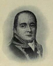
WILLIAM BLIGH, 1812
Reproduced from Jose's History.
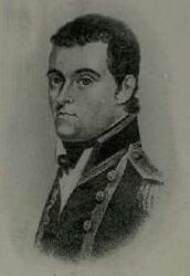
MATTHEW FLINDERS, 1811
Reproduced from Scott's Life of Flinders.

PHILLIP PARKER KING
Reproduced from Feldheim's Brisbane Old and New.

J. BEETE JUKES, 1870
Photo, from Bust by Joseph Watkins, R.H.A.
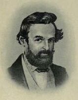
LUDWIG LEICHHARDT, 1844
Reproduced from Long's Stories of Australian Exploration.
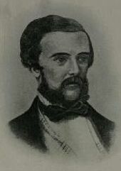
EDMUND BESLEY COURT KENNEDY, 1847
Reproduced from Long's Stories of Australian Exploration.

WILLIAM CARRON, 1870
Reproduced from Journ. Roy. Soc., N.S.W., Vol. 42.

SIR AUGUSTUS CHARLES GREGORY, 1898
Photo, lent by Hugh Macintosh, Brisbane.

ROBERT O'HARA BURKE, 1860
Reproduced from Long's Stories of Australian Exploration.

WILLIAM JOHN WILLS, 1860
Reproduced from Long's Stories of Australian Exploration.
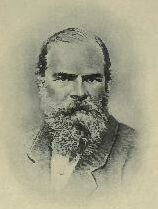
WILLIAM LANDSBOROUGH, 1870
Reproduced from Feldheim's Brisbane Old and New.

JOHN McKINLAY, 1870
Reproduced from Feldheim's Adelaide Old and New.

FRANK (LEFT) AND ALICK JARDINE (RIGHT), 1867
Reproduced from Byerley's Jardine Expedition.

FRANK JARDINE, 1917
Reproduced from Queenslander of 10th November, 1917.
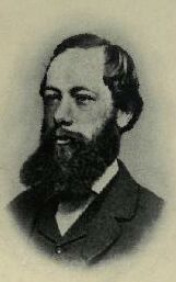
RICHARD DAINTREE, 1871
Reproduced from Dunn's Founders of the Geological Survey of
Victoria.
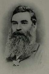
WILLIAM HANN, 1873
Reproduced from Photo, lent by his daughter Mrs. Charles Clarke, Maryvale.
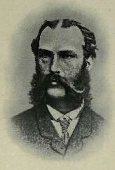
NORMAN TAYLOR, 1873
Reproduced from Dunn's Founders of the Geological Survey of
Victoria.

THOMAS TATE, 25 JUNE, 1913 (71st BIRTHDAY)
Reproduced from Photo, lent by his daughter Mrs. Leake, Maxwellton,
Queensland.
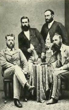
HANN EXPEDITION, 1872: (LEFT) THOMAS TATE; (LEANING) WILLIAM HANN; (ERECT) FRED
WARNER; NORMAN TAYLOR (RIGHT)
Reproduced from Photo, lent by Mrs. Leake.

GEORGE ELPHINSTONE DALRYMPLE, 1876
Reproduced from Feldheim's Brisbane Old and New.
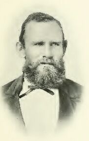
WILLIAM J. WEBB, 1916
Reproduced from Photo, lent by himself.

JOHN MOFFAT, 1904
Reproduced from Photo, lent by his daughter Miss E. L. Moffat.

JAMES VENTURE MULLIGAN, 1905
Photo. Poulsen, Brisbane, lent by T. J. Byers, Hughenden.

ROBERT LOGAN JACK, 1877
Photo. McKenzie, Paisley.

BENJAMIN NEAVE PEACH, 1877
Photo. Bowman, Glasgow.

JAMES CROSBIE, 1891
Reproduced from Photo, lent by Mrs. Crosbie.

JAMES SIMPSON LOVE, 1878
Photo. Munro, Edinburgh.

JAMES SIMPSON LOVE, 1920
Photo. Bernice Agar, Sydney.
SIR THOMAS MCILWRAITH, 1893
Photo, lent by Hugh Macintosh, Brisbane.
HUGH LOCKHART, 1875
Photo. Moffat, Edinburgh.

EDWARD HULL, 1869
Photo. A. G. Tod, Cheltenham.

JANET SIMPSON JACK, 1920
Photo. Bernice Agar, Sydney.

JOHN T. EMBLEY, 1887
Photo. Turtle & Co.
JOHN T. EMBLEV, 1919
Photo. J. Ward Symons.

JOHN DICKIE, 1912
Reproduced from Photo, lent by W. J. Webb.

JAMES DICK, 1910
Reproduced from Photo, lent by W. J. Webb.
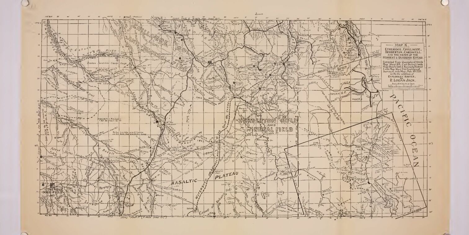
K. ETHERIDGE, CHILLAGOE, HERBERTON, CARDWELL AND THE HEADS OF THE HERBERT AND
BURDEKIN RIVERS = QUEENSLAND 4-MILE MAP 18A, 2-MILE MAP OF COOK DISTRICT,
SHEETS 5 AND 6, AND 2-MILE MAP OF KENNEDY DISTRICT, SHEET 9. SHOWS LAND ROUTES
OF LEICHHARDT, 1845; KENNEDY, 1848; HANN, 1872; MULLIGAN, 1873-75.
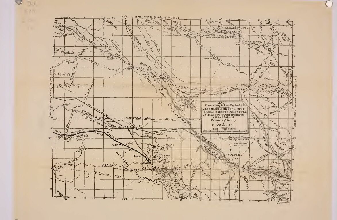
L. CROYDON AND PART OF ETHERIDGE GOLDFIELDS, THE GILBERT, ETHERIDGE AND
EINASLEIGH RIVERS AND THE HEAD OF THE SO-CALLED STAATEN RIVER = QUEENSLAND
4-MILE MAP, SHEET 18B. SHOWS LAND ROUTES OF GREGORY, 1856; MCKINLAY, 1862; F.
AND A. JARDINE, 1864; MACDONALD, 1864.

M. BURKETOWN, NORMANTON AND THE SOUTHERN MOUTHS OF THE GILBERT RIVER =
QUEENSLAND 4-MILE MAP, SHEET 19A, WITH ADDITIONS FROM ADMIRALTY CHARTS. SHOWS
SEA ROUTES OF "PERU" AND "AERNEM," 1623; "LIMMEN" (TASMAN), 1644;
"INVESTIGATOR" (FLINDERS), 1802; "BEAGLE" (STOKES) AND HER BOATS, 1841: AND
LAND ROUTES OF LEICHHARDT, 1845; GREGORY, 1856; BURKE AND WILLS, 1861; WALKER,
1861; LANDSBOROUGH, 1862; MCKINLAY, 1862; MACDONALD, 1864.

N. NORTH WESTERN CORNER OF QUEENSLAND, AND THE GULF OF CARPENTARIA = QUEENSLAND
4-MILE MAP, SHEET 19A AND PART OF 19D, WITH ADDITIONS FROM ADMIRALTY CHARTS.
SHOWS SEA ROUTES OF "LIMMEN" (TASMAN), 1644; "INVESTIGATOR" (FLINDERS), 1802;
"BEAGLE'S" BOATS, 1841: AND LAND ROUTES OF LEICHHARDT, 1845; GREGORY, 1856;
LANDSBOROUGH, 1861; BEDFORD, 1882; EMBLEY, 1889.
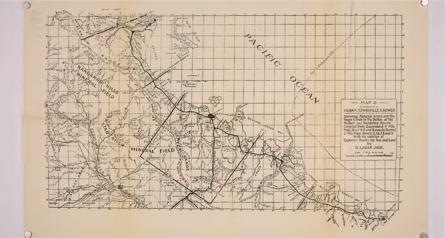
O. INGHAM, TOWNSVILLE AND BOWEN, AND DELTAS OF HERBERT AND BURDEKIN RIVERS =
QUEENSLAND 4-MILE MAP, SHEET 14D AND KENNEDY DISTRICT 2-MILE MAP, SHEETS, 1, 2,
6, 7, 8 AND 9. SHOWS SEA ROUTE OF "ENDEAVOUR" (COOK), 1770: AND LAND ROUTES OF
LEICHHARDT, 1845; GREGORY, 1856.
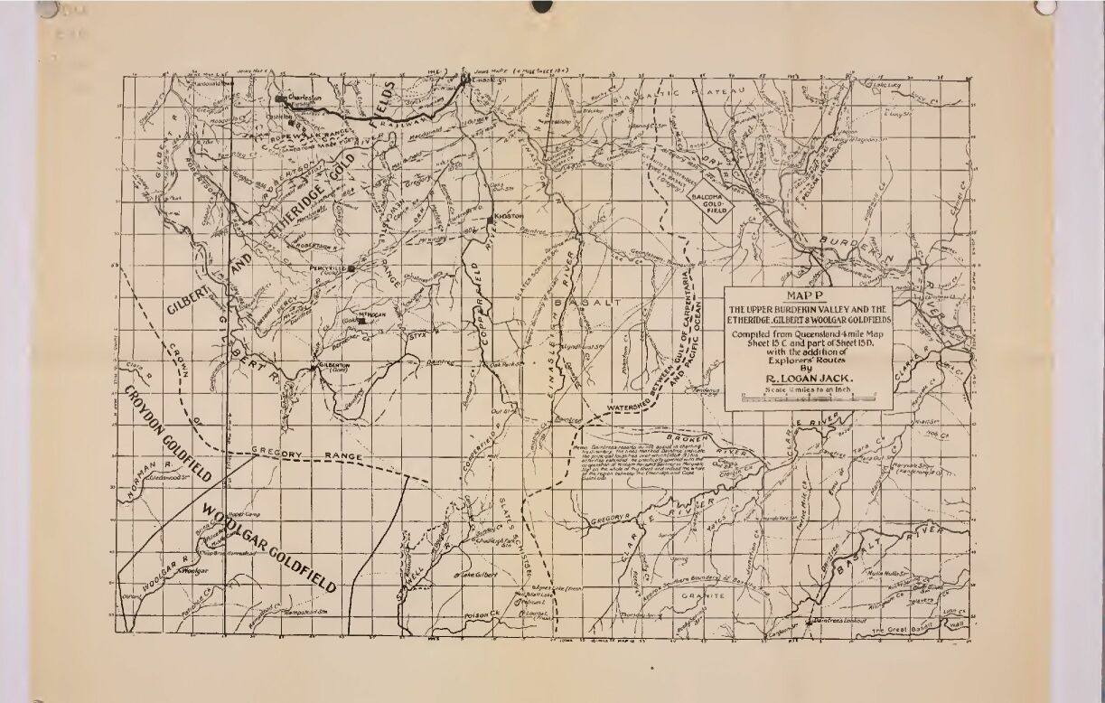
P. THE UPPER BURDEKIN VALLEY AND THE ETHERIDGE, GILBERT AND WOOLGAR GOLDFIELDS
= QUEENSLAND 4-MILE MAP, SHEET 15C AND PART OF 15D. SHOWS LAND ROUTES OF
LEICHHARDT, 1845; GREGORY, 1856; MCKINLAY, 1862; MACDONALD, 1864; DAINTREE,
1864-9.
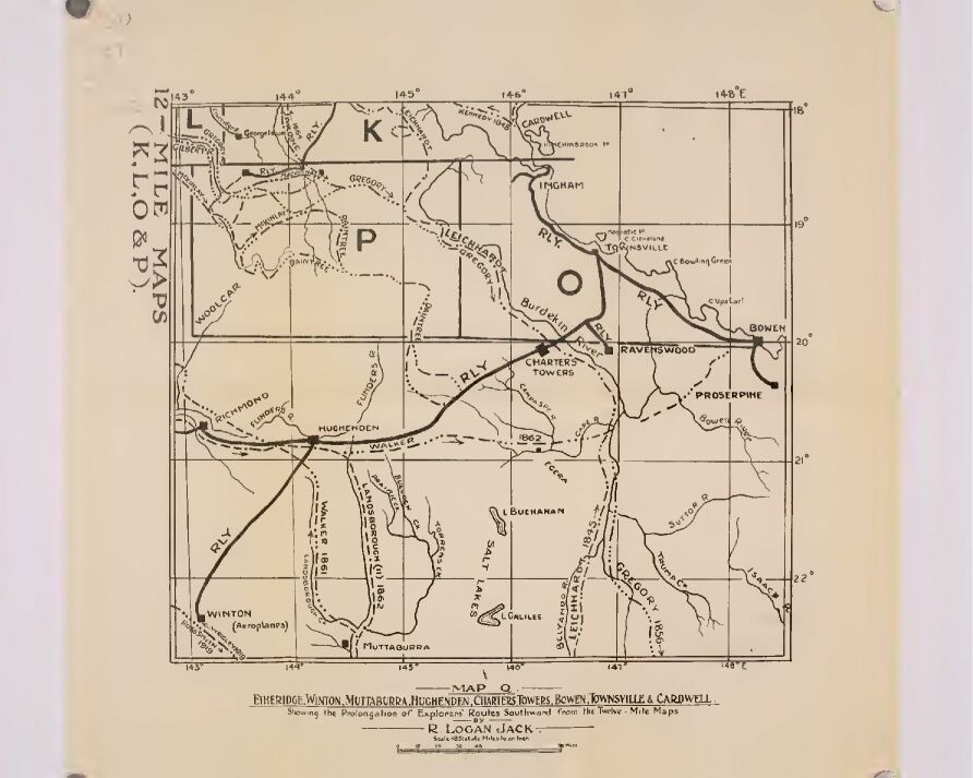
Q. CARDWELL, TOWNSVILLE, BOWEN, WINTON, ETC., INCLUDING MAPS O AND P, PARTS OF
K AND L, AND QUEENSLAND 4-MILE MAPS 14B, 15A, 10D, 11C, AND PARTS OF 14A, 15B,
15D, 10C AND 11D. SHOWS LAND ROUTES OF LEICHHARDT, 1845; KENNEDY, 1848; F. AND
A. JARDINE, 1864; GREGORY, 1856; WALKER, 1861; MCKINLAY, 1862; WALKER, 1862;
LANDSBOROUGH, 1862; MACDONALD, 1864; DAINTREE, 1863-70; WRIGLEY (AEROPLANE),
1919; ROSS-SMITH (AEROPLANE), 1919.

R. CAMOOWEAL, CROYDON, MOUNT CUTHBERT, CLONCURRY, SELWYN, COLLINGWOOD,
INCLUDING PARTS OF L, M AND N, QUEENSLAND 4-MILE MAPS, SHEETS 16C, 16D, 16A,
16B, 12C AND 12D, AND PARTS OF 15D, 15C AND 11D. SHOWS LAND ROUTES OF
LEICHHARDT, 1845; GREGORY, 1856; BURKE AND WILLS, 1861; WALKER, 1861;
LANDSBOROUGH, 1862; MCKINLAY, 1862; MACDONALD, 1864; JACK, 1881; WRIGLEY
(AEROPLANE), 1919; ROSS-SMITH (AEROPLANE), 1919.
This site is full of FREE ebooks - Project Gutenberg Australia